africa, southwest asia (middle east), and southern...
TRANSCRIPT
Africa, Southwest Asia (Middle East), and Southern &
Eastern Asia
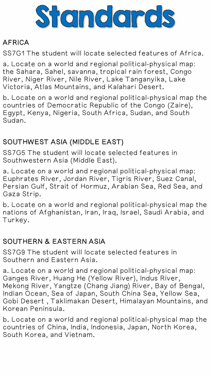
AFRICA
SS7G1 The student will locate selected features of Africa.
a. Locate on a world and regional political-physical map: the Sahara, Sahel, savanna, tropical rain forest, Congo River, Niger River, Nile River, Lake Tanganyika, Lake Victoria, Atlas Mountains, and Kalahari Desert.
b. Locate on a world and regional political-physical map the countries of Democratic Republic of the Congo (Zaire), Egypt, Kenya, Nigeria, South Africa, Sudan, and South Sudan.
SOUTHWEST ASIA (MIDDLE EAST)
SS7G5 The student will locate selected features in Southwestern Asia (Middle East).
a. Locate on a world and regional political-physical map: Euphrates River, Jordan River, Tigris River, Suez Canal, Persian Gulf, Strait of Hormuz, Arabian Sea, Red Sea, and Gaza Strip.
b. Locate on a world and regional political-physical map the nations of Afghanistan, Iran, Iraq, Israel, Saudi Arabia, and Turkey.
SOUTHERN & EASTERN ASIA
SS7G9 The student will locate selected features in Southern and Eastern Asia.
a. Locate on a world and regional political-physical map: Ganges River, Huang He (Yellow River), Indus River, Mekong River, Yangtze (Chang Jiang) River, Bay of Bengal, Indian Ocean, Sea of Japan, South China Sea, Yellow Sea, Gobi Desert , Taklimakan Desert, Himalayan Mountains, and Korean Peninsula.
b. Locate on a world and regional political-physical map the countries of China, India, Indonesia, Japan, North Korea, South Korea, and Vietnam.
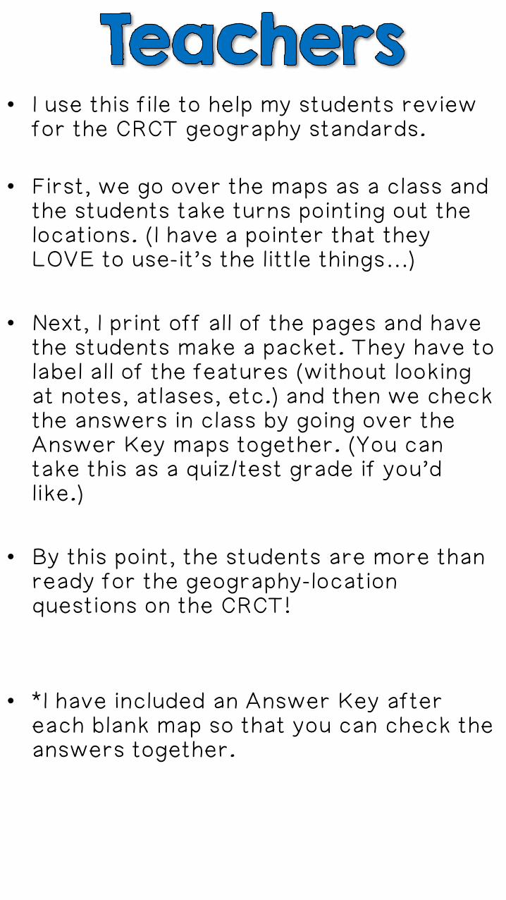
• I use this file to help my students review for the CRCT geography standards.
• First, we go over the maps as a class and the students take turns pointing out the locations. (I have a pointer that they LOVE to use-it’s the little things…)
• Next, I print off all of the pages and have the students make a packet. They have to label all of the features (without looking at notes, atlases, etc.) and then we check the answers in class by going over the Answer Key maps together. (You can take this as a quiz/test grade if you’d like.)
• By this point, the students are more than ready for the geography-location questions on the CRCT!
• *I have included an Answer Key after each blank map so that you can check the answers together.
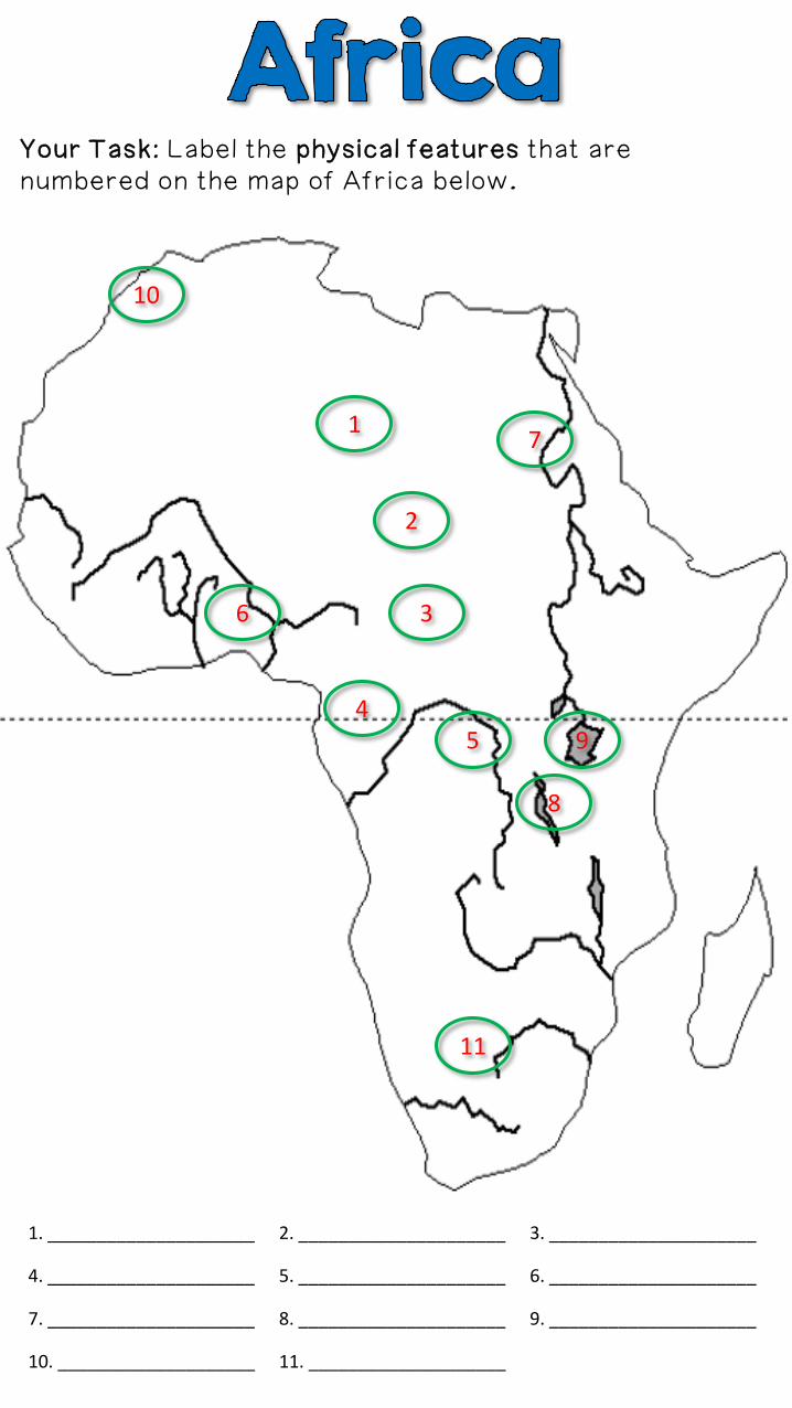
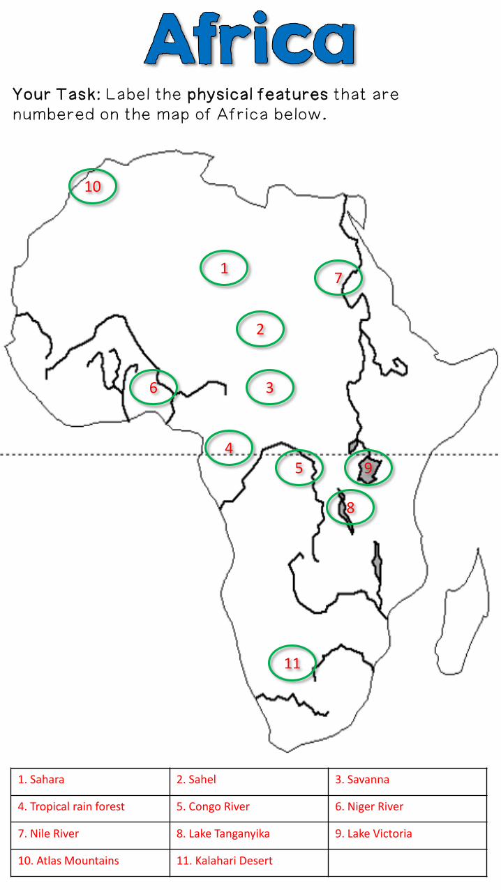
Your Task: Label the physical features that are numbered on the map of Africa below.
1
2
3
45
7
6
1. _____________________ 2. _____________________ 3. _____________________
4. _____________________ 5. _____________________ 6. _____________________
7. _____________________ 8. _____________________ 9. _____________________
10. ____________________ 11. ____________________
9
8
11
10
Your Task: Label the physical features that are numbered on the map of Africa below.
1
2
3
45
7
6
1. Sahara 2. Sahel 3. Savanna
4. Tropical rain forest 5. Congo River 6. Niger River
7. Nile River 8. Lake Tanganyika 9. Lake Victoria
10. Atlas Mountains 11. Kalahari Desert
9
8
11
10
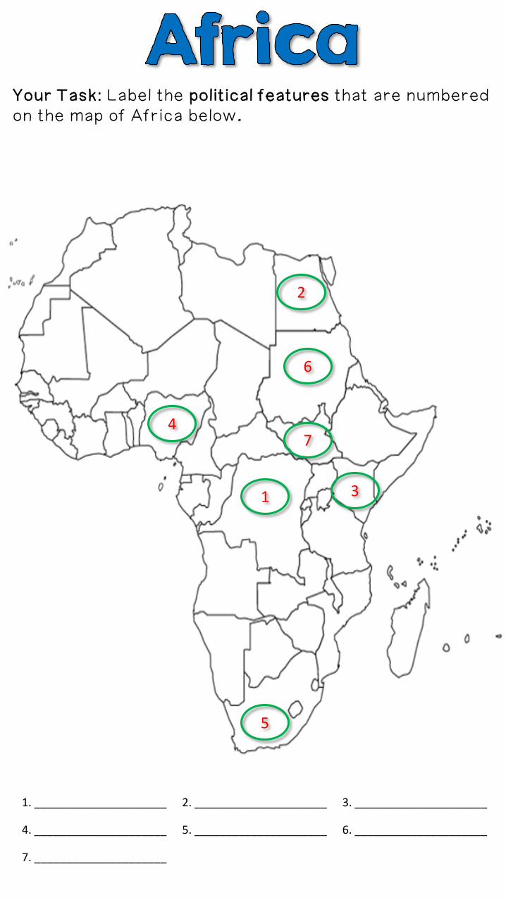
Your Task: Label the political features that are numbered on the map of Africa below.
1
2
3
4
5
7
6
1. _____________________ 2. _____________________ 3. _____________________
4. _____________________ 5. _____________________ 6. _____________________
7. _____________________
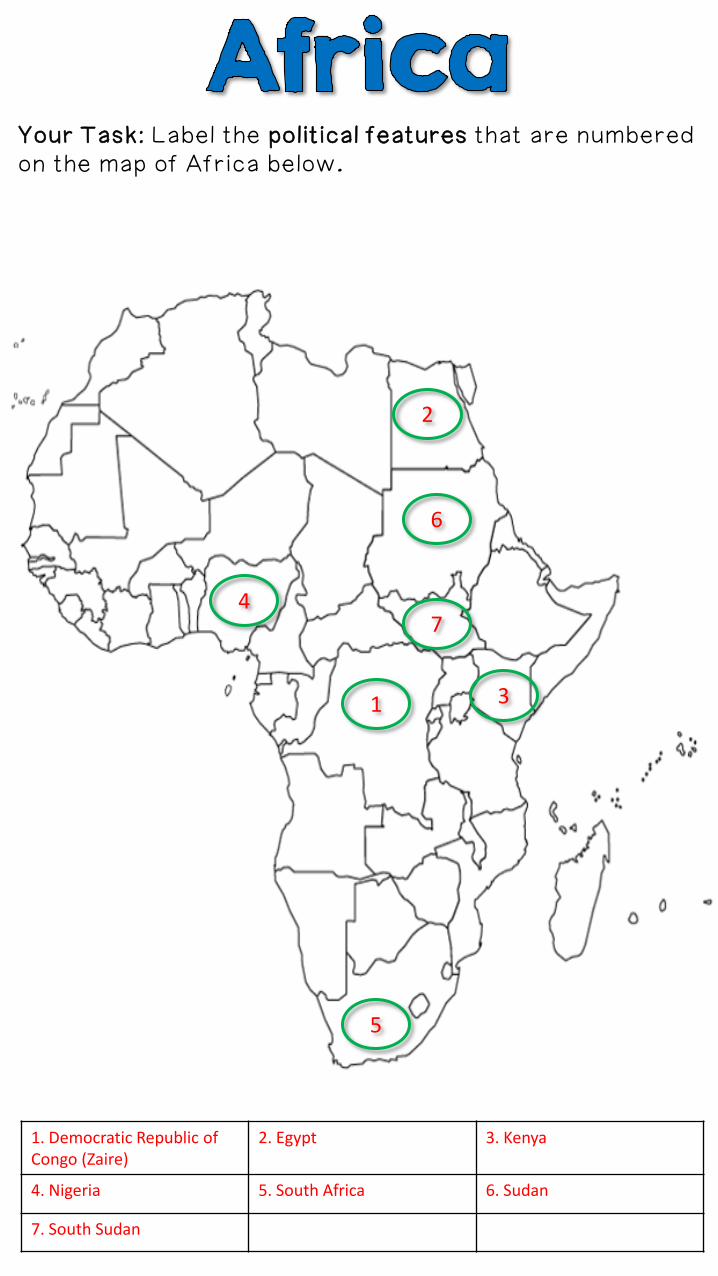
Your Task: Label the political features that are numbered on the map of Africa below.
1
2
3
4
5
7
6
1. Democratic Republic of Congo (Zaire)
2. Egypt 3. Kenya
4. Nigeria 5. South Africa 6. Sudan
7. South Sudan
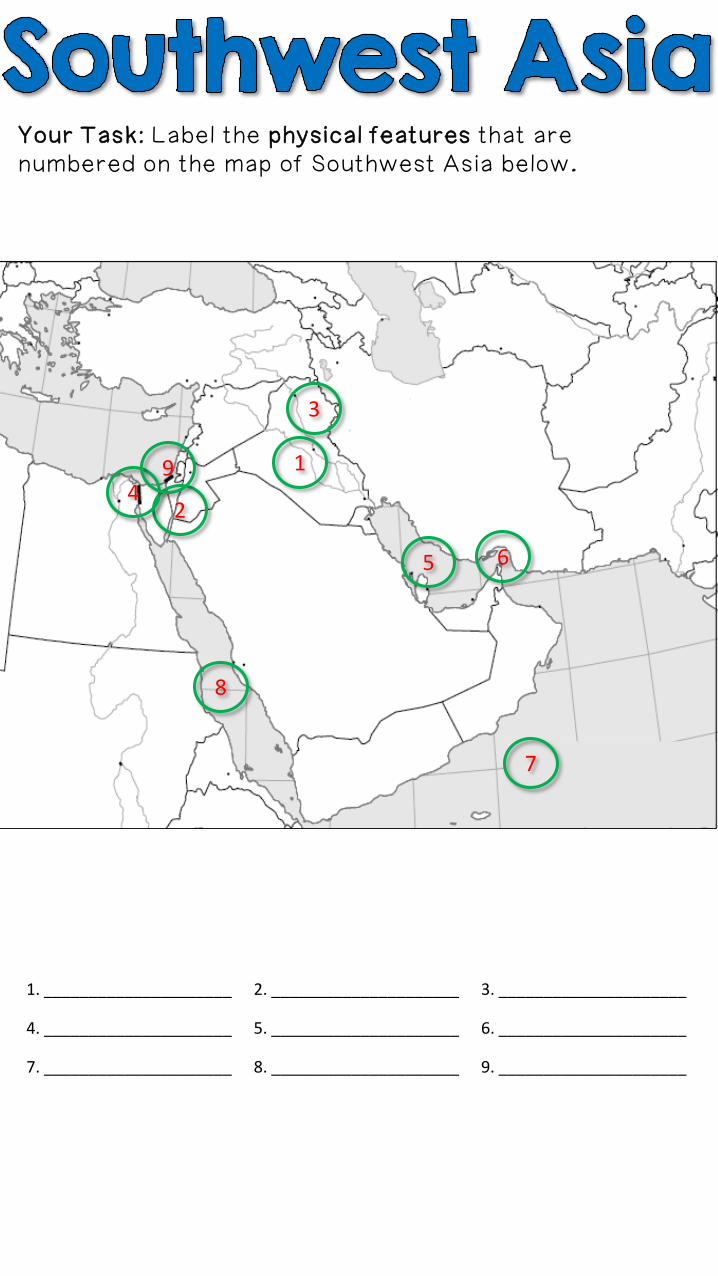
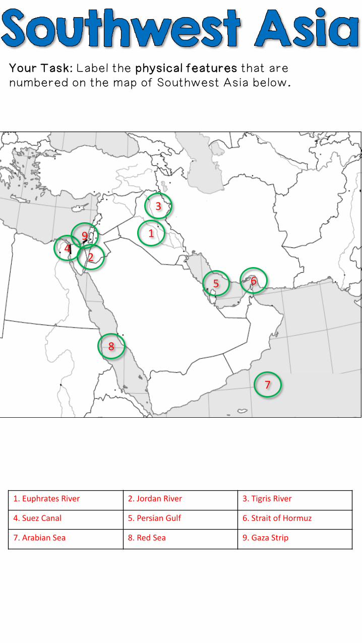
Your Task: Label the physical features that are numbered on the map of Southwest Asia below.
1. _____________________ 2. _____________________ 3. _____________________
4. _____________________ 5. _____________________ 6. _____________________
7. _____________________ 8. _____________________ 9. _____________________
1
2
3
4
5 6
9
8
7
Your Task: Label the physical features that are numbered on the map of Southwest Asia below.
1. Euphrates River 2. Jordan River 3. Tigris River
4. Suez Canal 5. Persian Gulf 6. Strait of Hormuz
7. Arabian Sea 8. Red Sea 9. Gaza Strip
1
2
3
4
5 6
9
8
7
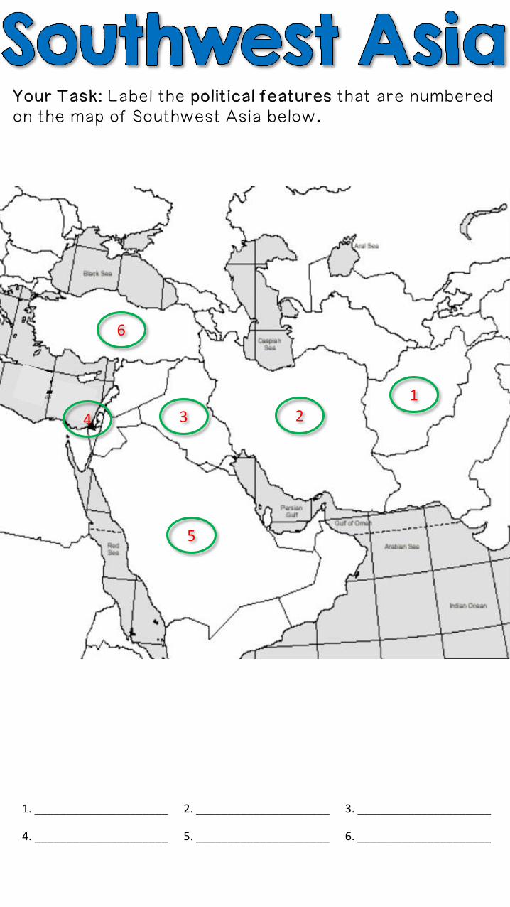
Your Task: Label the political features that are numbered on the map of Southwest Asia below.
1. _____________________ 2. _____________________ 3. _____________________
4. _____________________ 5. _____________________ 6. _____________________
1234
5
6
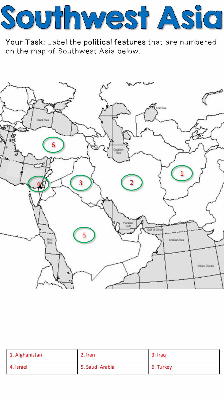
Your Task: Label the political features that are numbered on the map of Southwest Asia below.
1. Afghanistan 2. Iran 3. Iraq
4. Israel 5. Saudi Arabia 6. Turkey
1234
5
6
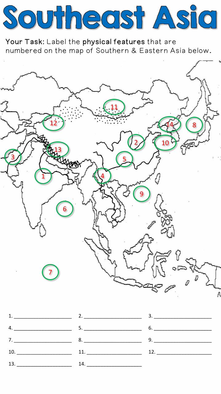
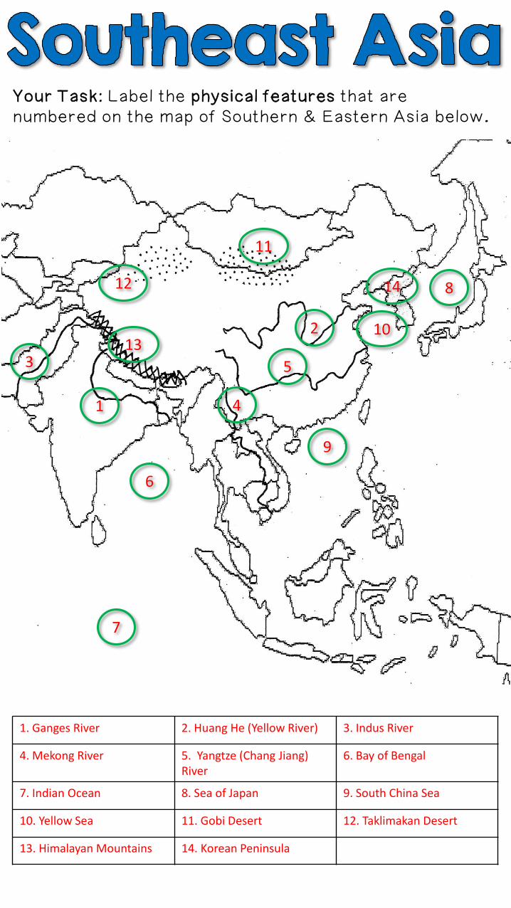
Your Task: Label the physical features that are numbered on the map of Southern & Eastern Asia below.
1
2
3
4
5
6
1. _____________________ 2. _____________________ 3. _____________________
4. _____________________ 5. _____________________ 6. _____________________
7. _____________________ 8. _____________________ 9. _____________________
10. ____________________ 11. ____________________ 12. ____________________
13. ____________________ 14. ____________________
7
8
9
10
11
12
13
14
Your Task: Label the physical features that are numbered on the map of Southern & Eastern Asia below.
1
2
3
4
5
6
7
8
9
10
11
12
13
14
1. Ganges River 2. Huang He (Yellow River) 3. Indus River
4. Mekong River 5. Yangtze (Chang Jiang) River
6. Bay of Bengal
7. Indian Ocean 8. Sea of Japan 9. South China Sea
10. Yellow Sea 11. Gobi Desert 12. Taklimakan Desert
13. Himalayan Mountains 14. Korean Peninsula
Your Task: Label the political features that are numbered on the map of Southern & Eastern Asia below.
1
2
3
45
7
6
1. _____________________ 2. _____________________ 3. _____________________
4. _____________________ 5. _____________________ 6. _____________________
7. _____________________
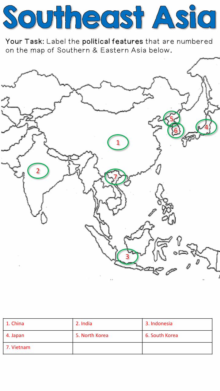
Your Task: Label the political features that are numbered on the map of Southern & Eastern Asia below.
1
2
3
45
7
6
1. China 2. India 3. Indonesia
4. Japan 5. North Korea 6. South Korea
7. Vietnam

Thank you for downloading
this file. I’m looking forward
to reading your feedback.
If you’re interested in more
CRCT materials, please click
the logo to visit my store:
© Copyright 2013. Brain Wrinkles. All rights reserved.
Permission is granted to copy pages specifically designed
for student or teacher use by the original purchaser or
licensee. The reproduction of any other part of this
product is strictly prohibited. Copying any part of this
product and placing it on the Internet in any form (even a
personal/classroom website) is strictly forbidden. Doing so
makes it possible for an Internet search to make the
document available on the Internet, free of charge, and is a
violation of the Digital Millennium Copyright Act (DMCA).
All images were found via Creative Commons and
labeled for reuse.
•Fonts:
•Backgrounds & Graphics: