advanced webinar: change detection for land cover mapping · classification algorithms • used to...
TRANSCRIPT
National Aeronautics and Space Administration
Cindy Schmidt, Amber McCullumGuest Speaker: Jenny HewsonSeptember 28, 2018
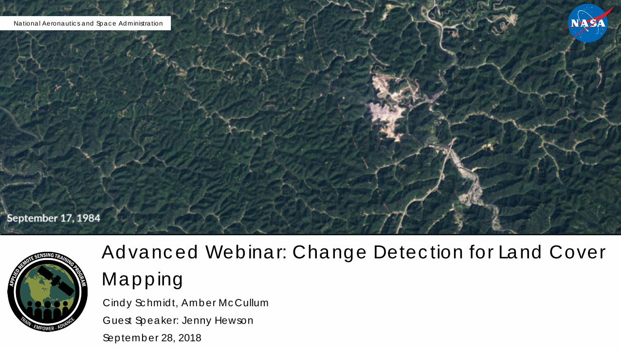
Advanced Webinar: Change Detection for Land Cover Mapping

NASA’s Applied Remote Sensing Training Program 2
Course Structure
• Two, two-hour sessions on Friday, September 28, and Friday, October 5, 2018• The same content will be presented at two different times each day:
– Session A: 10:00-12:00 EDT (UTC-4)– Session B: 18:00-20:00 EDT (UTC-4)– Please only sign up for and attend one session per week
• Webinar recordings, PowerPoint presentations, and the homework assignment can be found after each session at: – https://arset.gsfc.nasa.gov/land/webinars/adv-change18– Q&A: Following each lecture and/or by email
• [email protected], or • [email protected]
NASA’s Applied Remote Sensing Training Program 3
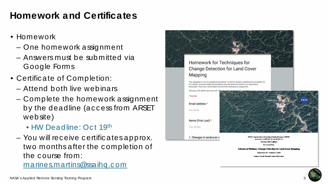
Homework and Certificates
• Homework– One homework assignment– Answers must be submitted via
Google Forms• Certificate of Completion:
– Attend both live webinars– Complete the homework assignment
by the deadline (access from ARSET website)• HW Deadline: Oct 19th
– You will receive certificates approx. two months after the completion of the course from: [email protected]

NASA’s Applied Remote Sensing Training Program 4
Prerequisites
• Fundamentals of Remote Sensing– Sessions 1 and 2A (Land)– On demand webinar, available anytime
• Advanced Webinar: Land Cover Classification with Satellite Imagery
• Download and install QGIS and all accompanying software Use this exercise for help: Downloading and Installing QGIS
• Download and install the R statistical program• Download and install R Studio

NASA’s Applied Remote Sensing Training Program 5
Accessing Course Materialshttps://arset.gsfc.nasa.gov/land/webinars/adv-change18

NASA’s Applied Remote Sensing Training Program 6
Course Outline
Session 1: Introduction to Change Detection
Session 2: Conducting Change Detection with QGIS & R

NASA’s Applied Remote Sensing Training Program 7
Session 2 Agenda
• Supervised Classification Review• Methodology for Two-Date
classification and change detection– Image preparation– Developing training sites– The Random Forest Algorithm– Classification refinement – Image post-processing
• Exercise 2

Guest Speaker: Jenny Hewson, Conservation International

Supervised Classification

NASA’s Applied Remote Sensing Training Program 10
Image Classification
Supervised• Uses expert-defined areas of known
vegetation types (training areas) to tune parameters of classification algorithms
• Algorithm then automatically identifies and labels areas similar to the training data
Unsupervised• Uses classification algorithms to assign
pixels into one of a number of user-specified class groupings
• Interpreters assign each of the groupings of pixels a value corresponding to a land cover class
Methods
Credit: David DiBiase, Penn State Department of Geography
NASA’s Applied Remote Sensing Training Program 11
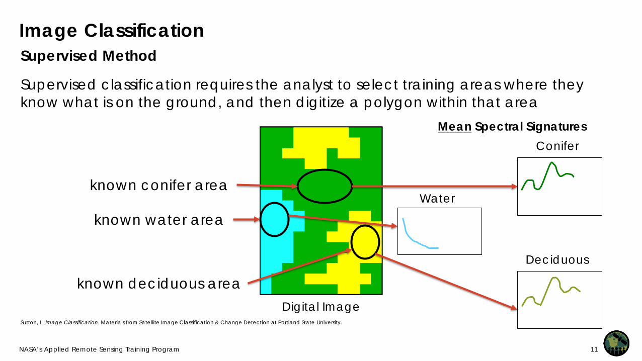
Image Classification
Supervised classification requires the analyst to select training areas where they know what is on the ground, and then digitize a polygon within that area
Supervised Method
Sutton, L. Image Classification. Materials from Satellite Image Classification & Change Detection at Portland State University.
Digital Image
known conifer area
known water area
known deciduous area
Mean Spectral SignaturesConifer
Deciduous
Water

NASA’s Applied Remote Sensing Training Program 12
Image Classification
The spectral signature of each pixel gets matched with the training signatures and the image is classified accordingly
Supervised Method
Multispectral Image
Information (Classified Image) Spectral signature of
next pixel to be classified
Unknown
Mean Spectral Signatures
Water
Conifer
Deciduous

Two-Date Supervised Classification and Change Detection

NASA’s Applied Remote Sensing Training Program 14
Methodology
Import images and create a 2-date image stack
Image enhancement, stretching, band combinations
Develop training sites
Run the Random Forest Algorithm in R
Refine the classification with multiple iterations
Conduct post-processing
Save and export final map
1
2
3
4
5
6
7

NASA’s Applied Remote Sensing Training Program 15
Cloud Masking
• Cloudy pixels affect the ability of optical satellites to “see” land surface
• Cloudy pixels can be incorrectly classified in imagery, affecting the accuracy
• Cloud masking removes cloudy pixels• Landsat Surface Reflectance Products
have a cloud mask layer– Pixels are identified as clouds based
on their reflectance values• The user can use this cloud mask layer
to remove clouds in each image
Image Credit: HySpeed Computing
1
This example illustrates QA output for a subset Landsat 8 scene of Lake Tahoe acquired on April 12, 2014

NASA’s Applied Remote Sensing Training Program 16
Band Stacking of Two Dates
• The next step is to stack the two multi-band images into one image
• Assume Date 1 is Landsat 5 and Date 2 is Landsat 8
• Direct change classification minimizes classification errors
Bands Date 1 Name Bands Date 2Blue 1 7
1 Blue 2 82 Green 93 Red 104 NIR 115 SWIR 1 126 SWIR 2 13
Date 1 (Landsat 5) Bands 1-6
Date 2 (Landsat 8) Bands 1-7
Combined Image
Bands 1-13
Bands in new combined stack
2

NASA’s Applied Remote Sensing Training Program 17
Image Enhancement
• Makes the image easier to interpret – Stretching
• Ex: adjust the minimum and maximum values OR use the standard deviation of the pixels to make the image look brighter
– Band Combinations• Ex: False color can be used to
make vegetation red to stand out in the image
2

NASA’s Applied Remote Sensing Training Program 18
Multi-Date Image Enhancement
• Instead of 7 bands, you have 13 bands• Highlights changes between two dates • Example: Multi-temporal false color
composite:– Red band: Band 12 (SWIR1 – date 2)– Green band: Band 5 (SWIR1- date 1)– Blue Band: Band 8 (Blue – date 2)
2

NASA’s Applied Remote Sensing Training Program 19
Training Site Guidelines
• Training sites should be distributed across the entire scene
• Both change and non-change should be included
• Size of training sites will depend on spectral characteristics of image– Simple images large training sites– Spectrally complex small training
sites• Key: All spectral variability in the
image must be captured
3

NASA’s Applied Remote Sensing Training Program 20
Change Land Cover Classes
Normally you would have a single digit code for a single-date classification:
For two-date change classification, codes will be 2 digits:
Cover Class CodeForest 1
Non-Forest 2Water 3Urban 4Cloud 5
Shadow 6
Cover Class CodeForest-Forest 11
Forest-NonForest 12NonForest-Forest 21
Water-Water 33Urban-Urban 44
3

NASA’s Applied Remote Sensing Training Program 21
Training Sites for two-date classification
• Since we are using a decision tree classification (in this case Random Forest) we do not need training sites to be homogenous
• That means you can mix forest types or non-forest land cover types
• You should try and capture the range of spectral signatures included in each class
• If you have an image with background pixels, you will need to add a class and create a training area in the no-data (background) area– Assign it 88 (unclassified)
3

NASA’s Applied Remote Sensing Training Program 22
Classification Algorithms
• Used to classify the whole image by comparing spectral characteristics of each pixel to the spectral characteristics of the training sites for land cover classes
• Different available methods– Minimum Distance– Maximum Likelihood– Spectral Angle Mapping– Random Forest*
• These methods determine different ways for the classes to be defined based on their statistics
4

NASA’s Applied Remote Sensing Training Program 23
Random Forest Algorithm
• Example of an ensemble model (combines the results from model models; logic result from a combination will be better than from a single model)
• Supervised learning• Random Forest algorithm takes a
random set of training sites (usually 2/3) and builds multiple decision (classification) trees; remaining ~1/3 used to estimate error and importance of each predictor variable
Training Pixels
Random Subset
Random Subset
Random Subset
Random Subset
Class 1 Class 2
4

NASA’s Applied Remote Sensing Training Program 24
Random Forest Algorithm
• Trees have branches (nodes) and leaves (class labels)
• There is a random component to each decision – think about a coin toss
• Classes are assigned to the pixels based on the majority rule, as if each random decision tree “votes” on what the class for that pixel should be
• The exercise in this webinar uses spectral data, but you could also use other data, such as DEMs, climate layers, and soil maps (continuous or categorical)
4
Training Pixels
Random Subset
Random Subset
Random Subset
Random Subset
Class 1 Class 2
NASA’s Applied Remote Sensing Training Program 25
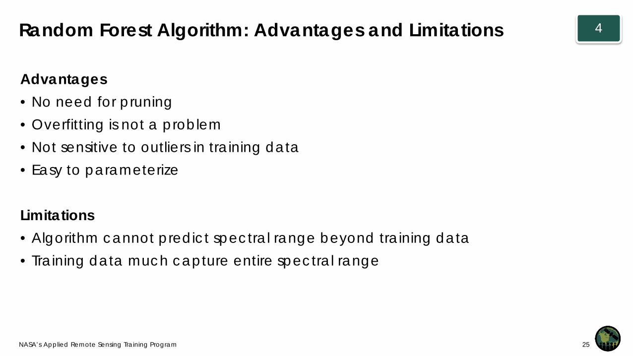
Advantages• No need for pruning• Overfitting is not a problem• Not sensitive to outliers in training data• Easy to parameterize
Limitations• Algorithm cannot predict spectral range beyond training data• Training data much capture entire spectral range
4Random Forest Algorithm: Advantages and Limitations

NASA’s Applied Remote Sensing Training Program 26
Multiple Iterations
• Image classification is an iterative process• Number of iterations will depend on:
– Image complexity– Number of classes– Intended use of final product: How accurate do
you need your map to be?• Review results:
– Check map accuracy – Change/update training sites– Re-run Random Forest Algorithm with new training
sites– Conduct filtering– Check map accuracy again
5
Develop training sites
Run the Random Forest Algorithm in R
Refine the classification with multiple iterations
Conduct post-processing

NASA’s Applied Remote Sensing Training Program 27
Post-Processing
• Filtering can be used to remove “noise” or isolated pixels that may be incorrectly classified, from an image
• Majority filter: – Each group of pixels are
considered in a map – The filter assigns the
predominant class to the central pixel
– User-defined number of pixels surrounding the central pixel may be changed to the class of the central pixel
Unfiltered
Filtered
6

Exercise: 2-Date Image Classification and Change Detection

NASA’s Applied Remote Sensing Training Program 29
Contacts
• ARSET Land Management & Wildfire Contacts– Cynthia Schmidt: [email protected]– Amber McCullum: [email protected]
• General ARSET Inquiries– Ana Prados: [email protected]
• ARSET Website:– http://arset.gsfc.nasa.gov

National Aeronautics and Space Administration
Remember to Complete the Homework by October 19, 2018
Thank You