ad-a260 152 - defense technical information center · maximum observed wind speeds ... this...
TRANSCRIPT

AD-A260 152
CLIMATE AND WEATHER
of the
HORN OF AFRICA
=EXECUTIVE SUMMARY=
, fFE T . b y
Kenneth R. Walters, SrCapt Richard D. Arnold
DECEMBER 1992
Approved for public release;distribution is unlimited.
USAF93-01693 ENVIRONMENTAL TECHNICAL1931i-0 1 6931111lPli1i,11! APPLICATIONS CENTER
Scott Air Force Base, Illinois, 62225-5116

REVIEW AND APPROVAL STATEMENT
USAFETAC/TN--92/006, Horn of Africa Climate and Weather--Executive Summary,December 1992, has been reviewed and is approved for public release. There is noobjection to unlimited distribution of this document to the public at large, or by theDefense Technical Information Center (DTIC) to the National Technical InformationService (NTIS).
JUDSON E. STAILEY, Lt Mol, USAF KENNETH R. AALTERS, SrCommander Lead Writer
WALTER S. BURGI VNN
Scientific and Technical InformationProgram Manager24 December 1992
ii
REPORT DOCUMENTATION PAGE
2. Report Date: December 1992
3. Report Type: Technical Note
4. Title: Horn of Africa Climate and Weather--Executive Summary
6. Author: Kenneth R. Walters, Sr., Capt Richard D. Arnold
7. Performing Organization Name and Address: USAF EnvironmentalTechnical Applications Center (USAFETAC), Building 859 Buchanan Street, ScottAir Force Base, Illinois 62225-5116
8. Performing Organization Report Number: USAFETAC/TN--92/006
12. Distribution/Availability Statement: Approved for public release; distributionis unlimited.
13. Abstract: Provides a brief executive summary of annual weather andclimatology for the region generally known as the "Horn of Africa," an area thatcomprises Somalia, Yemen, Djibouti, Ethiopia, Sudan, and Kenya.
14. Subiect Terms: CLIMATOLOGY, WEATHER, SUMMARY, HORN OFAFRICA, SOMALIA, YEMEN, DJIBOUTI, ETHIOPIA, SUDAN, KENYA
15. Number of Pages: 36
17. Security Classification of Report: Unclassified
18. Security Classification of this Page: Unclassified
19. Security Classification of Abstract: Unclassified
20. Limitation of Abstract: UL
iii
PREFACE
This summary was requested by the U.S. Transportation Command (USTRANSCOM)staff to assist in planning for Operation RESTORE HOPE, which began on 9 December1992. The study begins with a general summary of climate and weather across the entireHorn of Africa, then provides a similar summary for each of the countries it comprises.Most of the information in this summary was extracted from USAFETAC/TN--90/004,SWANEA (Southwest Asia--Northeast Africa)--A Climatological Study, Volume 1- TheHorn of Africa, supplemented with more up-to-date information recently available. Thelead writer is Chief of the USAF Environmental Technical Applications Center's ReadinessSupport Branch, USAFETAC/DOJ.
Accesion For
NTIS CRA&IDTIC TABUiWannounced 5]Justification
ByDist IbUtion
Availability Codes
Avail and orDist Special
DMI! Q4UALI4TY InSpEo"FnD a
iv
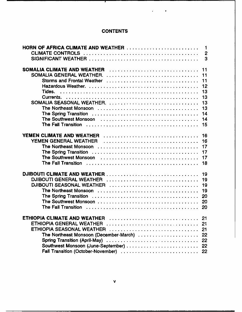
CONTENTS
HORN OF AFRICA CLIMATE AND WEATHER ......................... 1CLIMATE CONTROLS ........................................ 2SIGNIFICANT W EATHER ...................................... 3
SOMALIA CLIMATE AND WEATHER ............................... 11SOMALIA GENERAL WEATHER .................................. 11
Storms and Frontal Weather ................................ 11Hazardous Weather ........................................ 12Tides .................................................. 13Currents ................................................ 13
SOMALIA SEASONAL WEATHER ................................. 13The Northeast Monsoon ................................... 13The Spring Transition ..................................... 14The Southwest Monsoon .................................. 14The Fall Transition ....................................... 15
YEMEN CLIMATE AND WEATHER ................................. 16YEMEN GENERAL WEATHER ................................. 16
The Northeast Monsoon ................................... 17The Spring Transition ..................................... 17The Southwest Monsoon .................................. 17The Fall Transition ....................................... 18
DJIBOUTI CLIMATE AND WEATHER ................................ 19DJIBOUTI GENERAL WEATHER ................................ 19DJIBOUTI SEASONAL WEATHER ............................... 19
The Northeast Monsoon ................................... 19The Spring Transition ..................................... 20The Southwest Monsoon ................................... 20The Fall Transition ....................................... 20
ETHIOPIA CLIMATE AND WEATHER ............................... 21ETHIOPIA GENERAL WEATHER ................................ 21ETHIOPIA SEASONAL WEATHER ............................... 21
The Northeast Monsoon (December-March) ..................... 22Spring Transition (April-May) ................................ 22Southwest Monsoon (June-September) ......................... 22Fall Transition (October-November) ........................... 22
v
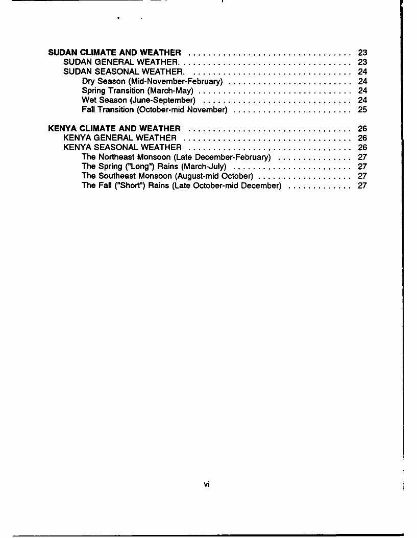
SUDAN CLIMATE AND WEATHER ................................. 23SUDAN GENERAL WEATHER ................................... 23SUDAN SEASONAL WEATHER .................................. 24
Dry Season (Mid-November-February) ......................... 24Spring Transition (March-May) ............................... 24Wet Season (June-September) .............................. 24Fall Transition (October-mid November) ........................ 25
KENYA CLIMATE AND WEATHER ................................. 26KENYA GENERAL WEATHER .................................. 26KENYA SEASONAL WEATHER ................................. 26
The Northeast Monsoon (Late December-February) ............... 27The Spring ("Long") Rains (March-July) ........................ 27The Southeast Monsoon (August-mid October) ................... 27The Fall ("Short") Rains (Late October-mid December) ............. 27
vi
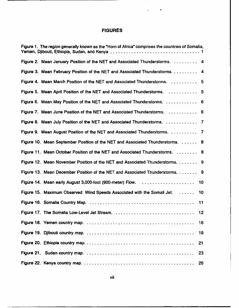
FIGURES
Figure 1. The region generally known as the "Horn of Africa" comprises the countries of Somalia,Yemen, Djibouti, Ethiopia, Sudan, and Kenya .................................. 1
Figure 2. Mean January Position of the NET and Associated Thunderstorms ........... 4
Figure 3. Mean February Position of the NET and Associated Thunderstorms .......... 4
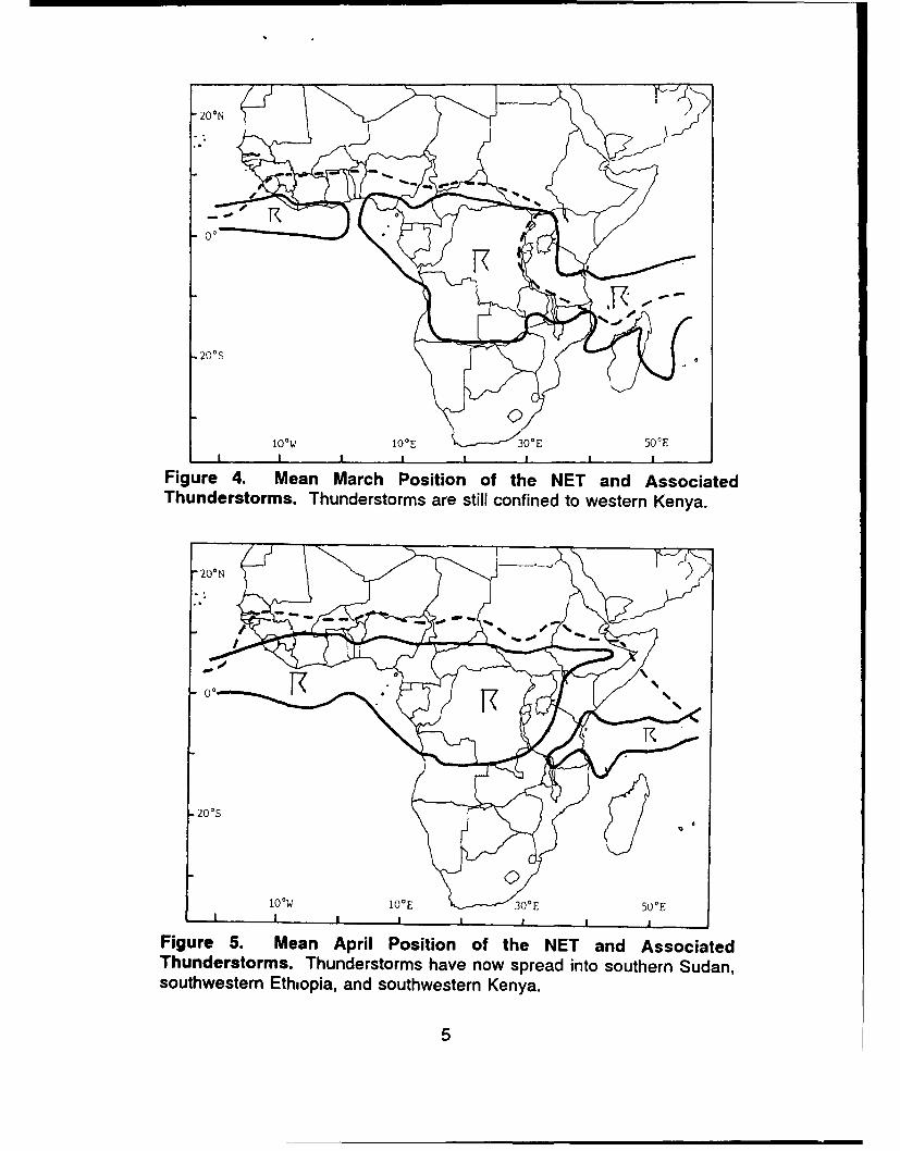
Figure 4. Mean March Position of the NET and Associated Thunderstorms ............ 5
Figure 5. Mean April Position of the NET and Associated Thunderstorms ............ 5
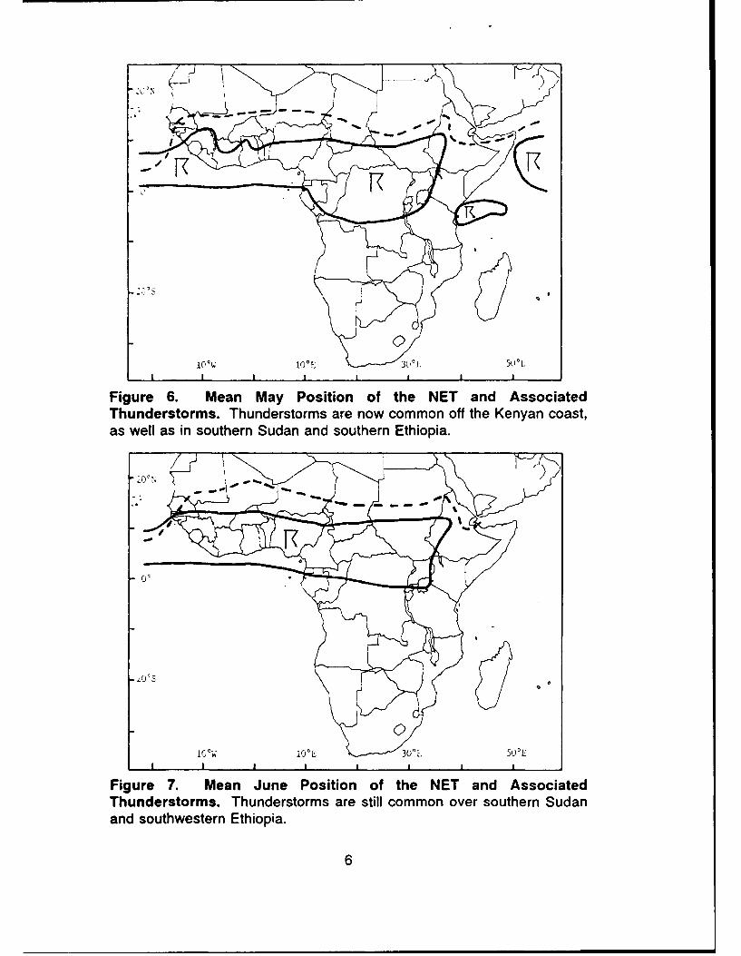
Figure 6. Mean May Position of the NET and Associated Thunderstorms .............. 6
Figure 7. Mean June Position of the NET and Associated Thunderstorms ............. 6
Figure 8. Mean July Position of the NET and Associated Thunderstorms .............. 7
Figure 9. Mean August Position of the NET and Associated Thunderstorms ............ 7
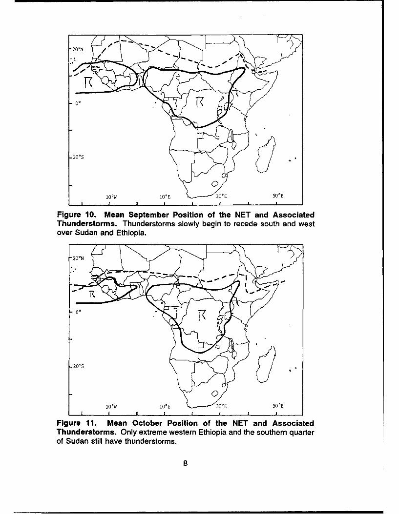
Figure 10. Mean September Position of the NET and Associated Thunderstorms ........ 8
Figure 11. Mean October Position of the NET and Associated Thunderstorms .......... 8
Figure 12. Mean November Position of the NET and Associated Thunderstorms ........ 9
Figure 13. Mean December Position of the NET and Associated Thunderstorms ........ 9
Figure 14. Mean early August 3,000-foot (900-meter) Flow . .................... 10
Figure 15. Maximum Observed Wind Speeds Associated with the Somali Jet ....... 10
Figure 16. Somalia Country Map .......................................... 11
Figure 17. The Somalia Low-Level Jet Stream ................................ 12
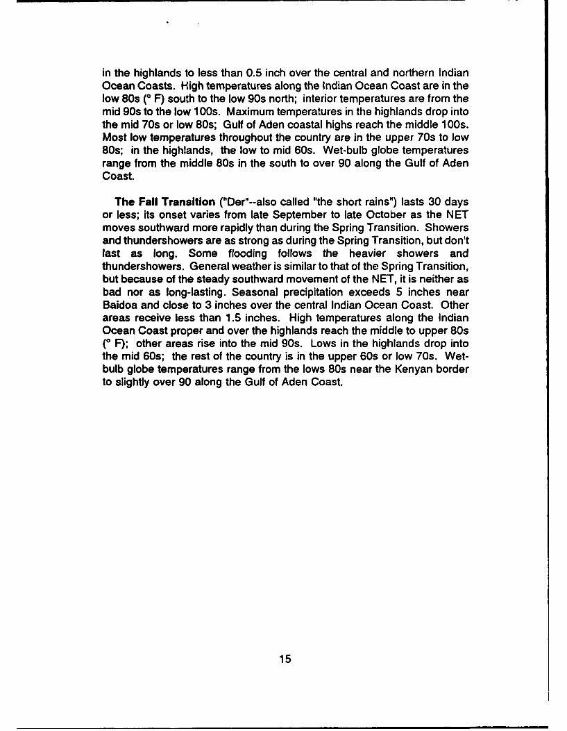
Figure 18. Yemen country map ........................................... 16
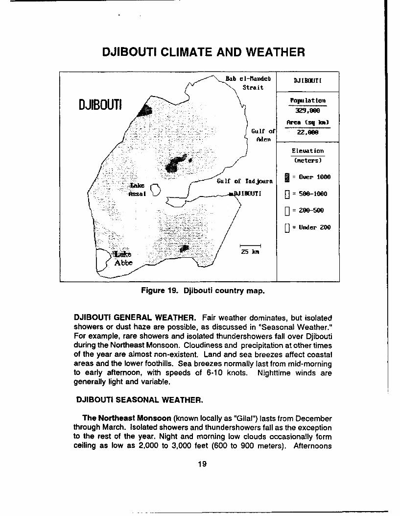
Figure 19. Djibouti country map .......................................... 19
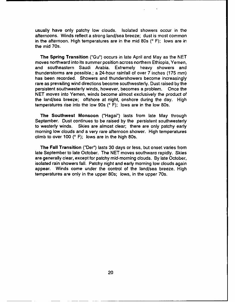
Figure 20. Ethiopia country map .......................................... 21
Figure 21. Sudan country map ........................................... 23
Figure 22. Kenya country map ........................................... 26
vii

HORN OF AFRICA CLIMATE AND WEATHER
*Port Sudan
Atbarah'
ýKhartoum Kassal~ Ak ordal ,.-.Mti& Sana
Wad Huadydah..
.A] Ubavyid - 7- Soconta- d ~ indrAseb *Aden A
*DOjiboutiDese.<
- Berbera
Malakil Addis' _ BuraoAbabaj,~ aa - lwaresa
~Garoe
,.- Weyne
Baidoa
WMIL Mogadishu
I .-- o' ~ Nanyuki
* FdakurChisimayu
qIairobi
- ~Arusba),,-
.hMombasaUpji 'aaa -Road - Ra'roac
/2D3 4CO Kdorrt-v
LDar es Salaa 202 0
504270 3-80 (544686)
Figure 1. The region generally known as the "Horn of Africa" comprises thecountries of Somalia, Yemen, Djibouti, Ethiopia, Sudan, and Kenya (map courtesyCentra[ Intelligence Agency).

CLIMATE CONTROLS
Weather across the Horn of Africa is controlled by the north-southoscillation of the Near Equatorial Trough (NET), which is also known as theIntertropical Convergence Zone (ITCZ) or Monsoon Trough. Figures 2-13show the mean monthly positions of the NET and associated thunderstormactivity. NET passage (either north or south) at any given location variesmarkedly from year to year. As a result, the frequency of shower orthundershower activity also varies greatly from one year to another.Additionally, orographic lifting of moist Indian Ocean air may cause isolatedthunderstorms or showers to begin or persist well after the rest of an areahas lost its shower activity. The hills northwest of Baidoa, Somalia, and theKenyan highlands--especially in the higher mountains--are two knownexamples of such regions. Lake Victoria's "lake breeze" causes almostyear-round thunderstorm and shower activity over an area just east andnortheast of the lake.
* In January, only Sudan and northern Ethiopia are affected by northernhemisphere frontal systems; precipitation--mostly heavy showers orthundershowers--falls in northern Ethiopia and, because of forced lift, overthe mountains along the southern shore of the Gulf of Aden and over theKenyan highlands.. The rest of the region, under the influence of theNortheast Monsoon until late February or early March, is hot and dry.
o Between March and April, the NET moves rapidly northward, reachingsouthern Sudan and extreme northern Kenya by 1 April. By 1 May, it hasreached a line that lies across central Sudan, northeast Ethiopia, andnorthem Somalia. By 1 July, the NET lies across extreme northern Sudanand northern Yemen.
o Onset of the Somali Jet occurs over Kenya in April after northward NETpassage. This low-level, high-speed band of southern hemisphere airstreams north, then northeast, across eastern Kenya, Somalia, and offshoresoutheast of Yemen and the Arabian Peninsula. It is a dominant feature ofthe Southwest Monsoon. It is strongest in July and August, but weakens bymid-September and disappears in late October as the NET moves southinto central Somalia.
o In early September, the NET reverses direction and begins to movesouth, cutting off the moist southern hemisphere air that fuels extensiverainshowers and thunderstorms south of the NET. By about 1 November,the NET reaches southern Sudan, Southern Ethiopia, and central Somalia.It passes southward out of the area by mid-December to complete theannual cycle.
2

* The northerly to northeasterly low-level winds following the NET as itmoves south bring good weather within 2 to 3 weeks of its passage. Thereis an exception: In Kenya just east of Lake Victoria, thunderstorms formyear-round because of a complex lake breeze (similar to the sea breeze incoastal areas) that forces warm moist air up the mountains of westernKenya.
SIGNIFICANT WEATHER
* Air operations in Kenya and Somalia are temporarily restricted in Somaliaand Kenya from a month before to a month after NET passage. They arealso restricted over the southwestern half of Ethiopia and the southern halfof Sudan from late April through October.
* Mogadishu has patchy night and morning low cloudiness during theSouthwest Monsoon; there are isolated rain showers and an occasionalthundershower during June and July. Late night and early morning lowclouds are common at mountain airfields during both rainy seasons.
"* Thunderstorm activity throughout the year is shown in Figures 2-13.
"* Land transportation over unpaved roads is difficult during rainy seasons.
"* Sea transport can be hazardous in the northern Arabian Sea and off theSomali and Kenyan coasts from June through September due to strongsurface winds and high seas associated with the Somalia Jet, whichroutinely produces strong low-level wind shear and moderate turbulence orgreater over eastern Kenya and the northern Arabian Sea. The jet alsoproduces surface winds in excess of 25 knots over the northwesternArabian Sea. The jet's position and wind speeds in early August are shownin Figure 14; Figure 15 shows the strongest known winds.
* Favored tracks for rare tropical storms are east of Madagascar. Isolatedstorms may enter the northern Mozambique channel in April and May andfrom September through December. They recurve and move southeastsouth of Madagascar, producing high seas and waves along the Kenyancoast.
3

20oN -200N
-200S
100W 100E 30E500E
I I I I I- I I II
Figure 2. Mean January Position of the NET and AssociatedThunderstorms. Thunderstorms are confined to Lake Victoria and thearea around it.
-200S
II
10OW 100E 300E 50'E
Figure 3. Mean February Position of the NET and AssociatedThunderstorms. Thunderstorms have spread northeast into extremesouthwestern Kenya.
4
200 N
10 W 100 E E 50'EII I I ! I I
Figure 4. Mean March Position of the NET and AssociatedThunderstorms. Thunderstorms are still confined to western Kenya.
200 N
t I I° I I I - I
Figure 5. Mean April Position of the NET and AssociatedThunderstorms. Thunderstorms have now spread into southern Sudan,southwestern Ethiopia, and southwestern Kenya.
5
0
1 0 O • 1O 0E 3 U° [.. 5 ('L°
III I I p I
Figure 6. Mean May Position of the NET and AssociatedThunderstorms. Thunderstorms are now common off the Kenyan coast,as well as in southern Sudan and southern Ethiopia.
/Q
IOc % 10-L 30'L 5 0'L
I I I I I I I I
Figure 7. Mean June Position of the NET and AssociatedThunderstorms. Thunderstorms are still common over southern Sudanand southwestern Ethiopia.
6

S- %
20°SN
IO°W IOVE 3OE 50 0 EI I I
Figure 8. Mean July Position of the NET and AssociatedThunderstorms. Thunderstorms remain common over southern Sudanand western Ethiopia.
oo2 0 0 S
0 °
10OW IOE 300E 50')E
Figure 9. Mean August Position of the NET and AssociatedThunderstorms. Thunderstorms still occur over southern Sudan andwestern Ethiopia.
7
20°N
- - -
100 W 1OE 30 0E 50 0 EI • I I p p I I
Figure 10. Mean September Position of the NET and AssociatedThunderstorms. Thunderstorms slowly begin to recede south and westover Sudan and Ethiopia.
200N
- ---
100 W 100E 30 0E 50 0 EIIII I I I I
Figure 11. Mean October Position of the NET and AssociatedThunderstorms. Only extreme western Ethiopia and the southern quarterof Sudan still have thunderstorms.
8
20oN9
200 S
IO°W IO E 30'E 500EI I I I I I I I
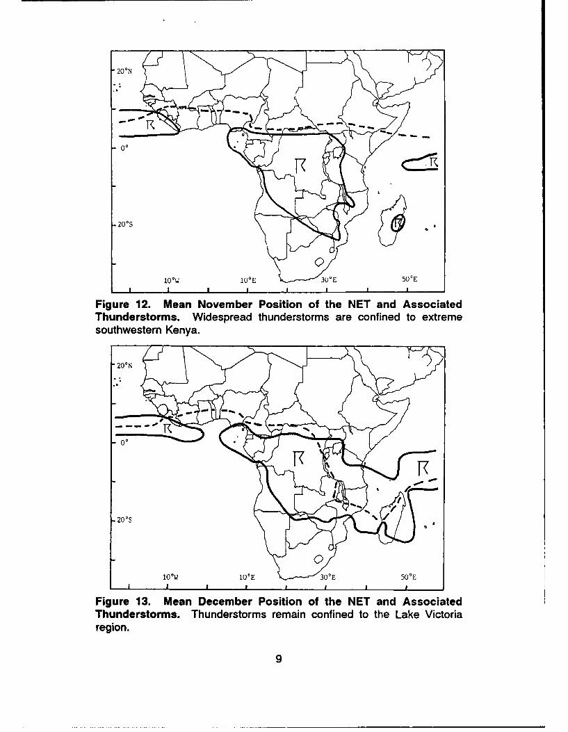
Figure 12. Mean November Position of the NET and AssociatedThunderstorms. Widespread thunderstorms are confined to extremesouthwestern Kenya.
200N
NOW 10E 30'E 50'EI I I I I I I
Figure 13. Mean December Position of the NET and AssociatedThunderstorms. Thunderstorms remain confined to the Lake Victoriaregion.
9
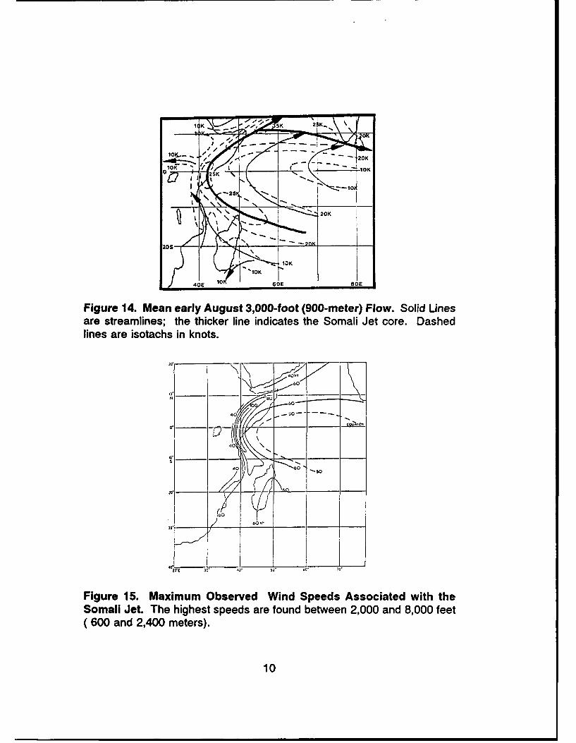
""1O K 2 K_
Figure 14. Mean early August 3,000-foot (900-meter) Flow. Solid Linesare streamlines; the thicker line indicates the Somali Jet core. Dashedlines are isotachs in knots.
3-10
(~ ~ 0 60 and 2,00meer)
\ -25 1
OK
400 t
40 0
N
-_
40 -5
30* 1 50' 70.
Figure 15. Maximum Observed Wind Speeds Associated with theSomali Jet. The highest speeds are found between 2,000 and 8,000 feet(600 and 2,400 meters).
10

SOMALIA CLIMATE AND WEATHER
GULF OF t . 'SONAL I A
Popu Lat to"Harg O.2 Million
Area (sq k3)
637.657CLIMATIC ZONES
I ADEN COAST Elevation
2 HIGHLANDS (meters)3 INDIAN OCEAN = Over 1080
OAST 0 = -ee
M]=Uder 2M
IND l1Cityj Population
S!" O CEA N jj Over 1,WO ,WOerka Over 5N,900
c Over 100900Chisi~aao 0 Uther MeAN
* Capital
Figure 16. Somalia Country Map. The only high terrain is along the Gulfof Aden coast. Isolated peaks--the highest being Surad Ad east ofBerbera--reach above 7,000 feet. Note the division of the country into three"ozones of climatic commonality." These are the Gulf of Aden Coast, theHighlands, and the Indian Ocean Coast.
SOMALIA GENERAL WEATHER. The NET's north-south oscillation resultsin two main seasons and two transitions--see "Seasonal Weather." Theshowers and thundershowers produced by the NET drive most weatheralong the eastern African coast. Precipitation generally falls within 150miles north and 250 miles south of the NET as it oscillates north and south.
Storms and Frontal Weather. Although frontal weather and tropicalstorms are almost unknown in Somalia, a very rare (but very strong)southern hemisphere cold front may push northward along the Kenyancoast during July and August before dissipating. Similarly, very strongnorthern hemisphere cold fronts may push southward into the Red Sea and
11
across Arabia, then dissipate. South Indian Ocean tropical storms crossMadagascar with some frequency, but none have ever recurved northwardinto Somalia. Similarly, no Arabian Sea tropical storms have so far reachedthe Indian ocean Coast of Somalia. However, such storms are known tohave entered the Gulf of Aden in the past 150 years before dissipating;one may have made landfall during the late 19th century on the extremenorthwestern Somali Gulf of Aden coast.
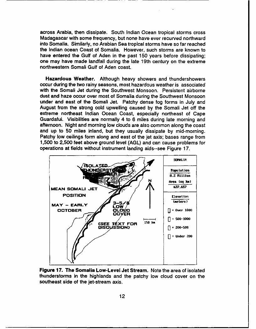
Hazardous Weather. Although heavy showers and thundershowersoccur during the two rainy seasons, most hazardous weather is associatedwith the Somali Jet during the Southwest Monsoon. Persistent airbornedust and haze occur over most of Somalia during the Southwest Monsoonunder and east of the Somali Jet. Patchy dense fog forms in July andAugust from the strong cold upwelling caused by the Somali Jet off theextreme northeast Indian Ocean Coast, especially northeast of CapeGuardafui. Visibilities are normally 4 to 6 miles during late morning andafternoon. Night and morning low clouds are also common along the coastand up to 50 miles inland, but they usually dissipate by mid-morning.Patchy low ceilings form along and east of the jet axis; bases range from1,500 to 2,500 feet above ground level (AGL) and can cause problems foroperations at fields without instrument landing aids--see Figure 17.
SOILIA
POEO Ppulation
82 Mlillion
MEAN SOMALI JET
POSITIONElevationMAY - EARLY O(meters)
OCTOBER OLD [ = Ouer 10000 CEER
[0 = Under 200
Figure 17. The Somalia Low-Level Jet Stream. Note the area of isolatedthunderstorms in the highlands and the patchy low cloud cover on thesoutheast side of the jet-stream axis.
12
The Somali Jet produces strong low-level winds and associatedturbulence, particularly over the Indian Ocean coastal interior, the easternHighlands, and the eastern Gulf of Aden Coast. Surface wind speedsbelow the Somali Jet core are highest (40 knots or more) between localmidnight and dawn. Afternoon gusts reach 20-25 knots. In the jet core,normally found between 3,000 and 5,000 feet (900 and 1,545 meters) MSL,speeds can reach 80 knots. Moderate to severe low-level turbulenceoccurs within 50 to 100 miles of the jet core from the surface to 7,000 feet(2,135 meters) MSL. A complex low-level eddy forms along the coast justeast of Cape Guardafui on the extreme northeastern tip of Somalia. Low-level winds about 75 miles east of the Cape are strong, with variabledirections. They pose operational problems for both aircraft and ships.Seas can be rough and erratic, with steep swells.
Tides. Tides along both the Gulf of Aden and Indian Ocean Coasts arediurnal. Mean Gulf of Aden tides are about 3 1/2 feet, with extremesreaching nearly 7 feet. Those along the Indian Ocean Coast are from 4feet along the north coast to almost 7 feet at the Juba River bar; extremesare nearly 12 feet.
Currents. Offshore ocean currents during the northeast monsoon arenortheasterly at 1 to 3 knots. During the southwest monsoon, they becomesouthwesterly at 2 to 4 knots. Surfs are high only when a tropical cyclonepassing well offshore recurves toward the southwest and the northernMozambique Channel. Such rare conditions are most likely in April, Mayor November.
SOMALIA SEASONAL WEATHER. Rainfall in Somalia varies dramaticallyfrom one year to the next; it is important to remember note that all rainfallvalues discussed here are averages, in both duration and amount. Someyears' rainfall may be two to three times the average, while in other years,there may be none. Somalia is divided into three climatological regions:The Gulf of Aden Coast, the Highlands, and the Indian Ocean Coast.Seasonal variations among these regions are discussed below.
The Northeast Monsoon (known locally as "Gilal") lasts from Decemberthrough March. Precipitation is confined to mountain slopes that face northand northeast. Northeast Monsoon weather is generally good, but isolatedshowers and thundershowers fall over the western Highlands andnorthward-facing slopes of the Highlands immediately inland from the Gulfof Aden Coast. Isolated showers and thundershowers also fall over higherterrain north of Baidoa. Seasonal precipitation averages just over 4 inchessouth of the Gulf of Aden Coast and near 2.5 inches north of Baidoa.Elsewhere, the average is less than 1 inch. In December and March, night
13

and early morning patchy fog and low cloud form along the coast south ofMogadishu and over the marshes of the Juba and Webi Shabelle Riversnorth and northeast of Chisimaayo. High temperatures range from the low80s in the Highlands to the middle 90s (0 F) over the Indian Ocean Coast,rising to slightly over 100 in the southern Indian Ocean coastal interior.Wet-bulb globe temperatures--used by the U.S. Army to evaluatetemperature and humidity effects on troops--range from 80 to 85.
The Spring Transition ("Gu"--also known as the "long rains") occurs inApril and May as the NET moves north toward its summer position acrossnorthern Ethiopia, Yemen, and southeastern Saudi Arabia. Generalraininess--mostly showers and thundershowers--accompanies the NET asit moves north. The NET often oscillates southward during this period; asa result, rains last longer and are more widespread than those of the FallTransition. Surface transport over unpaved roads can be difficult; someflash flooding may occur. Ceilings are below 3,000 feet above ground level(AGL) more than half the time over the Indian Ocean Coast and theHighlands. Only the Gulf of Aden Coast has good weather, but even thereoccasional showers move off the Highlands over the coast. Fog and lowclouds are common along the coast south of Mogadishu and over themarshes of the Juba and Webi Shabelle Rivers north and northeast ofChisimaayo. Seasonal precipitation ranges from less than 0.5 inch over theeastern Gulf of Aden Coast, to more than 2 inches over the Highlands.Average rainfall over the Indian Ocean Coast increases dramatically towardthe south, rising to more 10 inches south of Chisimaayo. Temperaturesdrop as the rains and cloud cover move north. Highs over the Gulf of AdenCoast and the Highlands are from the mid 90s (* F) to the mid 100s. Onthe southern Indian Ocean Coast proper, temperatures decrease to the low80s by the end of the season. Lows are in the mid 70s except over theHighlands, where they drop to the low 60s. Wet-bulb globe temperaturesremain in the high 80s.
The Southwest Monsoon (known locally as "Hagai") lasts from late Maythrough September. It is marked by sustained southwesterly winds below7,000 to 10,000 feet MSL. The core of these winds--the SomaliJet--persists from May through early October. Figure 14 showed its meanAugust position. Core altitude is about 4,000 feet MSL; core speeds canexceed 80 knots, as was shown in Figure 15; Figure 16 showed its meanposition from May through early October and its general effects on Somaliaweather. Scattered showers fall over the southern half of Somalia. Isolatedthunderstorms form over the western and central Highlands. Other weatherduring the Southwest Monsoon is directly related to the Somali Jet; seediscussions under "General Weather." Seasonal precipitation ranges fromnear 5 inches along the coast south of Mogadishu and more than 10 inches
14
in the highlands to less than 0.5 inch over the central and northern IndianOcean Coasts. High temperatures along the Indian Ocean Coast are in thelow 80s (0 F) south to the low 90s north; interior temperatures are from themid 90s to the low 100s. Maximum temperatures in the highlands drop intothe mid 70s or low 80s; Gulf of Aden coastal highs reach the middle 100s.Most low temperatures throughout the country are in the upper 70s to low80s; in the highlands, the low to mid 60s. Wet-bulb globe temperaturesrange from the middle 80s in the south to over 90 along the Gulf of AdenCoast.
The Fall Transition ("Der"--also called "the short rains") lasts 30 daysor less; its onset varies from late September to late October as the NETmoves southward more rapidly than during the Spring Transition. Showersand thundershowers are as strong as during the Spring Transition, but don'tlast as long. Some flooding follows the heavier showers andthundershowers. General weather is similar to that of the Spring Transition,but because of the steady southward movement of the NET, it is neither asbad nor as long-lasting. Seasonal precipitation exceeds 5 inches nearBaidoa and close to 3 inches over the central Indian Ocean Coast. Otherareas receive less than 1.5 inches. High temperatures along the IndianOcean Coast proper and over the highlands reach the middle to upper 80s(0 F); other areas rise into the mid 90s. Lows in the highlands drop intothe mid 60s; the rest of the country is in the upper 60s or low 70s. Wet-bulb globe temperatures range from the lows 80s near the Kenyan borderto slightly over 90 along the Gulf of Aden Coast.
15
YEMEN CLIMATE AND WEATHER
VDID4
YEMENY
Area (sq ka.)
5Z7 .978
Eleuation
(meters)"" = Ouer 100i
Re= Under ZOO&eraa 0Island•'•in'• City Population
1 over 1,e..e0
Gulf of Aden Over 500.080* Ouer 100,0We
SUnder 109,000
Figure 18. Yemen country map.
YEMEN GENERAL WEATHER. Cloud cover and precipitation over thehighlands vary from one year to the next, but coastal weather is relativelyconstant--hot and humid with little rainfall, especially along the Gulf of Aden.Showers and thundershowers fall over the highlands during the NortheastMonsoon and over the higher mountains during the Southwest Monsoon.The NET lies across the Yemeni highlands only during the SouthwestMonsoon. Morning fog occasionally forms along coasts, which aregenerally dry.
Land/sea breezes affect coastal areas and the lower foothills. Seabreezes at 6-10 knots normally last from mid-morning to early afternoon;they produce rainshowers and thunderstorms along the mountains, wherewinds are usually from the N or NE at 5 to 7 knots. Nighttime winds aregenerally light and variable. Frontal weather and tropical storms are rare.A strong Mediterranean cold front may push southward into the Red Sea
16
and across Arabia before dissipating. Only three Arabian Sea tropicalstorms have entered the Gulf of Aden before dissipating; one may havemade landfall on the extreme northwestern Somali Gulf of Aden coastduring the late 19th century.
YEMEN SEASONAL WEATHER.
The Northeast Monsoon (known locally as "Gilal") lasts from Decemberthrough March. Isolated showers and thundershowers fall over theHighlands. Extremely strong Mediterranean cold fronts can reach the area.Weather is generally dry along the coast. Sea breezes producerainshowers and thunderstorms along the mountains. By December, a coldfront crosses the area every 5 to 10 days bringing light precipitation andincreased mid- and upper-level clouds. Occasional 1,000-2,000 footceilings become scattered in the afternoon. Where Inland mountains facethe coast, clouds are likely to form between 0900 and 1800 LST. Frontalpassages in December bring primarily middle and upper clouds, with rainshowers over the Highlands. Showers and thundershowers bring as muchas 5 inches of rain a season to the higher mountains. Snow falls above10,000 feet (3,050 meters). Mean daily highs are in the low 70s (o F) to low90s; mean daily lows range from the low 50s to mid 70s. The Highlandsare considerably cooler--Sa'na has dropped to 220 F in December.
The Spring Transition ("Gu") occurs in late April and May as the NETmoves northward into its summer position across northern Ethiopia, Yemen,and southeastern Saudi Arabia. Isolated showers and thundershowersaccompany it over the Highlands. Coastal areas remain hot, humid, anddry. Patchy low clouds cause occasional, mostly morning 2,000- to 3,000-foot (600- to 900-meter) ceilings at Aden. Isolated showers fall in May asthe NET moves through the Gulf of Aden. Afternoon showers andthundershowers become more frequent over the southwestern Highlands.Coastal high temperatures range from the mid to low 90s (0 F), with lowsin the mid-60s. In the cooler highlands, temperatures are from the mid-70sto the low 80s,with lows in the low 40s. Surface transport over unpavedroads can be difficult; flash flooding may occur.
The Southwest Monsoon ("Hagai") lasts from late May throughSeptember. It is marked by routine showers over the Highlands. Earlymorning low clouds occasionally form ceilings below 1,000 feet (300 meters)that move onshore along the Gulf of Aden coast and dissipate by mid-morning. Isolated afternoon and evening thundershowers develop along theinland coastal mountains. Some persist until near midnight in the Adenarea, but most dissipate after sunset. Late afternoon showers andthundershowers are common over the southwestern Highlands; isolated
17

severe thunderstorms have been reported. Dust and haze restrict visibilitiesto 3 miles on many afternoons. Coastal high temperatures reach the mid-90s (* F); lows are in the upper 70s or low 80s. Highland temperatures are10 to 15 degrees cooler.
The Fall Transition ("Der") is the driest time of the year. It lasts 30 daysor less, but onset varies from late September to late October as the NETmoves southward rapidly. Once the NET has moved south into Somalia,precipitation decreases rapidly. Skies are generally clear, except forafternoon clouds over the higher peaks. Only widely isolated showers fallover the highest terrain. Even the southwestern highlands get only isolatedshowers. Snow falls above 10,000 feet (3,050 meters) as the first of theMediterranean cold fronts arrives in late November, bringing extensivemiddle and high cloudiness. Coastal temperatures reach the low 90s (* F)and fall into to the low 70s; Highland highs range from the middle 50s tothe low 70s, depending on elevation. Lows in the interior can go belowfreezing, but rarely.
18
DJIBOUTI CLIMATE AND WEATHER
lab el-Ilandeb DJIBOUTI
DJIBOUTIPopulationDJIBOUTI3208Area (sq km)
Gulf of ZeeeAden ________
Eleuation
(meters)t_ ..... : ....... = Ouer MO e)
Gulf of Tad.joura
IE]UTI []see-ieee[J=200--500
.,= Under ZO0
S- "'•.•Z5 kn
SAbbe ':;-
Figure 19. Djibouti country map.
DJIBOUTI GENERAL WEATHER. Fair weather dominates, but isolatedshowers or dust haze are possible, as discussed in "Seasonal Weather."For example, rare showers and isolated thundershowers fall over Djiboutiduring the Northeast Monsoon. Cloudiness and precipitation at other timesof the year are almost non-existent. Land and sea breezes affect coastalareas and the lower foothills. Sea breezes normally last from mid-morningto early afternoon, with speeds of 6-10 knots. Nighttime winds aregenerally light and variable.
DJIBOUTI SEASONAL WEATHER.
The Northeast Monsoon (known locally as "Gilal") lasts from Decemberthrough March. Isolated showers and thundershowers fall as the exceptionto the rest of the year. Night and morning low clouds occasionally formceiling as low as 2,000 to 3,000 feet (600 to 900 meters). Afternoons
19
usually have only patchy low clouds. Isolated showers occur in theafternoons. Winds reflect a strong land/sea breeze; dust is most commonin the afternoon. High temperatures are in the mid 80s (0 F); lows are inthe mid 70s.
The Spring Transition ("Gu") occurs in late April and May as the NETmoves northward into its summer position across northern Ethiopia, Yemen,and southeastern Saudi Arabia. Extremely heavy showers andthunderstorms are possible.; a 24-hour rainfall of over 7 inches (175 mm)has been recorded. Showers and thundershowers become increasinglyrare as prevailing wind directions become southwesterly. Dust raised by thepersistent southwesterly winds, however, becomes a problem. Once theNET moves into Yemen, winds become almost exclusively the product ofthe land/sea breeze; offshore at night, onshore during the day. Hightemperatures rise into the low 90s (0 F); lows are in the low 80s.
The Southwest Monsoon ("Hagai") lasts from late May throughSeptember. Dust continues to be raised by the persistent southwesterlyto westerly winds. Skies are almost clear; there are only patchy earlymorning low clouds and a very rare afternoon shower. High temperaturesclimb to over 100 (0 F); lows are in the high 80s.
The Fall Transition ("Der") lasts 30 days or less, but onset varies fromlate September to late October. The NET moves southwara rapidly. Skiesare generally clear, except for patchy mid-morning clouds. By late October,isolated rain showers fall. Patchy night and early morning low clouds againappear. Winds come under the control of the land/sea breeze. Hightemperatures are only in the upper 80s; lows, in the upper 70s.
20
ETHIOPIA CLIMATE AND WEATHER
ETHIOPIA
Red SeaPopulation
~-$~.' ~'49.8 Mihllion
Area (sq kIm)
"Desert Eleuation
200 km(meters)
kos* = Over 2000
a _ -I0 = 1900-2000
[I=500-1000,. Under 500
Figure 20. Ethiopia country map.
ETHIOPIA GENERAL WEATHER. Terrain plays a key role in Ethiopianweather. Widespread showers and thunderstorms form over the westernhighlands and the mountains of the eastern highlands from April throughSeptember. The showers end in October and good weather dominatesmost of Ethiopia from November through March. Showers, however, fall inthe far southwestern mountains all year.
ETHIOPIA SEASONAL WEATHER. Mountain weather is notoriouslyvariable; what occurs on one side of a ridge may not happen across theridge crest. The higher mountains in the southwest have showers andthundershowers all year. Mountain valleys often have low overcast nightand morning cloudiness, especially if showers have fallen late the previousafternoon. Wind patterns are caused by a complex series of terrain-controlled airflows. Temperatures are a function of elevation.
21
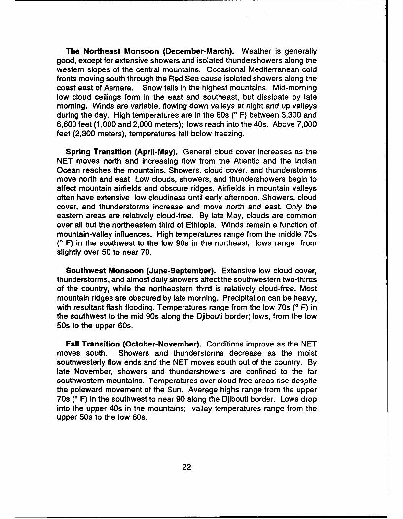
The Northeast Monsoon (December-March). Weather is generallygood, except for extensive showers and isolated thundershowers along thewestern slopes of the central mountains. Occasional Mediterranean coldfronts moving south through the Red Sea cause isolated showers along thecoast east of Asmara. Snow falls in the highest mountains. Mid-morninglow cloud ceilings form in the east and southeast, but dissipate by latemorning. Winds are variable, flowing down valleys at night and up valleysduring the day. High temperatures are in the 80s (0 F) between 3,300 and6,600 feet (1,000 and 2,000 meters); lows reach into the 40s. Above 7,000feet (2,300 meters), temperatures fall below freezing.
Spring Transition (April-May). General cloud cover increases as theNET moves north and increasing flow from the Atlantic and the IndianOcean reaches the mountains. Showers, cloud cover, and thunderstormsmove north and east Low clouds, showers, and thundershowers begin toaffect mountain airfields and obscure ridges. Airfields in mountain valleysoften have extensive low cloudiness until early afternoon. Showers, cloudcover, and thunderstorms increase and move north and east. Only theeastern areas are relatively cloud-free. By late May, clouds are commonover all but the northeastern third of Ethiopia. Winds remain a function ofmountain-valley influences. High temperatures range from the middle 70s(0 F) in the southwest to the low 90s in the northeast; lows range fromslightly over 50 to near 70.
Southwest Monsoon (June-September). Extensive low cloud cover,thunderstorms, and almost daily showers affect the southwestern two-thirdsof the country, while the northeastern third is relatively cloud-free. Mostmountain ridges are obscured by late morning. Precipitation can be heavy,with resultant flash flooding. Temperatures range from the low 70s (0 F) inthe southwest to the mid 90s along the Djibouti border; lows, from the low50s to the upper 60s.
Fall Transition (October-November). Conditions improve as the NETmoves south. Showers and thunderstorms decrease as the moistsouthwesterly flow ends and the NET moves south out of the country. Bylate November, showers and thundershowers are confined to the farsouthwestern mountains. Temperatures over cloud-free areas rise despitethe poleward movement of the Sun. Average highs range from the upper70s (0 F) in the southwest to near 90 along the Djibouti border. Lows dropinto the upper 40s in the mountains; valley temperatures range from theupper 50s to the low 60s.
22
SUDAN CLIMATE AND WEATHER
SUDO
P•opu lat ton"PortDSudN 24.5 Miillion
k FArea (sq 1(m)
2,595,1113
dS~dldEleuation
(meters)
E =Ovr 1000
E 00-5oo
. Under ZOO
. :CityC Population• • :I1O km
* Ouer 1,080,060
- Duer 500,M89*Over 100,8000
i Under 100,000
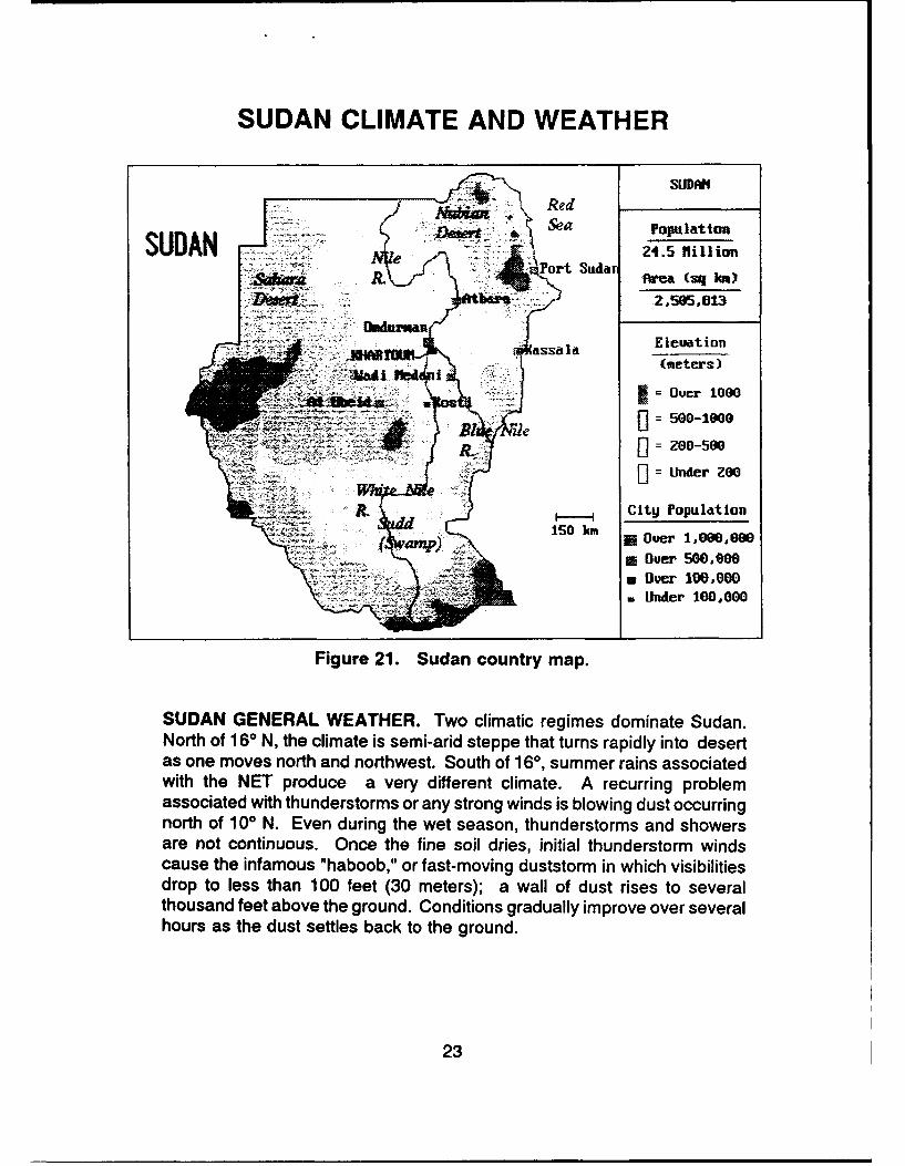
Figure 21. Sudan country map.
SUDAN GENERAL WEATHER. Two climatic regimes dominate Sudan.North of 160 N, the climate is semi-arid steppe that turns rapidly into desertas one moves north and northwest. South of 160, summer rains associatedwith the NET produce a very different climate. A recurring problemassociated with thunderstorms or any strong winds is blowing dust occurringnorth of 100 N. Even during the wet season, thunderstorms and showersare not continuous. Once the fine soil dries, initial thunderstorm windscause the infamous "haboob," or fast-moving duststorm in which visibilitiesdrop to less than 100 feet (30 meters); a wall of dust rises to severalthousand feet above the ground. Conditions gradually improve over severalhours as the dust settles back to the ground.
23

SUDAN SEASONAL WEATHER.
Dry Season (Mid-November-February). The NET has moved south ofSudan, but Mediterranean frontal systems crossing the area produceblowing dust. Only in the extreme south do occasional northward surgesof the NET produce very isolated showers. Skies are almost clear below20,000 feet except in the extreme south where isolated afternoon showersoccur. Isolated showers also fall over the mountains bordering Ethiopia;snow has been briefly observed above 10,000 feet (3,050 meters). Windsahead of frontal systems pick up dust--a persistent "dust haze" restrictsvisibilities in the northern half of Sudan to less than 6 miles much of thetime, and visibilities drop well below 3 miles 1 day in 10. The lowestvisibilities occur when a frontal system penetrates well south into Sudan, orwhen a major storm moves across northern Libya and Egypt. Hightemperatures are over 100 (0 F); lows drop to near freezing over theSahara.
Spring Transition (March-May). As the NET moves north (to about 150N) by the end of May, summer rainshowers and thunderstorms begin to thesouth; they normally lag the NET by about 150 miles. The NET does notmove continuously northward, but advances and retreats (or "surges") inresponse to storm systems developing in Algeria that move east along thecoast into northern Egypt. Periods of showers and thundershowersalternate with periods of dry northerly winds. By late May, thunderstormsare occurring south of 14°. "Haboobs" are common with the strong windsassociated with isolated thunderstorms occurring between the NET and thegeneral area of rains 100 to 150 miles south of the NET. By late May, hightemperatures range from near 100 (0 F) in the south to over 1050 in the dryair north of the NET.
Wet Season (June-September). The NET oscillates between 170 and200 N during the wet season, but it has reached 250 N. From 100 milessouth of the NET southward, extensive low ceilings and poor visibilities arecommon with showers and thundershowers. "Haboobs" are associated withthe strong (over 50 knots in some cases) winds of the isolatedthunderstorms just south of the NET where general rains are not occurring.Extensive squall lines form -etween 150 and 300 W south of 150 N andmove westward from late June through mid-September. Seasonal rainstotal over 10 inches south of Khartoum, but exceed 38 inches in theextreme southwest. Flooding is common. High temperatures north of 150N average near 1100 F; south of 150 N, they are in the high 80s to low90s. Low temperatures drop to the upper 70s in the north and to the upper60s south.
24

Fall Transition (October-mid November). The NET moves steadilysouthward, reaching extreme southern Sudan by mid-November. Unlike thespring transition, "surges" are rare. NET passage southward marks thestart of the dry season, with its northerly winds and blowing dust.Precipitation and associated cloudiness recede southward rapidly as theNET moves south. Weather north of the NET rapidly reverts to the dry,dusty conditions of winter (the dry season). Temperatures range from highsof 95 to 1000 F, with lows in the upper 60s to low 80s.
25

KENYA CLIMATE AND WEATHER
Chadi 24.3 flillionA Desert
Area (sq kcm)
"TEHI( "THE PLAI S Eluat ion
(meters)
* Ouer 2000Lakea
pI
UUnder 5W0
OvD~er 1,OOOO00S\i* Over 500. 'O,
IN~ Du Oer 100,000Indian Under 100,000
ombasa Ocean Capital
Figure 22. Kenya country map. Kenya is divided into two climaticregions, as shown. These regions reflect the combined influences of thedual passage of the NET, the rising terrain westward, and the effects of theIndian Ocean.
KENYA GENERAL WEATHER. Night and morning low clouds form 1,500to 2,500 foot (400 to 600 meter) ceilings all year. Nocturnal fog and fogbanks along the coast and near rivers routinely reduce visibilities to lessthan 3 miles. Ceilings in showers and thundershowers may go as low as100 feet (30 meters) and 1/4 mile (400 meters).
KENYA SEASONAL WEATHER. Highland locations and Lake Victoria donot necessarily conform to the seasonal regimes discussed below becauseof rainfall enhancement from moist Indian Ocean Air lifted over ridges. TheCentral Mountains have the wettest season during northern hemispheresummer, but the extreme north is wettest in March and April. Lake Victoriahas no dry season; a complex series of airflow interactions ensures that
26
showers and thundershowers--many producing hail--occur all year long onthe Kenyan side of the lake. Late December through February and Augustthrough mid-October are "drier" seasons between the two primary wetseasons on the plains. During the spring and fall wet seasons, showersand thundershowers become widespread, especially in the afternoons andat night. The spring wet season has the most rainfall over the northeasternplains, but by the end of the fall rains, most falls over the southwesternplains. Onset, strength, and duration of these rains are extremely variablefrom one year to the next. Flash flooding is a particular problem during thetwo rainy seasons, when thunderstorm tops can reach 50,000 feet MSL.
The Northeast Monsoon (Late December-February). The NET liessouth of Kenya. Drier, more stable, air is brought inland by northeasterlywinds. Only widely isolated afternoon showers, and an occasionalthundershower, form over higher terrain; otherwise, showers are rare. Hightemperatures range from the mid 80s (* F) to the mid 90s; lows are in themid 60s or low 70s.
The Spring ("Long") Rains (March-July). Showers andthundershowers are widespread as the NET moves slowly northward;north-south oscillations are common. The Somali low-level jet forms overextreme eastern Kenya by late April and persists through July. The windspeed core altitude ranges from 3,000 to 7,000 feet; peak speeds areabove 50 knots. Moderate to severe turbulence occurs within 35 to 50miles horizontally and 2,000 to 6,000 vertically of the core. Hightemperatures are in the mid 80s (0 F); lows are in the low 70s.
The Southeast Monsoon (August-mid October). The Somali low-leveljet persists until late September. Showers and thundershowers decreasein coverage and frequency, but both increase in mid to late October as theNET moves far enough south to affect Kenya. High temperatures drop tonear 800 F; lows are in the upper 60s.
The Fall ("Short") Rains (Late October-mid December). The NETmoves across Kenya into Tanzania by late December. Unlike the SpringRains, north-south oscillations are rare. Actual rainy season length on theplains is between 4 and 6 weeks at any one spot. High temperatures arein the upper 80s (0 F); lows are near 70.
27

DISTRIBUTION
HO AFIXOW , Pentagon, Washington, DC 20301 ........................................................ IHO USAF/XOOOW, Rm BD927, Washington, DC 20330-5054 .............................................. 1OSAFISS. Rm 4C1052. Pentagon, Attn: Weather, Washington, DC 20330-6560 .................................. 1USTC J3/J4-OW, Scott Dr., Bldg 1900. Scott AFB, IL 62225-7001 ............................................ 3AWS/XTX/DO/XT, Losey St.. Bldg 1521, Scott AFB, IL 62225-5008 ........................................... 1Dot 4, AWS. Bldg 91027, Hurlburt FId, FL 32544-5000 .................................................... 1Dot 5, HO AW S, Keesler AFB, MS 39534-5000 ......................................................... 1HO AFGWCIDOM/SY/RM, MBB39, 106 Peacekeeper Dr., Ste 2N3, Offutt AFB, NE 86113-4039 ..................... 1AFSFC/DON, Stop 82. Bldg 715, Patrick Ave.. Falcon AFB, CO 80912-5000 .................................... IUSAFETAC, Scott AFB, IL 62225-5000 ............................................................... 6CL-A, USAFETAC, Federal Building, Rm 305. Asheville, NC 28801-2723 ....................................... 1NCDC Library (D542X2), Federal Building, Asheville, NC 28801-2723 (2 copies of SCSs) ........................... 1AFSPACECOM/DOWA. Bldg 1, Stop 7, Peterson Rd., Peterson AFB, CO 80914-5001 ............................. 1AFTAC/DOW , Patrick AFB, FL 32925-5000 ............................................................ 1USAICS, Attn: ATSI-CDW. Ft Huachuca, AZ 85613-6000 .................................................. 1AFMC(I)IDOW, Bldg 266, Post 108P Chidlaw Rd.,Wright-Patterson AFB, OH 45433-5000 ........................... IFASTC/TAW, 4115 Hobble Creek Rd., Ste 33. Wright-Patterson AFB, OH 45433-5637 ............................. 1ASD/WE, Bldg 91. 3rd St. Wright-Patterson AFB, OH 45433-6503 ........................................... 1AFIT/CIR, W right-Patterson AFB, OH 45433-6583 ....................................................... 1WLJDOA, Wright-Patterson AFB, OH 45433-6543 ....................................................... IWI/DOW, Wright Patterson AFB, OH 45433-6543 ................................................... . 1FASTC/TAW, Wright-Patterson AFB, OH 45433-6543 ..................................................... 1P1JW E, Kirtland AFS, NM 87117-5000 ................................................................ 1HO AFOTEC/W E, Kirtland AFB, NM 87117-7001 ........................................................ 1RI/W E, Griffiss AFB, NY 13441-5700 .......... ...................................................... 1RIJSULCorridor W, Ste 262, 26 Electronic Pkwy, Griffiss AFB. NY 13441-4514 .................................. 1AFCESA/W E, Tyndall AFB, FL 32403-5000 ............................................................ 1AFCES/RDXT, Bldg 1120, Stop 21, Tyndall AFB, FL 32403-5000 ............................................ 1ESD/WE, Vandenberg Dr., Bldg 1624, Hanscom AFB, MA 01731-5000 ........................................ 1PL/TSML, Research Library, Hanscom AFB, MA 01731-5000 ............................................... 1PL/GP, Hansom AFB. MA 01731-5000 ................................................................ IAFFTC/W E, Edwards AFB. CA 93523-5000 ............................................................ 1UTTR/W E, Hill AFB, UT 84056-5000 ................................................................. 1USCENTCOM/CCJ3-W, Bldg 540, MacDill Blvd. MacDill AFB, FL 33608-7001 ................................... 1HO AFTAC/TNK, 1030 Highway AlA, Patrick AFB, FL 32925-5000 ........................................... 1ESMC/W E, Patrick AFB, FL 32925-5000 .............................................................. 1OL-A. AFCOS, Site R, Fort Ritchie, MD 21719-5010 ...................................................... 1USAFALCENT RA, Pope AFB. NC 28308-5000 ......................................................... 1CCSO/FL Tinker AFB, OK 73145-6340 ............................................................... IAFOSR/NL. Boiling AFB, DC 20332-5000 .............................................................. 1TFW C/W E. Nellis AFB, NV 89191-5000 ............................................................... 1SMC, Dot 2/TDO, Onizuka AFB CA 94088-3430 ......................................................... IAL/OEBE, 2402 East Drive. Brooks AFB. TX 78235-5114 .................................................. 1AMC/XOWR. Bldg P40 N, Martin Ave. Scott AFB. IL 62225-5000 ............................................ 3AMC/TACC. Bldg P40 N. Martin Ave, Scott AFB, IL 62225-5000 ............................................. 1AFSOC/DOW, Bldg 1, Hudburt FLD, FL 32544-5000 ...................................................... 1ATCIDOTW, 244 F Street East. Suite #3, Randolph AFB, TX 78150-4325 ...................................... 1502 OSS/OSW, Bldg 844, Rm 117, Maxwell AFB, AL 36112-5000 ........................................... 1CFA. C-2/SW O. APO AP 96258-0210 .............................................................. . 1603 ACCS/W E. Unit 2051. APO AP 96278-5000 ......................................................... 180SS/W X, APO AP 96264-5000 .................................................................... 1PACAF/DOW, Bldg 1102. Hickam AFB. HI 96853-5000 .................................................... IDot 1, HO PACAF, COMNAVMAR, PSC 489. Box 20. FPO AP 96540-0051 ..................................... 111OPG/WE, 6900 9th Ste 205, Elmendorf AFB. AK 99506-5000 ............................................. II IWS. 1215 Flightfine Ave. Ste 2. Eielson AFB, AK 99702-1520 ........................................... 11 5WS, Hickam AFB, HI 96353-5000 .......................... 1USSTRATCOMIJ3615, Rm L127. Bldg 522. 901 SAC Blvd, Offutt AFS, NE 68113-5000 ............................ 1ACC/DOW, Bldg 21, 30 Elm St. Ste 215, Langley AFB, VA 23655-2093 ........................................ 512AOGIAOSW, E Ave., Bldg 2900, Bergstrom AFB. TX 78743-5000 .......................................... 1USCENTCOM/CCJ3-W. MacDill AFB, FL 33608-7001 ................................ .................. . 5
28
USSOCCENT/SCJ2-SWO, MacDill AFB, FL 33608-7001.................................................USSOCOM /SOJ3-W, MacD ll AFB , FL 33608-6001 ....................................................... 1
IWG, Bldg 168, Hardee St., Ft McPherson, GA 30300-5000 ................................................ 3OL-A, 5WS. AFZJISWO, Ft Irwin, CA 92310-3000 ..................................................... IOL-B, Dot 2, 5WS, Ft Indiantown GAP, PA 17003-5002 ................................................... 1CDR USASOC, Attn: AOIN-ST, Ft Bragg, NC 28307-5200 ................................................. 1JSOC/Woather, P.O. Box 70239, Ft Bragg, NC 28307-5000 ................................................ 1Dot 4/WXG, Hangar Access Dr., Bldg 2065, Ft Drum, NY 13602-5042 ......................................... 1Dot 58, 1WXG, Bldg 9601, Butts AAF, Ft Carson, CO 80913-6403 ........................................... 1HO 5th U.S. Army, AFKB-OP (SWO), Ft Sam Houston, TX 78234-7001 ....................................... 1USAFE/DOW, Unit 3050, Box 15, APO AE 09094-5000 ................................................... IUSAFE/DOWO, Unit 3050, Box 500, APO AE 09094-5000 ................................................. 117AFIDOW , Unit 4065, APO AE 09136-5000 .................... .................... ................. 1HO USEUCOM ECJ3, Unit 30400, Box 1000, APO AE 09128-4209 ........................................... 17WS, CINCUSAREUR/AREAWX, APO AE 09403-5000 ................................................... 17W S, Unit 29351, APO AE 09014-5000 ............................................................... 116AFISWO, Unit 6365, APO AE 09641-5000 ........................................................... 1COMNAVOCEANCOM, Code N312, Stennis Space Ctr, MS 39529-5000 ....................................... 1COMNAVOCEANCOM (Capt Brown, Code N332), Stennis Space Ctr, MS 39529-5001 ............................. 1NAVOCEANO (Rusty Russum), Bldg 8100, Rm 203D, Stennis Space Ctr, MS 39522-5001 .......................... 1NAVOCEANO. Code 9220 (Tony Ortolano), Stennis Space Ctr, MS 39529-5001 ................................. 1Maury Oceanographic Library, Naval Oceanography Office, Stennis Space Ctr, MS 39522-5001 ...................... 1Naval Research Laboratory, Monterey, CA 93943-5006 .................................................... 1Naval Research Laboratory. Code 4323, Washington, DC 20375 ............................................. INaval Postgraduate School, Chmn. Dept of Meteorology, Code 63, Monterey, CA 93943-5000 ....................... 1Naval Air Warfare Center-Weapons Division, Geophysical Sciences Branch, Code 3254, Point Mugu, CA 93042-5001 ..... 1Armed Forces Medical Intelligence Center, Information Services Division, Bldg 1607, Ft Detrick, Frederick, MD 21702-5004 .. 1Chief, APG Met Team, Bldg 1134, Attn: AMSTE-TC-AM CAB, Aberdeen Proving Ground, MD 21005-5001 .............. IAtmospheric Sciences Laboratory (SLCAS-AS-l 3 10-2c), White Sands Missile Range, NM 88CiJ2-5501 ................ 1TECOM Atmos Sci Div, AMSTE-TC-AA (MacBlain), White Sands Missile Range. NM 88002-5504 ..................... 1White Sands Met Team, AMSTE-TC-AM (WS), White Sands Missile Range, NM 88002-5501 ........................ 1USA TECOM, ATTN: AMSTE-TC-AM (RE) TECOM Met Team, Redstone Arsenal, AL 35898-8052 .................... 1Director, U.S.A.-CETEC, Attn: GL-AE (Whitmarsh), Fort Belvoir, VA 22060-5546 ................................. 1Technical Library, Dugway Proving Ground, Dugway. UT 84022-5000 ......................................... 1HO NATO Staff Meteorological Officer IMSIOPS APO AE 09724 ............................................. INOAA/MASC Library MCS, 325 Broadway, Boulder, CO 80303-3328 .......................................... 2NOAA Ubrary-EOC4WSC4, Attn: ACO, 6009 Executive Blvd, Rockville, MD 20852 ................................ 1NOAAJNESDIS (Attn: Nancy Everson, E/RA22), World Weather Bldg. Rm 703. Washington, DC 20233 ................. 1NGDC, NOAA, Mail Code EIGC4, 325 Broadway, Boulder, CO 80333-3328 ..................................... 1NWS Training Center, 617 Hardesty, Kansas City, MO 64124 ............................................... 1NIST Pubs Production, Rm A635, Admin Bldg, Gaithersburg, MD 20899 ....................................... 1DTIC-FDAC, Cameron Station, Alexandria, VA 22304-6145 ................................................. 2AULILSE, Maxwell AFB, AL 36112-5564 .............................................................. 1AW STL, Scott AFB, IL 62225-5438 ................................................................. 100
29