achieving sustainable, compact development in the portland
TRANSCRIPT

Portland State University Portland State University
PDXScholar PDXScholar
Institute of Portland Metropolitan Studies Publications Institute of Portland Metropolitan Studies
11-1-2009
Achieving Sustainable, Compact Development in the Achieving Sustainable, Compact Development in the
Portland Metropolitan Area: New Tools and Portland Metropolitan Area: New Tools and
Approaches for Developing Centers and Corridors Approaches for Developing Centers and Corridors
Gil Kelley Portland State University
Sheila A. Martin Portland State University, [email protected]
Elizabeth Mylott Portland State University, [email protected]
Follow this and additional works at: https://pdxscholar.library.pdx.edu/metropolitianstudies
Part of the Urban Studies and Planning Commons
Let us know how access to this document benefits you.
Citation Details Citation Details Kelley, Gil, "Achieving sustainable, compact development in the Portland Metropolitan Area : New tools and approaches for developing centers and corridors" (2009). A policy report prepared by the Instite of Portland Metropolitan Studies. Found at http://www.pdx.edu/sites/www.pdx.edu.ims/files/ims_centerscorridors.pdf
This Technical Report is brought to you for free and open access. It has been accepted for inclusion in Institute of Portland Metropolitan Studies Publications by an authorized administrator of PDXScholar. Please contact us if we can make this document more accessible: [email protected].
P O L I C Y R E P O R T
Achieving Sustainable, Compact Development
in the Portland Metropolitan Area:
New Tools and Approaches for Developing Centers and Corridors
PREPARED BY
The Institute of Portland Metropolitan Studies Portland State University
NOVEMBER, 2009
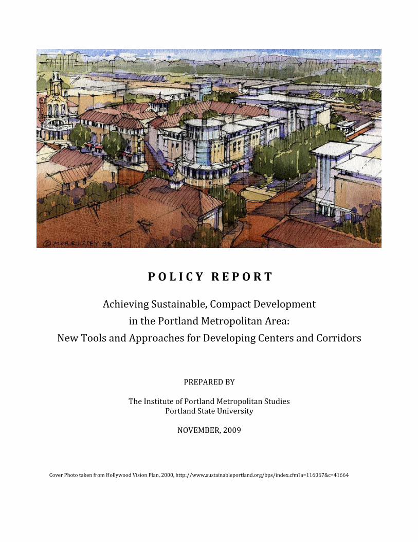
Cover Photo taken from Hollywood Vision Plan, 2000, http://www.sustainableportland.org/bps/index.cfm?a=116067&c=41664

This report has been prepared by the Institute of Portland Metropolitan Studies based on the deliberations of a group of Portland area experts in real estate development and finance, known for this purpose as the Expert Advisory Group on Developing Centers and Corridors, convened in July through October of 2009.
Expert Advisory Group on Developing Centers and Corridors
Convener/Facilitator:
Gil Kelley, Senior Research Fellow, Institute for Portland Metropolitan Studies* Expert Advisory Group Members:
Dennis Wilde, Principal, Gerding-Edlin Development; Residential, Commercial and Institutional Developers
Vern Rifer, Principal, Vernon L. Rifer Real Estate Development Inc.; Residential and Commercial Developers
Jerry Johnson, Principal, Johnson/Gardner; Economists and Real Estate Development Experts
Kate Allen, Housing Policy Manager; City of Portland, Office of Commissioner Fish
Matthew Stanley, Senior Relations Officer; Umpqua Bank
Mark New, New & Neville; Real Estate Appraisers
Abe Farkas, Principal, ECO Northwest, Economic and Planning Consultants
Kevin Cavenaugh, Principal, Cavenaugh & Cavenaugh, LLC & Ten-Pod Development, Architects & Developers
Jim Irvine, Principal, The Conifer Group; Residential Developers
Dave Leland, Principal, Leland Consulting; Planning and Development Consultants
Steve Burdick, Principal, Killian Pacific; Residential Developers
Beverly Bookin, Principal, The Bookin Group; Urban Planning Consultants
Don Hanson, Principal, OTAK; Land Planners and Development Consultants
Ed McNamara, Principal, Turtle Island Development; Residential Developer
John Southgate, Development Director, City of Hillsboro
Alice Rouyer, Redevelopment Director, City of Gresham,
Ron Bunch, Community Development Director, City of Tigard
Michael Mehaffy, Principal, Structura Naturalis Inc.; Planners and Development Consultants
John Spencer, Principal, Spencer and Kupper; Planners and Development Consultants
* Mr. Kelley is the former Director of Planning for the City of Portland. He served as project lead for this effort and is the principal author of this report. Dr. Sheila Martin, IMS Director, and Elizabeth Mylott, Research Assistant also contributed to this study. IMS wishes to thank the staff of Metro for their participation and support, particularly Robin McArthur, Andy Shaw, Chris Deffebach, Megan Gibb and Beth Cohen.

November 12, 2009 Mr. Michael Jordan Chief Operating Officer Metro 600 NE Grand Avenue Portland, OR 97232 Dear Mr. Jordan: We are pleased to transmit the findings and conclusions of the Expert Advisory Group on Developing Centers and Corridors. This group was convened by the Institute for Portland Metropolitan Studies at the request of Metro and was charged with investigating the barriers to compact, mixed use development in the metropolitan area, with a particular focus on centers and corridors. The group met several times over the summer and enthusiastically offers a perspective on the current and long-term challenges to development, a set of overall recommendations on enhancing the investment environment, and a proposed Action Plan for increasing public and private investment in centers and corridors. We have written up their findings and recommendations in this report and would be happy to present this report, with the assistance of members of the Expert Advisory Group (EAG), to the Metro Policy Advisory Committee and to Metro Council. The EAG and some of the regular observers of the group’s proceedings (primarily local elected officials) have also expressed an interest in presenting these findings to local city councils and planning commissions. Please let us know how we can help you present and further the work that has begun here. Sincerely, Sheila Martin, PhD Gil Kelley, Director Senior Research Fellow

[This page intentionally left blank]
Table of Contents
Executive Summary 1
Chapter 1 Purpose and Background 9
Planning context, Metro’s request of IMS and the task of the Expert Advisory Group
Chapter 2 Findings and Conclusions 13
Trends, challenges and opportunities for the Portland metropolitan area
Chapter 3 Recommended Action Plan 20
New tools and strategies for achieving compact urban development
Chapter 4 The Role of Metro 29
Future roles for Metro in implementing the recommended action plan
Chapter 5 Next Steps 30
Background Documents 31 Institute of Portland Metropolitan Studies. (2009). Initial Assumptions, Challenges and Key Questions for EAG. Portland, OR: IMS. Metro. (2009). Achieving Mixed Use Compact Development in Centers and Corridors: Aspirations, Challenges and Tools – Background Information for EAG. Portland, OR: Metro.

References
Brown, M., Southworth, F. and Sarzynski, A. (2008). Shrinking the Carbon Footprint of Metropolitan America. Washington, D.C.: Brookings Institute, (retrieved November, 2009), http://www.brookings.edu/~/media/Files/rc/reports/2008/05_carbon_footprint_sarzynski/carbonfootprint_report.pdf
Brown, M., Southworth, F. and Stovall, T. (2005). Towards a Climate-Friendly Built Environment. Arlington, VA: Pew Center on Global Climate Change, (retrieved November, 2009), http://www.pewclimate.org/docUploads/Buildings_FINAL.pdf. Bürer, M.J., Goldstein, D. and Holtzclaw, J. (2004). Location Efficiency as the Missing Piece of the Energy Puzzle: How Smart Growth Can Unlock Trillion Dollar Consumer Cost Savings. Washington, D.C.: American Council for an Energy-Efficient Economy, (retrieved November, 2009), http://docs.nrdc.org/air/files/air_06031001a.pdf. City of Portland Bureau of Planning and Sustainability. Infill Design. Portland, OR, (retrieved November, 2009), http://www.portlandonline.com/bps/index.cfm?c=34024. City of Portland Bureau of Planning and Sustainability. Portland Courtyard Housing Competition. Portland, OR: (retrieved November, 2009), http://www.courtyardhousing.org/. Ewing, R. et al. (2007). Growing Cooler: The Evidence on Urban Development and Climate Change. Washington, D.C.: Urban Land Institute, (retrieved November, 2009), http://www.smartgrowthamerica.org/documents/growingcoolerCH1.pdf. Frank, R. (2009). Portland area builders switch to small, efficient homes. Portland, OR: The Oregonian, (retrieved November 2009), http://www.oregonlive.com/business/index.ssf/2009/10/portland-area_builders_shift_t.html. Glaeser, E. and Kahn, M. (2008). The Greenness of Cities. Cambridge, MA: Harvard University, (retrieved November, 2009), http://www.hks.harvard.edu/rappaport/downloads/policybriefs/greencities_final.pdf. Golob, T. and Brownstone, B. (2008). The Impact of Residential Density on Vehicle Usage and Energy Consumption. Irvine, CA: The Institute of Transportation Studies, (retrieved November, 2009), http://repositories.cdlib.org/itsirvine/wps/WPS05_01. HUD-DOT-EPA Interagency Partnership for Sustainable Communities, (retrieved November, 2009), http://www.epa.gov/dced/2009-0616-epahuddot.htm. Leinberger, C. (2008). The Next Slum? Atlantic Monthly (retrieved November, 2009), http://www.theatlantic.com/doc/200803/subprime. Litman, T. (2009). Transportation Elasticities: How Prices and Other Factors Affect Travel Behavior. Victoria, B.C.: Victoria Transport Policy Institute, (retrieved November, 2009), http://www.vtpi.org/elasticities.pdf.

Mazza, P. (2004). Transportation and Global Warming Solutions. Climate Solutions Issue Briefing. Seattle, WA: Climate Solutions, (retrieved November, 2009), http://www.climate-solutions.org/publications/CS_Transportation_and_Global_Warming_Solutions_20074-05-24_53.pdf. Nelson, A. (2008). Metropolitan Portland Mega Trends 2005-2040. Presentation to Metro Council, (retrieved November, 2009),
http://www.oregonmetro.gov/files/planning/nelson.pdf. Umpqua Life Investor Relations, (retrieved November, 2009), http://www.umpquabank.com/1.0/pages/InvestorRelations.aspx?prodCAT=aInvestors&lp. Vulcan Project. West Lafayette, IN: Purdue University, (retrieved November, 2009), www.purdue.edu/eas/carbon/vulcan/index.php.

This report presents the findings of a group of public and private real estate development experts that investigated the tools and strategies that will be needed to get us from here ….
Photos taken from Metro’s image library
… to here. As you will read, simply hoping the economy will rebound won’t be sufficient.

1
Executive Summary This report represents the work of a group of local public, private and institutional experts in real estate development and finance convened by the Institute of Portland Metropolitan Studies at Portland State University. This was done at the request of Metro, which wanted outside expert advice on ways to achieve more robust development of centers and corridors in the Portland metropolitan area, an important aspect of implementing the 2040 Growth Concept. Although the expert advisory group (EAG) enthusiastically took on this task, it wanted to first back up a step and deliberate over whether and to what extent center and corridor-based development was indicated by long term trends and what larger implications this might have for both the local real estate development industry and for regional governance. In other words, rather than to simply offer a list of new micro strategies, the EAG wanted to preface its advice with an opinion about the magnitude of shifts that may now be occurring in the marketplace and extend its advice into the realm of governance, particularly with regard to what they see as a more sustainable and effective framework for public-private-institutional collaboration for managing growth and building desirable communities. The background and purpose of the EAG work is further explained in Chapter 1. The group’s principal findings and conclusions, explained in Chapter 2, are that: A. Compact mixed-use development is highly indicated by major trends. The direct and indirect costs (including environmental costs) of low-density, sprawled development are becoming much greater and will be very difficult to sustain. This trend will likely continue and escalate as the true costs of energy and carbon are “priced in” to the development equation. Demographic changes and consumer interests are shifting demand toward more compact development forms. The current credit situation is unlike anything the U.S. has experienced in many decades. This condition will likely last several years and the credit market will likely not return to the way it was. The current level of public investment in compact urban development is not sufficient to address escalating costs of development. There will be a need for recalibration of the ratio of public to private investment in compact urban development, at least in the near to medium term, and this may differ from place to place. B. The Portland metropolitan area will need to overcome present obstacles and create new mechanisms to encourage the development of centers and corridors that is needed to accommodate increased demand. The variety of financial, regulatory and design challenges to center and corridor development require new, more innovative approaches, including enhanced public-private-institutional cooperation. Given the scarcity of resources in the public sector there is a need to both prioritize investments and consider ways to enhance resources for investment. Improving certainty and reducing transaction costs in local development deals (including permitting) will be needed if infill supply is to be accessible. Good design will be critical in gaining and sustaining public acceptance and building the kind of communities that we want. Many of these changes will not be possible unless the region develops a focused and sustained collaboration between public, private, non-profit and institutional sectors to deliver on the promise of a new way of building our communities. The EAG advocates an “action plan” in Chapter 3, a set of strategies that should be employed to encourage more robust development in centers and corridors, including:

2
1. Establish a structure for on-going cross-sector structure collaboration and learning, including a task force composed of public, private, non-profit, professional association and institutional interest and a University of 2040-type educational structure. Teams from the Expert Advisory Group will also engage in an early outreach and education effort about the findings of this report. 2. Develop a diagnostic tool for assessing the health of individual centers and corridors that can determine the relative strengths and weaknesses of various components in locally specific ways. A diagnostic tool would address vision, orientation and commitment to the private sector, available resources and the physical and market conditions in the area. Local jurisdictions may need to realign internal structures and protocols to address significant barriers that often stand in the way of facilitating compact development. 3. Develop a Public-Private “Development Toolkit”, including a set of center and corridor design prototypes, a checklist for initial assessment of potential public-private investments (development partnerships) for local governments, a public-private Development Handbook and continue to enhance pilot programs and demonstration projects. Conducting an assessment of the use of more traditional tools already in use in some jurisdictions will help provide a better understanding of their applicability to other centers and corridors. 4. Develop a new approach to gap financing. Lenders are unwilling to assume any construction or stabilization risk until their problem assets are resolved. Assemblage of land is a barrier of entry for development projects in smaller communities. Underwriting and construction loan management could be outsourced to commercial lenders with a core competency in construction lending. Interest rate risk would be mitigated with an appropriate hedge. Commercial banks are reluctant, unwilling, or unable to portfolio residential condominium loans while condominium projects achieve stabilization. Local governments could make up for this lack of available financing through providing a variety of levels of support including providing credit enhancements (e.g. third party guarantees, letters of credit, etc.) to lenders of development projects. 5. Create a new mechanism for metropolitan infrastructure investments that will support compact mixed-use development. Although further details of such a mechanism will need to be further investigated, it could be governed by the following characteristics: flexible funding source, strategic allocation not ”dividing the spoils” allocation, emphasis on leveraging public and private dollars and key outcomes, constant over a long period of time. 6. Advocate for legislative changes and position the region for federal and foundation funding. State law should be amended to allow local governments in the Metro region the voluntary option of whether to adopt geographically limited discretionary review for certain large, high impact developments in town centers and corridors designated in the 2040 Growth Concept. Another issue that needs to be addressed by the legislature is enhancing local authority for public infrastructure financing. State limitations on local taxes for infrastructure funding that will be necessary to build/rebuild centers and corridors should be removed. The region should also make efforts to position itself for federal support within the emerging “placed-based” funding emphasis of key federal departments and programs. It is important to note that the EAG believes that developing these strategies further should be accompanied by an assessment of the readiness of all designated corridors and centers to fulfill 2040 aspirations, even with new tools and strategies. The EAG believes that not all centers and

3
corridors can be expected to develop as envisioned in the 2040 Growth Concept, at least not within the expected time frame and perhaps, not as robustly. In order to accommodate this reality, the EAG feels that there ought to be flexibility within the regional planning process to designate new centers, including some at or near the edge and to possibly change the designation of some existing centers. This report was developed by the EAG with the primary focus of encouraging center and corridor development in both the long and short term. The group recognized that Metro, and its regional partners, are currently engaged in decision-making about the urban growth boundary and designating urban rural reserves and further recognized that these decisions are governed by state law and have their own processes and will be governed by adopted regional criteria. While the group expressed the hope that Urban Growth Boundary and Urban Reserves decisions be strategic in light of the larger forces illuminated in this report, the information presented in this report is intended to focus on current and future challenges to successful center and corridor development. Most importantly, the group recommends that implementation of these new efforts not simply be left to Metro to initiate or deliver on its own. Instead, these strategies should be fleshed out, added to and implemented by a new or reinvigorated collaboration between public and private interests, including community and institutional interests. In this construct, Metro would retain and even enhance its leadership role but would be able to engage the kind of cross-sector collaboration that will be needed to lead desired and necessary change in a positive way. Without this and without prioritizing this as an early action, the EAG believes that limited initiatives can be accomplished but the overall effort required will not be able to be sustained, nor its full potential realized. The need for a collaborative regional strategy is more fully explained in Chapters 3 and 4. The EAG members thank Metro for the opportunity to offer candid and thoughtful advice and stand ready to help in continued work to build “the greatest place”.

4
Chapter 1
Purpose and Background Background The Portland area’s regional government, Metro, has broad authority to plan for the future of the metropolitan area, particularly for the urbanized areas of Clackamas, Multnomah and Washington counties that include and surround the city of Portland.1 Metro’s work in this regard is guided by a long-term regional growth management plan, the 2040 Growth Concept, first adopted in 1995, that carries out the mandates of Oregon’s land use planning law and establishes a vision for the region.2 Metro’s role has largely been to set development policy and to rely on the private sector and local jurisdictions to implement 2040 Growth Concept. However, Metro has also been involved in implementation of the long range plan in two significant ways: allocating regional transportation funds to local jurisdictions for construction of a variety of road, transit, bicycle and pedestrian projects; and acquiring permanent open space though voter-approved public bonds.3 Although Metro has independent taxing authority, it has used this power very sparingly.4 Since its inception fifteen years ago, the 2040 Growth Concept has posited compact, mixed-use, transit-oriented development as a central element of shaping regional growth patterns, limiting sprawl and creating livable communities. The primary locations for accommodating this kind of urban form are in areas known as centers and corridors, so designated in the 2040 Growth Concept. Directing growth into centers, corridors, and employment areas as designated in the 2040 Growth Concept has been the region’s overarching strategy to preserving farms, forests and natural areas outside the boundary and protecting single-family neighborhoods within existing communities. Specifically, the region has agreed that encouraging compact development can help to address climate change, ensure equity, create jobs, and protect the region’s quality of life. The centers and corridors recently inventoried for Metro’s study on center and corridor performance (which did not account for the entirety of 2040 designated corridors) comprise about 12 percent of the land area within the urban growth boundary but attract about 22 percent, almost double, of the total development activity inside the three-county area.5 In 2002, Metro voters, upon referral by the Metro Council, committed to retain the low-density character of existing single family neighborhoods currently within the urban growth boundary – designated as single family
1 The UGB was first established by Metro in 1979 and approved by Land Conservation and Development the following year. Since then, the boundary has been expanded a total of 186 times. However, only 3 expansions have been of significant acreage (over 1000 acres), with the biggest addition in 2002 with over 18,000 acres. From 1998-2008, the percent of total residential permits for the three-county region that occurred inside the UGB is 89 percent versus 11 percent outside the UGB [Draft 2009-2030 Urban Growth Report, Residential Analysis]. 2 Oregon Senate Bill 100, passed in 1973, created the Department of Land Conservation and Development (DLCD) and the Land Conservation and Development Commission (LCDC), which developed 19 statewide land use planning goals. Metro’s own long-range growth management plan, the 2040 Growth Concept was first adopted by the Metro Council in 1995. 3 The Regional Flexible Fund process, through which federal funds are allocated to transportation projects, occurs every two years and is documented in the Metropolitan Transportation Improvement Plan (MTIP). The amount allocated for Regional Flexible Funds in the 2012-2013 cycle was $67,799,741. Metro has also issued two bond measures for open space. Voters approved the $135.6 million 1995 open space bond measure to protect over 8,130 acres of natural areas and 74 miles of river frontage. Voters also approved the $227.4 million 2006 natural areas bond measure, which has already protected over 800 acres of natural habitat. 4 The Metro charter gives Metro authority to ask for voter approval for broad-based revenue sources such as a property tax, sales tax or income tax. Metro’s only property tax levy for operations is dedicated to the Oregon Zoo. The charter also grants the council authority to adopt taxes of limited applicability without a vote of the people, but only after review by a citizen tax study committee. The only niche tax currently levied by Metro is an excise tax on Metro’s goods and services. 5 According to building permit data from 2000-2007 that was recently analyzed for a Metro study on center and corridor performance. The centers used in the study include all regional and town centers, but only 70 corridors were analyzed for the study. There are many more 2040 corridors in the region than the 70 studied.

5
residential neighborhoods outside of regional and town centers.6 Other areas include employment and industrial areas that could also see substantial investment and re-development. The basic spatial diagram of the 2040 Growth Concept is shown in Figure 1. As part of its strategies to manage growth, address climate and equity concerns, protect quality of life, and promote job creation, Metro has made a number of efforts in the last five years to encourage compact center and corridor-based development. These efforts include conducting public and leadership education, convening development forums and assisting pilot projects with gap financing and technical assistance. However, although centers and corridors in the metro area have been emerging and developing, they have not done so as quickly or as robustly as hoped. Centers and corridors in the region have the potential to be more successful than they have demonstrated so far. Most local jurisdictions have come to embrace the 2040 aspirations by zoning for more mixed-use capacity and, in some cases, creating urban renewal districts to spur local development. Many centers and corridors have also seen substantial transportation improvements in the last 15 years, including provision of light rail transit. However, in most cases, this transit investment alone has not provided a sufficient basis for aggressive private investment in nearby development. In order to ensure existing urban areas can accommodate future growth and achieve sufficient capacity for households and jobs, additional, more innovative tools will be needed to encourage private investment in centers and corridors. Metro is currently shifting its focus and energy towards implementing the 2040 Growth Concept. A focus on implementation will be crucial to support the Making the Greatest Place initiative, the region’s new, integrated approach to guiding growth and development that responds to new market, financial, social, and environmental challenges. Metro is placing emphasis on the creation of new tools and approaches designed to achieve key outcomes agreed upon by the region, such as vibrant communities, economic prosperity, and leadership on climate, within the overall 2040 Growth Concept policy framework. Metro’s request of IMS In June, 2009, Metro asked the Institute of Portland Metropolitan Studies at Portland State University (IMS) to convene experts in real estate development and finance to identify obstacles and recommend possible strategies for enhancing the state of center and corridor development. The subsequent recommendations will be presented to Metro’s Chief Operating Officer and to the Metro Policy Advisory Committee and Metro Council. It is hoped that these findings and recommendations will become part of the Making the Greatest Place policy discussions and deliberations Metro is conducting over the year with constituent jurisdictions, the general public and a variety of stakeholders on the future shape of the region, leading up to an important set of decisions that Metro will make later this year and in 2010. These decisions involve: whether, where and how to expand the urban growth boundary; where and how to designate urban and rural reserves; how to prioritize and perhaps enhance infrastructure funding within the region; whether and how to change metro-level development policies for constituent jurisdictions; and how to best foster public-private partnerships at multiple levels for implementation of the 2040 Growth Concept. Local jurisdictions will also be developing and refining aspirations and mechanisms for development of centers and corridors for which they may find these recommendations useful.
6 In 2002, the Metro Council referred Measure 26-29 to voters which amended the Metro charter to, prohibit Metro from requiring increased density in existing single-family neighborhoods. The measure passed.

6
From July through September, 2009 IMS convened a group of public and private development and finance experts from around the Portland metropolitan area. That group, known for this purpose as the Expert Advisory Group on Developing Centers and Corridors (EAG), was composed of developers, lenders, planners, development consultants, appraisers, brokers, public sector development officials and public infrastructure providers. The group met several times at Portland State University over the summer and engaged in an active on-line discussion as well. Sub-group meetings on finance and on design and regulation augmented the large group meetings. The EAG considered the following questions:
Are market, financing and other trends pointing to compact, mixed-use development or not?
If so, are there specific obstacles to this type of development in the Portland metropolitan area that should be removed?
What actions might be taken to improve the investment environment for center and corridor development, and by whom?
Based on the EAG deliberations over these questions, IMS has prepared this report, which sets forth a number of findings and conclusions about compact, mixed-use development in centers and corridors. Also included is a six-point action plan recommended by the EAG. The action plan is aimed at developing new strategies and tools that would encourage and accelerate the development of centers and corridors in the metropolitan area over the next ten to twenty years. The action plan makes the following recommendations, which are described in more detail in chapter 3:
A. Establish a structure for on-going cross-sector collaboration and learning B. Develop a diagnostic tool for assessing the health of individual centers and corridors C. Develop a public-private development toolkit to facilitate appropriate development D. Develop a new approach to gap financing E. Create a new mechanism for metropolitan infrastructure investments that will support
compact mixed use development F. Advocate for legislative changes and position the region for federal and foundation funding
The reader will note that the EAG’s findings and recommendations are dramatic; they suggest an ambitious agenda and recommend a new kind of cross-sector collaboration to implement this agenda. Expanding the discussion of these objectives to leaders in the government, private, non-profit and community sectors is paramount in the group’s recommendations, as is creating an ongoing, collaborative forum for continued work and education. In writing this report IMS has attempted to state the conclusions and recommendations in the voice of the EAG itself. The members of the EAG have expressed an interest and desire to stay involved in some way as these recommendations are shared and acted upon by Metro, local governments and other groups and organizations throughout the metropolitan area.

7
Figure 1 - 2040 Growth Concept

8
Chapter 2
Findings and Conclusions The shape of future development in the Portland area will be the result of several factors, some under our control and some not. These external and internal factors were identified as an important context for subsequent findings and recommendations on center and corridor development. Important external factors, climate change, increasing energy and resource costs, demographic and consumer preference shifts, infrastructure delivery deficiencies and financial/credit changes, will require us to rethink or intensify key policies and strategies that we now use. These factors represent major trends that are already beginning to evidence themselves here and elsewhere and will intensify greatly over the next several years and decades. Our ability to respond to them will have much to do with whether Portland remains a desirable place to live and a competitive place to do business. Because these factors are so large and change-inducing we have taken some effort to describe their magnitude in the next section. There is also a crucial set of internal factors that must be re-aligned to make the most of an adaptive, creative and ultimately successful urban development strategy for the Portland metropolitan area in light of the external drivers. These factors include:
Developing a set development templates that will work for retrofitting the area’s centers and corridors within market and financial constraints;
Building the capacity of the local development community to create value in new ways; Greatly enhancing public-private-institutional collaboration for both investing and learning; Educating local officials, planners and citizen/interest groups about the value of new
development models and collaboration; and Developing new tools and processes for local development and development review.
These challenges and opportunities are enumerated in this chapter; recommended actions follow in the next chapter. Challenges and Opportunities Ahead We are entering a time of great change in urban development in the United States; this is a watershed moment in which the national economy is being reshaped and in which our patterns of urban development will also be reshaped. Global economic and environmental forces mean that the next decade will likely produce shifts in thinking and investment that may be as transformative as those in the decade following the Second World War. That decade, and the policies and investments that began in it, have largely shaped the pattern of development we live in today. The GI Bill, the mortgage interest deduction (initially limited to single family home ownership), the building of the modern highway system, the shutdown of inner city rail/streetcar systems, the availability of cheap land at the city edges, cheap fuel and energy and the re-orientation of consumer interests and the residential building industry to the expanding suburbs combined to spawn a new pattern of cities in the U.S. The post-war American city, outside of its pre-war core, is typically sprawling, automobile-dependent, socially segregated, monolithic in character, energy consuming, multi-jurisdictional and fiscally strained. Sixty years on, the “post-war” way of building cities and communities has become no longer sustainable and may not even be desirable to consumers. Energy costs are rising, the level of carbon

9
emissions as they relate to global warming has become a defining issue, over-extended private lending is contracting and the gap between public resources and demands for public service and infrastructure continues to widen. At the same time, demographic changes in our population and changing consumer interests are pointing to a new demand for more urban, walkable environments with a variety of housing types and services nearby. The post-war building era is rapidly closing – it may even have closed already, with the recent collapse of the financial and credit markets. In the coming decades our cities and our national economy will be challenged to find new ways of organizing a more sustainable pattern of development. This will certainly involve finding good ways of filling in and redeveloping already “urbanized” areas – both urban and suburban - that can be transformed to create the kind of neighborhoods and communities that include elements of livability and vitality that are now being demanded by an increasing number of Americans. The Portland metropolitan area may have an advantage over most American metropolitan areas, a running start in meeting these new challenges. This is because we have been very intentional about our development over the last several decades, making deliberate efforts to provide a level of “livability” and land conservation that are not typical of the post-war American city. Although the application of this intentionality has been uneven and the subject of continued local and regional debate, it has produced two advantages that the region may now build upon: a pattern of investments in physical development that has begun to anticipate the challenges of maintaining livability, sustainability, prosperity and equity in the “post-carbon era”; and, perhaps more importantly, a “civic infrastructure” that promotes collaboration among government, business, institutions and public interests in shaping our communities. This collaboration has encouraged innovation and promoted cost-sharing. We can use these building blocks (our “DNA”) to continue to develop our region and our communities in ways that are healthy, vital and sustainable while maintaining our sense of place and special identity, even as the metropolitan area (seven-county) grows by one million more people over the next 30 years.7 However, we should not assume that this potential for success will be realized on its own. It will not occur as a result of simply continuing current policies and practices, nor even by making incremental adjustments to them. Instead, we must again take stock of the situation, be very intentional in our efforts and bold in our thinking. We urge the Portland metropolitan region’s policy-makers, developers, lenders, planners, architects and community leaders to understand the magnitude of the shifts occurring in the present pause in market activity and to think creatively and act deliberately. What will be demanded as the market recovers is nothing short of a new paradigm in investment, one where compact, mixed-use and sustainable development is the norm, rather than the exception or the “leading edge” as it is now, and one where public-private-institutional-community collaboration is the foundation of success. This report sets forth some ideas about how to start down this new path of more sustainable and successful urban development. General Finding #1: Compact mixed-use development is highly indicated by major trends
The EAG considered whether market, financing and other trends point to compact, mixed use development going forward. Our assessment is that although forces and results have been mixed thus far; this type of development will be the prototype for the next several decades. We cannot over-emphasize the importance of this. In general, this finding is supportive of the “architecture” of the 2040 Growth Concept and of keeping a tight urban growth boundary. However, as discussed in General Finding number 2; the 2040 Growth Concept and current policy are not sufficient to fully
7 These forecasts were released by Metro in March 2009 and are for the seven-county Portland-Beaverton-Vancouver Primary
Metropolitan Statistical Area (PMSA), http://library.oregonmetro.gov/files/20-50_range_forecast.pdf

10
capture the future activity indicated by these trends. Our first conclusion was reached for the following four reasons:
a. The direct and indirect costs (including environmental costs) of low-density,
sprawled development are becoming much greater and will be very difficult to sustain. This trend will likely continue and escalate as the true costs of energy and carbon are “priced in” to the development equation.
Climate change is now documented; carbon emissions are the cause. In Oregon, transportation alone accounts for 34 percent of greenhouse gas emissions. Compact urban development and an increase in mass transit ridership can reduce transportation emissions. Pedestrian friendly compact development with a mix of land uses can reduces driving from 20 to 40 percent, and is increasingly being cited as an important factor in achieving greenhouse gas reductions.8 According to the Environmental Protection Agency, in 2008 passenger cars , vans, and SUVs accounted for 64 percent of all transportation emissions.9 Accordingly, changing land use patterns to more compact development and making investments in improved transit and transportation options can achieve meaningful greenhouse gas reductions in the long term, ranging from 9 to 15 percent reduction by 2050.10 From a consumer standpoint, peak oil and rising energy prices, long lead time for fuel efficient fleet of vehicles, and transportation costs as a share of household budget mean shorter commute trips will be demanded and home sizes will be smaller. One challenge to increasing the amount of compact urban development is the costs and difficulty in delivering public infrastructure. In some areas the available infrastructure is not sufficient to support additional development. Metro is just beginning to document these costs through its research and planning initiatives. The 2008 Regional Infrastructure Analysis found that the public and private investment needed to accommodate growth in jobs and housing in the Portland metropolitan area through 2035 is $27 to 41 billion, with $10 billion needed just to repair and rebuild existing infrastructure. Traditional funding sources are expected to cover only about half that amount.
b. Demographic changes and consumer interests are shifting demand toward more urban development forms.
The population of the United States is projected grow by about 100 million between now and 2050. The population, which is aging, will continue to urbanize (90 percent of U.S. residents will live in cities versus 81 percent now). There is growing evidence that the population wants a more efficient living pattern – smaller homes, less private open space but more walkable neighborhoods with services close by, shorter commute times and transportation options.11 Metro estimates that the population of the seven-county Portland metropolitan area will increase from 1.9 million in 2000 to 3.6 to 4.4 million in 2060.12 Demographic changes in the Portland metropolitan area from 2000 to 2030 include a decrease in the percent of households with children (32 to 28 percent) and an increase in the percent of households without children (from 68 to 72 percent).13 In addition, households without children in the Portland metropolitan area are
8 Growing Cooler: The Evidence on Urban Development and Climate Change, Urban Land Institute, October 2007. 9 Regional High Capacity Transit System Plan Summary Report, Metro, September 2009, 10 Moving Cooler,: An Analysis of Transportation Strategies for Reducing Greenhouse Gas Emissions, July 2009 11 National Association of Realtors & Smart Growth America, American Preference Survey 2004. 12 20 and 50 year population and employment range forecasts, March 2009 draft 13 Arthur Nelson, Metropolitan Portland mega-trends 2005-2040, presentation to Metro Council October 8, 2008

11
projected to account for 86 percent of growth from 2000 to 2040.14 These trends projecting smaller households without children underline the idea that demand is shifting from single-family homes to smaller multi-family units and even rentals.15 This demand for multi-family units in more compact and walkable settings can be met at a variety of urban and suburban scales. Centers and corridors represent an opportunities to showcase and develop new types of development.
c. The current credit situation is unlike anything the U.S. has experienced in many decades. This condition will likely last several years and the credit market will likely not return to the way it was.
As a result of the recent financial crisis, commercial banks are consumed by managing “problem loan” portfolios. The need to clear out backlog, including toxic loans, will prevent many commercial banks from entering into new projects for several years. Additionally, regulatory and shareholder pressure exists to reduce the percentage of loan portfolios that are related to land acquisition, speculative development, and investor real estate. Underwriting criteria has tightened, and lending for certain project types has been curtailed. Mezzanine lenders are consumed by existing problem assets in their investment portfolio. The ability to raise capital for new mezzanine funds is limited until exit strategies, such as sale or refinance of underlying asset, for portfolio investments improve. Institutions like Fannie Mae, who in the past bought up many of these loan packages, will no longer be buying them; and it is not clear who will take on that role. Banks are also reluctant to carry too much on their books, even after backlog is cleared. Large projects will be viewed as high risk loans because the market won’t necessarily absorb all of the units/spaces as quickly as in the “easy credit era” that just ended. There is no good exit strategy for lenders who will already be holding a lot of unwanted property. In the future, large equity shares will be standard. In this new lending environment, the credit-worthiness of developer/development partners will be emphasized much more so than in the past and may become a part of federal guidelines. Developers are now required to make larger equity investments at project inception, and demonstrate ready access to liquid resources to make additional equity contributions in the event that their projects are over budget or are not achieving targeted stabilization (e.g. lease-up, sale) as underwritten. A substantial gap exists between the capital required to invest in centers and corridors to support more intensive, compact urban development required to meet the region’s growth needs and the capital available to fund the investment. Smaller/phased projects, for example 20-50 units in one to three buildings as opposed to 200 units in one building, may be easier to finance. Re-use projects that add three to five residential units in the top floor of an updated building may be the scale the market could support. The current financial preference for smaller projects holds implications for centers and corridors and requires a rethinking of construction types.
d. The current level of public investment in compact urban development is not
sufficient to address escalating costs of development. There will be a need for recalibration of the ratio of public to private investment in compact urban
14 Arthur Nelson, Metropolitan Portland mega-trends 2005-2040, presentation to Metro Council October 8, 2008 15 Arthur Nelson, Metropolitan Portland mega-trends 2005-2040, presentation to Metro Council October 8, 2008

12
development, at least in the near to medium term, and this may differ from place to place.
Public or institutional investment will be very important, perhaps critical for the next several years, given the financial situation described above. From a public policy point of view, we may need to recalibrate the role and share of public investment in desired development outcomes. Two approaches of public investment and involvement in desired development outcomes-infrastructure provision and direct participation in lending (including land resources)- are possible and may be needed in tandem to address the current situation. Direct participation in lending may be more difficult to implement in terms of public acceptance unless there are clear public benefits and some check and balance or relative transparency. Third party institutional and non-profit entities acting as “brokers”/participants would provide greater skill and nimbleness but require accountability where public resources are concerned. Implications of Finding #1: These factors indicate there will likely be a pronounced shift in demand toward infill development in the coming years, but this can only happen if supply is provided and barriers that prevent the supply of compact development types are removed. The set of factors described above point strongly to the fact that demand will be for development inside the current metropolitan area foot print, assuming supply can be achieved. At workshops held in 2008, the region’s mayors, councilors, and commissioners endorsed scenarios that accelerated and intensified development in centers and corridors and more recently, local aspirations from communities around the region reinforced this goal. Yet for these aspirations to be realized, significant design, regulatory, and financial tools are required to achieve capacity already existing within the metro area. It is also necessary to shift our thinking about land supply. Although we have traditionally thought of supply as being raw land outside and at the edge of the region, we need to start thinking of it as underutilized land inside existing communities. There is capacity inside the existing metro area, but it is not accessible or developable in the same way as undeveloped land outside the boundary. Metro models estimate that the region’s centers and corridors have much more zoned capacity than can be developed under current market conditions.16 This strongly supports the need for a new set of tools to unlock this excess and underutilized zoned capacity. For example, the City of Portland has estimated that 400 acres of vacant or underutilized land within its boundaries could become available for development in the next 20 years resulting in up to 100 million square feet of new building area.17 It is important to recognize that not all aspirations for growth in the region may be realized. The 2040 Growth Concept is a fifty year vision and not all centers and corridors will be developed as the 2040 Growth Concept envisions them, at least not in the 20-year time frame and perhaps not as robustly. In addition, some employment land may be warranted at the edge of the metropolitan region to meet specific needs as industry changes and evolves.
16 “Achieving Mixed use Compact Development in Centers and Corridors; Aspirations, Challenges, and Tools”, Background Information
prepared for Expert Advisory Group by Metro staff, July 2009.
17 City of Portland, local aspirations, June 2009

13
General Finding #2: The Portland metropolitan area will need to overcome present obstacles and create new mechanisms to further the development of centers and corridors
The EAG also considered the following question, “What are the specific obstacles to center and corridor development in the Portland metropolitan area?”
e. The Portland metropolitan area has a significant supply of underdeveloped land
inside the urban growth boundary but current development approaches will need to be reworked and some development constraints will need to be removed to unlock that supply.
Communities around the region have aspirations for accommodating significant growth in regional and town centers, corridors, and employment areas. Generally, the communities with high aspirations for growth such as Hillsboro, Tigard, Gresham, and Oregon City have the capacity to accommodate desired growth. However, full recognition of that density on the part of the public has not been tested in very many places since the original visual preference work by Metro. Although the zoned land supply is there, it is hard to realize the potential of this capacity with existing thinking and the traditional toolkit and approaches used by local governments. There are several constraints on development that if addressed, might free up additional supply within centers and corridors. These barriers include:
fragmented property ownership difficulty in aggregating land in small parcels availability and cost of parking inflexible development code and fees that don’t support compact development
To better accommodate these constraints, much new development will need to be finer grained and perhaps phased; a new breed of developer or overall development approach may also be needed to work this landscape. Since our region tends to have smaller more niche developers that lack the capacity to shift to alternative cities and learn new regulatory protocols, the lack of developer capacity also needs to be addressed.
f. Given the scarcity of resources in the public sector there is a need to both prioritize
investments and consider ways to enhance resources for investment.
Many local jurisdictions are interested in pursuing development through urban renewal and property taxes in general, but these tools have long term limitations under Oregon law due to restrictions on revenue raised through property taxes.18 In addition, the need to focus the marginal dollars generated by development that best achieves desired outcomes must be balanced with concerns about ensuring a geographically equitable distribution of resources. This raises issues of equity and geographic spread versus “leveragability”. In any case, prioritization, although difficult
18 Measure 5, adopted in 1990, limits the amount of property taxes that can be collected from each property by $5 per $1,000 of real
market value (RMV) for education taxes and $10 per $1,000 of RMV for general government taxes. Measure 50, adopted in 1997, separated real market value from assessed value and reduced assessed value to 10 percent minus the 1995-1996 assessed value amount.. In addition, Measure 50 froze existing property tax bases into permanent rates and limited assessed value growth to 3 percent per year unless major renovations occur on the property. Measure 50 provisions also apply to new properties, which are taxed at the same assessed value to real market value ratio as existing property..

14
politically, will have little effect without a new discipline around exercising leverage and cost sharing.
g. Improving certainty and reducing transaction costs in local development deals (including permitting) will be needed if infill supply is to be accessible.
Throughout the initial stages of the development process, tensions exist between certainty and flexibility and between community acceptance and time efficiency on the part of the developer. In order to overcome barriers and expedite development, certain elements of the development process need to be improved. Development and design review templates or frameworks can be developed to be regionally applicable but open to adaptation by local communities. Financial mechanisms for lowering risk in initial development deal negotiations might include the provision of seed money up front. Pilot projects that use clear information to advertise successes of reducing transaction costs and risks will be important to promoting this agenda.
h. Good design will be critical in gaining and sustaining public acceptance and building
the kind of communities that we want. The public and private sectors must pursue and promote contextually appropriate, quality development and involve community members and neighbors in the development process on a narrow spectrum of issues to help them better understand community benefits of certain development. Ordinances need to be reviewed for standards and State law that limits discretionary design review may need to be changed. A model zoning code, including form based concepts would be one way to help communities adjust their current zoning to accommodate new growth. A design toolkit, supported by Metro and a public private collaboration, is another approach that would allow communities to develop customized design standards, providing continuity and coordination while allowing individual control over the character of the result.
i. There is need for a focused and sustained collaboration between public, private, non-
profit and institutional sectors to deliver on the promise of a new way of building our communities.
A focused and sustained collaboration between the public, private, non-profit and institutional sectors has not really existed in a formal way before. Although project-focused alliances have real value, the scale and complexity of the current challenge demand a higher level and more explicit forms of collaboration. An action plan like the one proposed here, including development of mechanisms for public financing and the creation of development toolkits and new development approaches may allow the results that single entities acing alone cannot achieve. Collaboration should not be viewed as being solely in the service of “deal-making” or co-investing; it must also serve the interest of education (continuous learning) and adaptive change (as we learn more and find new challenges). There needs to be a collective focus, beginning now, on educating leaders and the general public, starting with education of Metro and local officials and extending to development and design professionals and to neighborhood and other community organizations. An ongoing public private collaborative dialogue will increase understanding and build trust between different sectors.

15
Chapter 3
Recommended Action Plan
The Expert Advisory Group recommends that a six-part action plan be adopted as a holistic development strategy for the region. Although key elements of this plan are directed at and recommended for Metro to implement, it is equally important that local governments, professional associations, lenders and development groups also endorse it and participate in its further development. Metro should take the lead in convening the partners that will be needed to further develop and implement this Plan. Metro should also take a larger long term role in facilitating the implementation of compact urban development, by increasing its focus on an enhanced role in education, technical assistance, gap financing, infrastructure financing, and legislative advocacy. A. Establish a structure for on-going cross-sector structure collaboration and learning.
Justification: The future of urban development, particularly infill development, will require multiple parties acting together in new ways. The traditional roles of government (regulator and infrastructure provider) and private developers (capital formation and real estate development) are not sufficient to accomplish robust center and corridor development. A more strategic view by governments of the use of tools at their disposal and more willingness on the part of private developers and lenders to meet public and community objectives and engage local governments as partners are required. This challenge may also require the emergence of a third kind of entity: quasi-governmental/quasi-private entities to facilitate aspects of development and redevelopment. This could take the form of a parking authority or regional “gap-financing” bank, possibly one that also brokers development credit transfers. Furthermore, the shift to this new way of developing centers and corridors will take time and learning. This will require a sustained collaboration that is suitable for not only facilitating development but also for fostering on-going learning and adaptation. We need a convener, a public/private/institutional transaction broker and a University of 2040, where ongoing training and idea exchange/experimentation can occur. This kind of institution could provide a forum for regional exchange of local success stories in centers and corridors, useful strategies for achieving aspirations and ways to overcome challenges. Some formal partnership between local and regional actors should be formed to initiate this collaborative effort. Finally, public education about the importance of compact urban development and the new tools needed to achieve it should begin now, while the Making the Greatest Place process is engaging the community and local political leaders about achieving local aspirations. Recommendation #1: Establish a task force composed of public, private, non-profit, professional association and institutional interests, and charge them with designing a structure that will accomplish three specific purposes:
a. Devise an implementation strategy for this action plan b. Engage a spectrum of interests – particularly those policy and professional parties who will
be key to the action plan’s implementation; and c. Examine and suggest ways in which a partnership and education function could be funded
and sustained over time The Metro Council President should convene this effort, together with the President of Portland State University and the Dean of the University of Oregon (Portland).

16
Recommendation #2: Establish a University of 2040. A collaborative research think tank, the University of 2040 would advance best practices, while providing education for communities, developers, lenders and appointed and elected officials on facilitating compact urban development. The research and education provided by the University of 2040 will be central to the success of center and corridor development. Community groups must be shown that developers can act as partners, helping to achieve community aspirations. Developers need to learn how to work with the public sector to craft public-private partnerships. City councils and staff need to be educated about the complexities of financing, vertical ownership, and other on the ground realities of center and corridor development. City agencies need to engage in communication with each other and Metro to access support services. The Center for Real Estate at PSU runs a mentoring program for developers but the efforts need to be expanded. A University of 2040 that provides continual education and resources around achieving aspirations set forth in the 2040 Growth Concept Growth Concept could easily build off this foundation. Recommendation #3: Engage in an early outreach and education effort about the findings of this report. Teams from the Expert Advisory Group need to make contact with people at the ground level, including property owners, city officials and developers to communicate on the benefits of increased density, including improved service and urban amenities. EAG members can assist Metro over the next year in outreach efforts aimed at gaining understanding and acceptance of the findings and recommendations in this report.
B. Develop a Diagnostic Tool for Centers and Corridors Justification: Although centers and corridors throughout the Portland metropolitan area share many attributes and aspirations, they are not all the same. They do not currently perform at equal levels nor should they be expected to perform in the exact same ways. A diagnostic tool for center and corridor health would provide a clear assessment of which areas have the necessary preconditions for successful development. This tool could be used by local governments as a self-assessment tool, by the region as a guide to making targeted regional investments and by developers to identify which areas are ready for investment. Talking in generalities can be of little use to local officials, developers and activists concerned with developing particular places. A convenient assessment tool is needed to assess the local conditions of these places and help in developing strategies for improvement and in efficient allocation of regional resources for assistance. In order to best use limited resources, both Metro and local governments need to make strategic investment decisions. Developers and lenders can benefit from knowing what level of commitment cities have for improvement and where they stand in the continuum of effort that will be required to achieve high performance. Developers and lenders will also make their own assessments for market values and conditions for individual projects. The diagnostic tool will also allow communities interested in working with Metro to direct growth in predetermined centers and corridors to determine whether they have the requisite conditions for growth. If conditions in the community are not ready for growth, the diagnostic tool will provide guidelines as to the types of conditions needed. The tool would help Metro invest their resources, help local governments build awareness, political support and the right conditions for growth. The diagnostic tool would also help developers by allowing communities to demonstrate their willingness and ability to make a public investment.

17
For example: Due to an insufficient street network, some regional centers lack adequate on-street parking. Creation of a street network would increase the amount of on-street parking thus allowing for new higher density development in the center. The street network would also provide greater connectivity, not only for cars and transit but also for pedestrians. The investment in infrastructure would demonstrate to Metro and potential developers that the community is a willing and enthusiastic participant in center development. Furthermore, the new streets would help to gain the support of the residents around the center by assuaging fears about traffic congestion while building a more livable community. Recommendation #4: Develop a diagnostic tool for assessing the health of individual centers and corridors that can determine the relative strengths and weaknesses of various components in locally specific ways. A diagnostic tool might include the following: Vision:
Does the community have a vision that is both unique to the place and fits with the Metro 2040 Growth Concept?
Are local codes supportive of the type of development envisioned for the area? Does the city have redevelopment plans and strategies for targeted areas?
Orientation and commitment to private sector:
Is there private sector interest and/or engagement? Has the community identified redevelopment sites/areas and opportunities? Has there been a proactive outreach demonstration to the private sector on the part of the
jurisdiction? Has the city demonstrated willingness to act as a backstop for a certain number of projects? Have market studies been conducted?
Resources:
Does the community have development tools and financial incentives to facilitate desired development?
Is the community targeting other public funds (parks, transportation, etc) towards meeting desired redevelopment goals?
What kind of private investments have been made that carry out the intent of the plan? Do these projects have official priority designation? Are staff assigned to plan implementation? Is there a budget?
Physical and market conditions (external factors):
What is the ratio of vacant, underutilized land compared to improvement to land values? What is the land utilization? Floor area ratio? How does the corridor function – capacity to ratio? What are the ownership structures and parcelazation structure? Are the market conditions right for this type of development? What size of financing gap would exist for projects and what are the options?
The diagnostic tool should be easily understood by local staffs, officials, citizens and development interests, even though some of the underlying analysis may be technical. Metro, or the 2040 University function should lead the initial development of this tool and provide some level of on-going training and assistance to communities in using and refining it.
18
Recommendation # 5: Local jurisdictions may need to realign internal structures and protocols to address significant barriers that often stand in the way of facilitating compact development.
These challenges include a lack of a shared goal or mission among different city departments on development and building review processes, difficulty in helping to assemble small parcels of land for development to use, and translating community aspirations into urban development. Strong direction from city leaders will be required to achieve greater alignment between city departments. The diagnostic tool mentioned in the preceding recommendation could be one way for local jurisdictions to identify necessary changes in the protocol and priorities their city. However, a shift in the overall development approach of local jurisdictions will be required to fully achieve and accommodate the elements of this action plan and for those cities and counties to realize stated aspirations about center and corridor development.
C. Develop a Public-Private “Development Toolkit”
Justification: That public-private partnerships are essential to the success of high-density center and corridor development can be challenging for inexperienced developers and officials. Metro can help to facilitate such partnerships through the provision of guidance and technical support, including physical design prototypes and basic public-private development agreement guidelines and examples. Recommendation #6: Prepare a set of center and corridor design prototypes or a design manual Entering into a lengthy and costly public design review process with unknown outcomes can pose a significant risk to developers and finding ways to mitigate that risk is important to encouraging more quality and successful development activity in centers and corridors. Public and private expectations about the form of infill development can be greatly enhanced by having a family of physical development prototypes. These can help local efforts to implement area plans and strategies for town centers and corridors and can be helpful in developing and refining codes and in infrastructure budgeting. These prototypes can be used to illustrate site plans, building forms, phased development, parking and street design. This can perhaps be accomplished with 10 to 15 basic prototype development templates, with variations. Development codes could be adjusted to allow simplified and expedited review of projects that conform to these, including simple design review. Projects that want to or need to go another route could be subjected to more discretionary review. The exterior detailing of the approved prototypes could be subject to creativity. Design prototypes should cover site, near off-site and building plans and elevations for at least these infill development types:
1. Mixed-use (housing above or beside office or retail) 2. Base story (wood or concrete) plus 3 stories of wood-frame over 3. Base (concrete) plus 5 stories (steel) over 4. Courtyard housing 5. Phased development
Recommendation #7: Prepare a checklist for initial assessment of potential public-private investments (development partnerships) for local governments.

19
Many local jurisdictions have no clear way of assessing whether a development deal that involves some expenditure of public resources or special approvals is better than the next one. In addition, it is often unclear to local jurisdictions what public investments are most crucial in attracting private development and crafting successful public-private collaborations. Both the public and private parties often defer all risk and decision to the end of the process. A standardized initial assessment process could help all parties in sorting out which deals have potential to go further in the process and which should be reconfigured or rejected. A simple decision-tree analysis could simplify the process and add transparency for the public. As an example, a checklist might ask the following questions:
Is the proposed project within the designated target area? Is the proposed project envisioned in the sub-area/development strategy for the target
area? Is the amount of the requested public participation necessary for the development to have a
reasonable probability of earning a market return on the investment of his/her resources? Can the City reasonably anticipate earning a return on the public participation equal to the
percent it would currently pay on general obligation bonds assuming a new present value calculated over a 25 year term?
Will the architectural design of the project be commendable? Recommendation #8: Prepare a public-private Development Handbook After an initial screening and a project is “green-lighted” to move forward, there is still a need for the actors involved to understand the components of an eventual deal for a public-private development. This understanding can be greatly enhanced for smaller jurisdictions and relatively inexperienced developers by having some standard materials that can be customized during the process. Even for experienced developers and agency staff, potential surprises and risks can be avoided or lowered by having a common set of understandings at the outset of the negotiation process. A handbook for public-private partnerships with model agreements and processes could be helpful and could be augmented with information particular to local jurisdictions. Metro and/or the University 2040 function should prepare this material and conduct trainings with the help of real estate professionals. Alternately, a series of questions to be addressed in a non-binding letter of understanding, followed by a formal agreement, can help guide jurisdictions through the public-private development process. The following examples represent the types of questions that should be included among the many questions to be included in such a list:
If the site is owned by the public entity, who will be responsible for remediation of any soil contamination?
Which group(s) will have design review or oversight, when will this oversight occur and when is the determination considered vested?
Who is responsible for the cost of each infrastructure piece (sewer, water, streets, sidewalks, street lights, street furniture) and who is responsible for the construction of these improvements?
If a public ROW is vacated, is there a cost to the developer, how much, what rights are retained by the public and what obligations are assigned to the public and to the developer?
Recommendation #9: Continue and enhance pilot programs and demonstration projects

20
Expand the Metro Transit Oriented Development (TOD) program to enable it facilitate additional developments around the metropolitan area, particularly where there are high levels of leverage available. This should include not only some level of gap financing but also some predevelopment/feasibility work, and possibly infrastructure funding. As the recommendations in the next section are implemented and grow (gap financing bank, & regional infrastructure finance) this expanded TOD program could combine and coordinate the application of some of those resources. Recommendation #10: Conducting an assessment of the use of more traditional tools already in use in some jurisdictions will help provide a better understanding of their applicability to other centers and corridors. This could be done in conjunction with the development and deployment of the “diagnostic tool” described in Recommendation #4. Some of this work may have already been done by Metro as part of its centers program. The following tools should be examined:
High capacity transit plans/availability On the ground density/capacity versus zoned density/capacity Urban Renewal/TIF programs Economic Improvement Districts Reduced parking strategies/codes Mixed use development codes TDM programs Flexible zoning codes Incentives for more efficient energy use, including the disclosure of a building’s energy
performance at the time of sale, that will help to fuel needed building and district-scale economies – e.g. market pricing bonus/penalty, district energy.
Investment protocols and partnership information including incentive based pilots of prototypes that can be taken to scale for regional centers, entry-level requirements for self identifying (if you are willing to come to this level then you have access for these programs).
D. Develop a new approach to gap financing Justification: Mezzanine lenders are consumed by existing problem assets in their investment portfolio. The ability to raise capital for new mezzanine funds is limited until exit strategies (e.g. sale or refinance of underlying asset) for portfolio investments improve. Commercial banks are consumed by management of problem loan portfolios. In addition, regulatory and shareholder pressure exists to reduce the percentage of loan portfolios that are related to land acquisition, speculative development, and investor real estate. Underwriting criteria has tightened, and lending for certain project types has been curtailed. Secondary markets (e.g. Fannie Mae, Freddie Mac) have tightened underwriting requirements, frustrating exit strategies for construction lenders on condominium and single family residential projects. Developers are now required to make larger equity investments at project inception, and demonstrate ready access to liquid resources to make additional equity contributions in the event that their projects are over budget or are not achieving targeted stabilization (e.g. lease-up, sale) as underwritten. A substantial gap exists between the capital required to invest in centers and corridors to support more intensive, compact urban development required to meet the region’s growth needs and the capital available to fund the investment. This gap might require a more active public role and involvement in the financial equation. The lending market is changing and now is the time to build the capacity to structure a variety of creative lending tools and mechanisms that take advance higher levels of collaboration between the public and private sector

21
Recommendation #11: Local governments use Community Development Block Grants (stimulus), or other federal or local resources to acquire land or under-performing properties (bank “Other Real Estate Owned”) located in Centers and Corridors, at a low cost (e.g. lenders are motivated sellers). Acquired properties can be “inventories” until market conditions improve. Pursuant to a development agreement, properties can be donates as “developer equity” once performance based “success” hurdles have been achieved (e.g. meets “green”, transit, affordability, market stabilization tests, etc. Benefits: Land or under-performing properties can be acquired at a low cost (e.g. lenders are motivated sellers). Acquired properties can be “inventoried” until market conditions improve. Pursuant to a development agreement, properties can be donated as “developer equity” once performance based “success” hurdles have been achieved (e.g. meets “green”, transit, affordability, market stabilization tests, etc). Recommendation #12: Local governments use bond authority to provide construction and stabilization financing for projects. Underwriting and construction loan management could be outsourced to commercial lenders with a core competency in construction lending. Interest rate risk would be mitigated with an appropriate hedge. Benefits: Local government benefits from project completion, and may earn a return on the loan portfolio (e.g. coupon, less cost of funds/fees to lender for underwriting and servicing/interest rate hedge/credit risk). If possible, local government could participate in project profits due to the level of risk assumed. Recommendation #13: Commercial banks are reluctant, unwilling, or unable to portfolio residential condominium loans while condominium projects achieve stabilization. Local governments can portfolio residential condominium loans while condominium projects achieve stabilization. Underwriting and interim servicing of residential mortgages would be outsourced to mortgage lending departments of commercial banks (fee for service) to insure that mortgages meet secondary market requirements, payments are applied correctly, and hazard insurance is tracked. Local government mitigates rate risk with an appropriate hedge. Cash returned to local government when portfolio can be sold on the secondary market. Benefits: Local government benefits from project completion, and may earn a return on the loan portfolio (e.g. coupon, less cost of funds/fees to lender for underwriting and servicing/interest rate hedge/credit risk). Developer and lender enjoy greater certainty to their exit strategy. Recommendation #14: Local governments provide credit enhancements (e.g. third party guarantees, letters of credit, etc.) to lenders of development projects. Benefits: Local government minimizes cash outlay (assuming project performs) and benefits from project completion. Developer and lender enjoy greater certainty to their exit strategies. Recommendation #15: Demographics must be well researched and support the project problem it is designed to solve (e.g. seniors, workforce housing, live workspaces, etc). Local governments need to enlist the assistance of experienced developers for input on what will be required for successful development. Larger projects must be scalable (e.g. a 200 unit housing project would be phased as four 50-unit buildings to reduce construction and stabilization risk. Commercial lenders with

22
capabilities to provide construction, stabilization and permanent financing need to be at the table at project inception. Benefits: Large and small developers have the capacity and interest to participate. Construction and stabilization risk is reduced. E. Create a new mechanism for metropolitan infrastructure investments that will support
compact mixed-use development. Although further details of such a mechanism will need to be investigated, it could be governed by the following characteristics:
Flexible funding source Strategic allocation not ”dividing the spoils” allocation Emphasis on leveraging public and private dollars and key outcomes Constant over a long period of time
F. Advocate for legislative changes and position the region for federal and foundation
funding
Justification: One attempt broaden the authority to allow discretionary design review to include housing in centers and corridors locations, had region-wide endorsement from Metro and a coalition of cities in the 2007 legislative session, but did not pass, It was mentioned once. The 2007 bill (SB 891) nearly passed when industry groups were either supportive or took a neutral stance, but a very small group of affordable housing advocates were effective with one legislator in raising the concern that design review could add to the cost of housing developments and that some jurisdictions might use the authority to discourage needed housing. In a different strategy, the City of Portland sought a similar bill in 2009 (SB 907) and those were unsuccessful as well, drawing additional opposition from the state homebuilders association. The city has experienced examples of poor design and siting for large housing developments along key light rail station areas, particularly in East Portland where the lot pattern and lack of street grid to do not lend themselves to a “clear and objective” measurable “standards” template.
Recommendation #16: State law should be amended to allow local governments in the metro Region the voluntarily option of whether to adopt geographically limited discretionary review for certain large, high impact developments in town centers and corridors designated in the Region 2040 Plan. Despite the previous challenges of passing similar legislation, this effort should be continued as it would address significant challenges to development in centers and corridors. For example once common templates and overall design guidelines are in place for local centers and corridors, the permit approval process should be much easier to navigate for applicants and the public; however, some form of design review will be needed to maintain quality, reassure the public and prevent writing overly prescriptive codes. In complex mixed –use environments this is best accomplished by limited discretionary design review. However, currently State law (ORS 197.303 – known as the Oregon Needed Housing Statute) prohibits local jurisdictions from enacting such discretionary authority for development where housing is included, even in limited geographies outside of Portland’s Central City and Gateway Regional Center districts. Recommendation #17: Metro should help cities improve the design quality in their centers and corridors by convening a stakeholders group for advice and consultation on how to conduct a study of the design review issue. A study might include best practices, examination of better “standards” for difficult sites and a cost-benefit analysis to assess any impacts to affordable housing – using

23
existing design review examples. Metro could propose a safe harbor region-wide minimum design guideline template or a “clear and objective” standards template that then could be executed locally.
Recommendation #18: Infrastructure Finance - Local governments have limited authority to raise revenues in order to provide increased capital for public investments and public private partnerships. State law currently places restrictions and in some cases, outright prohibitions, on city, county and regional government taxing authority. Past initiatives capping property taxes have significantly reduced core local government revenues. The region should petition the state to review limitations on local taxing authority to provide new tools to make public investments in centers and corridors, particularly removing state restrictions on local taxing authority. Allowing the Portland metropolitan region to raise revenues to support public investments will be critical to the success of future growth and development Recommendation #19: Place-based Programming at the federal level - A new approach to federal funding that encourages collaboration among several federal agencies (HUD, EPA, DOT) provides an opportunity for the metro region to be an innovator in leveraging dollars to execute key development projects. The region should work to be a leader in demonstrating how to combine funds from different sources together to make a difference in the financial feasibility of the project. For example, the region should work to leverage existing transportation dollars, MTIP, HUD, CDBG or new affordable housing funds, and brownfields and other environmental funds and use this experience to support future success in securing additional federal funding.

24
Chapter 4
Role for METRO Metro is central to the successful development of centers and corridors. The following new or expanded roles for Metro within its existing general authority should be considered. In some cases it may be decided that a new or other existing third party should take on all or part of a role described here, at some point in time. However, all of these are essential for carrying out an adequate centers and corridors development program of sufficient scale and timing and Metro should have some role.
Convener/facilitator - Convene experts such as the task force mentioned in the action plan to refine the implementation of these recommendations.
Education and Outreach - Enhanced role in funding and facilitating education and outreach programs and forums that share local successes in these endeavors.
New tools for center and corridor/compact, mixed-use development - Develop and promote
new tools to address obstacles to development.
Infrastructure financing - Help to increase the total funding available by bringing new money to the table to support infrastructure. Also working to be creative in using a mix of public dollars to leverage private funds.
Gap financing bank – Possibly act as manager of money put together by several lenders,
lending sources.
Pilot programs/manager of predevelopment funds -
Expanded incentives - Operate a program to entice jurisdictions with various incentives to pursue compact urban development.
Technical support – Increase technical support for project phasing and implementation,
template development agreements, model zoning code, SDC credits, public-private collaboration, and diagnostic tools so local partners may better tackle challenging projects.

25
Chapter 5
Next Steps This report contains recommendations that can be accomplished in both the long and the short term. Elements of the action plan also must be accommodated within the existing programs, priorities and budget capacity of Metro and local jurisdictions. Specifically, Metro’s three-year long “Making the Greatest Place” effort is in the final stages of decision making. This process will culminate in decisions on transportation and land use priorities through actions on the Regional Transportation Plan, the Urban Growth Report, and urban and rural reserves in 2009. With these decisions, Metro has indicated that it will shift to an “implementation” phase of Making the Greatest Place. This focus on implementing the policy priorities designated in the Making the Greatest Place process will help guide the agency’s overall budget priorities and the Planning Department’s 5-year strategic plan that are currently underway. Metro Council and Metro staff will use the recommendations on promoting development outcomes presented in this report to help inform these budget and strategic planning processes, and decide how to advance the action plan described here. Metro staff will also continue to coordinate with interested EAG members on the details of the group’s recommendations as time, schedules, and interest allow. The EAG believes that there are a few recommended actions that can and should be adopted within the next several months. First, the EAG strongly emphasizes the importance of conducting outreach to local jurisdictions and the general public around the findings and recommendations presented in the report. Select EAG members will present the report to the Metro Council and to the Metropolitan Policy Advisory Committee (MPAC) as well as to local jurisdictions who are interested. In addition, the EAG feels that it is important for Metro to begin the process of developing a collaborative effort between the public, private and institutional sectors that promotes successful center and corridor development. As mentioned in the action plan, the EAG recommends that Metro Council President David Bragdon convene potential partners from the University of Oregon, Portland State University, local jurisdictions and private developers and real estate interests to discuss how to best advance regional collaboration and education around compact urban development. It is unclear what form this effort will take. The EAG strongly recommends that Metro lay the groundwork for this effort shortly after the report is released in order to maintain momentum around the recommendations and build support for future efforts like the University of 2040.

26
Background Documents
Investing in Centers and Corridors Challenge: As we recover from the current recession and real estate development rebounds from its present dormant state, what will make private investment to develop centers and corridors in metropolitan Portland more attractive, robust and timely? What will make these projects “pencil out”? Assumptions:
1. Population and employment in metropolitan Portland will grow substantially over the next two decades and billions of dollars of private and public capital will be expended to serve this need, as well the changing needs of the current population and employers. The Portland metro area has had, and will likely continue to have an explicit and proactive set of public policies (at the local and metropolitan level) that will help shape this growth. In general terms, these policies have been effective in directing growth and change to date toward regionally held aspirations for quality of life, economic vitality and environmental health.
2. Several other important trends indicate that compact, mixed-use development (such as that available in centers and corridors) will play an increasing role in market demand and public expenditures in the coming decades: rising energy costs to consumers and businesses, the emerging imperative to reduce the “carbon footprint” of urban development, the growing and systemic deficiencies in public infrastructure financing and the need for infrastructure efficiencies, an aging population and reduced household size, and growing consumer interest in convenient, walkable and sociable districts as centers for daily life.
3. Centers and corridors play a central role in adopted policy and in recently affirmed local aspirations for focusing new development. Whereas significant land areas with the metro region are planned for (or will continue to serve as) low-density residential use or for industrial/employment use, more intensive, mixed-use development of centers and corridors throughout the region is and will remain a key public policy objective. Although centers and corridors represent only about 12 percent of the land area inside the current Urban Growth Boundary, they represent the potential for several times that amount in development capacity. They also represent perhaps the most important opportunity for developing local identity and local housing, employment and transportation options. To some extent this pattern and policy also exists in Clark County, which is outside of Metro’s jurisdiction but is an essential part of the metropolitan economy. Through conversations and work sessions with local elected leaders and stakeholders, Metro has recently reaffirmed local aspirations to further develop centers and corridors as a central component of directing new growth and investment.
4. Whereas there have been notable successes in center-based mixed-used
development in the last decade, it is clear that there are also significant challenges and obstacles to be overcome in developing many of the region’s centers and nearly all of its corridors to a level commensurate with local and regional aspirations. The

27
Pearl District, South Waterfront, the Hollywood district and several main streets in Portland have seen a clear pattern of investment that reflect these goals, as has downtown Vancouver. There have also been notable projects in Gresham, Hillsboro, Lake Oswego and Milwaukee that indicate future potential for development of robust mixed-use districts. However, many centers and corridors, even those well served by transit and with appropriate zoning, have seen little of this kind of investment. Metro has summarized the challenges faced by local cities and counties in achieving compact, mixed-use development, based experiences reported by local jurisdictions and, to some extent, by private sector developers, as well as from Metro’s own TOD program (see summary list attached). These range from regulatory issues, to infrastructure finance to community acceptance (neighbors) and other issues. This list of challenges should be reviewed and augmented by this Expert Advisory Group.
5. Compact mixed use districts (centers and corridors) in the Metro area should not all be expected to develop at once and, because conditions vary from area to area; future strategies will need to be nuanced to fit local situations and the metropolitan development toolkit should be sufficiently broad to allow different approaches in different locales. A number of factors influence the readiness of centers and corridors for robust, compact mixed-use development, including market strength, community and political will and presence of infrastructure. In the attached summary of center and corridor development over the last decade, prepared by Metro staff, it’s clear that some centers are established, others are emerging and some are only planned or new and have not yet become ready for the kind of development envisioned by the 2040 Growth Concept. One question that arises then is: should infrastructure investments be concentrated in areas that show readiness now and turn to investments in other places once they reach a point of readiness? The Metro summary document provides a good jumping off point for discussion of this and other issues.
Key questions for discussion by the Expert Advisory Group:
1. Which of the identified challenges/obstacles are most important to work on in the coming months, or year, and by whom? Are there additional challenges to be identified?
2. Will public-private partnerships (project-based or broader) be essential to center and corridor-based development? In what forms?
3. Are there new or existing tools or strategies that merit particular consideration? What are some leading ideas for further exploration?

28
Achieving Mixed Use Compact Development in Centers and Corridors: Aspirations, Challenges, and Tools
Background Information
Prepared for Expert Advisory Group by Metro staff, July 2009
Introduction and Background on 2040 Growth Concept Consistent with the region’s 2040 Growth Concept, local jurisdictions throughout the Metro region have created visions for their communities and adopted plans for growth. Using a variety of tools, and financial incentives, communities have implemented some of their plans and have aspirations to see even more of their visions turn to reality. A key part of the 2040 Growth Concept calls for investments in centers and corridors to support more intensive, compact urban development in order to meet the region’s growth needs. Regional Centers are larger and serve markets of 100,000s while Town Centers serve markets of 10,000s. Corridors, main streets and station areas are other locations targeted for mixed use development. Though they cover only 12 percent of the region’s land area, centers and corridors hold existing zoned capacity to meet a significantly larger share of the region’s growth. At workshops held last fall, the region’s mayors, commissioners and councilors endorsed scenarios that accelerated and intensified development in centers and corridors and expressed willingness to consider new tools to support this development. The Institute of Metropolitan Studies, under contract by Metro, will convene a dozen experts in the field of finance and development to provide advice on how to encourage private investments and achieve the kind of vibrant places that communities desire. This paper, prepared by Metro staff, provides background information for the panel on the status of the centers and corridors in the region, the aspirations and challenges for these areas and the tools that have been considered in the past to overcome barriers. The paper is intended to help set the stage for discussion and recommendations by the expert panel on the following questions:
Are we identifying the right challenges? Are there some missing?
Are these the right tools? What tools should we be applying?
How can the public and private sector best work together to leverage successful
development?
Status of Centers and Corridors Over the last 15 years, since the 2040 Growth Concept was adopted, local jurisdictions have developed plans for the Central City, seven Regional Centers and 33 Town Centers designated on the regional 2040 Growth Concept map. In addition, communities have developed plans for main streets and station communities designated at light rail stations outside of these centers. To a lesser extent, communities have planned for mixed use development on corridors designated on the 2040 Growth Concept map, which make up 400 miles of major and minor arterials and state highways. Centers and corridors combined make up about 12 percent of the area inside the urban

29
growth boundary. Metro’s models estimate that these areas have much more zoned capacity than can be developed under current market conditions.
For the last eight years for which data was available (2000 – 2007), the three-county region
(Clackamas, Multnomah and Washington counties) recorded $20.5 billion in commercial
and residential improvement investments based on building permit data. These
investments (in raw dollars unadjusted for price changes) included the whole range of
improvements for which building permits are required from parking lot resurfacing to
multi-story office buildings. Of this amount, about two thirds was devoted to residential
investment and one third was devoted to commercial investment. While centers and
corridors only make up about 12 percent of total regional acres, they attracted 22 percent
(or almost twice) of the total investment in the region. Commercial investment
predominates in the Central City and Regional Centers while residential development
predominates in the Town Centers and corridors.
Three-County private investments as measured by building permit values 2000 -
2007 Commercial Residential Total Three county investments
$6.8 B $13.7 B $20.5B
Share of three county investments in Centers and Corridors
$2.5B (36.8%)
$2.0 B (14.6%)
$4.5B (22%)
Source: Building permit value data from Multnomah, Washington and Clackamas counties 2000-2007.
The region’s centers have experienced different levels of private re-investment and effects
on creating compact mixed use development. Some centers are established and have
existing examples of vibrant mixed use businesses and residences, others are just emerging
as centers and others are new centers in the planning stages. Very few of the region’s
corridors have developed as vibrant, compact mixed use areas. The large acreage of these
areas and zoned capacity presents a large untapped potential.
Many factors influence the readiness and development interest in centers and corridors.
o Existing urban form- Some centers have a pedestrian friendly, grid-like
development pattern, some are highly auto-oriented and lack a pedestrian
environment.
o Investment incentives- Some jurisdictions have directed financial assistance
through urban renewal and other incentives to enhance development potential in
centers and corridors, many have not.
o Level of establishment- Some centers are established and have existing examples
of vibrant mixed use while others are just emerging and others are new centers in
the planning stages.

30
Past regional investments also have influenced the readiness of development in centers and
corridors, including:
o Level of regional access- Some centers are located along limited access highways
while other centers and corridors are located on local or county arterials;
o Level of transit service- Some centers and corridors have high capacity transit or
frequent bus service while others have little or no service; and
o Level of street enhancements and connectivity- Including green spaces, trails
and other amenities.
The following examples give a very brief overview of current status of development in the Central City, Regional Centers, Town Centers and Corridors.
Central City: About half of the 3000 acres included in the Central City, (after
accounting for parks, the river and public right of way), can accommodate development.
The area includes about 21,000 housing units and 70,000 jobs today. Since 1990, the
area has developed an average of 1.3 million square feet of new development per year,
according to the Bureau of Planning. The Central City has the highest levels of private
investment, estimated at $25/square foot based on the building permit data – or 10
times the value invested other centers and corridors. Values from building permit data
can be more than ten times less than assessed value. Since 2000, the building permit
data suggest about $1.6 billion was invested in the Central City, or about one quarter of
the total centers and corridors permit value.

31
Figure 1: Areas Designated as Regional Centers in Local Plans
Regional Centers: The seven Regional Centers, shown in Figure 1, account for about 3,400
acres. They range in size from 144 acres (Hillsboro) to 617 acres (Gateway). On average,
they have a density of about 28 people per acre (people per acre refers to people who live
and/or work in the area), less than 2 businesses per acre and 3 dwelling units per acre19, as
shown in Figure 3. They reflect a mix of orientation – from government centers to regional
shopping malls to historic town centers. The following highlights a few of the distinguishing
characteristics of these Regional Centers:
19 State of the Centers Report, Metro, 2009.
Hillsboro
Washington Square
Beaverton
Gateway
Gresham
Oregon City
Clackamas

32
Figure 2: People per Acre in Regional Centers (includes residents and workers).
Source: State of the Centers Report, Metro January 2009 (ESRI business analyst data,
www.ESRI.com)
Figure 3: Residential and Business Density in Regional Centers
This figure helps illustrate the variety of urban form among the regional centers and shows which
centers contain primarily residential or business developments or both.
Source: State of the Centers Report, Metro January 2009 (ESRI business analyst data,
www.ESRI.com)

33
o Washington Square Regional Center - Home of a major retail mall dating to the
1970s, the Center is located in both Tigard and Beaverton and has access to
Highway 217 and several Washington County arterials and most recently, the new
Westside Express rail. It has the lowest number of people per acre (5 people/acre)
of all the Regional Centers based on the number of people living and working in the
area and is a regional destination for shoppers. The Washington Square Center plan,
a multi-jurisdictional effort, was completed within the last ten years to guide
development.
o Hillsboro Regional Center – Located in historic county seat of Washington County,
Hillsboro has more people per acre (60 people/acre) than other Regional Centers
largely due to its government and institutional job base. It has direct light rail
access to the Central City and is some distance from a limited access Highway 26 to
the north. The City released a draft Downtown Community Plan in June and is in the
process of revising their downtown code and considering urban renewal among
other investments to support development. Recent larger scale development
projects include the new Pacific University Campus expansion in downtown as well
as a new City Hall and housing.
o Gresham Regional Center – The center includes two neighborhoods, Civic
Neighborhood and downtown, within its 387 acres. The downtown is the historic
center of Gresham while the Civic Neighborhood is the new government and
commercial area developed around the light rail station. The area currently has 19
people per acre, an average level of dwelling units per acre and above average level
of businesses per acre, compared to other Regional Centers. The city of Gresham
has made a major investment in civic buildings and has partnered with Metro on
several transit-oriented development projects. The City is currently updating its
downtown code to support redevelopment and has applied vertical housing tax
credits and explored other financing tools. Highway access between I-84 and
Highway 26 has long been on the region’s list of transportation projects to improve
access to the Regional Center and manage through traffic.
o Beaverton Regional Center – Serving as a commercial center located at the
crossroads of two state highways (Hwy 8 and Hwy 10), Beaverton has a historic
downtown with multiple property owners and small businesses, as well as larger
scale development in the commercial area around the Beaverton Fred Meyer.
Beaverton developed plans around the light rail stations and partnered with Metro
for transit oriented development at the Beaverton Round and the Westgate site. The
area has more people per acre (37 people/ acre) along with more dwelling units and
businesses per acre than average for Regional Centers.
o Gateway –Located in the city of Portland, Gateway is the only center served by two
Interstates (I-84, I-205) and, when the Max Green Line opens in the fall, by three
light rail lines. Gateway has one of the highest levels of dwelling units per acre (6)
and people per acre (25) in the region. The 617-acre area includes established

34
commercial and residential neighborhoods. Plans for Gateway call for major street
improvements, including sidewalks, medians and increased connectivity within the
super blocks, and new parks, plazas and other amenities to support redevelopment.
The City has established an urban renewal area for Gateway to provide financial
incentives.
o Oregon City Regional Center – Oregon City is similar to Hillsboro as a historic county
seat and has access from Highway 99E and I- 205. The center has the lowest
number of people acre (at 9) compared to other regional centers and covers 414
acres. The City of Oregon City has focused recent redevelopment efforts on two
opportunity sites within the Center: a commercial development called The Rivers;
and a mixed use residential project at The Cove. Both projects are in the final stages
of planning.
o Clackamas Regional Center – In an unincorporated area, the Clackamas Regional
Center is the home of a major regional shopping mall. The center, which includes
the residential areas near the mall, has one of the highest dwelling units per acre (6)
and lowest number of businesses per acre. Urban renewal funds supported access
to the Center from I-205, the soon-to-be opened MAX Green Line, access within the
center and other investments in the 489-acre center. The County has plans for new
development opportunities associated with the station areas along the MAX Green
line.

35
Figure 4: Areas Designated as Town Centers in Local Plans
Forest Grove
Bethany
Orenco Tanasborne
St. Johns
Sunset Transit
Milwaukie Tigard
Hollywood
Troutdale
Rockwood
Damascus
Gladstone
Pleasant Valley
Hillsdale
Wilsonville
Lake Grove
Tualatin
Lents
Fairview
Happy Valley
West Linn
Murray/Scholls
Sherwood
King City
Cedar Mill
West Portland
Lake Oswego
Raleigh Hills
36
Town Centers: The Town Centers as a whole cover about 7,800 acres and range in size
from the smallest at 48 acres (Gladstone) to the larges at 405 acres (Tanasbourne). Figures
4 and 5 illustrate the Town Center locations and their size. On average, Town Centers are
more residential than the Regional Centers with higher average dwelling units per acre (5)
and fewer businesses per acre (.5). The Town Centers cover a wide range of mixed use
development status with some relatively recently developed, some emerging as centers and
some more established. Some Town Centers are the downtown areas of small towns, some
are new towns and some are older neighborhoods. Figure 6 illustrates the variety in the
current physical character of the Town Centers. Some, such as Hollywood, have higher
residential and commercial density. Others, such as Murray/Scholls have residential, but
not commercial density and others, such as Pleasant Valley, are not yet developed. A few
examples of the current status of Town Centers include:
o Established Town Centers – Some Town Centers contain established historic
downtowns with some already existing mixed use or compact development. Tigard,
Lake Oswego, Tualatin and Forest Grove Town Centers are examples of centers
located in established commercial districts with some mixed use development. Lake
Oswego is an example of a center that applied urban renewal to support commercial
and residential development at the Town Center scale. Hollywood and Hillsdale, in
Portland, offer other examples of mixed use development in an older, established
neighborhood. Milwaukie, another historic downtown, also has had recent mixed
use development. These centers have access to a state highway or interstate. Over
the years, these communities have invested in redevelopment and streetscape
improvements and have developed plans for their communities that include high
capacity transit, trails, parks or plazas.
o Emerging Town Centers – Some Town Centers are more recently developed and are
emerging as leaders with some mixed use or compact development. Orenco and
Tanasbourne in Hillsboro, Bethany and Fairview Village Town Center are examples
of Centers that have begun to develop over the past 20 years with more residential
than business density. These emerging centers have somewhat limited transit
service available, although Orenco is in a light rail station area, and have vehicular
access from either state highways or interstates.
o New Town Centers – Some centers are so new that they have not yet developed and
are in the planning stages. These include the Pleasant Valley and Damascus centers
which were recently added to the urban growth boundary as well as area that are
still developing their centers plans, such as Happy Valley. These areas have limited
vehicular access and little to no transit service.

37
Figure 5: People per Acre in Town Centers (includes residents and workers).
Source: State of the Centers Report, Metro January 2009 (ESRI business analyst data,
www.ESRI.com)
Figure 6: Residential and Business Density in Town Centers
This figure helps illustrate the variety of urban form among the town centers and shows which
centers contain primarily residential or business developments or both.
Source: State of the Centers Report, Metro January 2009 (ESRI business analyst data,
www.ESRI.com)

38
Corridors: Corridors reflect the largest acreage of any of the 2040 design types at over
16,000 acres. The corridors are located along existing and past state highways and major
arterials and include some historic main street districts. The Corridor designation on the
2040 Growth Concept map, represented in figure 7, includes a half block on either side of
the road. Some of the corridors are designated as main streets. Many of the corridors, but
not all, are served by frequent bus service and most of the corridors carry high traffic
volumes. Few communities have developed plans to implement these corridors as mixed
use development and some of the corridors remain in single family residential use. The
corridors are quite varied and represent great potential for redevelopment. Examples of
the variety of corridors include:
o Main streets – Examples of corridors on main streets include Tacoma Street in
Sellwood and Adair/Baseline in Cornelius and Walker Road in Beaverton. In
Portland, Southeast Belmont, and Southeast Hawthorne are examples of main
streets with mixed use development. Some of these Main streets function more like
centers in that commercial and multi-family development extend beyond a half
block on either side of the road.
o Major city or county arterials- Examples of these corridors include Northeast MLK,
Interstate Avenue, Division Street and other major arterials in East Portland with
commercial and residential redevelopment. While they may carry high traffic
volumes, the street design of the more developed corridors supports other modes.
o State Highways - Many of the region’s corridors are located along state highways
that play a major role in vehicular traffic flow. Examples include, 82nd Avenue,
McLaughlin Boulevard, Powell Boulevard and Beaverton Hillsdale Highway. While
these corridors have experienced commercial and residential investment, little
mixed use and compact development has occurred.

39
Figure 7: Applied Region 2040 Concept Map
This map represents areas designated as 2040 design types in local plans.

40
Aspirations
Communities have significant aspirations for growth in their centers and corridors and face
a variety of challenges in achieving these aspirations. Metro recently requested planning
directors to summarize the aspirations for growth in their community, the values that guide
that growth and the barriers to achieving their aspirations. Unlike zoning or other reported
data, the local aspirations submissions reflect where communities are investing their
leadership skills, time and financial resources and identify barriers to achieving these
aspirations.
The aspirations reflect the consistent values of the region as a whole – a desire to develop
vibrant, sustainable communities, attract strong, well–paid jobs, increase the jobs/housing
balance and protect and improve natural areas. The aspirations reflect commitment to
developing in centers and corridors consistent with the 2040 Growth Concept and
demonstrate that aspirations in new areas such as Bridgeport Village, where more intense
development is located outside of a center or corridor, are the exception.
Some communities aspire for growth that could double or triple their current population or
jobs while others are aspire to grow 25 percent or less. The aspirations reflect the mixed
state of planning and challenges facing the centers and corridors in the region. These
aspirations will likely evolve as communities update their comprehensive plans and modify
their policies to respond to changing circumstances and growth challenges.
The following summaries are drawn from the local aspirations and illustrate the range of development that communities are trying to achieve and the challenges they face:
Central City: Has the highest aspirations for growth and has zoned capacity available to
meet these aspirations for years to come. Planning staff estimate that roughly 400 acres
of vacant or underutilized land either is now or could likely become available for
development in the next 20 years within the Central City resulting in over 100 million
square feet of new building area if it were all developed. If 50 percent or 60 percent of
this were developed as residential, it could represent between 50,000 and 60,000 new
dwelling units. Aspirations include increasing the share of the region’s job growth in
the Central City. With zoning and infrastructure largely in place, the City aspires to
develop zoned capacity and achieve their job growth targets.
Regional Centers: Communities also have aspirations for significant growth in the
Regional Centers. Highlights from some of the aspirations for Regional Centers include:
o Tigard’s aspirations for Washington Square Regional Center call for development of
50 dwelling units/acre and floor area ratio (FAR) of 2.0 or greater. Beaverton is
considering options for increasing zoning to support their aspirations for
redevelopment of an existing office park area west of Hwy 217. Aspirations call for
improved access across Highway 217, and creation of an integrated, pedestrian and
bike-friendly center with an integrated bus and high capacity transit system.

41
Aspirations include connecting to the new WES station from one side of Highway
217 to another and improving access from one side of the mall to the other across
the parking surrounding the mall. Aspirations also call for addressing the congestion
on Highway 217 to improve access and mobility standards to support
redevelopment.
o Hillsboro Regional Center – The City’s downtown plan calls for 2000 to 3000 more
jobs (a 25 percent increase) and 3000 more dwelling units (a 100 percent increase)
in the larger Hillsboro Downtown area. Aspirations call for developing in a style that
is compatible with the historic downtown area. Metro and the City also co-own a
one acre redevelopment site in the heart of downtown directly adjacent to the
Hillsboro Transit Centers that the City aspires to develop.
o Gresham Regional Center – Aspirations reflected in adopted plans for development
in the downtown portion of the Regional Center include growing from 2500 jobs to
6000 jobs and from 1000 residents to 3,300 residents. In Civic Neighborhood,
aspirations reflected in adopted plans call for doubling from 1000 jobs to 2000 jobs
and increasing residences five-fold from 400 residences to 2000. Aspirations for
Civic Neighborhood envision a tall, dense, mixed-use, transit-oriented urban
environment with two MAX stations, Gresham’s largest concentration of retail
stores and home to the tallest buildings in Gresham, both commercial office and
residential. Aspirations for downtown Gresham envision a community with
amenities such as boutique retail, coffee shops, performing arts center, relocated
City Hall, bike shops, brew pubs and other nightlife, child care, multiple fine dining
restaurants and a grocery store.
o Beaverton Regional Center – Beaverton is developing a comprehensive vision for its
downtown using information gathered through an extensive public visioning
process that was completed last year. The City aspires to have a vibrant mixed use
and sustainable downtown that connects the library to the Round. The City has
invested in supporting redevelopment at the Beaverton Round MAX station and the
adjacent Westgate and is considering urban renewal as a tool. Beaverton also
desires to improve the infrastructure within the center and has identified multiple
investments in their transportation system plan to support circulation, access, and
connectivity. The City has conducted parking studies and is interested in improving
parking management.
Town Centers: Aspirations for Town Centers reflect greater diversity than for Regional
Centers. Some centers have aspirations for significant growth while others aspire for
limited additional growth. The following highlights a few of the more significant of the
aspirations and challenges.
o Tigard Town Center –Tigard has aspirations for 2500 housing units and 1.9 million
square feet of commercial in their downtown, which currently has about one million
square feet of commercial. Tigard envisions a mixed use urban village that includes

42
two-to-eight story buildings with transit supportive land use densities. Their
aspirations include improved street connectivity, parking standards and,
potentially, structured parking. Tigard has already made multiple investments to
support these plans, including preparation of a new vision document, location of
new WES station, Main Street enhancements, adoption of urban renewal and
relocation plans for the transit center, new investments in Fanno Creek trail and
plans for a new plaza. High capacity transit is envisioned as a part of their center as
well as an integrated bus/rail transit center.
o Amber Glen/Tanasbourne –Hillsboro has aspirations to expand the Tanasbourne
Town Center with development at the adjacent 252-acre Amber Glen site and re-
designating the Town Center to a Regional Center. Plans call for 2000 new jobs and
5000 new dwelling units on the Amber Glen site for a total of 24,000 units and
14,000 jobs in the combined center. Hillsboro has an active development planning
process with the major property owners of the area. Aspirations include investing in
the infrastructure for the center, including a new park and light rail transit
extension as well as developing mid-rise housing.
Corridors: Several jurisdictions identified aspirations for re-evaluating the potential
for mixed-use development along corridors. Compared to the aspirations for centers,
aspirations for corridors are not as well developed and some are being considered for
the first time. Successful examples of corridor development patterns are harder to find,
but some examples include recent development on the east side of Portland such as
Southeast Hawthorne, Southeast Belmont and Northeast Sandy and along MLK and
Interstate. A few examples of aspirations for corridors include:
o Tigard identified aspirations for the Hwy 99W corridor for 40 to 50 dwelling units
per acre and 30 to 40 employees per acres with a FAR of 2.0 or greater and two to
10 story buildings with larger buildings at key nodes. High capacity transit is a key
component of this aspiration. Highway 99 W is one of the most congested and most
used facilities in the region and aspirations include addressing impacts to the
highway, improving pedestrian and bike safety and achieving high quality urban
design and aesthetics.
o Beaverton identified interest in examining the potential to redevelop several
corridors. One example was a possible re-evaluation of the Main Street at Walker
Road and 158th, an area currently planned for 750 dwelling units and 3000 jobs.
o Portland identified enormous redevelopment potential in corridors and main
streets, particularly in East Portland based on the revitalization corridors have
recently seen along Southeast Hawthorne, Southeast Belmont, Southeast Division,
Southeast Milwaukie, Northeast Broadway, Northeast MLK, Northeast Alberta,
Northeast Killingsworth and Northwest 23rd and 21st Avenues, Northwest Thurman
Street and parts of Beaverton-Hillsdale Highway. Aspirations for the corridors
include improved infrastructure, access and circulation, higher rent levels, regional

43
and fright traffic, expanded local market areas, more complete street infrastructure
and smaller pedestrian-oriented or community-focused clusters.
o In East Multnomah County, Wood Village and Fairview aspirations reflect interest in
developing along the Halsey and Sandy corridors and Wood Village is considering
plan amendments to support mixed use along the corridor. Gresham is initiating a
study of their transit corridors for potential increased mixed use development.

44
Table 1: Corridors Redevelopment Potential as Identified by Planning Directors in Local
Aspirations
Corridor Location Aspiration Walker Road and 158th
Beaverton Current zoning calls for 750 dwelling units and 3080 jobs by 2020. Exploring options for corridor development
Beaverton Hillsdale Highway
Beaverton Current zoning calls for 750 dwelling units and 3080 jobs by 2020. Exploring options for corridor development.
Sandy Boulevard Fairview Interest in redeveloping 90.5 acres of vacant and re-developable land
Hwy 8 Forest Grove Commercial corridor development Sandy Boulevard Wood Village Adopted new streetscape design and /or development
standards and mixed use development standards for neighborhood commercial zone
Halsey Street Wood Village Adopted new streetscape design and /or development standards and mixed use development standards for neighborhood commercial zone
Interstate Avenue Portland Add 3250 dwelling units and 1,220 jobs between 2005 and 2035
82nd Avenue Portland Mixed use development potential, particularly at key opportunity sites and along future streetcar line
Sandy Boulevard Portland Additional mixed use, residential and commercial development potential, particularly around key nodes and future streetcar line.
Martin Luther King Jr. Boulevard
Portland Continued mixed use, commercial and residential development
Cully Boulevard Portland Additional small business and local serving retail for neighborhood
NE Killingsworth Street
Portland Mixed use commercial plans, particularly linked to future of PCC and PPS
Powell Boulevard Portland Potential for redevelopment, particularly linked to future light rail line
Foster Road Portland Commercial development similar to Sellwood Moreland SE Belmont Street Portland Realize planned development and potential of future
streetcar lines to support development SE Hawthorne Boulevard
Portland Realize planned development and potential of future streetcar lines to support development
SE Division Street Portland Realize planned development with future streetcar lines to support development along Green Line station and, east of I-205, to achieve activity level similar to Hillsdale
Milwaukie Avenue Portland Potential for additional mixed use commercial along future LRT line
Tacoma Street Portland Achieve existing main street zoning (45’building heights and 3:1 FAR)
SE/NE 122nd Avenue
Portland Commercial and residential development as planned with activity level similar to Hillsdale.
Kenton/Denver Portland Redevelopment goal similar to Sellwood Moreland activity Interstate Avenue Portland Redevelopment along light rail line SE 136th Portland Potential for future corridor designation

45
Challenges
Over the last fifteen years, many challenges to developing in centers and corridors have emerged. Based on the recent local aspiration submissions, the research that Metro has completed while developing a series of Community Investment Toolkits, and the experience in supporting transit oriented development, several major challenges have been identified in achieving development according to the 2040 goals. A full bibliography of recent research is attached. Some of the key challenges are summarized below:
Market: The market does not support the rent levels needed to make vertical mixed use
development financially feasible. Market feasibility becomes more challenging at greater
distances from the Central City.
Zoning: The local aspirations and Metro data indicate that zoned capacity is not a problem –
the challenge lies in developing codes that make the type of development we want to see the
easiest thing to build. Many development codes present challenges for 2040 mixed use
vertical development in some communities. For example, density requirements, height
limits, and open space requirements can be barriers to developing mixed use or higher
density projects.
Design: Transitions between more compact development and existing neighborhoods has
been identified as a problem affecting the implementation of projects in corridors and
centers. These new developments face urban design challenges and the need for
stakeholder support.
Public Private Partnerships: Creating vibrant communities requires private investments
and working relationships between the public and private sectors. Many communities lack
the expertise and capacity to engage in public private partnerships.
Parking: Parking presents multiple challenges. Too much parking is a barrier for pedestrian
and transit use and limits FAR while an adequate or even abundant parking supply is a
necessity for most lenders. Structured parking is often a suitable but costly solution, and
funding these structures requires new public and private partnerships.
Public Amenities: Vibrant communities have natural areas, parks, open space or some
public space. Local jurisdictions have faced a variety of challenges in funding and designing
these to create the sense of place that makes a center or corridor successful and able to
leverage additional development.
Corridor design: Lacking a wealth of successful examples, communities face a challenge in
visualizing and designing a corridor that is compatible with higher traffic volumes and
speed as well as with an attractive linear pattern of development.
Fragmented property ownership: While some centers, particularly the newer centers, have
single property owners, most face the challenge of moving forward on a coherent vision
among multiple property owners with different objectives.

46
Development code: While zoned capacity is not identified as a challenge except in the new
developing areas, barriers in the existing code and the permitting process have been
identified as challenges. Several cities are revising their code to support mixed use
development now.
Fees: Finding the right balance of using fees to support compact development and generate
revenue is a challenge. Several cities discount fees to support redevelopment. Setting up the
fee structure that supports compact development is a challenge when cities need revenue.
Some cities have developed tiered system development charge fees and others give credits
for transit oriented development. High fees further reduce the financial feasibility of
compact mixed use.
Local access: Achieving local circulation and street connectivity are challenges for most
centers. Retrofitting an established neighborhood, such as Gateway or downtown Beaverton
is expensive and affects many stakeholders.
Regional highway access: Providing or maintaining access to the regional highway system is
also a challenge. Emerging and new centers need new interchanges, highway or arterial
access in order to achieve their aspirations. These projects compete for funding and take
years to build.
Transit access: Local aspirations identified improved transit access more than any other
challenge to achieving their aspiration. Improved service, either by streetcar, light rail,
frequent bus or even new bus route connections, is seen as important to increasing the
market, improving access and supporting more compact development. Increasing transit
services before the market is fully developed brings funding challenges.
Tools to implement the 2040 Growth Concept Over the last 15 years, communities have tried to implement the 2040 Growth Concept and have faced a variety of challenges and tried a mix of tools to help get the development on the ground that the local jurisdictions envisioned. Metro’s Community Investment Toolkits provide examples of some of these tools. Tools that have been used include:
Financial: A variety of financial tools have been applied to help close the gap between what
the market will support and the higher mixed use development costs. Some of the most
common tools include urban renewal, tax abatements and fee reductions. In addition,
financial tools have included direct public investments in a project and in the infrastructure
to support the project. Additional funding sources include the gas tax, property tax, system
development charges, street utility fees and local improvement districts. Figure 5 shows
where urban renewal is currently applied within the region and the extent of the urban
renewal capacity that is used.
Land Assembly: The public and private sector have had to apply tools to assemble land with
multiple property owners in established areas. Newer areas, with fewer owners, still
require land assembly. Private sector tools include a variety of lease purchases and
47
agreements. Public sector tools include voluntary, willing seller agreements or use of
eminent domain.
Parking tools: Public sector tools include changing parking code minimums or maximums,
regulating on-street parking and allowing for shared-use parking. The Central City has led
the region with public parking structures. In the areas outside of the Central City, the
private sector has invested in parking structures for private developments, most notably for
medical facilities. Shared parking arrangements have been made in some locations.
Plans and codes: Development plans, mixed use development zoning and code changes are
tools the public sector has used to support and implement their vision. Most communities in
the region have developed plans for their centers and few have developed plans for their
corridors. This is a tool that continues to be updated as community plans evolve.
Public sector staff: Having public sector staff oriented and trained to work with the private
sector is a tool that only a few communities have had the resources to support. Hillsboro is
an example of making a priority to have public staff to support private development and it
has helped support the redevelopment in their downtown and other parts of the City.
Public infrastructure investments: Investments in community infrastructure, including
parks, plazas, trails, streets and sidewalks, is an approach that communities throughout the
region have applied. Metro’s Metropolitan Transportation Improvement Program (MTIP)
criteria have supported funding applications for allocations of federal transportation funds.
Metro’s open space bond measure, which dedicated a share for local park use, has been an
important source of funding for parks.
Transit investments: The region has made capital transit investments a priority as a tool to
leverage redevelopment. The private sector has contributed to the local match for specific
projects.
Education and Marketing: Jurisdictions have developed marketing and education plans as
part urban renewal plans and implementation. Other examples include the use of
visualization tools to develop neighborhood and other stakeholder support and urban
design and planning classes. Additionally, private sector broker materials market
individual sites and districts.

48
Figure 8: Financial Incentives Currently Used Around the Region
Source: Community Investment Toolkit, Volume 1: Financial Incentives, Metro June 2007

49
Figure 9: Map of Urban Renewal Currently Used in the Region
Source: Community Investment Toolkit, Volume 1: Financial Incentives, Metro June 2007

50
Expertise Needed The expert panel is intended to help determine if the barriers and challenges identified in this report are the right ones and what tools can be applied locally and regionally to achieve the private investments desired. In doing so, the expert panel will help answer the following question:
What are the best tools to support a strong public private partnership and achieve the local
aspirations for development in centers and corridors?
Annotated Bibliography This bibliography includes the sources, studies, and reports used for this summary report as well as additional publications that relate to center and corridor development. Local Aspirations Summary, January 2009 Local aspirations were submitted from communities around the region in response to a set of questions developed by Metro. The content of local aspirations from communities around the region is focused on three main topics; their plans for growth in centers and corridors and other areas in the community, their ambitions for the future of their community, and the list of policy and investment choices required for achieving this desired character of their community. Depending on the ambition and character of each jurisdiction’s summary in response, their local aspirations were deemed either high medium or low. http://www.oregonmetro.gov/index.cfm/go/by.web/id=30756 Atlas of Mobility Corridors, April 2009 Created as part of the RTP update, the Atlas of Mobility Corridors is a way to present land use and transportation conditions for each of the region’s twenty-four major travel corridors. Each corridor featured in the Atlas is described according to location in the region, transportation facilities, land use patterns, and gaps in various travel mode such as pedestrian, freight, transit, and bike. The Atlas provides a way to compare circumstances and data between corridors in the region. (No web link)
State of the Centers Report, January 2009
The State of the Centers Report provides the status of the 37 centers identified in the 2040 growth concept and highlights six types of centers that illustrate different points along an activity spectrum. Each profile describes current conditions of regional and town centers including density, jobs-housing balance, and community amenities. The activity spectrum is based on hours and types of activity and density. The report also provides current statistics on each center including information on residents, median age, income and household size, current park and transit services, and key infrastructure for center development.
http://rim.metro-region.org/webdrawer/rec/194279/view/Metro%20 %20Advisory%20Committee%20Records%20-%20Full%20Committee%20Meeting%20Records%20-%20State%20of%20the%20Centers%20Report.PDF

51
Linking Investments with Our Vision - Investment Scenarios, fall 2008 Metro tested five different investment scenarios to understand how public investments can be made efficiently and promote private investment in centers and corridors to help the region grow in accordance with 2040 growth concept. The five scenarios vary by location, total dollar amount, and timing of the investments in urban centers and corridors categorized under low, medium, and high investment with all other non-investment policy actions left unchanged. The results of the test indicate that investments are most effective when used in a targeted manner and particularly in the central city and in regional centers. Targeted incentives and investments in centers and corridors can be an effective means of attracting additional households to these areas. (No web link) Regional Infrastructure Analysis, June 2008 This report summarizes costs for eight infrastructure types throughout the region needed to achieve great communities and accommodate growth in the region over the next 30 years, ranging from 27 to 41 billion. Traditional funding sources are expected to cover only about half the estimated costs of infrastructure investment. The report discusses four approaches to infrastructure planning, development and finance strategies including efficient service delivery, demand management, innovative planning and design, and new funding. http://library.oregonmetro.gov/files/regionalinfrastructureanalysis.pdf Promoting Vibrant Communities with System Development Charges, Galardi Consulting, Dr. Arthur C. Nelson, Paramatrix, and Beery, Elsner, and Hammond, LLP July 2007 This report contains model System Development Charges (SDCs) that promote greater financial equity and the region's 2040 Growth Concept. A goal of this study was to explore SDCs that reflect the real costs associated with serving different developments and the report outlines how to calculate SDCs to reflect these differences in infrastructure costs and impacts to the system. The report presents the variety of technical and policy based approaches that local jurisdictions can choose for their SDCs and the considerations for selecting an SDC structure such as impact fees versus full cost recovery, location-specific SDCs, and the impacts of green design on infrastructure costs. It also discusses incorporating 2040 infrastructure types, such as parking garages, into local SDC fee schedules. http://library.oregonmetro.gov/files/sdc_report.pdf
Urban Living Infrastructure Report, Johnson Gardner, June 2007
The Urban Living Infrastructure Report explores whether urban amenities improve the financial feasibility of mixed use urban residential development by resulting in higher prices for residential development. Financial viability remains the primary obstacle to achieving many of the development forms envisioned by the 2040 growth concept. Higher density development forms tend to cost more per square foot to build, and require higher pricing to make them viable. The study uses a hedonic analysis of 2006 home transaction prices adjacent to various urban amenities in five urban metropolitan areas throughout the region (SE Division, Sellwood, Multnomah Village, Lake Oswego, and SW Murray/SW Scholls Ferry). The results show that the availability of certain urban amenities has an impact on pricing for a variety of homes.

52
(No web link)
Community Investment Toolkit, June 2007 The Community Investment Toolkit presents strategies and tools that can be used to stimulate investment in the region’s centers, corridors, employment, and industrial areas to implement the 2040 Growth Concept. The strategies include financial incentives, urban design and local zoning and building codes, and employment and industrial areas. Volume One: Financial Incentives. Volume one of the Community Investment Toolkit provides financial tools that local jurisdictions can use to stimulate private investment and encourage implementation of the 2040 growth concept. The investment tools discussed in this report include the Vertical Housing Program, Transit-Oriented Tax Exemption programs, urban renewal areas, and improvement districts as well as enterprise zones. This toolkit assesses the opportunities and challenges with using each tool as well as tips for local implementation. It also highlights the use of each financial incentive in the region through case studies. http://library.oregonmetro.gov/files/financial_incentives_toolkit_final.pdf Volume Two: Innovative Design and Development Codes: Volume two of the Toolkit outlines code changes and design guidelines that can assist in creating better neighborhoods and more efficient use of land. The major strategies featured in the toolkit include design and code fixes to facilitate transitions from suburban to urban style development over time, code flexibility to support building design that fits in the existing neighborhood context, and managing parking to maximize and support the urban form. In addition, this toolkit features strategies to better engage the public and private sector in zoning and the planning and development process. http://library.oregonmetro.gov/files/design_dev_codes_toolkit.pdf Regional Housing Choice Implementation Strategy, April 2006 This report presents the implementation strategy and recommendations of the Housing Choice Task Force formed in 2005. The charge of the Housing Choice Task Force was to assess barriers that hinder work-force housing supply in the 2040 Growth Concept and to compile the experience from local pilot projects that identify the solutions to meet local Affordable Housing Production Goals to develop solutions for increasing housing and affordable housing supply. The report includes recommended solutions to reduce the cost of housing and increase the development of affordable housing and implementation strategies for overcoming traditional barriers to affordable housing development. http://library.oregonmetro.gov/files/regional_housing_choices_imp_strat_032306.pdf Metro Summary Report: Metro Corridors Project, ECO Northwest, Freedman Tung & Bottomly, Kittelson & Associates, Johnson Gardner, and Angelo Eaton, June 2005 The Metro Corridors Report, a product of the Metro Corridors Project, includes a summary report, a land use and analysis report, a case study report and a technical report. The study summarizes the issues and policies in Metro-designated Corridors and evaluates how 2040 goals for Corridors can

53
be achieved. The adopted Metro goal for Corridors is to make them pedestrian and bike friendly and to increase density. This report describes the varied nature of corridors in the region, the challenges they face in development, and policy options to accelerate development in corridors. Most of Metro’s analytical work and policy has focused on the various classifications of Centers identified in the Growth Concept. This report is part of a project that focuses on Corridor development. However, the recommendations presented in this report are mostly targeted to Corridors in suburban locations, and slightly less applicable to Corridors in inner-city locations. (No web link)
Ten Principles for Achieving Region 2040 Centers, Leland Consulting Group, Parsons Brinckerhoff, 2002
This report outlines ten proactive strategies to achieve 2040 centers in the region with a focus on creating incentives and removing barriers to center development. The principles cited in the report are general and meant to apply to centers of all size, mix of uses, character and stage of development, regardless of location and timing of development. The report defines what it means to be a center, what elements make up a center, and how a center can best interact with adjacent corridors. The report delineates challenges to investing in centers including financial and regulatory barriers and describes how thoughtful planning and leadership between the public and private sector can serve to address those challenges.
http://www.oregonmetro.gov/files/planning/centers_principles.pdf
Creating livable streets: Street design guidelines for 2040, June 2002 The Creating Livable Streets handbook provides regional street design guidelines that support the goals of the 2040 growth concept and regional transportation plan for both new and existing streets. The goals of the handbook are to integrate street design more closely with land use considerations, support multi-modal activity, community livability, and economic activity. (No web link) Green Streets: Innovative Solutions for Stormwater and Stream Crossings, June 2002 The Green Streets handbook illustrates green street designs for efficient multimodal traffic use while maintaining nature in neighborhoods. The topics covered include the basic concepts of green street design, innovative solutions to stormwater and stream crossings and tree planting. The handbook also features case studies and examples of successful green streets approaches throughout the region and a strategy for implementing green streets. (No web link) Main Street Study: a User’s Guide to Main streets, March 1996 This implementation guide focuses on main streets as a key design type of the 2040 growth concept and as important element for creating local character in a regional context, fostering local business development, and reducing automobile traffic. The handbook provides a variety of tools and strategies for encouraging main streets both old and new as a subset of larger commercial corridors. The handbook features case studies of successful main streets around the region and

54
delineates five lessons to apply to main streets throughout the region including streetscape design elements, multi-modal transportation and accessibility, desired land use mix, regulatory fixes, and local business organization. Specific recommendations or next steps are provided for both the private and public sector. (No web link yet) Regional Main streets: An Implementation Strategy to Promote Main Street and Corridor Development, July 1995 This report describes the factors, public and private actions, and physical guidelines that are necessary to making corridors and main streets successful. The report describes an implementation strategy for main streets and corridors that includes regional and local actions as well as government and community roles. Regional standards are developed to provide local jurisdictions with specific code and plan amendments to better implement the policy direction of the 2040 growth concept. Specific standards and guidelines are categorized under land use, density, design, circulation, and parking. The overall conclusion of the report is that regulation is one strategy in an array of implementation strategies that can be utilized to encourage and engage main streets and corridors around the region. (No web link yet)