accc adaptation to climate and coastal change in...
TRANSCRIPT
Credits
Authors Isabelle NIANG, George NAI, Regina FOLORUNSHO, Mamadou DIOP, Mamadou SOW,Dodou TRAWALLY, Serigne FAYE, André BIHIBINDI, Ndiaga DIOP, Charlotte KARIBUHOYE.PublishersMinielle TALL, Annie BONNIN RONCERELTranslatorsHerman V. Oualbiogo (English version), Tommy Melo (Portuguese version)
Illustrations et design www.designbyreg.dphoto.com
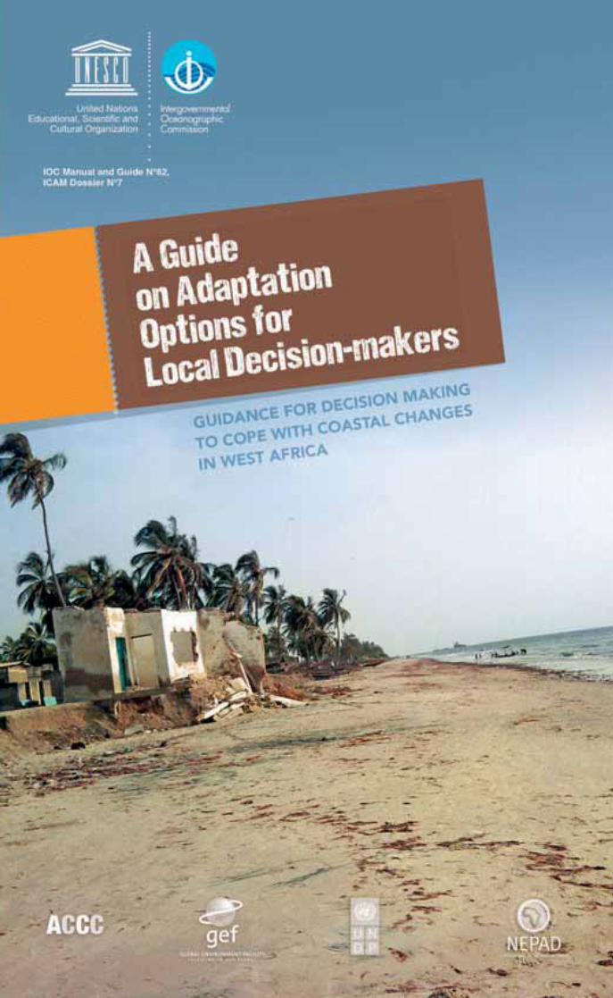
ACCC Adaptation to Climate and Coastal Change in Western Africa
MPA Marine Protected Area
CC Climate Change
IOC-UNESCO Intergovernmental Oceanographic Commission-UNESCO
GEF Global Environment Facility
IPCC Intergovernmental Panel on Climate Change
JICA Japan International Cooperation Agency for Development
UNDP United Nations Development Program
UNEP United Nations Environment Program
DC/PVD Developing Countries/Pays en Voie de Développement
BR Biosphere Reserve
SINEPAD Interim Secretariat of NEPAD (New Partnership for Africa)
AU African Union
UCAD Cheikh Anta Diop University of Dakar
IUCN International Union for Conservation of Nature
UNESCO United Nations Educational, Scientific and Cultural Organization
WACAF West and Central Atlantic Africa
WAAME West African Association for Marine Environment
Abbreviations
UNESCO-IOC/2012/PI/H/1
IOC Manual and Guide N° 62, ICAM Dossier N°7Published by the United Nations Educational, Scientific and Cultural Organization International Oceanographic Commission (UNESCO IOC), 7, Placede Fontenoy, 75352 Paris 07 SP, France.
© UNESCO 2012
The designations employed and the presentation of material throughout this publication do not imply the expression of any opinion whatsoever on thepart of UNESCO IOC concerning the legal status of any country, territory, city or area or of its authorities, or the delimitation of its frontiers or boundaries.
The authors are responsible for the choice and the presentation of the facts contained in this guide and for the opinions expressed therein, which arenot necessarily those of UNESCO IOC and do not commit the Organization.
This publication may be reproduced in whole or in part and in any form for educational or nonprofit purposes without special permission from thecopyright holder, provided acknowledgement of the source is made. UNESCO IOC would appreciate receiving a copy of any publication that uses thispublication as a source.
No use of this publication may be made for resale or for any other commercial purpose what so ever without prior permission in writing from UNESCO IOC.
For bibliographic purposes, this document should be cited as follows: Guide on adaptation options in coastal areas for decision-makers, UNESCO/IOC 2012
Printed in Senegal

Table of contents
2
Editorial 3
Introduction 4
Hard-engineering optionsSeawalls 10
Groins 12
Beach revetment 16
Softer engineering optionsArtificial beach nourishment 18
Restoration of dunes 22
Mangrove restoration as a defence against coastal erosion 26
Integrated resource management optionsOptimizing land use through planning options 28
Water Resource Management 32
Protecting marine ecosystems through biological recovery 36
The role of Marine Protected Areas 40
What to choose? 44
The authors, contacts and references 47
Fact sheet 1
Fact sheet 2
Fact sheet 3
Fact sheet 4
Fact sheet 5
Fact sheet 6
Fact sheet 7
Fact sheet 8
Fact sheet 9
Fact sheet 10
Editorial
3
Ed
itoria
l
The coasts of Africa are threatened with increased human pressures whichcombined with existing natural phenomena such as erosion, will lead toflooding of low lying areas, the degradation of mangroves and salt intrusion insoils and water. In most coastal states of West Africa, the impact of predictedclimate changes will bring new concerns for populations, but also for investorsand policymakers. Given the economic importance of these coastal areas, it isnow unthinkable to delay action as the cost of inaction will be greater thanefforts to adapt now. However, acting in haste, whilst demonstrating willingnessto adapt, can generate even greater risk such as “maladaptation” throughadverse impacts resulting from bad decisions.
Because climate change is now a reality, the phenomena associated withthese changes will intensify in the coming years. When one holds a positionas decision maker, it is important to bear in mind that in addition to humanlives that depend on the choices we make, we also have infrastructure suchas ports, fishing and tourism facilities that could disappear and nullifyeconomic development efforts that must be preserved. It is thereforeparamount to build on sound and scientific advice to guide actions on coastaladaptation. It is in this vein that we have designed these guidelines to aiddecision making, and these are primarily intended for local decision-makersworking in the coastal zone.
Through the implementation of the GEF Project on Coastal Adaptation in WestAfrica (ACCC), we have been able to document a large amount of experiencesfrom coastal managers, scientists, engineers on the implementation ofconcrete adaptation techniques. You will find 10 fact sheets summarizingnational experts’ experiences from The Gambia, Ghana, Mauritania, Nigeriaand Senegal, which constitute a true “toolbox”, reviewing options ofadaptation to climate change in coastal areas. In a few pages, we arepresenting options to expand opportunities for stakeholders. We hope thereader will find useful the practical advice ranging from solutions that involvethe construction of structures to the implementation of principles for improvedmanagement of natural resources, mainly through non-structural options.
This guide is a collective work that provides local communities and theirpolicymakers, options, based on cost-effectiveness and human resourcesavailable, for the most appropriate techniques and lasting solutions to theimpacts of climate change threatening the survival of your communities andthe attractiveness of your areas.
We hope that sound decisions will be made, taking into account the impactsgenerated on populations and ecosystems, as this is the responsibility ofdecision makers towards present and future generations.
We wish you an excellent reading!
Wendy Watson-Wright,Assistant Director-General of UNESCO,
Executive Secretary of the Intergovernmental Oceanographic Commission of UNESCO

4
1 Excerpt from the address of Mrs. Irina Bokova, Director General of UNESCO, at the World Oceans Day.Source : http://unesdoc.unesco.org/images/0019/001927/192759f.pdf
IntroductionWhether we speak about adaptation or about the mitigation of its impacts,climate change is now a reality. Such a collective awareness is a prerequisiteto any action because, once the factors and causes of climate change areknown, no one can pretend having no response. These solutions are realfighting strategies which, to be effective, must be monitored, maintained andaccompanied, especially in developing countries known to be the mostvulnerable to climate change impacts. Indeed, climate change will impactnatural, economic and human systems which, because they are complex anddiffer from one region to another, shall cover both water resources and landmanagement or populations.
It is important to remember that sea level rise is one of the major challengesinduced by climate change. “The Blue Economy” – derived from the oceans- plays a central role in our daily lives. The seafood is the main source ofprotein for at least one in four persons. Half the world population lives incoastal areas within 50 kilometres range from the sea. Ninety percent of theworld trade is done by sea. Thanks to technological advances, economicactivities in coastal areas and in deep water are increasingly intensifying anddiversifying”1. However many are those who ignore the size of these impacts,not only on natural equilibrium, but also on the economic and social life ofpeople.
We therefore undertook to contribute to one of the strategies against themanifestations of climate change by producing this information on adaptationoptions in coastal areas. This information and the experience sharing are crucialin this area because the victims of climate change can learn from theirrespective experiences. Once shared, these experiences will help othervulnerable groups under the same conditions to identify ways of action andavoid the inappropriate use of improvised strategies and options. After areview of erosion problems, this guide presents the key concepts forunderstanding the phenomenon of coastal erosion and the different types ofdefence, but also management of resources, their characteristics and costs in10 fact sheets.
The purpose of this guide is to provide local decision-makers with the optionscategorized as follows:
Three hard engineering options for the construction of more or less rigiddefence structures (seawalls, groins and revetments);
Three softer non-structural options in harmony with coastal dynamics(artificial nourishment of beaches, dune replenishment, and mangroverestoration);
Four options for integrated management of ecosystems (land management,management of water resources, sustainable community management offisheries resources, and marine protected areas).

5
By presenting different techniques to adapt to the climate change identifiedin the African coastal zone on its Atlantic side, this guide aims to expand theintervention possibilities of stakeholders who, as they are too often tornbetween the many priorities they face, are making decisions in a hurry at therisk of opting for a solution the implementation of which can be a source ofdire consequences for the future of the community. The guide also opens aperspective for the inclusion of environmental management as a whole, thecoastal erosion issues being generally part of a set of environmental challengesthat local decision-makers have to manage. Whether for building a seawall,creating a marine protected area or observing a period of “biological rest”,the guide on adaptation options in coastal areas includes practical experiencesin the implementation of structure and non-structure options, and integratedmanagement of natural resources, providing local decision-makers withrelevant information.
A final concluding chapter describes the requirements for monitoring andevaluating the implementation of these 10 options. It also offers a comparativeanalysis of their positive and negative impacts to assist in decision-making.Thanks to the operational advice presented, local decision-makers willdetermine the relevance and, depending on the context, adopt one techniquerather than another, based on objective criteria.
What do we know with certainty about climate change?
When it comes to coastal erosion, climate and coastal change and its effectson the coast of West Africa, it is essential to ensure that stakeholders haveaccurate and high quality information. Recent observations have shown thatwe are already well beyond the projected maximum elevation of sea levelmade for the period 1990 - 2100 and that despite the urgency to act, decision-makers will not all be able to calculate the “recession rate” of beaches. Anotherexpected consequence of the global warming is a strengthening of westerlywinds, coming from higher latitudes, which are already evident in some places,especially with stronger waves affecting the coast and increasing coastalerosion. It is equally relevant to ensure that the stakeholders, for whom thispublication is meant, have sufficient understanding of the key conceptscontained in this guide. This section presents the key terms used so that allreaders can easily become familiar with this topic.
REVIEW OF KEY CONCEPTS
Intr
od
uctio
n
6
What is coastal erosion?
It is already a reality in many countries worldwide, as over 70% of sandy coastsare now eroding. Resulting from a combination of both natural and humanfactors taking place on multiple temporal and spatial scales, coastal erosionoccurs when the sea is gaining ground on the earth through the action of wind,movements of waves and tides and when sediment (sand) becomes insufficientto provide natural protection to beaches. While this erosion is a natural processthat has always existed and shaped the shores of the world, it is nowadays clearthat its scope is far from being only natural. Many human factors contribute toexacerbate this phenomenon including:
• Beach sand extraction because of the high demand for buildingmaterials for human settlements;
• The construction of structures perpendicular to the coast;
• Constructions near the coast or on the beaches;
• Deforestation of coastal dunes and mangroves that play a stabilizingrole against coastal erosion.
These processes are followed by land salinization phenomena that poseproblems both for farming and drinking water supplies for people and animals.Traditional activities (such as rice farming) are abandoned in favour of theexploitation of salt, as is the case for example in Palmarin (Senegal).Polarization of populations along the coastal zone in urban areas should alsobe noted. In Mauritania, for example, the nomadic population has gone downfrom over 70% in 1960 to less than 10% currently2 is now established on thecoast line.
What is the variation of the shoreline?
This term refers to the recession of the waterfront as a result of coastal erosion.The shoreline is the meeting point between the sea and land: the higher theelevation of sea level, the greater the horizontal recession will also be. Forexample, 50cm of vertical rise in sea level can produce up to 50 meters ofhorizontal recession of the shoreline. With the backward movement of theshoreline between 1 and 2 m per year on average - which can sometimes beeven higher under certain circumstances - some coastal states are in factseriously threatened in West Africa:
2 Source : www.erosioncotiere.com/index.php?option=com_content&task=view&id=10&Itemid=7

7
The most exposed area is the city of Nouakchott, especially at the port built in1986, where protective structures in place (a check dam built in 1987, then aprotection groin in 1991) tend to collapse. Recession rates of 25 m per yearhave been registered in this area. According to information disclosed duringthe caravan of the Mauritanian coast (Association of Parliamentarians), it isconfirmed that the village of Ndiago (community near St. Louis, Senegal) isalso threatened;
Large coastal cities to the south along the “Petite Côte” and north (near St.Louis) are almost all concerned with the encroachment of the sea, whichconstitutes a serious threat to the prestigious tourist facilities they provide. Forthese areas, the rates of recession vary substantially between 1 and 2 m peryear. Rates up to 137 m per year were recorded in the case of the breach inthe Sangomar offshore bar. It is important to note that this type of erosionpace, extremely fast, will persist as long as the situation has not furtherstabilized;
Coastal erosion has justified the development of infrastructure for consistentprotection of the coast. Despite this, the Gambian coast remains a concern,particularly in the area of Banjul. Recession rates of 1.8 m per year areregistered for the section of coast between Cape Point and Bald Cape. Also,many tourist facilities, like those of the Senegambia Hotel are still under threat,while others have completely disappeared, like some hotels close to Banjul,the capital;
The Varela beach for example is subjected to a severe process of erosionreported to be at least 2 m per year. Other parts of the country are affected asis the case of Bubaque Island and the islands of Porcos and Melo, located inthe Bijagos archipelago;
Although it is likely that coastal erosion affects a number of islands, the lack ofofficial statistics on the magnitude of the erosion impedes any certainty.However, in selected areas under the ACCC project, some values higher than2 m per year of shoreline recession rate were reported.
In Mauritania
In Senegal
In The Gambia
In Guinea Bissau
In Cape Verde
Intr
od
uctio
n

8
Why is it necessary to adapt?
Given the economic importance of coastal areas - characterized by a highconcentration of populations, port, fisheries and/or tourism infrastructure - wemust also underscore the importance of preserving vital ecosystems forbiodiversity, even beyond the profits from key sectors such as fishing and tourismthat also depend on environmental conditions. It is not sufficiently emphasizedthat coastal areas, on the one hand subject to degradation of natural origin,suffer on the other hand extreme pressure from residents. By polluting,plundering and devastating their environment, people aggravate the erosionand degradation of natural areas at risk. But, in order to act effectively againstthe negative impacts of climate change, while benefiting from the opportunitiesit offers, local communities living on the coast must now have full control of thesituation in order to select and apply appropriate measures in terms ofadaptation.
What impacts should we adapt to in coastal areas?
One of the most certain consequences of climate change is the rising sea levelwhich, on present trends, will continue to accelerate. Indeed since 1900, tidegauges have recorded a rate between 1 and 2 mm rise in the sea level per yearet since 1993, satellite data have shown a marked acceleration of this rate.Climate models (1990 and 2100) predict a steady rise in sea level between 9and 88 cm depending on the development options to be selected. This impliesfor example that by 2050, the upper level indicated by the projections wouldbe 5 to 32 cm (compared to 1990), well above the rates of sea level elevationthat we know today. These projections are even more disturbing that recentdata obtained are already well above the maximum projections. Risks ofexperiencing a greater rise in sea level are real (UNEP, 2008), hence theimportance of ensuring the regularity of follow-up of the sea level.
Economic value at risk (millions US$ and % of GNP)
217*(52%)
6330(542%)
499-707(14%)
2315,860
Land at risk (km2) 92 289-468 874,5 6042-6073
The Gambia Guinea Mauritania Senegal Sierra Leone
Population at risk (x 1000) 42 500 109-178 26-1220
Adaptation cost (millions US$) 4.4 1824,5 973-2156
GDP (millions US$)461
(2007)3407 1064 4971
Table 1: Impacts of 1 m rise in the sea level in five coastal countries of West Africa
Source: Niang-Diop, I. (2005). Impacts of climate change on the coastal zones of Africa. In: IOC “Coastalzones in sub-Saharan Africa: A scientific review of the priority issues influencing sustainability andvulnerability of coastal communities”, London, 27-28 May 2003, Workshop Report 186, ICAM Dossier n°4,27-33.
9
The impacts of the rising sea level in coastal areas are the best known. We knowthat in terms of biophysical impacts, the currently observed phenomena,including coastal erosion, will accelerate. This will generate a number of socio-economic impacts that, for now, are recorded in terms of population to relocate,investments lost or threatened economic activities to be modified or moved.These economic values at risk must be determined to apply appropriatesolutions. The values shown in the table below (Table 1) must be regarded asminima because only some elements available were considered (value of landand buildings sometimes).
It turns out that the costs of impacts thus calculated are already from 10% to50% of the Gross National Product (GNP) as shown in the above table compiledfrom data from the initial national communications at the UNFCCC from 5 WestAfrica countries. However, the adaptation costs are usually lower than those ofthe economic values exposed to climate risks. In any case, they must be studiedin-depth.
Why is the role of local decision makers essential?
While negotiations are underway on the international level, adaptation toclimate change shall first be undertaken locally. Various officials at this levelmust be fully aware of their responsibilities, which include:
• The need for sound management of natural resources taking intoconsideration the possible effects of climate change. This means theimplementation of local development plans, and land occupancy plansenabling adaptation to climate change (maintaining availability of landlocated high up, good management of water resources, protection ofhabitats and important species for fish farming and tourism);
• The need to master advanced knowledge of adaptation options;
• The need to develop awareness and inform people so they canunderstand the phenomena in progress and better implement localpolicies (protection, better management, land use, etc.).
• The need to establish a monitoring policy (M&E) involving directlyaffected communities: the issue of structures involves greater reactivity,particularly through the establishment of a monitoring and warningsystem so that solutions are implemented. This is discussed in the lastchapter.
Intr
od
uctio
n

Seawalls are gravity-base structures placed between the backshores and the infra-structure located immediately behind. They are erected parallel to the coast, withthe main function of protecting the facilities located at the back against the risk offlooding by sea water. These are structures meant to minimize the damage causedby very heavy swells. They do not protect the beaches at the ends of the walls anddo not fight against the causes of erosion.
OPTION IMPLEMENTATION
These structures are simple to make but require the intervention of aconstruction company that will be responsible for transporting thematerials and arranging them according to the plan adopted for itsconstruction. Such structures can be built with different materials (wood,rocks, concrete, etc.). In all cases, seawalls are only designed to protect theland and infrastructure located on the backside.
Their function is neither to protect adjoining beaches, nor to those locatedbetween the sea and the wall. Most often, the former is subject to increasederosion while the latter would disappear.
Wherever possible, the walls must be extended by connecting arms at eachend to prevent the phenomena of skirting round by waves. To mitigate thenegative impacts of the walls, you can take advantage of their slope (theflatter the angle, the less problem you have) and permeability (when it isirregular, as is the case with riprap, there is more dissipation of the waveenergy which is no longer available for reflection).
These are costly structures (see section on costs below) which requiremaintenance to extend their lifespan. Besides, seawalls seem to lead tothe disappearance of beaches located in front, due to phenomena ofreflection of waves.
10
Seawalls
Fact sheet 1
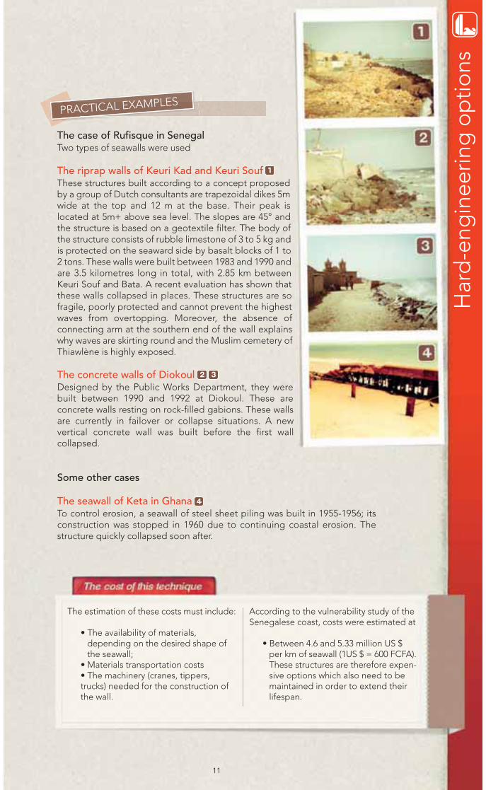
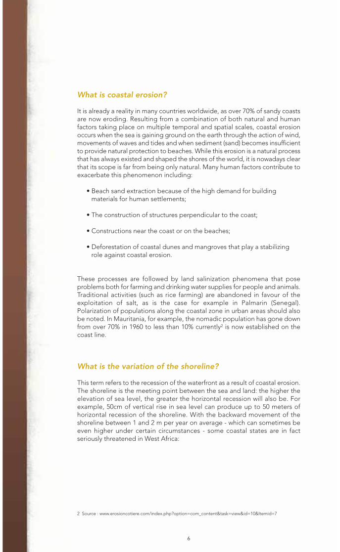
The case of Rufisque in SenegalTwo types of seawalls were used
The riprap walls of Keuri Kad and Keuri Souf These structures built according to a concept proposedby a group of Dutch consultants are trapezoidal dikes 5mwide at the top and 12 m at the base. Their peak islocated at 5m+ above sea level. The slopes are 45° andthe structure is based on a geotextile filter. The body ofthe structure consists of rubble limestone of 3 to 5 kg andis protected on the seaward side by basalt blocks of 1 to2 tons. These walls were built between 1983 and 1990 andare 3.5 kilometres long in total, with 2.85 km betweenKeuri Souf and Bata. A recent evaluation has shown thatthese walls collapsed in places. These structures are sofragile, poorly protected and cannot prevent the highestwaves from overtopping. Moreover, the absence ofconnecting arm at the southern end of the wall explainswhy waves are skirting round and the Muslim cemetery ofThiawlène is highly exposed.
The concrete walls of Diokoul Designed by the Public Works Department, they werebuilt between 1990 and 1992 at Diokoul. These areconcrete walls resting on rock-filled gabions. These wallsare currently in failover or collapse situations. A newvertical concrete wall was built before the first wallcollapsed.
Some other cases
The seawall of Keta in Ghana To control erosion, a seawall of steel sheet piling was built in 1955-1956; itsconstruction was stopped in 1960 due to continuing coastal erosion. Thestructure quickly collapsed soon after.
The estimation of these costs must include:
• The availability of materials,depending on the desired shape ofthe seawall;
• Materials transportation costs• The machinery (cranes, tippers,trucks) needed for the construction ofthe wall.
According to the vulnerability study of theSenegalese coast, costs were estimated at
• Between 4.6 and 5.33 million US $per km of seawall (1US $ = 600 FCFA).These structures are therefore expen-sive options which also need to bemaintained in order to extend theirlifespan.
2 3
11
PRACTICAL EXAMPLES
1
4
Har
d-e
ngin
eerin
g o
ptio
ns

The groins are cross-stream structures, constructed and installed to control themovement of beach sand, leading to the trapping and accumulation of sand betweenthese structures. Arranged perpendicular to the shoreline, they can serve as a singlestructure to meet a particular need, but in most cases they are built in series to formgroin fields. The groins can lead to complex patterns of currents and waves, hencethe importance of monitoring.
OPTION IMPLEMENTATION AND IMPACTS OBTAINED DEPENDINGON MATERIALS
The groins option is generally chosen along beaches where the movement- mainly sediment movement through the currents – parallel to the beachis quite significant at any time of the year to ensure proper operation ofthe groins depending on the desired goals and objectives. Groins reduceparallel movement to the coast by trapping beach materials and lead to achange in the direction of the beach relative to the directions of thedominant waves. These structures mainly affect the transport done byoverthrusting - a mode of transport from the bottom - and are particularlyeffective on gravel or pebble beaches. The sand, when it is transportedtemporarily in suspension during periods of high wave or current energy,will tend to be carried over or around any structure perpendicular to theshore. Several types of materials can be used and produce differentimpacts.
• Rock groins have the advantage of being based on simple constructionmethods. They are sustainable on the long-term and have the possibilityto absorb the wave energy due to their semi-permeable nature.
• Wooden groins last for a shorter period of time and tend to reflect theenergy rather than absorbing it.
12
Groins
Fact sheet 2
13
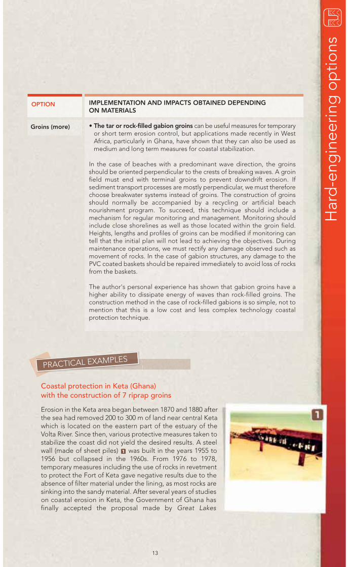
Coastal protection in Keta (Ghana)with the construction of 7 riprap groins
Erosion in the Keta area began between 1870 and 1880 afterthe sea had removed 200 to 300 m of land near central Ketawhich is located on the eastern part of the estuary of theVolta River. Since then, various protective measures taken tostabilize the coast did not yield the desired results. A steelwall (made of sheet piles) was built in the years 1955 to1956 but collapsed in the 1960s. From 1976 to 1978,temporary measures including the use of rocks in revetmentto protect the Fort of Keta gave negative results due to theabsence of filter material under the lining, as most rocks aresinking into the sandy material. After several years of studieson coastal erosion in Keta, the Government of Ghana hasfinally accepted the proposal made by Great Lakes
1
PRACTICAL EXAMPLES
Har
d-e
ngin
eerin
g o
ptio
ns
OPTION
Groins (more)
IMPLEMENTATION AND IMPACTS OBTAINED DEPENDINGON MATERIALS
• The tar or rock-filled gabion groins can be useful measures for temporaryor short term erosion control, but applications made recently in WestAfrica, particularly in Ghana, have shown that they can also be used asmedium and long term measures for coastal stabilization.
In the case of beaches with a predominant wave direction, the groinsshould be oriented perpendicular to the crests of breaking waves. A groinfield must end with terminal groins to prevent downdrift erosion. Ifsediment transport processes are mostly perpendicular, we must thereforechoose breakwater systems instead of groins. The construction of groinsshould normally be accompanied by a recycling or artificial beachnourishment program. To succeed, this technique should include amechanism for regular monitoring and management. Monitoring shouldinclude close shorelines as well as those located within the groin field.Heights, lengths and profiles of groins can be modified if monitoring cantell that the initial plan will not lead to achieving the objectives. Duringmaintenance operations, we must rectify any damage observed such asmovement of rocks. In the case of gabion structures, any damage to thePVC coated baskets should be repaired immediately to avoid loss of rocksfrom the baskets.
The author's personal experience has shown that gabion groins have ahigher ability to dissipate energy of waves than rock-filled groins. Theconstruction method in the case of rock-filled gabions is so simple, not tomention that this is a low cost and less complex technology coastalprotection technique.
14
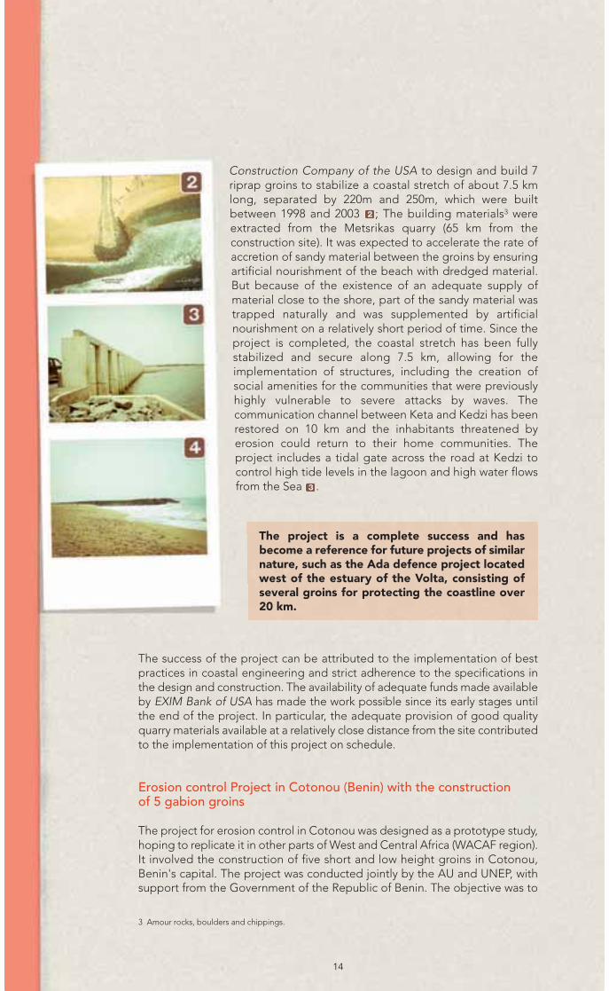
Construction Company of the USA to design and build 7riprap groins to stabilize a coastal stretch of about 7.5 kmlong, separated by 220m and 250m, which were builtbetween 1998 and 2003 ; The building materials3 wereextracted from the Metsrikas quarry (65 km from theconstruction site). It was expected to accelerate the rate ofaccretion of sandy material between the groins by ensuringartificial nourishment of the beach with dredged material.But because of the existence of an adequate supply ofmaterial close to the shore, part of the sandy material wastrapped naturally and was supplemented by artificialnourishment on a relatively short period of time. Since theproject is completed, the coastal stretch has been fullystabilized and secure along 7.5 km, allowing for theimplementation of structures, including the creation ofsocial amenities for the communities that were previouslyhighly vulnerable to severe attacks by waves. Thecommunication channel between Keta and Kedzi has beenrestored on 10 km and the inhabitants threatened byerosion could return to their home communities. Theproject includes a tidal gate across the road at Kedzi tocontrol high tide levels in the lagoon and high water flowsfrom the Sea .
2
3
The success of the project can be attributed to the implementation of bestpractices in coastal engineering and strict adherence to the specifications inthe design and construction. The availability of adequate funds made availableby EXIM Bank of USA has made the work possible since its early stages untilthe end of the project. In particular, the adequate provision of good qualityquarry materials available at a relatively close distance from the site contributedto the implementation of this project on schedule.
Erosion control Project in Cotonou (Benin) with the constructionof 5 gabion groins
The project for erosion control in Cotonou was designed as a prototype study,hoping to replicate it in other parts of West and Central Africa (WACAF region).It involved the construction of five short and low height groins in Cotonou,Benin's capital. The project was conducted jointly by the AU and UNEP, withsupport from the Government of the Republic of Benin. The objective was to
3 Amour rocks, boulders and chippings.
The project is a complete success and hasbecome a reference for future projects of similarnature, such as the Ada defence project locatedwest of the estuary of the Volta, consisting ofseveral groins for protecting the coastline over20 km.
15
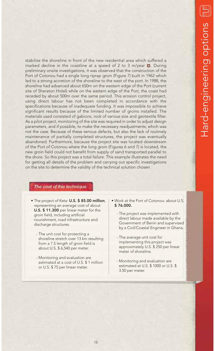
stabilize the shoreline in front of the new residential area which suffered amarked decline in the coastline at a speed of 2 to 3 m/year . Duringpreliminary onsite investigations, it was observed that the construction of thePort of Cotonou had a single long riprap groin (Figure 7) built in 1962 whichled to a strong accretion of the shoreline to the west of the port. In 1988, theshoreline had advanced about 650m on the western edge of the Port (currentsite of Sheraton Hotel) while on the eastern edge of the Port, the coast hadreceded by about 500m over the same period. This erosion control project,using direct labour has not been completed in accordance with thespecifications because of inadequate funding. It was impossible to achievesignificant results because of the limited number of groins installed. Thematerials used consisted of gabions, rock of various size and geotextile filter.As a pilot project, monitoring of the site was required in order to adjust designparameters, and if possible, to make the necessary readjustments; which wasnot the case. Because of these serious defects, but also the lack of routinelymaintenance of partially completed structures, the project was eventuallyabandoned. Furthermore, because the project site was located downstreamof the Port of Cotonou where the long groin (Figures 6 and 7) is located, thenew groin field could not benefit from supply of sand transported parallel tothe shore. So this project was a total failure. This example illustrates the needfor getting all details of the problem and carrying out specific investigationson the site to determine the validity of the technical solution chosen.
4
• The project of Keta: U.S. $ 85.00 million,representing an average cost of aboutU.S. $ 11.300 per linear meter for thegroin field, including artificialnourishment, road infrastructure anddischarge structures.
- The unit cost for protecting ashoreline stretch over 13 km resultingfrom a 7.5 length of groin field isabout U.S. $ 6,540 per meter.
- Monitoring and evaluation areestimated at a cost of U.S. $ 1 millionor U.S. $ 75 per linear meter.
• Work at the Port of Cotonou: about U.S.$ 76.000.
- The project was implemented withdirect labour made available by theGovernment of Benin and supervisedby a Civil/Coastal Engineer in Ghana.
- The average unit cost forimplementing this project wasapproximately U.S. $ 250 per linearmeter of shoreline.
- Monitoring and evaluation areestimated at U.S. $ 1000 or U.S. $3.50 per meter.
Har
d-e
ngin
eerin
g o
ptio
ns

A beach revetment is a structure installed parallel to the coast consisting in coveringthe beach with materials more resistant to waves than the beach sand (seeFigure 2). The main difference with a seawall is that the slope is flatter. Its surfacemay be smooth or rough and its dimension is not necessarily equivalent to thedistance between the beach and the mainland.
OPTIONS IMPLEMENTATION
Several types of materials of different conditions can be used to obtain thestabilization of a beach. Revetments are particularly suitable in the case ofhigh and moderate energy environments where severe erosion of thebeach already occurred.
They have the advantage of being flexible and can be adjusted in case oferosion or subsidence of the bank. They can be perceived as having lessvalue for recreation compared to other structures such as limestone walls.However, a well constructed and well maintained revetment cannotinterfere with public use of the beach. We must consider the aestheticaspect in a case by case basis and generally prefer local stones for makingthe revetments which may consist of either rigid structures (concrete blocks)or flexible structures (rip-raps, meaning layers of rocks protecting anembankment against the action of water).
Rigid structures tend to be more massive, but are generally inappropriateto deal with a structure-based adjustment or compaction of underlyingmaterials. A flexible revetment is made of lighter units that can toleratevarying degrees of movement.
16
Revetmentswith rigid orflexiblestructure
Fact sheet 3

17
James Town beach revetment in Accra (Ghana) A first revetment of 100m long was built between 1959 and 1960;it was part of a package of measures to counteract coastalerosion, which was undertaken during the construction of thespillway of Korle Lagoon. After 15 years, this revetment has beenseverely attacked by overtopping sea waves. The “run-up” andovertopping also affected the road located east of therevetment, with an interruption of the road between Korlelagoon and central Accra at high tide. The width of the beachadjoining the road was seriously eroded and reduced to 5-7 mwide. To address this situation, a low cost and low technologygabion revetment was proposed and implemented between1983 and 1984. This revetment was made of PVC coated gabionsto provide protection to the most affected part of the road alongthe beach that stretched for 200 meters. Within 12 to 18 months,the results achieved were remarkable. The overtopping of theroad by the swells had ceased; substantial accretion occurredand beach profiles became flatter than before the installation ofthis revetment. The main factors responsible for this high rate ofaccretion were the flat slope of the revetment and the effectivedissipation properties of the rock-filled gabion structure.
Labadi Beach Revetment (Ghana) Here, the shoreline recession rate was 3 to 5 m per year between 1955 and 1985.The period that recorded the highest recession rate is between 1965 and 1978,when an area of 100 m of beach, considered safe for the development of a leisureproject suffered an average erosion rate of 7.5 m per year, which led to animmediate suspension of any development project in the area. The maincomponent of the structure, the construction of which began in 1982, was madeof rock-filled gabions. It was the first time the gabion technology was used to solvecoastal erosion problems in Ghana. The immediate objective was to providetemporary protection to a cafeteria the foundations of which had been underminedby scouring and were in the process of collapsing. Before that, other low cost andsimple technology protection techniques (using a mixture of wood and sandbags)had been tried unsuccessfully. The Labadi shoreline protection project, whichinvolved 1,600 m of beach, was organized around three steps that gradually led tomastering the technique. After a pilot phase, it was decided to reduce the slopeof the revetment (by 1/2.5 to 1/5) and to replace, for the base of the structure,riprap gabions by boulders, once at the area of rocky outcrops. After completionof the gabion revetment structure, the beach is now protected from attacks bywaves; the bathymetry of the submarine beach has become flatter and a sense ofsafety was created. This improved situation has led to reviving various componentsof the Pleasure Beach project, which is part and parcel of La-Palm Royal BeachHotel complex project completed 15 years ago.
Cost of the rock-filled gabion revetment atJamestown Beach was U.S. $ 435 perlinear meter of protected shoreline.
• Monitoring and evaluation: anestimated cost of U.S. $ 5 per meter.
• Cost of the Labadi Beach revetmentproject: U.S. $ 1,300 for Phases Iand II.
• A total cost of U.S. $ 1,600 forPhase III per linear meter ofprotected shoreline.
• Unit cost of monitoring andevaluation is estimated at U.S. $ 20per meter.
PRACTICAL EXAMPLES
1 2
3
Har
d-e
ngin
eerin
g o
ptio
ns
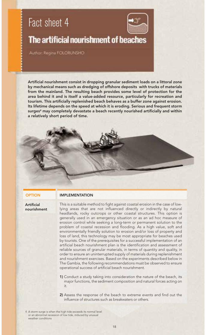
Artificial nourishment consist in dropping granular sediment loads on a littoral zoneby mechanical means such as dredging of offshore deposits with trucks of materialsfrom the mainland. The resulting beach provides some level of protection for thearea behind it and is itself a value-added resource, particularly for recreation andtourism. This artificially replenished beach behaves as a buffer zone against erosion.Its lifetime depends on the speed at which it is eroding. Serious and frequent stormsurges4 may completely devastate a beach recently nourished artificially and withina relatively short period of time.
OPTION IMPLEMENTATION
This is a suitable method to fight against coastal erosion in the case of low-lying areas that are not influenced directly or indirectly by naturalheadlands, rocky outcrops or other coastal structures. This option isgenerally used in an emergency situation or as an ad hoc measure oferosion control while seeking a long-term or permanent solution to theproblem of coastal recession and flooding. As a high value, soft andenvironmentally friendly solution to erosion and/or loss of property andloss of land, this technology may be most appropriate for beaches usedby tourists. One of the prerequisites for a successful implementation of anartificial beach nourishment plan is the identification and assessment ofreliable sources of granular materials, in terms of quantity and quality, inorder to ensure an uninterrupted supply of materials during replenishmentand nourishment exercises. Based on the experiments described below inThe Gambia, the following recommendations must be observed to ensureoperational success of artificial beach nourishment.
1) Conduct a study taking into consideration the nature of the beach, itsmajor functions, the sediment composition and natural forces acting onit.
2) Assess the response of the beach to extreme events and find out theinfluence of structures such as breakwaters or others.
18
Artificialnourishment
4 A storm surge is when the high tide exceeds its normal levelor an abnormal recession of low tide, induced by unusualweather conditions
Fact sheet 4
3) Create a beach management unit to regularly assess the various optionsand techniques that can be implemented to address the problem (s).
This should be supported by the following monitoring measures to ensuremaintenance of the project:
- Production of regular and controlled beach profiles
- Verification of the implementation of a minimum “set back” from themean high tide line for construction
- Prohibition of sand mining on the beaches
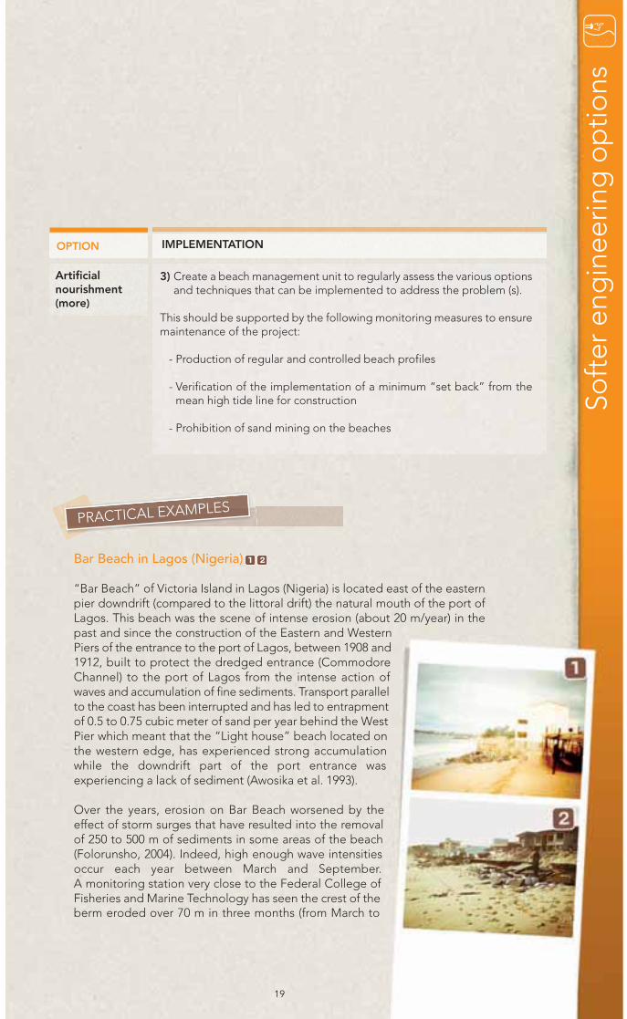
Bar Beach in Lagos (Nigeria)
“Bar Beach” of Victoria Island in Lagos (Nigeria) is located east of the easternpier downdrift (compared to the littoral drift) the natural mouth of the port ofLagos. This beach was the scene of intense erosion (about 20 m/year) in thepast and since the construction of the Eastern and WesternPiers of the entrance to the port of Lagos, between 1908 and1912, built to protect the dredged entrance (CommodoreChannel) to the port of Lagos from the intense action ofwaves and accumulation of fine sediments. Transport parallelto the coast has been interrupted and has led to entrapmentof 0.5 to 0.75 cubic meter of sand per year behind the WestPier which meant that the “Light house” beach located onthe western edge, has experienced strong accumulationwhile the downdrift part of the port entrance wasexperiencing a lack of sediment (Awosika et al. 1993).
Over the years, erosion on Bar Beach worsened by theeffect of storm surges that have resulted into the removalof 250 to 500 m of sediments in some areas of the beach(Folorunsho, 2004). Indeed, high enough wave intensitiesoccur each year between March and September.A monitoring station very close to the Federal College ofFisheries and Marine Technology has seen the crest of theberm eroded over 70 m in three months (from March to
PRACTICAL EXAMPLES
IMPLEMENTATION
19
1 2
Soft
er e
ngin
eerin
g o
ptio
ns
OPTION
Artificialnourishment (more)

The Federal Government of Nigeria has been the only funder of the artificialnourishment of Bar Beach since 1969. This is because constitutionally, only theFederal Government of Nigeria has the legal mandate and is responsible forthe coastal zone. Artificial nourishment of the beach in Lagos has failedbecause of the absence of artificial nourishment activities scheduled for thestabilization of the rapidly eroding beach. Given the predominant erosion, theintense coastal dynamics and the low-lying position of Bar Beach, artificialnourishment programs must be carried out on average every two years tomaintain balance. Moreover, it would have been necessary to ensure that theforeshore (parts covered, at least in part at high tide, and uncovered duringlow tides) have been properly lowered to allow dissipation of wave energybefore it reaches the crest of the beach berm.
The beaches of The Gambia In this country, the Government has invested about U.S. $ 20million for artificial nourishment of a beach of about 100 mwide, especially in Kololi. The project was supervised by theDutch engineering firm Royal Haskoning. The Gambia hasopted for this soft technology in order to preserve theaesthetic integrity of the beach. The technical realization ofthis option has resulted in a loss of half of the imported sandin two years (Bromfield, 2006).
June 2000) during a period of storm. By 1958, several protection options havebeen implemented to reduce the impacts of the construction of the Piers(groin, discharge of fine sediments, pumping stations). To avoid the impendingcollapse of commercial and residential buildings, federal and state offices anddisruption of socio-economic activities in Lagos Island, the artificialnourishment formula was used until a nearly permanent solution to theproblem is found. Following the call for tenders issued by the FederalGovernment of Nigeria to identify a sustainable solution to coastal erosion onBar Beach, a conference of stakeholders was held in Lagos in 2005.
180
125
95
110
105
80
113
67
101
67
58
+6
• ONIRU
• Government liaisonbureau
• Behind EKO Hotel
Change in theberm crest inmarch 2000(m)
Change in theberm crest inJune 2000 (m)
Change in theberm crest inFebruary 2001(m)
Cumulatedloss of beachover 12months (m)
Bar Beach erosionmonitoring station
Table 2: Study on the erosion of Bar Beach: March 2000 - February 2001 Trends
20
BEFORE
AFTER
3

21
In conclusion, while being one of the solutions taking into consideration thedynamics of the coastline, the artificial nourishment of beaches has somedrawbacks due to:
• The difficulty in finding suitable materials at a good distance
• The need for periodic replenishment (hence its high cost) associated withregular supply of sediment needed to offset the inevitable losses on beachessubject to erosion. In the Netherlands, where beach nourishment is now aroutine practice, it is estimated that the average annual cost of one kilometreof recharged beach is equivalent to that of one kilometre of motorway.
• Bar Beach in Lagos is artificiallyreplenished at intervals of 2 to 3 yearswhich makes this solution very costly inthe long term.
• The cost of 3 km of artificially nourishedbeach is estimated at 700 million naira(or U.S. $ 2026.6 per linear meter) by the Lagos State Commissioner for thedevelopment of the waterfront (DavidAmuwa 2008).
2 km
120 m
52 m
-68 m
1 km
150 m
16 m
-134 m
Length of artificially nourished beach (2004)
Width of the nourished beach
Length of the beach in 2011
Erosion of the nourished beach over 7 years
State HouseBanjul
Bar SeaviewKololi Point
Table 3: Trends of erosion at the State House and Kololi (2000 and 2011)
Source: Adapted from Dodou Trawally
Soft
er e
ngin
eerin
g o
ptio
ns
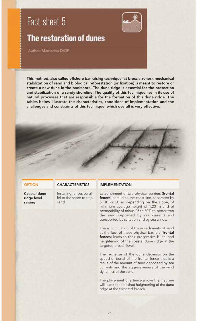
This method, also called offshore bar raising technique (at breccia zones), mechanicalstabilization of sand and biological reforestation (or fixation) is meant to restore orcreate a new dune in the backshore. The dune ridge is essential for the protectionand stabilization of a sandy shoreline. The quality of this technique lies in its use ofnatural processes that are responsible for the formation of this dune ridge. Thetables below illustrate the characteristics, conditions of implementation and thechallenges and constraints of this technique, which overall is very effective.
22
Coastal duneridge levelraising
OPTION IMPLEMENTATION
Establishment of two physical barriers (frontalfences) parallel to the coast line, separated by5, 10 or 20 m depending on the slope, ofminimum average height of 1.20 m and ofpermeability of minus 25 to 30% to better trapthe sand deposited by sea currents andtransported by saltation and by sea winds.
The accumulation of these sediments of sandat the foot of these physical barriers (frontalfences) leads to their progressive burial andheightening of the coastal dune ridge at thetargeted breach level.
The recharge of the dune depends on thespeed of burial of the frontal fence that is aresult of the amount of sand deposited by seacurrents and the aggressiveness of the winddynamics of the sand.
The placement of a fence above the first onewill lead to the desired heightening of the duneridge at the targeted breach.
CHARACTERISTICS
Installing fences paral-lel to the shore to trapsand
Fact sheet 5

23
Mechanicalstabilizing ofthe dune ridge
OPTION IMPLEMENTATION
The reforestation of the dune ridge areas thathave graded their natural level requires priormechanical stabilization of moving sand.
This operation is essentially based on the prin-ciples of windbreaks. Because the wind is adriving force that moves the sand grains accor-ding to their weight by flight, small jumps(saltation) or rolling (creep), the idea is to miti-gate the speed force to minimize if not stopthe movement of sand. This includes:
• Segmenting the dune ridge with physical bar-riers (counter-dune, or counter-dune fences)of 1.20 m to 1.50 m minimum average height,of 25 to 30% permeability, and perpendicu-larly to the direction of prevailing winds.
• Establishing side barriers (fences) perpendi-cular to the counter-dune fences to counteractthe action of side winds that move sand, inaddition to the prevailing direction winds onthe slope of the dune.
This forms a network of fences or wattle thedensity of which varies with the aggressivenessof the winds and the height of the dune.Usually, a wattle (the mesh size of which shallnot exceed 50 m on its sides) will be sufficientto cope with the dynamics of the offshore windand stabilize sand movement to allow its refo-restation. The materials used for carrying outthe work are branches from local woody vege-tation (such as Euphorbia balsamifera,Leptadenia pyrotechnica, date palms, Typha,Indigofera oblongifolia, Prosopis juliflora,Balanites aegyptiaca) which can be useddepending on availability.
CHARACTERISTICS
Establishing a wattle tostabilize the sand andallow reforestation
Fixingbiologically orreforesting thedune ridge
Planting will take place during the rainy season(generally in the month in August), when thejunction between the residual moisture in the soiland moisture from the new rainfalls occurs. Theycan be made square at the rate of 400 plants/hain combination or in staggered rows at a rate of360 plants/ha.
Each species is planted in the most suitable areafor its development at the dune. Speciesselection will favour the use of local vegetation
Planting speciesadapted to theecosystem
Soft
er e
ngin
eerin
g o
ptio
ns

24
that existed and/or still exist on the coast, or asimilar ecosystem in the case of introduction ofexotic species. This choice will take into account:
- The adaptation of the species to the weatherof the ecosystem;
- The adaptation to halophilic soils;
- The adaptation of species to sea spray;
- The rapid growth of the species;
- The adaptation to dune soils;
- The ability of the species to develop inassociation with others.
In this respect, the following species aregenerally used for carrying out this activity.Tamarix senegalensis, Nitraria retusa, Atriplexnumularia, and Atriplex halumus.
For these three techniques, the difficulty is to foresee the following bottlenecks:
• Inadequacy of materials for mechanical dune stabilization;
• Lack of close supervision by experts;
• Lack of systematic and regular monitoring;
• Lack of organization to produce a rigorous work.
• Use of species not adapted to the ecosystem;
• Rainfall deficit;
• Invasion of grasshoppers, termites and others;
• Lack of protection.
IMPLEMENTATION
Fixingbiologically orreforesting thedune ridge
OPTION CARACTERISTICS
Planting species adap-ted to the ecosystem
25
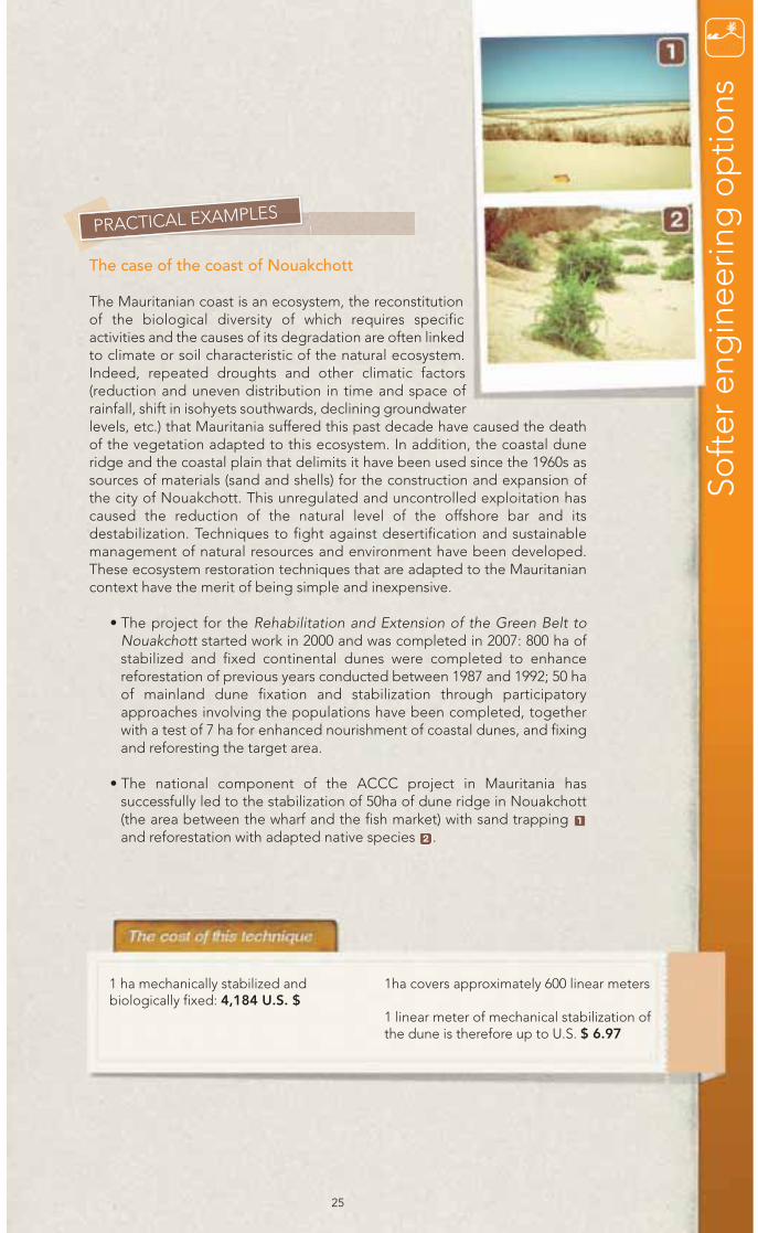
The case of the coast of Nouakchott
The Mauritanian coast is an ecosystem, the reconstitutionof the biological diversity of which requires specificactivities and the causes of its degradation are often linkedto climate or soil characteristic of the natural ecosystem.Indeed, repeated droughts and other climatic factors(reduction and uneven distribution in time and space ofrainfall, shift in isohyets southwards, declining groundwaterlevels, etc.) that Mauritania suffered this past decade have caused the deathof the vegetation adapted to this ecosystem. In addition, the coastal duneridge and the coastal plain that delimits it have been used since the 1960s assources of materials (sand and shells) for the construction and expansion ofthe city of Nouakchott. This unregulated and uncontrolled exploitation hascaused the reduction of the natural level of the offshore bar and itsdestabilization. Techniques to fight against desertification and sustainablemanagement of natural resources and environment have been developed.These ecosystem restoration techniques that are adapted to the Mauritaniancontext have the merit of being simple and inexpensive.
• The project for the Rehabilitation and Extension of the Green Belt toNouakchott started work in 2000 and was completed in 2007: 800 ha ofstabilized and fixed continental dunes were completed to enhancereforestation of previous years conducted between 1987 and 1992; 50 haof mainland dune fixation and stabilization through participatoryapproaches involving the populations have been completed, togetherwith a test of 7 ha for enhanced nourishment of coastal dunes, and fixingand reforesting the target area.
• The national component of the ACCC project in Mauritania hassuccessfully led to the stabilization of 50ha of dune ridge in Nouakchott(the area between the wharf and the fish market) with sand trapping and reforestation with adapted native species .2
1
PRACTICAL EXAMPLES
1 ha mechanically stabilized andbiologically fixed: 4,184 U.S. $
1ha covers approximately 600 linear meters
1 linear meter of mechanical stabilization ofthe dune is therefore up to U.S. $ 6.97
Soft
er e
ngin
eerin
g o
ptio
ns

In West Africa, the mangrove covers large areas and includes six species of mangrovetrees, the most common being the Rhizophora - the red mangrove - and the Avicennia -the white mangrove. While providing valuable economic and ecological services (wood,reproduction and growth of marine animals, the stabilization of the coast), promotingthe accumulation and fixation of marine sediments to reduce the impact of coastalerosion, and sequestering atmospheric carbon, the mangrove can also mitigate globalwarming and combat the phenomenon of sea level rise. Despite these applications,significant losses of mangrove areas are however recorded, due to the cutting of trees,construction of dams, dikes, roads and drought in the last thirty years. In six countries inthe sub-region (Mauritania, Senegal, The Gambia, Guinea Bissau, Guinea and SierraLeone) estimates show that the maximum surface of the mangrove on 3 million ha, hasdeclined to 1 million ha in 1990 and fell down to 797,200 ha in 2007 (WCMC, 2007).
26
OPTION IMPLEMENTATION
Depending on the growth and multiplication requirements of the species,this type of reforestation should consider the following conditions:
• Hydrology, including the frequency of flooding by the tide. TheRhizophora grows well in an area flooded daily by the tide or along thechannels (bolongs). We shall seek to increase the volume of watersubmersion by opening small channels;
• The nature of the substratum: clay is better than sand, generally poorerwith a low capacity for water retention;
• The planting period must be in the middle of the rainy season, whenrains have neutralized the maximum salt in the soil and the substratum isvery loose (potopoto). Furthermore, it is at this period that the seedlings(or propagula) - still on the mother tree - mature and begin to fall.
• Seedling quality: good seedlings are greenish, with a nice bud and notdamaged by predators such as crabs;
ReforestationwithRhizophora
Fact sheet 6

27
IMPLEMENTATION
• The planting technique: 1/3 of the propagulum must be sunk, straight,into the mud (potopoto). The planting distance varies depending on thefertility of the substratum and the risk of seedling mortality. The principleis to plant densely when the mortality risk is high, such as a spacing of 25to 50 cm between plants. On more fertile and less salty sites we can adoptspacing of 1 to 2 m;
• Stages of reforestation: a tree-planting campaign is a labour-intensivework, which requires above all, a good capacity for maximum mobilizationof stakeholders from all segments of the eligible population. Collectionand transportation of propagula is the first step done the day beforeplanting in order to achieve best results. Sorting and planting are doneon the same day, the major constraint is the fact that planting is done atlow tide. Three teams should be established to ensure:
- Sorting of propagula,- The supply of propagula to planters,- Planting.
• Monitoring of plantations: it is intended to assess the success rate ofthe operation and in case of deaths, to replace the plants. The growthrate which depends on the availability of fresh water and fertility of thesubstratum is also a parameter to monitor. Disease cases for themangroves are rare.
PRACTICAL EXAMPLES
Reforestation on the Island of Djirnda in the Saloum (Senegal) Annual campaigns began in 2003 with support from projectsimplemented by IUCN and JICA. In 2008 an area of 1.5 ha wascovered by Rhizophora. Despite the modest size of thereforested area, this action has a considerable impact inmotivating people who pursue the restoration through anassociation of women for reforestation who are extending thesurface every year.
Reforestation at Gagué Sharif in the Sine (Senegal)Several reforestation campaigns were conducted on this site,including by WAAME, JICA and UCAD. However, due to highsoil salinity results are rather disappointing. Mortality is highand survivors’ growth is slowed.
• The cost varies from one country toanother in the sub-region.
• By including the logistics for thecollection of propagula and catering
for the villagers, one reforestation day,mobilizing 100 people will cost 150,000to 200,000 FCFA (about U.S. $ 333to 445).
1
Soft
er e
ngin
eerin
g o
ptio
ns
OPTION
ReforestationwithRhizophora(more)
Beyond the hard engineering and soft engineering options, the size of the legal andadministrative management of this land portion is a must. This section describes sixoptions of land use as a management tool for controlling climate change induced coastalerosion, which are illustrated with the case of the Gambia.
28
Delineation ofshorelines
OPTIONS DESCRIPTION, IMPLEMENTATION AND CONSTRAINTS
A stretch of land from a dozen to a few hundred meters is defined todelineate the coastal zone to protect mainly against humaninterference.
A rule must be implemented; a rigorous public awareness is necessary.Difficulties can arise for law enforcement and control of intrusions
Classificationof shorelines
The classification or subdivision of the shoreline mainly occurs basedon the biophysical conditions encountered.
Technical capacities to define these limits and the availability of highresolution satellite images are required for this option. Local expertiseand support tools, such as geographic information systems (GIS), aregenerally inadequate, forcing to call on external expertise.
Zoning ofshorelines
The shoreline is classified into subdivision for different uses.
The implementation of a regulation is necessary, together with a syste-matic awareness of the public, recognition of property rights and theinvolvement of all stakeholders. New infrastructure within these limitsmay be required. Difficulties sometimes arise in enforcing regulationsand controlling the incursions of the public.
Buffer zonesfor coastalforests
Buffer zones are defined around the main forests to preserve their integrity.
The enforcement of an appropriate regulation is necessary; so is the directinvolvement of local communities for forest management and systematicpublic awareness-raising.
It is sometimes difficult to enforce the implementation of buffer zones; newinfrastructure for defining these areas may be required.
Fact sheet 7
29
Acquisition ofcoastal lands
Unused or abandoned coastal land are acquired and converted to a beneficial environmental use, a new use in line with the ecology of the site. Local people must be involved in all decisions, and the directmanagement of the area is a requirement. It is essential to conduct studies on the new land use to prevent any risk of damaging the ecology of places.
Displacementof activities andinfrastructure
Activities and/or infrastructure are moved to prevent any problems.Appropriate sites for these activities or facilities must be identified.The new sites must be acceptable before displacements are planned,for if this is not the case, there is a risk of triggering legal disputes.
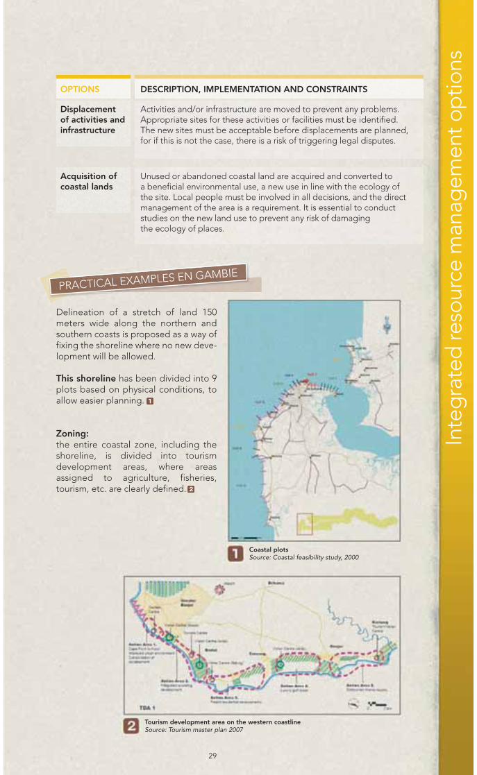
PRACTICAL EXAMPLES EN GAMBIE
Delineation of a stretch of land 150meters wide along the northern andsouthern coasts is proposed as a way offixing the shoreline where no new deve-lopment will be allowed.
This shoreline has been divided into 9plots based on physical conditions, toallow easier planning.
Zoning:the entire coastal zone, including theshoreline, is divided into tourismdevelopment areas, where areasassigned to agriculture, fisheries,tourism, etc. are clearly defined.
1
2
Coastal plotsSource: Coastal feasibility study, 2000
Tourism development area on the western coastlineSource: Tourism master plan 2007
Inte
gra
ted
reso
urce
man
agem
ent o
ptio
ns
OPTIONS DESCRIPTION, IMPLEMENTATION AND CONSTRAINTS

30
Displacement of sand pitsSource: National Env. Agency, 2011
Buffer Zone: The Gambian coastal zone has four forestreserves; however, none of them has abuffer zone
The systematic displacement of sandextraction places along the coast to avoidimpacts such as increased coastal erosionhas been instituted.
An unused sand pit has been exploited inthe village of Kartong in the ACCC projectto support local ecotourism.
3
4

31
SET BACK LINES• Quite costly technique for setting limits, especially if the area is extensive.
The cost of developing infrastructure depends on the type selected.
•The expert service for demarcation is U.S. $ 150 /hour.
CLASSIFICATION OF THE SHORELINE• Quite expensive technique because of the remuneration of expertise and for
the possible purchase of high resolution satellite images.
• The expert service depends on the number of man hours/day, usually U.S. $ 150/hour.
• Satellite imagery: for a resolution of 2.5 m/5m the high-resolution imaging costs U.S. $ 7,500 to U.S. $ 10,500 for a full view.
ZONING • Infrastructure Development, for example 1.5m-high concrete pillar used for
demarcations costs about U.S. $ 25.
• The expert service for demarcation is U.S. $ 250/hour.
• High-resolution satellite imagery: 7500 U.S. $/image resolution of 5m as anexample.
BUFFER ZONES FOR COASTAL FORESTS• High resolution satellite imaging: U.S. $ 7500/ image resolution of 5 m as an
example. The expert service for demarcation is U.S. $ 150/hour
• The costs of monitoring to maintain the buffer zone; monthly salaries ofU.S. $ 80/month/person.
DISPLACEMENT OF ACTIVITIES• High cost, because this option requires the development of new infrastructure and
may also involve compensation.
• Significant costs for infrastructure such as roads and buildings.
• Potential compensation.
• This can trigger legal disputes if the parties do not want to move their operations.
LAND ACQUISITION• Could mean developing new infrastructure and therefore relatively expensive.
• Infrastructure such as access roads, the boundary fences, etc. For example the cost offencing at Kartong over about 250m stood at U.S. $ 5.500.
• Unskilled labour.
Inte
gra
ted
reso
urce
man
agem
ent o
ptio
ns
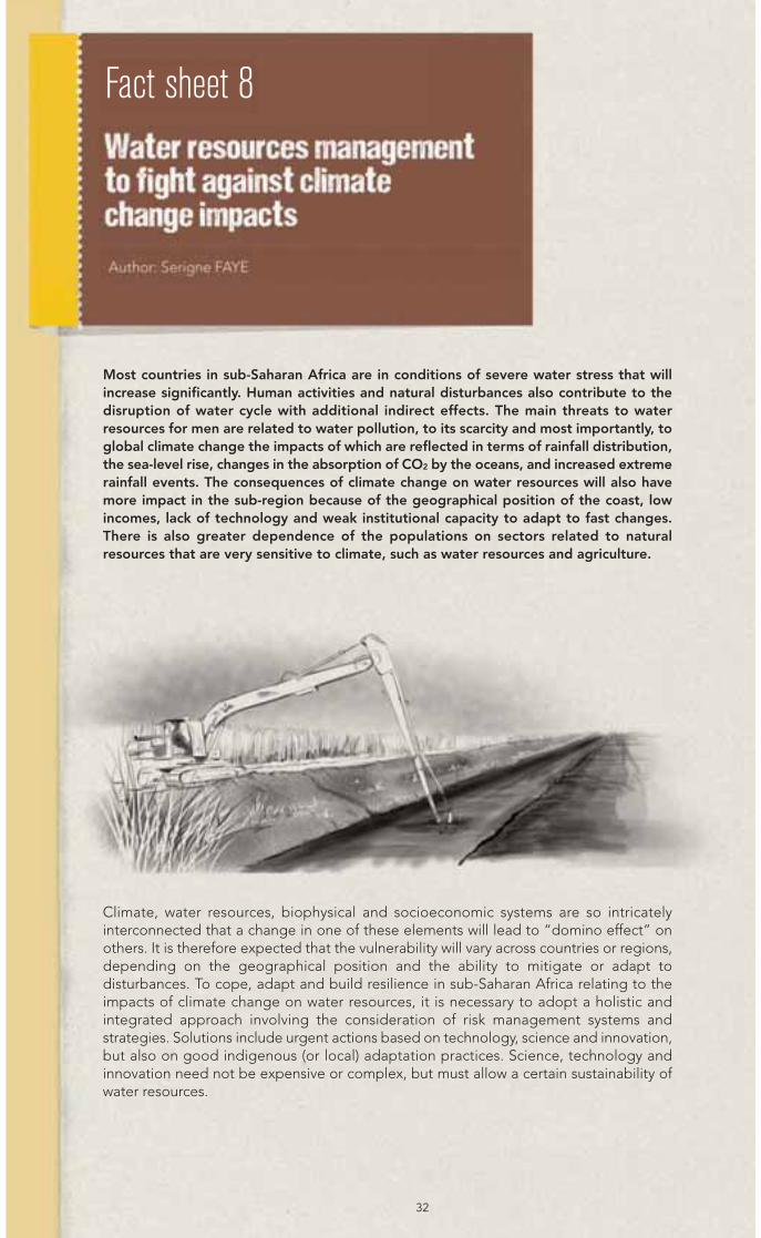
Most countries in sub-Saharan Africa are in conditions of severe water stress that willincrease significantly. Human activities and natural disturbances also contribute to thedisruption of water cycle with additional indirect effects. The main threats to waterresources for men are related to water pollution, to its scarcity and most importantly, toglobal climate change the impacts of which are reflected in terms of rainfall distribution,the sea-level rise, changes in the absorption of CO2 by the oceans, and increased extremerainfall events. The consequences of climate change on water resources will also havemore impact in the sub-region because of the geographical position of the coast, lowincomes, lack of technology and weak institutional capacity to adapt to fast changes.There is also greater dependence of the populations on sectors related to naturalresources that are very sensitive to climate, such as water resources and agriculture.
Climate, water resources, biophysical and socioeconomic systems are so intricatelyinterconnected that a change in one of these elements will lead to “domino effect” onothers. It is therefore expected that the vulnerability will vary across countries or regions,depending on the geographical position and the ability to mitigate or adapt todisturbances. To cope, adapt and build resilience in sub-Saharan Africa relating to theimpacts of climate change on water resources, it is necessary to adopt a holistic andintegrated approach involving the consideration of risk management systems andstrategies. Solutions include urgent actions based on technology, science and innovation,but also on good indigenous (or local) adaptation practices. Science, technology andinnovation need not be expensive or complex, but must allow a certain sustainability ofwater resources.
32
Fact sheet 8
33
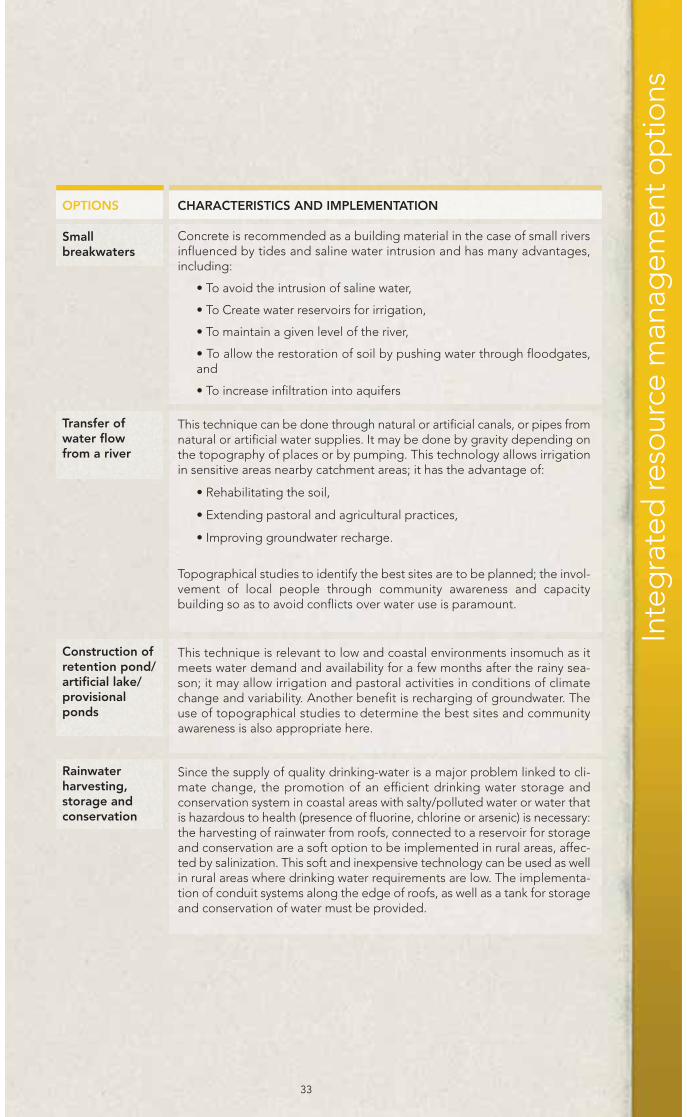
Smallbreakwaters
OPTIONS CHARACTERISTICS AND IMPLEMENTATION
Concrete is recommended as a building material in the case of small riversinfluenced by tides and saline water intrusion and has many advantages,including:
• To avoid the intrusion of saline water,
• To Create water reservoirs for irrigation,
• To maintain a given level of the river,
• To allow the restoration of soil by pushing water through floodgates,and
• To increase infiltration into aquifers
Transfer ofwater flowfrom a river
This technique can be done through natural or artificial canals, or pipes fromnatural or artificial water supplies. It may be done by gravity depending onthe topography of places or by pumping. This technology allows irrigationin sensitive areas nearby catchment areas; it has the advantage of:
• Rehabilitating the soil,
• Extending pastoral and agricultural practices,
• Improving groundwater recharge.
Topographical studies to identify the best sites are to be planned; the invol-vement of local people through community awareness and capacitybuilding so as to avoid conflicts over water use is paramount.
Construction ofretention pond/artificial lake/provisionalponds
This technique is relevant to low and coastal environments insomuch as itmeets water demand and availability for a few months after the rainy sea-son; it may allow irrigation and pastoral activities in conditions of climatechange and variability. Another benefit is recharging of groundwater. Theuse of topographical studies to determine the best sites and communityawareness is also appropriate here.
Rainwaterharvesting,storage andconservation
Since the supply of quality drinking-water is a major problem linked to cli-mate change, the promotion of an efficient drinking water storage andconservation system in coastal areas with salty/polluted water or water thatis hazardous to health (presence of fluorine, chlorine or arsenic) is necessary:the harvesting of rainwater from roofs, connected to a reservoir for storageand conservation are a soft option to be implemented in rural areas, affec-ted by salinization. This soft and inexpensive technology can be used as wellin rural areas where drinking water requirements are low. The implementa-tion of conduit systems along the edge of roofs, as well as a tank for storageand conservation of water must be provided.
Inte
gra
ted
reso
urce
man
agem
ent o
ptio
ns
34
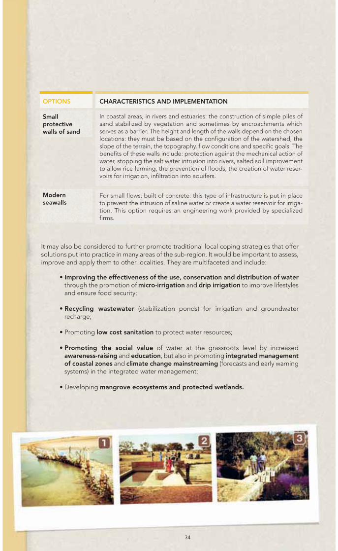
Smallprotectivewalls of sand
OPTIONS CHARACTERISTICS AND IMPLEMENTATION
In coastal areas, in rivers and estuaries: the construction of simple piles ofsand stabilized by vegetation and sometimes by encroachments whichserves as a barrier. The height and length of the walls depend on the chosenlocations: they must be based on the configuration of the watershed, theslope of the terrain, the topography, flow conditions and specific goals. Thebenefits of these walls include: protection against the mechanical action ofwater, stopping the salt water intrusion into rivers, salted soil improvementto allow rice farming, the prevention of floods, the creation of water reser-voirs for irrigation, infiltration into aquifers.
Modernseawalls
For small flows; built of concrete: this type of infrastructure is put in placeto prevent the intrusion of saline water or create a water reservoir for irriga-tion. This option requires an engineering work provided by specializedfirms.
It may also be considered to further promote traditional local coping strategies that offersolutions put into practice in many areas of the sub-region. It would be important to assess,improve and apply them to other localities. They are multifaceted and include:
• Improving the effectiveness of the use, conservation and distribution of waterthrough the promotion of micro-irrigation and drip irrigation to improve lifestylesand ensure food security;
• Recycling wastewater (stabilization ponds) for irrigation and groundwaterrecharge;
• Promoting low cost sanitation to protect water resources;
• Promoting the social value of water at the grassroots level by increasedawareness-raising and education, but also in promoting integrated managementof coastal zones and climate change mainstreaming (forecasts and early warningsystems) in the integrated water management;
• Developing mangrove ecosystems and protected wetlands.

35
Small dams
• From 700 to 800 U.S. $ per linearmeter: costs depend on the size of theriver, the tank capacity, the flow andcondition of the river.
Transfer of water from a river
• U.S. $ 5 to 50, the lowest linear costwhich may be valid if natural conditionsof the terrain are favourable (gravitydrainage and natural reservoir). Thecost varies depending on the type oftank, the distance to the source, thetransfer mode (gravity, pump), andparticipation of local people;
Construction of retentionponds/artificial lakes /temporaryreservoirs
• Can be up to U.S. $ 60,000 for a100,000-cubic-meter tank. The costdepends on the size of the tank andthe local geomorphology.
Rainwater harvesting, storage andconservation
• U.S. $ 800 to 900 for a 20-cubic-meter tank.
Small sand bunds
• Unit costs can be significantlyreduced if we use the experiencesand the involvement of local peopleand if we use local materials andrudimentary elements.
Modern seawalls
• U.S. $ 300 to 500 minimum per linearmeter.
PRACTICAL EXAMPLES
Some examples are listed below and illustratedfrom 1 to 4 pages 34, 35:
Sand dam consolidated by local vegetation at Loul Sessene (Fatick).
Sand dam reinforced with shells at Nyassia in Lower Casamance.
Modern concrete seawall at Loul Sessene (Fatick).
Small concrete seawall with outflow at Nema Ba in the Saloum.
Artificial canal at Richard Toll (northern Senegal).
Rainwater harvesting pond in Nianing/Mbour, Senegal; the retention pondsprogram provided successful examples that ensure water availability during3 to 6 months after the rainy season.
A 350-cubic-meter tank in the village of Kailo, in the Bliss and Karone islands.
1
2
3
4
Inte
gra
ted
reso
urce
man
agem
ent o
ptio
ns
Protection and conservation of marine and coastal ecosystems, particularly with respectto the impacts of erosion exacerbated by climate change, are necessary for many reasonsbecause:
• They provide habitat for fish resources
• They ensure the sustainability of these resources to levels that sustain theircontinued availability,
• They contribute to the reduction of extreme poverty in fishing communities throughthe improvement of trade, job creation and food availability;
Biological recovery is one measure that can be implemented in the field of fishing. Itconsists in suspending fishing activities during a renewable period of time through sus-tainable community management of fisheries resources. This rest is instituted in areasmost at risk, characterized by an intensive exploitation that results into the depletion offisheries resources. The biological rest is for preserving the biological parent stock ofspecies and to ensure recovery of the stock under normal, natural conditions, without fi-shing.
36
OPTION IMPLEMENTATION
The biological recovery is usually considered when it comes to mono-specific stocks such as octopus, bars, tiger prawns, etc. It is essentialfor managers to know the following in advance:
• The biological parameters (breeding area, breeding season) ofthe resources involved in the biological recovery,
• The delineation of sensitive areas of reproduction, nursery,fishing for the species concerned and
• Identification of the critical exploitation period or the fishing geartargeting these resources will be the next steps. At this stage theeconomic cost shall be estimated and supportive measures pro-posed for stakeholders (fishermen, ship-owners, industrialists,government).
Only on the basis of all this information, shall we proceed to developa regulatory framework and establish a monitoring system during theclosed season for the target area.
Biologicalrecovery
Fact sheet 9

37
PRACTICAL EXAMPLES
In SenegalOn order of the Ministry of Fisheries (dated November 2009), annual periodsof rest called biological recovery in waters under Senegalese jurisdiction havebeen established for industrial fishing vessels.
Mauritania and Morocco The introduction of biological rest is regular because the exploitation offisheries resources focuses on mono-specific stocks (octopus, crayfish, lobsters,sardines). Since the 2000s, fisheries managers in both countries establish eachyear, a biological rest period of two months renewable according to thebiological characteristics of species.
In Guinea As in most countries of West Africa, commercial fishing focuses on multi-specific stocks where the various species do not have the same biologicalparameters; in this case, other fisheries management measures are used,(fishing licenses, quotas, gear mesh, marketing size, etc.).
Fishing of octopus and cymbium (yet in Wolof) in the villagesof Nianing and Pointe SareneNianing and Pointe Sarene are two villages on the southern coast of Senegal,also known as the “Petite Côte”, wide open on the Senegalese coast. Theyare among the richest fishing communities of the country because the Petite
Inte
gra
ted
reso
urce
man
agem
ent o
ptio
ns

38
Côte is a spawning and nursery area for many species due to favourabledynamic marine conditions. It houses the largest fishing port in Senegal whichprovides more than 70% of all landings. However, this part of the coast ofSenegal is also marked by the development of other activities such as tourismthat builds on the importance of beaches located in the area and thefavourable coastal climate that prevails. It is characterized by:
• An abusive exploitation of fisheries and coastal resources in fishing sites.Despite the existence of a code of fishing and legislation on themanagement of maritime public domain in Senegal, compulsorymeasures are not applied in most cases. The fishermen are using fishinggear that degrade the marine environment and cause a depletion of fishproducts while demand is increasingly growing. There is a considerableincrease in the number of fishing boats and fishermen, particularlybecause of the recurrence of drought, and the unrestricted access to theresource, thus increasing the fishing effort while fish stocks suffered ageneral decline in recent years.
• The development of seaside tourism, the occupation and exploitation ofthe coastal stretch in various forms are exacerbating the degradation ofthe mangrove, coastal erosion, and hamper the development of manyspecies, including turtles that bury their eggs in beach sand. Theseaspects are major constraints for the balance of the marine and coastalecosystems.
In 2003, fishermen in Nianing and Pointe Sarene have investedin sustainable community management of fisheries resourceswith the support of researchers, state technicians anddevelopment partners to reverse the trend . They have takenmeasures to adapt to increasingly changing environmental,economic and demographic contexts. They were able toestablish a biological rest period for octopus and cymbium,both major income-generating produce. The rest period is fromSeptember 20 to October 20 of each year, which is the breedingseason of octopus on the Petite Côte. The observance of thebiological rest is accompanied by immersion of clay-pots inwhich the octopuses lay eggs. During this period, manycymbium newborns are collected along the protected coastal
stretch and carried into the sea. The observance of the biological recovery hasbecome possible, since the idea came from local fishermen, because of theimportance of using their experience and knowledge in fisheries management.Indeed, the participatory approach in fisheries management is moreadvantageous than the centralized approach in terms of cost of labour, andhence suitable for developing countries where public finances are facing severedifficulties.
1
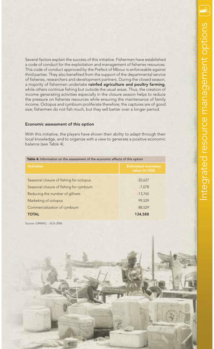
39
Several factors explain the success of this initiative. Fishermen have establisheda code of conduct for the exploitation and management of fisheries resources.This code of conduct approved by the Prefect of Mbour is enforceable againstthird parties. They also benefited from the support of the departmental serviceof fisheries, researchers and development partners. During the closed season,a majority of fishermen undertake rainfed agriculture and poultry farming,while others continue fishing but outside the usual areas. Thus, the creation ofincome generating activities especially in the closure season helps to reducethe pressure on fisheries resources while ensuring the maintenance of familyincome. Octopus and cymbium proliferate therefore; the captures are of goodsize; fishermen do not fish much, but they sell better over a longer period.
Economic assessment of this option
With this initiative, the players have shown their ability to adapt through theirlocal knowledge, and to organize with a view to generate a positive economicbalance (see Table 4).
Seasonal closure of fishing for octopus
Seasonal closure of fishing for cymbium
Reducing the number of gillnets
Marketing of octopus
Commercialization of cymbium
TOTAL
-32,627
-7,078
-13,765
99,529
88,529
134,588
Activities Estimated monetaryvalue (in US$)
Table 4: Information on the assessment of the economic effects of this option
Inte
gra
ted
reso
urce
man
agem
ent o
ptio
ns
Source: GIRMAC - JICA 2006
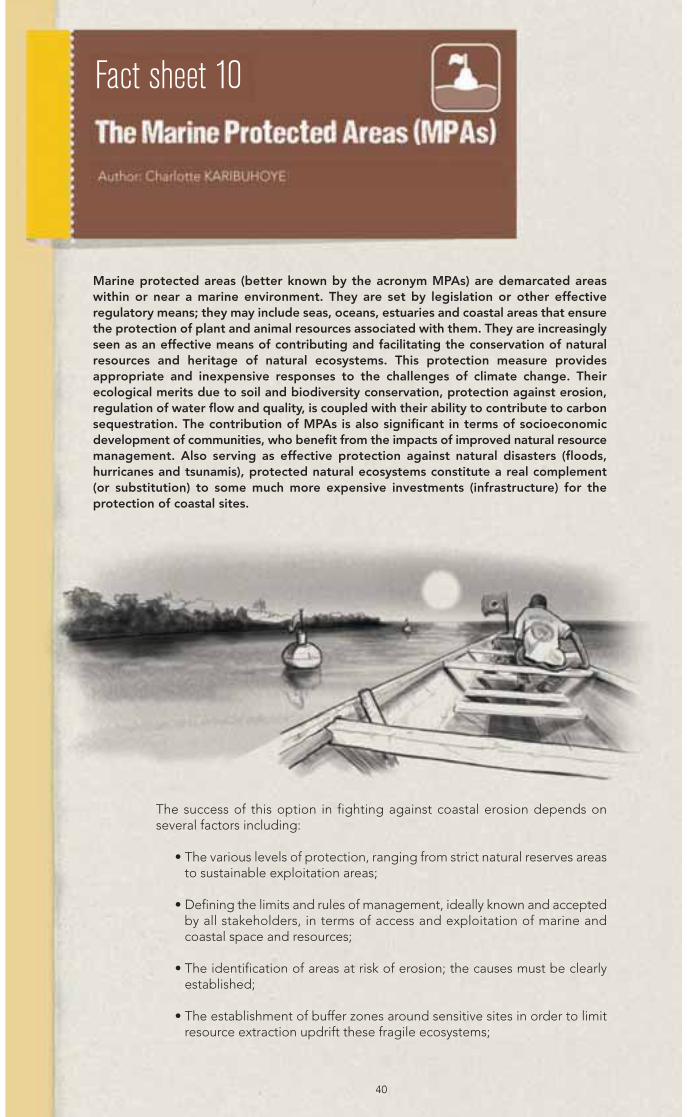
Marine protected areas (better known by the acronym MPAs) are demarcated areaswithin or near a marine environment. They are set by legislation or other effectiveregulatory means; they may include seas, oceans, estuaries and coastal areas that ensurethe protection of plant and animal resources associated with them. They are increasinglyseen as an effective means of contributing and facilitating the conservation of naturalresources and heritage of natural ecosystems. This protection measure providesappropriate and inexpensive responses to the challenges of climate change. Theirecological merits due to soil and biodiversity conservation, protection against erosion,regulation of water flow and quality, is coupled with their ability to contribute to carbonsequestration. The contribution of MPAs is also significant in terms of socioeconomicdevelopment of communities, who benefit from the impacts of improved natural resourcemanagement. Also serving as effective protection against natural disasters (floods,hurricanes and tsunamis), protected natural ecosystems constitute a real complement(or substitution) to some much more expensive investments (infrastructure) for theprotection of coastal sites.
40
The success of this option in fighting against coastal erosion depends onseveral factors including:
• The various levels of protection, ranging from strict natural reserves areasto sustainable exploitation areas;
• Defining the limits and rules of management, ideally known and acceptedby all stakeholders, in terms of access and exploitation of marine andcoastal space and resources;
• The identification of areas at risk of erosion; the causes must be clearlyestablished;
• The establishment of buffer zones around sensitive sites in order to limitresource extraction updrift these fragile ecosystems;
Fact sheet 10
41
OPTIONS IMPLEMENTATION
Clear objectives and a well defined space, with management rules knownand recognized by the various actors are needed.
• The identification of areas vulnerable to erosion and/or sites still ear-marked to protect as part of the implementation of MPAs
• The involvement of all key players in the implementation of measures,including local communities, officials from the central level, but alsoexternal users who exploit space and resources in and around targetedsites. An integrative approach that combines at the best, not only thedifferent categories of actors, but also the various modes of practiceand various interests.
• The availability of the necessary means for the effective managementof the site.
• Regular monitoring of the site and the implementation of adaptivemanagement measures if needed.
The formal establishment of AMPs at the regulatory level is not sufficient ifthe site management measures do not reduce pressure on sensitiveresources and maintain the proper functioning of ecosystems. This some-times requires the mobilization of significant human and technicalresources, in addition to a strong political will that are unfortunately notmuch available.
• In addition, although the reduction of risk factors induced by human acti-vities must be accompanied by concrete measures to promotealternative income generating activities for the benefit of communi-ties dependent on coastal resources, an investment and a long term visionare needed to achieve and maintain the necessary level of protection.
• Finally, the establishment of an MPA should be included in a moreholistic approach to coastal zone management, taking into accountthe various development sectors and the interests of all stakeholderswith a view to minimize any risk of conflicts.
MarineProtectedAreas (MPAs)
Inte
gra
ted
reso
urce
man
agem
ent o
ptio
ns
• Sufficient means of management available for their enforcement (surveillanceand monitoring, information and communication, facilities...);
• The establishment of a governance system for the effective involvementof stakeholders (communities, users, government...) in MPAs managementand in decision making.
The implementation of supportive measures, including the development ofincome generating activities to help reduce pressure on sensitive resources. It is also important to note that since the MPAs can often protect the lastremnants of natural habitat, the latter must be included in areas of enhancedprotection to maintain their resilience. This protection of the most vulnerablesites ensures their natural regeneration that could be reinforced by othercomplementary actions, such as habitat restoration, replanting of trees, etc.

42
PRACTICAL EXAMPLES
There are still rare examples of MPAs currently in place to fight against coastalerosion and climate change. Some practices have nevertheless revealed to beconvincing in some particularly sensitive areas which are described in thefollowing examples.
Tanbi National Park in The Gambia
Located at the mouth of the Gambia River, between the cities of Banjul andKanifing, the Tanbi National Park is a wetland of internationalimportance, consisting mainly of mangrove swamps and isbounded on the north by the Atlantic Ocean and on the eastby the River Gambia. Due to its characteristics and location,this park plays an important role for biodiversityconservation and the reproduction of many marinespecies. But it is also known for its effects on thestabilization and protection of the coast against coastalerosion. This is also a highly valuable element given thevulnerability of the city of Banjul, and The Gambia as a wholeto the impacts of climate change. This significant contributionis also partly reflected in the management of this MPA asactivities of habitat restoration (including fighting againsterosion and salt intrusion, but also for the preservation of acentral swamp) are organized. Mangrove cutting andinfrastructure development are prohibited. Landing is alsoforbidden on three central islands. However, with urbangrowth and the development of various activities related toeconomic development, this site is more exposed to the
threat of the spread of urban areas. These increasing human pressures arethreatening the integrity and operation of the site. This is how we shouldunderstand the approach of the ACCC project which was to contribute to thedelimitation of the park.
The Porcos Island in Guinea-Bissau
Porcos Island, located south of Carache Island and northwest of the Bijagosarchipelago, is classified as a biosphere reserve (BR). It covers three marineprotected areas and countless sacred sites traditionally protected by localcommunities of the Bijagos ethnic group. This island, formerly a nesting areafor sea turtles, is rich in fishery resources and mangroves. Given thevulnerability of the Porcos Island, the need to preserve its ecological andsocioeconomic value was reflected in the zoning of the Bolama-Bijagosbiosphere reserve. The island is part of the central zones of the BR, where amore severe restriction of human activities is considered (limiting humansettlements, tourist facilities, fishing camps, mining...). In principle, only thelocal traditional activities which have low toxicity to the environment are

43
permitted. However, like other sites in the archipelago, this island has beenunder considerable pressure, particularly because of its massive occupationby illegal camps home to hundreds of people (mostly fishermen fromneighbouring countries such as Senegal, Sierra Leone, Ghana and Guinea).This massive occupation has resulted in an exacerbation of coastal erosion,especially due to unbridled exploitation of mangroves for fish smoking, amongothers. A portion of the island (the cape) has consequently disappeared asshown in the following images. As part of strengthening the management ofthe biosphere reserve, steps have been taken to end this illegal occupation.The dismantling of settlements in 2008 has greatly reduced the pressure onthe island, including erosion. Regular monitoring of the site is necessary toassess its evolution, particularly the regeneration of mangroves and thereduction of erosion.
The specific costs for the AMP option infighting against erosion are difficult toestimate as this option must be part of aglobal system of the MPA management.The establishment and management ofan MPA usually involve a long processand several steps, costs of which willdepend on the objectives ofestablishment, duration, location andsize of the site, the complexity of itsmanagement, etc.
• The minimum cost of an MPAestablishment over a period of 4 to 5years is between € 20,000 to morethan € 3,000,000 depending on thecircumstances, the size of the MPA,the scale of investments at the startand duration of the process.
• For the operation, costs depend on thecomplexity of management. Monitoringcosts in particular can be very high inhighly used MPAs but other activities(ecological monitoring, communication,and various facilities to support localdevelopment) can also be expensive.
• Available data on MPAs in the WestAfrica sub-region indicate costs rangingfrom 1 to 32 €/ha. In community MPAswhere the surveillance and monitoringare often the result of local populations,costs can generally be lower per hectarethan in the case of MPAs managed byinstitutions.
Inte
gra
ted
reso
urce
man
agem
ent o
ptio
ns

The Fact sheets 1 to 10 described the technical characteristics of major options,the most commonly encountered and their costs. These characteristics arecoupled with steps required for monitoring and maintenance, in particular forthe hard-engineering options which are summarized in this section.
The benefits of regular monitoring of coastal management are generally wellunderstood by engineers and other stakeholders. Although it entails somecosts, it also generates the most benefits for the following reasons:
• The acquisition and analysis of long-term data through regular monitoring(e.g. beach profile) may be cheaper and more reliable than intensiveshort-term measures or modelling;
• It provides warnings about existing problems before they become seriousand expensive to repair;
• It facilitates performance evaluation of existing defence systems to allowsuccessive improvements under the management strategy.
To ensure effective coastal management, monitoring should be extended. Itshould include such essential data for engineering factors as:
• Conditions of swells and tides;
• The winds;
• The sediment supply;
• The rising sea level;
• Flood risks associated with marine and hydrological factors.
Less obvious characteristics such as ecology, water quality, impacts of sand andgravel mining may also require monitoring in certain circumstances. The valueof these new data in most cases depends on the time available for recordingand duration of these recordings. For this reason, and given the fundamentalimportance of planning and designing, the recording of data shall begin at theearliest. Very often, the need to respond to an urgent need leads to a too shorttime being devoted to work to allow the acquisition of good quality data andover an adequate period of time, which is however a prerequisite for long-termcoastal monitoring programs.
An impact assessment of existing conditions on the site and of infrastructureworks in coastal areas during the construction period and beyond is alsorequired. This step assesses the positive and negative impacts in order todetermine the effectiveness of the various project components for achievingthe goals and objectives of the project. The assessment will provide customers,signatories of contracts and other stakeholders with useful information aboutthe primary objectives in order to solve the problems of coastal erosion, and
What to choose?
44

INTEGRATED RESOURCE MANAGEMENT
SOFTER ENGINEERING OPTIONS
HARD ENGINEERING OPTIONS
land degradation, including the destruction of infrastructure and loss of privateand public properties at the site and surrounding areas. In the case of beachrevetments for example, it is paramount to assess the impact of energydissipation and the run up of waves or their overflow on the structure andadjoining areas, and the sediment supply. Regarding the groins, theeffectiveness of the structure to stabilize the shoreline (meaning, theeffectiveness of the ability to trap sand) is very important. It is equally importantto assess the impact on areas downdrift the groins for instance.
What decision to make? Based on the evidence provided in this guide, wehope that policymakers will be better equipped to take action. To perfect theirapproach, we are proposing the following table which provides an overview ofpositive and negative impacts and costs associated with the different options.
1. Seawalls
2. Groins
3. Beach revetment
4. Artificial beach nourishment(or replenishment)
5. Restoration of dunes
6. Coast fixing through mangroverestoration
7. Optimizing the use of coastallands
8. Integrate management of waterresources
9. Biological recovery throughsustainable, community-basedfisheries resource management
10. The role of Marine ProtectedAreas (MPAs)
POSITIVE IMPACTS NEGATIVE IMPACTS COSTS
Table 5: Summary of impacts and costs of adaptation options in coastal areas
Wha
t to
cho
ose
?
45
!
46
In terms of cost/benefit analysis, the results are mixed, especially because ofthe risks of “maladaptation” (a change in natural or human systems leading toincreased vulnerability instead of reducing it as defined by the IPCC) generatedby the seawalls option. The natural dynamics of beaches is the result of manynatural parameters such as waves, currents, tides, wind, soil erosion plus therise in sea level, as explained in previous sections. When it is under no stressfrom human activity, the natural evolution of a beach depends on the dynamicsof the beach itself, which gradually absorbs the wave energy. Seawalls are astriking example of option with low cost/benefit yield, because although theyoffer immediate protection, which is the goal often sought by policymakers,the erection of walls affects these dynamics as they are a barrier increasing thereflection of waves and hence their impacts and erosion. This entails a loss offront beaches and further erosion at the end of these structures. Hard defencestructures tend most often to oppose, or hinder coastal processes, thusinducing many adverse impacts (collapse, transfer of problems withexacerbation of coastal erosion, etc.). These hard engineering options are alsothe most expensive ones, even if the cost of revetment is relatively lower.
These physical phenomena explain the fact that the most cost-effective optionsin the control of erosion, with a smaller negative impact on the coast, are softdefence structures that act in harmony with the natural dynamics, or the leastdisturb them. The high cost of artificial beach nourishment, however, must behighlighted, although interesting results were obtained with that option. Thesecosts are mainly due to the fact that the operations of artificial nourishmentshould be regularly maintained. The other two soft engineering optionsgenerate interesting results at lower costs.
As for the four management options, they generally produce positive effects(as they help in better management of resources in an integrated manner).However, one should bear in mind that they also have a cost though muchlower than the costs of hard-engineering options. However, they are ofadditional interest to the populations, since they all involve a participatoryapproach.

47
FACT SHEET N°1Author: Isabelle NIANG ensured the coordinationof the ACCC project and the implementation of itsregional components, mainly for training, communi-cation and cooperation at the sub-regional level fromlate 2008 to late 2011. Lecturer at the Cheikh AntaDiop University of Dakar. Nobel Prize Winner, as oneof “Coordinating Lead Author” of the fifth IPCC as-sessment report (Africa Chapter). Holds a PhD in ma-rine geology and a doctoral thesis in coastal geology.
Contacts : Isabelle NiangDepartment of GeologyCheikh Anta Diop University of DakarSENEGALTel.: +221 77 363 24 56 (Cell)Email: [email protected]
Bibliography:GUEYE, K. (1997). Conception d’un ouvrage de protec-tion côtière contre les inondations à Rufisque. Engineerdoctoral thesis, University of Dakar, 170 p., 48 fig., 53.NIANG-DIOP, I. (1995). L’érosion côtière sur la PetiteCôte du Sénégal à partir de l’exemple de Rufisque.Passé-Présent-Futur. Thesis, University of Angers, Vol.1, 318 pp., 112 fig., 47 tab.
FACT SHEETS N° 2 et 3Auteur: George NAI, private consultant involved inthe planning, preliminary design and implementationof projects in Ghana. Civil engineer; he worked forthe Department of Public Works, the Department ofHydrological Services and the Ministry of PublicWorks and Housing from 1965 to 2001, where hemade numerous engineering works, including plan-ning, on site investigations, design and supervisionof a number of drainage and flood control systems,and coastal protection projects. He pioneered theusage of gabions for coastal protection works inGhana with particular reference to the gabion revet-ment pilot project at Labadi Beach and other loca-tions along the shoreline of Ghana. He activelyparticipated in the investigations, planning and su-pervision of the Keta and Assinie Coastal Defenceproject (2005 to 2008).
Contacts : George NaiGhana Civil Coastal Engineer CCECSPO Box TN768 Teshie Nungua Accra, GHANA Tel.: +233 273427918Fax: +233 302715555Email : [email protected]
J. Stanley-Owusu & Co.P.O. Box 3751, Accra, GHANA Tel.: +208 511 6565, +302 664023 E-mail: [email protected]
Director of Hydrology P.O. Box M 501, Accra - GHANATel.: +302 666694E-mail: [email protected]
Great Lakes Dredge & Dock Company,212 York Road, Oak Brook,Illinois 60523, USA.Tel.: +630 574 3000 Fax: +630 574 2909E-mail: [email protected]
Bibliography:CIRIA TN Groins in coastal engineering: data on per-formance of existing groin system (1990) CIRIA TN Seawalls: Survey of Performance and Des-ign Practice (1886)COASTAL ENGINEERING RESEARCH CENTRE, Ft.Belvoir, Virginia, January (1964)IBE, A.C. ANTIA E.E Preliminary assessment of theimpacts of erosion along the Nigerian ShorelineNIOMR Tech. Paper, No. 13. (1983),NORWEGIAN INSTITUTE OF TECHNOLOGY Rub-ble Mound Breakwaters, Report, (1979)OWEN M. W., The hydraulic design of seawall pro-files, proc Conference on Shoreline Protection, Sou-thampton (1982), PETHICK, J., An introduction to Coastal Geomorpho-logy, Edward Arnold, London (1984) Terram System Specification Guide, Terram LimitedNP4 OYR, UKU.S. ARMY CORPS OF ENGINEERING, Guide on theuses of groins in coastal engineering, US (1990)
FACT SHEET N°4Author: Regina FOLORUNSHO is Assistant Directorand Head of Research at the Institute of Oceanogra-phy in Laos (Nigeria). She works particularly on theimpact assessment of sea level rise and climatechange on the coasts of Nigeria. She holds a Ph.D. inclimatology from the University of Lagos.
Contacts : Regina FolorunshoNigerian Institute for Oceanography and Marine Research Victoria Island, P.M.B. 12729, Lagos, NIGERIA Tel.: +234- (0)8033124016Email: [email protected] /[email protected]
Bibliography:AWOSIKA L. F., Storm Surge of August 1995 andFlooding of the Victoria Island on 17 August 1995. Anunpublished paper (1995).AWOSIKA, L. F., IBE, A. C.; Anthropogenic activitiesaffecting sediment load balance along the westernAfrican Nigeria coastline. Coastline of West Africa Ed.Awosika (1993).AWOSIKA,L.F., DUBLIN-GREEN C. O. AND FOLO-RUNSHO R.: Study of Main drainage Channels of VictoriaIsland and Ikoyi Islands in Lagos Nigeria and their Res-ponse to Tidal and Sea level Changes,www.unesco.org/csi/act/lagos/drains2.htm (2000)BROMFIELD, T., (2006): http://www.geographical.co.uk/Magazine/Atlantic_rising_-_Sep_10.htmlAMUWA D. (2008): Lagos Bar Beach project. (2008)http://www.skyscrapercity.com/archive/index.php/t-948684.htmlFOLORUNSHO, R., AWOSIKA L. F.; MeteorologicalInduced Changes Along the Nigerian (1995):BORDOMER – IOC BORDEAUX, Coastal Zone andImplications for Integrated Coastal Zone ManagementPlan. Proc. Int. Conf. 95, Coastal Change, 804 – 811.Fo-lorunsho, R., (2004): Environmental Consequences ofMeteorological Factors affecting Ocean , 1995.UNPUBLISHED PhD THESIS, Dynamics along theGulf of Guinea Coast. Royal Haskoning, The cause ofcoastal erosion on a nourished beach in Kololi, TheGambia (2004).
Aut
hors
, co
ntac
ts a
nd re
fere
nces
Authors, contacts and references

48
http://www.nedeco.nl/projects/the-cause-of-coastal-erosion-on-a-nourished-beach-in-kololi-the-gambia
FACT SHEET N°5Author: Mamadou DIOP is the Coordinator of theWest Africa Mangrove Initiative (WAMI) project cove-ring Mauritania, Senegal, The Gambia, Guinea Bis-sau, Guinea and Sierra Leone. Former Executive withthe Ministry Delegate to the Prime Minister of Mau-ritania in Charge of Environment and Sustainable De-velopment. President of the National NGO “Actionpour la Protection de l’Environnement” (APE), holderof Engineering degree in Applied Sciences (speciali-zed in Forestry) from the Rural Polytechnic Institute(RPI) Katibougou (Mali).
Contacts : Mamadou DiopBP : 170 Nouakchott - MAURITANIATel.: 222 651 35 71Email : [email protected]
Ould Saleck MeimineNouakchott - MAURITANIATel.: + 222 455 4744 / +222 2265 47 44Email: [email protected]
Ould Mohamed MousaphaNouakchott - MAURITANIATel.:+ 222 46412155/+222 22002178Email: [email protected]
Bibliography:FAO, Lutte contre l’ensablement: l’exemple de laMauritanie, Etude FAO : Forêt-158 (2010). Fiche techniques sur la stabilisation mécanique et lafixation biologiques des dunes "Projet Lutte Contrel’Ensablement et de Mise en Valeur Agro-Sylvio-Pas-toral" (PLEMVASP) (1983 and 1997).FLM Etude de l’impact des reboisements de protec-tion sur la restauration de l’environnement urbain etpériurbain de Nouakchott-Mauritanie (2002).FLM Etude sur l’intensification et la diversification desproductions végétales en zones arides et semi-aridesen Mauritanie, (1998).FLM Etude sur la conservation et la protection desespèces forestières des zones humides dans le basdelta du fleuve Sénégal en Mauritanie (2000).Modules de formation "Les Stratégies de Fixationdes Dunes en Mauritanie", Projet ACCC - Nouak-chott (2009).
FACT SHEET N°6Author: Mamadou SOW is the coordinator of the re-gional IUCN/WI project titled “West Africa MangroveInitiative”. He is an Agricultural Engineer graduatedfrom the Faculty of Agronomy (DES) and the Agricul-tural Academy of Ukraine (Kiev, Russia).
Contacts : Mamadou SowUICN - SENEGALTel.: +221 77 204 42 40 Email: [email protected] / [email protected]
Richard DacostaWetlands International AfricaSENEGALTel.: +221 77 549 84 81
Ngor DourUniversity of Ziguinchor - SENEGALTel.: +221 77 553 32 03 Email: [email protected]
Massané DIAM Village Chief of Buram - THE GAMBIATel.: +220 694 75 74
Ibrahima BANGOURANational Directorate of Waters and Forestry - GUINEA Tel.: +224 62 57 10 88Email: [email protected]
Abdoulaye DIAMEWAAME - SENEGALTel.: +221 77 553 31 03Email: [email protected]
Bibliography:CORCORAN E, RAVILIOUS C, SKUJA M: Mangrovesof Western and Central Africa. UNEP Nairobi 87pages (2007). http://books.google.com/books?id=xdrMCcDQaaoC&printsec=frontcover&hl=fr&source=gbs_ge_summary_r&cad=0#MERCIER DÉGUÉ-NAMBONA R,: Contribution desreboisements de mangrove du delta du Saloum (Sé-négal) à la séquestration de carbone atmosphérique:cas des villages Djirnda et Sanghako. UCAD Dakar.75 pages (2008). http://www.memoireonline.com/12/09/3025/m_Contribution-des-reboisements-de-mangrove-du-delta-du-saloum-senegal-a-la-se17.htmlIUCN Senegal-Wetlands International Africa : ActivityReport of the West Africa Mangrove Initiative project.IUCN/WI Dakar. 28 pages (2009)LAFFOLEY, D, GRIMSDITCH G: The management ofnatural coastal carbon sinks. UNEP Nairobi. 64 pages(2009). http://cmsdata.iucn.org/downloads/carbon_managment_report_final_printed_version.pdf
FACT SHEET N° 7Author: Dodou TRAWALLY is the Manager of thenational ACCC project in The Gambia. He has a 15years experience in the environmental field, speciali-zing in environmental information and managementsystems analysis. His works involve Climate Change,the mapping of environmental resources, the muni-cipal waste management and Integrated Environ-mental Assessment and Reporting (EnvironmentAgency, Banjul (The Gambia). He holds a Master ofScience from the Stuttgart University of AppliedSciences (Germany) and a Bachelor and a Master ofScience from Saint Mary's University.
Contacts : Dodou Trawally National Environment Agency,Gambia Environment HouseJimpex Road, Kanifing, Postal: P. M. B. 48, Banjul, THE GAMBIATel.: +220 4399-429 (office) + 220 985-1049 (cell)Email: [email protected]
Bibliography:US Environmental Protection Agency, (2009). Synthe-sis of Adaptation Options for Coastal Areas. Availablefrom http://www.epa.gov/cre/adaptationoption.html[Accessed, August 2010]

49
Aut
hors
, co
ntac
ts a
nd re
fere
nces
USAID, (2007). Adapting to Climate Variability &Change: a guidance manual for development plan-ning. Available from: http://pdf.usaid.gov/pdf_docs/PNADJ990.pdf [Accessed, August 2010]USEPA, (2009). Climate Ready Estuaries: 2009 Pro-gress Report. Available from: http://www.epa.gov/cre/downloads/2009-CRE-Progress-Report.pdf [Ac-cessed, August 2010]STEWART et al., (2003). A Guide to Land Use Plan-ning in Coastal Areas of the Maritime Provinces: Ca-nada Technical Report of Fisheries and AquaticSciences No. 2443. Available from: http://www.dfo-mpo.gc.ca/Library/316491.pdf [Accessed, December2010]UNIVERSITY OF MORATUWA (2010). Land Use Plan-ning Tools: Land Use Planning & Development (TP2415). Available from: http://www.mrt.ac.lk/tcp/uploads [Accessed, December 2010]MUSTELIN, J. (ed) (2009). Practical measures to tackleclimate change: coastal forest buffer zones and sho-reline change in Zanzibar, Tanzania. Available from:http://www.unesco.org/csi/climate-frontlines/Practi-calMeasuresZanzibar_Ebook.pdf [Accessed, Decem-ber 2010]FAO (1993), Guidelines for land-use planning. Availa-ble from: http://www.fao.org/docrep/t0715e/t0715e00.HTM [Accessed, December 2010]ALMER et al., (1999). Land Use Planning: Methods,Strategies & Tools. Available from: http://www.iapad.org/publications/ppgis/gtz_plup.pdf [Accessed, December 2010]LEWSEY ET AL., (undated), Mainstreaming Adapta-tion to Climate Change: Climate Change Impacts onLand Use Planning and Coastal Infrastructure. Avai-lable from: http://www.oas.org/macc/Docs/LUPIn-frastIssues.doc [Accessed, January 2011]
FACT SHEET N°8Author: Serigne FAYE is Full Professor at the CheikhAnta Diop University, Senegal. Lecturer and Resear-cher for 20 years in the field of management of waterresources and environmental protection. Activemember of several professional associations (Interna-tional Association of Hydro-geologists, InternationalAssociation of Hydrological Sciences, National WaterPartnership with Senegal). He holds a PhD in Engi-neering and a postdoctoral thesis in Hydrogeology,and author of several scientific and technical publica-tions.
Contacts:Serigne FAYEGeology Department /Faculty of Sciences and TechniquesCheikh Anta Diop University / Dakar PO Box 5005Dakar - SENEGAL Tel: +221 774118395 / Fax +221 338246318 Email: [email protected] / [email protected] /[email protected]
Enda Tiers Monde / Actions en Casamance BP 224 ZiguinchorSENEGAL/Email: [email protected]
GRDR (Groupe de Recherche et de Réalisations pourle Développement Rural) Av. Emile Badiane BP 813 Ziguinchor - SENEGAL Email [email protected]
Directorate of Retention Ponds and Artificial Lakes Route des Pères Maristes, Hann BP 2041 DakarSENEGALEmail: [email protected]
Compagnie Sucrière Sénégalaise (CSS), HeadquartersRichard TOLL B.P: 49, Richard Toll - SENEGALTel: +221 33938 23 23 Fax: +221 33963 31 47
Agence CSS B.P: 2031, Dakar - SENEGALTel: +221 33832 28 86 Fax: +221 33832 91 92
SAED/Ngallèle RN2 BP 74 Saint Louis - SENEGALTel + 33 9382200 Email: [email protected]
Bibliography:ONI S.I, EGE E Rainwater Potential for domesticwater supply in Edo State, Indus journal of manage-ment, 5 social sciences volume 2; N°2 37-98; (2008).h t t p : / / i n d u s . e d u . p k / R e P E c / i i h / j o u r n l / 1 -RainwaterHarvestingPotentialforDomesticWaterSup-plyinEdoState-S.pdfDOWNING, TE, RINGIUS L, HULME M, WAUGHRAY.D: Adapting to climate change in Africa, mitigationand adaptation strategies for global change 2; 19-44(1997).ENDA Tiers monde: Diffusion de technologies ap-propriées et de mode de gestion concertée et dura-ble des ressources naturelles en Casamance(Sénégal). Technical Document (2010).ENDA Tiers monde: Lutte contre la désertification.UNDP: Community Water Initiative fostering watersecurity and climate change adaptation and mitiga-tion; technical report (2010)GRDR Aménagement et valorisation des vallées enBasse Casamance: Manuel technique (2008).
FACT SHEET N°9André Bihibindi: Programs and Projects Monitoringand Evaluation Officer of the Network on Fishery Po-licies in West Africa “REPAO”. He is currently invol-ved in research activities on participatory action andcapitalization as part of the Program of Adaptationof Fishing Policies to Climate Change in West Africa”(APPECCAO). He worked for ENDA/RUP for ten yearsas the PADE (Sustainable Environmental Improve-ment Program) Program Officer. Holds a post-gra-duate degree (DESS) in Planning, Decentralizationand Territorial Development.
Ndiaga DIOP: Program Manager of the Network onFishery Policies in West Africa (REPAO). Since 2008he is member of a research team on “ClimateChange and Fisheries in Senegal”, which aims to fa-cilitate the adaptation of Fishing Policy to ClimateChange. He is member of the National ConcertationCommittee for adapting fisheries to climate change(CNCP/CC), and holds a Master in Economics, majorin Economic Analysis and Policy, and a post-graduatedegree (DEA) in Environment Sciences from theCheikh Anta Diop University of Dakar.
50
Contacts: André BihibindiProjects Monitoring and Evaluation OfficerENDA DIAPOL/REPAOLiberté IV n°5000BP 47076, Dakar - SENEGALTel : 221 77 450 92 63 / 33 8252787Fax : 221 33 8252799Email: [email protected]
Raphael NDOURFisherman at Nianing - SenegalTél: +221 773544161
Mbaye SARREFisherman at Pointe Sarène - SenegalTel : +221 776306815
Bibliography:THIAO D., SARRE A.: Gestion des ressources halieu-tiques sénégalaises : rapport national présenté au 5ecours d’AJIOST (Afro-Japanese Institute of Oceano-graphic Science and Technology) (2008)GIRMaC: Manuel de cogestion des pêcheries, théo-ries et études de cas au Japon, aux Philippines et auSénégal, (2007). http://www.lapresse.tn/09052011/28688/la-nature-a-trouve-son-compte-et-les-pe-cheurs.html
FACT SHEET N°10Author: Charlotte KARIBUHOYE ensures the regio-nal coordination of the marine protected areas pro-gram for the Banc d'Arguin International Foundation(FIBA), a Swiss foundation that operates in the field ofmarine and coastal conservation and sustainable de-velopment in West Africa. She technically supervisesmany projects supported by FIBA to support the crea-tion and strengthening of MPAs, and the establish-ment of the regional network of MPAs in West Africa,RAMPAO. She is Vice-Chair of the World Commissionon Protected Areas of IUCN (International Union forConservation of Nature) for Central and West Africa,based in Dakar (Senegal).
Contacts: Charlotte KaribuhoyeAMP FIBA/PRCM Program CoordinatorBP 3215, Dakar - SENEGALTel : 221 33 869 02 88 / 77570 5171Fax : 221 33 824 92 46Email : [email protected] ; [email protected]
Alfredo da SilvaPorcos Island Director of the Institute for Biodiversity and ProtectedAreas of Guiinea-Bissau (IBAP)GUINEA BISSAUEmail: [email protected]
Alpha JALLOWTanbi National Park Director, Department of Parks and Wildlife Manage-ment (DPWM), THE GAMBIAEmail: [email protected]
Bibliography:BUBU P.JALLOW, MALANG K. A. BARROW, STE-PHEN P. LEATHERMAN 1996. Vulnerability of the co-astal zone of The Gambia to sea level rise anddevelopment of response strategies and adaptationoptions. Climate Research, Vol. 6: 165-177. (1996)BUBU P. JALLOW, SEKOU TOURE, MALANG M. K.BARROW, ASSA ACHY MATHIEU. 1999. Coastal zoneof The Gambia and the Abidjan region in Côted’Ivoire: sea level rise vulnerability, response strate-gies, and adaptation options, Vol. 12: 129–136, (1999)DA SILVA A. Adaptação as Mudanças Climáticas naZona Costeira da Guiné-Bissau (2005)DPWM. Tanbi national Park management plan.(2008Update)DUDLEY, N., S. STOLTON, A. BELOKUROV, L. KRUE-GER, N. LOPOUKHINE, K. MACKINNON, T. SAND-WITH AND N.SEKHRAN [editors] Natural Solutions:Protected areas helping people cope with climatechange, IUCN-WCPA, The Nature Conservancy,UNDP, Wildlife Conservation Society, The World Bankand WWF, Gland, Switzerland, Washington DC andNew York (2009)INEP/IBAP 2006. Updated management Plan of theBolama-Bijagos Biosphere Reserve (RBABB)LAFFOLEY, D. & GRIMSDITCH, G. (eds). The mana-gement of natural coastal carbon sinks. IUCN, Gland,Switzerland. 53 pp, (2009).NELLEMANN, C., CORCORAN, E., DUARTE, C. M.,VALDES, L., DEYOUNG, C FONSECA, L., GRIMS-DITCH, G. (Eds).. Blue Carbon. A Rapid Response As-sessment. United Nations Environment Program,GRID-Arendal, www.grida.no (2009)SANDWITH & SUAREZ (undated). Adapting to Cli-mate Change - Ecosystem-based approaches forPeople and Nature. The Nature ConservancyWORLD BANK. Convenient Solutions to an Inconve-nient Truth: Ecosystembased Approaches to ClimateChange (2009).

GESTION INTEGREE DES RESSOURCES
OPTIONS NON STRUCTURELLES
HARD ENGINEERING OPTIONS
1. Seawalls
2. Groins
3. Beach revetment
4. Artificial beach nourishment (or replenishment)
5. Reconstruction of dunes
6. Coast fixing through mangroverestoration
7. Optimizing the use of coastallands
8 Integrated managementof water resources
9 Biological recovery throughsustainable, community-basedfisheries resource management
10 The role of Marine ProtectedAreas (MPAs)
POSITIVE IMPACTS NEGATIVE IMPACTS COSTS
Summary of impacts and costs of adaptation optionsin coastal areas
!
Five countries in the West Africa region, namely Cape Verde, The Gambia, Guinea Bissau,Mauritania and Senegal, facing problems of coastal erosion have asked UNESCO/IOC in2003 through a request from SINEPAD to develop a project proposal for funding by theUNDP/GEF. After approval by GEF in late 2004, the ACCC project began in 2005. Itsobjective is to identify along eroded coastlines some pilot actions for the protection ofsensitive areas and formulate a priority program to implement them as part of an integratedmanagement approach. In addition to identifying priority sites and actions, the projectfocuses on the causes, socio-economic and environmental impacts, existing legislations,past experiences of protection and future projections in the short, medium and long term,related to climate and coastal changes in the region. The planned measures were discussedin consultation with local and national inter-ministerial committees. The project addressedissues specific to each country as well as the regional dimension due to similarenvironmental conditions with an eye to sharing experiences for building the most adaptedresponse possible to climate and coastal changes in West Africa. This manual is the resultof a taskforce of national experts set up as part of this project.
About the ACCC project