ablos conference 2010, monaco - iho
TRANSCRIPT
Latham & Watkins is the business name of Latham & Watkins (London) LLP, a registered limited liability partnership organised under the laws of New York and regulated by the Solicitors Regulation Authority
(SRA No. 203820). A list of the names of the partners of Latham & Watkins (London) LLP is open to inspection at its principal place of business, 99 Bishopsgate, London EC2M 3XF, and such persons are
either solicitors, registered foreign lawyers or European lawyers. We are affiliated with the firm Latham & Watkins LLP, a limited liability partnership organised under the laws of Delaware. In connection with
this presentation, you agree not to share with Latham & Watkins (London) LLP any confidential information regarding this potential engagement unless and until an attorney/client relationship is established.
©Copyright 2010 Latham & Watkins. All Rights Reserved.1
Controversy in the Bay of Bengal: Issues surrounding the Delimitation of Bangladesh’s Maritime Boundaries with India and Myanmar
ABLOS Conference 2010, Monaco
Stephen FiettaPartner, Public International Law Group

2
Controversy in the Bay of Bengal: Issues surrounding the Delimitation of Bangladesh’s Maritime Boundaries with India and Myanmar
• Introduction and disclaimers
• Background to the disputes
• Procedural overview of the two proceedings
• Substantive overview of the two proceedings
• Some (tentative) concluding remarks…
3
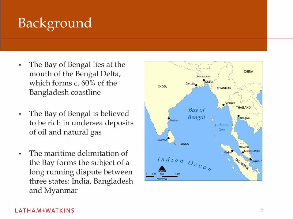
Background
• The Bay of Bengal lies at the mouth of the Bengal Delta, which forms c. 60% of the Bangladesh coastline
• The Bay of Bengal is believed to be rich in undersea deposits of oil and natural gas
• The maritime delimitation of the Bay forms the subject of a long running dispute between three states: India, Bangladesh and Myanmar
4
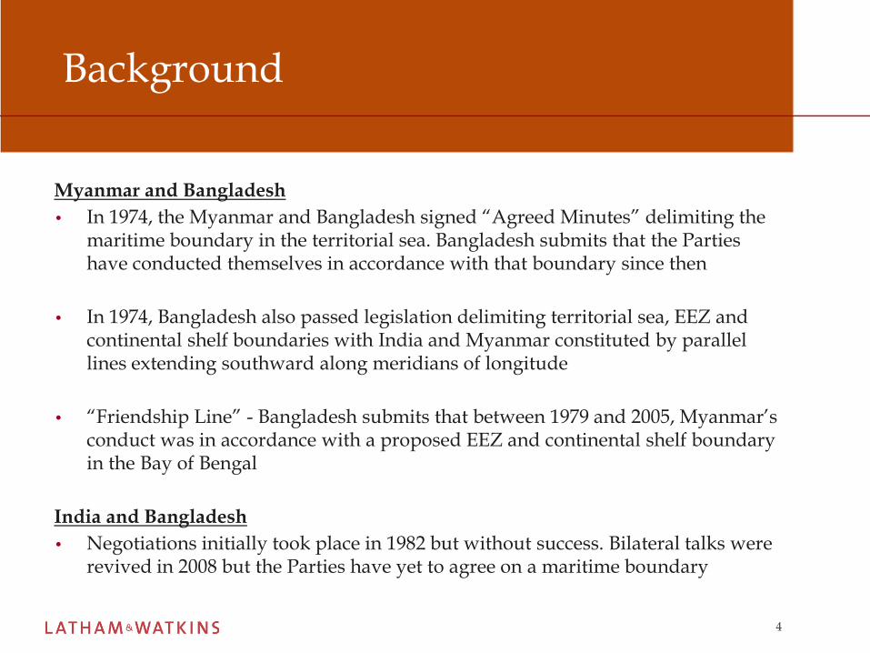
Background
Myanmar and Bangladesh
• In 1974, the Myanmar and Bangladesh signed “Agreed Minutes” delimiting the maritime boundary in the territorial sea. Bangladesh submits that the Parties have conducted themselves in accordance with that boundary since then
• In 1974, Bangladesh also passed legislation delimiting territorial sea, EEZ and continental shelf boundaries with India and Myanmar constituted by parallel lines extending southward along meridians of longitude
• “Friendship Line” - Bangladesh submits that between 1979 and 2005, Myanmar’s conduct was in accordance with a proposed EEZ and continental shelf boundary in the Bay of Bengal
India and Bangladesh
• Negotiations initially took place in 1982 but without success. Bilateral talks were revived in 2008 but the Parties have yet to agree on a maritime boundary

5
Background – the catalyst for legal proceedings
• A growing demand for resources/ energy crisis
• Accompanying advances in technology
• Competing oil concession activities, particularly since 2008 between Bangladesh and Myanmar on the Bangladesh side of the so-called “Friendship Line”
• CLCS submissions made by India and Myanmar denying Bangladesh any OCS entitlement
• New Moore Island/South Talpetty Island has disappeared
6
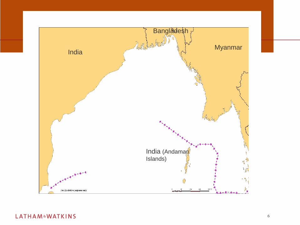
IndiaMyanmar
India (Andaman
Islands)
Bangladesh

7
Procedural overview
• India, Bangladesh and Myanmar are all signatories to the UnitedNations Law of the Sea Convention 1982 (UNCLOS)
• Under Part XV of UNCLOS, states are free to choose one or more of thefollowing means for the settlement of maritime boundary delimitationdisputes :-
• The International Tribunal for the Law of the Sea (ITLOS)
• The International Court of Justice (ICJ)
• An arbitral tribunal constituted in accordance with Annex VII
8
Overview of Proceedings
• On 8 October 2009, Bangladesh instituted arbitral proceedings againstboth the Myanmar and India pursuant to Annex VII of UNCLOS
• India consented to arbitration with Bangladesh under Annex VII (thedefault option under UNCLOS)
• Myanmar proposed that its dispute with Bangladesh be submitted toITLOS. On 4 November 2009, Myanmar transmitted a declarationconsenting to the jurisdiction of ITLOS. On 12 December 2009,Bangladesh reciprocated this declaration
• Myanmar and India are both represented by Sir Michael Wood and ProfAlain Pellet: potential conflict of interest? Collusion between India andMyanmar?

9
ITLOS Proceedings: Myanmar and Bangladesh
• This dispute between Bangladesh and Myanmar is the firstmaritime delimitation case to be heard by ITLOS
• The Tribunal’s mandate is to delimit the territorial sea, EEZand continental shelf (including beyond 200M) boundarybetween the two countries in the Bay of Bengal
• Expedited time-limits (set by agreement)
• 1 July 2010 – Filing of the Memorial by Bangladesh• 1 December 2010 –Filing of the Counter-Memorial by Myanmar
• 15 March 2011 – Filing of reply by Bangladesh• 1 July 2011 – Filing of Rejoinder by Myanmar

10
India and Bangladesh
• Each Party appoints one member of the arbitral tribunal with the otherthree members being appointed by agreement between the parties
• Bangladesh appointed Vaughan Lowe Q.C (since resigned) and Indiaappointed P. Sreenivasa Rao. The Parties were unable to agree upon theother members of the tribunal
• The President of ITLOS was required to appoint the remaining threemembers and, on 12 February 2010, appointed Rüdiger Wolfrum (aspresident) (Germany), Tullio Treves (Italy) and Ivan Shearer (Australia)to the arbitral tribunal

11
Annex VIII Arbitration: India and Bangladesh
• The Tribunal’s mandate is to delimit the territorial sea, EEZ andcontinental shelf (including beyond 200M) boundary betweenthe two countries in the Bay of Bengal
• The Parties have fixed a substantially slower timetable for firstround in written submissions:
• Bangladesh will file its Memorial in May 2011
• India will file its Counter-Memorial in May 2012

12
Substantive overview: Bangladesh’s straight baseline system
• Bangladesh’s coastline is highly dynamic/unstable and fluctuates backand forth continuously
• Bangladesh claims straight baselines based on depth criteria; selecting eight base points following a 10-fathom (60 feet) line - Territorial Waters and Maritime Zones Act 1974
• Bangladesh’s straight baseline system is controversial and has been challenged by both India and Myanmar
13
Straight Baselines – UNCLOS Art 7
Article 7(2)
• Where because of the presence of a delta and other natural conditions the coastline is highly unstable, the appropriate points may be selected along the furthest seaward extent of the low-water line, and, notwithstanding subsequent regression of the low-water line, the straight baselines shall remain effective until changed by the coastal State in accordance with this Convention
• Does Bangladesh meet these requirements?
• Will Bangladesh even rely upon its straight baselines in a legal forum regulated by UNCLOS?
14
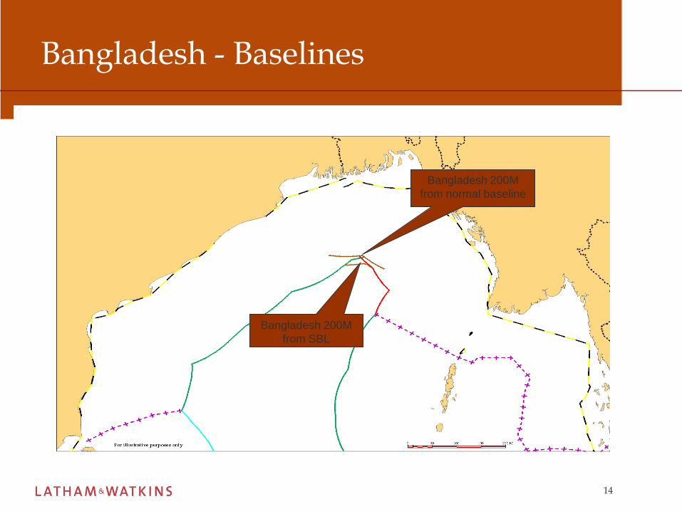
Bangladesh - Baselines
Bangladesh 200M
from SBL
Bangladesh 200M
from normal baseline

15
Bangladesh - Baselines
67M42M

16
Convergence of 200m Zones; possible convergence of OCS/EEZ areas
126 sq km
37 sq M
17
Possible Positions of the Parties – India & Myanmar
• India and Myanmar are both expected to claim amaritime delimitation with Bangladesh based on theapplication of an equidistance line, discounting anydisadvantages Bangladesh may suffer due to itsgeography
• The “normal” methodology for modern maritimeboundary to limitation
18
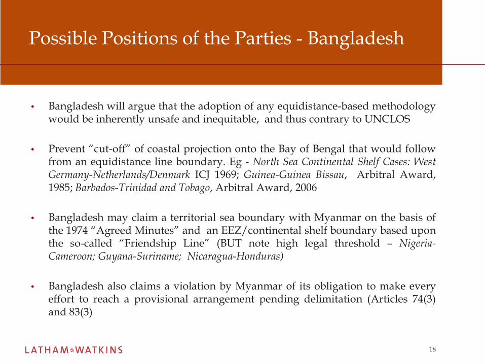
Possible Positions of the Parties - Bangladesh
• Bangladesh will argue that the adoption of any equidistance-based methodologywould be inherently unsafe and inequitable, and thus contrary to UNCLOS
• Prevent “cut-off” of coastal projection onto the Bay of Bengal that would followfrom an equidistance line boundary. Eg - North Sea Continental Shelf Cases: WestGermany-Netherlands/Denmark ICJ 1969; Guinea-Guinea Bissau, Arbitral Award,1985; Barbados-Trinidad and Tobago, Arbitral Award, 2006
• Bangladesh may claim a territorial sea boundary with Myanmar on the basis ofthe 1974 “Agreed Minutes” and an EEZ/continental shelf boundary based uponthe so-called “Friendship Line” (BUT note high legal threshold – Nigeria-Cameroon; Guyana-Suriname; Nicaragua-Honduras)
• Bangladesh also claims a violation by Myanmar of its obligation to make everyeffort to reach a provisional arrangement pending delimitation (Articles 74(3)and 83(3)

19
Bangladesh – effect of normal and straight baselines upon an equidistance line
115M

20
Offshore blocks – Oil and Gas exploration

21
Outer Continental Shelf – Overlapping CLCS Submissions
• 16 December 2008 - Myanmar submitted information regarding theouter continental shelf in the Bay of Bengal to the Commission on theLimits of the Continental Shelf (CLCS)
• 11 May 2009 - India submitted its own information regarding the outercontinental shelf in the Bay of Bengal to the CLCS
• Bangladesh will submit its CLCS claims by July 2011
• ITLOS and the Annex VII Tribunal are mandated with th delimiting anyouter continental shelf boundaries between Bangladesh-Myanmar andBangladesh-India in the Bay of Bengal
• Will there be any OCS boundary to delimit? If so, what methodologywill be used?
22
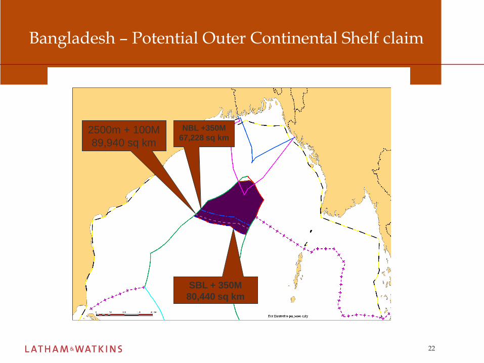
Bangladesh – Potential Outer Continental Shelf claim
SBL + 350M
80,440 sq km
NBL +350M
67,228 sq km2500m + 100M
89,940 sq km

23
Myanmar – Outer Continental Shelf Claim
24
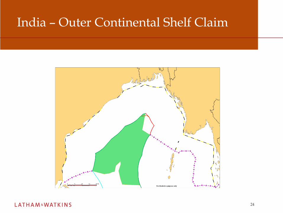
India – Outer Continental Shelf Claim
25
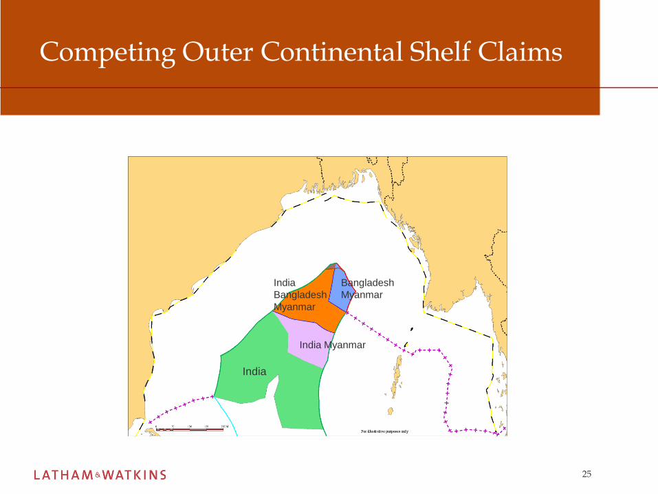
Competing Outer Continental Shelf Claims
India
India Myanmar
India
Bangladesh
Myanmar
Bangladesh
Myanmar
26
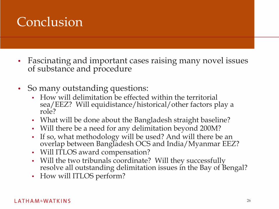
Conclusion
• Fascinating and important cases raising many novel issues of substance and procedure
• So many outstanding questions:• How will delimitation be effected within the territorial
sea/EEZ? Will equidistance/historical/other factors play a role?
• What will be done about the Bangladesh straight baseline?• Will there be a need for any delimitation beyond 200M?• If so, what methodology will be used? And will there be an
overlap between Bangladesh OCS and India/Myanmar EEZ?• Will ITLOS award compensation?• Will the two tribunals coordinate? Will they successfully
resolve all outstanding delimitation issues in the Bay of Bengal?• How will ITLOS perform?