a visual tour of carmans river - portal to discovery river watershed protection plan - draft carmans...
TRANSCRIPT
Carmans River Watershed Protection Plan - DRAFT Carmans River Study Group, January 2011
1
A Social and Environmental History of Carmans River Thomas B Williams1 Since the last ice age ended over 10,000 years ago, the Carmans River served a variety of uses for area residents. First used by Native Americans for fishing and transportation, it is now used by for hunting, fishing, recreation and the enjoyment of its wild beauty. As the largest river on Long Island, it holds a special place in the hearts of residents of Brookhaven Town and Suffolk County.
1 The author would like to thank the following for their assistance in compiling this history: Marty Van Lith (Brookhaven Hamlet Historian), The Post Morrow-Foundation, John Pavacic and Julie Hargraves (Pine Barrens Commission), Robert Kessler (Yaphank Historical Society), Peter Scully (Regional Director for Region 1, NYS DEC), Karen Mouzakes (Yaphank Historical Society), Nick Gibbons (Suffolk County Parks and Recreation Department), Chart Guthrie (NYS DEC), Anthony Graves (TOB DEP), John Turner (TOB, Director, DEP), Eva Greguski (TOB PELM).
Carmans River Watershed Protection Plan - DRAFT Carmans River Study Group, January 2011
2
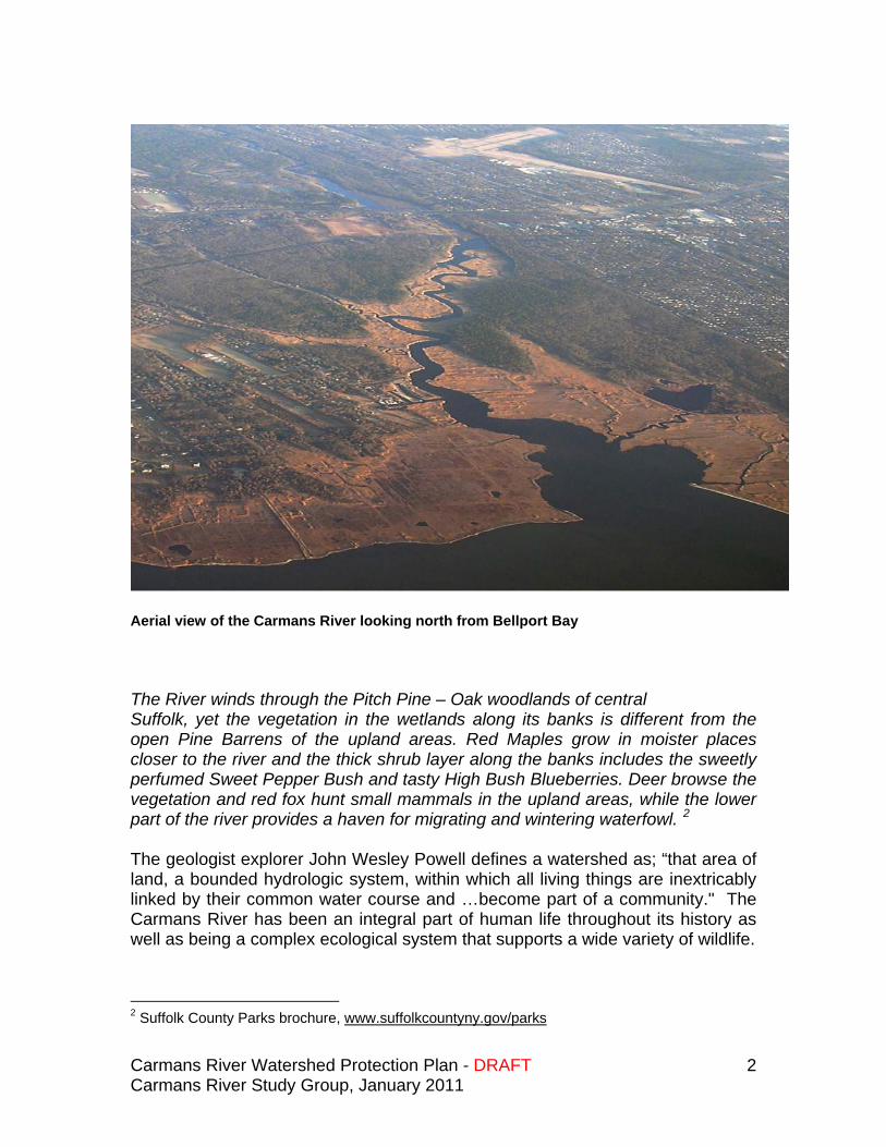
Aerial view of the Carmans River looking north from Bellport Bay The River winds through the Pitch Pine – Oak woodlands of central Suffolk, yet the vegetation in the wetlands along its banks is different from the open Pine Barrens of the upland areas. Red Maples grow in moister places closer to the river and the thick shrub layer along the banks includes the sweetly perfumed Sweet Pepper Bush and tasty High Bush Blueberries. Deer browse the vegetation and red fox hunt small mammals in the upland areas, while the lower part of the river provides a haven for migrating and wintering waterfowl. 2 The geologist explorer John Wesley Powell defines a watershed as; “that area of land, a bounded hydrologic system, within which all living things are inextricably linked by their common water course and …become part of a community." The Carmans River has been an integral part of human life throughout its history as well as being a complex ecological system that supports a wide variety of wildlife.
2 Suffolk County Parks brochure, www.suffolkcountyny.gov/parks
Carmans River Watershed Protection Plan - DRAFT Carmans River Study Group, January 2011
3
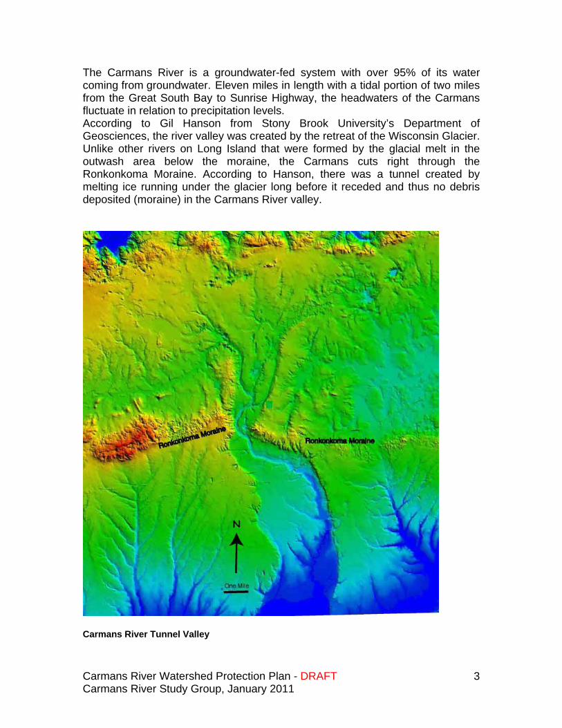
The Carmans River is a groundwater-fed system with over 95% of its water coming from groundwater. Eleven miles in length with a tidal portion of two miles from the Great South Bay to Sunrise Highway, the headwaters of the Carmans fluctuate in relation to precipitation levels. According to Gil Hanson from Stony Brook University’s Department of Geosciences, the river valley was created by the retreat of the Wisconsin Glacier. Unlike other rivers on Long Island that were formed by the glacial melt in the outwash area below the moraine, the Carmans cuts right through the Ronkonkoma Moraine. According to Hanson, there was a tunnel created by melting ice running under the glacier long before it receded and thus no debris deposited (moraine) in the Carmans River valley.
Carmans River Tunnel Valley
Carmans River Watershed Protection Plan - DRAFT Carmans River Study Group, January 2011
4
Native Americans used the river as a source of food including oysters, clams, and fish for thousands of years. European settlers arrived in 1655. In 1657, 256 acres of salt marsh meadow was purchased from the Unkechaugs, a tribe that had lived in the area for many generations and which was part of the Algonquin Nation.
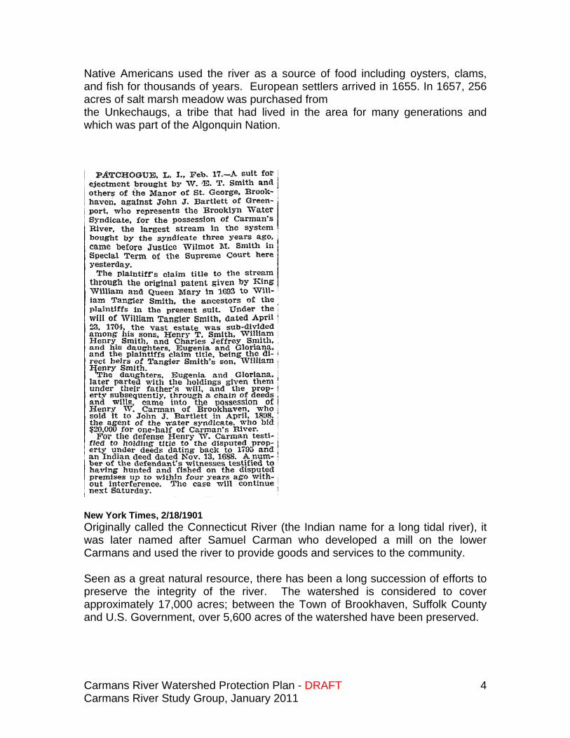
New York Times, 2/18/1901 Originally called the Connecticut River (the Indian name for a long tidal river), it was later named after Samuel Carman who developed a mill on the lower Carmans and used the river to provide goods and services to the community. Seen as a great natural resource, there has been a long succession of efforts to preserve the integrity of the river. The watershed is considered to cover approximately 17,000 acres; between the Town of Brookhaven, Suffolk County and U.S. Government, over 5,600 acres of the watershed have been preserved.
Carmans River Watershed Protection Plan - DRAFT Carmans River Study Group, January 2011
5
Efforts have been made over the years to access the water from Carmans River (among others) for New York City. The Brooklyn Water Syndicate tried in 1901 to tap the water of the Carmans. The Carmans River can be separated into four sections: The tidal river from Great South Bay to Sunrise Highway, which includes
the US Fish and Wildlife Wertheim refuge. Southaven County Park and Hards Lake The Yaphank area and two lakes (Willow and Lily Lakes, Upper and
Lower Lakes respectively) The upper river from the headwaters in Middle Island south through
Cathedral Pines, East Bartlett Road, and the Novak property to the northern regions of “Upper Lake” or Willow Lake, as it is now known
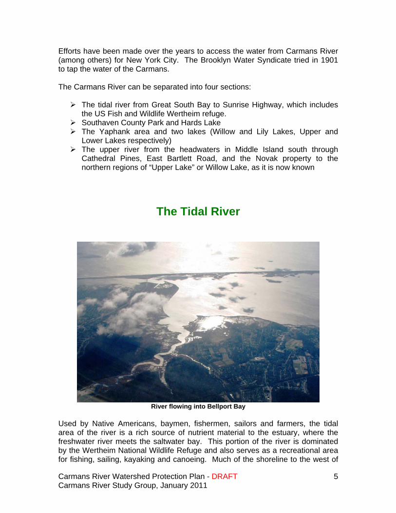
The Tidal River
River flowing into Bellport Bay
Used by Native Americans, baymen, fishermen, sailors and farmers, the tidal area of the river is a rich source of nutrient material to the estuary, where the freshwater river meets the saltwater bay. This portion of the river is dominated by the Wertheim National Wildlife Refuge and also serves as a recreational area for fishing, sailing, kayaking and canoeing. Much of the shoreline to the west of
Carmans River Watershed Protection Plan - DRAFT Carmans River Study Group, January 2011
6
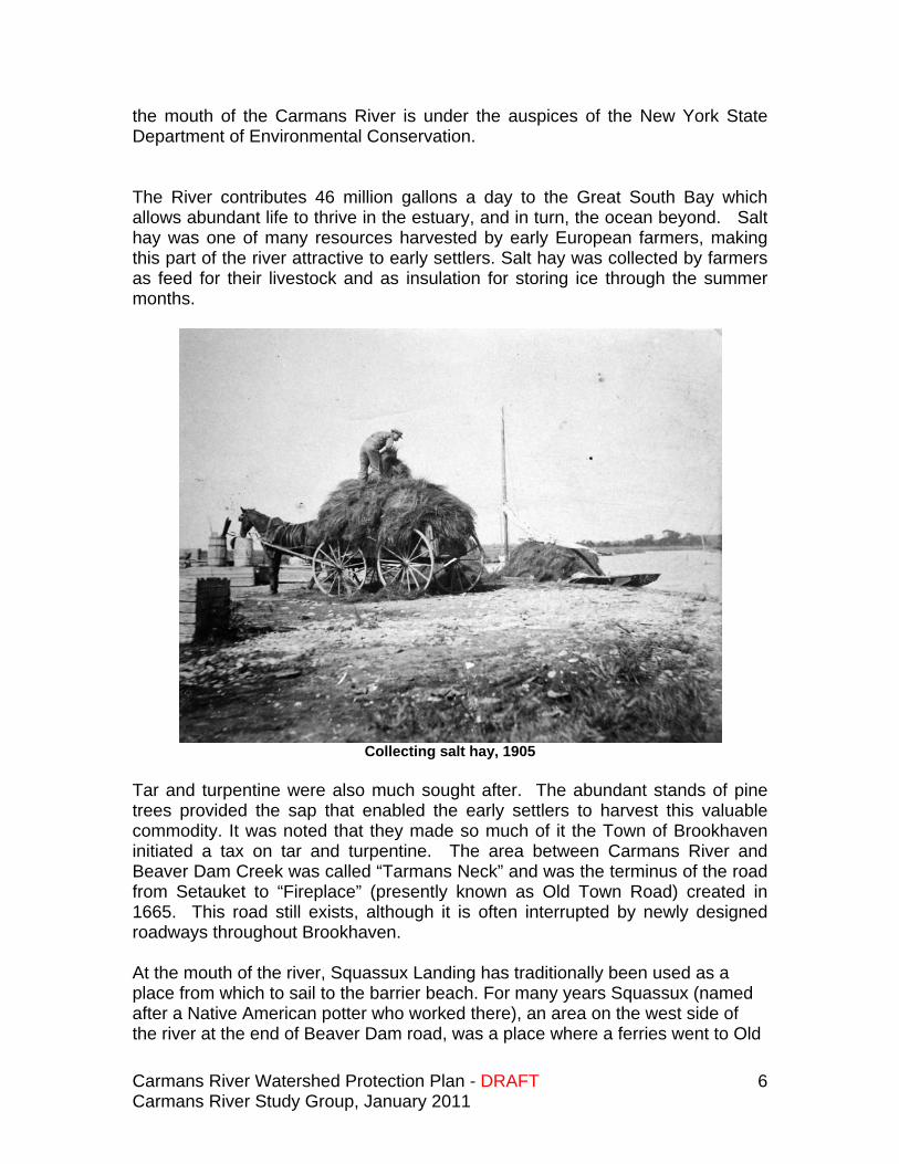
the mouth of the Carmans River is under the auspices of the New York State Department of Environmental Conservation. The River contributes 46 million gallons a day to the Great South Bay which allows abundant life to thrive in the estuary, and in turn, the ocean beyond. Salt hay was one of many resources harvested by early European farmers, making this part of the river attractive to early settlers. Salt hay was collected by farmers as feed for their livestock and as insulation for storing ice through the summer months.
Collecting salt hay, 1905
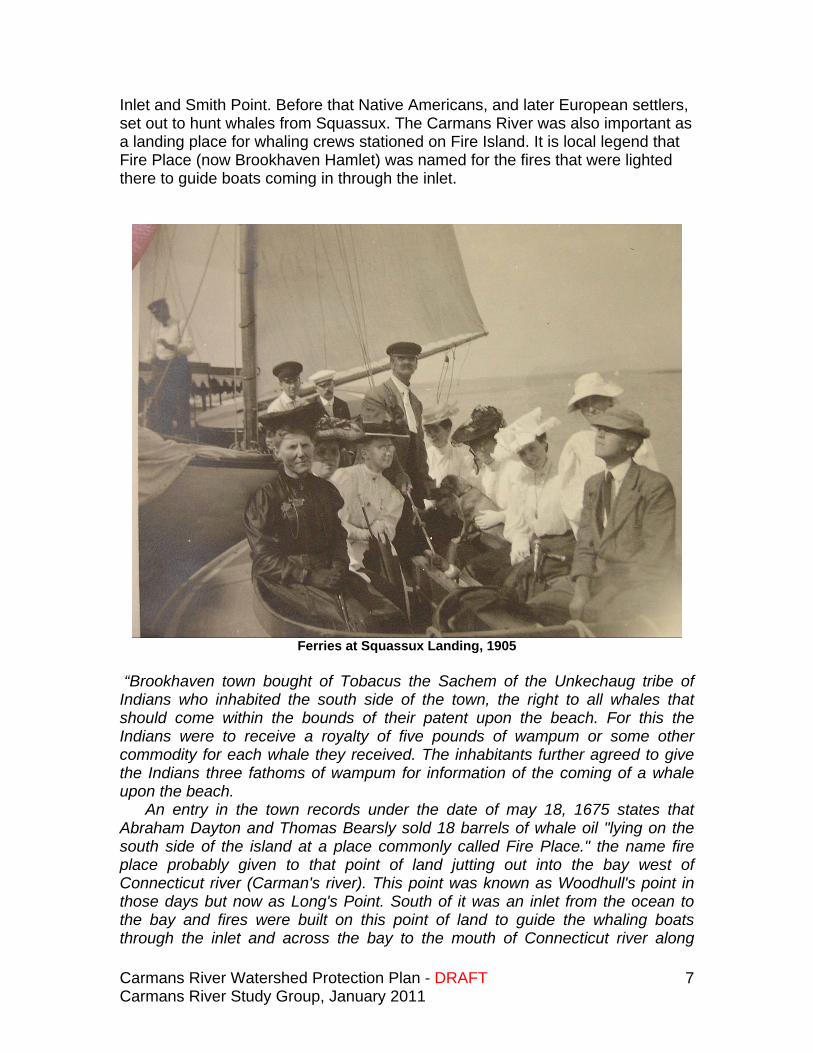
Tar and turpentine were also much sought after. The abundant stands of pine trees provided the sap that enabled the early settlers to harvest this valuable commodity. It was noted that they made so much of it the Town of Brookhaven initiated a tax on tar and turpentine. The area between Carmans River and Beaver Dam Creek was called “Tarmans Neck” and was the terminus of the road from Setauket to “Fireplace” (presently known as Old Town Road) created in 1665. This road still exists, although it is often interrupted by newly designed roadways throughout Brookhaven. At the mouth of the river, Squassux Landing has traditionally been used as a place from which to sail to the barrier beach. For many years Squassux (named after a Native American potter who worked there), an area on the west side of the river at the end of Beaver Dam road, was a place where a ferries went to Old
Carmans River Watershed Protection Plan - DRAFT Carmans River Study Group, January 2011
7
Inlet and Smith Point. Before that Native Americans, and later European settlers, set out to hunt whales from Squassux. The Carmans River was also important as a landing place for whaling crews stationed on Fire Island. It is local legend that Fire Place (now Brookhaven Hamlet) was named for the fires that were lighted there to guide boats coming in through the inlet.
Ferries at Squassux Landing, 1905 “Brookhaven town bought of Tobacus the Sachem of the Unkechaug tribe of Indians who inhabited the south side of the town, the right to all whales that should come within the bounds of their patent upon the beach. For this the Indians were to receive a royalty of five pounds of wampum or some other commodity for each whale they received. The inhabitants further agreed to give the Indians three fathoms of wampum for information of the coming of a whale upon the beach. An entry in the town records under the date of may 18, 1675 states that Abraham Dayton and Thomas Bearsly sold 18 barrels of whale oil "lying on the south side of the island at a place commonly called Fire Place." the name fire place probably given to that point of land jutting out into the bay west of Connecticut river (Carman's river). This point was known as Woodhull's point in those days but now as Long's Point. South of it was an inlet from the ocean to the bay and fires were built on this point of land to guide the whaling boats through the inlet and across the bay to the mouth of Connecticut river along
Carmans River Watershed Protection Plan - DRAFT Carmans River Study Group, January 2011
8
whose banks were the landing places with such names as "Indian Landing," "Sqaussucks Landing," and "Zach's Landing," at which the boats docked. One landmark on the beach still bears the name of "Whale House Point." Places were established also, where the whales which had been harpooned and towed in were cut up and "tried" in big kettles for the oil they contained. One such place was maintained by the widow of Col. William Smith to which her Whaleboat manned by a crew of Indians brought an average of 20 whales a winter to be "tried." The oil and whalebones were sent to England.”3 William “Tangier” Smith was granted a patent from the English King in 1693 for 90 square miles of Brookhaven Town on the east side of the Carmans River. The patent began at the south shore, north through Manorville to Flanders in the east, and included most of the east side of the Carmans River. There is a complicated line of ownership since 1693. Much of the land around the east side of the river was purchased from Native Americans, then given to William Tangier Smith by way of the Dongan Patent, and finally purchased in smaller lots from the Smith heirs. On the west side of the river, the Town of Brookhaven purchased land from Native Americans and later sold it to multiple owners. Subsequent purchasers would include Samuel Carman Sr., the Suffolk Club, Maurice Wertheim and various land owners in the Yaphank area. The Carmans River also played a key role in the American Revolution. In 1780, the Battle of Mastic was fought at Fort St. George and led by Major Benjamin Tallmadge. He crossed Long Island Sound from Connecticut and coming south from Mt. Sinai, traveled along the Carmans River. He surprised the British garrison there, captured approximately 50 soldiers, traveled back to Setauket and returned to Connecticut victorious. The Tallmadge Trail celebrates and traces this victory, crosses the river at Bartlett Road in the upper reaches of the river and travels south along the east side of the river to Mastic. The Carmans River area has also been attractive to land speculators and developers. In 1910 4,000 acres were purchased by the Tangiers Manor Corporation from the heirs of William Smith in order to develop “Tangiers.” While the new owner was unable to make this dream a reality (he imagined a large hotel on Fire Island at Smith Point, among other ideas) and had abandoned the project by 1916, much of his planning was later used by Walter T. Shirley to develop Shirley, Mastic Beach and Mastic. The 4,000 acres on the east side of the River was repurchased at a tax auction by the Smith family after the Tangiers Corporation went bankrupt. Some of this land was later purchased by Maurice Wertheim. Much of the west side of the river was purchased from the Native Americans by the Town. An initial sale of what is known as Yaphank Neck, to Sam Terrell
3 Thomas R. Bayles, Long Island History: Whaling Once Popular in the Town, www.longwood.k12.ny.us/history
Carmans River Watershed Protection Plan - DRAFT Carmans River Study Group, January 2011
9
through a town approved purchase in 1688, subsequently became the property of Samuel Carman where he built his tavern and operated the mill.
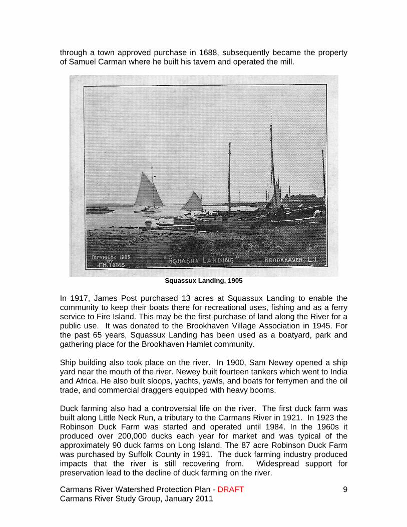
Squassux Landing, 1905
In 1917, James Post purchased 13 acres at Squassux Landing to enable the community to keep their boats there for recreational uses, fishing and as a ferry service to Fire Island. This may be the first purchase of land along the River for a public use. It was donated to the Brookhaven Village Association in 1945. For the past 65 years, Squassux Landing has been used as a boatyard, park and gathering place for the Brookhaven Hamlet community. Ship building also took place on the river. In 1900, Sam Newey opened a ship yard near the mouth of the river. Newey built fourteen tankers which went to India and Africa. He also built sloops, yachts, yawls, and boats for ferrymen and the oil trade, and commercial draggers equipped with heavy booms. Duck farming also had a controversial life on the river. The first duck farm was built along Little Neck Run, a tributary to the Carmans River in 1921. In 1923 the Robinson Duck Farm was started and operated until 1984. In the 1960s it produced over 200,000 ducks each year for market and was typical of the approximately 90 duck farms on Long Island. The 87 acre Robinson Duck Farm was purchased by Suffolk County in 1991. The duck farming industry produced impacts that the river is still recovering from. Widespread support for preservation lead to the decline of duck farming on the river.
Carmans River Watershed Protection Plan - DRAFT Carmans River Study Group, January 2011
10
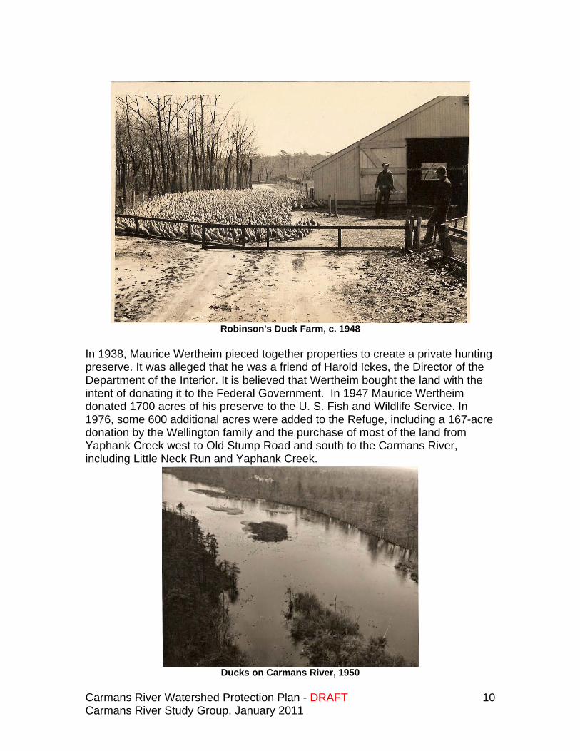
Robinson's Duck Farm, c. 1948
In 1938, Maurice Wertheim pieced together properties to create a private hunting preserve. It was alleged that he was a friend of Harold Ickes, the Director of the Department of the Interior. It is believed that Wertheim bought the land with the intent of donating it to the Federal Government. In 1947 Maurice Wertheim donated 1700 acres of his preserve to the U. S. Fish and Wildlife Service. In 1976, some 600 additional acres were added to the Refuge, including a 167-acre donation by the Wellington family and the purchase of most of the land from Yaphank Creek west to Old Stump Road and south to the Carmans River, including Little Neck Run and Yaphank Creek.
Ducks on Carmans River, 1950
Carmans River Watershed Protection Plan - DRAFT Carmans River Study Group, January 2011
11
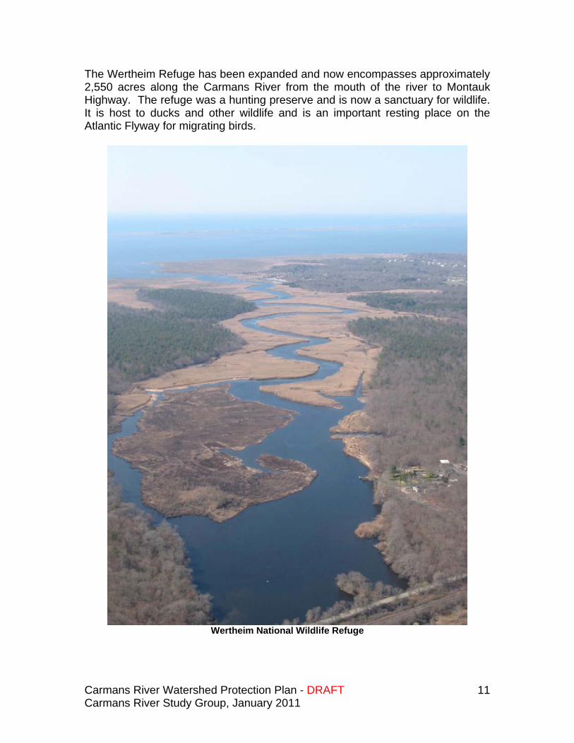
The Wertheim Refuge has been expanded and now encompasses approximately 2,550 acres along the Carmans River from the mouth of the river to Montauk Highway. The refuge was a hunting preserve and is now a sanctuary for wildlife. It is host to ducks and other wildlife and is an important resting place on the Atlantic Flyway for migrating birds.
Wertheim National Wildlife Refuge
Carmans River Watershed Protection Plan - DRAFT Carmans River Study Group, January 2011
12
Southaven Park and Hard’s Lake
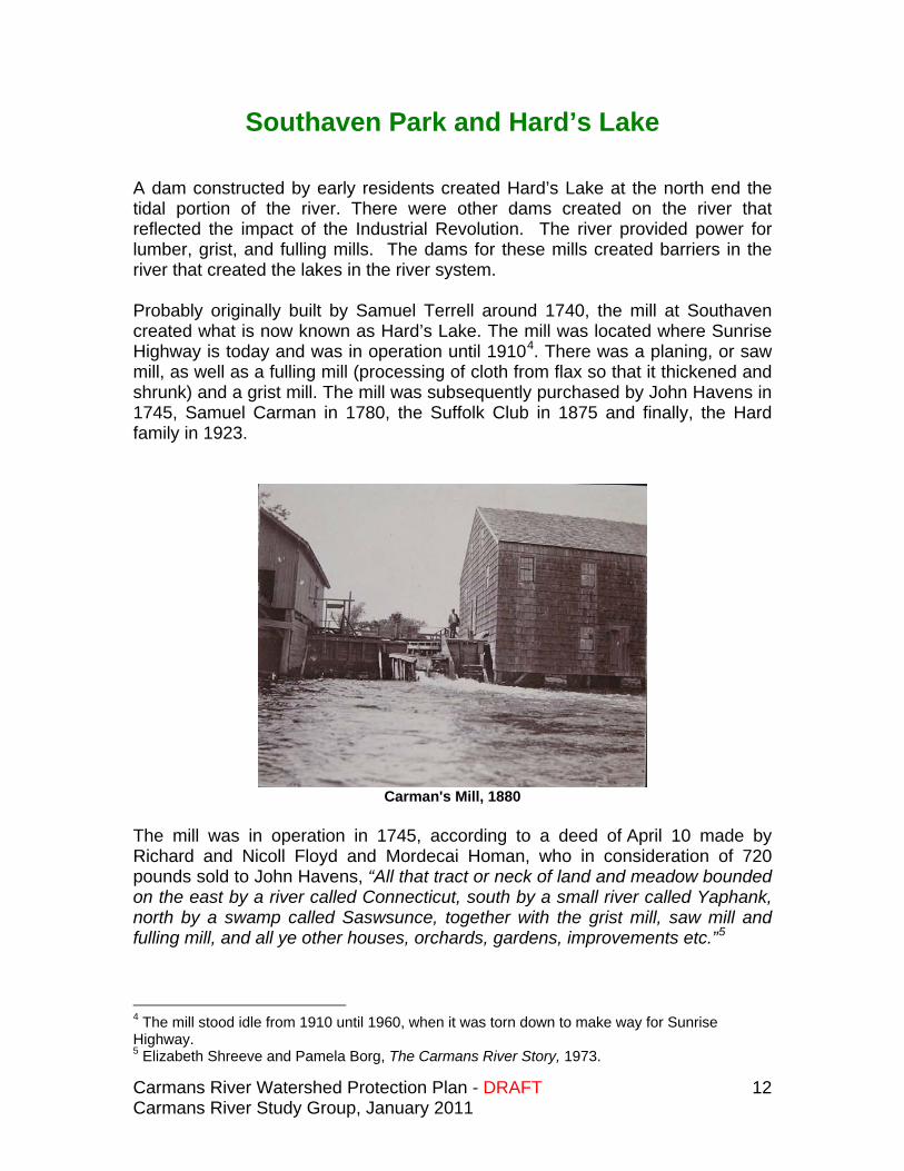
A dam constructed by early residents created Hard’s Lake at the north end the tidal portion of the river. There were other dams created on the river that reflected the impact of the Industrial Revolution. The river provided power for lumber, grist, and fulling mills. The dams for these mills created barriers in the river that created the lakes in the river system. Probably originally built by Samuel Terrell around 1740, the mill at Southaven created what is now known as Hard’s Lake. The mill was located where Sunrise Highway is today and was in operation until 19104. There was a planing, or saw mill, as well as a fulling mill (processing of cloth from flax so that it thickened and shrunk) and a grist mill. The mill was subsequently purchased by John Havens in 1745, Samuel Carman in 1780, the Suffolk Club in 1875 and finally, the Hard family in 1923.
Carman's Mill, 1880
The mill was in operation in 1745, according to a deed of April 10 made by Richard and Nicoll Floyd and Mordecai Homan, who in consideration of 720 pounds sold to John Havens, “All that tract or neck of land and meadow bounded on the east by a river called Connecticut, south by a small river called Yaphank, north by a swamp called Saswsunce, together with the grist mill, saw mill and fulling mill, and all ye other houses, orchards, gardens, improvements etc.”5
4 The mill stood idle from 1910 until 1960, when it was torn down to make way for Sunrise Highway. 5 Elizabeth Shreeve and Pamela Borg, The Carmans River Story, 1973.
Carmans River Watershed Protection Plan - DRAFT Carmans River Study Group, January 2011
13
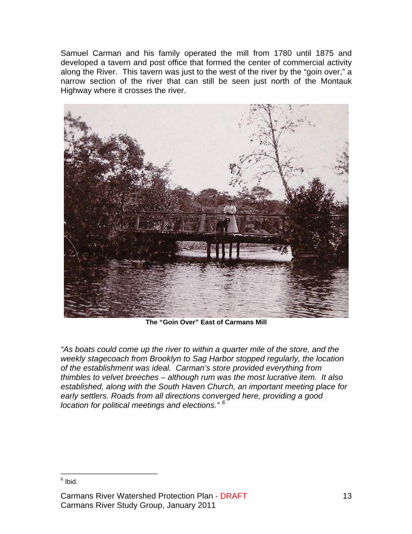
Samuel Carman and his family operated the mill from 1780 until 1875 and developed a tavern and post office that formed the center of commercial activity along the River. This tavern was just to the west of the river by the “goin over,” a narrow section of the river that can still be seen just north of the Montauk Highway where it crosses the river.
The “Goin Over” East of Carmans Mill
“As boats could come up the river to within a quarter mile of the store, and the weekly stagecoach from Brooklyn to Sag Harbor stopped regularly, the location of the establishment was ideal. Carman’s store provided everything from thimbles to velvet breeches – although rum was the most lucrative item. It also established, along with the South Haven Church, an important meeting place for early settlers. Roads from all directions converged here, providing a good location for political meetings and elections.” 6
6 Ibid.
Carmans River Watershed Protection Plan - DRAFT Carmans River Study Group, January 2011
14
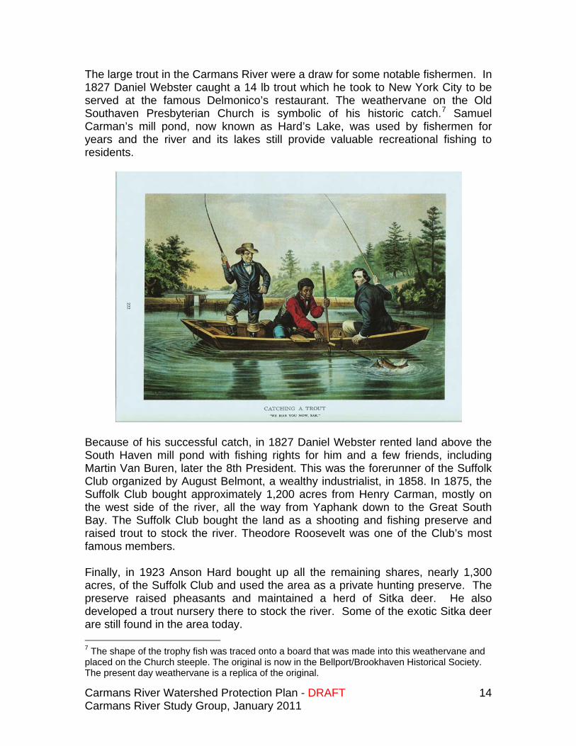
The large trout in the Carmans River were a draw for some notable fishermen. In 1827 Daniel Webster caught a 14 lb trout which he took to New York City to be served at the famous Delmonico’s restaurant. The weathervane on the Old Southaven Presbyterian Church is symbolic of his historic catch.7 Samuel Carman’s mill pond, now known as Hard’s Lake, was used by fishermen for years and the river and its lakes still provide valuable recreational fishing to residents.
Because of his successful catch, in 1827 Daniel Webster rented land above the South Haven mill pond with fishing rights for him and a few friends, including Martin Van Buren, later the 8th President. This was the forerunner of the Suffolk Club organized by August Belmont, a wealthy industrialist, in 1858. In 1875, the Suffolk Club bought approximately 1,200 acres from Henry Carman, mostly on the west side of the river, all the way from Yaphank down to the Great South Bay. The Suffolk Club bought the land as a shooting and fishing preserve and raised trout to stock the river. Theodore Roosevelt was one of the Club’s most famous members. Finally, in 1923 Anson Hard bought up all the remaining shares, nearly 1,300 acres, of the Suffolk Club and used the area as a private hunting preserve. The preserve raised pheasants and maintained a herd of Sitka deer. He also developed a trout nursery there to stock the river. Some of the exotic Sitka deer are still found in the area today. 7 The shape of the trophy fish was traced onto a board that was made into this weathervane and placed on the Church steeple. The original is now in the Bellport/Brookhaven Historical Society. The present day weathervane is a replica of the original.
Carmans River Watershed Protection Plan - DRAFT Carmans River Study Group, January 2011
15
C-gate Dam, Southaven Park
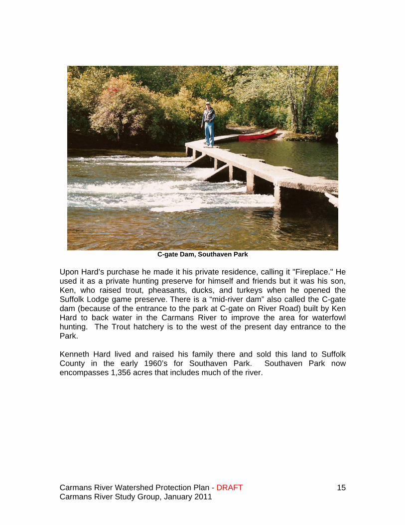
Upon Hard’s purchase he made it his private residence, calling it "Fireplace." He used it as a private hunting preserve for himself and friends but it was his son, Ken, who raised trout, pheasants, ducks, and turkeys when he opened the Suffolk Lodge game preserve. There is a “mid-river dam” also called the C-gate dam (because of the entrance to the park at C-gate on River Road) built by Ken Hard to back water in the Carmans River to improve the area for waterfowl hunting. The Trout hatchery is to the west of the present day entrance to the Park. Kenneth Hard lived and raised his family there and sold this land to Suffolk County in the early 1960’s for Southaven Park. Southaven Park now encompasses 1,356 acres that includes much of the river.
Carmans River Watershed Protection Plan - DRAFT Carmans River Study Group, January 2011
16
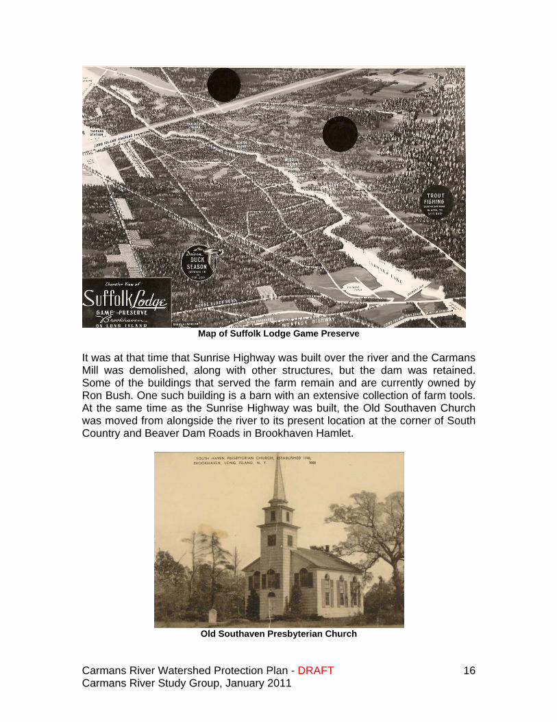
Map of Suffolk Lodge Game Preserve
It was at that time that Sunrise Highway was built over the river and the Carmans Mill was demolished, along with other structures, but the dam was retained. Some of the buildings that served the farm remain and are currently owned by Ron Bush. One such building is a barn with an extensive collection of farm tools. At the same time as the Sunrise Highway was built, the Old Southaven Church was moved from alongside the river to its present location at the corner of South Country and Beaver Dam Roads in Brookhaven Hamlet.
Old Southaven Presbyterian Church
Carmans River Watershed Protection Plan - DRAFT Carmans River Study Group, January 2011
17
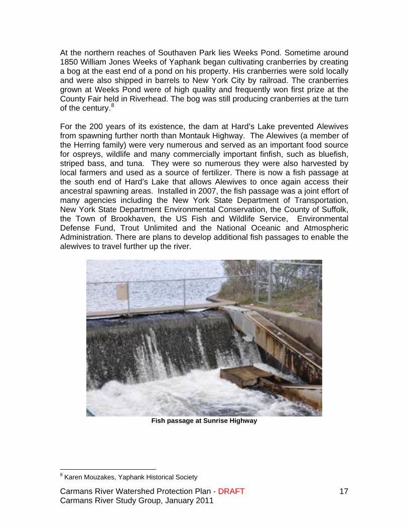
At the northern reaches of Southaven Park lies Weeks Pond. Sometime around 1850 William Jones Weeks of Yaphank began cultivating cranberries by creating a bog at the east end of a pond on his property. His cranberries were sold locally and were also shipped in barrels to New York City by railroad. The cranberries grown at Weeks Pond were of high quality and frequently won first prize at the County Fair held in Riverhead. The bog was still producing cranberries at the turn of the century.8 For the 200 years of its existence, the dam at Hard’s Lake prevented Alewives from spawning further north than Montauk Highway. The Alewives (a member of the Herring family) were very numerous and served as an important food source for ospreys, wildlife and many commercially important finfish, such as bluefish, striped bass, and tuna. They were so numerous they were also harvested by local farmers and used as a source of fertilizer. There is now a fish passage at the south end of Hard’s Lake that allows Alewives to once again access their ancestral spawning areas. Installed in 2007, the fish passage was a joint effort of many agencies including the New York State Department of Transportation, New York State Department Environmental Conservation, the County of Suffolk, the Town of Brookhaven, the US Fish and Wildlife Service, Environmental Defense Fund, Trout Unlimited and the National Oceanic and Atmospheric Administration. There are plans to develop additional fish passages to enable the alewives to travel further up the river.
Fish passage at Sunrise Highway
8 Karen Mouzakes, Yaphank Historical Society
Carmans River Watershed Protection Plan - DRAFT Carmans River Study Group, January 2011
18
Yaphank and Millville
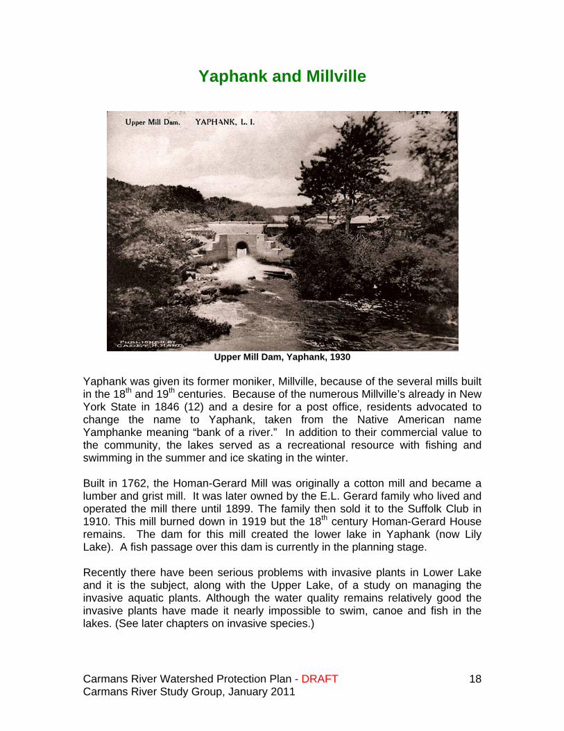
Upper Mill Dam, Yaphank, 1930
Yaphank was given its former moniker, Millville, because of the several mills built in the 18th and 19th centuries. Because of the numerous Millville’s already in New York State in 1846 (12) and a desire for a post office, residents advocated to change the name to Yaphank, taken from the Native American name Yamphanke meaning “bank of a river.” In addition to their commercial value to the community, the lakes served as a recreational resource with fishing and swimming in the summer and ice skating in the winter. Built in 1762, the Homan-Gerard Mill was originally a cotton mill and became a lumber and grist mill. It was later owned by the E.L. Gerard family who lived and operated the mill there until 1899. The family then sold it to the Suffolk Club in 1910. This mill burned down in 1919 but the 18th century Homan-Gerard House remains. The dam for this mill created the lower lake in Yaphank (now Lily Lake). A fish passage over this dam is currently in the planning stage. Recently there have been serious problems with invasive plants in Lower Lake and it is the subject, along with the Upper Lake, of a study on managing the invasive aquatic plants. Although the water quality remains relatively good the invasive plants have made it nearly impossible to swim, canoe and fish in the lakes. (See later chapters on invasive species.)
Carmans River Watershed Protection Plan - DRAFT Carmans River Study Group, January 2011
19
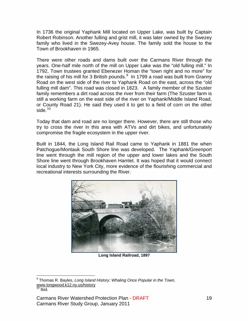
In 1736 the original Yaphank Mill located on Upper Lake, was built by Captain Robert Robinson. Another fulling and grist mill, it was later owned by the Swezey family who lived in the Swezey-Avey house. The family sold the house to the Town of Brookhaven in 1965. There were other roads and dams built over the Carmans River through the years. One-half mile north of the mill on Upper Lake was the “old fulling mill.” In 1792, Town trustees granted Ebenezer Homan the “town right and no more” for the raising of his mill for 3 British pounds.9 In 1799 a road was built from Granny Road on the west side of the river to Yaphank Road on the east, across the “old fulling mill dam”. This road was closed in 1823. A family member of the Szuster family remembers a dirt road across the river from their farm (The Szuster farm is still a working farm on the east side of the river on Yaphank/Middle Island Road, or County Road 21). He said they used it to get to a field of corn on the other side.10 Today that dam and road are no longer there. However, there are still those who try to cross the river in this area with ATVs and dirt bikes, and unfortunately compromise the fragile ecosystem in the upper river. Built in 1844, the Long Island Rail Road came to Yaphank in 1881 the when Patchogue/Montauk South Shore line was developed. The Yaphank/Greenport line went through the mill region of the upper and lower lakes and the South Shore line went through Brookhaven Hamlet. It was hoped that it would connect local industry to New York City, more evidence of the flourishing commercial and recreational interests surrounding the River.
Long Island Railroad, 1897
9 Thomas R. Bayles, Long Island History: Whaling Once Popular in the Town, www.longwood.k12.ny.us/history 10 Ibid.
Carmans River Watershed Protection Plan - DRAFT Carmans River Study Group, January 2011
20
The Upper River and Headwaters To the north of the Upper Lake on the west side of the river two camps were developed for recreational purposes in the 1930’s. A third camp, Camp Olympia, just south of Upper Lake was purchased from the Girl Scouts by the Town of Brookhaven in 2002. Camp Sebago to the northwest of the Upper Lake remains an active summer youth camp owned and operated by the Suffolk County Girl Scouts. In 1968 Brookhaven Country Day Camp on the western edge of the Lower Lake was developed and currently remains an active camp. The following is a short history of Camp Siegfried which is on the west side of the Upper Lake just off of Mill Road. Camp Siegfried, a German-American summer camp located in Yaphank, was purchased in 1935. Families first used the camp as a summer resort and it later became a year-round residence. Robert Kessler shares his recollections:
Camp Siegfried was purchased as a summer camp for people of German descent who lived in the city (mostly in Ridgewood). When the land was first purchased in 1935 it was a farm and it was open land. People would come out in droves on the weekends and camp on the grounds, swim in the lake and just socialize. In the late 30’s and 40’s some summer houses began to spring up on the property, and eventually people purchased them and it slowly became the community that it is today. The property consisted of 52 acres which went to the center of the lake. When the Town took the Lakes in the early 70’s (the community) lost about 6 acres. The Town paid $101.00 for the 6 acres, one dollar for the river bottom and one hundred dollars for a dock that was on the property. We now own 46 acres of one of the most beautiful places on L.I. We have 43 homes in our community and we maintain a lot of open space. We have also agreed never to build any more new houses in our community. The property is privately owned and it takes in the entire west side of the lake.11
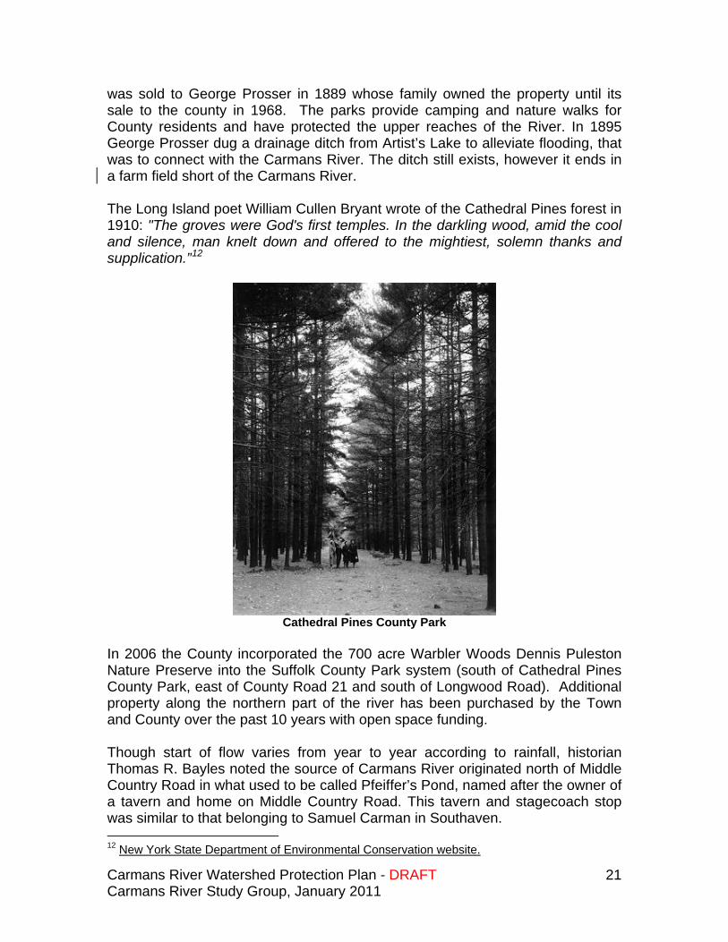
The County acquired the 514-acre Cathedral Pines and 58-acre Prosser Pines in the northern reaches of the River in 1968.
Purchased by Suffolk County, Cathedral Pines was the first protected area in the upper regions of the river. Acquired in 1968, Cathedral Pines (514 acres) and Prosser Pines (58 acres) is made up of a beautiful stand of white pines planted in 1812 by William Dayton. Prosser Pines was originally purchased by James Dayton in 1793, and it was his son William who planted the pines. The property
11 Email correspondence from Robert Kessler, Yaphank Historical Society, 2010.
Carmans River Watershed Protection Plan - DRAFT Carmans River Study Group, January 2011
21
was sold to George Prosser in 1889 whose family owned the property until its sale to the county in 1968. The parks provide camping and nature walks for County residents and have protected the upper reaches of the River. In 1895 George Prosser dug a drainage ditch from Artist’s Lake to alleviate flooding, that was to connect with the Carmans River. The ditch still exists, however it ends in a farm field short of the Carmans River. The Long Island poet William Cullen Bryant wrote of the Cathedral Pines forest in 1910: "The groves were God's first temples. In the darkling wood, amid the cool and silence, man knelt down and offered to the mightiest, solemn thanks and supplication.”12
Cathedral Pines County Park
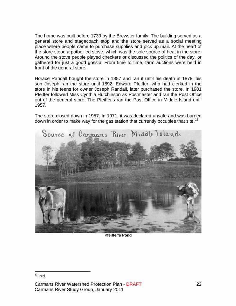
In 2006 the County incorporated the 700 acre Warbler Woods Dennis Puleston Nature Preserve into the Suffolk County Park system (south of Cathedral Pines County Park, east of County Road 21 and south of Longwood Road). Additional property along the northern part of the river has been purchased by the Town and County over the past 10 years with open space funding. Though start of flow varies from year to year according to rainfall, historian Thomas R. Bayles noted the source of Carmans River originated north of Middle Country Road in what used to be called Pfeiffer’s Pond, named after the owner of a tavern and home on Middle Country Road. This tavern and stagecoach stop was similar to that belonging to Samuel Carman in Southaven. 12 New York State Department of Environmental Conservation website.
Carmans River Watershed Protection Plan - DRAFT Carmans River Study Group, January 2011
22
The home was built before 1739 by the Brewster family. The building served as a general store and stagecoach stop and the store served as a social meeting place where people came to purchase supplies and pick up mail. At the heart of the store stood a potbellied stove, which was the sole source of heat in the store. Around the stove people played checkers or discussed the politics of the day, or gathered for just a good gossip. From time to time, farm auctions were held in front of the general store. Horace Randall bought the store in 1857 and ran it until his death in 1878; his son Joseph ran the store until 1892. Edward Pfeiffer, who had clerked in the store in his teens for owner Joseph Randall, later purchased the store. In 1901 Pfeiffer followed Miss Cynthia Hutchinson as Postmaster and ran the Post Office out of the general store. The Pfeiffer's ran the Post Office in Middle Island until 1957. The store closed down in 1957. In 1971, it was declared unsafe and was burned down in order to make way for the gas station that currently occupies that site.13
Pfeiffer's Pond
13 Ibid.
Carmans River Watershed Protection Plan - DRAFT Carmans River Study Group, January 2011
23
The Beauty of the River In 1972 a group of students from Bellport High School, under the leadership of teacher Art Cooley, and naturalist Dennis Puleston, wrote “The Carmans River Story: A Natural and Human History,” which helped designate the river as one of the first “Wild, Scenic and Recreational” rivers in New York State.
The state's Wild Scenic and Recreational Rivers Act protects those rivers of the state that possess outstanding scenic, ecological, recreational, historic, and scientific values. These attributes may include value derived from fish and wildlife and botanical resources, aesthetic quality, archaeological significance and other cultural and historic features. State policy is to preserve designated rivers in a free flowing condition, protecting them from improvident development and use. This policy is intended to preserve the enjoyment and benefits derived from these rivers for present and future generations.14
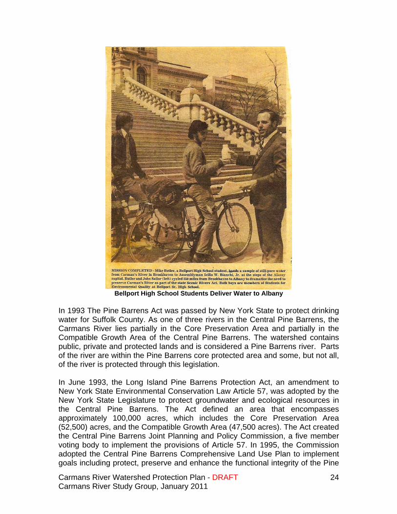
Two Bellport High School students cycled 250 miles to Albany to present then New York State Assemblyman, Bill Bianchi, with a sample of “still-pure water” from the Carmans River to request the State Legislature to include Carmans River as a part of the Wild, Scenic and Recreational River’s act under newly passed legislation. Students for Environmental Quality at Bellport High School played an important part in passing the Carmans River Protection Act.
With their report, SEQ hoped to influence legislation “to improve [these] important resources for the benefit of future generations in terms of recreation, aesthetics, and wildlife. Over time, the students had recognized the significant value of these three attributes. For them, the undeveloped land along the riverbanks was not simply a place pregnant with profitable possibilities. From their perspective, the river represented a natural ecosystem which countless fish, birds, plants, animals, and micro-organisms had called home. At the same time, the students had also developed a relationship with the river through recreation. Indeed, many of them had spent their formative years paddling along its shoreline, swimming in its waters, and fishing along its banks. For most SEQ members, more than just a few childhood memories were bound to the local waterway, which often fueled their desire to preserve the landscape in its natural state.15
14 NYS DEC notation, www.longwood.k12.ny.us/history 15 Neil Buffet, A River’s Place: High School Activism and Environmental Protection on Long Island, New York, 1956-1974, 2010.
Carmans River Watershed Protection Plan - DRAFT Carmans River Study Group, January 2011
24
Bellport High School Students Deliver Water to Albany
In 1993 The Pine Barrens Act was passed by New York State to protect drinking water for Suffolk County. As one of three rivers in the Central Pine Barrens, the Carmans River lies partially in the Core Preservation Area and partially in the Compatible Growth Area of the Central Pine Barrens. The watershed contains public, private and protected lands and is considered a Pine Barrens river. Parts of the river are within the Pine Barrens core protected area and some, but not all, of the river is protected through this legislation. In June 1993, the Long Island Pine Barrens Protection Act, an amendment to New York State Environmental Conservation Law Article 57, was adopted by the New York State Legislature to protect groundwater and ecological resources in the Central Pine Barrens. The Act defined an area that encompasses approximately 100,000 acres, which includes the Core Preservation Area (52,500) acres, and the Compatible Growth Area (47,500 acres). The Act created the Central Pine Barrens Joint Planning and Policy Commission, a five member voting body to implement the provisions of Article 57. In 1995, the Commission adopted the Central Pine Barrens Comprehensive Land Use Plan to implement goals including protect, preserve and enhance the functional integrity of the Pine
Carmans River Watershed Protection Plan - DRAFT Carmans River Study Group, January 2011
25
Barrens ecosystem and protect the quality of surface water and groundwater, discourage piecemeal and scattered development, promote active and passive recreational and environmental educational uses, accommodate development in a manner consistent with the long-term integrity of the pine Barrens ecosystem, and to ensure that the pattern of development is compact, efficient, and orderly. In 1998, Wertheim National Wildlife Refuge, at the mouth of the river, was added to the boundary of the Central Pine Barrens in the Core Preservation Area16. In 2000 the Carmans River Partnership was formed after a successful effort was mounted to protect a 15 acre parcel directly on the east bank of the river north of Montauk Highway, which was slated to become a Home Depot site. The Partnership, consisting of Federal, State, County, Town and private individuals and civic groups, has met over the past 10 years to bring together all interested parties that seek to protect and preserve the Carmans River. This group proposed this document “Carmans River Watershed Protection Plan Study” to the Town of Brookhaven and the Pine Barrens Commission in order to determine what needs to be done to assure the long term preservation of the river corridor.
16 Email from Julie Hargraves, Central Pine Barrens Commission, 2010
Carmans River Watershed Protection Plan - DRAFT Carmans River Study Group, January 2011
26
Caring for the River
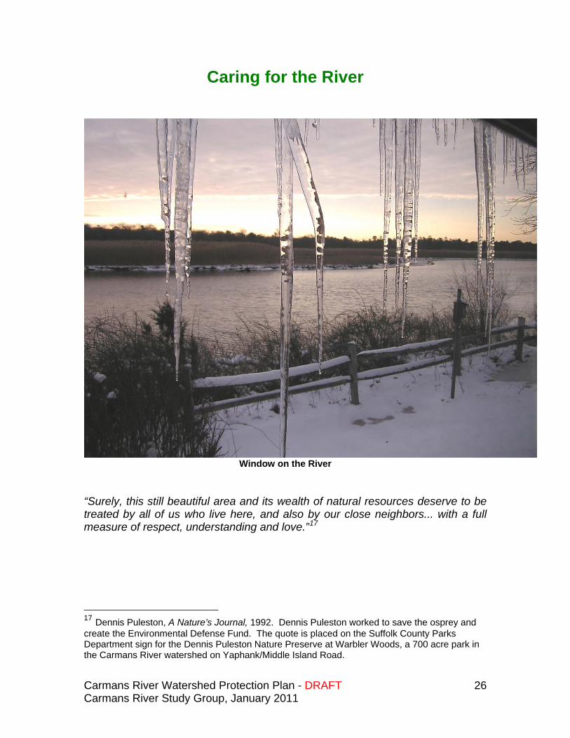
Window on the River
“Surely, this still beautiful area and its wealth of natural resources deserve to be treated by all of us who live here, and also by our close neighbors... with a full measure of respect, understanding and love.”17
17 Dennis Puleston, A Nature’s Journal, 1992. Dennis Puleston worked to save the osprey and create the Environmental Defense Fund. The quote is placed on the Suffolk County Parks Department sign for the Dennis Puleston Nature Preserve at Warbler Woods, a 700 acre park in the Carmans River watershed on Yaphank/Middle Island Road.