a teacher’s guide - ncdot: home · a teacher’s guide. ... weymouth woods sandhills nature...
TRANSCRIPT

n c s c e n i c b y w a y s
North Carolina Department of Transportation
Department of Public Instruction
A Teacher’s Guide

North Carolina Scenic Byways Presented by the North Carolina Department of Transportation and
developed in partnership with the North Carolina Department of Public Instruction
Printing of this booklet was made possibleby a Scenic Byways Grant from the Federal Highway Administration.
North Carolina Scenic Byways is furnished free of charge and is not to be sold or used for
promotional, commercial or political purposes.
This publication is printed on recycled paper.September 2003
Our goal is to identify and highlight scenic roads with unusual, exceptional, or unique intrinsic qualities for public viewing and enjoyment.
Education Tourism Preservation Sustainability

Table of conTenTs
Introduction ..................................................................................................................1
MounTains
BluE RIDGE PARkwAy ............................................................................................3Hello, Down There .................................................................................................4-5The Sacred Seven ...................................................................................................6-7Parade of Tartans ....................................................................................................8-9Appalachian Rocks, Rock On .......................................................................10-14Home Sweet Home ..........................................................................................15-16It’s Moving Day ...................................................................................................17-20CHEROHAlA BywAy ............................................................................................ 21It’s Electric .............................................................................................................22-23Trail of Tears ..........................................................................................................24-25They led the Cherokee ........................................................................................ 26land of Giants .....................................................................................................27-29Paper Please! .............................................................................................................. 30FOREST HERITAGE BywAy..................................................................................31 Back To My Roots ...............................................................................................32-34Come One, Come All .......................................................................................35-37Decisions, Decisions, Decisions ..................................................................38-39Go Fish! ...................................................................................................................40-44littlejim ..................................................................................................................45-46Pioneer life ...........................................................................................................47-48The Good Ol’ Days .............................................................................................49-50Soggy Bottom Bogs .........................................................................................51-52Timber! ...................................................................................................................53-56where Did It Come From? .............................................................................57-60

PiedMonT
NORTH DuRHAM BywAy .................................................................................. 62Mounds Away .....................................................................................................63-64There’s No Place like Home .........................................................................65-66Imagine That!.......................................................................................................67-74Slave Days .............................................................................................................75-76POTTERy ROAD SCENIC BywAy .................................................................... 77what’s In A Name? .................................................................................................. 78It’s Just a Family Tradition .............................................................................79-80wEyMOuTH wOODS SANDHIllS NATuRE PRESERvE ...................... 81weymouth woods ............................................................................................82-83Riding On the Plank .........................................................................................84-85Made In the uSA ................................................................................................86-87uHwARRIE SCENIC ROAD .................................................................................. 88The uhwarries Are Alive with the Sound of Bluegrass ........................................................................89-90Holiday Plantation Style .................................................................................91-92
coasTal
lAFAyETTE’S TOuR ................................................................................................ 94Festivals Across lafayette and North Carolina .......................................... 95The Black Bard ....................................................................................................96-99A Mountain On the Coast? ..................................................................... 100-101A who’s who of the Byways ................................................................... 102-104Halifax Resolves .......................................................................................... 105-106ROANOkE vOyAGES CORRIDOR ..................................................................107The lost Colony – Come Find us ......................................................... 108-109Self-sufficient or Interdependent ........................................................ 110-111what’s in wanchese? ................................................................................. 112-113watch Out for the Shoal ........................................................................... 114-115METEOR lAkES ......................................................................................................116Picture This ..................................................................................................... 117-118A Citizen To Be Proud Of .......................................................................... 119-120It Tastes So Good ...................................................................................................121Revolutionary Idea................................................................................................122Murphy to Manteo ..................................................................................... 123-124
Table of conTenTs

inTroducTionwelcome to the North Carolina Scenic Byways. This project is a product of a year-long collaboration with the Department of Transportation and the Department of Public Instruction. The purpose of this collaboration is to provide a support document targeted for Fourth Grade students and teachers. Developed hands-on lesson plans and activities will help educators and students gain a great-er knowledge of these byways while providing tremendous resources about their geographical, historical, and cultural significance. The project targeted Fourth Grade teachers because they are in an advantageous position to influence children to be environmentally conscious and because the Fourth Grade curricula are com-patible with the goals of the project.
The North Carolina Department of Transportation has designated 45 Scenic Byways to give visitors and residents a chance to experience a bit of North Carolina history, geog-raphy and culture while raising awareness for the protec-tion and preservation of these treasures. The document North Carolina Scenic Byways includes only a few of these byways. These byways were chosen because they contain some of the most environmentally significant areas in the three regions of North Carolina.
The results of teacher research and explorations are presented here, a guide written for teachers, by teachers. The activities presented may be copied and used by any teacher or group who wishes to learn more about the Scenic Byways of North Carolina.

lesson PlansBluE RIDGE PARkwAy 3 Hello, Down There 4 The Sacred Seven 6Parade of Tartans 8Appalachian Rocks, Rock On 10Home Sweet Home 15It’s Moving Day 17CHEROHAlA BywAy 21It’s Electric 22Trail of Tears 24They led the Cherokee 26land of Giants 27Paper Please! 30FOREST HERITAGE BywAy 31 Back To My Roots 32Come One, Come All 35Decisions, Decisions, Decisions 38Go Fish! 40littlejim 45Pioneer life 47The Good Ol’ Days 49Soggy Bottom Bogs 51Timber! 53where Did It Come From? 57
m o u n t a i n r e g i o n

3
blue ridge ParkwayThe Blue Ridge Parkway is 469 miles long – 217 miles in virginia, including the Skyline Drive, and 252 miles in North Carolina. It was conceived during the Great Depression – though the idea had some germination earlier – as a scenic tourist link between Shenandoah National Park in virginia and the Great Smokey Mountains Nation Park in North Carolina and Tennessee. It was implemented out of a need to put people to work in 1935 during the Depression and the Civilian Conservation Corp (CCC) provided the labor.
Planning and landscape design for the Parkway began December 26, 1933 and construction began in September 1935. The Civilian Conservation Corp began work on several sections of the Parkway simultaneously, with sections being given priority where employment needs were greatest. Contractors were man-dated to hire local people whenever possible. Four CCC camps were established at various points along the route to perform the work.
work continued steadily until the start of ww II by which time approximately 2/3 of the Parkway was complete. In 1942, the CCC was closed out and work on the remaining section of the Parkway was sporadic. The
work was not completely finished until 1987 when the linn Cove viaduct was completed. This section has been called the “most complicated segmental bridge ever built”. It is an elaborate double-S curve elevated bridge that skirts the side of Grandfather Mountain. The purpose of elevating the roadway rather that
blasting it into the side of the mountain was to limit the impact on ecologically sensitive Grandfather Mountain, which is designated by uNESCO as an International Biosphere Reserve.
An effort of 52 years, nine presidents and $130-mil-lion dollars resulted in the world’s first parkway designed exclusively for leisure travel and recre-ational use. The 250 miles section in North Carolina
includes seven visitor centers and numerous smaller infor-mation centers; 25 tunnels; 72 hiking trails leading to geological wonders such as waterfalls, gorges, and caves; and a wide variety of elevations ranging from 2,000 feet at the French Broad River to 6,053 feet at Richland Balsam.
Resource Blue Ridge Parkway Travel Guide: Parkway History http://NCNatural.com/Parkway/BRP-History.html

4
lesson ObjectiveStudents will locate ten of North Carolina’s highest mountain peaks and construct a bar graph to display the elevation of each peak.
NCDPI Goals and ObjectivesSocial Studies Goal 1 The learner will apply the five themes of
geography to North Carolina and its people.
1.01 locate in absolute and relative terms, major landforms, bodies of water and natural resources in North Carolina.
1.02 Describe and compare physical and cultural characteristics of the regions.
MathGoal 4 The learner will demonstrate an understanding
and use of graphing, probability, and data analysis.
4.02 Display data in a variety of ways including circle graphs. Discuss the advantages and disadvantages of each form including ease of creation and purpose of the graph.
4.03 Collect, organize, and display data from surveys, research, and classroom experiments. Include data from other disciplines such as science, physical education, social studies, and the media.
Pre-Activities• Students will be provided with a chart including the
elevation of North Carolina’s highest mountain peaks. • Students will locate these mountain peaks on a large,
classroom map
ActivitiesActivity 1Students will be provided with a handout of the ten highest peaks in the mountain region of North Carolina
Activity 2Students will locate these peaks on the classroom map
Activity 3Students will use the information to create a bar graph and answer questions on the handout
Materials• large classroom map of the mountain region• list of the ten highest mountain peaks• Handout sheet (High Peaks in North Carolina)• Graph paper
Assessment• Students will successfully answer the questions
concerning the mountain peaks on the handout (30 points)
• Students will accurately construct a bar graph using the mountain peak elevations
Title the graph 10 points
Title each axis correctly 15 points
Establish reasonable increments for mountain peaks 20 points
Color the information neatly and correctly 25 points
Extended Activities• Students will research Elisha Mitchell and his
contribution to western North Carolina.• Students will work in small groups to create a relief map
of the Appalachian Mountains in North Carolina out of salt, flour and water. when the clay is dry, the students can paint the different elevations with tem-pera paint. See web site for relief map directions.
Resourceswww.edu.ssc.nana.gov/ltp/lessonPlans/easy_to_see.htm this web site provides information and vocabulary needed for relief maps.
http://Encarta.msn.com
Hello, down THere

5
use the information found in the table to answer the following questions. Then list the peaks in order from the lowest to highest and using this information create a bar graph to show your results.
1. what is the highest peak on the list?2. How many feet high is Grandfather Mountain?3. what is the lowest peak on the list?4. which peak is the fourth highest on the list?5. list the mountain peaks that are over 1 mile in elevation.
Clingman’s Dome 6,643 ft.
Mount Sterling 5,835 ft
Mount Mitchell 6,684 ft.
Richland Balsam 6,540 ft.
Roan Mountain 6,285 ft.
Mount Guyot 6,621 ft.
Grandfather Mountain 5,916 ft
Big Bald Mountain 5,516 ft.
Mount Hardison 6,134 ft.
Mount Pisgah 5,749 ft.
HigH Peaks in norTH carolina

6
Each student will make their own dreamcatcher with a vari-ety of yarns
* NOTE: use the following websites:• www.dreamcatchersonline.com/• www.kinderart.com/multic/dream.htm• www.kinderart.com/sculpture.facepl.htm
Allow students to share their dreamcatchers. These websites include the legend of the dreamcatcher and several ways to construct Indian masks and the necessary materials.
Activity 3Each student will create their own Indian legend explaining the existence of some part of nature; such as “How the Deer got His Antlers”, “How the Skunk got its Smell”, “why the Turtle has a Shell”, etc. after reading selected books from the school or classroom library. Compile student made legends into a class book.
AssessmentThe students will successfully research one of the masks of a Cherokee clan and design one of their own with their information. They will also create an Indian legend and con-struct a dreamcatcher.
RubricSuccessfully construct a dreamcatcher and be able to relate its significance to the Cherokee 20 points
Research and write a one- page report on one Cherokee clan 20 points
Create a facemask to represent your chosen clan 20 points
Deliver a group presentation of all information 20 points
write an Indian legend to explain the existence of some part of nature 20 points
Extended Activities• The students will work in groups to research tribal art,
basket making, weaving and music. They will then create an artifact to represent their research.
• Students will create tessellation patterns using Native American designs.
• Students will create Native American designs using sponge painting.
Resources
THe sacred seven
lesson ObjectivesStudents will research the seven clans of the Cherokee tribe and design a mask to represent each clan. They will also become acquainted with a variety of Cherokee leg-ends and create their own.
NCDPI Goals and ObjectivesSocial StudiesGoal 2 The learner will examine the importance of the
role of ethnic groups and examine the multiple roles they have played in the development of North Carolina.
2.01 locate and describe American Indians in North Carolina, past and present.
Goal 5 The learner will examine the impact of various cul-tural groups on North Carolina.
5.02 Describe traditional art, music, and craft forms in North Carolina.
language ArtsGoal 2 The learner will develop and apply strategies and
skills to comprehend text that is read, heard, and viewed.
2.03 Read a variety of texts, including fiction (leg-ends, novels, folklore, science fiction)
Pre-Activities• Students will discuss the traditional and contemporary
lifestyles of the Cherokee tribe.• Students will explore the seven clans of the Cherokee,
their background and the importance of the Council House.
• The class will read the book, Dreamcatcher, by Audrey Osofsky or A Story of the Dreamcatcher, by Finder, and discuss its importance to Cherokee customs and beliefs.
ActivitiesActivity 1Divide the class into groups to research one of the clans and design a mask to represent that clan.
use the website for a list of clans and description of masks.
1. Bird2. Paint3. Deer4. wolf5. Blue6. long Hair7. wild Potato
Activity 2

7
web sites:
www.dreamcatchersonline.com
www.kinderart.com/sculpture/facepl.htm
Osofsky, Audrey. Dreamcatcher. Orchard Books, 1992
Finder. A Story of the Dreamcatcher. Mother Bird Books, 1996
Bruchac, Joseph. Any books written by this author are excellent sources for Indian legends and stories.

8
lesson ObjectiveThe students will learn about the history and culture of the Scottish immigrants who moved to North Carolina through the Grandfather Highland Games.
NCDPI Goals and ObjectivesSocial Studies Goal 1 The learner will analyze the characteristics of the
people of North Carolina.
1.02 Describe the origins and characteristics of major groups that settled in North Carolina and assess their influence on North Carolina customs.
Goal 6 The learner will evaluate the significance of the movement of people, goods, and ideas from place to place.
6.01 Trace the movement of people, goods, and ideas from one part of the state to another and between North Carolina and other places.
BackgroundOne of the most exciting festivals held in the mountains is the Grandfather Mountain Highland Games. The Scottish Highland Games began hundreds of years ago as a way to choose the strongest men to work for the kings and chiefs of Scotland. Today, the Highland Games are held wherever Scots have settled. The Highland Games at Grandfather Mountain were started in 1956 with the help of Agnes MacRae Morton, whose family still owns the land on which the games are held. During the first evening of the festival, each clan, a group of families with the same ancestors, introduce themselves in a torchlight ceremony known as the Calling of the Clans. For the next four days, as many as 40,000 people watch competitions in Heavy Events. These games test the strength of the athletes, both men and women. The Parade of Tartans is a colorful event that takes place after Sunday church service. To the music of the bagpipes, the athletes march across the field in their kilts, or skirts. Each kilt has a plaid design called a tartan. Different Scottish clans have different tartans. The Grandfather Mountain Highland Games help preserve the Scottish culture and traditions.
Pre-ActivitiesThe students will share aspects of their culture and ways that people in their community celebrate their heritage. Have them share cultural and heritage programs, shows, or festivals they have attended that focus on different cultures.
Read and discuss the section in your social studies text book about the migration of Scottish immigrants to North Carolina, their culture, and the purpose of the Highland Games.
Explain to the class that they are going to learn more about the Scottish culture by studying about a yearly event held in western North Carolina called the Grandfather Mountain Highland Games near Grandfather’s Mountain.
ActivitiesActivity 1 - Clans Divide the class into groups or clans. Each clan will decide on a clan name, design a coat of arms, and make a sash that will be decorated with their own tartan or plaid design. you may want to play bagpipe music in the back-ground or invite someone to visit your class who plays the bagpipes.
Official clan names can be found at www.electricscotland.com/webclans
Activity 2 – Research Highland Game EventsEach clan will be assigned an event to research that is played at the Highland Games. Groups will become the experts on the event. After learning about their event, each group will create a way that they can play the game using items found at school or at home. For example, instead of throwing a 16 lb. metal ball in the “Putting the Stone” event, they could toss a softball. For a different twist, have a mini version of the Highland Games. Invent ways of playing the game in miniature. Toss toothpicks instead of a caber. Each group will be responsible for researching the event, com-ing up with an alternative way to play the event, and then teach the rest of the class how to play the game. See the following web sites for specific information on each event:
www.gmhg.org/officialscottishrules.htmwww.nbhighlandgames.com/sport.html
Suggested events:• stone throw• hay toss• caber• farmer’s walk• rolling pin• tug-o-war
Activity 3 - Participate in their own Highland Games
Parade of TarTans

9
Conduct your classroom version of the Highland Games. Open the games with a torchlight ceremony with each clan wearing their sashes and carrying their coat of arms. let the students compete in their Highland Games they created. End the games with the Parade of Tartans.
Resources web sites:
www.gmhg.org/officialscottishrules.htmwww.nbhighlandgames.com/sport.html

10
lesson ObjectivesThe students will learn to identify a variety of rocks and minerals found in the Appalachian Mountains of western North Carolina – how they were formed and what they look like.
NCDPI Goals and ObjectivesSocial StudiesGoal 1 The learner will apply the five themes of
geography to North Carolina and its people.
1.02 Describe and compare physical and cultural characteristics of the regions.
ScienceGoal 2 The learner will build an understanding of the
composition and uses of rocks and minerals.
2.01 Describe the composition of a mineral
2.02 Analyze the mineral composition of rocks and minerals
2.04 Classify rocks using student-devised rules
Pre-ActivitiesThe teacher will read the attached article “How the Mountains Developed” describing how the Appalachian Mountains were formed.
ActivitiesStudents will learn the meaning of the following terms to better understand rock formations.
1. weathering2. erosion3. igneous4. metamorphic5. sedimentary
Students will bring to class a rock no bigger than the palm of their hand and conduct the tests and measurements listed on the attached worksheet. They should then use rock identifying books to determine its type and name.
Students will be provided with a list of rocks and minerals found in the Appalachian Mountains. They will research the characteristics of four and illustrate. (See attached sheet for additional rocks and minerals)
1. Feldspar2. Granite3. Sapphire4. Ruby5. Hiddenite6. Quartz7. Gold
Materials• Tape measures – inches and centimeters• Balance scales and gram weights• Rock identifying books• Nail• Penny• Small hammer
AssessmentRubricBring in a rock 10 points
Correctly complete worksheet 60 points
Complete a graph to show rocks of classmates 30 points
Extended ActivitiesHave students classify all their rocks several different ways• Color • Solid color or mixed• Shiny or dull• Smooth or rough• less than 100 grams or more than 100 grams• Floats or sinks in water• Soft – breaks easily or hard – can’t be chipped• using this information, students will create bar (show
numbers) or circle graphs(fractions) to present the results.
ResourcesAIMS Education Foundation. “Pet Rock” activity,
Overhead and underfoot. 1997
Parkway Milepost, “Appalachian Geology”, Fall-winter, 2001-02
web sites:
http://library.thinkquest.org/J002289/act.html – This is a student friendly website with all kinds of fun activities about rocks.
http://ericir.syr.edu/cgibin/printlesson…tual/lessons/Science/Geology/GlG0204.html – This website contains several activities that help students learn about the 3 kinds of rocks and how each one was formed.
aPPalacHian rocks, rock on
11
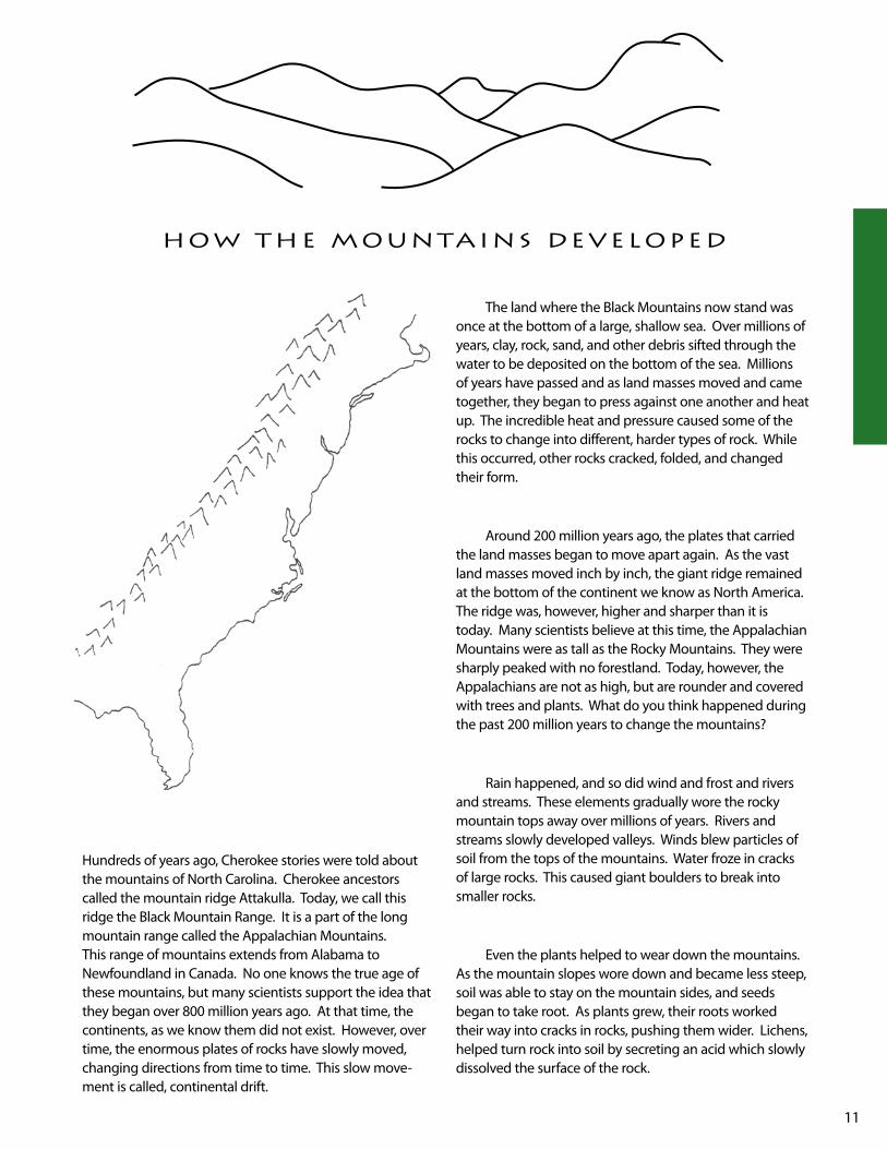
How THe MounTains develoPed
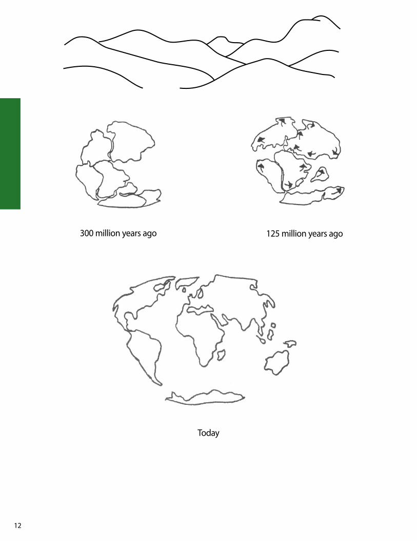
Hundreds of years ago, Cherokee stories were told about the mountains of North Carolina. Cherokee ancestors called the mountain ridge Attakulla. Today, we call this ridge the Black Mountain Range. It is a part of the long mountain range called the Appalachian Mountains. This range of mountains extends from Alabama to Newfoundland in Canada. No one knows the true age of these mountains, but many scientists support the idea that they began over 800 million years ago. At that time, the continents, as we know them did not exist. However, over time, the enormous plates of rocks have slowly moved, changing directions from time to time. This slow move-ment is called, continental drift.
The land where the Black Mountains now stand was once at the bottom of a large, shallow sea. Over millions of years, clay, rock, sand, and other debris sifted through the water to be deposited on the bottom of the sea. Millions of years have passed and as land masses moved and came together, they began to press against one another and heat up. The incredible heat and pressure caused some of the rocks to change into different, harder types of rock. while this occurred, other rocks cracked, folded, and changed their form.
Around 200 million years ago, the plates that carried the land masses began to move apart again. As the vast land masses moved inch by inch, the giant ridge remained at the bottom of the continent we know as North America. The ridge was, however, higher and sharper than it is today. Many scientists believe at this time, the Appalachian Mountains were as tall as the Rocky Mountains. They were sharply peaked with no forestland. Today, however, the Appalachians are not as high, but are rounder and covered with trees and plants. what do you think happened during the past 200 million years to change the mountains?
Rain happened, and so did wind and frost and rivers and streams. These elements gradually wore the rocky mountain tops away over millions of years. Rivers and streams slowly developed valleys. winds blew particles of soil from the tops of the mountains. water froze in cracks of large rocks. This caused giant boulders to break into smaller rocks.
Even the plants helped to wear down the mountains. As the mountain slopes wore down and became less steep, soil was able to stay on the mountain sides, and seeds began to take root. As plants grew, their roots worked their way into cracks in rocks, pushing them wider. lichens, helped turn rock into soil by secreting an acid which slowly dissolved the surface of the rock.
12
300 million years ago 125 million years ago
Today

13
X X
1. where did you find your rock? __________________________________________________________________
___________________________________________________________________________________________
2. Describe your rock: Smooth or rough: ____________________________________________________________________________
Color: ______________________________________________________________________________________
light or dark: ________________________________________________________________________________
Solid color or mixed: __________________________________________________________________________
3. use a magnifying glass and describe in detail what you observe about your rock. Then draw and color a picture of what your rock looks like.
___________________________________________________________________________________________
___________________________________________________________________________________________
___________________________________________________________________________________________
___________________________________________________________________________________________
___________________________________________________________________________________________
___________________________________________________________________________________________
___________________________________________________________________________________________
___________________________________________________________________________________________
aPPalacHian rocks, rock on!
Experiment Results
length Mass will it break Try to Does it float? easily? scratch
Inches Nail
Centimeters Penny

14
Min
in
g H
is
To
ry
in
we
sT
er
n n
or
TH
ca
ro
lin
a
Al
legh
. As
he
wat
a.
Aver
y M
itch.
ya
n.
Mad
i. Bu
n.
Hen
d.
Hay
. Tr
ans.
Jack
. Sw
ain
Mac
on
Gra
. Ch
ero.
Cl
ay
agat
e
x
quar
tz
x
x
x
gold
en b
eryl
x x
x
x
gale
na
x
opal
x
x
barit
e
x
grap
hite
x
coop
er
x x
x
x
x
x
x
coru
ndum
x
x x
x
x x
x x
x
x
lead
x
chro
mbr
ite
x
clay
x x
x x
x x
x
x
emer
ald
x x
hidd
enite
gold
& si
lver
x
x x
x
garn
et
x
x
x
x
ruby
x
x x
x
x
x x
sapp
hire
x
x x
x
x
x x

15
tats created in Activities 1 and 2.
Assessment habitat includes necessities for survival 60 pointsoverall appearance 20 pointsclassified ad (well written and accurate) 20 points 100 points
ResourcesProject wild
Project learning Tree
Ranger Rick’s: Nature Scope
web site: www.ncwildlife.org/pg10_Outdoorkids/pg10e5a.htm
HoMe sweeT HoMe
lesson ObjectiveThe students will be able to recognize the importance of a suitable habitat and how limiting factors such as food and shelter affects the survival of an animal or population of animals.
The students will be able to explain how North Carolina's bear population is monitored and managed.
The students will design an animal habitat and write a clas-sified ad describing the habitat.
NCDPI Goals and ObjectivesScienceGoal 1 The learner will build an understanding of animal
growth and adaptation.
1.03 Evaluate living and nonliving things that affect animal life.
Communication ArtsGoal 4 The learner will apply strategies and skills to
create oral, written, and visual texts.
4.07 Compose fiction, nonfiction, poetry, and drama using self-selected and assigned top-ics and forms.
4.09 Produce work that follows the conventions of particular genres
4.10 use technology as a tool to gather, organize, and present information.
Pre-Activitywrite the following words on the chalkboard: people, pets, wildlife. Ask the students what do people need in order to survive? list their answers under the word “people”. Do the same for pets and wildlife. Have the stu-dents categorize items into larger ideas and narrow down the lists to come up with the essential survival needs for people, pets, and wildlife. Students will come to the con-clusion that all living organisms have similar basic needs. (food, water, shelter, space to live, etc.)
Activities Activity 1The students will understand the concepts of wildlife habitat using the lesson “wildlife” from www.ncforestry.org/docs/Resource%20Materials/index.htm
ExtensionHave students visit www.ncwildlife.org/pg10_outdoorkids/pg10e5a.htm.
Activity 2
Animal Diorama Each student will pick an animal that lives in wNC, see list for suggestions. (Suggestion: you may want to have them focus on endangered species of North Carolina.) They will research their animal’s habitat and design a diorama of it. The habitat must resemble and include everything, living and nonliving, that is necessary for their animal to remain healthy and reproduce.
Activity 3Ask the students if anyone knows what a classified ad is? Discuss what classified ads are and what they include. you may want to have some examples to share. Explain that each person will write a classified ad. They are to pretend they are their animal and that they want to sell their home. The ad should describe their home and things found in their habitat.
Example
Once they are written, read each classified ad anonymously. See if the students can match the classified adds to the habi-
THE ANIMAl TIMES Classified Ads
An underground Castle: lots of tunnels available in Mrs. Smith’s backyard. Home to plenty of juicy earthworms and other tasty
creatures. There’s loose soil for easy tunneling and there aren’t any pesky cats in the
neighborhood. This super backyard buy is available immediately. (mole)
16
Mam
mal
s w
hite
-taile
d de
er
big
eare
d ba
t so
uthe
rn ro
ck v
ole
wild
boa
rs
sout
hern
pyg
my
shre
wel
k gr
ay b
at
mea
dow
vol
e ch
ipm
unks
sh
ort-t
aile
d sh
rew
blac
k be
ars
east
ern
smal
l foo
ted
bat
yello
w n
osed
vol
e gr
ound
hog
s lo
ng-ta
iled
shre
wra
ccoo
ns
virg
inia
big
ear
ed b
at
river
ott
er
red
wol
f w
ater
shre
wst
riped
skun
k In
dian
a ba
t co
tton
tail
rabb
it op
ossu
m
sout
hern
flyi
ng sq
uirr
elsp
otte
d sk
unk
Alle
ghan
y w
oodr
at
leas
t wea
sel
star
nose
d m
ole
nort
hern
flyi
ng sq
uirr
elbe
aver
s w
ild g
oat
red
fox
east
ern
mol
e ea
ster
n gr
ay sq
uirr
elde
er m
ice
bobc
at
gray
fox
east
ern
coug
ar
red
squi
rrel
Sala
man
ders
he
llben
der
sout
hern
zig
zag
gr
een
wat
erro
ck k
nob
no
rthe
rn d
usky
long
-tail
w
elle
r's
red
se
al
Cher
okee
crev
ice
mou
ntai
n du
sky
2
lined
bl
ack
belli
ed
pygm
y co
mm
on m
udpu
ppy
Jord
an's
se
epag
e
red
spot
ted
new
t im
itato
r m
ole
ea
ster
n ne
wt
Juna
lusk
a
sprin
g
mud
fo
ur to
ed
shov
elno
se
Telli
co
slim
y
mar
bled
ra
vine
re
dbac
k
yona
hlos
see
Snak
es
Turt
les
blac
k ra
t sna
ke
nort
hern
ring
neck
snak
e ea
ster
n rib
bon
snak
e sn
appi
ng tu
rtle
ea
ster
n pa
inte
d tu
rtle
timbe
r rat
tlesn
ake
nort
hern
bro
wn
snak
e co
rn sn
ake
bog
turt
le
east
ern
muc
k tu
rtle
copp
erhe
ads
east
ern
wor
m sn
ake
east
ern
king
snak
e ea
ster
n bo
x tu
rtle
ea
ster
n sp
iny
softs
hell
turt
leno
rthe
rn b
lack
race
r qu
een
snak
e ea
ster
n m
ilk sn
ake
logg
erhe
ad m
usk
turt
le
ea
ster
n ga
rter
snak
e no
rthe
rn w
ater
snak
e
nort
hern
pin
esna
ke
nort
hern
red
belli
ed sn
ake
Frog
s & To
ads
liza
rds
Arac
hnid
sw
ood
frog
Amer
ican
toad
no
rthe
rn sp
ring
pepp
er
nort
hern
fenc
e la
mps
hade
spid
erpi
cker
el fr
og
Fow
ler's
toad
gr
ay tr
eefro
g fiv
e-lin
ed sk
ink
NC
funn
el w
eb ta
ratu
lagr
een
frog
nort
hern
cric
ket f
rog
upla
nd c
horu
s fro
g co
al sk
ink
blac
k w
idow
bullf
rog
mou
ntai
n ch
orus
frog
broa
dhea
ded
skin
k
we
sT
er
n n
or
TH
ca
ro
lin
a a
niM
al
s

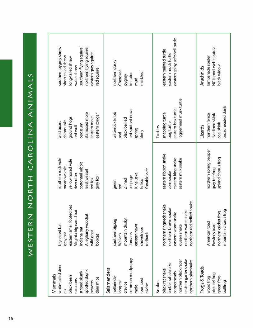
17
lesson ObjectivesThe students will be able to list limiting factors affecting populations of migrating water birds.
The students will be able to track a migrating bird on a map.
NCDPI Goals and ObjectivesSocial StudiesGoal 5 The learner will evaluate ways the people of North
Carolina use, modify and adapt to the physical environment.
5.02 Describe how North Carolinians now use, modify, or adapt to their physical environment.
5.03 Analyze causes and consequences of the misuse of the physical environment and pro-pose alternatives.
ScienceGoal 1 The learner will build an understanding of animal
growth and adaptation.
1.02 Determine animal behaviors and body struc-tures that have specific growth and survival functions in a particular habitat.
BackgroundThe mountains of western North Carolina offer ample opportunities for watching the annual bird migrations. Thousands of temporary residents like the Summer Tanager come to this area each season on their way up from Central America and down from Canada. Several species including wrens, Carolina chickadees and slate-colored juncos have only to travel up and down the slopes of Mount Mitchell with the changing seasons. whether they migrate during the day or night, use the stars, sun, or the earth’s magnetic field to guide them, they all basically migrate for the same reason, food. It is easier to breed where food is than where it is not.
Pre-Activity The students will discuss what migration means and why animals migrate.
Activities Activity 1 – Moving Day GameGive each student the handout “Moving Day”.
Read and discuss why birds migrate. Make a list of the hazards birds encounter when migrating on large index cards.
Play this game in a large open area. The students will role-play being migrating birds traveling between nesting habitats and wintering grounds. One side of the playing area will be the nesting habitats and the other side will be the wintering ground. At each end of the playing area, place one paper plate on the ground for every two students playing the game. Each plate will represent a suit-able habitat for migrating birds to land in.
All of the students should stand on the nesting grounds side of the playing area. In order to survive they must have one foot on a paper plate, but only two people can share a plate or habitat. when you say, “It’s Moving Day”, all stu-dents will travel, or migrate, over to the wintering grounds on the other side of the playing area. Remind them that only two people can share a habitat. If they can’t find a habitat to land on safely, they will die.
In the second and following rounds tell the students that along the way they will be subject to the hazards listed on the cards at either end of the migration path. Pick one of the hazards and show that card to the class. At the other side, remove a couple of plates. Say, “It’s Moving Day”, and have all the students travel to the other end of the migra-tion route. Some students will not be able to find a suitable habitat to land on and will die. These students will stand over to the side for the remainder of the game. Everyone who lands safely will continue to play.
Continue playing the game the same way. Each time pick a different hazard card and remove a couple of plates at the opposite end to demonstrate how that hazard effects the population of the migrating birds. Suggestion: keep a run-ning record of the population during the game and graph the results.
After playing the game, review some of the hazards migrat-ing birds encounter on their migration routes. Brainstorm ways of protecting migration bird populations over time.
Activity 2
iT ’s Moving day

18
Divide the class into teams and let them work together to complete this activity. Give each student a map of North and South America. The students will track migrating osprey on their map via satellite from the Carolina Raptor Center. Go to the following web site: www.birdsofprey.org, then click on migration at the top of the page. Pick one osprey to follow, for example Ms. Charlotte. Click on “first movements” under the bird name. Students will put a dot where their osprey began. Ms. Charlotte began her journey in Charlotte, North Carolina so they would place a dot on Charlotte, North Carolina. Students can follow their journey by clicking on “next movement” above the map. Each day they will place a dot where their bird was and track them all the way down into South America. Once all of the dots are plotted they can connect the dots and see the path their osprey followed.
Extensions1. On a different map, have students track their same bird’s
route back home. They can compare the routes and the length of time it took for each journey.
2. Students can calculate the total number of miles the migrating osprey flew each way and round trip.
3. Students can estimate the number of miles flown per day.
4. Students can make a line graph showing the number of miles flown daily during their migration.
Extension Activity
The students will select a migrating bird from the wNC bird list to research their migration route and the habitats needed for their survival. In their reports they can include maps of the summer and winter range of their species and also their northern and southern migration routes. Migration information on 20 different North Carolina spe-cies can be found at the following web site: www.ncwildlife.org/fs_index_07_conservation.htm
ResourcesProject wild
web sites:
www.birdsofprey.org
www.inhs.uiuc.edu/chf/pub/virtualbird/student/les8.html
www.ncwildlife.org/fs_index_07_conservation.htm
For more information on hawk and monarch butterfly migration in North Carolina see:
http://ncnatural.com/NCNatural/wildlife/migrate.html

19
More than one-third of the world's birds migrate. Migration is an instinct triggered by seasonal changes in weather and lack of food.
what causes the urge to migrate? Changes in the angle and amount of light rays may trigger migration. low-pressure areas in the fall trigger a southward migration. High pressure in the spring encourages movement to the north. A lack of food in the fall and winter may also send birds toward areas where food supplies are more readily available.
Birds migrate during the day or night. Daytime, or diurnal, migrators are generally larger (geese) or are predators (hawks). These birds navigate by sight and have few if any predators. Songbirds are noc-turnal and migrate in the safety of darkness. Their daylight hours are spent searching for food and resting for the next leg of their trip.
The ability of birds to migrate great distances and return to the same general area year after year is a subject which has fascinated people
for centuries. Diurnal migrators fly along broad air routes established by physical features such as major rivers, coastlines, mountains and lakes. The position of the stars and moon and the Earth's magnetic field are used by nocturnal migrators.
Birds encounter many hazards during their migra-tion. Nocturnal and low-flying migrants risk flying into man-made objects such as tall buildings, power lines and towers, windows and aircraft. Songbirds may encounter predators (hawks) migrating at the same time. Habitat destruction and pollution are also migrational hazards.
Storms during migration kill migrant birds. Hunting seasons are established to harvest abundant and desirable species (ducks, geese, mourning doves) during the fall migration. Even though birds are harvested, hunting is allowed within limits that a population can withstand.
Moving day

20
year
-Rou
nd
East
ern
Tow
hee
Barr
ed O
wl
Ceda
r wax
win
g Am
eric
an R
obin
Re
d-he
aded
woo
dpec
ker
Pine
Sisk
inBr
own-
head
ed C
owbi
rd
Gre
at H
orne
d O
wl
Nor
ther
n Ca
rdin
al
Nor
ther
n M
ocki
ngbi
rd
Red-
belli
ed w
oodp
ecke
r So
ng S
parr
owEu
rope
an S
tarli
ng
Mal
lard
N
orth
ern
Bobw
hite
Sh
arp-
skin
ned
Haw
k Pi
leat
ed w
oodp
ecke
r Ca
rolin
a w
ren
Red-
win
ged
Blac
kbird
w
ild T
urke
y Am
eric
an k
estr
el
Rock
Dov
e H
airy
woo
dpec
ker
Dar
k-ey
ed Ju
nco
Com
mon
Gra
ckle
Re
d-br
east
ed N
utha
tch
Nor
ther
n Fl
icke
r Ca
nadi
an G
oose
Ea
ster
n Bl
uebi
rd
Hou
se S
parr
owAm
eric
an C
row
w
hite
-bre
aste
d N
utha
tch
Mou
rnin
g D
ove
Mal
lard
Bl
ue Ja
y Re
d-ta
iled
Haw
kBl
ack
vultu
re
Caro
lina
Chic
kade
e Pi
ed-b
illed
Gre
be
Amer
ican
Gol
dfin
ch
Belte
d ki
ngfis
her
East
ern
Scre
ech-
Ow
lTu
rkey
vul
ture
Tu
fted
Titm
ouse
Re
d-Sh
ould
er H
awk
Pine
war
bler
Ch
ippi
ng S
parr
ow
yello
w-b
ellie
d Sa
psuc
ker
Dow
ny w
oodp
ecke
r Ea
ster
n Ph
oebe
Ru
ffed
Gro
use
East
ern
Mea
dow
lark
H
ouse
Fin
ch
Sum
mer
Blac
k an
d w
hite
war
bler
Ba
rn S
wal
low
Co
mm
on N
ight
haw
k Ba
ltim
ore
Orio
le
*Eas
tern
woo
d-Pe
wee
*B
lack
-thro
ated
Blu
e w
arbl
erRo
se-b
reas
ted
Gro
sbea
k Pu
rple
Mar
tin
whi
p-po
or-w
ill
*Orc
hard
Orio
le
*Hoo
ded
war
bler
*E
aste
rn k
ingb
ird*B
lue-
gray
Gna
tcat
cher
Ch
imne
y Sw
ift
Brow
n Th
rash
er
*Sum
mer
Tana
ger
*lou
isian
a w
ater
thru
sh
Gre
at B
reas
ted
Flyc
atch
erTr
ee S
wal
low
H
ouse
wre
n ki
lldee
r Co
mm
on y
ello
wth
roat
*O
venb
ird
Gra
y Ca
tbird
*Ind
igo
Bunt
ing
Blue
Gro
sbea
k ye
llow
-bill
ed C
ucko
o *B
road
-win
ged
Haw
k *w
ood
Thru
sh
*Rub
y-th
roat
ed H
umm
ingb
ird*B
lue
Gro
sbea
k w
ood
Thru
sh
Ring
-nec
ked
Duc
k *C
hest
nut-s
ided
war
bler
*y
ello
w-th
roat
ed v
ireo
*Nor
ther
n Ro
ugh-
win
ged
Swal
low
*Gol
den-
win
ged
war
bler
*w
hite
Eye
d vi
ero
Gre
en H
eron
w
ood
Duc
k
win
ter
Am
eric
an C
oot
Ring
-nec
ked
Duc
k Pu
rple
Fin
ch
less
er S
caup
Ri
ng-b
illed
Gul
l
less
er S
caup
H
oode
d M
erga
nser
w
hite
-thro
ated
Spa
rrow
Ru
by-c
row
ned
king
let
Even
ing
Gro
sbea
k
Mig
ratio
n
Co
mm
on M
oorh
en
Bald
Eag
le
Spot
ted
Sand
pipe
r H
errin
g Fu
ll lo
gger
head
Shr
ike
Red-
brea
sted
Mer
gans
erD
oubl
e-br
east
ed C
orm
oran
t li
ttle
Blu
e H
eron
D
unlin
G
reat
Egr
et
Gre
at B
lue
Her
on
yello
w-ru
mpe
d w
arbl
erBl
ack-
crow
ned
Nig
ht-H
eron
le
ast S
andp
iper
G
reat
er y
ello
wle
gs
Palm
war
bler
Fo
ster
's Te
rn
Sem
ipal
mat
ed S
andp
iper
Com
mon
loo
n Se
mip
alm
ated
Plo
ver
Blue
-win
ged
Teal
N
orth
ern
Har
rier
Catt
le E
gret
* In
dica
tes b
irds t
hat a
re li
sted
at h
ttp:
//w
ww
.ncw
ildlif
e.or
g/fs
_ind
ex_0
7_co
nser
vatio
n.ht
m
we
sT
er
n n
or
TH
ca
ro
lin
a b
ir
ds
21
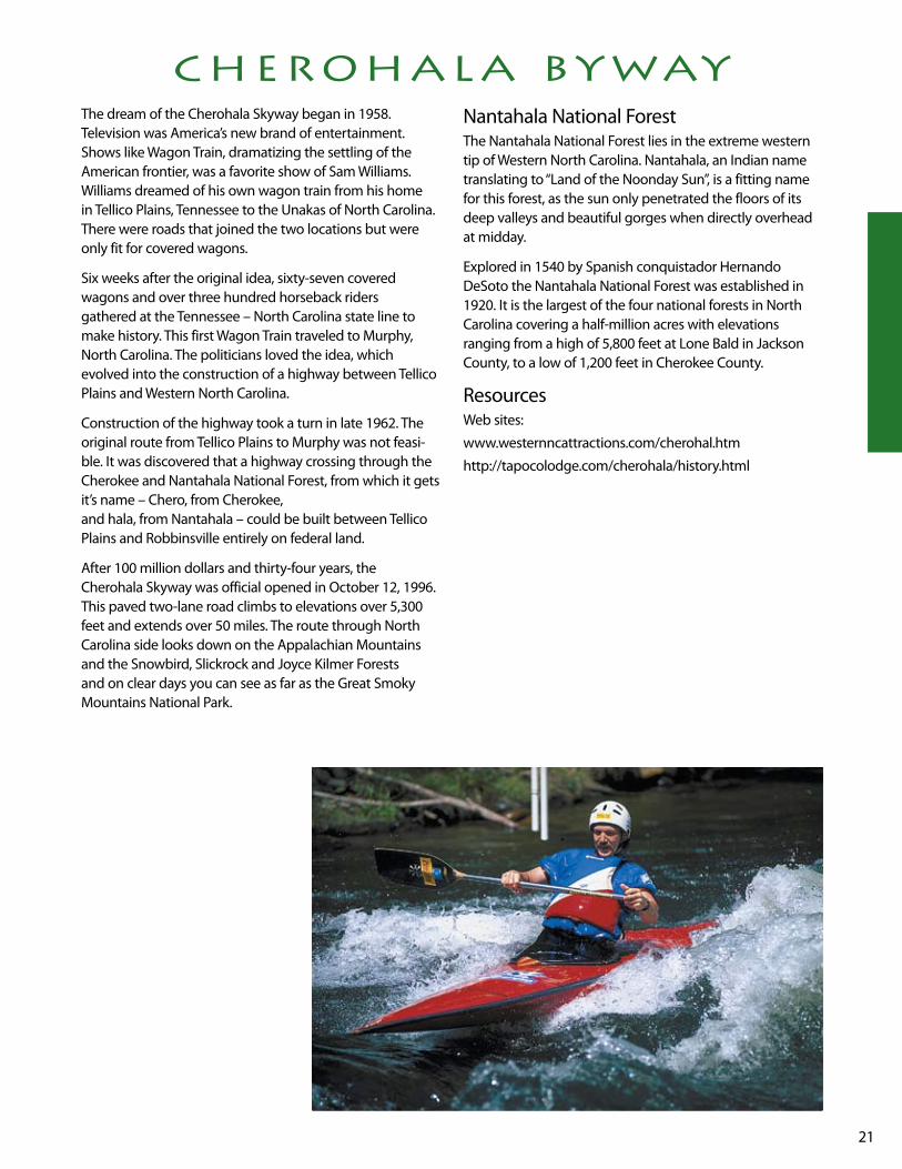
cHeroHala bywayThe dream of the Cherohala Skyway began in 1958. Television was America’s new brand of entertainment. Shows like wagon Train, dramatizing the settling of the American frontier, was a favorite show of Sam williams. williams dreamed of his own wagon train from his home in Tellico Plains, Tennessee to the unakas of North Carolina. There were roads that joined the two locations but were only fit for covered wagons.
Six weeks after the original idea, sixty-seven covered wagons and over three hundred horseback riders gathered at the Tennessee – North Carolina state line to make history. This first wagon Train traveled to Murphy, North Carolina. The politicians loved the idea, which evolved into the construction of a highway between Tellico Plains and western North Carolina.
Construction of the highway took a turn in late 1962. The original route from Tellico Plains to Murphy was not feasi-ble. It was discovered that a highway crossing through the Cherokee and Nantahala National Forest, from which it gets it’s name – Chero, from Cherokee, and hala, from Nantahala – could be built between Tellico Plains and Robbinsville entirely on federal land.
After 100 million dollars and thirty-four years, the Cherohala Skyway was official opened in October 12, 1996. This paved two-lane road climbs to elevations over 5,300 feet and extends over 50 miles. The route through North Carolina side looks down on the Appalachian Mountains and the Snowbird, Slickrock and Joyce kilmer Forests and on clear days you can see as far as the Great Smoky Mountains National Park.
Nantahala National ForestThe Nantahala National Forest lies in the extreme western tip of western North Carolina. Nantahala, an Indian name translating to “land of the Noonday Sun”, is a fitting name for this forest, as the sun only penetrated the floors of its deep valleys and beautiful gorges when directly overhead at midday.
Explored in 1540 by Spanish conquistador Hernando DeSoto the Nantahala National Forest was established in 1920. It is the largest of the four national forests in North Carolina covering a half-million acres with elevations ranging from a high of 5,800 feet at lone Bald in Jackson County, to a low of 1,200 feet in Cherokee County.
Resourcesweb sites:
www.westernncattractions.com/cherohal.htm
http://tapocolodge.com/cherohala/history.html

22
lesson Objectives The students will be able to locate major rivers in western North Carolina and Fontana Dam on a map. They will be able to explain the steps involved in making hydroelectric-ity and build their own dam that can hold back water.
NCDPI Goal and ObjectivesSocial StudiesGoal 3 The learner will locate major physical features and
suggest the influence of location on life in North Carolina.
3.02 locate in absolute and relative terms major landforms, bodies of water, and natural resources in North Carolina.
Goal 8 The learner will examine ways North Carolinians govern themselves.
8.02 Demonstrate an understanding of the importance of responsible citizenship and explain ways North Carolinians can par-ticipate as citizens.
Goal 9 The learner will evaluate how North Carolinians use economic resources to satisfy their wants and needs.
9.03 Categorize the state's resources as natural, human, or capital.
9.04 Assess the use being made of natural resources in North Carolina.
Goal 10 The learner will analyze North Carolina's economic relationships.
10.02 Analyze examples of interdependence in the North Carolina economy and in our eco-nomic relationships with other states and other nations.
Goal 12 The learner will trace developments in North Carolina history and describe their impact on the lives of people today.
12.02 Assess the influence of an important event from North Carolina's past on life today
BackgroundTall dams have been built on several rivers in the Mountain region, including the Hiwassee, little Tennessee, and Tuckasegee Rivers. Fontana Dam, located across a gorge on the little Tennessee River in northern Graham County, is the highest dam east of the Rocky Mountains reaching 480 feet. Built just as America was entering world war II, Fontana supplied electricity to fuel the war effort. The site was located in the remote mountains of North Carolina so a railroad had to be built
to transport supplies. A community for the workers and their families was erected in the wilderness, almost over-night. The 5,000 or so men and women who assembled at Fontana in 1942 worked in three shifts, around-the-clock, seven days a week. The massive project broke construction records and in November 1944, the lake began to fill and, soon after power generation became a reality. The project took just over three years and cost $74.7 million. In peacetime, Fontana helps improve navigation on the Tennessee River and controls flooding that once reached as far as Chattanooga, Tennessee.
For more information see: http://main.nc.us/graham/ fantana.html
Pre-ActivitiesMaterials5-6 cards with North Carolina lake names written on them. (write names of lakes in each region, but focus on lakes in the mountains)
Provide students with a map of North Carolina’s lakes and rivers (in textbook). Briefly review different bodies of water (lake, sounds, seas, oceans). Show a name of a lake in North Carolina on one of the cards prepared earlier. Ask the stu-dents to locate the lake on the map and ask who has ever been to that lake before to describe it. Continue with other lakes written on your cards.
Discuss with the students that most of the lakes in western North Carolina are man-made. Have the student predict how they think the lakes on the map were created. (Dams being built across rivers.) Ask the students to brainstorm reasons for the lakes being created. (Guide them to understand that hydroelectric power uses water to generate electricity.)
The students will locate Fontana lake and Dam in Graham County on a map. Discuss the history of Fontana Dam with the students provided in the background section.
ActivitiesActivity 1 - HydroelectricityThe students will look at pictures of hydroelectric dams in books or on the Internet.
web sites:
www.nationalgeographic.com/eye/floods/science_01.html
http://main.nc.us/tapocolodge/fontana/
iT ’s elecTric

23
The students will research how hydroelectric power is made. They will illustrate and label each step in making hydroelec-tric power in a cartoon style format with caption. (web site www.wvic.com/hydro-works.htm explains how hydroelec-tric power is generated and shows pictures of turbines and generators inside dams. Also science and/or social studies text books may have sections on this topic.)
Activity 2 – Building a DamMaterials• large container• water• modeling clay• sand• gravel• popsicle sticks
Divide the class into teams. Each team will build a dam using the instructions found at www.nationalgeographic.com/geoguide/dams/plansk4.html
AssessmentRubric4 Steps in making hydroelectric power are in sequential
order. Captions are written in complete detailed sentences. Illustrations are complete and colored neatly. 3 Steps in making hydroelectric power are in sequential
order. Captions are written in complete sentences with little
details. Illustrations are Ok and colored.
2 Step in making hydroelectric power are out of order or steps.
Captions are written as phrases with no details. Illustrations are messy and not colored neatly. 1 Steps in making hydroelectric power are out of order
and steps are missing. Captions are written as words or no words at all. Illustration are messy and not colored.
Enrichment Activitieslocate and label all the dams constructed on North Carolina rivers on a map.
Research the largest dams in the world and make a bar graph comparing their height.
Students can research potential positive and negative effects from constructing a dam on a river.
Resourcesweb sites:
www.nationalgeographic.com/eye/floods/science_01.html
http://main.nc.us/tapocolodge/fontana/
www.nationalgeographic.com/geoguide/dams/plansk4.html
www.wvic.com/hydro-works.htm

24
lesson Objectives Students will research events leading up to the Cherokee’s removal from North Carolina.
NCDPI Goals and ObjectivesSocial StudiesGoal 2 The learner will examine the importance of the
role of ethnic groups and examine the multiple roles they have played in the development of North Carolina.
2.01 locate and describe American Indians in North Carolina, past and present.
2.04 Describe how different ethnic groups have influenced culture, customs and history of North Carolina.
language ArtsGoal 2 The learner will develop and apply strategies and
skills to text that is read, heard, and viewed.
2.04 Identify and interpret elements of fiction and nonfiction and support by referencing the text to determine the plot, theme, main idea and supporting details, and author’s choice of words.
Goal 5 The learner will apply grammar and language con-ventions to communicate effectively.
5.08 Demonstrate evidence of language cohesion by logical sequence of fiction and nonfiction retells, time order sequence of events, and sustaining conversations on a topic.
Pre-ActivitiesDiscuss the Cherokee Indian tribe located on the Reservation in Swain County and locate the reservation on the map.
Research information or read classroom novels surrounding the Indian Removal and the Trail of Tears. (Recommended text – Remember My Name by Sara Banks. This book relays the story of Indian removal through the eyes of a young Cherokee girl. Another good novel is Soft Rain by Cornelia Cornelissen. This novel also tells about the Trail of Tears through the eyes of a child.)
ActivitiesActivity 1The students will research the events leading up to the Indian Removal to Oklahoma and create a timeline of significant events.
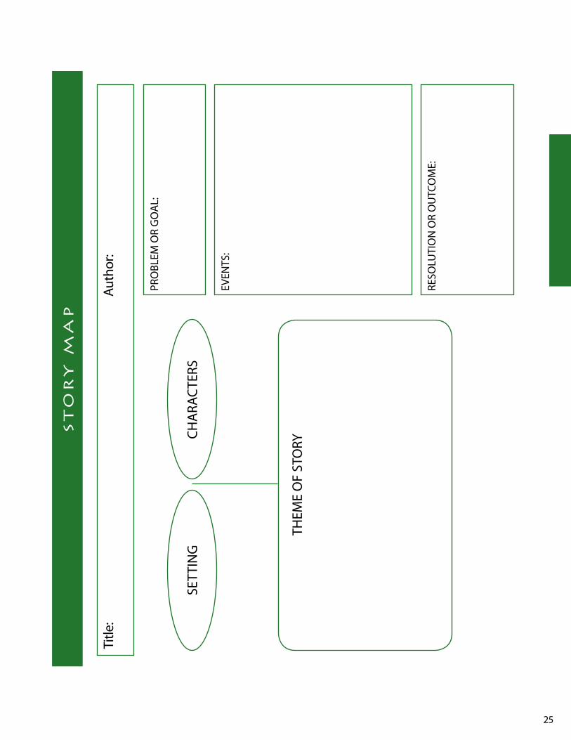
Activity 2The students will complete the attached story map – including plot, setting, main characters, problems and solution with supporting details from the book, Remember My Name by Sara Banks.
Activity 3Students will write a personal narrative through the eyes of a Cherokee child their own age, telling about the trip on the Trail of Tears.
AssessmentStudents will achieve a 2.5 or higher on a personal narrative using the 4th Grade writing Narrative Rubric
Extended ActivitiesStudents will research the Cherokee culture – homes, foods, government, etc. and report the findings to the class.
Students can work in groups to create a model of a typical Cherokee village.
Students will research the traditional dress of the Cherokee tribe. They will write a report and illustrate the clothing worn by men, women and children
ResourcesBanks, Sara. Remember My Name. Scholastic Books
Cornelissen, Cornelia. Soft Rain. yearling Books
web sites:
www.powersource.com/nation/dates.html
www.wncguide.com/graham/attractions.htm
www.main.nc.us/graham/cherokee.html
http://smokymtnmall.com/mall/cindians.html
Trail of Tears
25
sT
or
y M
aP
Title
: Au
thor
:
SETT
ING
CHA
RAC
TERS
THEM
E O
F ST
ORy
PRO
BlEM
OR
GO
Al:
EvEN
TS:
RESO
luTI
ON
OR
Ou
TCO
ME:
26
lesson ObjectivesThe students will be able to name several important Cherokee figures and their significant contributions to North Carolina history.
NCDPI Goals and ObjectivesGoal 2 The learner will examine the importance of the
role of ethnic groups and examine the multiple roles they have played in the development of North Carolina.
2.01 locate and describe American Indians in North Carolina, past and present.
2.04 Describe how different ethnic groups have influenced culture, customs, and history of North Carolina.
Goal 3 The learner will trace the history of colonization in North Carolina and evaluate its significance for diverse people’s ideas.
3.02 Identify people, symbols, events, and documents associated with North Carolina’s history.
Pre-ActivitiesStudents will review the events that led up to the Cherokee removal known as “The Trail of Tears”
Students will be introduced to a list of men and women that played a significant role in Cherokee history
ActivitiesThe students will research one important person in Cherokee history and prepare an oral presentation for the class. The presentation must focus on the individuals’ contributions whether positive or negative.
1. Sequoyah2. John Ross3. Tsali4. Andrew Jackson5. Nancy ward6. Junaluska7. Major General winfield E. Scott8. Elias Boudinout9. A yun ini – also known as Swimmer
AssessmentRubricReport (rough draft) – includes prewriting, sufficient information 25 points
Final copy of report – must be neat 40 points
Oral Presentation 35 points
Extended ActivitiesStudents will research the Cherokee alphabet. They will compose several messages using the letters of the Cherokee alphabet, and underneath each message, write it in English.
Students will create their own Cherokee counting book. Each page should contain a numeral word, digit and picture to illustrate the number. The picture should have significance to the Cherokee way of life (ex. 1 basket, 2 arrows, etc.)
The class will “publish” an issue of the “Phoenix” (name of the Cherokee newspaper) using articles written by the students about events of the Indian removal from North Carolina to Oklahoma.
Resourcesweb sites:
www.main.nc.us/graham/cherokee.html
www.wncguide.com/graham/attractions.htm
www.main.nc.us/graham/cherokee.html – This website includes information about several Cherokee leaders
www.rootsweb.com/~itcherok/cherokee_alpha.htm – This website includes the Cherokee alphabet and additional links about the Cherokee nation.
THey led THe cHerokee
27
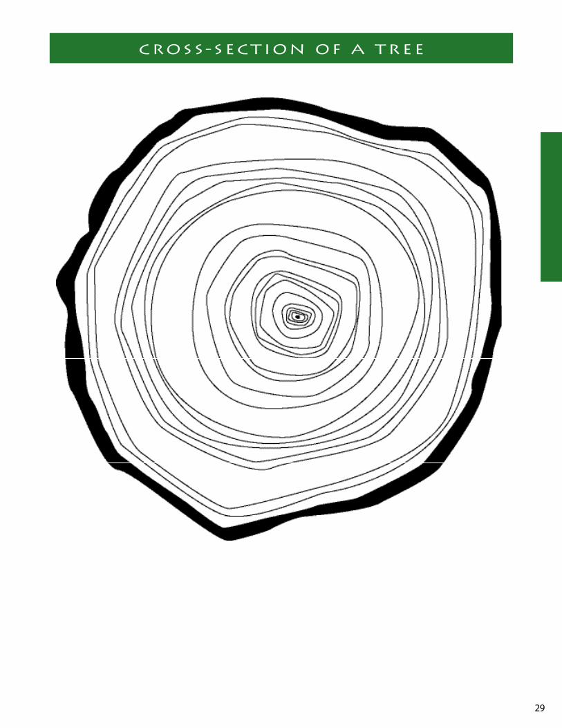
lesson ObjectivesThe students will be able to explain the difference between an old growth and second growth forest. They will be able to identify the different parts of the tree and determine the age of a tree using its growth rings.
NCDPI Goals and ObjectivesSocial StudiesGoal 9 The learner will evaluate how North Carolinians
use economic resources to satisfy their wants and needs.
9.04 Assess the use being made of natural resources in North Carolina.
MathematicsGoal 2 The learner will demonstrate an understanding
and use of the properties and relationships in geometry, and standard units of metric and customary measurement.
2.07 Estimate and measure length, capacity and mass using these additional units: inches, miles, centimeters, and kilometers; milliliters, cups, and pints; kilograms and tons.
BackgroundThe Forest Service inaugurated the little Santeelah, an impressive 3,800-acre remnant of virgin wilderness deep in the mountain of Graham County, as the Joyce kilmer Memorial Forest and dedicated it July 30, 1935. Once the uncharted hunting ground of the Cherokee Indians, today virgin trees grow more than 100 feet tall and some 20 feet in circumference around the base. Many of the giant trees in this old growth forest are hundreds of years old. The Memorial Forest, comprised of enormous poplars, huge red oaks, and giant hemlocks, as well as many other varieties of trees, is maintained in its primitive and natural state. No plants living or dead may be cut or removed.
The Joyce kilmer Memorial Forest is a tribute to a hero whose poem “Trees” inspired millions. Joyce kilmer, who was killed in action in France during wwI, has a living memorial in his memory, the Joyce kilmer Memorial Forest.
Pre-ActivitiesAsk the students if they ever walked through a forest. Have them describe what it looked like using their senses (sight, feel, hearing, smell). Focus their discussion on the size of the trees.
Outside or in the hallway have the students measure out 100 feet, the height of most of the trees in Joyce kilmer Forest. Determine how tall a building would be if each floor was 10 feet. (10 stories high) Compare this to the trees around their school or buildings in their com-munity.
Have the students stand holding hands to create a 20 foot circle. Most trees in the Joyce kilmer Memorial Forest is this wide or wider.
ActivitiesActivity 1 – “Trees”The students will research Joyce kilmer and write why a for-est is dedicated to him.
Make a transparency of the poem “Trees” and read it with your students. (see attached poem) Discuss what each line means.
Activity 2 – Age of a TreeBy counting a tree’s growth rings, you can tell it’s age. Every growth season, a tree adds a new layer of wood to its trunk. During a moist growing season, a tree may pro-duce a wide ring. During a drought, a colder-than-average winter, insect attack, or an unseasonable frost, a tree will produce narrow rings. The rings provide clues about the climate, or weather, of the area over time and evidence of disturbance to and around the tree, such as fires and floods.
Draw a cross section of a tree on the blackboard. Help stu-dents identify and label these parts of a tree: bark, phloem, cambium, xylem or sapwood, and heartwood. Explain how to count the rings to find the age of the tree (count only the light or only the dark rings). As a class, count the number of growth rings. Try to find indications of good growing sea-sons (rapid growth) or poor growing seasons (slow growth) due to drought or insect attack.
Pass out copies of drawn cross sections of a tree to each student. If possible, have actual cross sections cut from the trunk or limbs of a fallen tree. Have students estimate how old the tree was. Ask students to explain how they counted. See if they can determine periods of rapid or slow growth and predict possible causes.
Activity 3 – “My life as a Tree”
land of gianTs
28
Materials• paper plates
using white paper plates with ridges, demonstrate for students how to create a cross section of a tree using the bumpy perimeter as the bark, the small inside edge as the cambium, and the center circle as the heartwood. Have students each use a paper plate and crayons to make their own cross section of tree the same age as them. Have them label important events in their life (a time line) on the cross section using sticky labels.
Assessmentcross section accurately shows the age of the child 45 points
important events are label correctly 45 points
overall neatness 10 points
100 points
Extended Activities
Tree poemsHave students write their own poems about trees and illus-trate.
life of a PoplarDivide the class into teams. On a very large piece of paper, have students draw a life size cross section of a poplar tree growing in an old growth forest like Joyce kilmer. Have them draw in the life rings for 100 years and create a time line for the life of the poplar tree.
ResourcesProject learning Tree
web site:
www.westernncattractions.com/kJMF.htm
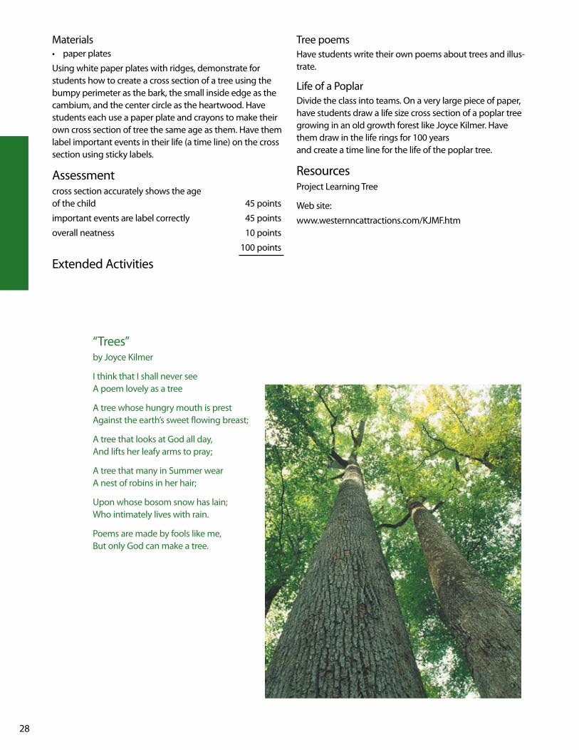
“Trees”by Joyce kilmer
I think that I shall never see A poem lovely as a tree
A tree whose hungry mouth is prest Against the earth’s sweet flowing breast;
A tree that looks at God all day, And lifts her leafy arms to pray;
A tree that many in Summer wear A nest of robins in her hair;
upon whose bosom snow has lain; who intimately lives with rain.
Poems are made by fools like me, But only God can make a tree.
29
cross-secTion of a Tree

30
lesson ObjectivesThe students will invent new ways of recycling brown paper bags and will become involved in “Earth Day Groceries Project”.
NCDPI Goals and ObjectivesSocial StudiesGoal 9 The learner will evaluate how North Carolinians
use economic resources to satisfy their wants and needs.
9.01 Explain the relationship between unlimited wants and limited resources.
9.04 Assess the use being made of natural resources in North Carolina.
Pre-ActivitiesIn small groups, the students will brainstorm different ways they can reuse, or recycle, a sheet of notebook paper in a new way besides writing or drawing on it. Share their sug-gestions with the class.
Discuss how our resources are limited and ask for suggestions on ways to protect them for the future.
Discuss recycling and why it is important with the class.
Materials• 2 brown paper grocery bags for each student in your
class.
Activity Activity 1 Each student will be given a brown paper grocery bag. Instruct them that they have to come up with an alternative way to use the brown paper grocery bag. Students will demonstrate the new use to the class. For suggestions see www.afandpa.org/kids_educators/index.html.
Click on – teacher tools
Activity 2Students will decorate a brown paper grocery bag with environmental images or concepts learned during this unit. The decorated bag can be put on display in the school and later taken back to the grocery store to be reused on Earth Day, April 22.
For more details about this nationwide project, see www.afandpa.org/kids_educators/index.html
Click on – teacher tools
Resources web sites:
www.afandpa.org/kids_educators/index.html – More recycling activities are available at this site.
PaPer Please !

31
Nestled below the Blue Ridge Parkway and along NC 276 the Forestry Heritage Byway begins at the entrance of the Pisgah National Forest. The Cherokee once lived in this area prior to the 1800’s and considered themselves to be par-ticipants in the natural world, which surround them rather than manipulators of their environment. Almost all of their life’s basic necessities, food, clothing, shelter, medicine, and water, were available in the woodlands.
Following the Davidson River, the Forest Heritage Byway has many interesting, educational, and historical sites to enjoy. The first stop along the way is the Pisgah Center for wildlife Education, operated by the NC wildlife Resources Commission. The center’s many exhibits focus on wildlife management and protection, fish culture and conservation education. Adjacent to Pisgah Center is the Pisgah Trout Hatchery, which manages the state’s wildlife and inland fish populations. They have released thousands of brook, rain-bow, and brown trout in the mountain streams.
All along looking Glass Creek are many beautiful natural features to enjoy. This rushing stream cascades down the mountainside offering many photographic opportuni-ties. One of the most popular sites is looking Glass Falls, a breathtaking 85-foot tall waterfall. Another site is Sliding Rock, a well-known spot used by locals as a natural water slide. looking Glass Creek spills 11,000 gallons of water a minute over this 60-foot long natural rock. At the end of this, sliders splash into a 6-foot deep pool.
Just past Sliding Rock is the entrance to the Cradle of Forestry in America, a National Historic Site, at the base of Mount Pisgah. In 1968 Congress set aside 6,500 acres of Pisgah’s National Forest land, including the Pink Beds campus area, to commemorate Dr. Carl Alwin Schenck’s Biltmore Forest School. Dr. Schenck’s forestry school, established in 1898, was the first of its kind in the nation. Today visitors can stroll through the rustic campus of the Biltmore Forest School and view exhibits of past and pres-ent forestry practices. (See logging History for more infor-mation.)
Adjacent to the Cradle of Forestry is a high elevation valley called the Pink Beds. It is a network of upland bogs supporting habitats more like those found on the Coastal Plains than the mountains. The Pink Beds are remarkable flat with lush stands of flowering rhododendron and moun-tain laurel. These wetlands contain soils and plants that are very different from the communities surrounding them. The rare swamp pink, dewdrops, and golden club are among the many plant species that live in this area. Dewdrops can only be found growing in three wNC counties. Bog turtles can also be found living in the mud, grass, and sphagnum
moss. Growing only 4 inches long, it is North Carolina’s smallest turtle.
The Forest Heritage Byway twists and turns up the mountainside and eventually crosses the Blue Ridge Parkway at wagon Gap Road. European settlers used this road to travel into this area in the 1800’s. Here the byway continues down into the community of Bethel not far from Canton, a community built around the former Champion International Paper, today Blue Ridge Paper Company, which played a major roll in the logging boom of the early 1900’s. Champion was one of the few companies who Dr. Schenck was able to convince to introduce sustained-yield forestry on its Pigeon River properties.
From here the byway turns up NC 215 heading south into the community of Sunburst, located along the shores of lake logan. The history of lake logan is forever apart of the logging business that once thrived in these forests. Sunburst, a logging town of 500 people, was built along the river with a sawmill and neat rows of houses for mill workers and lumbermen. The sawmill produced lumber to build the Canton paper mill, Champion International, 13 miles downstream, which opened in 1906. The sawmill at Sunburst burned in 1925, and lumbering operations were moved to another site. In 1932 Champion completed a dam across the river near the old sawmill town creating lake logan. This mile-long, 88-acre lake is still a constant water supply for the Canton paper mill.
The byway continues south over Cold Mountain, setting of Charles Frazier’s debut novel, Cold Mountain. The byway crosses the Blue Ridge Parkway again and winds southward down the mountain near Balsam lake that feeds into the French Broad River. Eventually the Forest Heritage Byway ends near Rosman.
whether you are want to step back in time and experience what life was like in the area during the logging boom, learn about the areas native plants and animals, or just enjoying a day hiking, biking, picnicking, fishing, and sliding down Sliding Rock, the Forest Heritage Byway is a beautiful place to visit.
ResourcesMcDaniel, lynda, Highroad Guide to the North Carolina
Mountains, longstreet, Atlanta, Ga., 1998.
Buxton, Barry, The Great Forest, An Appalachian Story, Appalachian Consortium Press, 1985.
Cradle of Forestry Trail Guide, uSDA Forest Service, July 2001.
North Carolina Scenic Byways, NC Department of Transportation.
foresT HeriTage byway

32
lesson ObjectivesStudents will create a written history of their own life and research their family heritage.
NCDPI Goals and ObjectivesSocial StudiesGoal 3 The learner will trace the history of colonization
in North Carolina and evaluate its significance for diverse people’s ideas.
3.04 Compare and contrast ways in which people, goods, and ideas moved in the past with their movement today.
language ArtsGoal 3 The learner will make connections through the use
of oral language, written language, and media and technology.
3.06 Conduct research for assigned projects or self-selected projects from a variety of sources through the use of technological and informal tools.
Goal 4 The learner will apply strategies and skills to create oral, written, and visual texts.
4.05 use planning strategies to generate topics and organize ideas.
4.07 Compose fiction, nonfiction, poetry, and drama using self-selected and assigned top-ics and forms.
Pre-ActivitiesThrough class discussion, the students will become aware of events that are important in their lives.
Students will create a personal timeline describing eight important events in their lives.
Students will discuss what an autobiography is and what information might be contained in that type of literature.
The students will discuss the importance of family heritage and what generations are in families.
ActivitiesActivity 1The students will be given the autobiography handout, Back To My Roots and will begin the project by creating or adding to their own timeline to briefly supply the informa-tion needed for the project.
Activity 2Each student will be given the Family Genealogy handout to take home and complete. (Flexibility can be given on this activity) Students may wish to design their own way of pre-senting family information. The information should go back 3 generations if possible.
Activity 3A brief summary of the student’s family tree information should accompany the handout. Possible additions could include: how the student got his/her name, when the par-ents or grandparents were born and where, and any other pertinent information about the student’s heritage.
Materials• Autobiography handout (Back To My Roots)• Family Genealogy Handout• Student created personal timelines
Extended ActivitiesStudents should read a variety of books about families – such as when the Relatives Came or when I was young in the Mountains by Cynthia Rylant. They will then write a personal narrative describing a family event that involved a time they spent with their relatives.
Create a venn Diagram comparing city life to country life. Be sure and include activities, transportation, food, sounds, homes, etc.
RubricTimeline neatly displayed with at least 8 events 20 points
Family tree creatively displayed 40 points
An autobiography of the student (at least 1 pg) 40 points
*NOTE – the autobiography activity included in this les-son could be graded using the North Carolina 4th Grade Narrative writing Rubric.
ResourcesRylant, Cynthia. Night in the Country. Aladdin
Paperbacks, 1991.
Rylant, Cynthia. when I was young in the Mountains. Aladdin Paperbacks
Rylant, Cynthia. when the Relatives Came. Aladdin Paperbacks, 1985
web site:
www.genealogy.com
back To My rooTs
33
This project will be an autobiography. The information will need to be arranged in sections some-what like chapters in a book. Each section will need to be neatly hand written or word-processed. Each section needs to be one paragraph minimum, you can include more but you need to have at least one paragraph. Each section needs to be titled and include illustrations or pictures (pictures would be best) representing that part of your life. Following are the sections that MuST be included:1. An Incident Before My Birth2. The Day I was Born or when My Parents Adopted Me or when I Moved In with _______3. My First Day In School4. A Memorable Family vacation5. The Best Friend I’ve Ever Had6. The Best Book I’ve Ever Read7. what I Hope To Be when I Grow up8. The Thing I’m Proudest Of9. The Person That I Admire10. My Favorite Holiday or My Favorite Season of The year
These sections could be included for extra credit:1. How My Family Came To This State, Country, or Community2. A Memorable Time I’ve Had At Home3. A Memorable Time I’ve Had at School4. My Hobby5. My Favorite Pet6. A Team That I Play On7. A Club or Group That I am in
This project will be counted as a writing, language, and Reading grade. Please make it something you will want to keep for the rest of your life. It should be a “scrapbook” of your life so far. Hopefully this will be a learning experience you will treasure for a lifetime!
This project should be put together neatly and be creative. Presentation will affect your grade. your project is due ___________________________
back To My rooTs

34
fa
Mil
y g
en
ea
lo
gy
Stud
ent
Fath
er
Fath
er
Fath
er
Mot
her
Mot
her
Mot
her
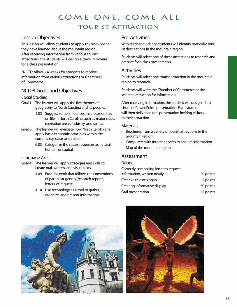
35
lesson Objectives This lesson will allow students to apply the knowledge they have learned about the mountain region. After receiving information from various tourist attractions, the students will design a travel brochure for a class presentation.
*NOTE: Allow 3-4 weeks for students to receive information from various attractions or Chambers of Commerce.
NCDPI Goals and ObjectivesSocial StudiesGoal 1 The learner will apply the five themes of
geography to North Carolina and its people.
1.03 Suggest some influences that location has on life in North Carolina such as major cities, recreation areas, industry, and farms.
Goal 6 The learner will evaluate how North Carolinians apply basic economic principles within the community, state, and nation.
6.03 Categorize the state’s resources as natural, human, or capital.
language ArtsGoal 4 The learner will apply strategies and skills to
create oral, written, and visual texts.
4.09 Produce work that follows the conventions of particular genres (research reports, letters-of-request).
4.10 use technology as a tool to gather, organize, and present information.
Pre-Activitieswith teacher guidance students will identify particular tour-ist destinations in the mountain region.
Students will select one of these attractions to research and prepare for a class presentation.
ActivitiesStudents will select one tourist attraction in the mountain region to research.
Students will write the Chamber of Commerce or the selected attraction for information.
After receiving information, the student will design a bro-chure or Power Point® presentation. Each student will then deliver an oral presentation inviting visitors to their attraction.
Materials• Brochures from a variety of tourist attractions in the
mountain region.• Computers with internet access to acquire information.• Map of the mountain region.
AssessmentRubricCorrectly composing letter to request information, written neatly 20 points
Creative title or slogan 5 points
Creating informative display 50 points
Oral presentation 25 points
coMe one, coMe all tourist attraction

36
we have touched on different area tourist attractions in the Mountain region of North Carolina. In this project you are going to research a tourist attraction and make a brochure or a Power Point® pre-sentation advertising this attraction.
Requirements of Project1. Pick a tourist attraction from the list. I have chosen _______________________________ as the
attraction that I will research.
2. Decide if you are going to make a brochure or Power Point® presentation. I have chosen to do a
__________________________.
3. Research the attraction by looking in books, using the Internet to find websites about the attrac-
tion, and by using other brochures. use this information to decide what you want to include in
your brochure or on your poster…do not copy, but do not make it up.
4. Have an idea of what you want to do and sketch an outline of your project to turn in by
__________________________________.
5. you will have class time to put together your project after it has been approved. Some class time
will be provided to do research but most of the research will have to be done outside of the class-
room.
6. we will share these projects in class so make it something you will be proud to share with your
classmates. BE CREATIvE!
7. you will need to share this sheet with your parents and have them sign it saying they know about
the project and will help you do research on it.
Parent Signature ___________________________________
Student Signature _________________________________
8. My Project was approved on ___________________________.
9. The final project will be due on ___________________________.
coMe one, coMe all assignMenT

37
X
• Tweetsie Railroad _______________________________________
• Ghost Town ____________________________________________
• Nature Center ___________________________________________
• Cherokee ______________________________________________
• Oconaluftee village ______________________________________
• Biltmore Estate __________________________________________
• Great Smoky Mountain Railroad ____________________________
• Cataloochee ____________________________________________
• Cradle of Forestry ________________________________________
• Nantahala whitewater Rafting _____________________________
• Chimney Rock __________________________________________
• The Blowing Rock _______________________________________
• linville Caverns _________________________________________
• Grandfather Mountain ____________________________________
• Mast General Store ______________________________________
• Blue Ridge Parkway ______________________________________
• Dillsboro _______________________________________________
• Flat Rock Playhouse ______________________________________
• Appalachian Trail ________________________________________
• Fontana village _________________________________________
• Folkmoot uSA __________________________________________
• Ski Sugar/Ski Beech ______________________________________
• Appalachian Summer Festival ______________________________
• Boone _________________________________________________
• Thomas wolfe Auditorium ________________________________
Possible siTes for coMe one, coMe all assignMenT

38
lesson ObjectivesIn this activity, students will role-play managing a tree farm. By using a piece of land as a tree farm, they will begin to understand the economic factors that influence manage-ment decisions for private forest lands.
NCDPI Goals and ObjectivesSocial StudiesGoal 5 The learner will evaluate ways the people of North
Carolina use, modify and adapt to the physical environment.
5.02 Describe how North Carolinians now use, modify, or adapt to their physical environment.
5.03 Analyze causes and consequences of the misuse of the physical environment and pro-pose alternatives.
Goal 9 The learner will evaluate how North Carolinians use economic resources to satisfy their wants and needs.
9.01 Explain the relationship between unlimited wants and limited resources.
9.02 Analyze the choices and opportunity cost involved in economic decisions.
9.04 Assess the use being made of natural resources in North Carolina.
BackgroundForests are an important part of our state’s environment and economy. when they are well managed, forests provide clean air and water, homes for wildlife, beautiful scenery places for recreation and more than 5,000 products we all use every day. But when they are not well managed, forests are often unhealthy and unproductive because of overcrowding, disease, insects, and competition for light, water and nutrients. To maintain or improve the health and productivity of a forest and to achieve the landowner’s objectives for the property, foresters and tree farmers use a number of management techniques, including prescribed burning, thinning, harvesting, and planting. Tree farms are forests that are managed to grow trees for wood products such as paper and lumber. Tree farmers want to manage their forests in an aesthetically pleasing and ecologically sound way, while growing trees for forest products. For more infor-mation on forest management practices see the following web site: www.ncforestry.org/docs/Mgmt/practices_index.htm
Pre-ActivitiesArrange students into five rows and prepare three signs that read FIREwOOD, PulP, and luMBER.
Ask the students what a tree farm is. Guide the discuss using the information in the background section.
ActivitiesActivity 1 – HarvestingAsk the students to sit flat on the floor beside their desks. Explain to them that they are pine tree seedlings that you planted on your barren land.
Ask the students to sit up on their knees in the floor beside their desk. Explain to them that they have been growing for about 15 years and need to be thinned so they can continue to grow quickly. If you don’t, they will become crowded and will start competing for food and water which will stunt their growth and make them more susceptible to insects and diseases. Sporadically, cut about 4 of the trees and have these students stand to the side of the group. These trees will be used for firewood so have them hold the FIREwOOD sign.
Now ask the rest of the students to sit in their chairs. Explain to them that they have been growing for about 15 more years and that they need to be thinned again. This time you will harvest every other pine tree for paper. These trees that you cut down should stand in a different line to the side of the group and hold the PAPER sign. They will be used to make pulp which will be made into paper products.
Explain to the remaining students that since several of the trees were harvested, the rest of the them will be able to continue growing for 15 more years. Ask the students to now stand in their chair. They have grown just about to their maximum height. If they are not harvested, they may be attacked by insects, infected with disease, or destroyed by wildfire. As a result, they will lose their value as timber. you decide to harvest the remaining trees for lumber. Cut down all of the remaining trees and have them stand to the side of the group holding the luMBER sign.
Now that all of the trees have been removed, tell the students that for every tree that was cut down you will replant seedling in their place. All of the students should return to their seat.
Activity 2 – Fire
decisions, decisions, decisions

39
line up all the students again the same way as you did for Activity 1. Ask them what natural events could drastically change the forest. Discuss students’ answers.
Ask all the students to stand at their desk and pretend they have are pine trees growing on your tree farm. Tell them that a wildfire swept through the tree farm destroying every tree on your farm. All the students should sit down in their seats. Discuss the results of the fire on the forest. Explain to the students that fortunately the seeds still in the ground will regenerate and will grow back over time. That fire is a natural and sometimes vital part of the forest lifecycle.
Activity 3 – DevelopingTell the students that they have been growing again for a while. Ask them to stand beside their desks. Explain to the students that you have decided to sell your tree farm and the new owner has decided to develop the land.
The first thing the new owner does is put in a road through the forest. Cut down a row of trees and ask them to stand to the side to be burned.
Now individuals purchase sections of the land to build homes on. Cut down trees here and there where the homes will be build. These cut down trees will join the others to the side to be burned.
Continue to cut down more and more trees for stores,
businesses, and schools in the community. As they are removed they should join the others of the side to be burned.
Afterwards, ask the students to imagine the community that has been built. Ask them if they would like to live there? Have them describe what it looks like. Ask the students what type of benefits could have been gained if the developer would have left some of the trees in place when building the community? Ask the students who the developer could have called to help them plan the devel-opment so that the community could have still benefited from the trees?
ResourcesProject learning Tree
web site:
www.ncforestry.org/docs/Mgmt/practices_index.htm

40
go fisH!
lesson ObjectivesStudents will be able to name, identify, and describe the characteristics and habitats of three freshwater trout in western North Carolina streams.
Students will role-play being freshwater trout to examine how the competition for food and pollution effects a trout’s survival.
NCDPI Goals and ObjectivesGoal 1 The learner will build an understanding of animal
growth and adaptation.
1.01 Relate structural characteristics and behavior of a variety of animals to the environment in which they are typically found.
1.02 Determine animal behaviors and body struc-tures that have specific growth and survival functions in a particular habitat.
Goal 4 The learner will apply strategies and skills to create oral, written, and visual texts.
4.05 use planning strategies to generate top-ics and organize ideas (e.g., brainstorming, mapping, webbing, reading, discussion).
4.06 Compose a draft that conveys major ideas and maintains focus on the topic with specific, relevant, supporting details by using preliminary plans.
BackgroundThere are about 70 different species of fish living in North Carolina’s fresh water including brim, bass, sucker, shiner, darter, and trout. Brook, rainbow, and brown trout are three types of trout that are raised in hatcheries like the one at Pisgah Center for wildlife Education and later released into the local streams and rivers. The brook trout is North Carolina’s only native trout, however, it is not a true trout it is a “char”. The rainbow and brown trout were introduced in the 1900’s.
Pre- ActivitiesThe students will watch the Pisgah Center for wildlife Education and Hatchery section of the Forest Heritage Byway video. Discuss the different types of trout (brooks, rainbows, and browns) raised at the Pisgah Fish Hatchery and the role of hatcheries.
ActivitiesActivity 1 – Comparing and Contrasting TroutThe students will color and cut out the brook, rainbow, and brown trout on the western North Carolina Trout coloring page. See web site www.landoskytu.com/ for col-ored pictures. using the “Trout in North Carolinas Streams” handout, guide the students in completing the triple venn diagram comparing and contrasting the dif-ferent trout in western North Carolina streams.
Activity 2 – Simulating Trout Competing for FoodReview with the students the types of food that all the trout eat as well as their behavior. The students will simulate being a brook trout and a rainbow trout searching for food.
Scatter 20 plain index cards on the floor. During the first round, half of the students will be brook and the other half will be rainbow. Attach the cut out fish from Activity 1 to the student’s shirt that matches the type of fish they are. when you instruct them to go, both groups will walk around the room and collect as many food cards as they can to survive. They must collect food in order to live. However, since brooks are wary fish, they will have to perform an activity like 3 jumping jacks or 3 pushups before they can collect a piece of food. The rainbows are more aggressive so they can just walk around and pick up food. when all the food has been collected, those with food live and go back to their starting position, those without food die and have to sit out on the side during the next round.
Discuss the results and predict what will happen when the fish that lived from round one play again. (Option: you may want to remove some of the food (index cards). Play the game again the same way and discuss the results. The students will predict how this type of food competition will effect each trout’s population over time and brainstorm solutions to this problem. Discuss with the class that because of this food competition, hatcheries release more brooks than rainbow and brown trout to better control populations. Play the game again the same way, but this time have more brooks than rainbow. Discuss the results.
Activity 3 – Simulating Trout

41
in Polluted StreamsMaterials40 index cards (20 plain and 20 labeled with skull and cross bones or X’s.)
Review with the students the tolerance level of each type of trout to pollution.
The students will simulate being brook and brown trout searching for food in a stream that has pollution in it. Half of the students will be brooks and the other half will be browns. Create cutout fish to identify the type of fish they are. Again place the food cards on the floor, but this time mix in 20 index cards with skull and cross bones or X’s on them tuned upside. These cards will represent pollution. when you instruct them to go, both groups will collect as much food as they can to survive the same way they did in Activity 2. They must collect food in order to live.
when all the cards are collected, the dead fish sit out on the side and the live fish go back to their starting posi-tion. Explain the since brooks are intolerant of pollution, if they picked up one pollution card they die automatically. Brown’s are more tolerant to pollution so they can pick up two pollution cards before they die. (Don’t tell them this until after you play the round.)
Discuss the results and predict what will happen when
the living fish play the game again. Play the game again the same way, but decrease the number are food cards and pollution cards on the floor. Discuss the results. The students will predict how pollution will effect each trout’s population over time. Brainstorm solutions to this problem. Discuss with the class that because browns are more tolerant to pollution they have a better chance of sur-vival, but several of them will still die.
AssessmentCorrectly and neatly colored trout pictures 10 points
venn diagram 45 points
paragraph 45 points
100 points
ResourcesPisgah Center for wildlife Education and Hatchery
web site:
www.landoskytu.com/ – Excellent resource for pictures of trout and information.

42
co
MP
ar
in
g a
nd
co
nT
ra
sT
in
g n
c T
ro
uT
Dire
ctio
nsCo
mpa
re a
nd c
ontr
ast t
he d
escr
iptio
n, h
abita
t, fo
od, a
nd so
cial
beh
avio
r of a
bro
ok, r
ainb
ow,
and
brow
n, tr
out.
writ
e a
deta
iled
para
grap
h be
low
.
____
____
____
____
____
____
____
____
____
____
____
____
____
____
____
____
____
____
____
____
____
____
___
____
____
____
____
____
____
____
____
____
____
____
____
____
____
____
____
____
____
____
____
____
____
___
____
____
____
____
____
____
____
____
____
____
____
____
____
____
____
____
____
____
____
____
____
____
___
____
____
____
____
____
____
____
____
____
____
____
____
____
____
____
____
____
____
____
____
____
____
___
____
____
____
____
____
____
____
____
____
____
____
____
____
____
____
____
____
____
____
____
____
____
___

43
co
MP
ar
in
g a
nd
co
nT
ra
sT
in
g n
c T
ro
uT
Dire
ctio
nsCo
mpa
re a
nd c
ontr
ast t
he d
escr
iptio
n, h
abita
t, fo
od, a
nd so
cial
beh
avio
r of a
bro
ok, r
ainb
ow,
and
brow
n, tr
out.
writ
e a
deta
iled
para
grap
h be
low
.
____
____
____
____
____
____
____
____
____
____
____
____
____
____
____
____
____
____
____
____
____
____
___
____
____
____
____
____
____
____
____
____
____
____
____
____
____
____
____
____
____
____
____
____
____
___
____
____
____
____
____
____
____
____
____
____
____
____
____
____
____
____
____
____
____
____
____
____
___
____
____
____
____
____
____
____
____
____
____
____
____
____
____
____
____
____
____
____
____
____
____
___
____
____
____
____
____
____
____
____
____
____
____
____
____
____
____
____
____
____
____
____
____
____
___
Brow
n•
brow
n w
ith o
rang
e sp
ots
• slo
wer
mov
ing
stre
ams
• m
ore
of a
noc
turn
al fe
eder
Rain
bow
• sc
arle
t str
ipe
on fl
anks
• fa
st m
ovin
g w
ater
• ju
mps
out
of t
he w
ater
whe
n ca
ught
Broo
k•
wor
m-li
ke m
arki
ngs
• hi
gher
ele
vatio
ns•
into
lera
nt to
pol
lutio
n•
shy
and
timid
• na
tive
• no
t nat
ive
to N
C •
tole
rant
to so
me
po
llutio
n
• d
iffic
ult t
o ca
tch
• ag
gres
sive
• ea
t aqu
atic
and
te
rres
tria
l ins
ects
• fo
und
in c
old
mtn
. st
ream
s with
hig
h ox
ygen
leve
ls

44
Tr
ou
T i
n n
or
TH
ca
ro
lin
a s
Tr
ea
Ms
Trou
t D
escr
iptio
n Fo
od
Hab
itat
Beha
vior
Broo
k Tr
out
Onl
y na
tive
trou
t in
NC
Also
kno
wn
in th
e Sm
okie
s as t
he
“spe
ckle
d” o
r “sp
ec”
Not
a tr
ue tr
out,
but a
“cha
r”
Rain
bow
Tro
utO
rigin
ally
from
Ca
lifor
nia
logg
ing
com
pani
es
bega
n st
ocki
ng in
19
10
Brow
n Tr
out
Orig
inal
ly fr
om
Ger
man
y
Intr
oduc
ed in
the
1900
’s
life
span
: 4 y
ears
yello
wish
, wor
m-li
ke m
arki
ngs r
unni
ng
alon
g th
e fis
h’s b
ack,
con
tras
ted
agai
nst
a da
rk g
reen
ish b
ackg
roun
d. A
long
the
flank
s are
num
erou
s pal
e ye
llow
spot
s and
us
ually
a fe
w re
d sp
ots s
urro
unde
d bl
ue
halo
s. D
urin
g fa
ll sp
awni
ng p
erio
d, th
e lo
wer
flan
ks o
f mal
es tu
rn a
bril
liant
red-
oran
ge.
life
span
: 3-5
yea
rsSi
lver
y fla
nks s
lash
ed w
ith sc
arle
t with
a
gree
nish
bac
k.
life
span
8-1
2 ye
ars
Brow
nish
-yel
low
col
or w
ith o
rang
e sp
ots
on th
e sid
es.
Aqua
tic in
sect
sst
onef
ly n
ymph
s, m
ayfli
es, c
addi
es fl
ies
Terr
estr
ial i
nsec
tsbe
es, w
asps
, bee
tles,
ants
, flie
s, gr
ass-
hopp
ers
Oth
ercr
awfis
h, m
inno
ws
Aqua
tic in
sect
sst
onef
ly n
ymph
s, m
ayfli
es, c
addi
es fl
ies
Terr
estr
ial i
nsec
tsbe
es, w
asps
, bee
tles,
ants
, flie
s, gr
ass-
hopp
ers
Oth
ercr
awfis
h, m
inno
ws,
wor
ms
Aqua
tic in
sect
sst
onef
ly n
ymph
s, m
ayfli
es, c
addi
es fl
ies
Terr
estr
ial i
nsec
tsbe
es, w
asps
, bee
tles,
ants
, flie
s, gr
ass-
hopp
ers
Oth
ercr
awfis
h, m
inno
ws,
wor
ms
Prim
arily
noc
turn
al fe
eder
and
dur
ing
inse
ct h
atch
es, t
hey
are
extr
emel
y se
lec-
tive
abou
t wha
t the
y ea
t.
mos
tly fo
und
in c
old
m
ount
ain
stre
ams i
n
high
er e
leva
tions
wat
er n
eeds
hig
h ox
ygen
leve
lin
tole
rant
to p
ollu
tion
reas
ons f
or b
rook
dec
line:
1. lo
ggin
g in
180
0’s
2. o
ver f
ished
3. in
trod
uctio
n of
new
trou
t4.
wat
er p
ollu
tion
mos
tly fo
und
in fa
st m
ovin
g,
cold
mou
ntai
n st
ream
s
wat
er n
eeds
hig
h ox
ygen
leve
l
tole
rant
to p
ollu
tion
pref
ers s
low
er m
ovin
g, c
old
mou
ntai
n st
ream
s in
low
el
evat
ions
with
goo
d co
ver
wat
er n
eeds
hig
h ox
ygen
leve
l
mor
e to
lera
nt to
pol
lutio
n
very
shy
and
timid
very
war
y fis
hea
sier t
o ca
tch
by a
ngle
rs
less
tim
id a
nd m
ore
ag
gres
sive
hard
er to
cat
ch b
y an
gler
s and
kn
own
for f
ight
ing
abili
tyte
nden
cy to
jum
p cl
ear o
f the
w
ater
whe
n ca
ught
very
agg
ress
ive
diffi
cult
to c
atch
by
angl
ers
beca
use
they
are
prim
arily
no
ctur
nal f
eede
r and
can
be
sele
ctiv
e ea
ter

45
lesson Objectives Students will learn about the pioneer way of life in the mountain region of North Carolina by reading this novel by Gloria Houston.
NCDPI Goals and ObjectivesSocial StudiesGoal 1 The learner will apply the five themes of
geography to North Carolina and its people.
1.04 Evaluate ways the people of North Carolina used, modified, and adapted to the physical environment, past and present.
Goal 3 The learner will trace the history of colonization in North Carolina and evaluate its significance for diverse people’s ideas.
3.04 Compare and contrast ways in which people, gods, and ideas moved in the past with their movement today.
language ArtsGoal 2 The learner will develop and apply strategies and
skills to comprehend text that is read, heard, and viewed.
2.07 Determine usefulness of information and ideas consistent with purpose.
Goal 3 The learner will make connections through the use of oral language, written language, and media and technology.
3.01 Respond to fiction, nonfiction, poetry, and drama using interpretive, critical, and evaluative processes by analyzing the impact of author’s word choice and context, examining the reasons for characters’ actions, identifying and examining characters’ motives, considering a situation or problem from different characters’ points of view.
Pre-ActivitiesTeacher will introduce the mountain author Gloria Houston (Her biography is on the internet www.ceap.wcu.edu/Houston).
Students will locate Avery County on a map.
Students will listen to the book My Great Aunt Arizona by Gloria Houston and discuss how the people of the book lived.
In small groups have students read littlejim by Gloria Houston.
Activities1. vocabulary – make a list of “mountain words” and what
they mean.2. Research the different modes of transportation
mentioned in the book.3. Discuss and research the importance of Christmas tree
production in the mountain region.4. Discuss and research the importance of traditions
mentioned in littlejim.
a. clogging
b. weaving
c. baking
d. church
e. slaughtering pigs
f. sledding
g. making butter
5. Students will discuss and research the foods mentioned and make a chart or graph to compare and contrast them to treats children eat today.
6. Students will create a venn diagram to compare and contrast the characters of uncle Bob and Bigjim.
7. Students will research tobacco growing in North Carolina and then debate the use of tobacco products.
8. The class will make a chart of the points littlejim made in his essay. Then each student will write to the prompt, “To be an American means…”
AssessmentEach student will successfully complete a narrative writing assignment on the topic of “To be an American means…”. (This could be graded using the North Carolina fourth Grade writing Rubric).
Each student will complete at least 3 of the above mentioned activities.
RubricEach activity completed neatly and thoroughly 75 points
Oral presentation of information 25 points
ResourcesHouston, Gloria. littlejim. Beech Tree Books.
(August, 1993)
liTTlejiM
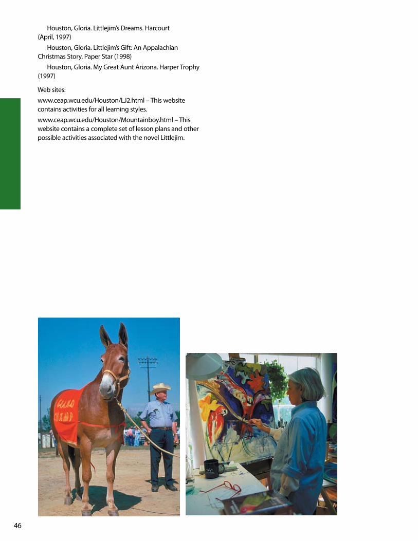
46
Houston, Gloria. littlejim’s Dreams. Harcourt (April, 1997)
Houston, Gloria. littlejim’s Gift: An Appalachian Christmas Story. Paper Star (1998)
Houston, Gloria. My Great Aunt Arizona. Harper Trophy (1997)
web sites:
www.ceap.wcu.edu/Houston/lJ2.html – This website contains activities for all learning styles.
www.ceap.wcu.edu/Houston/Mountainboy.html – This website contains a complete set of lesson plans and other possible activities associated with the novel littlejim.

47
lesson ObjectiveAfter researching the life of pioneers in the mountain region, small groups of students will deliver written and oral presentations to the class.
NCDPI Goals and Objectives:Social StudiesGoal 1 The learner will apply the five themes of
geography to North Carolina and its people.
1.04 Evaluate ways the people of North Carolina used, modified, and adapted to the physical environment, past and present.
language ArtsGoal 3 The learner will make connections through the use
of oral language, written language, and media and technology.
3.06 Conduct research for assigned projects or self-selected projects from a variety of sources through the use of technological and informal tools.
Pre-ActivitiesStudents will read and research the life of pioneers in the mountain region.
Students will discuss how the early settlers lived, worked and played.
Students will analyze the importance of the forest in the lives of the early settlers.
ActivitiesThe students will work in small groups to research the following information and report it to the entire class
1. Food – kinds of food and how it was obtained2. Homes – describe a typical pioneer home and the tools
used to build them3. Clothing – summer and winter clothing4. Occupations – men’s, women’s and children’s daily work5. Plants – those used for food, those used for medicine6. Animals – those used for food, those used for work
Each group will report their findings to the class and then each student will complete the graphic organizer using the information
AssessmentRubricStudents will work in small groups to research one of the above topics and prepare a written report 25 points
Each group will deliver an oral presentation 25 points
Students will correctly complete the graphic organizer handout 50 points
Extended ActivitiesStudents can research various tools used by the farmers of the 1800’s.
Students will work in small groups to design a diorama or poster illustrating pioneer life
Students will research various toys and games used by the pioneer children and present their findings to the class along with a demonstration.
Resourcesweb sites:
www.cowtown.net/users/oldtimer/toys.html
www.teachersfirst.com/summer/cornhusk.htm
www.amfolktoys.com
www.celebrate2000.augustchronicle.com/stories/ 111699/history.shtml
Pioneer life
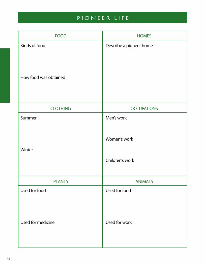
48
X X X X X X XPioneer life
FOOD HOMES
ClOTHING OCCuPATIONS
PlANTS ANIMAlS
kinds of food Describe a pioneer home
How food was obtained
Summer Men’s work
women’s work
winter Children’s work
used for food used for food
used for medicine used for work

49
lesson ObjectiveThe students will develop an understanding and appreciation for the life experiences of older relatives by conducting an interview, compiling the information and presenting it in an informative and comprehensive manner.
NCDPI Goals and ObjectivesSocial StudiesGoal 3 The learner will trace the history of colonization
in North Carolina and evaluate its significance for diverse people’s ideas.
3.04 Compare and contrast the ways in which people, goods, and ideas moved in the past with their movement today.
Goal 4 The learner will analyze social and political institutions in North Carolina such as government, religion, and family and how they structure society, influence behavior, and response to human needs.
4.01 Assess and evaluate the importance of regional diversity on the development of economic, social, and political institutions in North Carolina.
language ArtsGoal 3 The learner will make connections through the use
of oral language, written language, and media and technology.
3.06 Conduct research for assigned projects or self-directed projects from a variety of sources through the use of technological and informal tools.
Pre-ActivitiesStudents will discuss the information they researched about the pioneers of the mountain region and how their lives were so different.
The students will create a chart comparing life in the moun-tains in the early 1900’s and now.
The teacher will guide the students to begin thinking about an older relative or friend of the family they could interview.
ActivitiesEach student will receive a copy of interview questions to guide their interview with an older relative or friend of the family.
Students will be guided through this project with classroom assistance in presenting this information.
Each student will be required to present the research in both an oral and written presentation.
Materials• Interview guideline questions• Tape recorders• video cameras (If available)• Digital camera or instamatic camera (If available)
AssessmentRubricSelection of person to interview 15 points
Rough draft of interview questions and answers 25 points
Creative written presentation 10 points
Neat and informative written presentation 25 points
Creative oral presentation 25 points
THe good ol ’ days
50
This project includes an interview with your oldest living rel-ative that grew up in North Carolina. If you do not have a rel-ative, find a neighbor, family friend, or church member who is over the age of 60 and grew up in North Carolina. you will need to include the interview questions and responses in this project. After you have compiled the information you will need to write a biographical story about that person’s life. Be sure to include their name (if you ask permission) and why you chose them for the interview. Following are questions you need to use to conduct the interview:
1. what kind of music did you listen to?2. what kind of games and toys did you play with?3. what kind of food did you eat?4. what kind of houses did people live in?5. How big was your house?6. How many rooms did it have?7. How many people lived in your house?8. what careers did most people have?9. where were you born?10. what kind of work did you do when you were young-
er?11. what kind of clothes did you wear?12. How is today different from when you were my age?13. what kind of school did you go to?14. How many kids were in the class?
15. How did the kids behave and what were the punishments?
16. what kind of chores did you have to do?17. were there any special remedies your mother used for
cures?18. Do you remember any stories that were told to
you as a child (such as ghost stories, history legends, stories about famous people, tall tales, etc.)?
19. Do you have any hobbies or crafts?20. Does your family have any recipes that have been
handed down? If so, could you tell me about them? (if possible, get the recipe)
21. what kinds of transportation did people use?22. Is there anything else you can share that would help
us know what life was like when you were a kid?
you may wish to tape record or videotape the interview to help you write your paper. Also the tape would make a great memory someday!
This project will be counted as a Social Studies, writing, language, and Reading grade. Please make it something you will want to keep for the rest of your life. Hopefully this will be a learning experience you will treasure for a lifetime!
This project should be put together neatly. Presentation will affect your grade. your project is due _________________.
THe good ol ’ days

51
lesson ObjectiveThe students will make a clay model of a wetland to discover how they help filter silt and pollutants from water, prevent soil erosion, and reduce flood damage.
NCDPI Goals and ObjectivesScienceGoal 1 The learner will build an understanding of animal
growth and adaptation.
1.03 Evaluate living and nonliving things that affect animal life.
Communication ArtsGoal 3 The learner will make connections with text
through the use of oral language, written language, and media and technology.
3.06 Conduct research for assigned projects or self-selected projects from a variety of sources through the use of technological and informal tools.
Goal 4 The learner will apply strategies and skills to create oral, written, and visual texts.
4.05 use planning strategies to generate top-ics and organize ideas (e.g., brainstorming, mapping, webbing, reading, discussion).
4.06 Compose a draft that conveys major ideas and maintains focus on the topic with specific, relevant, supporting details by using preliminary plans.
4.10 use technology as a tool to gather, organize, and present information.
BackgroundMountain bogs are generally small (typically less than 5 acres), sometimes shrubby wetlands with saturated soils blanketed with hummocks of sphagnum moss. Bogs occur sporadically throughout the Mountains, although they may have once been larger and more common.
Mountain bogs are created when more water enters low areas than exits. Flat land below slopes is likely bog territory. Beavers may well have played an important role in forming mountain bogs, although fire grazing by native herd animals and clearing by Native Americans may have also been factors.
like many wetlands, bogs act as a filter system, helping to purify water supplies by absorbing pollutants from runoff. Floodwaters may also be slowed by some bogs, helping to control flooding. But it’s mostly as habitat for a variety of plants and animals, both common and rare.
Pre-ActivitiesBefore you begin the activity, make a demonstration model.
Materials• modeling clay • small piece of indoor/outdoor carpet• florist foam • jar of muddy water• roasting pans
Spread a layer of modeling clay in half of the roasting pan to represent land. Be sure to smooth the clay along the sides of the pan to seal the edges. leave the other half of the pan empty to represent a lake or other body of water. Shape the clay so that it gradually slopes down to the body of water. Cut a piece of indoor-outdoor carpet to com-pletely fill the space across the pan along the edge of the clay and the body of water. The carpeting represents the wetland buffer between dry land and open water.
watch the section of the Forest Heritage Byway video on Mountain bogs.
Ask the students to describe what a bog looks like and the types of plants and animal species found in a mountain bog.
ActivityActivity 1 – wetland ModelDemonstrate some of the functions of a wetland using the model. Explain that wetlands perform some very important functions, such as filtering pollutants, reducing flood dam-age, and preventing soil erosion. Explain that your model will demonstrate some of these functions.
Flood ControlSlowly pour some water on the land letting it run down the land, into the indoor-outdoor carpet, and eventually reach-ing the area for a body of water. Have the students describe what happens. (Some of the water is slowed down by the wetland, or carpeting. The excess slowly flows into the body of water.)
Remove the carpeting and water. Slowly pour the
soggy boTToM bogs
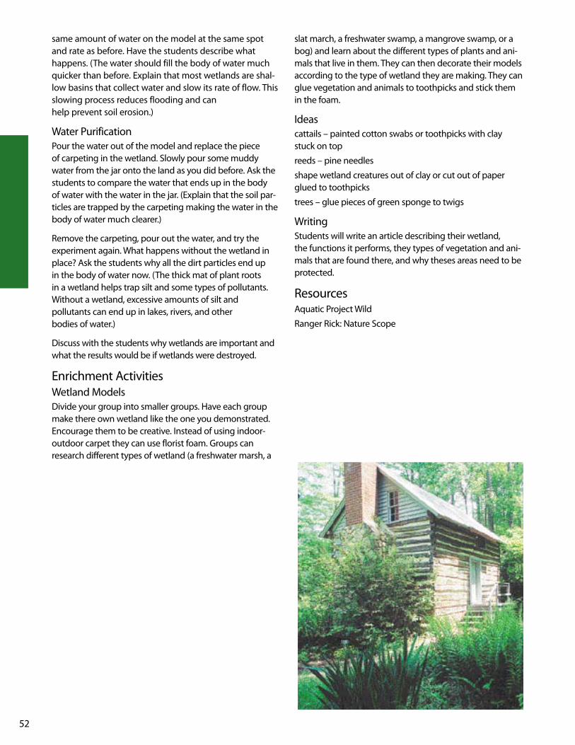
52
same amount of water on the model at the same spot and rate as before. Have the students describe what happens. (The water should fill the body of water much quicker than before. Explain that most wetlands are shal-low basins that collect water and slow its rate of flow. This slowing process reduces flooding and can help prevent soil erosion.)
water PurificationPour the water out of the model and replace the piece of carpeting in the wetland. Slowly pour some muddy water from the jar onto the land as you did before. Ask the students to compare the water that ends up in the body of water with the water in the jar. (Explain that the soil par-ticles are trapped by the carpeting making the water in the body of water much clearer.)
Remove the carpeting, pour out the water, and try the experiment again. what happens without the wetland in place? Ask the students why all the dirt particles end up in the body of water now. (The thick mat of plant roots in a wetland helps trap silt and some types of pollutants. without a wetland, excessive amounts of silt and pollutants can end up in lakes, rivers, and other bodies of water.)
Discuss with the students why wetlands are important and what the results would be if wetlands were destroyed.
Enrichment Activitieswetland ModelsDivide your group into smaller groups. Have each group make there own wetland like the one you demonstrated. Encourage them to be creative. Instead of using indoor-outdoor carpet they can use florist foam. Groups can research different types of wetland (a freshwater marsh, a
slat march, a freshwater swamp, a mangrove swamp, or a bog) and learn about the different types of plants and ani-mals that live in them. They can then decorate their models according to the type of wetland they are making. They can glue vegetation and animals to toothpicks and stick them in the foam.
Ideascattails – painted cotton swabs or toothpicks with clay stuck on top
reeds – pine needles
shape wetland creatures out of clay or cut out of paper glued to toothpicks
trees – glue pieces of green sponge to twigs
writingStudents will write an article describing their wetland, the functions it performs, they types of vegetation and ani-mals that are found there, and why theses areas need to be protected.
ResourcesAquatic Project wild
Ranger Rick: Nature Scope

53
lesson ObjectivesThe students will be able to write five facts about the regions’ history and how it still influences the life of its citizens. They will also be able to identify positive and nega-tive effects of logging in the 1800’s.
NCDPI Goals and ObjectivesSocial StudiesGoal 5 The learner will evaluate ways the people of North
Carolina use, modify and adapt to the physical environment.
5.01 Explain how North Carolinians in the past used, modified, or adapted to the physical environment.
5.03 Analyze causes and consequences of the misuse of the physical environment and pro-pose alternatives.
Goal 9 The learner will evaluate how North Carolinians use economic resources to satisfy their wants and needs.
9.01 Explain the relationship between unlimited wants and limited resources.
9.02 Analyze the choices and opportunity cost involved in economic decisions.
Goal 11 The learner will assess changes in ways of living over time and investigate why and how these changes occurred.
11.01 Identify and describe changes which have occurred in ways of living in North Carolina.
11.02 Distinguish among political, social, and eco-nomic changes.
Goal 12 The learner will trace developments in North Carolina history and describe their impact on the lives of people today.
12.02 Assess the influence of an important event from North Carolina's past on life today.
Pre-Activitiesview the Cradle of Forestry section of the Forest Heritage Byway video.
The students will locate the Forest Heritage Byway and Mount Pisgah on their individual maps and mark them.
Activity
Each student will be provided with the attached handout, “logging History in the 1800’s”. After reading the information, the class will discuss the history surrounding the region. They will become familiar with the geographic terrain, the life and occupation of its first settlers and how it still influences the life of its citizens today through classroom discussion. The class will then be divided into cooperative groups to complete the cause and effect chart. They will identify and evaluate at least seven effects of logging in the 1800’s. Following coopera-tive group activity, students will come back together as a class and discuss their answers and explain why the effects are positive or negative.
Examples of effects1. change in animal and plant habitat2. fire (lightning, sparks from machinery)3. erosion4. water (silting)5. aesthetic beauty6. able to meet national demands7. created economic growth for the area
AssessmentCorrectly identified effects 70 points (10 points each)
Evaluation of effects 14 points (2 points each)
worked cooperatively 16 points
100 points
ResourcesMcDaniel, lynda, Highroad Guide to the North Carolina
Mountains, longstreet, Atlanta Ga. 1998.
Buxton, Barry, The Great Forest, An Appalachian Story, Appalachian Consortium Press, 1985.
Cradle of Forestry Trail Guide, uSDA Forest Service, July 2001.
North Carolina, 4th grade textbook.
North Carolina Scenic Byways, NC Department of Transportation
TiMber!!
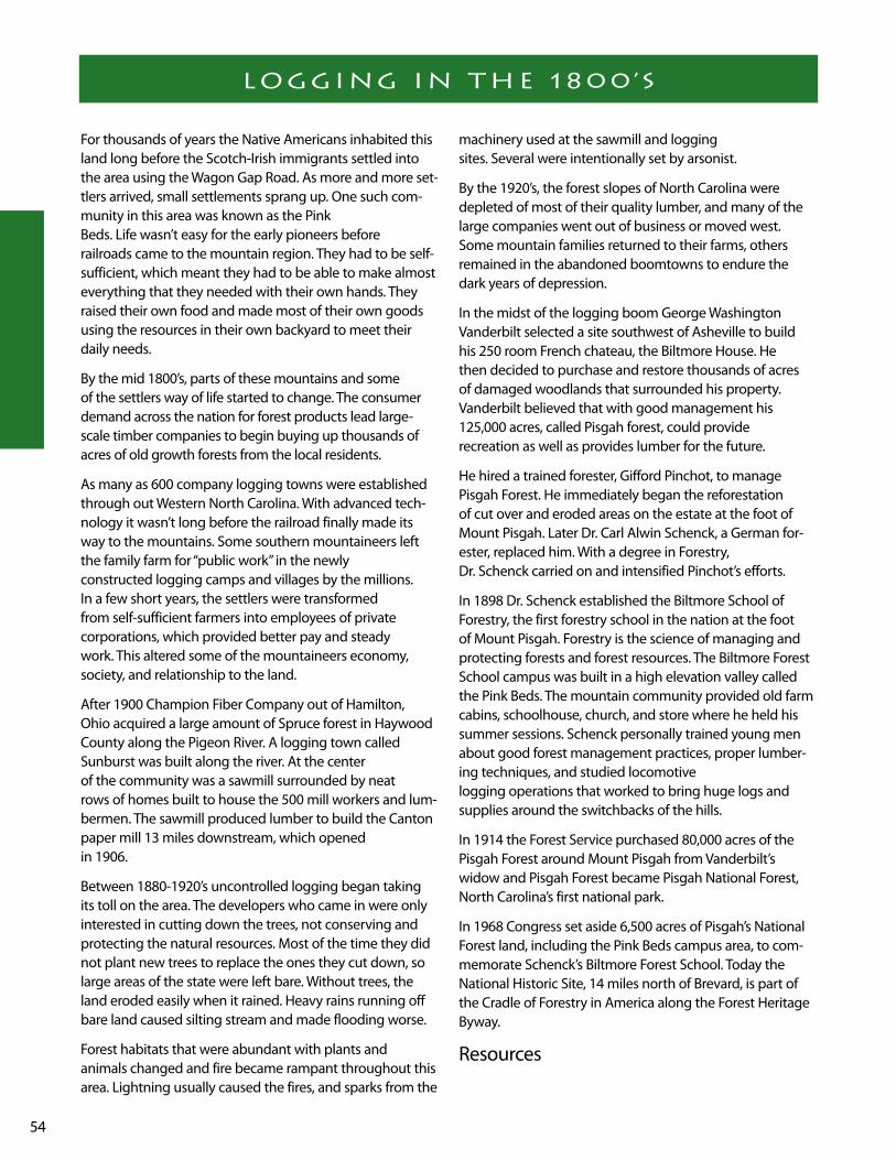
54
For thousands of years the Native Americans inhabited this land long before the Scotch-Irish immigrants settled into the area using the wagon Gap Road. As more and more set-tlers arrived, small settlements sprang up. One such com-munity in this area was known as the Pink Beds. life wasn’t easy for the early pioneers before railroads came to the mountain region. They had to be self-sufficient, which meant they had to be able to make almost everything that they needed with their own hands. They raised their own food and made most of their own goods using the resources in their own backyard to meet their daily needs.
By the mid 1800’s, parts of these mountains and some of the settlers way of life started to change. The consumer demand across the nation for forest products lead large-scale timber companies to begin buying up thousands of acres of old growth forests from the local residents.
As many as 600 company logging towns were established through out western North Carolina. with advanced tech-nology it wasn’t long before the railroad finally made its way to the mountains. Some southern mountaineers left the family farm for “public work” in the newly constructed logging camps and villages by the millions. In a few short years, the settlers were transformed from self-sufficient farmers into employees of private corporations, which provided better pay and steady work. This altered some of the mountaineers economy, society, and relationship to the land.
After 1900 Champion Fiber Company out of Hamilton, Ohio acquired a large amount of Spruce forest in Haywood County along the Pigeon River. A logging town called Sunburst was built along the river. At the center of the community was a sawmill surrounded by neat rows of homes built to house the 500 mill workers and lum-bermen. The sawmill produced lumber to build the Canton paper mill 13 miles downstream, which opened in 1906.
Between 1880-1920’s uncontrolled logging began taking its toll on the area. The developers who came in were only interested in cutting down the trees, not conserving and protecting the natural resources. Most of the time they did not plant new trees to replace the ones they cut down, so large areas of the state were left bare. without trees, the land eroded easily when it rained. Heavy rains running off bare land caused silting stream and made flooding worse.
Forest habitats that were abundant with plants and animals changed and fire became rampant throughout this area. lightning usually caused the fires, and sparks from the
machinery used at the sawmill and logging sites. Several were intentionally set by arsonist.
By the 1920’s, the forest slopes of North Carolina were depleted of most of their quality lumber, and many of the large companies went out of business or moved west. Some mountain families returned to their farms, others remained in the abandoned boomtowns to endure the dark years of depression.
In the midst of the logging boom George washington vanderbilt selected a site southwest of Asheville to build his 250 room French chateau, the Biltmore House. He then decided to purchase and restore thousands of acres of damaged woodlands that surrounded his property. vanderbilt believed that with good management his 125,000 acres, called Pisgah forest, could provide recreation as well as provides lumber for the future.
He hired a trained forester, Gifford Pinchot, to manage Pisgah Forest. He immediately began the reforestation of cut over and eroded areas on the estate at the foot of Mount Pisgah. later Dr. Carl Alwin Schenck, a German for-ester, replaced him. with a degree in Forestry, Dr. Schenck carried on and intensified Pinchot’s efforts.
In 1898 Dr. Schenck established the Biltmore School of Forestry, the first forestry school in the nation at the foot of Mount Pisgah. Forestry is the science of managing and protecting forests and forest resources. The Biltmore Forest School campus was built in a high elevation valley called the Pink Beds. The mountain community provided old farm cabins, schoolhouse, church, and store where he held his summer sessions. Schenck personally trained young men about good forest management practices, proper lumber-ing techniques, and studied locomotive logging operations that worked to bring huge logs and supplies around the switchbacks of the hills.
In 1914 the Forest Service purchased 80,000 acres of the Pisgah Forest around Mount Pisgah from vanderbilt’s widow and Pisgah Forest became Pisgah National Forest, North Carolina’s first national park.
In 1968 Congress set aside 6,500 acres of Pisgah’s National Forest land, including the Pink Beds campus area, to com-memorate Schenck’s Biltmore Forest School. Today the National Historic Site, 14 miles north of Brevard, is part of the Cradle of Forestry in America along the Forest Heritage Byway.
Resources
logging in THe 1800’s

55
McDaniel, lynda, Highroad Guide to the North Carolina Mountains, longstreet, Atlanta Ga. 1998.
Buxton, Barry, The Great Forest, An Appalachian Story, Appalachian Consortium Press, 1985.
Cradle of Forestry Trail Guide, uSDA Forest Service, July 2001.
North Carolina, 4th grade textbook.
North Carolina Scenic Byways, NC Department of Transportation
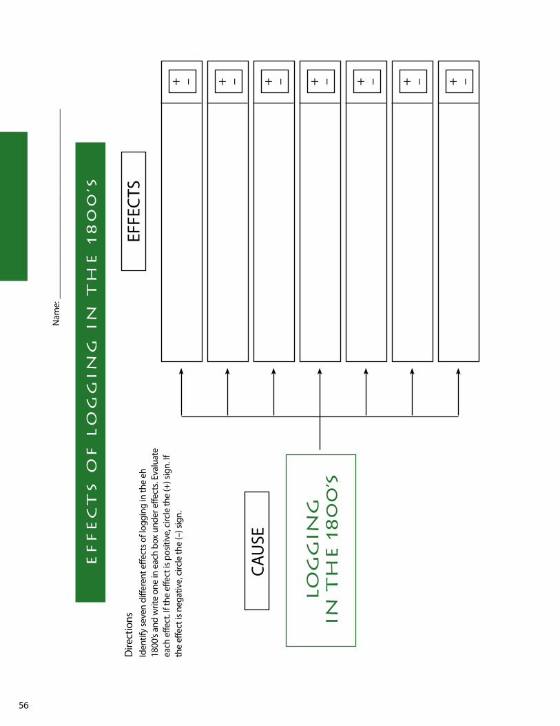
56
ef
fe
cT
s o
f l
og
gin
g i
n T
He
18
00
’s
Nam
e: _
____
____
____
____
____
____
____
____
____
____
_
Dire
ctio
nsId
entif
y se
ven
diffe
rent
effe
cts o
f log
ging
in th
e eh
18
00’s
and
writ
e on
e in
eac
h bo
x un
der e
ffect
s. Ev
alua
te
each
effe
ct. I
f the
effe
ct is
pos
itive
, circ
le th
e (+
) sig
n. If
th
e ef
fect
is n
egat
ive,
circ
le th
e (–
) sig
n.
CAu
SE
EFFE
CTS
lo
gg
ing
in
TH
e 1
80
0’s
+ – + – + – + – + – + – + –

57
lesson ObjectivesThe students will examine various products and realize that all parts of a tree are important in making the products we use everyday.
NCDPI Goals and ObjectivesSocial StudiesGoal 5 The learner will evaluate ways the people of North
Carolina use, modify and adapt to the physical environment.
5.02 Describe how North Carolinians now use, modify, or adapt to their physical environment.
Goal 9 The learner will evaluate how North Carolinians use economic resources to satisfy their wants and needs.
9.03 Categorize the state's resources as natural, human, or capital.
Communication ArtsGoal 4 The learner will apply strategies and skills to
create oral, written, and visual texts.
4.10 use technology as a tool to gather, organize, and present information.
Background144,100 North Carolinians work in the forest products industry with an annual payroll of $3 billion. Forestry is the second leading manufacturing industry in North Carolina. It leads the nation in furniture, hardwood veneer and plywood production, and is second in the production of hardwood pulpwood.
Activity Activity 1 (where did it come from?)Before doing this activity, collect as many different items as you can that come from trees, and some that don’t. Place them around the room. Some examples might include:
toothpicks piece of furniture glass jar
cardboard box baseball bat book
tissue paper chocolate bar with almonds
plastic comb toothpaste
rubber gloves pack of chewing gum
Divide the class into small groups. Each group will decide which items come from trees. All members have to agree on the decision. Once they agree, they will make a list of the items made from trees and they must be able to explain why each product is on their list.
After completing their list, have each group discuss
their conclusions.
Activity 2 (Goods from the woods)The students will complete the “Goods From the woods” handout by researching goods that come from different parts of the tree using NC Forestry web site www.ncfor-estry.org/docs/Products/goods.htm
Activity 3After completing the “Good from the woods” activity, ask the students to reevaluate their answers from activity.
If they would like to change any of their answers they can. Again all members of the group must agree. Discuss their conclusions. The students should come to realize that all the products displayed in the class came from a tree.
Assessment3 points for each correct answer 72 points
time on task and following directions 28 points
100 points
Extension ActivitiesMaking PaperThe students will make paper using the instructions atwww.ncforestry.org/docs/Resources%20Materials/ papermaking.htm
Materials needed for a class of 20 working in small groups of four.
Makes 5 runs.
• 4-inch by 6-inch piece of wire window screen (cover edges with duct tape) one large tub (large enough to hold about 2 gallons of and dip the screen in)
• 1 quart of liquid household laundry starch• two to three roles of automotive workshop towels to use
as blotting paper• two to three roles of paper towels• construction paper ( _ to _ 8 x10 sheet per run)• small brown paper bags ( _ bag per run)• a rolling pin• a blender• water• a smooth flat surface where the paper can lay flat
to dry
wHere did iT coMe froM?
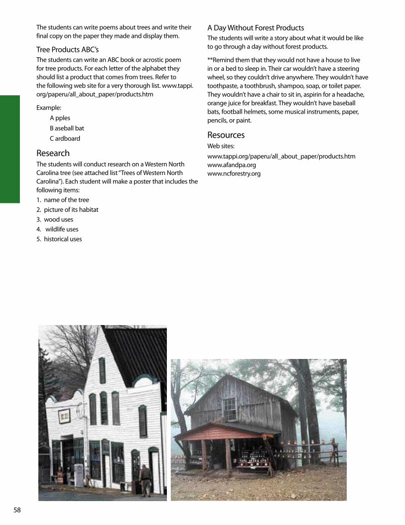
58
A Day without Forest ProductsThe students will write a story about what it would be like to go through a day without forest products.
**Remind them that they would not have a house to live in or a bed to sleep in. Their car wouldn’t have a steering wheel, so they couldn’t drive anywhere. They wouldn’t have toothpaste, a toothbrush, shampoo, soap, or toilet paper. They wouldn’t have a chair to sit in, aspirin for a headache, orange juice for breakfast. They wouldn’t have baseball bats, football helmets, some musical instruments, paper, pencils, or paint.
Resourcesweb sites:
www.tappi.org/paperu/all_about_paper/products.htmwww.afandpa.orgwww.ncforestry.org
The students can write poems about trees and write their final copy on the paper they made and display them.
Tree Products ABC’sThe students can write an ABC book or acrostic poem for tree products. For each letter of the alphabet they should list a product that comes from trees. Refer to the following web site for a very thorough list. www.tappi.org/paperu/all_about_paper/products.htm
Example:
A pples
B aseball bat
C ardboard
ResearchThe students will conduct research on a western North Carolina tree (see attached list “Trees of western North Carolina”). Each student will make a poster that includes the following items:1. name of the tree2. picture of its habitat3. wood uses4. wildlife uses5. historical uses

59
go
od
s f
ro
M T
He
wo
od
s
Nam
e: _
____
____
____
____
____
____
____
____
____
____
_
Frui
ts &
N
uts
Folia
geBr
anch
esTr
unk
Gum
sBa
rkSt
umps
Root
s
Dire
ctio
nsu
sing
the
web
site
ww
w.n
cfor
estr
y.org
/doc
s/Pr
oduc
ts/g
oods
.htm
, writ
e th
e na
mes
of t
hree
goo
ds th
at c
ome
from
eac
h pa
rt o
f a tr
ee.

60
Tr
ee
s o
f w
es
Te
rn
no
rT
H c
ar
ol
in
a
Pine
ea
ster
n w
hite
pin
e vi
rgin
ia p
ine
tabl
e-m
ount
ain
pine
pitc
h pi
ne
east
ern
hem
lock
re
d sp
ruce
shor
tleaf
pin
e fra
ser f
ir ea
ster
n re
dced
ar
Har
dwoo
ds
flo
wer
ing
dogw
ood
bitt
ernu
t hic
kory
no
rthe
rn re
d oa
ksu
gar m
aple
m
ocke
rnut
hic
kory
sc
arle
t oak
boxe
lder
sh
agba
rk h
icko
ry
sout
hern
red
oak
red
map
le
pign
ut h
icko
ry
blac
k oa
kw
hite
ash
sa
ssaf
ras
whi
te o
akgr
een
ash
red
mul
berr
y ch
estn
ut o
akye
llow
buc
keye
Am
eric
an sy
cam
ore
post
oak
blac
k w
alnu
t ye
llow
pop
ar
chin
kapi
n oa
kbl
ack
cher
ry
cucu
mbe
r tre
e sw
eet b
irch
Amer
ican
bee
ch
com
mon
per
simm
on
yello
w b
irch
Amer
ican
elm
bl
ack
tupe
lo
blac
k w
illow
slipp
ery
elm
Am
eric
an h
olly
w
hite
bas
swoo
dso
urw
ood
Caro
lina
silve
rbel
l se
rvic
eber
ry

lesson PlansNORTH DuRHAM COuNTRy BywAy 62Mounds Away 63There’s No Place like Home 65Imagine That! 67Slave Days 75POTTERy ROAD SCENIC BywAy 77what’s In A Name? 78It’s Just a Family Tradition 79wEyMOuTH wOODS SANDHIllS NATuRE PRESERvE 81weymouth woods 82Riding On the Plank 84Made In the uSA 86uHwARRIE SCENIC ROAD 88The uhwarries Are Alive with the Sound of Bluegrass 89
Holiday Plantation Style 91
p i e d m o n t r e g i o n

62
while Durham is famous as the home of Research Triangle Park, Duke and North Carolina Central universities, Durham is also known for its beautiful countryside, waterways and historic plantation farmlands. This byway meanders in and out of the back country roads just north of the city of Durham. Travel this byway to glimpse Durham's beautiful countryside, waterways, and historic plantation farmlands.
The backroads of Durham County explore the history of the southern gentry as well as the history of the slave in places like Stagville and Fairntosh plantations.
norTH durHaM counTry byway
Nature and wildlife are thriving in the Hill Demonstration Forest. An alternate route for the byway goes through this area where travelers will have a chance to see birds and lush vegetation.
Today, a variety of African-American history studies are conducted at Stagville Plantation, once among the largest plantation holdings in the south.
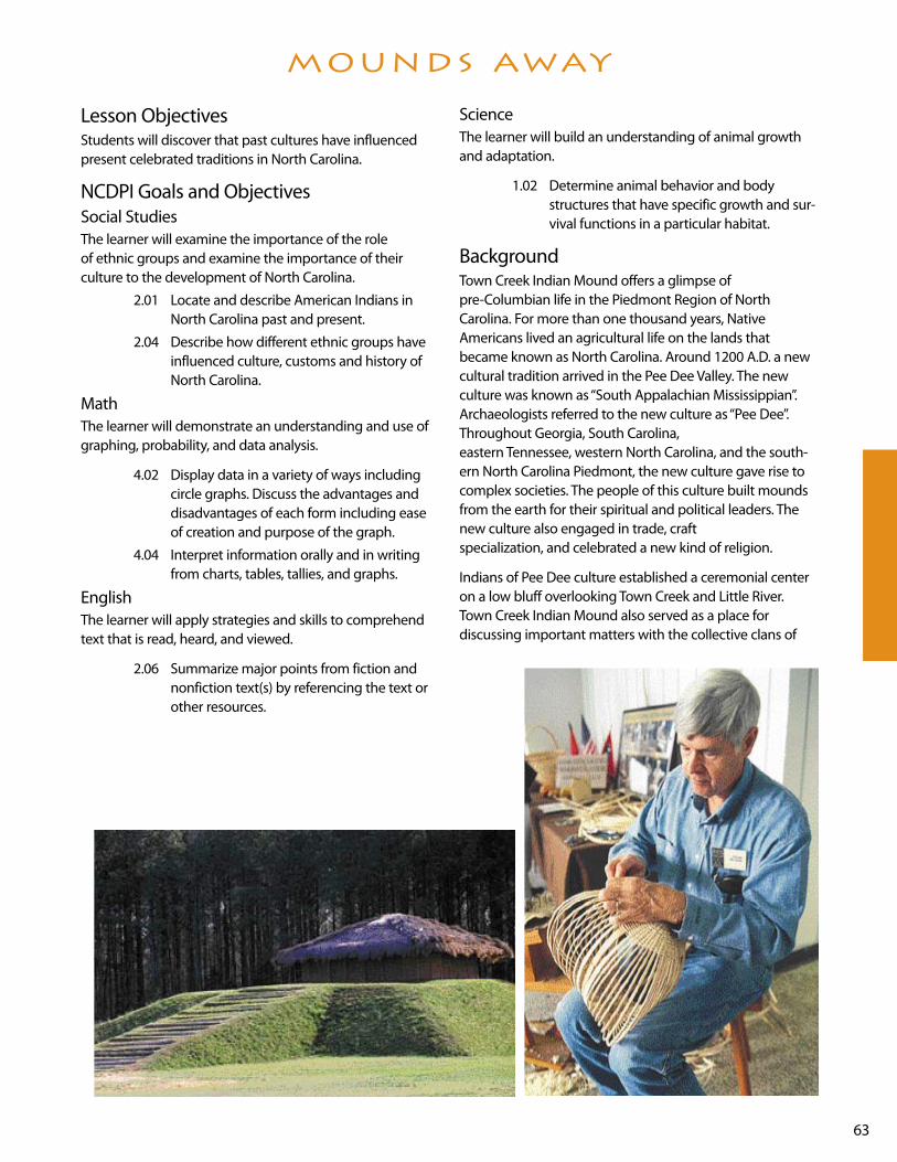
63
lesson ObjectivesStudents will discover that past cultures have influenced present celebrated traditions in North Carolina.
NCDPI Goals and ObjectivesSocial StudiesThe learner will examine the importance of the role of ethnic groups and examine the importance of their culture to the development of North Carolina.
2.01 locate and describe American Indians in North Carolina past and present.
2.04 Describe how different ethnic groups have influenced culture, customs and history of North Carolina.
MathThe learner will demonstrate an understanding and use of graphing, probability, and data analysis.
4.02 Display data in a variety of ways including circle graphs. Discuss the advantages and disadvantages of each form including ease of creation and purpose of the graph.
4.04 Interpret information orally and in writing from charts, tables, tallies, and graphs.
EnglishThe learner will apply strategies and skills to comprehend text that is read, heard, and viewed.
2.06 Summarize major points from fiction and nonfiction text(s) by referencing the text or other resources.
ScienceThe learner will build an understanding of animal growth and adaptation.
1.02 Determine animal behavior and body structures that have specific growth and sur-vival functions in a particular habitat.
Background Town Creek Indian Mound offers a glimpse of pre-Columbian life in the Piedmont Region of North Carolina. For more than one thousand years, Native Americans lived an agricultural life on the lands that became known as North Carolina. Around 1200 A.D. a new cultural tradition arrived in the Pee Dee valley. The new culture was known as “South Appalachian Mississippian”. Archaeologists referred to the new culture as “Pee Dee”. Throughout Georgia, South Carolina, eastern Tennessee, western North Carolina, and the south-ern North Carolina Piedmont, the new culture gave rise to complex societies. The people of this culture built mounds from the earth for their spiritual and political leaders. The new culture also engaged in trade, craft specialization, and celebrated a new kind of religion.
Indians of Pee Dee culture established a ceremonial center on a low bluff overlooking Town Creek and little River. Town Creek Indian Mound also served as a place for discussing important matters with the collective clans of
Mounds away

64
the tribe. It was the place where religious ceremonies and feasts took place. Many of the high-ranking members of the Pee Dee Indian tribe lived, died, and were buried in Town Creek Indian Mound.
Town Creek Indian Mound served as a ceremonial center. An important ceremony called “the busk” was held at Town Creek Indian Mound. During busk, houses were cleaned and the temple and grounds repaired. All fires were extin-guished and all debts were resolved. People came to the ceremony for rituals of purification, fasting, scratching the body with garfish teeth, and taking healing medicines. Everyone prepared to begin the new year with the eating of new corn at the conclusion of busk. At the end of busk, people returned to their villages carrying embers from the sacred fire which they used to relight the hearths of their homes.
Pre-ActivityMake a copy of the background information for the class. Read the information with the class. Ask students if the cel-ebration of “busk” remind them of a holiday they celebrate. On the board write New year's Day and Busk. using the information from the handout have students list things that happened during that time frame. under New year's Day list some things that you know people do to begin the new year.
Activity1
Have students interview an older adult in their home or neighborhood about things they did at the beginning of a new year. Assign students into groups of four. Have stu-dents share their information. were any of the responses similar? Create a class circle or bar graph to show their finding.
ResourcesNorth Carolina Scenic Byways
Time Before History: The Archaeology of North Carolina by H. Trawick ward and R. P. Stephen Davis Jr.

65
lesson ObjectivesThe students will discover why the zoo is located in the Piedmont Region of North Carolina.
NCDPI Goals and ObjectivesSocial StudiesThe learner will apply the five themes of geography to North Carolina and its people.
1.02 Describe and compare the physical and cultural characteristics of the regions.
1.03 Suggest some influences that the location has on life in North Carolina such as major cities, recreation areas, industry, and farms.
English language ArtsThe learner will make connections with text through the use of oral language, written language, and media and technology.
3.06 Conduct research for assigned projects or self selected projects (with assistance) from a variety of sources through the use of tech-nological and informal tools (e.g., print and non-print texts artifacts, people libraries, databases, computer networks.
The learner will apply strategies and skills to create oral, written and visual texts.
4.02 use oral and written language to: • present information and ideas in a clear,
concise manner • discuss • interview • solve problems • make decisions
4.03 Make an oral and written presentation using visual aids with an awareness of purpose and audience.
4.05 use planning strategies to generate topics and organize ideas (e.g., brainstorming map-ping webbing, reading, discussion).
4.07 Compose fiction, nonfiction, poetry, and drama using self-selected and assigned top-ics and forms (e.g., personal and imaginative narratives, research reports, dia-ries, journals, logs, rules, instructions).
BackgroundThe North Carolina Zoological Park has more than 500 acres in its African and North American continental regions. It is found in the wooded terrain in the ancient uwharrie Mountains of central North Carolina. It is a place of wonder and discovery. It is the country’s largest walk through natu-ral habitat zoo. The animals and plants are seen in settings that closely resemble the habitats in which they would live in the wild.
The zoo has approximately five miles of trails in its two continental regions. The zoo has nearly 1,000 additional acres that can be used for future expansions and improve-ments. Some of the Zoo’s more popular animal attractions are its polar bears, seals, sea lion, seabirds, river otters, bison, elk, alligators, elephants, rhinoceros, chimpanzees, baboons, gorillas, giraffes, zebras, ostriches and tropical birds. There are dozens of other spe-cies as well. There are numerous indoor exhibits, including the Sonora Desert, the African Pavilion, the R. J. Reynolds Forest Aviary and Streamside.
Pre-ActivitiesAsk how many students have ever been to a zoo. lead stu-dents in a discussion about their likes and dislikes about the zoo. Ask them what would make the zoo a better place to visit. list responses on chart paper.
write the word habitat on the board. Give each student a small index card. Instruct students to write the name of an animal on the card. Then tell students to draw the animal’s habitat. For students who are not sure what a habitat is lead them to a conclusion without actually telling them. when this activity is finished write the following statement on a large piece of chart paper: A habitat is… list responses and then tape the index cards around the responses.
Divide the class in groups of four. Tell students that they will be given 3 questions to discuss as a group. They will need to select one person to share their answers with the class.
Question 1 – How do you think the zoo benefits/helps North Carolina economically?
Question 2 – why do you think the zoo is in the piedmont region?
Question 3 – why would the mountains and coastal plains not be conducive for a zoo?
Allow students to share/discuss as a class.
THere ’s no Place like HoMe

66
ActivityThe zoo has an additional 1000 acres of land that can be developed. Students are to develop part of that land for a native North Carolina habitat site.
• with a partner, students will research native North Carolina animals. Refer to “Home Sweet Home” activity in mountain section of this notebook for ideas.
• Once students have selected an animal they are to research the animal to find out the following information:
A. lifespan
B. habitat
C. food
D. How much space should this animal have?
E. Has this animal ever been held in captivity?
F. what kind of other animals could possibly live in the same area with it?
G. Is your animal a carnivore, herbivore, or omnivore
H. who are the animal’s enemies?
• when all information has been gathered students are to make/draw (poster, diorama, etc.) a model of the new exhibit for zoo.
• Along with the model students should also write a brief description. It should include the information they researched.
• Students should have an opportunity to present their exhibit.
Poetry Boxes – Students will create a habitat for a zoo animal and experiment with short rhyming poetry. Before starting this project have students bring in a shoebox.
• Ask students to begin by selecting an animal from the zoo. Then have students research the animal’s habitat. Once the research is finished have students draw a
detailed plan of the habitat. As students work on their plans, tell them to leave space to insert a poem.
• Once students’ plans are complete invite them to gather the materials they feel are necessary to make and deco-rate the inside of their shoeboxes. Remind students to use the plan to guide them in decorating the shoebox. Make sure they leave a small place to insert their poem.
• Introduce students to Quatrains. Explain to them that this style is a rhyming poem. Quatrains can have two possible patterns: abba, the first and fourth lines rhyme with each other, as do the second and third lines. with abab, the first and third lines form a rhyming pair, as do the second and fourth lines.
• Once you’ve introduced students to the patterns, model writing a quatrain. Then invite students to help you write a class quatrain. when student are fairly comfortable with writing quatrains have them study the habitats they made. Students should write a draft and share with a partner. Remind students to follow one of the patterns. Make sure you read all poems before students start their final copy (you will serve as the editor).
• Have students make small frames using construction paper to fit around their poems.
• Once students have glued their poems into their boxes have them share their projects and poetry with the class.
• Find a place to display the poetry boxes.
ResourcesNorth Carolina Scenic Byways
web sites:
www.nczoo.org
www.byways.org

67
lesson Objectives Students will learn the importance Bennett Place had during the Civil war in North Carolina.
NCDPI Goals and ObjectivesSocial Studies 3.02 Identify people, symbols, events, and
documents associated with North Carolina History.
English language ArtsThe learner will apply strategies and skills to comprehend text that is read, heard and viewed.
2.02 Interact with text before during and after reading, listening and viewing by:
• setting a purpose using prior knowledge and text information
• making predictions
• formulating questions
• locating relevant information
• making connections with previous experiences, information and ideas
2.06 Summarize major points from fiction and nonfiction text(s) to clarify and retain information and ideas consistent with purpose.
The learner will make connections with text through the use of oral language, written language, and media and technology.
3.06 Conduct research for assigned projects or self-selected projects (with assistance) from a variety of sources through the use of tech-nological and informal tools (e.g., print and non-print texts artifacts, people libraries, databases, computer networks).
The learner will apply strategies and skills to create oral, written, and visual texts.
4.02 use oral and written language to:
• present information and ideas in a clear, concise manner
• discuss
• interview
• solve problems
• make decisions
4.09 Produce work that follows the conventions of particular genres.
BackgroundIn 1846 at age forty, James Bennett, his wife Nancy, and their three children settled on a 325-acre farm in Orange County. The family cultivated corn, wheat, oats, and potatoes, and raised hogs. Bennett was also a tailor, cobbler, and sold horse feed, tobacco plugs, and distilled liquor.
In April 1865, two battle-weary adversaries, Joseph E. Johnston and william T. Sherman, met under a flag of truce to discuss a peaceful solution to a tragic Civil war. The gen-erals and their escorts met midway between their lines on the Hillsborough Road, seven miles from Durham Station. Needing a place for a conference, Johnston suggested a simple farmhouse a short distance away. On three separate occasions the union and Confederate generals struggled to achieve equitable terms for surrender at the home of James and Nancy Bennett. On April 26, the Bennett dwell-ing became the site of the largest troop surrender of the Civil war.
In 1921, a fire destroyed the farmhouse and kitchen; only the stone chimney survived. The present buildings were carefully reconstructed in the 1960s using Civil war sketches and early photographs as a guide. The simple farm dwelling and log kitchen convey what life was like during a tragic period in our nation’s history. A modern visitor cen-ter with exhibits and an audiovisual program help tell the Bennett Place story.
Pre-ActivityShow student a map of the North Country Byway. Point out number 38 on the map. Tell students that this historic site is known as the famous “Bennett Place”. Tell students that the largest troop surrender of the Civil war was made at Bennett Place. Ask students what they know about the Civil war. list their responses. If it is clear to you that they don’t know about the Civil war then check with the Media Specialist for a suggested title that is leveled appropriately to read to students.
ActivityShow students the cover of the book Pink and Say by Patricia Polacco (try to get multiple copies of this text to have for other activities) and then ask them to discuss with a person close to them what they think the book is about. Give each student a sheet of notebook paper. Tell them to write what they think the book is going to be about (make a prediction). Allow students to share their prediction with a partner. Then read the first page of the text. Ask students if anyone wants to change their pre-diction. If so allow students time to write their new predic-
iMagine THaT!

68
tion. Now read the last page of the text. Ask students if they want to make changes to their second prediction. If so allow students time to do so. Collect papers and save until the book is finished. Before reading set the purpose with the following question: listen to find out how Pink and Say meet, how old they are, and what happens to the boys at the end of the story. Read the text. when fin-ished discuss the question above.
Tell students that they will have an Independent Contract for the activities for the rest of this lesson. Pass out the contract. Go over the directions for each activity. Model the activities if necessary. Allow your students to help you decide how long they should have to complete the assign-ments on the contract.
Resources North Carolina Scenic Byways by North Carolina
Department of Transportation
Pink and Say by Patricia Palocca
web sites:
www.ah.dcr.state.nc.us/sections/hs/Bennett/mzapril.htm
www.byways.org
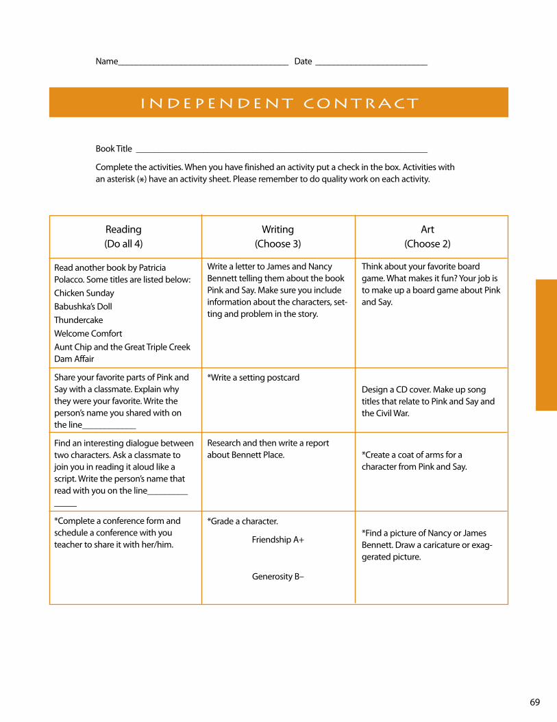
69
Book Title _________________________________________________________________
Complete the activities. when you have finished an activity put a check in the box. Activities with an asterisk (*) have an activity sheet. Please remember to do quality work on each activity.
indePendenT conTracT
Name ______________________________________ Date _________________________
Reading writing Art (Do all 4) (Choose 3) (Choose 2)
Read another book by Patricia Polacco. Some titles are listed below:Chicken SundayBabushka’s DollThundercakewelcome ComfortAunt Chip and the Great Triple Creek Dam Affair
Share your favorite parts of Pink and Say with a classmate. Explain why they were your favorite. write the person’s name you shared with on the line____________
Find an interesting dialogue between two characters. Ask a classmate to join you in reading it aloud like a script. write the person’s name that read with you on the line______________
*Complete a conference form and schedule a conference with you teacher to share it with her/him.
write a letter to James and Nancy Bennett telling them about the book Pink and Say. Make sure you include information about the characters, set-ting and problem in the story.
*write a setting postcard
Research and then write a report about Bennett Place.
*Grade a character.
Friendship A+
Generosity B–
Think about your favorite board game. what makes it fun? your job is to make up a board game about Pink and Say.
Design a CD cover. Make up song titles that relate to Pink and Say and the Civil war.
*Create a coat of arms for a character from Pink and Say.
*Find a picture of Nancy or James Bennett. Draw a caricature or exag-gerated picture.

70
Name ______________________________________ Date _________________________
Book Title _________________________________________________________________
seTTing PosTcard
Imagine that you are visiting an important setting in the story. write a postcard to a friend describ-ing the place. Make sure you tell what it looks like and what there is to do there. Fill in the postcard below, cut it out, draw a picture on the setting on the back.
__________________________________________
__________________________________________
__________________________________________
__________________________________________
__________________________________________
__________________________________________
__________________________________________
__________________________________________
__________________________________________
___________________________
___________________________
___________________________
___________________________
71
Name ______________________________________ Date _________________________
Book Title _________________________________________________________________
cHaracTer coaT of arMs
Design a coat of arms for a character in your book. In each section of the shield below draw a pic-ture that shows something about the character.

72
Name ______________________________________ Date _________________________
Book Title _________________________________________________________________
caricaTure
A caricature is a cartoon-like drawing that exaggerates the features and expression. It often includes a few objects that tell about the person. Draw your caricature below or you may ask the teacher for a larger piece of paper. underneath the drawing write the name of the person and describe your caricature. what part of that character did you exaggerate and why? Does this exag-geration show anything about this persons' character?

73
Name ______________________________________ Date _________________________
Book Title _________________________________________________________________
conference forM
write responses to the following questions. Make sure your responses are in complete sentences unless stated otherwise. Be prepared to discuss your answers at your teacher conference. Bring a copy of the book, your completed activities, and this form to the conference.
1. who do you think is the most interesting character? why?
2. what was the most difficult part of the book? what questions do you have about it?
3. Choose a favorite part to share at the conference. write the page number and explain why you like this part.
4. what is the main idea of this book?
Teacher Notes:

74
Name ______________________________________ Date _________________________
Book Title _________________________________________________________________
grading a cHaracTer
Choose a character from Pink and Say. Characters often have strengths and weaknesses. Give the character a grade (A, B, C, D, F) for each category. Beside the grade explain why you gave that grade and provide an example to support your explanation.
Character’s Name ___________________________________________________________
Category Grade Explanation and Examples
Responsibility
Thoughtfulness
Friendship
Generosity
Sense of Humor
Problem Solving
Compassion

75
lesson ObjectivesStudents will discover that we all have family traditions, some of which have greatly impacted the history of North Carolina.
NCDPI Goals and ObjectivesThe learner will examine the importance African Americans played in the development of North Carolina.
Social Studies 2.04 Describe how different ethnic groups have
influenced culture, custom, and history of North Carolina.
The learner will examine the impact of various cultural groups in North Carolina.
5.01 Explain different celebrated holidays, special days, and cultural traditions in North Carolina communities.
English language ArtsThe learner will apply strategies and skills to comprehend text that is read, heard, and viewed.
2.02 Interact with the text before, during, and after reading, listening and viewing by:
• setting a purpose using prior knowledge and text information.
• making predictions.
• formulating questions.
• locating relevant information.
• making connections with previous experiences, information, and ideas.
The learner will apply strategies and skills to create oral, written, and visual texts.
4.03 Make oral and written presentations using visuals aids with an awareness of purpose and audience.
The learner will apply grammar and language conventions to communicate effectively.
5.04 Compose multiple paragraphs with:
• topic sentence.
• specific and relevant details.
• logical progression and movement of ideas.
• coherence.
• elaboration.
• concluding statement related to the topic.
BackgroundThe slaves who were brought to America, and whose descendants were owned at Stagville were of west African origin. They were united by certain common beliefs but came from many different cultures. As the slaves increased in numbers they formed communities and combined vari-ous cultural remnants from Africa into a new viable African American culture. Examples of that culture have been found at Stagville. Scholars believe that a walking cane found at Stagville reflects the secret religious practices of slaves. The cane could have either placed a curse on its occupants or provided a blessing. Divining sticks (fork shaped objects) were also found in a slave house and were believed to be part of a west African practice of ensuring that the guardian spirit that protected the home would not be forgotten when the family moved to a new dwelling. Cowrie shells were also found in slave homes. These shells were used as money, clothing, decorations, hair ornaments, and in religious practices.
During the day, the lives of the slaves were filled with hard labor. They worked from sunrise to sunset. The night was left for the cultivation of the slave community. The slave com-munity educated its children to their cultural traditions. They also grew small vegetable plots, told stories, washed and cleaned their cabins, cared for family members, hunted and fished, engaged in athletic events, and formed groups to discuss their response to slavery.
Slave children were protected from the knowledge of their status in life for as long as parents could avoid the subject. Parents taught their children to be self-reliant and worked hard to prevent their children from internalizing that they were inferior. Slaves were constantly trying to make their conditions better. Slaves owned by mean masters wished for kinder masters, and slaves who had kinder masters wished to be free.
Pre-ActivitiesStudents will identify west Africa on a world map.
Divide class into sets of A and B. using A/B partners have students discuss the positive and negatives effects of moving to a new city/town or going to a new school. Explain to students that historically some minority groups were forced to move from one place to another without any say about it. Despite this, these groups of people still took their heritage and culture with them.
slave days

76
Activitieswrite the word traditions on the board. Ask students to discuss with a partner what they think a tradition is. list responses. Define traditions as: the handing down of customs, ideas, and beliefs from one generation to the next. Model with personal experiences. Have students make a list of some of their family traditions. Then have students to circle their favorite and write it on an index cards. As a group, share these family traditions
Review what a paragraph is. Then model writing a paragraph about your chosen tradition. Before students write their own paragraph(s) allow them to talk about their favorite tradition with a partner. when finished give them adequate time to write. Have students draw a detailed pic-ture to illustrate their paragraph(s). On subsequent days allow students to share their paragraphs.
Remind students that although slaves worked for their mas-ters and tried to educate their children about their customs and traditions the thing they longed for the most was to be free. Read under the Quilt of Night by Deborah Hopkinson. Set the purpose for reading with the following: listen to find out how the quilt helps the young slave girl and her family. when the story is finished have students discuss how the quilt helped. Also allow students share their favorite part of the story.
Inform students that over the next several days they will be going to the Media Center to research traditions that African-Americans brought to the piedmont region of North Carolina. They are to find at least two traditions and explain how these traditions have impacted life in North Carolina. Students will select a form of presenting informa-tion to the class such as Power Point, poster board, music, video, photographs, etc.
Resourcesunder the Quilt of Night by Deborah Hopkinson
North Carolina Scenic Byways
web sites:
www.byways.org
www.wsfcs.k12.nc/NCAFAM/Ben.html
www.ah.dcr.state.nc.us/sections/do/stagvill/maps.html
www.historicstagvillefoundation.org/civilwar.html

77
A trip down the Pottery Road Scenic Byway will expose you to many interesting things about the Piedmont of North Carolina. From Seagrove to Eagle Springs along highway 705, you can see a true picture of what life is like in the rural part of the piedmont of our state.
This byway begins at Seagrove, North Carolina. This town is known for The North Carolina Pottery Center. The north-west corner of Moore County is home to a group of people who really enjoy making pottery. Their ancestors came to Moore County from England in the 18th century. Today people from all over the world come to this little town to buy pottery made from North Carolina “clay”.
The town of whynot got its name because the people could not decide on a name for the Post Office. After saying “why not?” so many times, someone finally said, “let’s just call it whynot!”
The muddy clay soil along highway 705 was the reason the early settlers built a plank road. They made the road to transport their farm products to the railroads. There was an abundance of pine trees in the piedmont, so the settlers sawed the trees into planks and made the longest plank road in the world. The plank road has long since disap-peared, but we do have pictures of the Fayetteville and western Plank Road.
Robbins is a town named after the owner of a textile mill. The piedmont’s fast moving streams made it a good place to build textile mills. During the early 20th century many textile mills produced threads and fabrics for people all over the world. Today the textile mills of the piedmont have fallen on hard times. As you travel over the Pottery Road Scenic Byway, you may see empty buildings that were once thriving textile mills.
They stand as monuments to the important role textiles played in North Carolina’s history.
Pottery Road Scenic Byway ends near beautiful Pinehurst. weymouth woods Nature Preserve is located nearby. The last natural stand of long-leaf pines is located here. This was the first natural area to be brought into the state park sys-tem. There are many interesting things to see and do in the Pinehurst area.
A trip down Pottery Road Scenic Byway will lead you to enjoy the rich heritage of the people who live in the piedmont of our state. you will also enjoy the beautiful roll-ing hills and valleys of Moore and Randolph Counties.
PoTTery road byway

78
lesson ObjectiveThe student will locate towns on the Pottery Road Scenic Byway and discover how the towns were named.
NCDPI Goals and ObjectivesGoal 1 The learner will apply the five themes of
geography to North Carolina and its people.
1.02 Describe and compare physical and cultural characteristics of the regions.
Pre-Activitylocate these towns on a map. you may use individual desk maps or you may use the map provided with this lesson.• Pinehurst• Eagle Springs• Robbins• Jugtown• whynot• Seagrove
ActivitiesActivity 1Research how each of these towns got its name. you may use the section on Pottery Road in the book NC Scenic Byways published by the North Carolina Department of Transportation. (Pages 78-79) Add to the list the town of Mechanics Hill. Through cooperative learning groups, have the students group the towns by how they got their names by writing creative clues. As a class allow groups to share clues to see if the class can answer.
Activity 2
using the same section from NC Scenic Byways, determine when each town was established. Make a time line to show which town is the oldest and which is the youngest. Have the students add an illustration above each town on the time line that gives a clue as to how that town got its name.
AssessmentThe students will be able to develop a time line.
Extended Activitiesuse the reading section on Pottery Road from NC Scenic Byways. Give each student a calculator. Have them calculate the distance from Pinehurst to Seagrove. This will give them some practice adding decimals with the use of a calculator. (The length listed on page 79 in NC Scenic Byways is from Eagle Springs to Seagrove.) It would be helpful for the students to be able to see a map while they are computing the distance from Pinehurst to Seagrove.
use a map to find the names of towns in your county. Do a little research to see how these towns got their names.
ResourcesNC Scenic Byways, North Carolina Department of
Transportation
wHaT ’s in a naMe?

79
lesson ObjectivesThe students will identify traditional pottery art forms created in the Seagrove area of North Carolina.
NCDPI Goals and ObjectivesGoal 2 The learner will assess the influence of major
religions, ethical beliefs, and aesthetic values in North Carolina.
• Describe the traditional art forms and aesthetic values in North Carolina.
BackgroundIt’s Just a Family TraditionIn 1756 a man named william Cole left Staffordshire, England on a boat and came to Randolph County North Carolina. He brought with him the family tradition of mak-ing pottery. He settled in a town known as Seagrove.
william was surprised to find a rich clay soil at his new home. He immediately began to “throw” pots just like his parents in England had taught him to do. During this time most pottery was made to be used. It was not for dec-oration like some of the pottery we use today. The majority of pots in the late 1700’s were either redware or earthware.
Pretty soon other families from Staffordshire came to Randolph County too. Many of these people were skilled potters. Some of their family names were; Owens, lucks, Teagues, Coles, Awmans, and Cravens.
In the 18th century most of the potters at Seagrove made a living by farming. After cars, trucks, and trains made travel easy, people from other areas of our state and nation began to see the pottery made by the artist at Seagrove as they traveled through our state. The pottery was unique and beautiful. Of course the tourist wanted to buy it and take it home with them. Soon the artist at Seagrove were opening up galleries and making a living selling pottery.
In 1915, two Raleigh natives were visiting a county fair, and they saw some of the pottery made by the Coles, Owens, and other families of the Seagrove area. Jacques and Juliana Busbee owned a tearoom in Greenwich village, New york. The couple began to buy the pottery and ship it to New york for sale in the tearoom.
Meanwhile back in Seagrove parents and grandparents
were still passing down their tradition of making clay pots to their children and grandchildren. Jacques Busbee decided that he wanted to move to Seagrove to live. In 1922 he moved to Randolph County and established Jugtown Pottery. He hired two men, Ben Owen and Charlie Teague, to make pots for his shop. with encouragement from Jacques, these men developed new forms of pottery. A new market had grown for decorative pottery instead of useful pottery.
Jugtown is probably the most famous of all the potteries in the Seagrove area. vernon Owens, Ben Owens III, and many young Teagues, lucks, Coles, and Cravens are still at work there today designing pots just like their ancestors did over 250 years ago. If you visit there today, you may see a young boy or girl standing patiently beside his or her par-ent or grandparent. In front of them is a potter’s wheel with a pile of wet clay ready for a tradition to be passed down to another generation.
Pre-Activitieslead your students in a discussion about pottery. If you have some pottery, show it to your students. If you don’t have some examples of pottery, there are several web sites that show beautiful illustrations of pottery made in North Carolina. (See resources at the end of this lesson.)
lead a discussion of traditions. Ask if any of your students have traditions in their families. Tell them that they are going to study about a group of people who moved to North Carolina from England. They brought a very special tradition with them – making pottery.
ActivitiesActivity 1Divide your students into groups. Give each group a copy of “250 years of Clay” (This is enclosed in this lesson plan.) Assign each group a time period, and have them study about the kind of pottery that was made during that peri-od. Give each group a piece of poster board and markers or crayons, and have them design a piece of pottery to go along with the time period they researched. Have each group present their research and show the pot-tery they designed. Collaborate with the art teacher to make clay figures.
Activity 2
iT ’s jusT a faMily TradiTion

80
Create your own classroom art gallery. let each student use modeling clay, Play Dough, or some other modeling medium to design his or her own piece of pottery. After the pottery has dried, let the students decorate it with a color medium. Find an area in your classroom to display your student’s artwork. Give your “gallery” a name and let each student make a name card that tells who designed the pottery, what time period it represents, and why it was designed. Invite other classrooms and parents to come visit your “gallery”.
AssessmentRubricPottery turned in on time 25 points
Time period represented 25 points
Reason designed 25 points
Neatness 25 points
ResourcesOur State Magazine March 2002
web sites:
www.mintmuseum.org/craftinnc/02-04-00l.htm
www.ils.unc.edu/seagrove/homepage2.html

81
weyMouTH woods sandHills naTure
Preserve– the red-cockaded woodpecker, the pine barrens tree frog and the bog spicebush.
walk the sandy paths of weymouth woods. look to the canopy of its stately trees. listen to the sounds of its wood-lands. The fox squirrel, the longleaf pine and the role of fire are just a few of the subjects nature teaches in this fascinat-ing ecosystem.
Recent studies indicate that the Sandhills Region was formed primarily from sediments of clay, sand and gravel carried by streams and rivers from the Piedmont and deposited here. Exposure, weathering and erosion pro-duced the sand ridges that give the area its name.
The Sandhills region consists of nearly one million acres in south-central North Carolina. In the midst of this sandy terrain – famous for golf courses, peach orchards and horse farms – is weymouth woods, an 898-acre natural preserve.
A natural preserve, weymouth woods was the first natural area brought into the State Parks system. Donated in 1963 by Mrs. James Boyd, wife of the late North Carolina author, this protected area serves to preserve and portray the natural features unique to its region. weymouth woods is a place where you can look at the longleaf pine forest and see how human actions have affected the environment, where you can learn about rare and endangered species

82
lesson ObjectiveThe students will explore the way people have modified the longleaf pine forest, and discuss ways to preserve this ecosystem.
NCDPI Goals and ObjectivesGoal 1 The learner will apply the five themes of
geography to North Carolina and its people.
1.04 Evaluate ways the people of North Carolina used, modified, and adapted to the physical environment, past and present.
Backgroundweymouth woods Sandhills Nature Preserve is one of our state’s most valued ecosystems. In an ecosystem, all living things interact. The people of North Carolina are work-ing very hard to save the long- leaf pine ecosystem at weymouth woods. Many of the plants and animals that live in this ecosystem are becoming endangered. Man has changed the ecosystem because he wanted to build roads, homes, military bases, and shopping malls. In the 1700s and 1800s, the long-leaf pine forest was cut so that the settlers could build homes and clear the land for farming. The timber from the pines was very valuable. A large naval store industry developed in North Carolina. The settlers sold the turpentine, tar, pitch, and rosin they harvested from the long –leaf pine trees. Because so many trees were destroyed, many animals and plants lost their habitat. The people who lived there changed the ecosystem.
James Boyd, a well known North Carolina author, purchased a long-leaf pine forest near Southern Pines and named it weymouth woods because it reminded him of weymouth, England. Today it is known as weymouth woods Sandhills Nature Preserve. It was the first natural area to be brought into the State Parks System.
Today the long-leaf pine is an endangered species. The red-cockaded woodpecker and the pine barren tree frog are endangered animals that live in the long-leaf pine forest ecosystem. Many people and conservation organizations are working to protect the endangered spe-cies that live and grow in weymouth woods. Some things that are being done are 1. Buying large tracts of land to be protected areas for the plants and animals. 2. Placing man-made nests in the pine forest for the birds. 3. Planting large areas of long-leaf pine trees. 4. Relocating animals and plants to new habitats.
Pre-ActivitiesIf you have desk maps use them to trace the route of Pottery Road Scenic Byway. locate weymouth woods Sandhills Nature Preserve and mark its location by drawing a long-leaf pine tree. If you don’t have desk maps, use the map included in this lesson plan. (This map can be used to locate the other sites chosen for lessons from Pottery Road.)
watch the part of the video provided with this unit that shows POTTERy ROAD SCENIC BywAy. Introduce the vocabulary words the students will need to understand this lesson.
vocabulary Extinct – no longer exists, not living
Endangered species – plants and animals that may one day become extinct Ecosystem – a community of living things that interact with its environment
Preserve – to save
Turpentine – a solvent and fuel used as an illuminant
Pitch and rosin – used to seal hulls and decks of wooden ships
ActivitiesActivity 1 Have the students discuss what we can do to help rebuild the long-leaf pine ecosystem. Make a list on the board of their suggestions. Some things that are being done are: 1. Buying large tracts of land to be protected areas for the plants and animals. 2. Placing man–made nests in the pine forest for the birds. 3. Planting large areas of long-leaf pine trees. 4. Relocating animals and plants to the new habitats.
Activity 2The long-leaf pine is an endangered species. The red-cockaded woodpecker and the pine barren tree frog are endangered animals that live in the pine forest ecosystem.
Many other animals live in the pine forest of North Carolina. Divide your students into pairs. Give each group twelve-index cards. Have them draw two pictures of six animals that live in a pine forest. Each group should include the red-cocked woodpecker and the pine barren tree frog. The stu-dents will use these cards to play a game of Concentration. when the student makes a match he or she must give a way that we can improve the pine forest ecosystem and help our endangered species. Each match is worth 5 points. If the student matches an endan-gered species, he or she gets double points.
weyMouTH woods

83
Extended ActivitiesResearch an endangered species. you may choose a plant or an animal native to North Carolina or you may choose one from another area of the united States. As you research, try to discover how people have modified the ecosystem of your endangered species.
North Carolina got its nickname because so many long-leaf pine trees were cut down. Tell the students these stories of how the people from North Carolina became known as Tar Heels.
Some people say that when Cornwallis’ British troops ford-ed the Tar river in may 1781 on their way to yorktown, they got stuck in the tar that had been dumped in the river to keep it from being captured.
During the Civil war when troops from North Carolina, fighting in virginia, stuck to their posts during a hard battle, President Jefferson Davis wanted to buy all the tar in North Carolina to make virginians stick fast, too.
So much tar, pitch, and turpentine was produced in the pine woods of the state that outsiders started calling the people Tar Heels because so many got tar stuck on their feet when they were at work.
Resourcesweb sites:
www.ils.unc.edu/parkproject/visit/wewo/info.html
www.birdingamerica.com/North Carolina/weymouth.htm
www.sandhillsonline.com/attractions/weymouthwoods/

84
lesson ObjectiveThe students will assess what it was like to travel on a plank road. They will compare and contrast this means of transportation with transportation today.
NCDPI Goals and ObjectivesGoal 3 The learner will trace the history of colonization
in North Carolina and evaluate its significance for diverse people’s ideas.
3.04 Compare and contrast ways in which people, goods, and ideas moved in the past with their movement today.
BackgroundDuring the 1800’s, our state was not known as “the good roads state”. we struggled with the muddy clay soil. Deep ruts during rainy weather made travel on some roads almost impossible. A few railroads were built to help the people of North Carolina get their products to market. The people needed a way to get their products to the railroads that crisscrossed the state.
North Carolina had an abundance of long leaf pine trees and sawmills. Private companies began to make their own special kind of “all-weather” roads called plank roads. These roads were easier and cheaper to build than railroads. They were made by placing heavy timbers parallel to each other. Planks were placed crosswise over the timbers to form a road. The roads were about eight feet wide. They were toll roads. you paid your toll at gates or at houses along the route. These plank roads were called “farmers railroads”.
On October 1, 1849 the first planks were laid for the longest plank road in the world. It began in Fayetteville and trav-eled through Robbins to Salem and Bethania. It was 129 miles long and called the “Appian way” of North Carolina. For many years this plank road was very successful at help-ing transport products through the piedmont of our state. The Civil war and the building of more railroads finally put the plank roads out of business.
Pre-Activitiesvocabularyplank – a flat piece of wood
timber – a beam or piece of wood
toll – money you have to pay to use something
private – belonging to one person or one group of people
company – a corporation or business for making money
Review the portion of the POTTERy ROAD SCENIC BywAy video that deals with the Fayetteville and western Plank Road.
ActivitiesActivity 1Today North Carolina is known as “The Good Roads State”. That wasn’t always true. Make a transparency of the back-ground information on the Fayetteville and western Plank Road Company. Share the information presented in this transparency with the students. As you review the information have the students compare and contrast transportation on a plank road with transportation on our roads today.
Activity 2 Share the poem “Riding on the Plank”. It was written by Asa Stoddard around 1880. This poem describes a plank road in Michigan. Plank roads were common all over the united States during this time period. As you read the poem, have the students close their eyes and visualize what riding in a wagon on the plank road was like. you may want to have the students act out several stanzas of the poem. Discuss some of the things that happened when riding in a wagon on the plank road. Talk about the rhythm riding on the planks created. you can hear the rhythm as you read the poem. Ask your students if they have ever ridden on a road that made a rhythm or a pattern of sounds. Interstate highways made of sections of concrete have a rhythm as you drive over them. let your students brainstorm some things that have happened to them and their families as they have traveled on highways. After you have brainstormed, see if your class can write a poem about traveling today.
Activity 3 Build a model plank road.
Materials• 2 dowels• 25 craft sticks (wooden ice cream sticks)• Glue
Place two dowel rods parallel to each other. (These were known as stringers on the real plank road.) lay craft sticks flat across the dowel rods so that their edges touch. Glue the sticks to the dowel rods. (The craft sticks represent the 3-inch thick planks.)
riding on THe Plank

85
ResourcesNorth Carolina, lefler, Hugh T.; Stanford.
Patricia,Harcourt Brace Jovanovidh, Inc, New york; pages 229–230
web sites:
www.sos.state.mi.us. /history/museum/kidstuff/setting/ riding.html
www.sandhills.net/robbins.html
www.arch.dcr.state.nc.us/amobth/plankrd.htm
www.greensboro.com/connections/1998_stories/connhigh.html
Riding on the Plankby Asa Stoddard
Did you ever, friend or stranger. let me ask you free and frank, Brave the peril, dare the danger, Of a journey on the Plank?
Ever see the wild commotion, Hear the clatter, din and clank, Feel the quick electric motion, Caused by riding on the Plank?
Horses balking, drivers lashing, wishing all plank roads in – blank – And their owners with them flashing So it goes upon the Plank.
wagons creaking, groaning, crashing, wrecks bestrewing either bank Jarring, jolting, jambing, dashing, This is riding on the Plank.
Crocks and baskets rolling, smashing, Helpless owners looking blank, Eggs ad butter mixing, mashing, Cannot help it on the Plank.
Hats and bonnets strangely rocking, leave no space between them blank: kisses stolen, oh! what shocking Things do happen , on the Plank.
Fathers swearing, children squalling, Angry mothers try to spank: Seats upset and they go sprawling In the wagon on the Plank.
Tipping over, mercy on us! Broken ribs, or shattered shank, These afflictions come upon us, Come from riding on the Plank
Here, if you can save e pieces, lucky stars you well may thank, Though your doctor bill increases, ‘Tis for riding on the Plank.
ye, with torpid livers sickened, Cold and languid, lean and lank, Needing life-blood warmed and quickened, Try a journey on the Plank.
ye, half dead with indigestion, Stomachs cold as Greenland’s bank, This will cure without a question, Take one ride upon the plank.
Plank roads were built all over the united States. This poem was written about a plank road in Michigan. People in North Carolina had some of the same experiences when they rode on plank roads. If you have ever ridden on an Interstate highway that was made of sections of concrete, you know how bumpy a road can be. As you read this poem pay attention to the rhythm. you can almost feel yourself riding on the plank road. Try making up your own poem about a trip you have taken with your family.
86
lesson Objective The students will identify and describe changes that have occurred in the textile industry in North Carolina.
NCDPI Goals and ObjectivesGoal 11 The learner will assess change in ways of living
over time and investigate why and how these changes occurred.
11.01 Identify and describe changes, which have occurred in ways of living in North Carolina.
Backgroundwhen the first settlers came to North Carolina, they had to be self-sufficient. They were very resourceful and were able to meet most of their needs. Times have changed, and the people of North Carolina have changed with them.
Early settlers had to make their own clothes. It was a lengthy process. First they grew the fibers they needed to make thread. The most common fibers were cotton, flax, and hemp (which came from plants), and wool (which came from sheep). After the fibers were cleaned they were dyed using natural dyes found on the farm. walnut hulls boiled in water made a rich brown dye. Onions boiled in water made a soft yellow dye. After the fibers were dyed, they were turned into thread. The early settlers used spinning wheels to help them with this task. In Moore and Randolph Counties many of the settlers had come from Scotland, Ireland, and Germany. They brought with them the craft of weaving. The women in the family spent long hours siting at the handloom mak-ing fabric or cloth. The women were able to make only enough cloth to supply the needs of their family.
This time consuming process went on for years. Then a man named Samuel Slater came to America from England with an idea to build cloth-making machines that were run by waterpower. Cotton mills were built all along the rivers of the piedmont. Now fabrics could be made much faster. Many of the people who had once farmed in North Carolina now worked in the mill. Because they had little hands, and they could easily thread and work the looms, many young children and young women went to work in the textile mills. They were also cheap labor. Mill towns grew up along the rivers of North Carolina. By 1840 there were 25 cotton mills in North Carolina. These mills produced fabric for the people in the piedmont area of our state.
After 1877 the textile industry in North Carolina really took off. By 1900 there were 177 cotton mills in our state. The steam engine had been perfected and now factories no longer had to be located near rivers. The people of North Carolina were now providing cotton cloth to a growing uSA.
By 1925, North Carolina was the leading cotton textile man-ufacturer in the nation. Textiles were North Carolina’s most important industry. This boom continued for forty years. Many people earned a living by working in textile mills.
In the Early 1980’s the textile industry was threatened by cheaper foreign imports. The textile industry tried to modernize its machinery to help cut the cost of producing textiles. The last 25 years has seen a steady decline in the textile industry in North Carolina. Many of the mill towns still exist, but the mills are closed. The people in these towns have found other ways to make a living.
Pre-Activitieslead your students in a discussion of factories. Ask if any of their relatives work in a factory. what kinds of prod-ucts are made in factories? Are there any factories in your county? Explain that factories are a vital part of industry. Review vocabulary with students.
vocabularySelf-sufficient – able to meet you’re own needs
Fiber – a fine threadlike part
Flax – a fiber that comes from the stem of a plan
Hemp – a strong, tough fiber made from the stem of a plant
weave – to lace or put together
loom – a machine for weaving thread into cloth
Fabric – a material that is woven or knitted: cloth
Textiles – a fabric that is made by weaving or knitting
Share the background information provided in this lesson about textile mills with the students. Discuss the changes in making cloth over the years.
Activities
Made in THe usa

87
Activity 1Teach the students to weave. Cut slits in the top and bottom of a stiff piece of cardboard about the size of a potholder. using yarn, go from top to bottom until the card is full. Secure the end of the thread. Tie some yarn to a short pencil and going over one strand of thread and under the next continue on until you reach the edge of the cardboard. Go back in the other direction with the same pattern and you will eventually weave a piece of fabric. The students may enjoy experimenting with different colors of yarn to form pretty patterns.
AssessmentSet up an area in your classroom or Media Center to
display the weavings.
ResourcesNorth Carolina Our People, Places, and Past; Carolina
Academic Press, Durham, North Carolina 1987
North Carolina, The land and It’s People; Silver Burdett & Ginn, 1988
“Trailblazer Magazine” Early Spring 2000, volume 2; No.5

88
The uwharrie Mountains were formed several million years ago by volcanoes. The name uwharrie is an Indian word. we are not sure what it’s exact translation means, but we think it means rocky soil. Today this region of North Carolina is known as the “Carolina Slate Belt”. This meta-morphic rock can easily be observed as you travel through this area of rolling hills. The people around Asheboro and Concord have used this rock in their buildings and even to make fences.
1799 was a big year in the uwharrie Mountains. Gold was discovered on the Reed family farm. North Carolina led the nation in gold production until gold was discovered in California in 1849. Today the Reed Gold Mine is open for you to visit and “pan” for gold. The best part of the visit is that you get to keep all the gold you can find.
Troy is the home of the uhwarrie National Forest and lake Badin. visitors to this area can enjoy many outdoor activities. As you travel through this area, you can hear the sounds of bluegrass music. The people of the piedmont have been instrumental in developing this uniquely American form of music.
The North Carolina Zoological Park is located at Asheboro. we are very fortunate to have this valuable resource in our state. People of all ages enjoy visiting the animals and observing them in their natural habitat.
Enjoy a relaxing visit to the uwharrie Scenic Byway!
uwHarrie scenic road
89
lesson ObjectiveStudents will identify characteristics of folk music; be able to compare folk music to other styles of music, and recognize bluegrass music as a descendent of folk music and know the characteristics of bluegrass music.
NCDPI Goals and ObjectivesGoal 12 The learner will trace developments in North
Carolina history and describe their impact on the lives of people today.
12.02 Identify people, symbols, and events asso-ciated with North Carolina’s heritage.
BackgroundMany cultures are evident in the uwharrie Mountain Region; Native-American, African American, Scots-Irish, German, English, and Scottish Highlanders. Each culture group brought with them a distinct form of music. As these divers groups of people became friends and neigh-bors, they began to combine their form of music to create a new form. The rich blend of many cultures produced what we call Bluegrass Music.
Pre-ActivitiesShow the Scenic Byways video portion for this lesson. Read Appalachia – The Song of the Sleeping Birds by Cythia Rylant. Discuss Appalachian culture and what makes it unique. Discuss similarities of today’s life in Appalachia to the life and times of the book.
ActivitiesDiscuss folk music. Talk about the instruments (what they are and what family of instruments they come from) and start a list of instruments used in folk music to be contin-ued through the unit. Ask music teacher to be a resource.
Go over parts of a dulcimer and let students label a diagram of a dulcimer (your music teacher might have information on this). Explain how to play a dulcimer: lay the dulcimer flat on the table or on your lap, hold down the melody strings on the number of fret that you want to play, and strum the strings with your dominant hand. Practice playing the dulcimer by strumming a steady beat of differ-ent notes.
Ask the music teacher to share some bluegrass music to their favorite form of music.
Extended Activities
Making a Shoebox GuitarMaterials• Shoebox (without the top)• Four large rubber bands (the same length
but varying widths)• Paper towel tube• Tape• Scissors• Construction paper• Glue• Markers or colored pencils• Glitter (optional)
Procedure1. Have students decorate the shoebox using the markers
or colored pencils.2. wrap the rubber bands around the shoebox long way.
leave some space between the rubber bands.3. Attach the paper towel tube to the end of the
shoebox.4. Pluck or strum the rubber bands to make sound.
Resourcesweb sites:
www.lakesproject.org/regionshistory.htm
www.scholastic.com
THe uwHarries are alive wiTH THe sound
of bluegrass

90
co
MP
ar
in
g b
lu
eg
ra
ss
To
My
Mu
sic
Blu
EGRA
SSM
y kI
ND
OF
Mu
SIC
HO
w T
HE
TwO
A
RE S
IMIl
AR

91
lesson ObjectiveThe students will compare and contrast holiday celebrations for slaves and slaveowners.
NCDPI Goals and ObjectivesGoal 2 The learner will examine the importance of the
role of ethnic groups and examine the multiple roles they have played in the development of North Carolina.
2.04 Describe how different ethnic groups have influenced culture, customs, and the history of North Carolina.
Background In 1860, Stagville Plantation Estate covered about 30,000 acres. Nine hundred slaves worked the land. They produced tobacco, grain, and livestock for market. The Bennehan – Cameron families owned the plantation.
In 1950 Isabel van lennep inherited Stagville and eventually liggett and Meyers Tobacco Company became the owners. The Tobacco Company gave 71 acres of the plantation to the state of North Carolina.
Stagville was opened to the public as an educational historic preservation site by the division of Archives and History, Department of Cultural Resources in 1977. If you visit Stagville, you can participate in a wide variety of seminars, workshops, and conferences. Some topics you can learn about are historic preservation, African-American studies, and garden history. Duke and North Carolina Central universities, Old Salem, and Colonial williamsburg sponsor some of the programs.
Stagville Plantation was like a self-sufficient small town. The people who lived on the plantation had to work very hard, and make almost everything they needed to survive. Some very special luxury items were bought once a year from England. Most plantations during this period would have a stable, storehouse, smoke house, carpenter shop, black-smith shop, cobbler shop, mill, tannery, and spinning and weaving houses. Many of these buildings are still standing at Stagville and are being restored for visitors to tour.
The people who lived on plantations also had to make their own entertainment. Some of the entertainment, started hundreds of years ago, is still being enjoyed by the people of North Carolina today. Some activities the people of the Antebellum period enjoyed were billiards, chess, fox hunt-ing, horse racing, dancing, music, and parties.
Pre-ActivitiesBegin a discussion with what your students do for entertainment. lead into a discussion of what life was like for people one hundred and fifty years ago who lived on a plantation. Discuss what these people did for entertain-ment. Share background information with the students about Stagville Plantation. There are several web sites with pictures if you have access to the Internet. If you do not have access to the Internet, you may use the background information memo with this lesson plan. (www.historic-stagvillefoundation.org)
vocabularyPlantation – a large farm that usually produced one main cash crop
Antebellum – before the civil war
Slaves – people who worked on the plantations
Grain – corn, wheat, rye
livestock – cows, horses, sheep, pigs, chickens
Carpenter – a person who builds buildings
Blacksmith – a person who makes things out to metal
Cobbler – a person who makes things out of leather
ActivitiesActivity 1Have your students take out a sheet of paper and write wAyS TO HAvE FuN across the top. Read the book Christmas in the Big House, Christmas in the Quarters by Patricia C. and Fredrick l. Mckissack to your students. As you read, have them make a list of the ways the people on plantations entertained themselves. (This book will take several days to read. It would be appropriate to read during the Thanksgiving and Christmas holidays.)
Activity 2Have your students learn some of the songs that were popular during the Antebellum Period. Try to include songs that would have been sung by both cultures on the plan-tation. Consult with the Music teacher at your school for songs that your children would enjoy learning to sing.
Activity 3Dancing was a very popular form of entertainment in the Antebellum Period. Teach your students one of the dances the people on plantations enjoyed. The virginia Reel, Square Dancing and the Minuet were popular dances dur-ing this period. Consult your Physical Education teacher to help you with this activity.
Holiday PlanTaTion sTyle

92
Extended ActivityDolls have always been popular toys with children. Consult with you Art teacher to let your students make a doll. you may want to make a corn shuck doll or a yarn doll. Both of these materials would have been easy to acquire on a plantation during the antebellum period. Directions for a cornshuck doll can be found at www.diynet.com.
ResourcesChristmas in the Big House, Christmas in the Quarters,
by Patricia C and Fredrick l Mckissick

lesson PlanslAFAyETTE’S TOuR 94 Festivals Across lafayette 95 The Black Bard 96 A Mountain On the Coast? 100 A who’s who of the Byway 102 Halifax Resolves 105 ROANOkE vOyAGES CORRIDOR 107 The lost Colony – Come Find us 108 Self-sufficient or Interdependent 110 what’s in wanchese? 112 watch Out for the Shoal 114 METEOR lAkES 116 Picture This 117 A Citizen To Be Proud Of 119 It Tastes So Good 121 Revolutionary Idea 122 Murphy to Manteo 123
c o a s t a l r e g i o n

94
This byway is named for lafayette because it includes many of the communities lafayette visited on his tour of this country in 1825, but don’t let the name fool you.
There are many sites of interest that date back well before lafayette’s Tour in the 1800’s.
The byway begins near warrenton, home of several famous North Carolinians. This byway will also take you by the mountain on the coast, Medoc Mountain, also the place where America was introduced to the idea of cultivating grapes. Of particular interest to the fourth grade teacher and student, is the city of Halifax. It was here in 1776 that North Carolina delegates to the Continental Congress were given authority to vote for independence from England. One can take the Halifax Tour where several historic buildings still stand.
Rich in cultural diversity, one can visit Essex, home to free
African Americans before the Civil war. Scotland Neck, far-ther east, is named for the Scottish, who settled there. Murfreesboro, like warrenton, is home to several well-known North Carolinians.
Near the eastern end of this byway one can still experience a one-car cable ferry ride across the Meherrin River on the Parker Island Cable Ferry. Just honk your horn for the attendant, and he or she will escort you across the river! Don’t miss the Millpond State Park, suitable for camp-ing and canoeing.
This four-hour byway will lead you by historic sites, recreational areas, farms and the influences of ethnic groups on the culture of North Carolina.
lafayeTTe ’s Tour

95
lesson ObjectiveStudents will research various festivals across North Carolina and its historical significance.
NCDPI Social Studies Goals and ObjectivesGoal 2 The learner will examine the important role
of ethnic groups and examine the multiple roles they have played in the development of North Carolina.
2.03 Describe the similarities and differences among people of North Carolina past and present.
Goal 4 The learner will analyze social and political institutions in North Carolina such as government, education, religion, and family and how they structure society, influence behavior, and respond to human needs.
4.02 Identify religious groups that have influenced life in North Carolina and assess the impact of their beliefs.
BackgroundShow the video portion for laFayette Tour.
Pre-ActivitiesExplain to students who laFayette was, the significance of his visit to North Carolina, and why a community was named for him. Decades later, people living in this community still have celebrations in his honor. lead the class in a discussion about other towns or celebrations named for people. Create a class list of ideas. Inform the students that there are hundreds of celebrations held each year across North Carolina in honor of people and historical events.
ActivitiesActivity 1Select several festivals and celebrations found in the North Carolina County Fact Book. write these on small pieces of paper and place in a hat or bowl. After pairing students, allow partners to take two papers from the hat or bowl. Students will research using as many sources as possible on their celebrations or festivals. Allow 3-4 days for students to research and develop and oral and visual presentation. Students should be encouraged to dress in a costume appropriate for their two celebrations.
Activity 2
All celebrations/festivals begin to either honor a person or a historical event. Students will work in teams of 3-4 to brain-storm a famous person in their local community or a recent event that could become a celebration or festival. Teams will plan the event by:
• Creating a name for the celebration• Determining a date/time of year for the celebration• Explaining why this celebration should be named after
the selected person or event (at least three reasons)• Telling the various forms of entertainment performed• Clarifying the focus of the celebration such as a fund-
raiser, awareness of a cause, to honor a person who has impacted the community, or to reenact an event
• Determining why this celebration would attract people
ResourcesIt Happened in North Carolina by Scotti kent
North Carolina County Fact Book- volumes I & II by Beverly and Glenn Tetteron
North Carolina Festivals www.southfest.com/festival_list/n_carolina.html
fesTivals across lafayeTTe and norTH carolina
96
lesson ObjectivesStudents will write an acrostic poem using the letter from the name of a famous North Carolinian.
Make a bio–cube of a North Carolinian who has influenced religious and ethical beliefs, produced traditional forms of art, or were involved with solving eco-nomical, social, or political dilemmas that had ethical or moral ramifications.
Select a famous North Carolinian and write an essay on how his/her accomplishments effected a change in the lives of other people in North Carolina.
NCDPI Goals and ObjectivesSocial StudiesGoal 4 The learner will analyze social and political
institutions in North Carolina such as government, education, religion, and family and how they structure society, influence behavior, and response to human needs.
4.01 Assess and evaluate the importance of regional diversity on the development of economic, social, and political institutions in North Carolina.
4.02 Identify religious groups that have influenced life in North Carolina and assess the impact of their beliefs.
Goal 5 The learner will examine the impact of various cul-tural groups on North Carolina.
5.02 Describe traditional art music and craft forms in North Carolina.
MathGoal 2 The learner will demonstrate an understanding
and use of the properties and relationships in geometry, and standard units of metric and customary measurement.
2.02 use manipulatives, pictorial representa-tions, and appropriate vocabulary (e.g. faces, edges, vertices) to identify properties of polyhedra, identify in the environment.
Pre-Activities
The teacher will ask the class if they have ever wanted to surprise or impress someone before. In what ways do the students let people know they think someone is special? Do they give gifts or cards? Has anyone ever made a card or written a poem to their parents? The teacher is to inform the students that in the olden days, and even now, many people will write poems to impress their loved ones. Then ask the students, “what do you think people did if they didn’t think they could write a poem that would be impres-sive enough to the reader of the poem?” Discuss the fact that people are willing to pay others to write their poems for them. One such person who was often hired was a slave named George Moses Horton. He was hired by col-lege students to write poems. Horton would get paid to do something he was good at, and enjoyed doing. He not only wrote poems for college students, he wrote poems about things that were on his mind. Excerpts from the book, George Moses Horton: the Black Bard of North Carolina, are to be read. Horton is a famous black North Carolinian. Ask the students if they can name other famous black North Carolinians. Either take the students to a computer lab and use the website listed below or print the information out earlier so it can be shared with the class. Check with the school librarian for additional sources available at the school.
ActivitiesActivity 1 Read George Horton’s poems entitled “Acrostics” and “For The Fair Miss M. M. Mcl[ean] an Acrostic.” Introduce the form of poetry call acrostics (poetry where the letters of a name of a person, place, or thing are used to begin the first word of each line in a poem). Students are to write an acrostic using their own names. Have students write anoth-er one based on a family member they would like to honor.
AssessmentAcrostic - students name 25 points
Acrostic - Family member 25 points
50 points
Activity 2The students are going to make a bio–cube. The
THe black bard

97
dimensions and diagram for creating the cube is found in the resource section. Demonstrate the geometric terms “face,” “vertex” (vertices), and “edges” to the students while showing how to make the cubes.
Students are to choose a famous North Carolinian. (Teacher is to stress cultural diversity) website listings are also in the resource sections. Check with the school media specialist for alternate sources as well. They are to locate and produce in printed form the following information:
1. Name & Picture of person (Symbolic Clip Art can be used if no picture is available)
2. Date of birth (and death if deceased)3. Occupation (Clip art or drawing can be included) – artist,
politician, news journalist 4. Background – such as schools/colleges attended and/
or military training, where the were born – including region, county, and city
5. Personal statistic: married, unmarried children, parents; present residence (city, state) what they are doing now (if still living)
6. Accomplishments and/or Awards
The student is to place each piece of information on a different side of the cube.
Activity 3The students are to write a 75–100 word essay about
the famous North Carolinian they selected. The essay must include what changes were made due to his/her contrib-utes to society, and how these changes may have effected peoples lives today.
AssessmentBio–Cube: Activity 2 65 points
Essay: Activity 3 35 points
100 points
ResourcesThe Black Bard of North Carolina - George Moses Horton and His Poetry
Edited by Joan R. Sherman
Published by The university of North Carolina Press Chapel Hill & london 1997
web sites:
The Black Bard www.itpi.dpi.state.nc.us/nchistorical
NC African American History http://wsfcs.k12.nc.us/ncafam/main.html
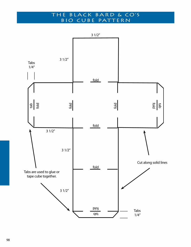
98
THe black bard & co’s bio cube PaTTern
Tabs1/4”
Tabs1/4”
Tabs are used to glue or tape cube together.
3 1/2”
3 1/2”
3 1/2”
3 1/2”
3 1/2”
fold
fold
fold
fold
fold
fold
foldfold
tab tab
tab
Cut along solid lines
99
Acrostics by George Moses Horton
Mistress of green in flowers arrayed Alluring all my heart away Replete with glory not to fade yet flourish in eternal May– Eternalized by distant fame– void of a shade in bloom devine– Pleasures await thy sacred name Or bid thee still proceed (s) to shine who has surpassed thy heavenly mein Expression will forbear to tell like thee not one I yet have seen let all adore thee lovely belle
So let our names together blend In floods of union to the end Or flow together soul in soul Nor distance break the soft control– How pleasing is the thought to me A thought of such a nymph as thee Reverts my language into song That flows delightful soft along– Return to me a soft reply On which I must with joy rely Give me thy hand and then thy heart Entirely mingled not to part Relume the tapor near expired Seeking a friend so long desired–
ca.1844
For the Fair Miss M. M. Mcl(ean)An Acrostic by George Moses Horton
May this inspired acrostic prove A perfect token of my love Return thy torch allmost expired yet find by whom thou art admired
My soul of love would fly to thee Constrained thy winning form to see
like pan whose destiny was grief Exploring nature for relief And sure when thee my love has found Nought els(e) in life can heal the wound
when on the constellations I cast my eyes afar Then I can tell My bonny belle The queen of every star
when I look from the mountain Or nature's lofty tower Then I can tell My bonny belle The queen of ever(y) flower
when gazing from the window On blooms both low and tall Then I can tell My charming belle The fairest one of all
Mr. Torence
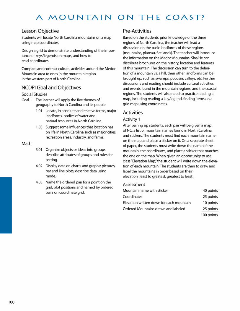
100
lesson ObjectiveStudents will locate North Carolina mountains on a map using map coordinates.
Design a grid to demonstrate understanding of the impor-tance of keys/legends on maps, and how to read coordinates.
Compare and contrast cultural activities around the Medoc Mountain area to ones in the mountain region in the western part of North Carolina.
NCDPI Goal and ObjectivesSocial StudiesGoal 1 The learner will apply the five themes of
geography to North Carolina and its people.
1.01 locate, in absolute and relative terms, major landforms, bodies of water and natural resources in North Carolina.
1.03 Suggest some influences that location has on life in North Carolina such as major cities, recreation areas, industry, and farms.
Math 3.01 Organize objects or ideas into groups:
describe attributes of groups and rules for sorting.
4.02 Display data on charts and graphs: pictures, bar and line plots; describe data using mode.
4.05 Name the ordered pair for a point on the grid; plot positions and named by ordered pairs on coordinate grid.
Pre-ActivitiesBased on the students’ prior knowledge of the three regions of North Carolina, the teacher will lead a discussion on the basic landforms of these regions (mountains, plateau, flat lands). The teacher will introduce the information on the Medoc Mountains. She/He can distribute brochures on the history, location and features of this mountain. The discussion can turn to the defini-tion of a mountain vs. a hill, then other landforms can be brought up, such as swamps, pocosin, valleys, etc. Further discussions and reading should include cultural activities and events found in the mountain regions, and the coastal regions. The students will also need to practice reading a map, including reading a key/legend, finding items on a grid map using coordinates.
ActivitiesActivity 1After pairing up students, each pair will be given a map of NC, a list of mountain names found in North Carolina, and stickers. The students must find each mountain name on the map and place a sticker on it. On a separate sheet of paper, the students must write down the name of the mountain, the coordinates, and place a sticker that matches the one on the map. when given an opportunity to use class “Elevation Map,” the student will write down the eleva-tion of each mountain. The students are then to draw and label the mountains in order based on their elevation (least to greatest; greatest to least).
AssessmentMountain name with sticker 40 points
Coordinates 25 points
Elevation written down for each mountain 10 points
Ordered Mountains drawn and labeled 25 points
100 points
a MounTain on THe coasT?
101
Activity 2If available, give each student a sheet of centimeter graph paper. If none is available, have each student draw a grid with the lines 1 centimeter apart from each other. The stu-dents are to create five icons to symbolize activities that people participate in while visiting mountains. The stu-dents are to draw these icons at coordinates of their choice. On a separate sheet of paper, they are to create an answer key. After the keys have been checked for their accuracy, the students are to exchange papers and write the ordered pair for each icon. The papers are given back to their own-ers who then check to see if their classmate found the cor-rect coordinates.
Rubric Grid w/icons 25 points
Answer key 25 points
50 points
Activity 3upon watching the video footage of the Medoc Mountain and reading the brochure information, the students are to discuss the advantages or disadvantages of living in a “mountain” area on the coastal region, compared to a mountain area in the mountain region. The students are to write an imaginative narrative about an adventure they had in the region they believe they would prefer. The narrative must include some activities that they would enjoy that would be consistent with living in that location.
AssessmentSame as the one for scoring narrative writing.
*Bonus points for contributing to the discussion groups
ResourceTopographical Information
web site:
www.topozone.com

102
lesson ObjectivesStudents will trace the route of the scenic byway on the map.
Choose and research a famous person from this byway.
Construct a wax museum to share with schoolmates.
NCDPI Goals and ObjectivesSocial StudiesGoal 1 The learner will apply the five themes of
geography to North Carolina and its people.
1.03 Suggest some influences that location has on life in North Carolina.
1.04 Explain how North Carolinians in the past used, modified, or adapted to the physical environment.
Goal 2 The learner will examine the importance of the role of ethic groups and examine the multiple roles they have played in the development of North Carolina.
2.03 Describe the similarities and differences among people of North Carolina, past and present.
Goal 3 The learner will trace the history of colonization in North Carolina and evaluate its significance for diverse people’s ideas.
3.02 Identify people, symbols and events associated with North Carolina’s heritage.
Goal 4 The learner will analyze social and political institutions in North Carolina such as government, education, religion, and family and how they structure society, influence behavior, and response to human needs.
4.05 Identify and assess the role of prominent persons in North Carolina, past and present.
Communications • uses print and electronic directories such as a table
of contents, index, or telephone book to locate information.
• Selects books and other materials that best suit purpose.
• Reads materials on a variety of topics beyond personal experiences.
Pre-Activities Prior to the first activity, all students will have viewed the lafayette’s Tour segment of the Scenic Byways video. Students will also have read the excerpt on lafayette’s Tour in the Scenic Byways book. Together students can generate a list of notable people mentioned in the byways excerpt.
ActivitiesActivity 1In this activity students will take a closer look at one section of the lafayette’s Tour byway. when cooperative groups have become “experts” on one segment of the byway, they will share their knowledge so all students will get an in depth look at the notable people and places on this four hour byway. The teacher will assign each group a portion of the byway to research. Students may start with the names from the list generated earlier in the pre-activities that correspond to their part of the byway or use other resources such as their social studies textbook, the Internet, or other reference materials. Each group will create an enlarged drawing of their portion of the byway using the maps on pp. 99-101 in the byways book. Students will enrich these maps with bubbles giving information about the persons who became famous along this route, including when and where. The groups’ drawings will then be placed together to form one large visual map of the entire scenic byway.
RubricParticipation and cooperation within the group 25 points
Important persons are noted with supporting details 50 points
Neatness and accuracy of group drawing 25 points
*while the class map will be sequential, and not chronological, the teacher may wish to ask students to cre-ate a timeline for the events and discoveries of the people of this byway.
Activity 2 This activity should follow Activity 1 after students have become more familiar with the people and events of the lafayette’s Tour Byway. Students will be given a contract to sign which obligates them to research one famous person from the lafayette’s Tour Scenic Byway. Students will write a report about this person, present the report to the class, and participate in a “who’s who of the Byway” wax museum.
Project Requirements
a wHo’s wHo of THe byway

103
1. Select a person from the lafayette’s Tour Scenic Byway. use the media center, social studies book, Internet, ency-
clopedias, biographies, etc. Have the person approved by the teacher. use at least three resources and docu-ment.
2. Complete the contract. Conference with your teacher. Have your parent sign your contract. Date:______________
3. Research the person you have chosen.4. Organize information in prewriting. Include as much information as you can about the
person.
Examples:• Birth – when and where• Childhood • Family• Major accomplishment• Difficult choices• Impact on North Carolina
5. write a rough draft of your research paper. Conference
with your teacher. Date:___________6. Publish your paper.7. Organize a display board or poster highlighting your
famous person. Include map, details of his/her life, draw-ings, portraits, or photographs. Date:___________
8. Plan costumes and props you can use to portray this per-son. Date___________
9. Share your presentation with the class. Date:_____________
10. Participate in the wax museum. Set up timely and orderly. Stand still and quiet as visitors come through. Date:___________
ResourcesNC Scenic Byways Book
North Carolina County Fact Book volume I and II by Beverly & Glenn Tetterton

104
wHo’s wHo of THe byway conTracT
I, ________________________________ have chosen to research __________________________. I understand that my grade will be based on the following point system.
RubricContract – 2 points. off each day its late Date ___________ 10 points
Report - Includes prewriting, sufficient information,
Neat final copy Date ___________ 40 points
Oral Presentation Date ___________ 25 points
Costume and Props Date ___________ 10 points
wax Museum Date ___________ 15 points
I understand the contract above. I realize that I should conference with the teacher several times. I should use several sources for my information. All assignments shall be turned in on time. I will complete this project to the best of my ability.
Student signature _____________________________________
I understand my child has a Social Studies project to complete by the above dates. I realize this project will be ________% of the Social Studies grade this grading period.
Parent signature ______________________________________

105
lesson ObjectivesStudents will recognize the North Carolina state flag.
Students will learn the dates on the state flag and understand each date’s significance.
Students will draw a North Carolina flag to scale.
Students will create their own flag choosing dates and sym-bols they feel are significant to our state’s history.
NCDPI Goals and ObjectivesSocial Studies Goal 3 The learner will trace the history of colonization
in North Carolina and evaluate its significance for diverse people’s ideas.
3.01 Distinguish among political, social, and economic changes.
3.02 Identify people, symbols, events, and documents associated with North Carolina’s history.
3.05 Describe the political and social history of colonial North Carolina and analyze its influ-ence on the state today.
Mathematics 1.09 Find the fractional part of a whole number.
2.04 Identify intersecting, parallel, and perpendicular lines and line segments and their midpoints; identify in the environment.
2.07 Measure length using inches/centimeters.
Communications • Read informational text.• Follow written instructions.• Express main idea and supporting detail in descriptive
writing.
BackgroundStudents will have prior knowledge of the Mecklenburg Declaration and that May 20, 1775 is thought to be the date this document boldly stated that the people of the colony of North Carolina were in favor of independence for all the colonies. British law would no longer be in effect in Mecklenburg County. (Students should be aware of loca-tion of Mecklenburg County.) Students should have viewed the “lafayette’s Tour” portion of the Scenic Byways video and be familiar with the area of Halifax and the Halifax Resolves.
Pre-ActivitiesStudents’ prior knowledge should include April 12, 1776 as the date this document, the Halifax Resolves, was signed to authorize North Carolina’s delegates to the Continental Congress to vote for independence from England. For handwriting practice and paragraph structure, students may copy paragraph about the flag prior to Activity 1.
ActivitiesActivity 1 This activity will involve measuring to create a North Carolina flag drawn to scale. using the North Carolina State Flag in the classroom as a model, students will duplicate the flag to scale on construction paper. Teachers may use the information at www.50states.com/ncarolin.htm for the correct dimensions of the flag. (9”x12” construction paper divides evenly and easily for this project)
Activity 2Begin this activity with a review of the Mecklenburg Declaration noting on the map where it took place. Remind students that nearly a year later, the Halifax Resolves was signed. Again note its physical location on the map. Ask students what they think is significant about the two loca-tions. Students may need to be reminded that land west of Mecklenburg was “backcountry” inhabited by very few colonists at the time, making Mecklenburg the western edge of settlement in North Carolina. Try to help them see that it signifies that colonists in the west and east were united in their thoughts and efforts to be independent. (An ongoing timeline in the classroom will help students bet-ter understand the events and changes taking place within North Carolina.) Through class discussion students will understand that the two dates on the state flag are impor-tant because they celebrate the fact that North Carolina was the first colony to declare its independence from England well before July 4, 1776. The significance of this date may need to be discussed as well. with a clear under-standing of why these dates are on the state flag, have stu-dents brainstorm as a class or in small groups, other dates that are important to our state. Students may use social studies textbook, reference books, brochures, etc. to gener-ate lists of dates.
HalifaX resolves

106
Rubric0-3 important dates you must not be from around these parts
4-6 important dates you need to open your textbook
7-9 important dates you are on your way to becoming a great historian
10 or more! you are a real TARHEEl!!
Activity 3using dates generated from Activity 2, allow students to create a new map for North Carolina that includes two dates the student feels are important to our state’s history. After designing their new state flags, have students write a paper explaining the symbols and colors they chose for the flags and the significance of the two dates they chose to use on their flag. Allow students to share their “new” North Carolina flags with classmates.
RubricNeatness 10 points
Scale 15 points
Flag includes 2 dates related to NC history 10 points
written paper clearly explains why you chose the dates, symbols, and colors of your flag 50 points
Oral presentation of your flag 25 points
100 points
ResourcesNorth Carolina Scenic Byways video
Pale As the Moon by Donna Campbell
web site:
www.50states.com/ncarolin.htm

107
If you’re looking for a great road trip for your family or the perfect field trip for your fourth graders, Roanoke voyages Corridor may be the trip for you! This short nine-mile byway is packed with historical, economic, and recreational interests for the traveler.
located on the island of Roanoke, the Roanoke voyages Corridor includes the following sites: • North Carolina Aquarium on Roanoke Island• Fort Raleigh Historic Site• Elizabethan Gardens• The lost Colony Outdoor Drama – located within the
Fort Raleigh Historic Site• Roanoke Island Festival Park – which includes a replica of
the Elizabeth II and an excellent hands-on museum for children
• wanchese – nearby fishing village, home to generations of North Carolina Fishermen
After enjoying these sites on Roanoke Island, you can cross the sound and visit Jockey’s Ridge, the wright Memorial, and three of North Carolina’s lighthouses.
roanoke voyages corridor

108
lesson ObjectivesStudents will locate Roanoke Island on the map and discuss its physical characteristics. Students will compare the settlement in 1587 to 1590, while predicting what hap-pened to the lost Colony.
NCDPI Goals and ObjectivesSocial StudiesGoal 1 The learner will apply the five themes of
geography to North Carolina and its people.
1.04 Evaluate ways the people of North Carolinian used, modified, and adapted to the physical environment, past and present.
Goal 2 The learner will examine the importance of the role of ethnic groups and examine the multiple roles they have played in the development of North Carolina.
2.03 Describe the similarities and differences among people of North Carolina, past and present.
Goal 3 The learner will trace the history of colonization in North Carolina and evaluate its significance for diverse people’s ideas.
3.01 Assess changes in ways of living over time and determine whether the changes are pri-marily political, economic, or social.
3.02 Identify people, symbols, events, and documents associated with North Carolina’s history.
3.03 Examine the lost Colony and explain its importance in the settlement of North Carolina.
Goal 4 The learner will analyze social and political institutions in North Carolina such as government, education, religion, and family and how they structure society, influence behavior, and response to human needs.
4.02 Identify religious groups that have influenced life in North Carolina and assess the impact of their beliefs.
Communications • Recognize the characteristics of narrative text.• Make inferences and draw conclusions from
information texts and stories beyond personal experiences.
• writes imaginative narratives with sufficient, related detail that revolve around an event and have a resolution.
Pre-ActivitiesStudents will have already discussed the first two expeditions to the Outer Banks of North Carolina. Students will be familiar with Sir walter Raleigh, Queen Elizabeth I, John white, Ralph lane, Manteo, and wanchese. Students will know the purpose of the first two expeditions and why they did not succeed. Students will be able to communi-cate that the third expedition differed from the previous two.
Explain and show photos or real artifacts. Explain how significant artifacts are to telling about the past.
ActivitiesActivity 1Provide students with literature about the lost Colony. you may use your Social Studies text, but will probably want to enrich this with other resources. Roanoke: The lost Colony by Brooke Coleman is a good picture book for fourth grad-ers. There is a complete account of the third expedition at www.nps.gov/fora/voyage2.htm. This site is exceptional as it offers possible explanations for the disappearance of the lost Colony.
After students have the background knowledge, allow them to team up and debate what they think happened to those 117 English settlers.
Activity 2The colonists remained on what is now Roanoke Island while John white returned to England for supplies. After many delays, he returned to find his entire colony missing. Pretend you are one of the colonist waiting on the island. you may choose to be an adult or child. Create a week's' entry on white blank paper. Detail what was going on. what were the children and adults doing? what was the weather like? was there a visit from the Croatoans? your specific information, messages, codes, and other writings may be a helpful artifact that holds the answer to what actually hap-pened to your lost colony. To make this activity look like an old artifact brew tea on stovetop. Immerse students' papers in the liquid for a minute or two after the tea has cooled. Stain papers after students have finished the journal entry.
Rubric
THe losT colony – coMe find us

109
4 The student has a strong command of narrative writing. The paper gives reasonable explanation with supporting details.
3 The student can write a narrative reasonable well. The paper may have a reasonable explanation, but details are sparse.
2 The student has a weak command of narrative writing. A reasonable explanation of what happened to the colony may or may not be evident. There are little or no details.
1 The student is not able to write a narrative paper on this topic.
Activity 3This activity appeals to the spatial and kinesthetic learn-ers. Students will create dioramas using two paper plates or two tagboard circles. Have students fold paper circles in half forming an l. Glue or staple the two vertical halves of the circles back to back ( ). The lower half of each circle will provide the base of the diorama on each side. Students will create a three dimensional scene of the colony in 1587. On the reverse side they will create the same scene show-ing what they think John white found when he returned in 1590. Students may present dioramas orally or write an explanation on index cards to go with each side of his/her diorama.
Rubric1587 Scene 25 points
1590 Scene 25 points
Neatness & attention to detail 15 points
written/Oral Presentation 35 points
100 points
ResourcesRoanoke: The lost Colony by Brooke Coleman
Pale As the Moon by Donna Campbell
web site:
www.nps.gov/fora/voyage2.htm

110
lesson ObjectivesStudents will locate islands of North Carolina.
Discuss issues/dilemmas an island faces verses the mainland.
Compare and contrast self-sufficiency and interdependency.
NCDPI Goals and ObjectivesSocial StudiesGoal 6 The learner will evaluate how North Carolinians
apply basic economic principles within the community, state, and nation.
6.01 Explain the relationship between unlimited wants and limited resources.
6.02 Analyze the choices and opportunity cost involved in economic decisions.
6.08 Cite examples of interdependence in North Carolina’s economy and evaluate the significance of economic relationships with other states and nations.
Health 2.03 Distinguishing between needs and wants
4.02 Explaining value of social support
Communications Formulate questions and find relevant information from reading materials.
Organize and summarize information by using a technique such as a graphic organizer.
Make inferences and draw conclusions from informational texts and stories beyond personal experiences.
Pre-Activitiesusing students’ prior knowledge of Roanoke Island and the lost Colony, the teacher will lead students in a discussion about what it means to be self-sufficient. Students who have already studied the mountain region may be familiar with this term. The teacher will also explain what interdependency means. Discussion should question why did it seem more important for colonists moving to the backcountry to be self-sufficient, than the first 117 settlers who were sent here. Class discussion may include student’s theories about what happened to the lost Colony. Did they try to be self-sufficient and fail? Did they become depen-dent on the Croatans and move with them? The purpose of these discussions is to get students thinking about how people interacted then and today.
ActivitiesActivity 1 Most students associate the word island with “deserted”. The picture in their minds is usually of blue water, palm trees, and lush vegetation. Begin this lesson by asking students to write about a day in the life of an islander. After students have written their journal entries, share them and record whether students’ accounts expressed self-suffi-ciency or interdependence. Most will probably be recorded under self-sufficiency. Ask students if they felt this was what the colonists at Roanoke faced. Then encourage students to think about life today. would every island have to be self-sufficient in order to survive? This will get students on the way to understanding that not all islands are deserted or like Gilligan’s.
Activity 2working in cooperative groups, ask students to list needs and wants that people on a small island may have trouble generating for themselves. Remind students to address the needs first, then the wants.
Rubric less than 10 Did your islanders die?
10-20 your group is thinking
more than 20 Island life isn’t always paradise, huh?
After this activity, as a class discuss what goods or services an island may have that people on the mainland would need or want. Help students to see that when the two work together they can provide most of their needs and wants for each other. Things they can’t provide themselves may come from another area, making us inter-dependent with other states and countries.
Activity 3working in pairs, have students make a game that involves interdependency between an island, mainland, and another state or country. Students ability to create a game board, cards, and an objective to work together will further develop their understanding of how people need to work together to be successful.
RubricRules and objective clearly stated 20 points
Game cards include advances and setbacks related to economy 40 points
Game board includes at least three locations that trade goods 20 points
Game board is neat and completed on time 20 points
100 points
self-sufficienT or inTerdePendenT

111
ResourcesRoanoke: The lost Colony by Brooke Coleman
The Colony of North Carolina by Susan whitehurst
112
lesson ObjectivesStudents will understand that commercial fishing is an important industry in North Carolina.
Identify species of fish important to North Carolina’s economy.
Compare catches and their monetary value through graphs.
Present information to peers about a specific seafood in North Carolina.
NCDPI Goals and ObjectivesSocial StudiesGoal 1 The learner will apply the five themes of
geography to North Carolina and its people.
1.03 Suggest some influences that location has on life in North Carolina such as major cities, recreation areas, industry, and farms.
Goal 2 The learner will examine the importance of the role of ethnic groups and examine the multiple roles they have played in the development of North Carolina.
2.03 Describe the similarities and differences among people of North Carolina, past and present.
Goal 3 The learner will trace the history of colonization in North Carolina and evaluate its significance for diverse people’s ideas.
Compare and contrast ways in which people, goods, and ideas moved in the past with their movement today.
Goal 6 The learner will evaluate how North Carolinians apply basic economic principles within the community, state, and nation.
6.01 Explain the relationship between unlimited and limited resources
6.02 Analyze the choices and opportunity cost involved in economic decisions
6.03 Categorize the state’s resources as natural, human, or capital
6.04 Assess how the state’s natural resources are being used.
Mathematics 4.02 Display data in a variety of ways including
circle graphs. Discuss the advantages and disadvantages of each form including ease of creation and purpose of the graph.
4.03 Collect, organize, and display data from surveys, research, and classroom experiments, including data collected over time.
4.04 Interpret information orally and in writing from charts, tables, tallies, and graphs.
Pre-Activities Students will have used field guides and other resources to learn about different fish species fished in North Carolina. Students will recognize and identify most on sight. Students will understand the term “commercial fishing” and how it compares to what they know – “recreational fishing”.
ActivitiesActivity 1 The teacher will invite a guest speaker to share the work of a commercial fisherman and/or its impact on North Carolina’s economy. Teachers in the Coastal Plain may contact a commercial fisherman or the Division of Marine Fisheries. Other regions may rely on information from the Department of wildlife Officers in your area. After the speaker has made his/her presentation and students have been involved in discussion, students may either draw or write a summary of the information they have learned. Teachers may also take notes during the presentation and quiz their students using teams, tic tac toe, or a Jeopardy styled game.
Activity 2This activity will allow students to engage in some math skills. using the web site www.ncfisheries.net/ students will compare catches and profits through the years. Once at this site, click Fun Stuff. Then click Fisheries Statistics. Students will then click Commercial. Students will choose year(s) and specie(s) as directed by the teacher. Teachers may have stu-dents compare one species through several years using a line graph, and/or compare different years or species using
wHaT ’s in wancHese?
113
a bar graph. Students may wish to go to the Recreational site and compare the two types of fish-ing. ( If computer access is an issue, the teacher may go to this sight and print the information for selected species and years and make copies for the students.) This site is easy to use and is a great way to incorporate math skills in Social Studies. Once students have made their line graphs or bar graphs they will see and better understand the impact commercial fishing has in North Carolina.
RubricGraph completed on time 10 points
Horizontal axis is accurate 20 points
vertical axis is accurate 20 points
Information is plotted accurately 20 points
Graph has a title 10 points
Neatness of graph 20 points
100 points
Activity 3Get your students attention with a “catchy” title for this activity. Call it the “Fish Fair” or “Seafood Share”. Students will work in groups of two or three and research one spe-cies of marine life commercially fished in North Carolina waters. They will share information through an oral pre-sentation and display. Students’ research should include the location fished in North Carolina, the season fished, profits for the previous year, any relevant information to that species such as regulations on size or number fished. Ask parents to help students by supplying a sample of the seafood for classmates to taste when each group presents its information.
Rubricworked cooperatively with team members 30 points
Display included text and visual images 30 points
Oral presentation exemplified understanding of species and included all required information 30 points
Seafood sample 10 points
100 points
Resourcesweb site:
www.ncfisheries.net/
114
lesson ObjectivesStudents will locate Roanoke Island and the Outer Banks on the map.
learn geographical terms associated with the Coastal Plain.
Create a clay model incorporating some of the geographical features.
NCDPI Goals and Objectives Social Studies Goal 1 The learner will apply the five themes of
geography to North Carolina and its people.
1.01 locate in absolute and relative terms major landforms, bodies of water, and natural resources in North Carolina.
Science 1.03 Evaluate living and nonliving things that
affect animal life.
Pre-ActivitiesThe teacher will have reviewed geographical terms such as island and coast which students are already familiar. The students will locate examples of these on the North Carolina map.
ActivitiesActivity 1SHOAlS The teacher may begin this lesson by asking students if they have ever heard of the Graveyard of the Atlantic. The poster “Ghost Fleet of the Outer Banks” is a good visual for fourth graders. It shows the North Carolina coastline and lists over 500 shipwrecks that occurred between 1585 and 1969. The teacher may also share one of the ghost stories of shipwrecks off the coast such as “Theodosia” from Mystery Tour A Student Guide to North Carolina Ghosts & legends. The teacher will then explain that this nickname for North Carolina’s coast is a result of the dangerous shoals. Students will understand that the term shoal means shallow and sandbar. Students will understand that both meaning resulted in many shipwrecks off our coast.
Materials• large plastic storage bins• Milk cartons• Modeling Clay
Activity 2
OuTER BANkS/BARRIER ISlANDS and SOuNDS This lesson explains to students what the Outer Banks are, and that they are geographical feature rather unique to North Carolina. Students will understand that these are huge sand ridges out in the ocean miles from the mainland. Students will understand that what is visible are only the tops of the ridge. Through a simulation, students will see that these sand ridges act as a “barrier” to the mainland, blocking the rough waves.
using large plastic storage bins, construct the “mainland” at one end using clay and milk carton houses. At the opposite end, pour in water until it meets the land. Then gently lift the “ocean” end creating the wave action. Repeat more vigorously. Students will see their homes topple as the waves become rougher. Then remove the water.
Next create a clay ridge in the center of the plastic bin. Pour water back in the bin. Students will notice that there is a space between the ridge and the mainland. Explain to them that this is a sound, a body of water that lies between the mainland and barrier islands. Add water to this area. Repeat the simulation. Students will see that the barrier island protects the homes on the mainland.
***This activity can be done as a demonstration, or as a center that students can go to, experiment, and write about their observations. Grading will vary according to how teacher implements the activity.
Activity 3DuNES/MEDANO This activity will allow students from all over the state to visit Jockey’s Ridge State Park via the Internet, or through brochures requested from the park. Students will learn that these are the highest sand dunes east of the Mississippi River. Students will understand that while the dunes shift, they don’t blow away due to win-ter winds blowing out of the northeast, and the summer winds blowing out of the southwest. Therefore, the sand is constantly blown back and forth. The teacher will also share with students that Jockey’s Ridge more accurately is a medano than a dune. A medano is a huge hill of shifting sand that lacks vegetation. Students will also see that not only do the dunes provide further protection for the mainland, but they also provide recreation for visitors to the Outer Banks. After students have been given information about the park, have them make an Outer Banks Cube. Each side of the cube should include a fact about the dunes. Allow students to share cubes with classmates. This is a good way to evaluate a topic that has been taught. use cubes throughout the year and display them, to show all the
waTcH ouT for THaT sHoal

115
places your class has “visited” this year.
The teacher may want to include the legend of how Jockey’s Ridge got its name. There are several accounts, one source is found in legends of the Outer Banks by Charles Harry whedbee.
RubricEach side contains fact about Jockey’s Ridge 60 points
At least 3 sides include a picture of fact or activity 15 points
Spelling 15 points
Neatness 10 points
100 points
ResourcesMystery Tour A Guide to North Carolina Ghosts & legends
by Beth Craddock Smith
legends of the Outer Banks by Charles Harry whedbee

116
Travel NC 242 North in Elizabethtown in Bladen County. Elizabethtown was named after Queen Elizabeth. The town was also the site of the 1781 Revolutionary war Battle where whigs broke Tory power by driving them into the deep ravine on the banks of the Cape Fear RIver.
Cross the Cape Fear River and enter the Bladen lakes State Forest. About four miles north of the Cape Fear is Jones
lake, the closest of the meteor lakes to NC 242. Jones lake, white lake, Singletary lake and lake waccamaw are all describes as being Carolina Bays believed to have been formed by ancient meteor showers. These depressions include lakes, swamps, savannas, and peat beds.
MeTeor lakes byway

117
lesson ObjectiveThe students will write directions on how to get from the school to a local restaurant, movie theatre, or store using relative location and landmarks.
Identify and list at least five main features, which distinguishes their community from others. Two will be geographical – location and landforms; the other three will be based on cultural, educational, and resources.
Create and design posters/murals to highlight the distinguishing features of their community. These would vary based on each student's interest and research.
Present their posters/murals to another class/grade level to explain their choices.
NCDPI Goals and ObjectivesSocial StudiesGoal 1 The learner will locate major physical features and
suggest the influence of location on life in North Carolina.
Goal 5 The learner will examine the impact of various cul-tural groups in North Carolina.
Pre-ActivitiesThe teacher will give instruction about relative and abso-lute location. They should be given various opportunities to locate places within their community using relative location (street maps) and different cities within the state and nation.
The teacher will discuss landmarks. He/She will lead a discussion how people use them in everyday situations to give directions to places. A discussion on historical landmarks should in sue. Discuss the differences between cultural/local, physical/geographical, and historical landmarks. These landmarks may be recent history that the teacher and/or students deem important. Compare these with landmarks that are famous nationwide.• Statue of liberty• Mount Rushmore• washington Monument• Disney land vs. Disney world, etc.
why do some landmarks stand out more than others?
The teacher will read information about the Meteor lakes
Byways. The students will be shown how to locate this stretch of road on a state map. landmarks used from the book's/web page's write up, and on the map will be discussed – How will these help someone who is explor-ing this byway? How are the cultural events, and landmarks similar or different to the ones in the student's community? The Meteor lakes area is a rural area – How is this different/same as the students? The teacher is to lead a discussion on why the community the students live in is special.
what cultural events are carried out there?
what natural resources are found in that location?
Any industries that stand out?
Educational institutions?
landforms?
People or places in history?
Activities Activity 1After the students have been given various opportunities to locate places within their community using relative loca-tion (street maps) and different cities within the state and nation.The teacher has discussed landmarks, the students will write directions on how to get from the school to a local restaurant, movie theatre, or store using rela-tive location and landmarks. The students must use street names and landmarks. The teacher will need to base the final locations on bus routes to be fair to all students. The students should read these aloud so they may compare their directions and see if they are all using the same or different landmarks. The teacher may want to put students in small groups and let them compare in that manner, grouped according to routes or exposure to places.
Activity 2After discussing the differences between cultural/local, physical/geographical, and historical landmarks, the students are to identify and list at least five main features, which distinguishes their community from others. Two will be geographical – location and landforms; the other three will be based on resources, cultural events, edu-cational locations (schools, colleges, and other institutions of higher learning).
Activity 3
PicTure THis

118
The students, either individually or using partners, are to make murals depicting significant influences within their community. One third must show something culturally, one third is to indicate an important physical landmark, and the other must show an important industry (service or prod-uct). The students must also come up with a slogan for their mural that would be an enticement to come to their community.
Activity 4The students will share information about their mural with a group or another class.
Assessment
Rubricwriting directions w/street names and landmarks 25 points
list of features 10 points
Poster/Mural 50 points
Poster/Mural oration 15 points
100 points

119
lesson ObjectiveThe students will list qualities a good citizen should possess; list qualities of a good leader.
Identify citizens and groups within the community that exhibit strong citizenship/leader qualities.
write their own goals as to how to become better citizens within their community.
write a letter to a local, state, or government official based on a community concern.
NCDPI Goals and ObjectivesGoal 3 The learner will trace the history of colonization
in North Carolina and evaluate its significance for diverse people's ideas.
3.01 Assess changes in ways of living over time and determine whether the changes are pri-marily political, economic, or social.
Goal 4 The learner will analyze social and political institutions in North Carolina such as government, education, religion, and family and how they structure society, influence behavior, and response to human needs.
4.03 Explain the importance of regional diversity on the development of economic, social and political institutions in North Carolina.
4.04 Examine ways North Carolinians govern themselves and identify major government authorities at the local and state level.
Pre-ActivitiesTeacher will lead discussion on citizenship, incorporating these questions:1. what is a citizen?2. what distinguishes a good citizen from a bad citizen? 3. How does a good citizen resolve his/her problem within
the community? 4. who are some of the people who help with these
situations in our local community? At the state level? National level?
5. what kinds of problems do you see in our community? 6. who should we talk to about them?
Before beginning Activity 3, contact the North Carolina
Justice Academy in Salemburg, at the phone number or address listed in the resource section.
ActivitiesActivity 1After discussing citizenship, the students will list qualities they feel a good citizen should have. They are to generate a diverse list of people they feel embody these qualities. This can be done as a whole group activity or individually at first and then shared as a group. The list should not merely be based upon people within the school environment. Students will then write up a plan for themselves, individually, to help them be better citizens.
Activity 2Discuss the qualities that a leader should have. Compare and contrast these qualities to the ones for a good citizen. use a venn Diagram. Do we and should we expect more of our leaders? Have students list five people they believe exhibit good leadership skills, and the qualities they exhibit. lists are not to include family members (unless they are considered important leaders). Students are to compare their list. were some of the lists the same; if so, why do they think they that happened? let students tell why they chose someone on their list.
Activity 3Ask the students to think of particular groups, organizations, offices, or positions in which people are affiliated, and tend to receive respect for the affiliation. Then inquire as to what types of training or education do they think people with those types of careers have had to go through. Tell the students of the existence of the North Carolina Justice Academy in Salemburg. It is a police academy where police officers from all over the state go to learn more advance instructions and tech-niques in the area of law enforcement. Show the students the catalog of courses that are offered by the academy, and read some of the choices. The students are to gener-ate lists of other careers that involve serving/leading the community. Then the students are to create a list of courses they believe people ought to take in order to be in the careers on their lists.
Activity 4
a ciTizen To be Proud of

120
Ask the students about concerns they may have for the community. Tell them it can be a concern as local as wheth-er there is a recycling center nearby, or as global as the condition of the oceans. After discussing several con-cerns, the class is to decide on one. Then they must decide which public official they would like to contact about their concern. Next, the students are to write business letters to an official stating their issue, view and, if one is thought of, solution to a particular problem. If you are not sure where to send the letters, contact the librarians at your local public library. They are very good about find-ing that information and sharing it.
Assessment
list of good citizenship and goals for self improvement 25 points
list of local leaders and their qualities 10 points
Creative list of courses 10 points
letter to government official 55 points
100 points
Resourcesweb site:
www.jus.state.nc.us/NCJA/

121
lesson ObjectivesThe student will identify, compare, and contrast agricultural produce found in the coastal plains with ones found in the Piedmont and Mountain regions using a venn diagram.
use the computer website listed in the resource section to locate types of produce grown in Bladen, Sampson, and Cumberland counties, as well as the various kinds that grown in their own county.
locate and record a recipe that requires a product that is grown in one of the three afore mentioned counties.
Alter a recipe by either doubling the recipe or reducing it by half
NCDPI Goal and Objectives Social StudiesGoal 6 The learner will evaluate how North Carolinians
apply basic economic principles within the community, state, and nation.
6.08 Cite examples of interdependence in North Carolina's economy and evaluate the significance of economic relationships with other states and nations.
MathGoal 1 The learner will read, write, model, and compute
with rational numbers.
1.04 Model, identify and compare rational numbers (fractions and mixed numbers)
2.07 Estimate and measure length, capacity, and mass using these additional units: inches, miles, cups, pints.
Pre-ActivitiesThe teacher will ask the class about some of their favor-ite foods. Then, he/she should ask the students to think about where these items come from before they are in the grocery stores. The next questions to be given are “Can everything be grown everywhere? why or why not? How do the various items get to the grocery store if they aren’t all grown nearby?” After discussing these things, have the students look up on the computer the variety of produce raised in North Carolina at the website listed in the resource section.
The teacher will also need to discuss fractions and measure-ment before/during the fourth activity.
ActivitiesActivity 1The students are to go to the computer to the web address www.agr.state.nc.us/markets/facilit/farm/. Once there, the students will click on the lumberton markets, because this will bring up markets and produce from the Bladen, Sampson, and Cumberland counties’ farms. when students look up Commodities, and Fruits and veggies Shipper Direct they will be able to find lists of produce found in that area. The students are to write down the names of at least five foods that are raised in that area. If a computer is unavail-able, this information can generally be found in most text-books, just not as detailed.
Activity 2The students should go back to the main map and find items that are raised the other two regions as well. They should write down five items from there. Students are to compare if any of the regions grow the same types of crops or animals. Compare using a venn diagram or a double bubble map.
Activity 3The students are to search through cookbooks, at home and/or at school, and on the afore mentioned website to find a recipe they would like to try to prepare that includes a product from the coastal region. The students would have to turn in a copy of the original recipe and a copy of the recipe either doubled or cut in half. The students are to prepare the recipe, tell primarily where the product is grown in the region or if it is grown all over the region and/or state and give a fact about the area or region from where it was grown.
This activity can be repeated for each region of the state.
Assessmentlist or products 15 points
venn diagram or double bubble map 15 points
Recipe w/product from region 60 points
Prepared food 10 points
100 points
Resource web site
www.agr.state.nc.us/markets/facilit/farm/
iT TasTes so good
122
lesson ObjectivesThe student will identify cities and towns in North Carolina which were named after people who played some part dur-ing the colonization/pre–Revolutionary war era.
The students will discuss the issues involved in the decision to move from one country to another.
NCDPI Goals and ObjectivesGoal 3 The learner will trace the history of the
colonization in North Carolina and evaluate its significance for diverse people's ideas.
3.01 Assess changes in ways of living over time and determine whether the changes are pri-marily political, economic, or social.
Goal 4 The learner will analyze social and political institutions in North Carolina such as government, education, religion, family and how they structure society, influence behavior, and response to human needs.
4.02 Identify religious groups that have influence life in North Carolina and assess the impart of their beliefs.
4.05 Identify and assess the role of prominent persons in North Carolina, past and present.
Pre-ActivitiesThe teacher will read the first part of the first paragraph from the Meteor lakes Byways section of the Scenic Byways book about Elizabethtown (stop when he/she gets to part about Bladen County). Ask the students if they know how any other towns got their names. If the teacher knows the history of the naming of the town or city the school is in she can share it with the students.
Students will read about various groups of people who have moved into the different regions of North Carolina. The readings can be from school textbooks, and/or books from the media center. Teacher should encourage the students to find books and share information they learn independently.
ActivitiesActivity 1The teacher takes the students outside and has the class join hands and form a circle. Then the students are to move their circle inward until they are shoulder to shoulder. The teacher ask, which was more comfortable, arm's length – holding hands, or shoulder to shoulder?” The teacher let's the students know that some people left their own countries to come to America because they were no longer comfortable in their own countries for various reasons. The teacher leads a discus-sion on what kinds of conditions may exist that would cause people to travel a great number of miles to go to an unknown land.
After that discussion has ended, the teacher would ask, “If you wanted to tag or grab someone in the circle, would it be easier get to them while you are shoulder to shoul-der–type close , or at arm's length?” The teacher then talks about the problem of trying to control a country and its people from across the seas. “How does this realization help us understand pre-Revolutionary war conditions?”
Activity 2After the readings and discussions about different groups of people who have travelled to America and it's impact on NC, the students will make a diorama based on one of the various trials they believe immigrants would have gone through to get there. The diorama must include:• title• a paragraph or two on index cards telling the location
from which the people travelled and why• a scene depicting an obstacle they had to overcome to
arrive there.
AssessmentClass participation 25 points
Title on diorama 10 points
Paragraph for diorama 40 points
Scene of diorama 25 points
100 points
revoluTionary idea
123
lesson ObjectivesStudents will locate Murphy and Manteo on a North Carolina State transportation map.
Map route and mileage from one location to the other.
Compare geographical features of these two points of inter-est in North Carolina.
Create a travel itinerary for an imaginary tourist traveling from east to west.
NCDPI Goals and ObjectivesSocial Studies Goal 1 The learner will apply the five themes of
geography to North Carolina and its people.
1.01 locate, in absolute and relative terms, major landforms, bodies of water and natural resources in North Carolina.
1.02 Describe and compare the physical and cultural characteristics of regions
1.05 Assess human movement as it relates to the physical environment.
Mathematics 1.02 use estimation techniques in determining
solutions to problems.
2.07 Estimate and measure length using miles.
2.08 write and solve meaningful, multi-step problems involving elapsed time.
4.06 Plot points that represent ordered pairs of data from many different resources.
Communications writes informational composition with teacher support.
BackgroundStudents will have previously studied the three regions of North Carolina and will have a good understanding of the regions’ physical and cultural differences. Students will know the names and locations of the three regions and will be familiar with the North Carolina transportation map.
Pre-ActivitiesStudents may or may not be familiar with alliteration. Teacher will begin this lesson either with review or introduction of that skill, explaining that the Department of Tourism was deliberate in its choosing of the two towns Murphy and Manteo for a new tourism campaign several years ago. Not only were location of each, far west and far east considered, but two places beginning with the same letter to make the slogan “stick”.
ActivitiesActivity 1 working in cooperative groups, the teacher will instruct stu-dents to find the name of each town and its ordered pair in the Index of Cities and Towns on the state transportation map. using the ordered pair, students will locate the towns of Murphy and Manteo. Students will then map a route from Murphy to Manteo, citing highways they will travel and cities through which they will pass. Students may calculate mileage as they go, or map route and then calculate mileage.
*Challenge – group may also calculate time trip will take given a rate ex. 50 m.p.h.
Activity 2Each group will share its route and mileage with the rest of the class. Students will compare the different routes and mileage, looking for similarities. Students will note the shortest, longest, most accurate, most scenic, most interest-ing routes. (Teacher may present groups with certificates noting what was special about that particular route.) After each group has shared its route and mileage the teacher may show students how to use the mileage chart on the state transportation map.
This further emphasizes that knowing how to use resources can make a task easier.
Activity 3 This activity may be done independently or in pairs. Students will act as a travel agent, planning an itinerary for a customer living along the Roanoke Corridor. Students will map a route to a town in the western part of the state. The route should include two points of interest for the traveler to stop and tour on his/her excursion. Agents will also need to include departure and arrival times in the itinerary based on a given hourly rate.
MurPHy To ManTeo

124
RubricCreative letterhead for your travel agency 10 points
Clear directions from point A to point B 30 points
Two points of interest included with at least two details about each 30 points
Approximate mileage is reasonable 15 points
Approximate travel time is reasonable 15 points
Bonus-alliteration us used in letterhead or the two towns chosen 5 points
105 points.
Resources
North Carolina State Transportation Maps
North Carolina Scenic Byways Book
North Carolina County Fact Book volume I and II by Beverly and Glenn Tetterton

noTes

noTes

acknowledgMenTsNorth Carolina Scenic Byways
Presented by the North Carolina Department of Transportation and developed in partnership with the North Carolina Department of Public Instruction
Produced by the Agency for Public Telecommunications NC Department of Administration
Program Advisors Education Curriculum ConsultantJeff lackey Tracey GreggsHelen landi NCDPINC DOT
Cooperating TeachersGlenna Rayburn Cheryal IsaacBethel Elementary Southwest ElementaryHaywood County School System Durham County School System
Terre Eldridge Mary Parker-AshleyNorth Canton Elementary South Topsail ElementaryHaywood County School System Pender County School System
Judy Campbell kathy FitzgeraldDabney Elementary Fred Anderson ElementaryHenderson County School System Pamlico County School System
writer and Producer GraphicsTrudy Thomson kirk Hewitt, Horizon video Productions
Assistant Producer and Editor Post-Production Sound DesignJim Haverkamp Chris Groegler, Horizon video Productions
Director of Photography Executive Producerwarren Gentry Eugene Murray
location lighting and Sound Traditional and Original Music kenny Conyers David DiGiuseppe and wayne Erbsen
Special thanks to the following persons and organizations for their generous contributions to this program:
Graphic DesignerMishaun CoatesAllison wait
PhotographyCourtesy of NC Division of Tourism and Film Development, Bill Russ
Resource and Content Development ConsultantsEd Morris, Historic Sites Division
Charlie Peek, Parks DivisionNC Department of Environment and Natural ResourcesMike Hill, Division of Archives and HistoryNC Department of Cultural Resources
Maryanne Friend, NC Arts Council
Funded by a Federal Highway Administration grant to the NCDOT Scenic Byways Program
NC Department of Cultural ResourcesGinny Culpepper, Tourism DivisionNC Department of CommerceCarol klinePark, Recreation, and Tourism ManagementNCSu Cooperative ExtensionDave wright