a handy reference booklet for the kansas mappers ... · 20061 - ge geary 20063 - go gove 20065 - gh...
TRANSCRIPT
A Handy Reference
Booklet for the
Kansas Mappers,
Appraisers, and
Cadastral Specialists.
KANSAS ASSOCIATION
OF MAPPERS P O Box 30785
Columbia, MO 65205
www.kansasmappers.org
This reference book was prepared and
provided by the Kansas Association of
Mappers, (KAM). KAM was founded in
1986 as a nonprofit organization for
professionals working in those fields
related to geographic information. KAM’s
mission is to provide our members with
specialized education, services, informa-
tion, a designation program, and the oppor-
tunity to belong to a community of profes-
sionals with similar backgrounds to
exchange ideas and experiences, address
common problems and concerns, and
obtain advice. Our membership has grown
to encompass a wide range of profession-
als, including manual cartographers, land
surveyors, and computer-based geographic
information specialists. KAM also pro-
vides a designation program to raise the
professional standards of mapping person-
nel and recognize those with superior
skills.
COMMONLY USED SCALES FOR
APPRAISAL M
APS:
Use the engineering scale marked “10” for all
1” = 100’ maps. ( urban )
Each increm
ent will represent 10 feet. (100’
divided by 10 increm
ents.)
Use the engineering scale marked “20” for all
1” = 200’ maps. ( suburban )
Each increm
ent will represent 10 feet. (200’
divided by 20 increm
ents.)
Use the engineering scale marked “40” for all
1” = 400’ maps. ( rural )
Each increm
ent will represent 10 feet. (400’
divided by 40 increm
ents.)
Use the engineering scale marked “50” for all
1” = 50’ maps. ( highly urban )
Each increm
ent will represent 1 feet. (50’
divided by 50 increm
ents.)
Scales
Ft./Inch
Miles/Inch
Acres/Sq. In
1:20,000
1666.667
0.316
63.769
FT./IN. =
SCALE
1:24,000
2000
0.379
91.827
12
1:31,680
2640
0.5
160
MI./IN. =
SCALE
1:48,000
4000
0.758
367.309
63,360
1:62,500
5208.33
0.986
622.744
IN./MI. =
63,360
1:63,360
5280
1
640
SCALE
1:125,000
10416.667
1.973
2490.98
METERS/IN. = FT./IN. X 0.3048
1:250,000
20833.333
3.946
9963.907
1:500,000
41666.667
7.891
39855.627
ACRES/SQ. IN. =
(SCALE)2
1:1,000,000
83333.333
15.783
159422.51
43,560 X 144
SCALE CONVERSIONS
SCALE CONVERSION
FORMULAS
19
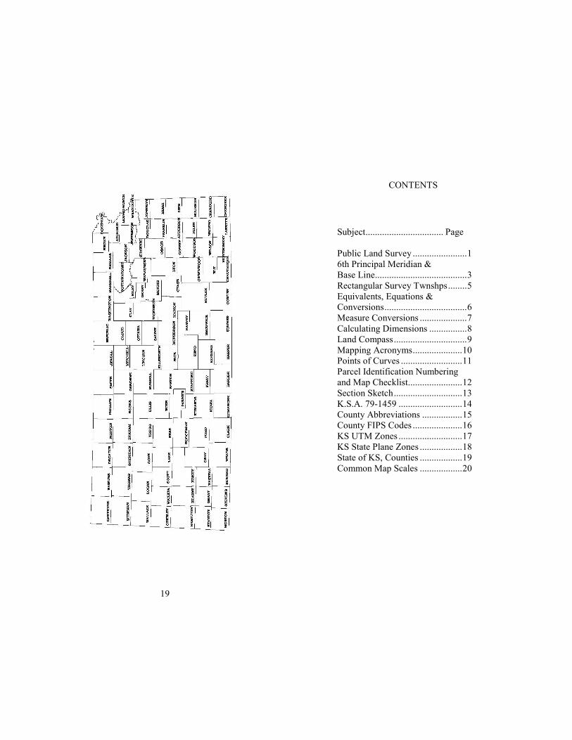
CONTENTS
Subject................................. Page
Public Land Survey .......................1
6th Principal Meridian &
Base Line.......................................3
Rectangular Survey Twnshps........5
Equivalents, Equations &
Conversions...................................6
Measure Conversions ....................7
Calculating Dimensions ................8
Land Compass...............................9
Mapping Acronyms.....................10
Points of Curves ..........................11
Parcel Identification Numbering
and Map Checklist.......................12
Section Sketch.............................13
K.S.A. 79-1459 ...........................14
County Abbreviations .................15
County FIPS Codes .....................16
KS UTM Zones ...........................17
KS State Plane Zones ..................18
State of KS, Counties ..................19
Common Map Scales ..................20
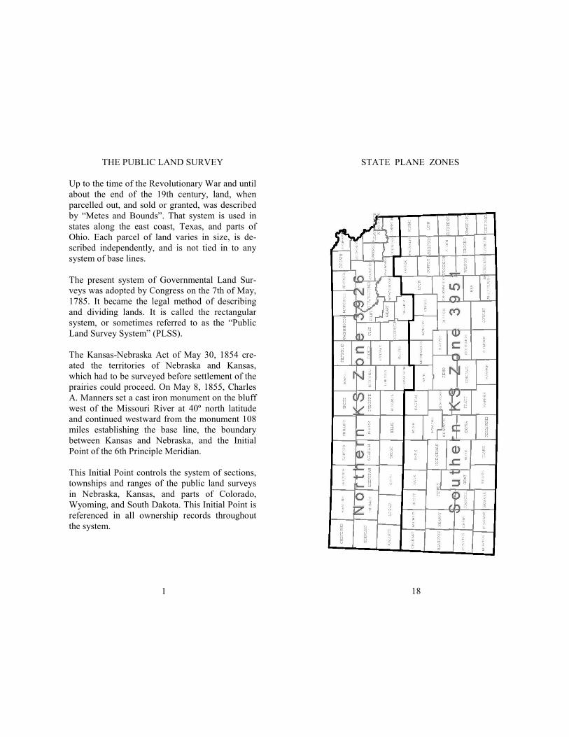
THE PUBLIC LAND SURVEY
Up to the time of the Revolutionary War and until
about the end of the 19th century, land, when
parcelled out, and sold or granted, was described
by “Metes and Bounds”. That system is used in
states along the east coast, Texas, and parts of
Ohio. Each parcel of land varies in size, is de-
scribed independently, and is not tied in to any
system of base lines.
The present system of Governmental Land Sur-
veys was adopted by Congress on the 7th of May,
1785. It became the legal method of describing
and dividing lands. It is called the rectangular
system, or sometimes referred to as the “Public
Land Survey System” (PLSS).
The Kansas-Nebraska Act of May 30, 1854 cre-
ated the territories of Nebraska and Kansas,
which had to be surveyed before settlement of the
prairies could proceed. On May 8, 1855, Charles
A. Manners set a cast iron monument on the bluff
west of the Missouri River at 40º north latitude
and continued westward from the monument 108
miles establishing the base line, the boundary
between Kansas and Nebraska, and the Initial
Point of the 6th Principle Meridian.
This Initial Point controls the system of sections,
townships and ranges of the public land surveys
in Nebraska, Kansas, and parts of Colorado,
Wyoming, and South Dakota. This Initial Point is
referenced in all ownership records throughout
the system.
1
18
STATE PLANE ZONES
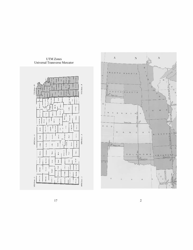
UTM Zones
Universal Transverse Mercator
17
2
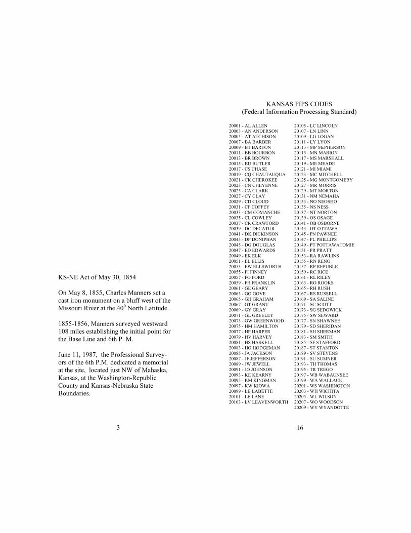
KS-NE Act of May 30, 1854
On May 8, 1855, Charles Manners set a
cast iron monument on a bluff west of the
Missouri River at the 400 North Latitude.
1855-1856, Manners surveyed westward
108 miles establishing the initial point for
the Base Line and 6th P. M.
June 11, 1987, the Professional Survey-
ors of the 6th P.M. dedicated a memorial
at the site, located just NW of Mahaska,
Kansas, at the Washington-Republic
County and Kansas-Nebraska State
Boundaries.
3
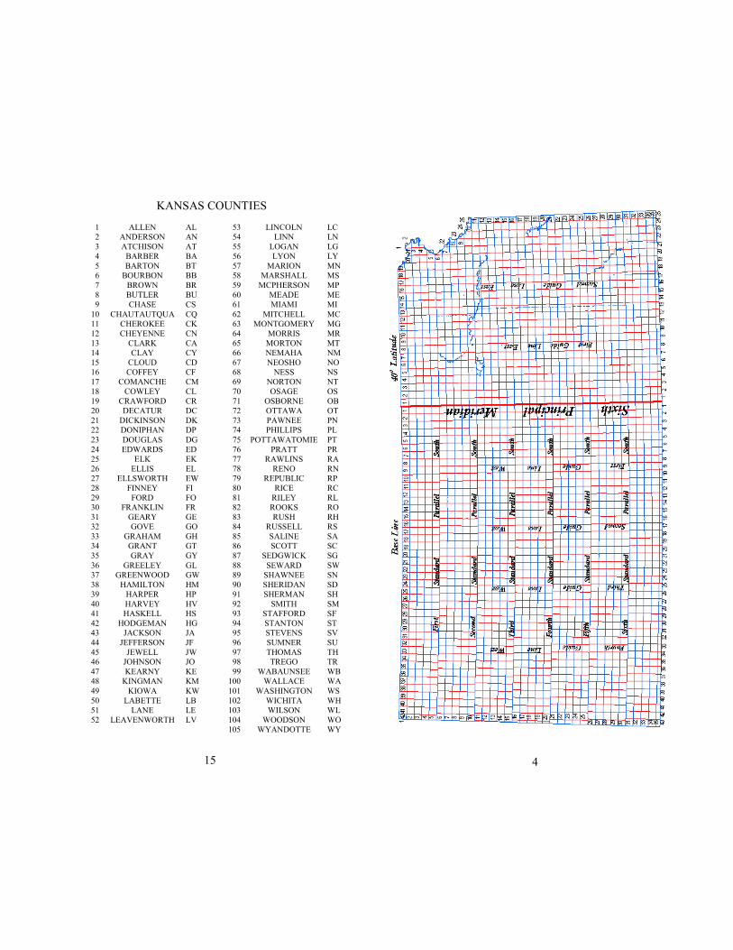
20001 - AL ALLEN
20003 - AN ANDERSON
20005 - AT ATCHISON
20007 - BA BARBER
20009 - BT BARTON
20011 - BB BOURBON
20013 - BR BROWN
20015 - BU BUTLER
20017 - CS CHASE
20019 - CQ CHAUTAUQUA
20021 - CK CHEROKEE
20023 - CN CHEYENNE
20025 - CA CLARK
20027 - CY CLAY
20029 - CD CLOUD
20031 - CF COFFEY
20033 - CM COMANCHE
20035 - CL COWLEY
20037 - CR CRAWFORD
20039 - DC DECATUR
20041 - DK DICKINSON
20043 - DP DONIPHAN
20045 - DG DOUGLAS
20047 - ED EDWARDS
20049 - EK ELK
20051 - EL ELLIS
20053 - EW ELLSWORTH
20055 - FI FINNEY
20057 - FO FORD
20059 - FR FRANKLIN
20061 - GE GEARY
20063 - GO GOVE
20065 - GH GRAHAM
20067 - GT GRANT
20069 - GY GRAY
20071 - GL GREELEY
20073 - GW GREENWOOD
20075 - HM HAMILTON
20077 - HP HARPER
20079 - HV HARVEY
20081 - HS HASKELL
20083 - HG HODGEMAN
20085 - JA JACKSON
20087 - JF JEFFERSON
20089 - JW JEWELL
20091 - JO JOHNSON
20093 - KE KEARNY
20095 - KM KINGMAN
20097 - KW KIOWA
20099 - LB LABETTE
20101 - LE LANE
20103 - LV LEAVENWORTH
20105 - LC LINCOLN
20107 - LN LINN
20109 - LG LOGAN
20111 - LY LYON
20113 - MP McPHERSON
20115 - MN MARION
20117 - MS MARSHALL
20119 - ME MEADE
20121 - MI MIAMI
20123 - MC MITCHELL
20125 - MG MONTGOMERY
20127 - MR MORRIS
20129 - MT MORTON
20131 - NM NEMAHA
20133 - NO NEOSHO
20135 - NS NESS
20137 - NT NORTON
20139 - OS OSAGE
20141 - OB OSBORNE
20143 - OT OTTAWA
20145 - PN PAWNEE
20147 - PL PHILLIPS
20149 - PT POTTAWATOMIE
20151 - PR PRATT
20153 - RA RAWLINS
20155 - RN RENO
20157 - RP REPUBLIC
20159 - RC RICE
20161 - RL RILEY
20163 - RO ROOKS
20165 - RH RUSH
20167 - RS RUSSELL
20169 - SA SALINE
20171 - SC SCOTT
20173 - SG SEDGWICK
20175 - SW SEWARD
20177 - SN SHAWNEE
20179 - SD SHERIDAN
20181 - SH SHERMAN
20183 - SM SMITH
20185 - SF STAFFORD
20187 - ST STANTON
20189 - SV STEVENS
20191 - SU SUMNER
20193 - TH THOMAS
20195 - TR TREGO
20197 - WB WABAUNSEE
20199 - WA WALLACE
20201 - WS WASHINGTON
20203 - WH WICHITA
20205 - WL WILSON
20207 - WO WOODSON
20209 - WY WYANDOTTE
KANSAS FIPS CODES
(Federal Information Processing Standard)
16
1 ALLEN AL
2 ANDERSON AN
3 ATCHISON AT
4 BARBER BA
5 BARTON BT
6 BOURBON BB
7 BROWN BR
8 BUTLER BU
9 CHASE CS
10 CHAUTAUTQUA CQ
11 CHEROKEE CK
12 CHEYENNE CN
13 CLARK CA
14 CLAY CY
15 CLOUD CD
16 COFFEY CF
17 COMANCHE CM
18 COWLEY CL
19 CRAWFORD CR
20 DECATUR DC
21 DICKINSON DK
22 DONIPHAN DP
23 DOUGLAS DG
24 EDWARDS ED
25 ELK EK
26 ELLIS EL
27 ELLSWORTH EW
28 FINNEY FI
29 FORD FO
30 FRANKLIN FR
31 GEARY GE
32 GOVE GO
33 GRAHAM GH
34 GRANT GT
35 GRAY GY
36 GREELEY GL
37 GREENWOOD GW
38 HAMILTON HM
39 HARPER HP
40 HARVEY HV
41 HASKELL HS
42 HODGEMAN HG
43 JACKSON JA
44 JEFFERSON JF
45 JEWELL JW
46 JOHNSON JO
47 KEARNY KE
48 KINGMAN KM
49 KIOWA KW
50 LABETTE LB
51 LANE LE
52 LEAVENWORTH LV
53 LINCOLN LC
54 LINN LN
55 LOGAN LG
56 LYON LY
57 MARION MN
58 MARSHALL MS
59 MCPHERSON MP
60 MEADE ME
61 MIAMI MI
62 MITCHELL MC
63 MONTGOMERY MG
64 MORRIS MR
65 MORTON MT
66 NEMAHA NM
67 NEOSHO NO
68 NESS NS
69 NORTON NT
70 OSAGE OS
71 OSBORNE OB
72 OTTAWA OT
73 PAWNEE PN
74 PHILLIPS PL
75 POTTAWATOMIE PT
76 PRATT PR
77 RAWLINS RA
78 RENO RN
79 REPUBLIC RP
80 RICE RC
81 RILEY RL
82 ROOKS RO
83 RUSH RH
84 RUSSELL RS
85 SALINE SA
86 SCOTT SC
87 SEDGWICK SG
88 SEWARD SW
89 SHAWNEE SN
90 SHERIDAN SD
91 SHERMAN SH
92 SMITH SM
93 STAFFORD SF
94 STANTON ST
95 STEVENS SV
96 SUMNER SU
97 THOMAS TH
98 TREGO TR
99 WABAUNSEE WB
100 WALLACE WA
101 WASHINGTON WS
102 WICHITA WH
103 WILSON WL
104 WOODSON WO
105 WYANDOTTE WY
15
KANSAS COUNTIES
4
5
6 M
ILES
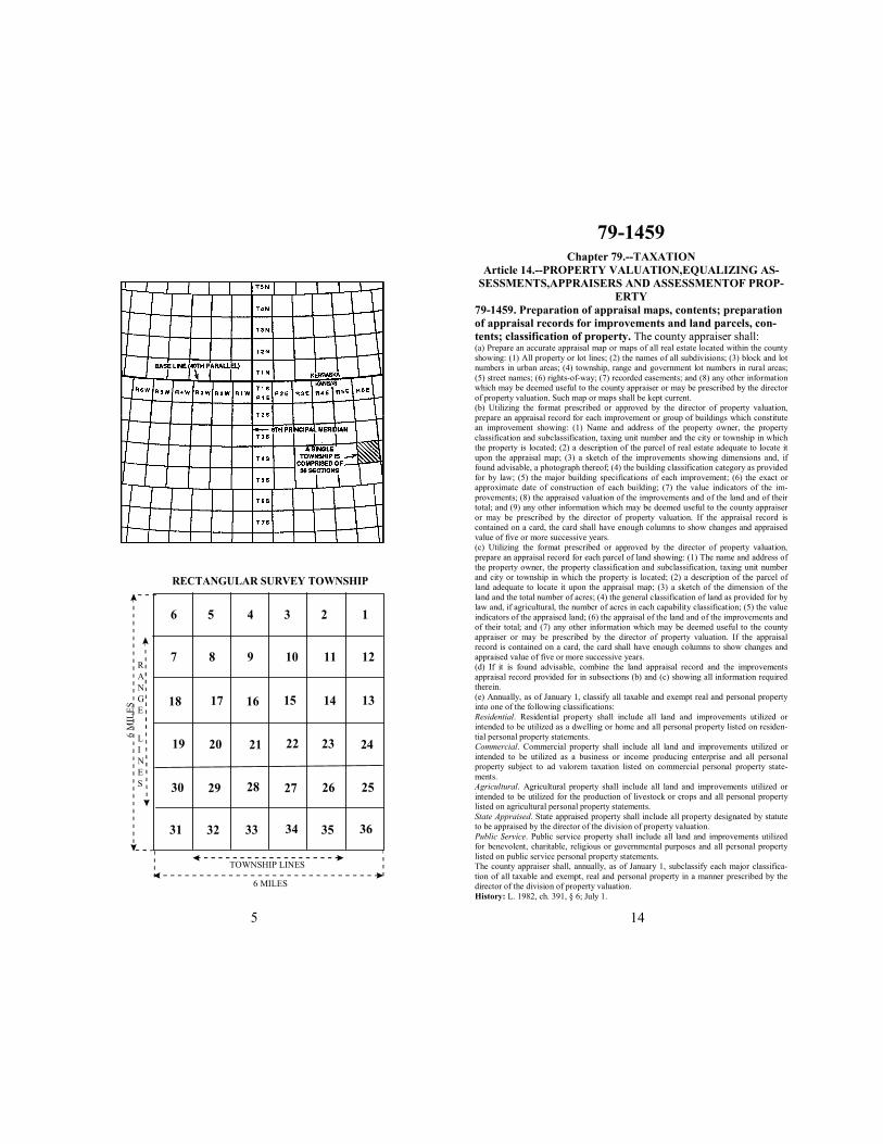
RECTANGULAR SURVEY TOWNSHIP
6
8 9 10 11 12
12345
7
26
18
23
17 16
3634
24
15 14 13
20 21 22
30 29 28
19
27
31 32 33
25
35
R
A
N
G
E
L
I
N
E
S
TOWNSHIP LINES
6 MILES
79-1459 Chapter 79.--TAXATION
Article 14.--PROPERTY VALUATION,EQUALIZING AS-
SESSMENTS,APPRAISERS AND ASSESSMENTOF PROP-
ERTY
79-1459. Preparation of appraisal maps, contents; preparation of appraisal records for improvements and land parcels, con-
tents; classification of property. The county appraiser shall: (a) Prepare an accurate appraisal map or maps of all real estate located within the county
showing: (1) All property or lot lines; (2) the names of all subdivisions; (3) block and lot
numbers in urban areas; (4) township, range and government lot numbers in rural areas;
(5) street names; (6) rights-of-way; (7) recorded easements; and (8) any other information
which may be deemed useful to the county appraiser or may be prescribed by the director
of property valuation. Such map or maps shall be kept current.
(b) Utilizing the format prescribed or approved by the director of property valuation,
prepare an appraisal record for each improvement or group of buildings which constitute
an improvement showing: (1) Name and address of the property owner, the property
classification and subclassification, taxing unit number and the city or township in which
the property is located; (2) a description of the parcel of real estate adequate to locate it
upon the appraisal map; (3) a sketch of the improvements showing dimensions and, if
found advisable, a photograph thereof; (4) the building classification category as provided
for by law; (5) the major building specifications of each improvement; (6) the exact or
approximate date of construction of each building; (7) the value indicators of the im-
provements; (8) the appraised valuation of the improvements and of the land and of their
total; and (9) any other information which may be deemed useful to the county appraiser
or may be prescribed by the director of property valuation. If the appraisal record is
contained on a card, the card shall have enough columns to show changes and appraised
value of five or more successive years.
(c) Utilizing the format prescribed or approved by the director of property valuation,
prepare an appraisal record for each parcel of land showing: (1) The name and address of
the property owner, the property classification and subclassification, taxing unit number
and city or township in which the property is located; (2) a description of the parcel of
land adequate to locate it upon the appraisal map; (3) a sketch of the dimension of the
land and the total number of acres; (4) the general classification of land as provided for by
law and, if agricultural, the number of acres in each capability classification; (5) the value
indicators of the appraised land; (6) the appraisal of the land and of the improvements and
of their total; and (7) any other information which may be deemed useful to the county
appraiser or may be prescribed by the director of property valuation. If the appraisal
record is contained on a card, the card shall have enough columns to show changes and
appraised value of five or more successive years.
(d) If it is found advisable, combine the land appraisal record and the improvements
appraisal record provided for in subsections (b) and (c) showing all information required
therein.
(e) Annually, as of January 1, classify all taxable and exempt real and personal property
into one of the following classifications:
Residential. Residential property shall include all land and improvements utilized or
intended to be utilized as a dwelling or home and all personal property listed on residen-
tial personal property statements.
Commercial. Commercial property shall include all land and improvements utilized or
intended to be utilized as a business or income producing enterprise and all personal
property subject to ad valorem taxation listed on commercial personal property state-
ments.
Agricultural. Agricultural property shall include all land and improvements utilized or
intended to be utilized for the production of livestock or crops and all personal property
listed on agricultural personal property statements.
State Appraised. State appraised property shall include all property designated by statute
to be appraised by the director of the division of property valuation.
Public Service. Public service property shall include all land and improvements utilized
for benevolent, charitable, religious or governmental purposes and all personal property
listed on public service personal property statements.
The county appraiser shall, annually, as of January 1, subclassify each major classifica-
tion of all taxable and exempt, real and personal property in a manner prescribed by the
director of the division of property valuation.
History: L. 1982, ch. 391, § 6; July 1.
14
13
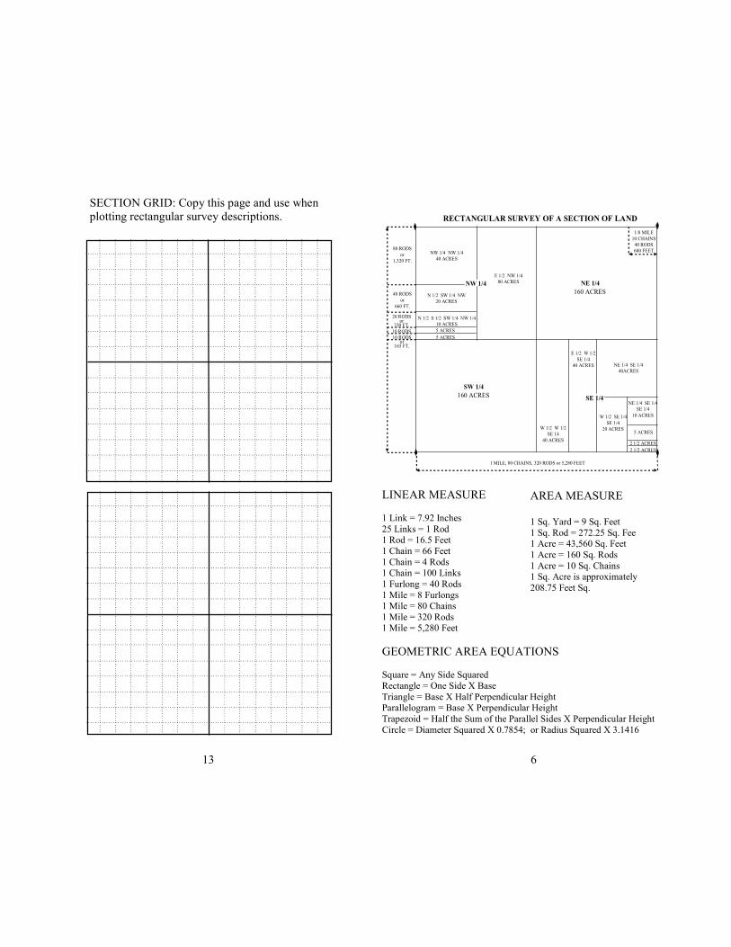
SECTION GRID: Copy this page and use when
plotting rectangular survey descriptions.
6
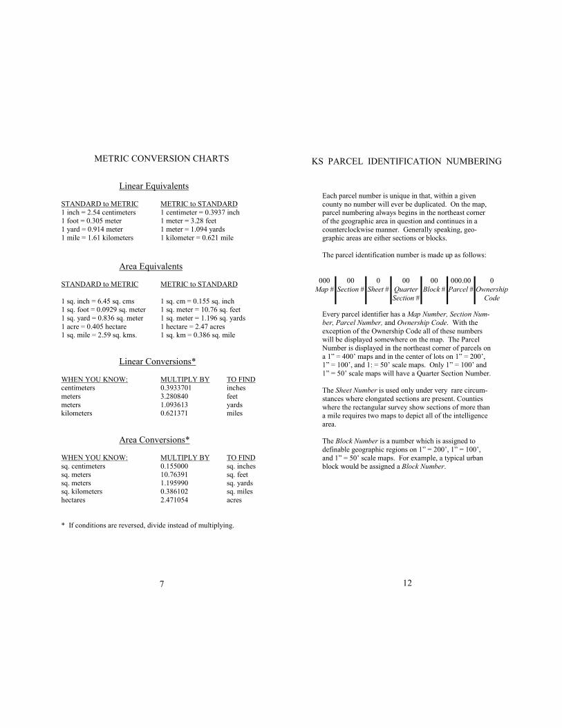
RECTANGULAR SURVEY OF A SECTION OF LAND
NW 1/4 NW 1/4 40 ACRES
N 1/2 SW 1/4 NW 20 ACRES
N 1/2 S 1/2 SW 1/4 NW 1/4 10 ACRES 5 ACRES 5 ACRES
E 1/2 NW 1/4 80 ACRES NW 1/4 NE 1/4
160 ACRES
1/8 MILE 10 CHAINS 40 RODS 680 FEET 80 RODS
or 1,320 FT.
40 RODS or
660 FT.
20 RODS or
330 FT. 10 RODS 10 RODS
or 165 FT.
SW 1/4 160 ACRES
W 1/2 W 1/2 SE 14
40 ACRES
E 1/2 W 1/2 SE 1/4
40 ACRES NE 1/4 SE 1/4 40ACRES
SE 1/4
W 1/2 SE 1/4 SE 1/4
20 ACRES
NE 1/4 SE 1/4 SE 1/4
10 ACRES
5 ACRES
2 1/2 ACRES 2 1/2 ACRES
1 MILE, 80 CHAINS, 320 RODS or 5,280 FEET
LINEAR MEASURE
1 Link = 7.92 Inches
25 Links = 1 Rod 1 Rod = 16.5 Feet
1 Chain = 66 Feet
1 Chain = 4 Rods 1 Chain = 100 Links
1 Furlong = 40 Rods
1 Mile = 8 Furlongs 1 Mile = 80 Chains
1 Mile = 320 Rods 1 Mile = 5,280 Feet
GEOMETRIC AREA EQUATIONS Square = Any Side Squared
Rectangle = One Side X Base
Triangle = Base X Half Perpendicular Height Parallelogram = Base X Perpendicular Height
Trapezoid = Half the Sum of the Parallel Sides X Perpendicular Height
Circle = Diameter Squared X 0.7854; or Radius Squared X 3.1416
AREA MEASURE
1 Sq. Yard = 9 Sq. Feet
1 Sq. Rod = 272.25 Sq. Fee 1 Acre = 43,560 Sq. Feet
1 Acre = 160 Sq. Rods
1 Acre = 10 Sq. Chains 1 Sq. Acre is approximately
208.75 Feet Sq.
7
METRIC CONVERSION CHARTS
Linear Equivalents
STANDARD to METRIC METRIC to STANDARD
1 inch = 2.54 centimeters 1 centimeter = 0.3937 inch 1 foot = 0.305 meter 1 meter = 3.28 feet
1 yard = 0.914 meter 1 meter = 1.094 yards
1 mile = 1.61 kilometers 1 kilometer = 0.621 mile
Area Equivalents STANDARD to METRIC METRIC to STANDARD
1 sq. inch = 6.45 sq. cms 1 sq. cm = 0.155 sq. inch 1 sq. foot = 0.0929 sq. meter 1 sq. meter = 10.76 sq. feet
1 sq. yard = 0.836 sq. meter 1 sq. meter = 1.196 sq. yards
1 acre = 0.405 hectare 1 hectare = 2.47 acres 1 sq. mile = 2.59 sq. kms. 1 sq. km = 0.386 sq. mile
Linear Conversions*
WHEN YOU KNOW: MULTIPLY BY TO FIND centimeters 0.3933701 inches
meters 3.280840 feet
meters 1.093613 yards kilometers 0.621371 miles
Area Conversions*
WHEN YOU KNOW: MULTIPLY BY TO FIND
sq. centimeters 0.155000 sq. inches sq. meters 10.76391 sq. feet
sq. meters 1.195990 sq. yards sq. kilometers 0.386102 sq. miles
hectares 2.471054 acres
* If conditions are reversed, divide instead of multiplying.
12
Each parcel number is unique in that, within a given
county no number will ever be duplicated. On the map, parcel numbering always begins in the northeast corner
of the geographic area in question and continues in a
counterclockwise manner. Generally speaking, geo-graphic areas are either sections or blocks.
The parcel identification number is made up as follows:
Every parcel identifier has a Map Number, Section Num-
ber, Parcel Number, and Ownership Code. With the
exception of the Ownership Code all of these numbers will be displayed somewhere on the map. The Parcel
Number is displayed in the northeast corner of parcels on
a 1” = 400’ maps and in the center of lots on 1” = 200’, 1” = 100’, and 1: = 50’ scale maps. Only 1” = 100’ and
1” = 50’ scale maps will have a Quarter Section Number.
The Sheet Number is used only under very rare circum-
stances where elongated sections are present. Counties
where the rectangular survey show sections of more than a mile requires two maps to depict all of the intelligence
area.
The Block Number is a number which is assigned to
definable geographic regions on 1” = 200’, 1” = 100’,
and 1” = 50’ scale maps. For example, a typical urban block would be assigned a Block Number.
000 00 0 00 00 000.00 0
Map # Section # Sheet # Quarter Block # Parcel # Ownership
Section # Code
KS PARCEL IDENTIFICATION NUMBERING
11
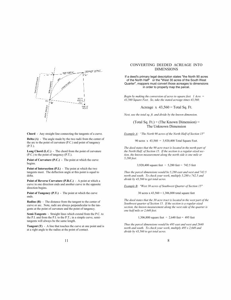
Chord - Any straight line connecting the tangents of a curve. Delta (∆) - The angle made by the two radii from the center of
the arc to the point of curvature (P.C.) and point of tangency
(P.T.). Long Chord (L.C.) - The chord from the point of curvature (P.C.) to the point of tangency (P.T.). Point of Curvature (P.C.) - The point at which the curve
begins. Point of Intersection (P.I.) - The point at which the two
tangents meet. The deflection angle at this point is equal to delta. Point of Reverse Curvature (P.R.C.) - A point at which a
curve in one direction ends and another curve in the opposite
direction begins. Point of Tangency (P.T.) - The point at which the curve ends. Radius (R) - The distance from the tangent to the center of
curve or arc. Note, radii are always perpendicular to the tan-
gents at the point of curvature and the point of tangency. Semi-Tangents - Straight lines which extend from the P.C. to the P.I. and from the P.I. to the P.T.; in a simple curve, semi-
tangents will always be the same length. Tangent (T) - A line that touches the curve at one point and is
at a right angle to the radius at the point of contact.
8
CONVERTING DEEDED ACREAGE INTO
DIMENSIONS
If a deed's primary legal description states "the North 90 acres of the North Half" or the "West 30 acres of the South West
Quarter", mappers must convert those acreages to dimensions in order to properly map the parcel.
Begin by making the conversion of acres to square feet. 1 Acre =
43,560 Square Feet. So, take the stated acreage times 43,560.
Acreage x 43,560 = Total Sq. Ft.
Next, use the total sq. ft. and divide by the known dimension.
(Total Sq. Ft.) ÷ (The Known Dimension) =
The Unknown Dimension
Example A: “The North 90 acres of the North Half of Section 15"
90 acres x 43,560 = 3,920,400 Total Square Feet.
The deed states that the 90 acre tract is located in the north part of the North Half. of Section 15. If the section is a regular-sized sec-
tion, the known measurement along the north side is one mile or
5,280 feet.
3,920,400 square feet ÷ 5,280 feet = 742.5 feet
Thus the parcel dimensions would be 5,280 east and west and 742.5
north and south. To check your work, multiply 5,280 x 742.5 and
divide by 43,560 to get total acres.
Example B: "West 30 acres of Southwest Quarter of Section 15"
30 acres x 43,560 = 1,306,800 total square feet
The deed states that the 30 acre tract is located in the west part of the Southwest quarter of Section 15. If the section is a regular-sized
section, the known measurement along the west side of the quarter is
one half mile or 2,640 feet.
1,306,800 square feet ÷ 2,640 feet = 495 feet
Thus the parcel dimensions would be 495 east and west and 2640
north and south. To check your work, multiply 495 x 2,640 and
divide by 43,560 to get total acres.
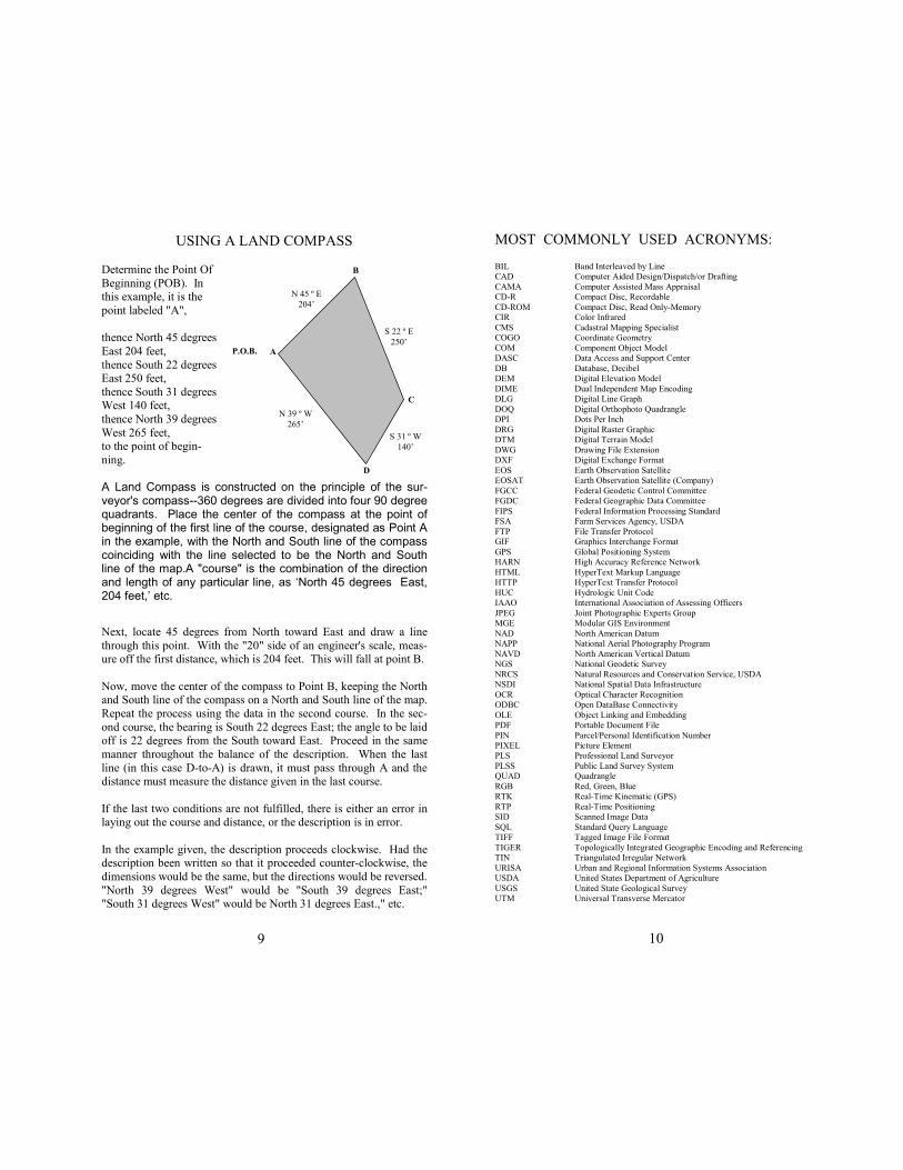
USING A LAND COMPASS
Determine the Point Of
Beginning (POB). In this example, it is the
point labeled "A",
thence North 45 degrees
East 204 feet,
thence South 22 degrees East 250 feet,
thence South 31 degrees West 140 feet,
thence North 39 degrees
West 265 feet, to the point of begin-
ning.
A Land Compass is constructed on the principle of the sur-veyor's compass--360 degrees are divided into four 90 degree quadrants. Place the center of the compass at the point of beginning of the first line of the course, designated as Point A in the example, with the North and South line of the compass coinciding with the line selected to be the North and South line of the map.A "course" is the combination of the direction and length of any particular line, as ‘North 45 degrees East, 204 feet,’ etc.
Next, locate 45 degrees from North toward East and draw a line
through this point. With the "20" side of an engineer's scale, meas-ure off the first distance, which is 204 feet. This will fall at point B.
Now, move the center of the compass to Point B, keeping the North and South line of the compass on a North and South line of the map.
Repeat the process using the data in the second course. In the sec-
ond course, the bearing is South 22 degrees East; the angle to be laid off is 22 degrees from the South toward East. Proceed in the same
manner throughout the balance of the description. When the last
line (in this case D-to-A) is drawn, it must pass through A and the distance must measure the distance given in the last course.
If the last two conditions are not fulfilled, there is either an error in laying out the course and distance, or the description is in error.
In the example given, the description proceeds clockwise. Had the description been written so that it proceeded counter-clockwise, the
dimensions would be the same, but the directions would be reversed.
"North 39 degrees West" would be "South 39 degrees East;" "South 31 degrees West" would be North 31 degrees East.," etc.
P.O.B. A
D
C
B
N 45 º E
204’
S 22 º E
250’
S 31 º W
140’
N 39 º W
265’
9
MOST COMMONLY USED ACRONYMS: BIL Band Interleaved by Line
CAD Computer Aided Design/Dispatch/or Drafting
CAMA Computer Assisted Mass Appraisal
CD-R Compact Disc, Recordable
CD-ROM Compact Disc, Read Only-Memory
CIR Color Infrared
CMS Cadastral Mapping Specialist
COGO Coordinate Geometry
COM Component Object Model
DASC Data Access and Support Center
DB Database, Decibel
DEM Digital Elevation Model
DIME Dual Independent Map Encoding
DLG Digital Line Graph
DOQ Digital Orthophoto Quadrangle
DPI Dots Per Inch
DRG Digital Raster Graphic
DTM Digital Terrain Model
DWG Drawing File Extension
DXF Digital Exchange Format
EOS Earth Observation Satellite
EOSAT Earth Observation Satellite (Company)
FGCC Federal Geodetic Control Committee
FGDC Federal Geographic Data Committee
FIPS Federal Information Processing Standard
FSA Farm Services Agency, USDA
FTP File Transfer Protocol
GIF Graphics Interchange Format
GPS Global Positioning System
HARN High Accuracy Reference Network
HTML HyperText Markup Language
HTTP HyperText Transfer Protocol
HUC Hydrologic Unit Code
IAAO International Association of Assessing Officers
JPEG Joint Photographic Experts Group
MGE Modular GIS Environment
NAD North American Datum
NAPP National Aerial Photography Program
NAVD North American Vertical Datum
NGS National Geodetic Survey
NRCS Natural Resources and Conservation Service, USDA
NSDI National Spatial Data Infrastructure
OCR Optical Character Recognition
ODBC Open DataBase Connectivity
OLE Object Linking and Embedding
PDF Portable Document File
PIN Parcel/Personal Identification Number
PIXEL Picture Element
PLS Professional Land Surveyor
PLSS Public Land Survey System
QUAD Quadrangle
RGB Red, Green, Blue
RTK Real-Time Kinematic (GPS)
RTP Real-Time Positioning
SID Scanned Image Data
SQL Standard Query Language
TIFF Tagged Image File Format
TIGER Topologically Integrated Geographic Encoding and Referencing
TIN Triangulated Irregular Network
URISA Urban and Regional Information Systems Association
USDA United States Department of Agriculture
USGS United State Geological Survey
UTM Universal Transverse Mercator
10