a cultural geography of the leschenault estuary district · in the report, an english translation...
TRANSCRIPT

Edith Cowan University Faculty of Regional Professional Studies
Sandra Wooltorton
Research Assistance, Qualitative and Quantitative Study: Frances Steele Noongar History and Culture Editor: Len Collard
History Editor: Phyllis Barnes
Vittoria Bay Autumn. Painting by Sue Kalab.
A Sense of Home:
A Cultural Geography of the Leschenault Estuary District
Report

2
This project was funded through an ECU/Industry Collaboration grant with support from the Department of
Water, HotRock, the Leschenault Catchment Council and the South West Catchments Council through
funding from the Australian Government’s Caring for our Country and the Government of Western Australia.
Excluding third party images which are used under license, copyright in this work belongs to Edith Cowan
University. Other than as permitted under the Copyright Act 1968 (Cth), you may not exercise any of the
exclusive rights of ECU or the other copyright holders without their permission. All copyright queries in
relation to material owned by Edith Cowan University should be directed to [email protected].
This report was published July, 2013 by Edith Cowan University: Centre for Sustainable Regional Futures.
Dr Sandra Wooltorton
Centre for Sustainable Regional Futures
Edith Cowan University
PO Box 1712
Bunbury WA 6230
+61 897807777
http://www.leschenaultproject.org.au

3
We wish to thank everyone who completed a survey, who participated in an interview or focus group, or
who helped organize or participate in the photo‐elicitation study.
We wish to thank the following people and organisations who helped to make this project successful:
ABC Local Radio: promoted the project through interviews.
Australind Library: promoted the project and collected hard copies of the survey.
Australind Historical Society: provided advice and assistance with document retrieval.
Bill Bennell, Nerrilee Boshammer and Zac Webb: provided advice.
Brendan Kelly: provided historical material and editorial assistance.
Bunbury City Council: promoted the project and collected hard copies of the survey.
Bunbury and Withers Libraries: promoted the project and collected hard copies of the survey.
Bunbury Dolphin Centre: promoted the project and collected hard copies of the survey.
Bunbury Rotary Club: promoted the project and made helpful links.
Chris Tate Photography: ph. 045 952 7897 or https://www.facebook.com/ChrisTatePhotography?ref=ts.
Cristal Global: assisted with data collection.
Dandjoo Moordiyup Dabakarn (Denise Smith‐Ali, Charmaine Bennell and Aunty Nora Dann): linguistic advice.
ECU Marketing: provided graphic design throughout the project.
Elaine Hill: provided photographs and support.
George Mardon: provided photographs, mapping and historical advice, and promoted the project.
Goomburrup Aboriginal Corporation: provided feedback and support.
Holly Smith: provided photographs.
Hugo Beckle: provided advice on the historical geography research design and implementation.
Joanna Hugues‐dit‐Ciles: provided photographs, advice and research connections.
John Castrilli: promoted the project.
John Ryan: provided editorial advice with the historical geography research.
John Vukovich: provided editorial advice.
Judy and Barry Johnston: provided historical advice and photographs.
King Cottage Staff and Volunteers: located maps and information.
Len Collard (University of Western Australia): provided historical and linguistic advice and editing detail.
Leschenault Catchments Council Members: promoted and supported the project.
Merrilyn and Michael Gollan: provided photographs and historical advice.
Merrilyn Shaw: facilitated meetings and provided key documents.
Marilyn Palmer: editorial assistance.
Mark Allen: provided research assistance.
Mike McKenna: initiated the project, provided editorial assistance.
Mike Whitehead: provided photographs, mapping advice and promoted the project.
Norm Flynn: provided information.
Perry Home: advertised the project and provided advice.
Dolphin Discovery Centre (Phil Coulthard): promoted the project.
Pierre Horwitz: provided research advice.
Phyllis Barnes: provided historical and editing advice and historical materials.
Rod Giblett: provided research and editing advice with the historical geography component of the research.
Sean Ellingham: provided photographs and promoted the project.
Sports Marine Boat Centre, Strickland Street, Bunbury: promoted the project.
Sue Kalab: provided works of art for publication and promoted the project: http://www.suekalab.com.

4
There are big issues in society that cannot be solved through a single disciplinary perspective, because the
problem is shared – such as the question of how to restore health to an estuary. These problems are often
referred to as ‘wicked problems’1 because they need creative, interdisciplinary, collaborative, multi‐scaled
solutions. This project was designed with these principles in mind. It has involved amateur and professional
geographers, photographers, artists, ecologists, scientists, social scientists, historians, journalists, elders,
linguists, radio announcers, librarians, environmental educators, researchers and teachers – and many
meetings.
TableofContentsNoongar Language ....................................................................................................................................... 7
Executive Summary ......................................................................................................................................... 8
Introduction ....................................................................................................................................................... 10
1.1 Methodology ........................................................................................................................................... 12
1.1.1 Goal and Aims ................................................................................................................................... 12
1.1.2 Philosophy and Theory ..................................................................................................................... 13
1.1.3 Conceptual Framework .................................................................................................................... 14
1.2 Significance .............................................................................................................................................. 15
1.2.1 Significance and Innovation .............................................................................................................. 15
1.2.2 Geographical Scope of the Research ................................................................................................ 16
1.3 Geographical Context .............................................................................................................................. 18
1.3.1 The Spatial and Ecological Character of the Leschenault Estuary .................................................... 19
1.3.2 A Short Socio‐Economic Geography of the Leschenault Estuary District ......................................... 21
1.3.3 Conclusion ........................................................................................................................................ 26
Place‐Based Social Values in Noongar Times .................................................................................................... 28
2.1 Elaap –Karlaboodjar: Home Place ........................................................................................................... 32
2.1.1 Elaap – Boodjar and Moort (Place and Family) ................................................................................ 33
2.1.2 Elaap – Boodjar: Territory ................................................................................................................ 35
2.1.3 Karlaboodjar Elaap: Leschenault ...................................................................................................... 36
2.2 Moort Elaap – Living In Relation to Boodjar ............................................................................................ 37
2.2.1 Ecological Knowledge of Boodjar – Nourishing Terrain ................................................................... 37
2.2.2 Dancing Up Nature – Kinship With Boodjar ..................................................................................... 40
2.2.3 Honouring Place ............................................................................................................................... 41
2.3 Katitjiny: Knowing .................................................................................................................................... 42
2.3.1 A Social Ecology of Place .................................................................................................................. 42
1 As described by Brown, Harris & Russell (2010).
5
2.3.2 Values – Elaap Derbal, Karlaboodjar ................................................................................................ 44
2.3.3 Interjection: Kura, Yeyi, Boordawan: Past, Present and future ........................................................ 47
Place‐based social values in Colonial times ....................................................................................................... 48
3.1 People, Place and Values ......................................................................................................................... 50
3.1.1 Sources ............................................................................................................................................. 50
3.1.2 Encounters with Place ...................................................................................................................... 51
3.2 An Elaap Sense of Home – An Immigrant Sense of Unfamiliarity ........................................................... 55
3.2.1 Place for Profit .................................................................................................................................. 56
3.2.2 Backgrounding of Place .................................................................................................................... 60
3.2.3 Linking Two Stories of Place ............................................................................................................. 62
3.3 Conclusion ............................................................................................................................................... 63
3.3.1 Values ............................................................................................................................................... 63
3.3.2 Photographs and Brief Summary of Changes ‐ Leschenault District, 1890s, 1900s ......................... 65
4.1 Research Method .................................................................................................................................... 80
4.1.1 Literature Review: Method .............................................................................................................. 80
4.2.2 The Instrument and Implementation ............................................................................................... 83
4.1 The Quantitative Study ............................................................................................................................ 84
4.2.1 Demographic Data ............................................................................................................................ 85
4.2.2 Place‐Based Social Values ................................................................................................................. 85
4.2.3 Priorities and Attitudes ..................................................................................................................... 87
4.2.4 Discussion and Conclusion................................................................................................................ 88
4.3 The Qualitative Study .............................................................................................................................. 90
4.3.1 Place‐Based Social Values ................................................................................................................. 90
4.3.2 Concerns About Places around the Leschenault Estuary and Inlet. ................................................. 92
4.3.3 Aspirations for the Estuary and Inlet ................................................................................................ 93
4.3.4 Conclusion: Place‐Based Social Values of the Leschenault District (2012) ...................................... 94
Conclusion: A Sense of Home in the Leschenault Estuary and Inlet District ..................................................... 96
Recommendations for Further Research ...................................................................................................... 97
Epilogue 1: Coming Home to Place in the Leschenault Estuary – A Writer’s Reflection ............................... 98
Epilogue 2: Cries of the Derbal Elaap: Where are you now, my people? ................................................... 100
References ................................................................................................................................................... 101
Appendix One: Copy of Survey Instrument ................................................................................................. 104
Appendix Two: Making a Bwok or Booga (Coat) ......................................................................................... 115
6
ListofPlates,TablesandFigures Plate 1: The sub‐catchment boundaries of the Leschenault Catchment. 16
Plate 2. Map showing Greater Bunbury Regional Scheme: GBRS Sheet 12. 17
Plate 3. Map showing Greater Bunbury Regional Scheme: GBRS Sheet 9. 18
Plate 4: Map showing the City of Bunbury boundaries. 23
Plate 5: Land uses with nutrient point sources in the Leschenault Catchment. 25
Plate 6: Visual Representation of Factors Affecting the Leschenault Estuary. 27
Plate 7: Copy of an 1829 Leschenault map by Lt. Preston, showing the whole estuarine water body.
29
Plate 8: Map of South West Section of “Tribal Boundaries in Aboriginal Australia” (Tindale, 1974).
35
Plate 9: Recent image showing the southern part of the Estuary with the Leschenault Peninsula in the background, and the Bila Borrigup snaking its way across the coastal plain in the foreground.
44
Plate 10: Eastern portion of Australia (Arrowsmith, 1841). 48
Plate 11: Copy of part of an article from the Perth Gazette and Western Australian Journal, 1833.
49
Plate 12: Copy of the wedding notice of George Eliot to Louisa Clifton, in the Inquirer: Perth WA, 1842.
49
Plate 13: Copy of a Quarter Sessions Court Report, from The Perth Gazette and Independent Journal of Politics and News, 1850.
49
Plate 14: Painting by Louisa Clifton, titled: View of Leschenault Bay 1841. 51
Plate 15. Copy of the 1841 map surveyed by Captain Stokes RN. 53
Plate 16. Impression of the settlement c1840 (Barnes, 2001, p.28). 54
Plate 17: Cutting from image titled: Section from Wheeler’s Bunbury 1891. 65
Plate 18: Picture is titled: Three Bunbury Aborigines: Bobby, Sarah and Maggie. 66
Plate 19: Town Centre Detail from Wheeler’s 1891. 67
Plate 20: Section of map titled: Leschenault Inlet 1898. 68
Plate 21: Part of a 1905 Bunbury Land Agency map with Noongar place‐names. 69
Plates 22: 1911 Postcards of Paddy’s Blunders (Leschenault Inlet, Bunbury). 70
Plate 23: Picture titled: Valdemar at Turkey Point Jetty and Boat C1922. 71
Plate 24: Picture titled: Valdemar at Turkey Point Jetty. 71
Plate 25: Photograph taken at Turkey Point, titled: Two ladies and a man, 1922. 72
Plate 26: Map titled Street plan of Bunbury by Steere & Clarke, Estate Agents. 72
Plate 27: Aerial photograph entitled: ‘Mouth’, dated 9/2/1958. 73
Plate 28: Image shows the Leschenault Estuary in the late 1970s. 74
Plate 29: Image shows the newly completed Inner Harbour in the late 1970s. 74
Plate 30: The Cut (2011), engineered in 1951. 75
Plate 31: Aerial view of estuary Leschenault Peninsula, which separates the Estuary from the ocean.
75
Plate 32: Map shows Leschenault Estuary and Inlet, adapted from LIMA (1993). 79 Table 1: Noongar Seasons (Bates 1985). 34
Table 2: Summary of Alterations to the Leschenault Estuary. 76
Table 3: Survey Respondents’ Sense of Place Values (Quantitative Extraction). 87
Table 4: Qualitative Interpretation of Place‐Based Social Values of Leschenault 94
Figure 1: Conceptual Framework as Networks of Relationships. 14
Figure 2: Engineered Alterations to the Estuary Over Time (Semeniuk, 2000). 20
Figure 3: Graph Showing Question 22 Responses. 88
7
Noongar2LanguageIn this report Noongar language was used where needed because it made some place‐based concepts easier
to describe. The Bunbury Noongar Language Centre’s orthography (lettering system) was used for the
purpose. The exception to the rule was that direct quotes precisely reproduced the spelling used in the
original source. In the report, an English translation of all Noongar words used is provided in text.
NoongarWordlistforElaapKarlaboodjaElaap – Noongar name for Leschenault District; also name of the people of the Leschenault District.
Babbingur – totem.
Bidi – path or trail, or veins. Bila or bilya – river. Bilgur – river people. Bila Barajillup – Preston River, near the mouth.
Bila Borrigup – Collie River, near the mouth.
Birdiya (teacher or elder) Booga or bwok – coat made from skins such as possum or small kangaroo.
Boodjar – a Noongar holistic concept of land or place that means full of life; ecosystem (and therefore
people). Nourishing terrain.
Boodjari – pregnant, full of life. Burong wongi – the language of the Elaap people. Buyungur – people of the foothills, or rocky country. Derbalung – … of the place where the salt water meets the freshwater (estuary people).
Gwenilup – place of the quenda. Kanya – sacred. Karl – fire, home. Home is where the birdiya can set fire to boodjar. Karlap – home‐place or fire place. Karlaboodjar – shared property in land. The boodjar one is co‐responsible for. Karlapgur – kin who share in the karlaboodjar. People of the place, kin of the place. Karlamaya – home hut; karlamaya mandjar – extended family huts built in a cluster.
Katitjiny – learning, speaking, knowing. Kobungur – older brother. Kongan – uncle. Koornt – hut; often covered with green balga (grass tree) leaves for waterproofing. Kaneang – of the west. Elaap people were regarded as Kaneang Bibbulmen (Bates, 1985). Mandjar – meeting or festival, sometimes for trade (eg. Mandjarup). Manitjmat – cockatoo lineage (moiety).
Maya – hut, often made from tea‐tree or paperbark. Maya is also the name for a preferred species of tea‐
tree bark for hut construction.
Mardalup – foot‐place, such as a ford or river crossing. There is a Mardalup at the mouth of the Collie River.
Moort – family or kinship relatives.
Wordungmat – crow lineage (moiety).
Yallor gannow – yallor is a dance, and gannow are steps. Yargril – charcoal.
2 Unless quoting a writer such as Collard (1994) who uses the spelling Nyungar, Noongar will be used since
that is the preference of the Dandjoo Moordiyup Dabakarn Bunbury Noongar Language and Culture Centre.

8
ExecutiveSummaryIn 2012, a project was implemented to determine the place‐based social values of the people of the Leschenault Estuary district. The project included a historical study, a literature review, a survey with quantitative and qualitative questions, targeted community engagement (five focus groups, six individual interviews) and a photo‐elicitation study with a group of high school children.
ResearchQuestionWhat is history of the relationship between people and place in the Leschenault Estuary District, and what is the relationship in 2012? What were, and what are the place‐based social values of the population?
HistoryThis land is old, rivers are old and stories are old. The South West has been continuously occupied for over 45,000 years. However the Leschenault estuarine system is young, formed around 8,000 years ago. The Elaap are Wardandi Noongar people who lived around the Leschenault Inlet and Estuary. The Elaap people cared for and highly valued the district. They saw it as alive, as life‐sustaining, as nourishing and as imbued with spirit. Landscape‐embedded stories unified heritage, culture, place and people. Stories of the estuary, rivers and ecosystem explained life and place.
The immigrants valued the estuary for its life‐sustaining qualities as well as for its aesthetic values, its recreational values and its biodiversity values. Some acknowledged its spiritual values. They also recognised two different values in the district. They could produce the foods and lifestyle to which they had been accustomed, and they saw place as property for economic gain.
Biogeographical/Socio‐economicContextOver the last 50 years in the Leschenault Catchment, total annual rainfall has decreased and total area of forest and natural open space has diminished with corresponding reduction in native fauna and flora. The human population has been rising and industrial and agricultural activity has been increasing along with a corresponding increase in nutrient and contaminant in catchment flows. Water extraction continues to increase. The Estuary3 is showing signs of stress such as occasional fish, dolphin and swan deaths, macro‐algal blooms and evidence of reduction in fish, prawn and crab stocks over time. The actual risk to estuarine health is difficult to quantify, but trends show that risk increases with time.
QuantitativeSurveyResultsOf the 753 surveys submitted, on average 620 completed answers were received against each question. Responses comprised roughly similar numbers of males and females. About three quarters of the respondents were over 36 years of age. Over half of the respondents lived within two kilometres of the Estuary. Over half of the respondents lived in the residential corridor east of the Leschenault Estuary. The respondents were a mixed group of newer and longer‐term residents of the district. Sixty‐four percent of the respondents were professionals, managers or retired.
Eighty‐four percent of respondents said they cherish the Estuary. All respondents indicated that they value the estuarine system for its natural open space, while other popular values were: being close to nature, dolphin habitat and recreational values. Ninety‐five percent of respondents said they wanted the environment considered in all decision‐making.
More than 80% of respondents use the Estuary or Inlet for walking, jogging or running and foreshore recreation. More than 50% of respondents also use the Estuary for walking the dog, crabbing, contemplation or meditation, bird‐watching, fishing, photography or artistic pursuits, kayaking, canoeing or rowing, swimming, motor‐boating, camping and outdoor pursuits. Sixty‐seven percent of respondents reported that they did not have sufficient local history knowledge.
3 Used by itself, Estuary refers to the Leschenault Estuary and/or the Leschenault Inlet.
9
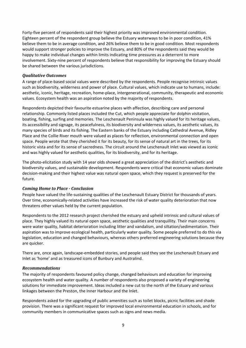
Forty‐five percent of respondents said their highest priority was improved environmental condition. Eighteen percent of the respondent group believe the Estuary waterways to be in poor condition, 41% believe them to be in average condition, and 26% believe them to be in good condition. Most respondents would support stronger policies to improve the Estuary, and 80% of the respondents said they would be happy to make individual changes within limits indicating time pressures as a deterrent to more involvement. Sixty‐nine percent of respondents believe that responsibility for improving the Estuary should be shared between the various jurisdictions.
QualitativeOutcomesA range of place‐based social values were described by the respondents. People recognise intrinsic values such as biodiversity, wilderness and power of place. Cultural values, which indicate use to humans, include: aesthetic, iconic, heritage, recreation, home‐place, intergenerational, community, therapeutic and economic values. Ecosystem health was an aspiration noted by the majority of respondents.
Respondents depicted their favourite estuarine places with affection, describing care and personal relationship. Commonly listed places included the Cut, which people appreciate for dolphin visitation, boating, fishing, surfing and memories. The Leschenault Peninsula was highly valued for its heritage values, its accessibility and signage, its peacefulness, its biodiversity and wilderness values, its aesthetic values, its many species of birds and its fishing. The Eastern banks of the Estuary including Cathedral Avenue, Ridley Place and the Collie River mouth were valued as places for reflection, environmental connection and open space. People wrote that they cherished it for its beauty, for its sense of natural art in the trees, for its historic vista and for its sense of sacredness. The circuit around the Leschenault Inlet was viewed as iconic and was highly valued for aesthetic qualities, for its biodiversity, and for its heritage.
The photo‐elicitation study with 14 year olds showed a great appreciation of the district’s aesthetic and biodiversity values, and sustainable development. Respondents were critical that economic values dominate decision‐making and their highest value was natural open space, which they request is preserved for the future.
ComingHometoPlace‐ConclusionPeople have valued the life‐sustaining qualities of the Leschenault Estuary District for thousands of years. Over time, economically‐related activities have increased the risk of water quality deterioration that now threatens other values held by the current population.
Respondents to the 2012 research project cherished the estuary and upheld intrinsic and cultural values of place. They highly valued its natural open space, aesthetic qualities and tranquillity. Their main concerns were water quality, habitat deterioration including litter and vandalism, and siltation/sedimentation. Their aspiration was to improve ecological health, particularly water quality. Some people preferred to do this via legislation, education and changed behaviours, whereas others preferred engineering solutions because they are quicker.
There are, once again, landscape‐embedded stories, and people said they see the Leschenault Estuary and Inlet as ‘home’ and as treasured icons of Bunbury and Australind.
RecommendationsThe majority of respondents favoured policy change, changed behaviours and education for improving ecosystem health and water quality. A number of respondents also proposed a variety of engineering solutions for immediate improvement. Ideas included a new cut to the north of the Estuary and various linkages between the Preston, the Inner Harbour and the Inlet.
Respondents asked for the upgrading of public amenities such as toilet blocks, picnic facilities and shade provision. There was a significant request for improved local environmental education in schools, and for community members in communicative spaces such as signs and news media.
10
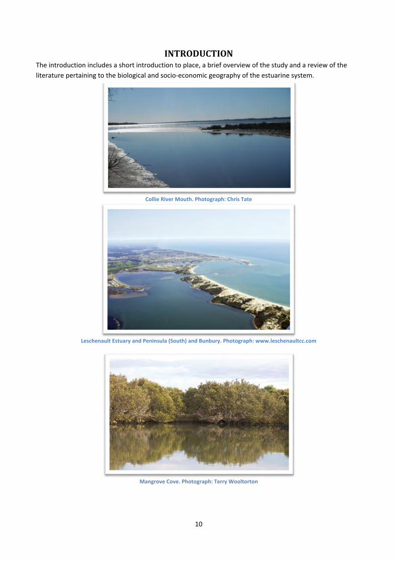
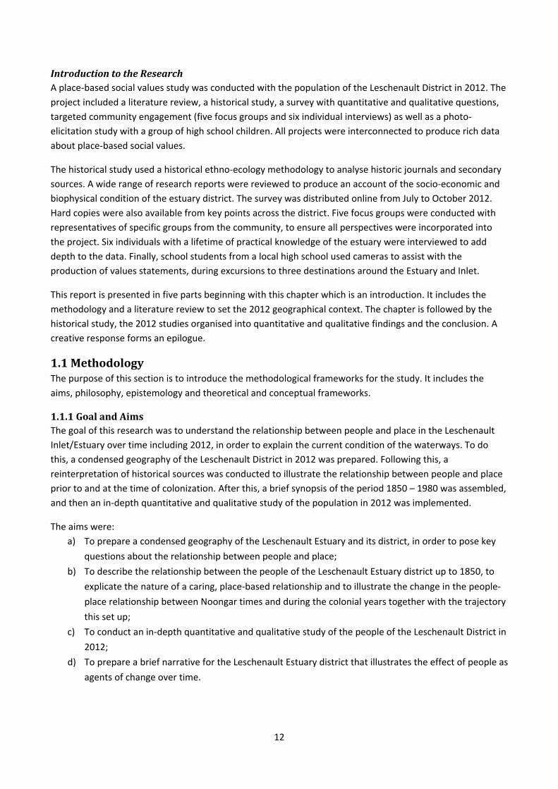
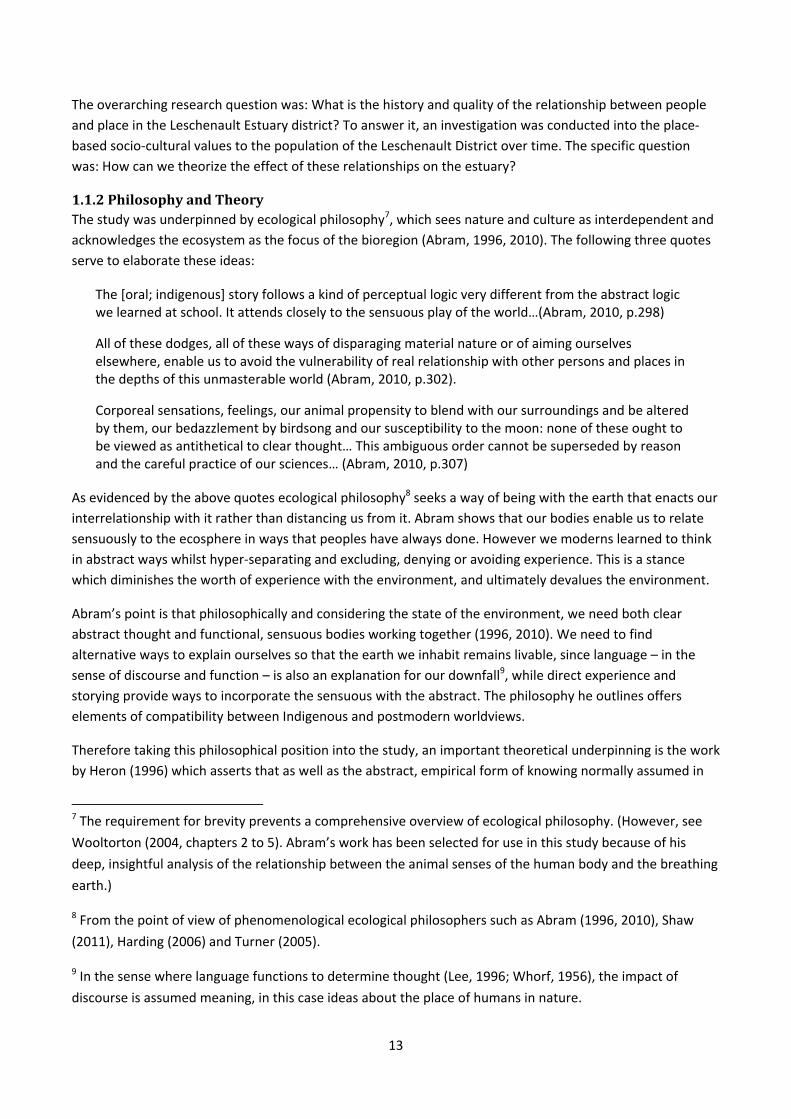
INTRODUCTIONThe introduction includes a short introduction to place, a brief overview of the study and a review of the
literature pertaining to the biological and socio‐economic geography of the estuarine system.
Collie River Mouth. Photograph: Chris Tate
Leschenault Estuary and Peninsula (South) and Bunbury. Photograph: www.leschenaultcc.com
Mangrove Cove. Photograph: Terry Wooltorton

11
This land is old, rivers are old and stories are old. The South West has been continuously occupied for over
45,000 years. However the Leschenault estuarine system is young, formed around 8,000 ago. The Elaap are Noongar4 people who lived in the Leschenault District5. The Elaap people cared for and highly valued the district. They saw it as alive, as life‐sustaining, as nourishing and as imbued with spirit. Landscape‐embedded
stories unified heritage, culture, place and people. Stories of the estuary and its rivers explained all of life;
people existed within a living, animated place.
Leschenault Estuary, Sunset. Photograph: Sean Ellingham.
45,000 years passed by. Then only two hundred years ago – a mere blink of the eye on the geological time
scale – the colonisers arrived. In the words of historian Phyllis Barnes:
…the locals had been clearing the land for centuries by burning to encourage new growth and these park‐like spaces with good herbage appealed to settlers who promptly settled on them (Barnes, 2013b).
A new chapter in the history of the Derbal6 began. Soon after arriving, the colonisers renamed many places –
including the waterways. They brought a new system of ownership and social hierarchy, and the desire for
foreign foods which required different food production systems. They brought an unfamiliar attitude to the
place. Rather than seeing it as living, or animated – they saw it as property for economic gain.
Another hundred and fifty years passed. During that time population growth associated with agricultural,
industrial and residential expansion proceeded apace with economic development. Today, the waterways
are beginning to show signs of ecological strain at the same time as mounting evidence that climate change
is reducing rainfall – adding to the range of stressors on the Leschenault Catchment and thus, the Estuary
and Inlet. From the perspective of geological time, these stressors began very recently.
There is now considerable community, industry and government engagement with these issues, all aiming to
research and address issues pertaining to water quality and ecological health in different, targeted ways. The
current study of the place‐based social values of the population is part of this agenda.
4 Noongar are the Aboriginal people from South West WA. 5 In this report, unless otherwise stated, Leschenault refers to the Leschenault Estuary and Inlet District.
There is a historical precedent for this. 6 Derbal means estuary – where the fresh water meets the salt water.
12
IntroductiontotheResearchA place‐based social values study was conducted with the population of the Leschenault District in 2012. The
project included a literature review, a historical study, a survey with quantitative and qualitative questions,
targeted community engagement (five focus groups and six individual interviews) as well as a photo‐
elicitation study with a group of high school children. All projects were interconnected to produce rich data
about place‐based social values.
The historical study used a historical ethno‐ecology methodology to analyse historic journals and secondary
sources. A wide range of research reports were reviewed to produce an account of the socio‐economic and
biophysical condition of the estuary district. The survey was distributed online from July to October 2012.
Hard copies were also available from key points across the district. Five focus groups were conducted with
representatives of specific groups from the community, to ensure all perspectives were incorporated into
the project. Six individuals with a lifetime of practical knowledge of the estuary were interviewed to add
depth to the data. Finally, school students from a local high school used cameras to assist with the
production of values statements, during excursions to three destinations around the Estuary and Inlet.
This report is presented in five parts beginning with this chapter which is an introduction. It includes the
methodology and a literature review to set the 2012 geographical context. The chapter is followed by the
historical study, the 2012 studies organised into quantitative and qualitative findings and the conclusion. A
creative response forms an epilogue.
1.1MethodologyThe purpose of this section is to introduce the methodological frameworks for the study. It includes the
aims, philosophy, epistemology and theoretical and conceptual frameworks.
1.1.1GoalandAimsThe goal of this research was to understand the relationship between people and place in the Leschenault
Inlet/Estuary over time including 2012, in order to explain the current condition of the waterways. To do
this, a condensed geography of the Leschenault District in 2012 was prepared. Following this, a
reinterpretation of historical sources was conducted to illustrate the relationship between people and place
prior to and at the time of colonization. After this, a brief synopsis of the period 1850 – 1980 was assembled,
and then an in‐depth quantitative and qualitative study of the population in 2012 was implemented.
The aims were:
a) To prepare a condensed geography of the Leschenault Estuary and its district, in order to pose key
questions about the relationship between people and place;
b) To describe the relationship between the people of the Leschenault Estuary district up to 1850, to
explicate the nature of a caring, place‐based relationship and to illustrate the change in the people‐
place relationship between Noongar times and during the colonial years together with the trajectory
this set up;
c) To conduct an in‐depth quantitative and qualitative study of the people of the Leschenault District in
2012;
d) To prepare a brief narrative for the Leschenault Estuary district that illustrates the effect of people as
agents of change over time.
13
The overarching research question was: What is the history and quality of the relationship between people
and place in the Leschenault Estuary district? To answer it, an investigation was conducted into the place‐
based socio‐cultural values to the population of the Leschenault District over time. The specific question
was: How can we theorize the effect of these relationships on the estuary?
1.1.2PhilosophyandTheoryThe study was underpinned by ecological philosophy7, which sees nature and culture as interdependent and
acknowledges the ecosystem as the focus of the bioregion (Abram, 1996, 2010). The following three quotes
serve to elaborate these ideas:
The [oral; indigenous] story follows a kind of perceptual logic very different from the abstract logic we learned at school. It attends closely to the sensuous play of the world…(Abram, 2010, p.298)
All of these dodges, all of these ways of disparaging material nature or of aiming ourselves elsewhere, enable us to avoid the vulnerability of real relationship with other persons and places in the depths of this unmasterable world (Abram, 2010, p.302).
Corporeal sensations, feelings, our animal propensity to blend with our surroundings and be altered by them, our bedazzlement by birdsong and our susceptibility to the moon: none of these ought to be viewed as antithetical to clear thought… This ambiguous order cannot be superseded by reason and the careful practice of our sciences… (Abram, 2010, p.307)
As evidenced by the above quotes ecological philosophy8 seeks a way of being with the earth that enacts our
interrelationship with it rather than distancing us from it. Abram shows that our bodies enable us to relate
sensuously to the ecosphere in ways that peoples have always done. However we moderns learned to think
in abstract ways whilst hyper‐separating and excluding, denying or avoiding experience. This is a stance
which diminishes the worth of experience with the environment, and ultimately devalues the environment.
Abram’s point is that philosophically and considering the state of the environment, we need both clear
abstract thought and functional, sensuous bodies working together (1996, 2010). We need to find
alternative ways to explain ourselves so that the earth we inhabit remains livable, since language – in the
sense of discourse and function – is also an explanation for our downfall9, while direct experience and
storying provide ways to incorporate the sensuous with the abstract. The philosophy he outlines offers
elements of compatibility between Indigenous and postmodern worldviews.
Therefore taking this philosophical position into the study, an important theoretical underpinning is the work
by Heron (1996) which asserts that as well as the abstract, empirical form of knowing normally assumed in
7 The requirement for brevity prevents a comprehensive overview of ecological philosophy. (However, see
Wooltorton (2004, chapters 2 to 5). Abram’s work has been selected for use in this study because of his
deep, insightful analysis of the relationship between the animal senses of the human body and the breathing
earth.)
8 From the point of view of phenomenological ecological philosophers such as Abram (1996, 2010), Shaw
(2011), Harding (2006) and Turner (2005).
9 In the sense where language functions to determine thought (Lee, 1996; Whorf, 1956), the impact of
discourse is assumed meaning, in this case ideas about the place of humans in nature.
14
the business‐as‐usual view of the world, there are other ways of knowing such as that evidenced by arts and
performative activities. This forms part of a socially critical theoretical framework (Chouinard, 2008) which
will be used to address the research question because:
the overt intention of this study is to create the conditions in which progressive change can occur;
in addition to current trends there are alternative possibilities for the Leschenault Estuary, and these
need to be anticipated and created; and
the study is intended to connect with efforts to preserve the estuary.
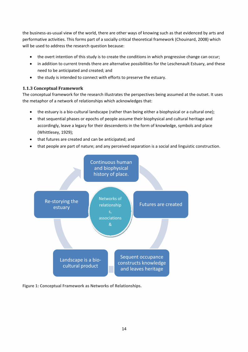
1.1.3ConceptualFrameworkThe conceptual framework for the research illustrates the perspectives being assumed at the outset. It uses
the metaphor of a network of relationships which acknowledges that:
the estuary is a bio‐cultural landscape (rather than being either a biophysical or a cultural one);
that sequential phases or epochs of people assume their biophysical and cultural heritage and
accordingly, leave a legacy for their descendents in the form of knowledge, symbols and place
(Whittlesey, 1929);
that futures are created and can be anticipated; and
that people are part of nature; and any perceived separation is a social and linguistic construction.
Figure 1: Conceptual Framework as Networks of Relationships.
Continuous human and biophysical history of place.
Futures are created
Sequent occupance constructs knowledge and leaves heritage
Landscape is a bio‐cultural product
Re‐storying the estuary
Networks of
relationship
s,
associations
&
15
1.2SignificanceThe purpose of this section was to highlight the significance of the research and outline its geographical
scope.
1.2.1SignificanceandInnovationThe health of the estuary is under stress due to intensifying socio‐economic pressures, increased nutrient
and contaminant loads, increased water extraction and reducing rainfall. Knowledge of the ways in which
the population understands and has understood the estuary and its district over time, can assist decision‐
making in relation to the estuary. Until recently, work on place‐based social values in the Leschenault
Catchment has been special‐purpose and narrow in a spatial and disciplinary sense (for example Beckwith
Environmental Planning, 2008, which relates to two parts of the estuarine section of the Collie River). The
local significance of the study is in its contribution to decision‐making concerning the estuary and its
environment.
The study is also significant from a methodological perspective. In studies by land managers and researchers,
people are often treated as separate from the biosphere rather than as part of biodiversity (Convention on
Wetlands [Ramsar 1971] Culture Working Group, 2008). This is because of the socially constructed view of
people of the western world as separate from nature due to the history and development of western
thought (Giblett, 2011; Plumwood, 2002). Therefore until recently research has looked for discontinuities
and separations rather than continuities and connections (Head, 2008), which this research will investigate.
The ways in which Australians value place from the point of view of philosophy are replete in the ecological
philosophy literature (for example Mathews, 2005; Plumwood, 2002); and in the Aboriginal studies literature
(for example Bird Rose, 1996; Head, 2000; Weir, 2009). A wide variety of accounts of individual valuing of
place is available in narrative form (for example Ward, 2011). However landscape‐scale place‐based social
values studies of whole populations from a historical and a contemporary perspective are still relatively new
in Australia. Substantial works by Brown (for example G. Brown & Brabyn, 2012; G. Brown & Weber, 2012;
Pocewicz, Nielsen‐Pincus, Brown, & Schnitzer, In Review) using Public Participation Geographic Information
Systems, and the study by Research Solutions (2007) on the Swan and Canning Rivers stand out from a
geographic point of view.
Turning attention to international studies, a range of place‐based socio‐cultural values work has been
implemented from an ecological perspective through the notion of ecosystem services and wise‐use of
wetlands (for example Ramsar Convention Secretariat, 2008; Ramsar COP09, 2005) and a variety of ways of
economically quantifying these to illustrate social value have been applied (for example Horwitz, Sommer, &
Thomas, Manuscript). A number of place‐based social values studies have been used for purposes such as
forest management (for example Fagerholm & Kayhko, 2009; Gunderson, Watson, Nelson, & Titre, 2004).
Many international organizations such as the WorldWatch Institute are now emphasizing the cultural
relationship between people and place, with a specific focus on promotion of sustainability attributes in a
society and minimizing ecologically damaging ones (Gardner, 2010). However, few interdisciplinary place‐
based studies of the socio‐cultural values of regional populations from a historical and a contemporary
perspective have been completed in Australia or internationally, although some are currently in process,
particularly in Chesapeake Bay, USA (for example Dennison, Carruthers, Thomas, & Glibert, 2004; Scientific
and Technical Advisory Committee, 2011). This Leschenault cultural geography project forms such an
endeavour.
16
In a nutshell, the research is of local significance because of its value to decision‐makers concerned with the
Leschenault Estuary/Inlet; and of methodological significance because of its philosophical perspective and
because there are still relatively few interdisciplinary studies of whole populations and their historic and
contemporary relationships with place, particularly wetlands.
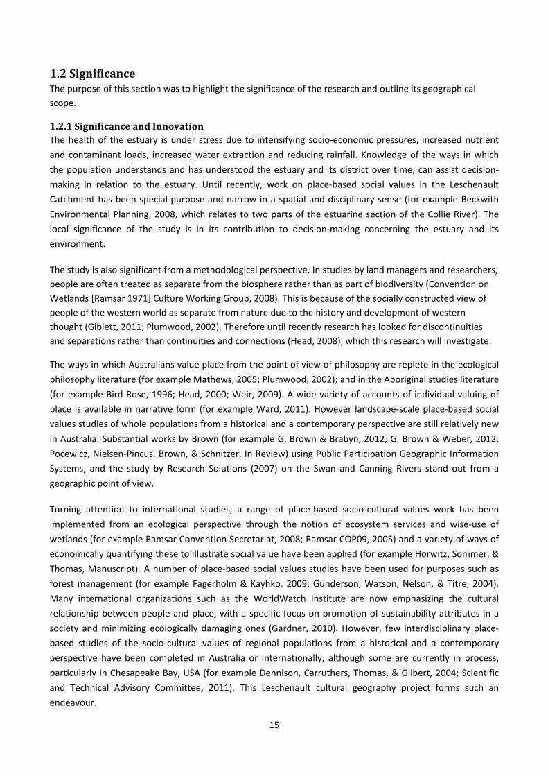
1.2.2GeographicalScopeoftheResearchThis study is limited to the Leschenault District to the coast on the west, several kilometres north, and about
five kilometres east and south of the waterways. It takes in parts of the Parkfield, Estuary Foreshore, Lower
Collie, Coast and Lower Preston Sub‐Catchments. Plate one shows the Leschenault Catchment with the sub‐
catchments marked. The approximate spatial focus of the study is marked in black. The town‐site in relation
to the estuary/inlet is shown in plates two and three overleaf.
Plate 1: The sub‐catchment boundaries of the Leschenault Catchment. The area outlined
in black shows
the extent of the
study area. Map
is from Hugues‐
dit‐Ciles (2011b,
p.9).
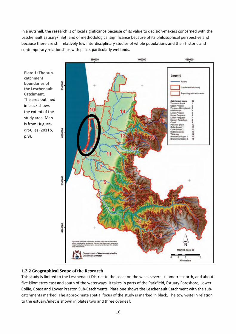
17
It is not possible to study this limited area in isolation of the social and ecological processes at the wider
range of scales that produced it, therefore data from the Leschenault Catchment and elsewhere will be used
as required (Scott, 2004, pp. 30‐31). Beyond the Leschenault Estuary/Inlet and the marked hinterland, no
claims for generalisability are made.
Plate 2. Map showing Greater Bunbury Regional Scheme: GBRS Sheet 12, produced by the Western Australian Planning Commission (2007). Adjoining map is overleaf.

18
Plate 3. Map showing Greater Bunbury Regional Scheme: GBRS Sheet 9, produced by the Western Australian Planning Commission (2007).
1.3GeographicalContextThe purpose of this section is to outline the geography of the Leschenault District. It includes the spatial and
ecological character of the waterways, the physical and biological values, a socio‐economic overview as well
as environmental groups and their concerns.
There are five rivers in the Leschenault Catchment which drain into the Leschenault Estuarine System: the
Wellesley, Collie, Brunswick, Preston and Ferguson. The Wellesley River flows into the Brunswick River. Two
rivers actually carry the water into the estuary: the Collie (into which the Brunswick flows) and the Preston
(into which the Ferguson flows). The estuary is shallow (up to two metres deep), and is about 14 kilometres
long and 1.5 to 2.5 kilometres wide, covering approximately 27 square kilometres (Brearley, 2005).
Lying between the Quindalup Dunes to the west and the Spearwood and Bassendean Dunes to the east, the
biodiversity of the estuary is very high. It comprises fringing estuarine forest, tidal salt marsh, a wide variety
of freshwater vegetation, sandy rise vegetation and mangroves which support a large number of
invertebrates such as crabs, prawns and molluscs. Many species of fish, birds – a number of which are
migratory – and a small colony of female bottle‐nosed dolphins inhabit the estuary (Brearley, 2005; Smith,
2012, pp. 84, 85).
Over the last fifty years, increasing pressures from farming, industrial activities and land‐clearing for
suburban developments have impacted upon the rivers, building up nutrient and contaminant levels and
affecting turbidity in the rivers and estuary. This is coincidental with steadily decreasing rainfall over time, as
19
the catchment now receives on average 15% less rain than it did fifty years ago (Macaulay, 2007). In fact it is
likely that since the mid 1970s the South West has experienced greater statistically evident impacts from
climate change than anywhere else in the world (McFarlane, 2005, pp. 19‐21). Consequently stress to
estuarine health is now evident with such outcomes as odours noticed by residents, algal blooms, fish and
dolphin deaths and decline in fish stocks (Department of Fisheries, 2012; Hugues‐dit‐Ciles, 2011b, pp. 32, 59‐
61; Smith, 2012). There are large economic costs involved in rectifying this situation, and considerable public
debate as to the extent and nature of the restoration that should be carried out (Department of Fisheries,
2012; Hugues‐dit‐Ciles, 2011b). Further elaboration is provided below.
1.3.1TheSpatialandEcologicalCharacteroftheLeschenaultEstuaryThis sub‐section reviews recent studies to illustrate the spatial and ecological character of the Leschenault
Estuary. Its purpose is to highlight both its ecological values and the nature of the threats to its long‐term
health.
A very large number of studies have been carried out on the Leschenault Estuary over the last thirty or so
years. McKenna (2007) followed by Hugues‐dit‐Ciles (2011b) condensed many of these to prepare major
reports on the environmental condition of the estuary and the surface waters feeding into it. Hugues‐dit‐
Ciles states the following about the Estuary. It:
is important for supporting migratory birds along their flight paths with 18 species listed under
two migratory bird agreements: the Japan – Australia, and the China – Australia (JAMBA and
CAMBA).
provides habitat for breeding and a dry‐season refuge for many numbers and species of water
birds.
is nationally significant for its geoheritage and the most‐southerly occurrence of the white
mangrove (Avicennia marina) in Western Australia.
is of state‐wide significance for its peripheral vegetation.
supports a wide range of recreational activities (picnicking, swimming, fishing, crabbing,
windsurfing, kite surfing, canoeing, kayaking and boating).
is the aesthetic backdrop for Bunbury and Australind.
is globally significant for its micro fauna (foraminifera diversity).
still has extensive sea grass meadows supporting aquatic biodiversity such as molluscs,
crustaceans and fish, which in turn support an active recreational fishing industry.
has an estuarine hydrologic structure different to other local, more classic‐type estuaries as
there is no simple river‐to‐sea gradient. (Hugues‐dit‐Ciles, 2011b, p.8)
Reports also highlight increased salinities and other changes associated with the ‘Cut’ which was excavated
through the peninsula in 1951 (McKenna, 2007, p. 7), as well as consistent water quality as a consequence of
its location and flushing capacity. The hydrodynamics of the lower river systems of the Collie, Brunswick and
Preston Rivers are determined by tidal influences to some extent but more strongly by climatic rainfall and
catchment runoff patterns. Seasonal patterns include freshwater surface flows in winter replaced by a
greater influence by tidal movements and saltwater intrusion in summer. However, there is nutrient loading
in the estuary due to rainfall reduction which has increased over time along with greater water usage rates
(Hugues‐dit‐Ciles, 2011b).
There are a large number of concerns about estuarine health including fish deaths occurring irregularly
between 1994 and 2004; dolphin deaths in 2009 and 2010; swan deaths along Cathedral Avenue in 2010;
20
sedimentation; increasing acid sulphate soils, organic enrichment of surface waters; loss of fringing
vegetation due to urban development and unregulated access; incremental habitat loss; decline in
macrophyte biomass; decreasing biodiversity and invertebrate fauna; summer algal blooms and anoxia due
to saline stratification and storm runoff of decomposing organic material. Below, Figure 2 is a graphic
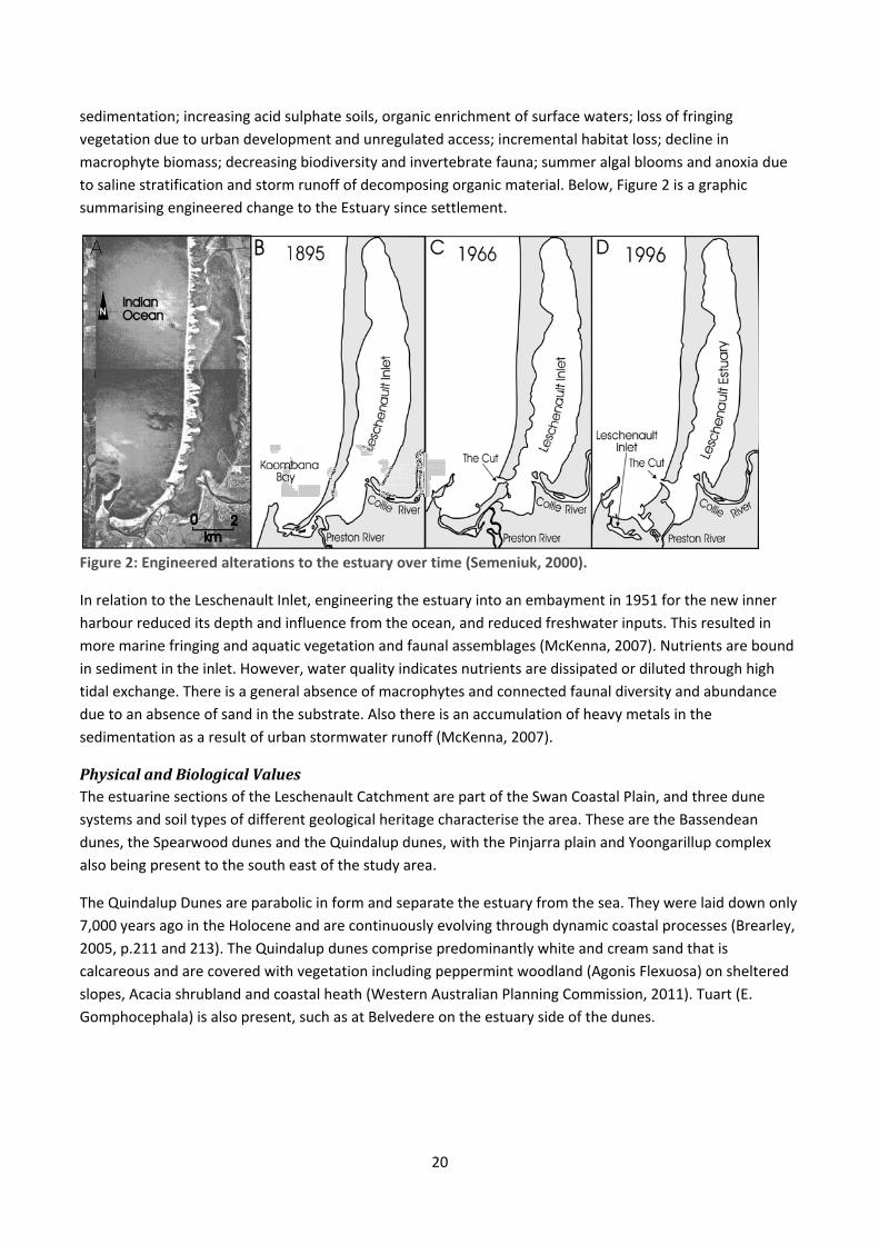
summarising engineered change to the Estuary since settlement.
Figure 2: Engineered alterations to the estuary over time (Semeniuk, 2000).
In relation to the Leschenault Inlet, engineering the estuary into an embayment in 1951 for the new inner
harbour reduced its depth and influence from the ocean, and reduced freshwater inputs. This resulted in
more marine fringing and aquatic vegetation and faunal assemblages (McKenna, 2007). Nutrients are bound
in sediment in the inlet. However, water quality indicates nutrients are dissipated or diluted through high
tidal exchange. There is a general absence of macrophytes and connected faunal diversity and abundance
due to an absence of sand in the substrate. Also there is an accumulation of heavy metals in the
sedimentation as a result of urban stormwater runoff (McKenna, 2007).
PhysicalandBiologicalValuesThe estuarine sections of the Leschenault Catchment are part of the Swan Coastal Plain, and three dune
systems and soil types of different geological heritage characterise the area. These are the Bassendean
dunes, the Spearwood dunes and the Quindalup dunes, with the Pinjarra plain and Yoongarillup complex
also being present to the south east of the study area.
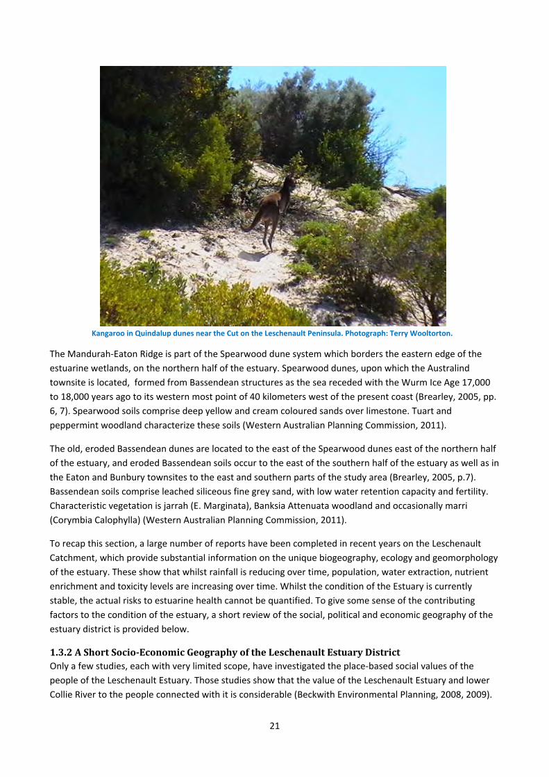
The Quindalup Dunes are parabolic in form and separate the estuary from the sea. They were laid down only
7,000 years ago in the Holocene and are continuously evolving through dynamic coastal processes (Brearley,
2005, p.211 and 213). The Quindalup dunes comprise predominantly white and cream sand that is
calcareous and are covered with vegetation including peppermint woodland (Agonis Flexuosa) on sheltered
slopes, Acacia shrubland and coastal heath (Western Australian Planning Commission, 2011). Tuart (E.
Gomphocephala) is also present, such as at Belvedere on the estuary side of the dunes.
21
Kangaroo in Quindalup dunes near the Cut on the Leschenault Peninsula. Photograph: Terry Wooltorton.
The Mandurah‐Eaton Ridge is part of the Spearwood dune system which borders the eastern edge of the
estuarine wetlands, on the northern half of the estuary. Spearwood dunes, upon which the Australind
townsite is located, formed from Bassendean structures as the sea receded with the Wurm Ice Age 17,000
to 18,000 years ago to its western most point of 40 kilometers west of the present coast (Brearley, 2005, pp.
6, 7). Spearwood soils comprise deep yellow and cream coloured sands over limestone. Tuart and
peppermint woodland characterize these soils (Western Australian Planning Commission, 2011).
The old, eroded Bassendean dunes are located to the east of the Spearwood dunes east of the northern half
of the estuary, and eroded Bassendean soils occur to the east of the southern half of the estuary as well as in
the Eaton and Bunbury townsites to the east and southern parts of the study area (Brearley, 2005, p.7).
Bassendean soils comprise leached siliceous fine grey sand, with low water retention capacity and fertility.
Characteristic vegetation is jarrah (E. Marginata), Banksia Attenuata woodland and occasionally marri
(Corymbia Calophylla) (Western Australian Planning Commission, 2011).
To recap this section, a large number of reports have been completed in recent years on the Leschenault
Catchment, which provide substantial information on the unique biogeography, ecology and geomorphology
of the estuary. These show that whilst rainfall is reducing over time, population, water extraction, nutrient
enrichment and toxicity levels are increasing over time. Whilst the condition of the Estuary is currently
stable, the actual risks to estuarine health cannot be quantified. To give some sense of the contributing
factors to the condition of the estuary, a short review of the social, political and economic geography of the
estuary district is provided below.
1.3.2AShortSocio‐EconomicGeographyoftheLeschenaultEstuaryDistrictOnly a few studies, each with very limited scope, have investigated the place‐based social values of the
people of the Leschenault Estuary. Those studies show that the value of the Leschenault Estuary and lower
Collie River to the people connected with it is considerable (Beckwith Environmental Planning, 2008, 2009).
22
This section reviews the land use and business activities of the area in order to provide a backdrop for the
daily lives of the population, to enable an understanding of the activities that affect the Estuary in some way.
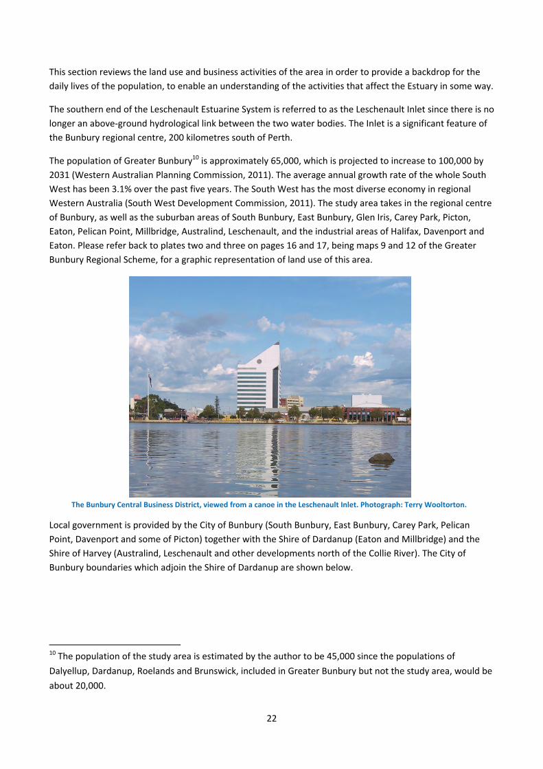
The southern end of the Leschenault Estuarine System is referred to as the Leschenault Inlet since there is no
longer an above‐ground hydrological link between the two water bodies. The Inlet is a significant feature of
the Bunbury regional centre, 200 kilometres south of Perth.
The population of Greater Bunbury10 is approximately 65,000, which is projected to increase to 100,000 by
2031 (Western Australian Planning Commission, 2011). The average annual growth rate of the whole South
West has been 3.1% over the past five years. The South West has the most diverse economy in regional
Western Australia (South West Development Commission, 2011). The study area takes in the regional centre
of Bunbury, as well as the suburban areas of South Bunbury, East Bunbury, Glen Iris, Carey Park, Picton,
Eaton, Pelican Point, Millbridge, Australind, Leschenault, and the industrial areas of Halifax, Davenport and
Eaton. Please refer back to plates two and three on pages 16 and 17, being maps 9 and 12 of the Greater
Bunbury Regional Scheme, for a graphic representation of land use of this area.
The Bunbury Central Business District, viewed from a canoe in the Leschenault Inlet. Photograph: Terry Wooltorton.
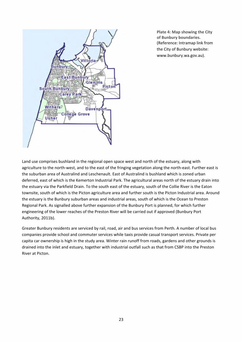
Local government is provided by the City of Bunbury (South Bunbury, East Bunbury, Carey Park, Pelican
Point, Davenport and some of Picton) together with the Shire of Dardanup (Eaton and Millbridge) and the
Shire of Harvey (Australind, Leschenault and other developments north of the Collie River). The City of
Bunbury boundaries which adjoin the Shire of Dardanup are shown below.
10 The population of the study area is estimated by the author to be 45,000 since the populations of
Dalyellup, Dardanup, Roelands and Brunswick, included in Greater Bunbury but not the study area, would be
about 20,000.
23
Plate 4: Map showing the City of Bunbury boundaries. (Reference: Intramap link from
the City of Bunbury website:
www.bunbury.wa.gov.au).
Land use comprises bushland in the regional open space west and north of the estuary, along with
agriculture to the north‐west, and to the east of the fringing vegetation along the north‐east. Further east is
the suburban area of Australind and Leschenault. East of Australind is bushland which is zoned urban
deferred, east of which is the Kemerton Industrial Park. The agricultural areas north of the estuary drain into
the estuary via the Parkfield Drain. To the south east of the estuary, south of the Collie River is the Eaton
townsite, south of which is the Picton agriculture area and further south is the Picton Industrial area. Around
the estuary is the Bunbury suburban areas and industrial areas, south of which is the Ocean to Preston
Regional Park. As signalled above further expansion of the Bunbury Port is planned, for which further
engineering of the lower reaches of the Preston River will be carried out if approved (Bunbury Port
Authority, 2011b).
Greater Bunbury residents are serviced by rail, road, air and bus services from Perth. A number of local bus
companies provide school and commuter services while taxis provide casual transport services. Private per
capita car ownership is high in the study area. Winter rain runoff from roads, gardens and other grounds is
drained into the inlet and estuary, together with industrial outfall such as that from CSBP into the Preston
River at Picton.
24
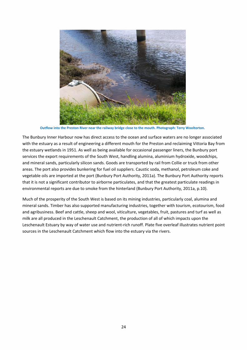
Outflow into the Preston River near the railway bridge close to the mouth. Photograph: Terry Wooltorton.
The Bunbury Inner Harbour now has direct access to the ocean and surface waters are no longer associated
with the estuary as a result of engineering a different mouth for the Preston and reclaiming Vittoria Bay from
the estuary wetlands in 1951. As well as being available for occasional passenger liners, the Bunbury port
services the export requirements of the South West, handling alumina, aluminium hydroxide, woodchips,
and mineral sands, particularly silicon sands. Goods are transported by rail from Collie or truck from other
areas. The port also provides bunkering for fuel oil suppliers. Caustic soda, methanol, petroleum coke and
vegetable oils are imported at the port (Bunbury Port Authority, 2011a). The Bunbury Port Authority reports
that it is not a significant contributor to airborne particulates, and that the greatest particulate readings in
environmental reports are due to smoke from the hinterland (Bunbury Port Authority, 2011a, p.10).
Much of the prosperity of the South West is based on its mining industries, particularly coal, alumina and
mineral sands. Timber has also supported manufacturing industries, together with tourism, ecotourism, food
and agribusiness. Beef and cattle, sheep and wool, viticulture, vegetables, fruit, pastures and turf as well as
milk are all produced in the Leschenault Catchment, the production of all of which impacts upon the
Leschenault Estuary by way of water use and nutrient‐rich runoff. Plate five overleaf illustrates nutrient point
sources in the Leschenault Catchment which flow into the estuary via the rivers.
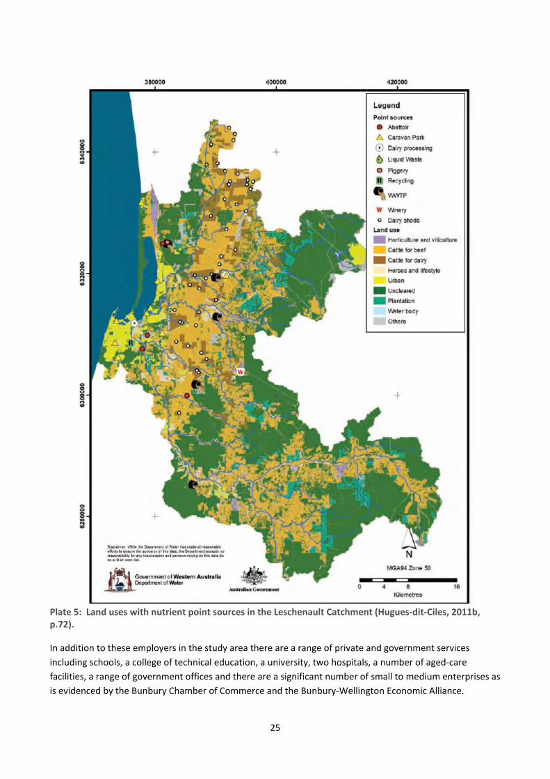
25
Plate 5: Land uses with nutrient point sources in the Leschenault Catchment (Hugues‐dit‐Ciles, 2011b, p.72).
In addition to these employers in the study area there are a range of private and government services
including schools, a college of technical education, a university, two hospitals, a number of aged‐care
facilities, a range of government offices and there are a significant number of small to medium enterprises as
is evidenced by the Bunbury Chamber of Commerce and the Bunbury‐Wellington Economic Alliance.
26
Tourism in the area focuses on the ocean, the Estuary/Inlet and waterfront locations for recreation‐related
purposes. Accordingly, a range of businesses are economically dependent upon the health of the Estuary and
Inlet including waterfront coffee shops, caravan parks, other short‐term waterfront accommodation units,
boat shops and tour boat operators. Economic values of land in the vicinity of the Estuary reflect their
sought‐after status.
Sporting,Recreation,VoluntaryGroupsandClubs.There is a very large number of sporting and recreation activities in the study area, many of which are water‐
based. These include boating, surfing and fishing, bicycle riding for which there are a range of bike paths, as
well as a range of recreation clubs such as football, cricket, running and other clubs with dedicated grounds
which require substantial water use. Similarly there is a full range of arts and cultural activities, events and
festivals in the district held in such venues as the Bunbury Entertainment Centre and the New Lyric Theatre.
A comparatively large number of voluntary environmental organisations in the study area advocate for the
environment, with a large number of people involved. A simple list of over 25 environmental organisations
was recently drawn up (Gibbs, 2011), which reflects local concerns about the protection of water sources,
waterways, clean air, forests, bushland, coastal areas, as well as unease about such issues as sustainable
agriculture, food security, transport and energy production. The presence of these organisations and media‐
related evidence of their activities; the provision of government services such as funding for catchment
councils, dolphin research and ecological restoration activities; real estate location choice and land values,
and recreational uses of the estuary provide considerable evidence of a population who greatly appreciate
their place.
1.3.3ConclusionThis section has shown the diverse vegetation types associated with the topography of the study area and
land uses. Shire councils were listed and the estimated population of the study area of 45,000 was tendered.
Industries and services which provide employment and in turn services to the population and the economy,
and which ultimately affect the estuary in some way, were presented. Intensification of pressure on the
estuary can be anticipated due to population and industrial expansion, compounded by a range of
uncertainties associated with climate change. The diagram overleaf at plate six illustrates some of the factors
affecting estuary health.
In conclusion it appears that the population values the Estuary/Inlet, as evidenced by small‐scale social
values studies; the existence of a wide variety of environment groups; Inlet and Estuary‐based tourism;
enhanced land values close to the waterways and the range of businesses which are economically‐
dependent on the estuary. However the socio‐economic activities of the population are producing an
increasing stress to the health of the Estuary. This leads to the question for the next section of this study,
which is: what is the history of the relationship between people and place in the Leschenault Estuary? To
answer it, an investigation was conducted into the place‐based socio‐cultural values of the population of the
Leschenault Estuary district up to the 1850s.

27
Plate 6: Visual Representation of Factors Affecting the Leschenault Estuary.
28
PLACE‐BASEDSOCIALVALUESINNOONGARTIMESThis chapter presents the research method used for this part of the study, followed by a historical ethno‐
ecology study of the Leschenault Estuary. All Noongars share ideologies and theories of knowledge (Collard,
1994, p.14; Collard, Harben, & van den Berg, 2004). These are framed as country or boodjar, people or moort and knowledge or katitjiny; the three essential aspects of what it means to be a Noongar11 (Collard, 2011,
p.20). Although these are deeply interconnected, the demands of writing need these elements to be
described one aspect at a time, which produces the appearance of simplicity when the reality is very
complex. The three elements are brought together over the course of this chapter.
Unless specified all references to the Leschenault Inlet and Estuary apply to the time it was the one water
body that extended from Pt McLeod (the Inlet mouth at Bunbury) to the north of Australind. The district and
the waterways were called ‘Leschenault’ in the 1830s and 1840s (Barnes, Cameron, & Willis, 2010), so that
name will be used here.
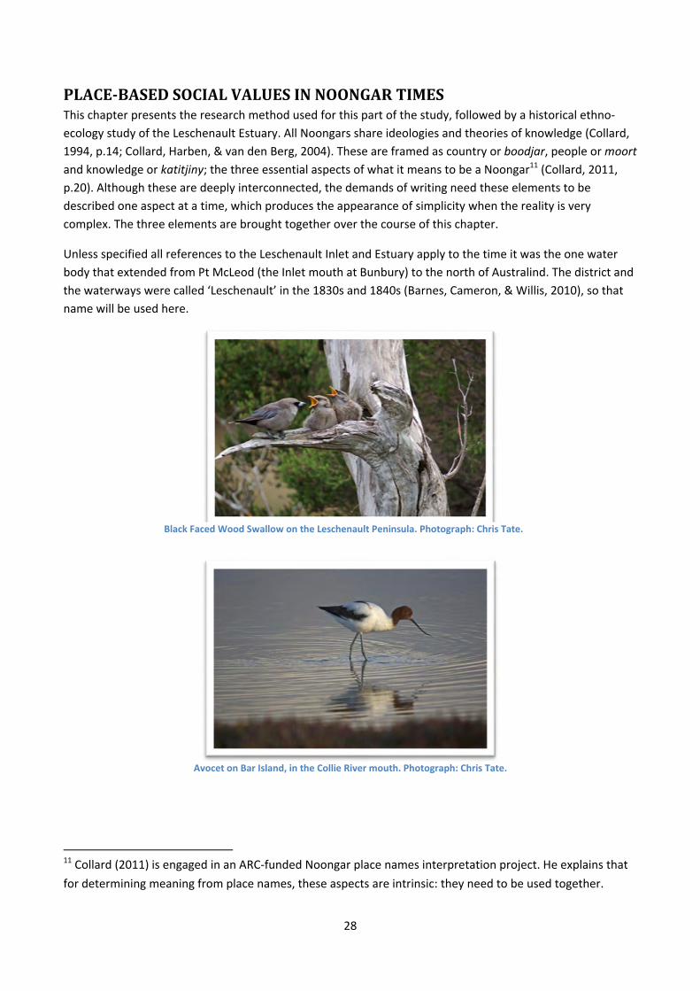
Avocet on Bar Island, in the Collie River mouth. Photograph: Chris Tate.
11 Collard (2011) is engaged in an ARC‐funded Noongar place names interpretation project. He explains that
for determining meaning from place names, these aspects are intrinsic: they need to be used together.
Black Faced Wood Swallow on the Leschenault Peninsula. Photograph: Chris Tate.

29
Plate 7: Copy of an 1829 map of Leschenault showing the whole estuarine water body, attributed to Lt Preston after whom the Bila Barajillup was renamed. Map shows locations where Noongar people were seen by Lt. Preston on his journey. (From the Brendan Kelly Collection.)
30
MethodandSourcesTo research the socio‐cultural values of Leschenault in Noongar times and in colonial times, a range of key
historical groups and characters were selected in an effort to represent a variety of perspectives. Selection
was made using the first criteria of historical material that could be used as ethnographic data for analysis
and interpretive description (Kincheloe & McLaren, 2002); and the second criteria a range of different
historical perspectives and experiences to add veracity.
A weakness in this study is the lack of a Noongar authored historical account. This has been compensated
for, to some extent, by the appropriate use of Noongar language12. It has also been addressed by the use of
modern Noongar perspectives, notably Collard (1994) who, after a historic study and consultation with
families and elders, completed a major study of the history of the Wonnerup and Ellensbrook homesteads,
which are in a similar geo‐cultural area. The data gathering strategy employed with the Noongar material in
the current document was for information from Bates (1985) to be included when it was commensurate with
perspectives provided by Collard (1994, 2011), or not contradictory to the information in the journals of
Bunbury, Wollaston and Clifton, thereby increasing the likelihood of its historical accuracy. The historical
identities are introduced below to contextualise their accounts and show the likelihood of distortion.
Baaburgurt, Yabburgurt and Nyalyert were three of the old Noongar men who lived in a camp for Aboriginal
people on the outskirts of Perth during the period 1904 – 1912, when Mrs Daisy Bates spent considerable
time living with and learning from them. By virtue of the territories that they had been born into, lived in and
had visiting rights to, which included the land from near the Harvey Estuary to the Capel River, each of them
was qualified to provide reliable information about Leschenault. The group of elders included Ngilgi, a
woman from the Wonnerup/Busselton area who also would have been able to contribute valuable
information on her neighbouring area. There was also a person from Bunbury who, very unfortunately, was
not identified by Bates (1985). Each of these people lived traditional Noongar lives, and their memories
comprised the pre‐colonial and early colonial years. Bates recorded South West socio‐cultural knowledge;
including some specific place‐based ecological knowledge (1985, pp.11,34,52). Bates’ work with this
informant group was selected for inclusion in this study due to the quality of the written detail of their
accounts.
Bates’ first‐hand observations are regarded as accurate by modern anthropologists such as Isobel White who
edited her work however it is important to take into account the colonial, hierarchical attitudes about
society through which she interpreted the information. Social Darwinism formed her unquestioned views on
social evolution, and she had a dislike of the people she called ‘half‐breeds’ (Bates, 1985, pp.21,2).
The reports and journals of Marshall Waller Clifton, a leading 1841 Australind property developer (Barnes,
2001; Barnes et al., 2010), have been used because of their almost daily regularity and the clerical quality of
his observations and reflections. His journals are primary historical documents, which have been
painstakingly transcribed by historian Phyllis Barnes into over 700 annotated pages. Similarly, the journals of
John Ramsden Wollaston, Anglican vicar, have been used due to the almost year‐round observations of life
in Bunbury on the banks of the lower Preston River. The main benefit of the journals, particularly Clifton’s,
was the large number of indirect or ‘throw‐away’ comments – the stories between the lines, captured within
12 The author of this current study, Sandra Wooltorton, speaks contemporary Noongar language
(Wooltorton, 1993).
31
the writers’ other intended meanings. The second reason their Noongar references were useful was simply
because records were made available of Noongar people in particular locations at specific times of the year.
Bunbury’s journals were written during (or just after) journeys with Noongar guides back and forth from
Pinjarra to Vasse in 1836 and 1837. Bunbury spoke basic Noongar language and his accounts are lucid and
descriptive. His journals have been chosen for their first‐hand observations with the first people of
Leschenault prior to settlement, in the context of the ecology of the place. Bunbury was constantly
accompanied by Noongar guides who showed him the place and gave him detailed explanations, so his
accounts are quite specific about places and Noongar technology. In this study care was taken with the use
of his journals, to account for the large cultural differences between the Noongar life‐way and Bunbury’s
colonial worldview.
Bates’ work was a valuable source because she asked the characters deliberately planned anthropological
questions about their culture. However there are several disadvantages to be considered when using her
work. Firstly, at the time of the interviews her informants had been exiled from their boodjar, or ‘country’ (see below), possibly for many years. This does not detract from the accuracy of their accounts however, but
it needs to be taken into account because they were ‘telling rather than showing’. Secondly, Bates’ questions
seem to have inquired about culture as if it was generalised rather than place‐based. This limits local
examples13, nonetheless there are ample to make the points in this report. Thirdly, Bates believed that
women did not have unique cultural knowledge and so did not ask questions of women about this, so there
are large gaps in her material. Nonetheless she spoke Noongar and her material is descriptive, rich and
meaningful. With the benefit of hindsight, her work is priceless as it allows a picture of the relationship
between people and place to be reconstructed, then authenticated using the primary accounts of the
observations of the settlers.
In summary, the method comprised ethnographic analysis of historical sources selected for primacy where
possible and directness of observation. The accounts of Wollaston, Clifton and Bunbury were valuable
because of the descriptiveness and careful, almost daily observations of life. The work of Bates was valuable
as it is based upon her methodical inquiries into the culture of the region.
An ethno‐ecological account of the Leschenault people at the time the area was known as Elaap is presented next. The following section aims to reconstruct Noongar life to show the nature of the relationship between
people and place. It uses the three sections of Collard’s (2011) framework, place, people and knowledge. Its
purpose is to highlight place‐based socio‐cultural values and to present an account that shows that people
have always lived here. This study offers only a beginning – a glimpse through a window into another time
and a different way of seeing the Leschenault District.
13 Some writers (for example Le Souef, 1993, p.6) say that studies of Aboriginal social organisation are non‐
sensical without geographical context. This critique has been considered with the use of each citation.

32
2.1Elaap–Karlaboodjar14:HomePlaceThe Noongar meaning of Elaap15 is ‘on or by the water’ (Collard, 2013). In South West coastal areas, Derbal means estuary; where the fresh and salt waters meet. Elaap is the name of the first people of the
Leschenault District, and the name of the district (Barnes et al., 2010, p.33). Derbal Elaap16 was the original name of the Leschenault Inlet. Boodjar means nourishing terrain17, a concept like country that includes
people and ecosystem.
This section presents Elaap – the place. It is presented in three subsections, which are people (Elaap) and place (boodjar); territory (karlaboodjar) and estuary (derbal Elaap). According to Bates’ informants (1985,
p.34), all coastal people were Wardandi18, or people of the ocean. People were also known as Bilgur19 (river
people), Derbalung (estuary people) or Buyun-gur (hill people20). In addition, collectives of people were known by their directional location. Bates writes that Bunbury people were known as the Western or
Kunniung21 Bibbulmen22, and their language was Burong23 Wongi.
Coombarnup or Gomburrup24 was a name for the Bunbury area (Bunbury, 1930, p.15; Bussell, 1930s;
Sanders, 1975, p.1), and according to Bussell (1930s, p. 8) was originally the area now known as Koombana
Bay. However in 1905 when Bates was carrying out her research, it seems likely that she was not aware of
14 Noongar words cited as part of a quote have been written as per the original document. However where
the same words are used in the text of this report, they are spelled as per the orthographic standards of the
Bunbury Noongar Language Centre. For example Moore’s (1850) kallabudjor is spelled as such in citing
Moore, but in the text of this report as karlaboodjar. 15 In the context used in this report. 16Note how Lieut. Bunbury refers to the Wonnerup Estuary in his conversation (presumably spoken in
Noongar) in the north east of the district whilst on route to the hills. In his use the word order is Anglicised –
generally in Noongar the noun (eg. Derbal) is followed by the adjective (eg. Wonnerup).
I soon halted and held up my hand in token of amity and to show I was unarmed and told them I was
Bunbury who had a mia [hut] at Pinjarrup. Upon this the whole party soon collected about us when I
introduced them to Wolgot as a Native from the Wonnerup Derbal and to Parker the Soldier;
(Bunbury, 1930, p.162. Emphasis added.). 17 Nourishing terrain is a notion used by Bird Rose (1996), to describe an Aboriginal understanding of land. 18 Bates used the spelling: Waddarn-di, but the modern spelling is used here. The word is not italicised in‐
text because it is in common use. 19 Until recently there has not been a consistent orthography used by the various historic recorders of
Noongar words. Hence not only do words vary according to the Noongar dialect of the speaker, but they
were heard and recorded through the ears of settlers who themselves used a range of British accents and
therefore could have recorded the same‐sounding word differently. In this study Noongar words will be
spelled the same way as the reference being cited, and at all other times it will be spelled according to
conventions in use by the Bunbury Noongar Language Project. 20 Boya means rock, stone or hill. 21 These days the Noongar translation of West is spelled Kaneang. 22 Bates (1985) used the appellative: Bibbulmen to refer to all Noongar groups. 23 Burong means to bring or fetch (Bates, 1985, p.47). Wongi is now spelled as Wanginy. 24 The spelling used for the remainder of this document will be that used today, Goomburrup, and it will not
be italicized as the term is in common use.
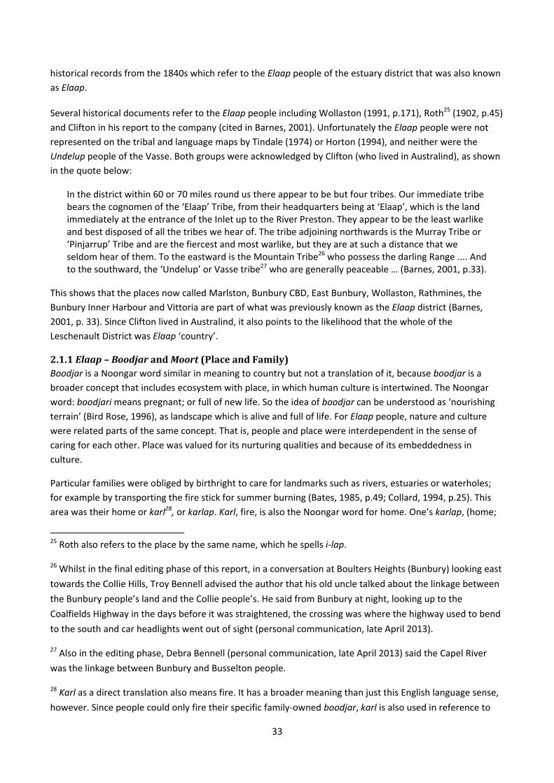
33
historical records from the 1840s which refer to the Elaap people of the estuary district that was also known as Elaap.
Several historical documents refer to the Elaap people including Wollaston (1991, p.171), Roth25 (1902, p.45)
and Clifton in his report to the company (cited in Barnes, 2001). Unfortunately the Elaap people were not represented on the tribal and language maps by Tindale (1974) or Horton (1994), and neither were the
Undelup people of the Vasse. Both groups were acknowledged by Clifton (who lived in Australind), as shown in the quote below:
In the district within 60 or 70 miles round us there appear to be but four tribes. Our immediate tribe bears the cognomen of the ‘Elaap’ Tribe, from their headquarters being at ‘Elaap’, which is the land immediately at the entrance of the Inlet up to the River Preston. They appear to be the least warlike and best disposed of all the tribes we hear of. The tribe adjoining northwards is the Murray Tribe or ‘Pinjarrup’ Tribe and are the fiercest and most warlike, but they are at such a distance that we seldom hear of them. To the eastward is the Mountain Tribe26 who possess the darling Range .... And to the southward, the ‘Undelup’ or Vasse tribe27 who are generally peaceable … (Barnes, 2001, p.33).
This shows that the places now called Marlston, Bunbury CBD, East Bunbury, Wollaston, Rathmines, the
Bunbury Inner Harbour and Vittoria are part of what was previously known as the Elaap district (Barnes, 2001, p. 33). Since Clifton lived in Australind, it also points to the likelihood that the whole of the
Leschenault District was Elaap ‘country’.
2.1.1Elaap–BoodjarandMoort(PlaceandFamily)Boodjar is a Noongar word similar in meaning to country but not a translation of it, because boodjar is a broader concept that includes ecosystem with place, in which human culture is intertwined. The Noongar
word: boodjari means pregnant; or full of new life. So the idea of boodjar can be understood as ‘nourishing terrain’ (Bird Rose, 1996), as landscape which is alive and full of life. For Elaap people, nature and culture were related parts of the same concept. That is, people and place were interdependent in the sense of
caring for each other. Place was valued for its nurturing qualities and because of its embeddedness in
culture.
Particular families were obliged by birthright to care for landmarks such as rivers, estuaries or waterholes;
for example by transporting the fire stick for summer burning (Bates, 1985, p.49; Collard, 1994, p.25). This
area was their home or karl28, or karlap. Karl, fire, is also the Noongar word for home. One’s karlap, (home;
25 Roth also refers to the place by the same name, which he spells i-lap.
26 Whilst in the final editing phase of this report, in a conversation at Boulters Heights (Bunbury) looking east
towards the Collie Hills, Troy Bennell advised the author that his old uncle talked about the linkage between
the Bunbury people’s land and the Collie people’s. He said from Bunbury at night, looking up to the
Coalfields Highway in the days before it was straightened, the crossing was where the highway used to bend
to the south and car headlights went out of sight (personal communication, late April 2013).
27 Also in the editing phase, Debra Bennell (personal communication, late April 2013) said the Capel River
was the linkage between Bunbury and Busselton people.
28 Karl as a direct translation also means fire. It has a broader meaning than just this English language sense,
however. Since people could only fire their specific family‐owned boodjar, karl is also used in reference to

34
place of fire) is the place one must accept responsibility to care for. Only the owner can burn. Moore defines
karlap (which he spells as kallip) as follows: a knowledge of localities; familiar acquaintance with a range of country, or with individuals. It was also used to express property in land (1850, p.54).
Similarly, kallabudjor29 was property in land (Moore, 1850, p. 54). Kallipgur (karlapgur) were members of
the same ‘fire‐place’, hearth or home. That is, karlapgur were kindred with each other and place (Bates, 1985, p.48). Karlap was cherished as home with home‐hearth‐heart values; and the Elaap people were the karlapgur for the district known as Elaap, around the water body now known as the Leschenault Inlet.
The people’s lifeway valued and honoured place. The Derbalung, who are people of the estuary, used a round, cyclical30 sense of time when living with Elaap’s seasonal rhythms and flows. In this way boodjar, together with tradition and the seasons, determined people’s daily activities. This was a geopolitical31 kinship
system, in which the kinship system prescribed the relationships between people and particular species or
individual animals or trees, and bonded them to place. The seasons were recorded by Bates (1985, p.240) as
follows:
Noongar Name English Translation
Mokur Winter – about June and July
Jilba Spring – about August and September
Kambarong October and November
Beeruk Summer – about December and January
Boornor Early autumn – about February and March
Winyarung Autumn – about April and May
Table 1: Noongar Seasons (Bates 1985).
Collard (1994, p.25) writes that clear responsibilities and rules were the basis for the Nyungar32 land system;
and trespassing, theft of food or firing of other Nyungars’ country without permission from the owners were
unmistakable breaches of land laws. When journeying across others’ territory it was expected that travellers
would only take enough meat and vegetables to feed themselves, however in times of profusion invitations
were given to neighbouring groups to share in the abundance (Collard, 1994, p.25).
this location. That is, karl also includes the English sense of ‘the home hearth’, and for Noongar speakers this
described a place rather than a building (Moore, 1850, p.53).
29 Budjor and putjar are the same word with different original writers. The Bunbury Noongar Language
Project stipulate the spelling as boodjar. When citing the original historic text, that spelling is reproduced.
30 Rather than the linear sense of time which underpins economically oriented societies such as those
labelled ‘first world’ or ‘developed’ including Australia today.
31 Geopolitical means that “geographic location is one of the major determinants of social and political
identity, thought and activity” Collard (1994, p.15). It is important to acknowledge the geopolitical nature of
Noongar theories, attitudes and beliefs (Collard, ibid.).
32 Collard and a number of other writers spell Nyungar this way.
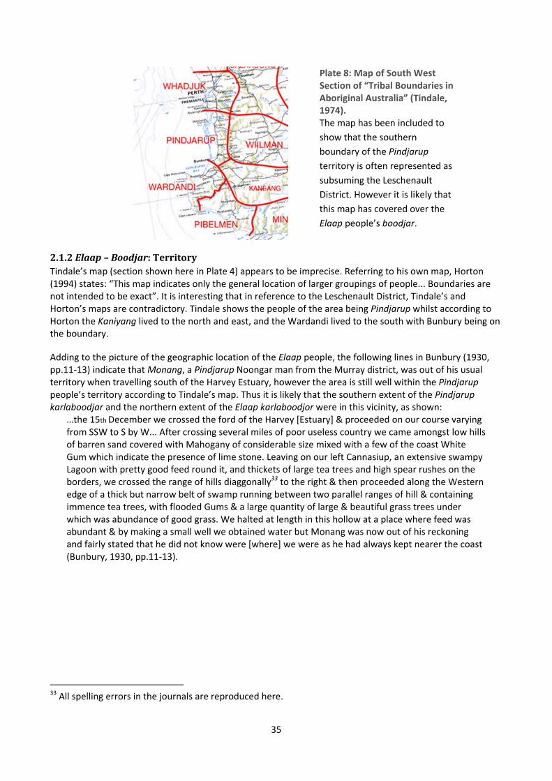
35
Plate 8: Map of South West Section of “Tribal Boundaries in Aboriginal Australia” (Tindale, 1974). The map has been included to
show that the southern
boundary of the Pindjarup territory is often represented as
subsuming the Leschenault
District. However it is likely that
this map has covered over the
Elaap people’s boodjar.
2.1.2Elaap–Boodjar:TerritoryTindale’s map (section shown here in Plate 4) appears to be imprecise. Referring to his own map, Horton (1994) states: “This map indicates only the general location of larger groupings of people... Boundaries are not intended to be exact”. It is interesting that in reference to the Leschenault District, Tindale’s and Horton’s maps are contradictory. Tindale shows the people of the area being Pindjarup whilst according to Horton the Kaniyang lived to the north and east, and the Wardandi lived to the south with Bunbury being on the boundary.
Adding to the picture of the geographic location of the Elaap people, the following lines in Bunbury (1930, pp.11‐13) indicate that Monang, a Pindjarup Noongar man from the Murray district, was out of his usual territory when travelling south of the Harvey Estuary, however the area is still well within the Pindjarup people’s territory according to Tindale’s map. Thus it is likely that the southern extent of the Pindjarup karlaboodjar and the northern extent of the Elaap karlaboodjor were in this vicinity, as shown:
…the 15th December we crossed the ford of the Harvey [Estuary] & proceeded on our course varying from SSW to S by W... After crossing several miles of poor useless country we came amongst low hills of barren sand covered with Mahogany of considerable size mixed with a few of the coast White Gum which indicate the presence of lime stone. Leaving on our left Cannasiup, an extensive swampy Lagoon with pretty good feed round it, and thickets of large tea trees and high spear rushes on the borders, we crossed the range of hills diaggonally33 to the right & then proceeded along the Western edge of a thick but narrow belt of swamp running between two parallel ranges of hill & containing immence tea trees, with flooded Gums & a large quantity of large & beautiful grass trees under which was abundance of good grass. We halted at length in this hollow at a place where feed was abundant & by making a small well we obtained water but Monang was now out of his reckoning and fairly stated that he did not know were [where] we were as he had always kept nearer the coast (Bunbury, 1930, pp.11‐13).
33 All spelling errors in the journals are reproduced here.
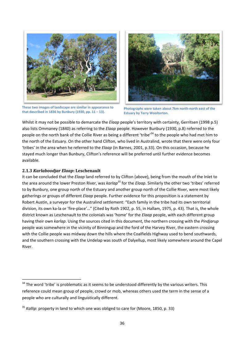
36
These two images of landscape are similar in appearance to that described in 1836 by Bunbury (1930, pp. 11 – 13).
Photographs were taken about 7km north‐north east of the Estuary by Terry Wooltorton.
Whilst it may not be possible to demarcate the Elaap people’s territory with certainty, Gerritsen (1998 p.5) also lists Ommaney (1840) as referring to the Elaap people. However Bunbury (1930, p.8) referred to the people on the north bank of the Collie River as being a different ‘tribe’34 to the people who had met him to
the north of the Estuary. On the other hand Clifton, who lived in Australind, wrote that there were only four
‘tribes’ in the area when he referred to the Elaap (in Barnes, 2001, p.33). On this occasion, because he stayed much longer than Bunbury, Clifton’s reference will be preferred until further evidence becomes
available.
2.1.3KarlaboodjarElaap:LeschenaultIt can be concluded that the Elaap land referred to by Clifton (above), being from the mouth of the Inlet to
the area around the lower Preston River, was karlap35 for the Elaap. Similarly the other two ‘tribes’ referred
to by Bunbury, one group north of the Estuary and another group north of the Collie River, were most likely
gatherings or groups of different Elaap people. Further evidence for this proposition is a statement by
Robert Austin, a surveyor for the Australind settlement: “Each family in the tribe had its own territorial
division, its own ka‐la or ‘fire‐place’…” (Cited by Roth 1902, p. 55, in Hallam, 1975, p. 43). That is, the whole
district known as Leschenault to the colonials was ‘home’ for the Elaap people, with each different group having their own karlap. Using the sources cited in this document, the northern crossing with the Pindjarup people was somewhere in the vicinity of Binningup and the ford of the Harvey River, the eastern crossing
with the Collie people was midway down the hills where the Coalfields Highway used to bend southwards,
and the southern crossing with the Undelap was south of Dalyellup, most likely somewhere around the Capel
River.
34 The word ‘tribe’ is problematic as it seems to be understood differently by the various writers. This
reference could mean group of people, crowd or mob, whereas others used the term in the sense of a
people who are culturally and linguistically different.
35 Kallip: property in land to which one was obliged to care for (Moore, 1850, p. 33)
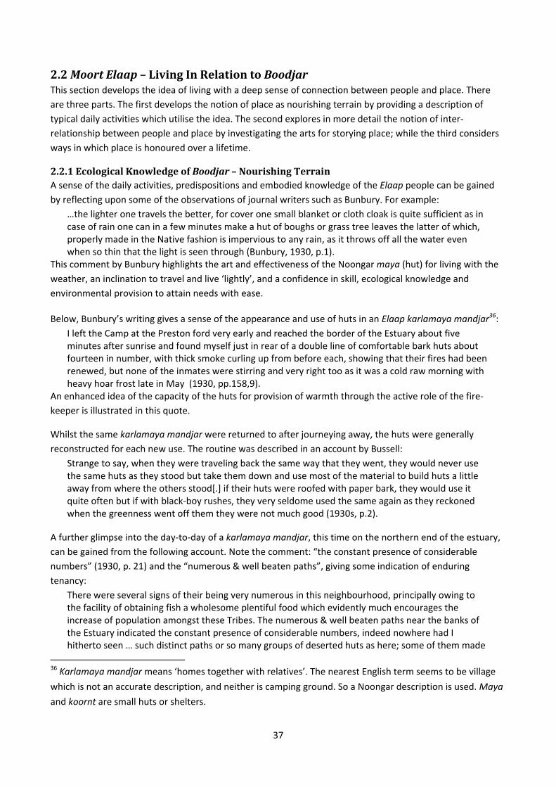
37
2.2MoortElaap–LivingInRelationtoBoodjarThis section develops the idea of living with a deep sense of connection between people and place. There
are three parts. The first develops the notion of place as nourishing terrain by providing a description of
typical daily activities which utilise the idea. The second explores in more detail the notion of inter‐
relationship between people and place by investigating the arts for storying place; while the third considers
ways in which place is honoured over a lifetime.
2.2.1EcologicalKnowledgeofBoodjar–NourishingTerrainA sense of the daily activities, predispositions and embodied knowledge of the Elaap people can be gained by reflecting upon some of the observations of journal writers such as Bunbury. For example:
…the lighter one travels the better, for cover one small blanket or cloth cloak is quite sufficient as in case of rain one can in a few minutes make a hut of boughs or grass tree leaves the latter of which, properly made in the Native fashion is impervious to any rain, as it throws off all the water even when so thin that the light is seen through (Bunbury, 1930, p.1).
This comment by Bunbury highlights the art and effectiveness of the Noongar maya (hut) for living with the weather, an inclination to travel and live ‘lightly’, and a confidence in skill, ecological knowledge and
environmental provision to attain needs with ease.
Below, Bunbury’s writing gives a sense of the appearance and use of huts in an Elaap karlamaya mandjar36:
I left the Camp at the Preston ford very early and reached the border of the Estuary about five minutes after sunrise and found myself just in rear of a double line of comfortable bark huts about fourteen in number, with thick smoke curling up from before each, showing that their fires had been renewed, but none of the inmates were stirring and very right too as it was a cold raw morning with heavy hoar frost late in May (1930, pp.158,9).
An enhanced idea of the capacity of the huts for provision of warmth through the active role of the fire‐
keeper is illustrated in this quote.
Whilst the same karlamaya mandjar were returned to after journeying away, the huts were generally reconstructed for each new use. The routine was described in an account by Bussell:
Strange to say, when they were traveling back the same way that they went, they would never use the same huts as they stood but take them down and use most of the material to build huts a little away from where the others stood[.] if their huts were roofed with paper bark, they would use it quite often but if with black‐boy rushes, they very seldome used the same again as they reckoned when the greenness went off them they were not much good (1930s, p.2).
A further glimpse into the day‐to‐day of a karlamaya mandjar, this time on the northern end of the estuary,
can be gained from the following account. Note the comment: “the constant presence of considerable
numbers” (1930, p. 21) and the “numerous & well beaten paths”, giving some indication of enduring
tenancy:
There were several signs of their being very numerous in this neighbourhood, principally owing to the facility of obtaining fish a wholesome plentiful food which evidently much encourages the increase of population amongst these Tribes. The numerous & well beaten paths near the banks of the Estuary indicated the constant presence of considerable numbers, indeed nowhere had I hitherto seen … such distinct paths or so many groups of deserted huts as here; some of them made
36 Karlamaya mandjar means ‘homes together with relatives’. The nearest English term seems to be village
which is not an accurate description, and neither is camping ground. So a Noongar description is used. Maya
and koornt are small huts or shelters.
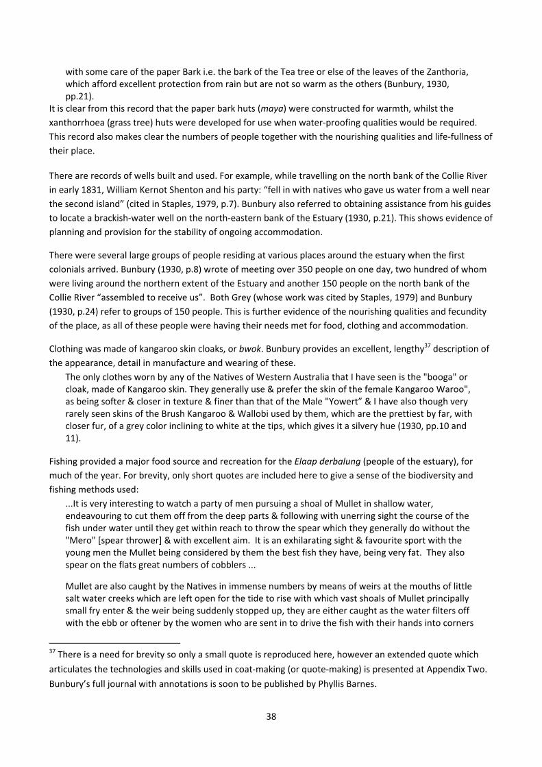
38
with some care of the paper Bark i.e. the bark of the Tea tree or else of the leaves of the Zanthoria, which afford excellent protection from rain but are not so warm as the others (Bunbury, 1930, pp.21).
It is clear from this record that the paper bark huts (maya) were constructed for warmth, whilst the
xanthorrhoea (grass tree) huts were developed for use when water‐proofing qualities would be required.
This record also makes clear the numbers of people together with the nourishing qualities and life‐fullness of
their place.
There are records of wells built and used. For example, while travelling on the north bank of the Collie River
in early 1831, William Kernot Shenton and his party: “fell in with natives who gave us water from a well near
the second island” (cited in Staples, 1979, p.7). Bunbury also referred to obtaining assistance from his guides
to locate a brackish‐water well on the north‐eastern bank of the Estuary (1930, p.21). This shows evidence of
planning and provision for the stability of ongoing accommodation.
There were several large groups of people residing at various places around the estuary when the first
colonials arrived. Bunbury (1930, p.8) wrote of meeting over 350 people on one day, two hundred of whom
were living around the northern extent of the Estuary and another 150 people on the north bank of the
Collie River “assembled to receive us”. Both Grey (whose work was cited by Staples, 1979) and Bunbury
(1930, p.24) refer to groups of 150 people. This is further evidence of the nourishing qualities and fecundity
of the place, as all of these people were having their needs met for food, clothing and accommodation.
Clothing was made of kangaroo skin cloaks, or bwok. Bunbury provides an excellent, lengthy37 description of the appearance, detail in manufacture and wearing of these.
The only clothes worn by any of the Natives of Western Australia that I have seen is the "booga" or cloak, made of Kangaroo skin. They generally use & prefer the skin of the female Kangaroo Waroo", as being softer & closer in texture & finer than that of the Male "Yowert” & I have also though very rarely seen skins of the Brush Kangaroo & Wallobi used by them, which are the prettiest by far, with closer fur, of a grey color inclining to white at the tips, which gives it a silvery hue (1930, pp.10 and 11).
Fishing provided a major food source and recreation for the Elaap derbalung (people of the estuary), for much of the year. For brevity, only short quotes are included here to give a sense of the biodiversity and
fishing methods used:
...It is very interesting to watch a party of men pursuing a shoal of Mullet in shallow water, endeavouring to cut them off from the deep parts & following with unerring sight the course of the fish under water until they get within reach to throw the spear which they generally do without the "Mero" [spear thrower] & with excellent aim. It is an exhilarating sight & favourite sport with the young men the Mullet being considered by them the best fish they have, being very fat. They also spear on the flats great numbers of cobblers ...
Mullet are also caught by the Natives in immense numbers by means of weirs at the mouths of little salt water creeks which are left open for the tide to rise with which vast shoals of Mullet principally small fry enter & the weir being suddenly stopped up, they are either caught as the water filters off with the ebb or oftener by the women who are sent in to drive the fish with their hands into corners
37 There is a need for brevity so only a small quote is reproduced here, however an extended quote which
articulates the technologies and skills used in coat‐making (or quote‐making) is presented at Appendix Two.
Bunbury’s full journal with annotations is soon to be published by Phyllis Barnes.
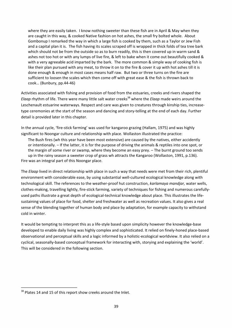
39
where they are easily taken. I know nothing sweeter than these fish are in April & May when they are caught in this way, & cooked Native fashion on hot ashes, the small fry bolted whole. About Gombonup I remarked the way in which a large fish is cooked by them, such as a Taylor or Jew Fish and a capital plan it is. The fish having its scales scraped off is wrapped in thick folds of tea tree bark which should not be from the outside so as to burn readily, this is then covered up in warm sand & ashes not too hot or with any lumps of live fire, & left to bake when it come out beautifully cooked & with a very agreeable acid imparted by the bark. The more common & simple way of cooking fish is like their plan pursued with any meat, to throw it on to the fire & cover it up with hot ashes till it is done enough & enough in most cases means half raw. But two or three turns on the fire are sufficient to loosen the scales which then come off with great ease & the fish is thrown back to cook… (Bunbury, pp.44‐46)
Activities associated with fishing and provision of food from the estuaries, creeks and rivers shaped the
Elaap rhythm of life. There were many little salt water creeks38 where the Elaap made weirs around the
Leschenault estuarine waterways. Respect and care was given to creatures through kinship ties, increase‐
type ceremonies at the start of the season and dancing and story‐telling at the end of each day. Further
detail is provided later in this chapter.
In the annual cycle, ‘fire‐stick farming’ was used for kangaroo grazing (Hallam, 1975) and was highly
significant to Noongar culture and relationship with place. Wollaston illustrated the practice:
The Bush fires (wh this year have been most extensive) are caused by the natives, either accidently or intentionally. – If the latter, it is for the purpose of driving the animals & reptiles into one spot, or the margin of some river or swamp, where they become an easy prey. – The burnt ground too sends up in the rainy season a sweeter crop of grass wh attracts the Kangaroo (Wollaston, 1991, p.136).
Fire was an integral part of this Noongar place.
The Elaap lived in direct relationship with place in such a way that needs were met from their rich, plentiful
environment with considerable ease, by using substantial well‐cultured ecological knowledge along with
technological skill. The references to the weather‐proof hut construction, karlamaya mandjar, water wells, clothes‐making, travelling lightly, fire‐stick farming, variety of techniques for fishing and numerous carefully‐
used paths illustrate a great depth of ecological‐technical knowledge about place. This illustrates the life‐
sustaining values of place for food, shelter and freshwater as well as recreation values. It also gives a real
sense of the blending together of human body and place by adaptation, for example capacity to withstand
cold in winter.
It would be tempting to interpret this as a life‐style based upon simplicity however the knowledge‐base
developed to enable daily living was highly complex and sophisticated. It relied on finely‐honed place‐based
observational and perceptual skills and a logic informed by a holistic‐ecological worldview. It also relied on a
cyclical, seasonally‐based conceptual framework for interacting with, storying and explaining the ‘world’.
This will be considered in the following section.
38 Plates 14 and 15 of this report show creeks around the Inlet.

40
2.2.2DancingUpNature–KinshipWithBoodjarNoongar people have always understood themselves to be integral to place, including relationship with
particular more‐than‐human39 species as well as human relatives. Kinship systems and family groups were
said to be established by the creation beings which linked people to each other and place. The laws
governing these relationships were handed down through artworks, dances, stories and songs since the
great‐grandparent ancestors (Collard, 1994, p.26). In this way, place was imbued with ontological40 values –
people existed because of and together with place. The Noongars would say that this connection to place
has been continuous since the dreamtime or Nyitting, or far, far back in the cold times41 when the great
stories began.
Noongars were a happy, contented people with a “light‐hearted, joyous disposition which takes refuge in
song and dance on every possible occasion”, noted Bates (1985, p.314). Many examples in Bunbury’s
journals support this comment, for example: “As we advanced [southwards along the eastern foreshore of
the Estuary] party after party of Natives joined us, hallooing screeching & receiving us with most boisterous
symptoms of joy” (1930, p.27). Some Bibbulmun kening (dances) originated in the Elaap district. Dances were created in all Noongar places, and sometimes at gatherings they were passed on to other groups.
These included dream dances, war dances and animal and bird dances which mimicked the manners and
habits of an animal or bird. Dances were always energetic and vibrant; they were “entered into with a zest
that never varies” (Bates, 1985, p.314). Dressing for the dances included adornment with bird feathers in the
hair (often cockatoo: manitj) by young men in particular. This being said, it is important to also remember
that punishments were strictly and swiftly applied in the event of transgression of any law (Bates, 1985,
p.77; Collard, 1994). In other words, Noongars were spontaneously cheerful people who respected and
abided by the rule of law.
Music, drama and dance are elements involved in each Noongar dance meeting (Bates, 1985, p.314).
Sometimes, dances were planned and invitations sent by messenger with message stick to most or all of the
Birdiya (elders or leaders) of the South West to invite appropriate respondents from among their members.
These big meetings were very popular in seasons of plenty. For example when the red‐gum flowers, totemic
dances in the Vasse and Capel areas (and most likely the Elaap boodjar as well), were held to increase the numbers of sea mullet and salmon. In Bates’ words: “At certain times in the year the rivers and estuaries of
the Southwestern districts swarm with sea mullet and salmon which come in for spawning” (1985, p.325).
Weirs made from wire grass were constructed to net the fish, and the evening before the fish were
collected, people of the mullet and salmon totem sang for the fish (Roth, 1902). While the recitation
continued, the dancers performed the actions of the fish moving towards their spawning grounds.
39 ‘More‐than‐human’ is a term used increasingly by ecological philosophers since Abram (1996) to refer to
humans and others; rather than to imply that humans are separate from ‘non‐human’ others – a term which
also implies human superiority.
40 Ontology is a term used in philosophy to mean the nature of existence and reality, or ‘being’. In Noongar,
this value system is Koorndarm Katitj. It means knowledge about how and why things are the way they are
(Collard et al., 2004).
41 The Nyitting is so far back it refers to before the last ice‐age, before the world was humanised (Collard,
personal communication, 2013).

41
2.2.3HonouringPlaceTravellers to the meetings used tracks called bidi (veins) which had been constructed and used for many,
many generations, as referred to in the observations by Bunbury. These were the tracks along which the
British were guided by the Noongars, and a good number of them became the highways as well as the
walking and bike tracks used today (Collard, 2011, p.28).
Great care was shown to all species. For example when walking along tracks, nothing at all was damaged as
observed by Bunbury in this example:
After following the edge of a bay about a mile & a half we turned into the Bush by a well beaten path, a little to the left leaving the point where the Preston debouches to the right but this River has not like the Collie a bar at the mouth & we had to seek a ford higher up. Our path was winding like all those made by Natives since they never attempt to remove obsticles [sic] but go round every fallen tree or other impediment & follow the tortuous course of a brook or swamp without any idea of cutting off angles. (Bunbury, 1930, p.33)
Here is an example of dancing which honoured local species and reinforced knowledge of place:
In the emu dance of the Bunbury and Busselton natives, the long stately stride of the bird is imitated most wonderfully, the left hand and arm being raised above the head and slightly crooked to represent the head and neck of the bird. As the performers dance with the high knee action, the arm and hand are moved as the bird moves its head and neck when walking. A second act shows the feeding, love‐making, chasing and final capture of the bird (Bates, 1985, p.324).
Noongar language is largely onomatopoeic which means that many of the words, particularly bird names,
sound like the call the animal makes. For example djidi djidi is the Noongar translation of the name for the
bird called willy wagtail, and its sound is just like its Noongar name. So Noongar language ‘speaks with the
land’ – it is the language of this place. Therefore ‘dancing up nature’ through drama, stories and words
together celebrated the close relationship between people and place. This shows the acknowledgment of
life‐values – place was seen to be alive and directly relational with people‐in‐ecosystem.
Birds in flight over the north east of the Leschenault Estuary, at Rosamel Swamp. Photograph: Terry Wooltorton.
Shredder, dolphin at the mouth of the Collie River. Photograph: Holly Smith.
LearningAboutPlaceJust after birth, Wardandi babies were gently rolled in sand and ashes warmed by a fire; and if born in the
cold weather they were wrapped in a kangaroo skin. At other times of the year babies were put into a goota (skin bag) (Bates, 1985, p.140). That is, Noongar babies were born directly into experience of environment.

42
Later they would play, under the guidance and care of their mothers and sisters, until they were five or six
years old, after which they would become interested in observing and mimicking their same‐sex parents and
older kin. That is, girls would learn about food location and preparation, bag and coat making and so on from
their mothers; whilst boys would learn from their fathers and older male kin to follow animal tracks, hunt
emu and kangaroo, catch fish and throw gidgee and kylie (Collard, 1994, p.36).
The first major changes in life for boys42 in Elaap boodjar came in preparation for their initiation, occurring
over a period of from two to five years. When the time came, boys were taken from their mother’s
karlamaya mandjar without ceremony by their mother’s brother, their kongan (uncle), and left with their elder brother‐in‐laws; their babbingur or kobungur. The boys learned advanced knowledge of hunting, weapon‐making, arts and general knowledge and skills of life.
This period of life resulted in learning all necessary bush craft as well as thorough and intimate knowledge of
laws and customs; and ended with their own marriage. By the end of this time, they were highly skilled and
knowledgeable young men ready for an adulthood of obligation to kin and place; and deep respect for their
totem (Bates, 1985, pp.150‐159). In short the values of place as nurturer, as life‐giver and as home were
deeply and formally embedded from birth with their corresponding obligations. These were enmeshed with
cultural, ontological and cosmological43 values.
To this point in the chapter a basic image of the life‐world44 of the Elaap has been produced, to illustrate the relationship between boodjar (place as nourishing terrain), moort (extended family which includes trees,
plants and animals) and katitjiny (knowledge, in this case a holistic, relational form of knowing each of these
notions). The life‐world is one of reciprocity and mutuality that honours and celebrates place through
perception, place‐based intelligence and culture. The next section shows the storied, spiritually‐based
dynamic that informed and provided purpose to daily life.
2.3Katitjiny:KnowingThis section illustrates a spiritual depth of connection to place in conclusion to the chapter. There appear to
be many spiritual values; however in acknowledgement of the holistic Noongar ontology it would be
anathema to separate them. Simply, place is imbued with spirit. It is presented in two sections, which are a
socio‐ecological way of being in place, and the set of values derived from the chapter.
2.3.1ASocialEcology45ofPlaceThe life‐world of the traditional Elaap Noongar people was informed by a deeply interconnected spiritual,
social and ecological way of being in place. Totems were a way of reinforcing a social ecology of place. The
42 Sadly, Bates did not inquire into initiation of girls into adulthood.
43 Cosmologies are theories and beliefs about creation of place and ‘the universe’. Traditional Noongar
theories and beliefs focus on the role of the warkal in the creation of life in the South West.
44 ‘Lifeworld’ is a term used in philosophy and sociology to refer to the individual person’s ‘everyday’
experience of life and consciousness. We could say it is the things we do because of our assumption of
knowledge and knowing, on the basis of who we are.
45 These days ‘social ecology’ tends to be regarded as an integrative, connective viewpoint that sees society
as part of ecology.
43
general term for totem in the South West is borungur, which is the same word as that meaning ‘elder
brother’. Wardandi46 people usually had several totems, each of which was regarded differently. The birds of
each of the two moieties47 were totemic for their bearers, that is, manitjmat (white cockatoo lineage) and wordungmat (crow lineage). The feathers of the white cockatoo were often worn as head decorations and were used as articles of commerce. Certain behaviours on the part of the bird of the opposite lineage
produced feelings in people somewhere between deep respect and fear because of its potential to herald or
produce evil magic (Bates, 1985, pp.192,3).
Trees had assigned moieties and sex48. Marri and tuart were Manitjmat male whereas paperbark, spearwood
and white‐flowered acacia were Manitjmat female. Peppermint, jarrah, white gum, jam and blue gum were
Wordungmat female. This kinship designation meant that everybody was related to one or more tree
species. In addition, whilst the trees themselves were part of the life‐world, they were also held as individual
totems by people of either moiety – as district or local totems, or as hereditary totems, described below.
Each semi‐moiety had a totem, such as emu, an animal or event to be cared for and never eaten or damaged
by the totem‐holder. In addition, district or local totems were those held by everyone born in that district.
Bates (1985) did not list an Elaap district totem. However she states (1992, p.141) that moojarr or Nuytsia floribunda (WA Christmas Tree) was sacred (kanya) to all Noongar groups because of its use by the spirits of the newly dead. It was never played in by children or used for fire‐making49. In fact the flowering of the
moojarr signalled law time and calling of the big mandjar50 meetings (Collard, 2013, personal
communication).
Hereditary totems are those in families which originated from ancestors, not necessarily very far back, who
assigned them because of a particular circumstance. For instance, a sea mullet totem was assigned to a
longstanding Capel district family who passed it to their male children. Finally, individual or personal totems
were assigned to babies by their grandparents or other influential people in their lives due to some incident
happening around their birth. For instance sea, land, moon, stars and daylight have been personal totems.
Personal totems could also be adopted or gifted by arrangement; when the giver and receiver were happy to
exchange obligations (Bates, 1985, p.195‐7). Beliefs about totems varied but an example was that elders
often sang or danced to increase some edible hereditary totems such as the salmon totem of the Busselton
district (Bates, 1985, p.195‐7).
46 People of coastal areas.
47 A moiety is a kinship organisational unit, or social lineage with two ‘halves’. In traditional Noongar society,
everyone and everything was either manitchmat (white cockatoo lineage) or wordungmat (crow lineage).
48 White in Bates (1985, p.193) stated that Bates listed 24 species of tree to make the point, however
unfortunately she has edited this out of the published book.
49 It is interesting that this sacred tree is currently Bunbury’s floral emblem.
50 Fair, or trade festival.
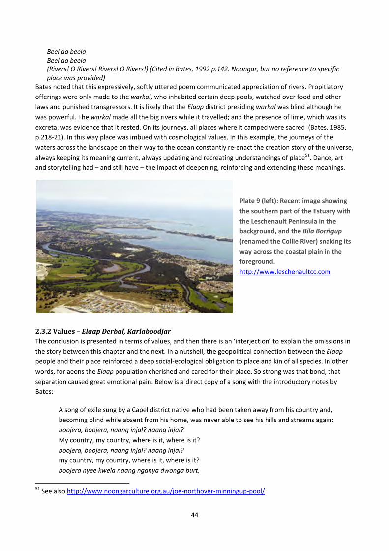
44
Beel aa beela Beel aa beela (Rivers! O Rivers! Rivers! O Rivers!) (Cited in Bates, 1992 p.142. Noongar, but no reference to specific place was provided)
Bates noted that this expressively, softly uttered poem communicated appreciation of rivers. Propitiatory
offerings were only made to the warkal, who inhabited certain deep pools, watched over food and other laws and punished transgressors. It is likely that the Elaap district presiding warkal was blind although he was powerful. The warkal made all the big rivers while it travelled; and the presence of lime, which was its
excreta, was evidence that it rested. On its journeys, all places where it camped were sacred (Bates, 1985,
p.218‐21). In this way place was imbued with cosmological values. In this example, the journeys of the
waters across the landscape on their way to the ocean constantly re‐enact the creation story of the universe,
always keeping its meaning current, always updating and recreating understandings of place51. Dance, art
and storytelling had – and still have – the impact of deepening, reinforcing and extending these meanings.
Plate 9 (left): Recent image showing
the southern part of the Estuary with
the Leschenault Peninsula in the
background, and the Bila Borrigup
(renamed the Collie River) snaking its
way across the coastal plain in the
foreground.
http://www.leschenaultcc.com
2.3.2Values–ElaapDerbal,KarlaboodjarThe conclusion is presented in terms of values, and then there is an ‘interjection’ to explain the omissions in
the story between this chapter and the next. In a nutshell, the geopolitical connection between the Elaap people and their place reinforced a deep social‐ecological obligation to place and kin of all species. In other
words, for aeons the Elaap population cherished and cared for their place. So strong was that bond, that separation caused great emotional pain. Below is a direct copy of a song with the introductory notes by
Bates:
A song of exile sung by a Capel district native who had been taken away from his country and,
becoming blind while absent from his home, was never able to see his hills and streams again:
boojera, boojera, naang injal? naang injal? My country, my country, where is it, where is it?
boojera, boojera, naang injal? naang injal? my country, my country, where is it, where is it?
boojera nyee kwela naang nganya dwonga burt,
51 See also http://www.noongarculture.org.au/joe‐northover‐minningup‐pool/.
45
this country I know not its name, I know not,
marreemba yooganin kooroo weeriba ingarda, wandering and standing I look far and far,
marreemba yookain kooroo weeree weeriba, wandering, standing, my eyes seek for it afar,
marreemba yookain tallaroo, marremba yookain, wandering, standing or dancing, wandering, standing,
boojera boojera, naang injal, naang injal? my country, my country, where is it, where is it?
The air of this song was melancholy in the extreme and expressed a high degree of feeling and passion. The long drawn out aa and oo uttered in the high cracked voice of the singer caused the ready tears to fall from the eyes of those who were also exiled from their own ground, and who sat round listening to the improvisation of their fellow exile (Bates, 1985, p.338).
In this chapter the lifeway of the population of Leschenault, Derbal Elaap Karlaboodjar, has been sketched. The Derbalung, the people of the Estuary and the lower Collie and lower Preston, were the Elaap people. They lived at home in the Estuary district for much of the year, leaving only for regional celebrations,
ceremonies and a variety of meetings, always returning home for their karlap. The description illustrated boodjar which means place as nourishing terrain, incorporating a notion of people as intrinsic to the
ecosystem of a nourishing landscape. Place and people co‐existed mutually, in reciprocal relation, and have
done for many thousands of years.
Abram lists a series of generalisations about the ways in which oral, indigenous cultures connect with place
(Abram, 2010, pp.268‐271). Here are those evidenced in this historic account, abstracted in quotation form:
Indigenous, oral intelligence is place‐based intelligence, an awareness infused by the local terrain.
The simple act of perception is experienced as an interchange between oneself and that which one
perceives – as a meeting, as participation, as a communion between beings.
The surrounding world, then, is experienced less as a collection of objects than as a community of
active agents, or subjects.
The ability of each thing or entity to influence the space around it may be viewed as the expressive
power of that being. All things, in this sense, are potentially expressive.
To an oral culture, the world is articulated as story… To a deeply oral culture, the earthly world is felt
as a vast, ever‐unfolding Story in which we – along with the other animals, plants and landforms –
are all characters.
In such a breathing cosmos, time is not a rectilinear movement from a distant past to a wholly
different future. Rather, time has an enveloping roundness, like the encircling horizon.
A world made of story is an earth permeated by dreams, a terrain filled with imagination. Yet this is
not so much our imagination, but rather the world’s imagination, in which our own actions are
participant.
This is the nature of a geopolitical human connection with place; a deeply reciprocal, mutual relationship
which forms place and results from place. The overarching question for this study was: what is the history of
the relationship between people and place in the Leschenault Estuary? To answer this, the place‐based

46
socio‐cultural values of the population of the Leschenault Estuary district in Noongar times are stated as
follows:
Spiritual values – place is imbued with spirit.
Life values – place is alive, and directly relational with people‐in‐ecosystem. Life of place exists prior
to and directly with people, who form part of that life.
Nurturing values – place nurtures and provides nourishment and as such people are obliged to
ensure its profundity.
Intrinsic values – place is comprised of plants and animals which exist in direct kin relations with
people. Since they are agents themselves, they have intrinsic rights and values.
Historic values – every part of place has its own small story that is part of the overarching story of
the place and its origins.
Cultural values – people are directly participant with place in deep reciprocal connection. Human
and place mutually exist.
Home/heart/hearth values – place is cherished for love of home‐place.
Cosmological values – place is part of the structure of the universe, and as such helps to explain the
meaning of the universe.
Ontological values – koorndam katitj; people exist because of and together with place.
Leschenault Estuary, storm approaching. Photo: Terry Wooltorton.
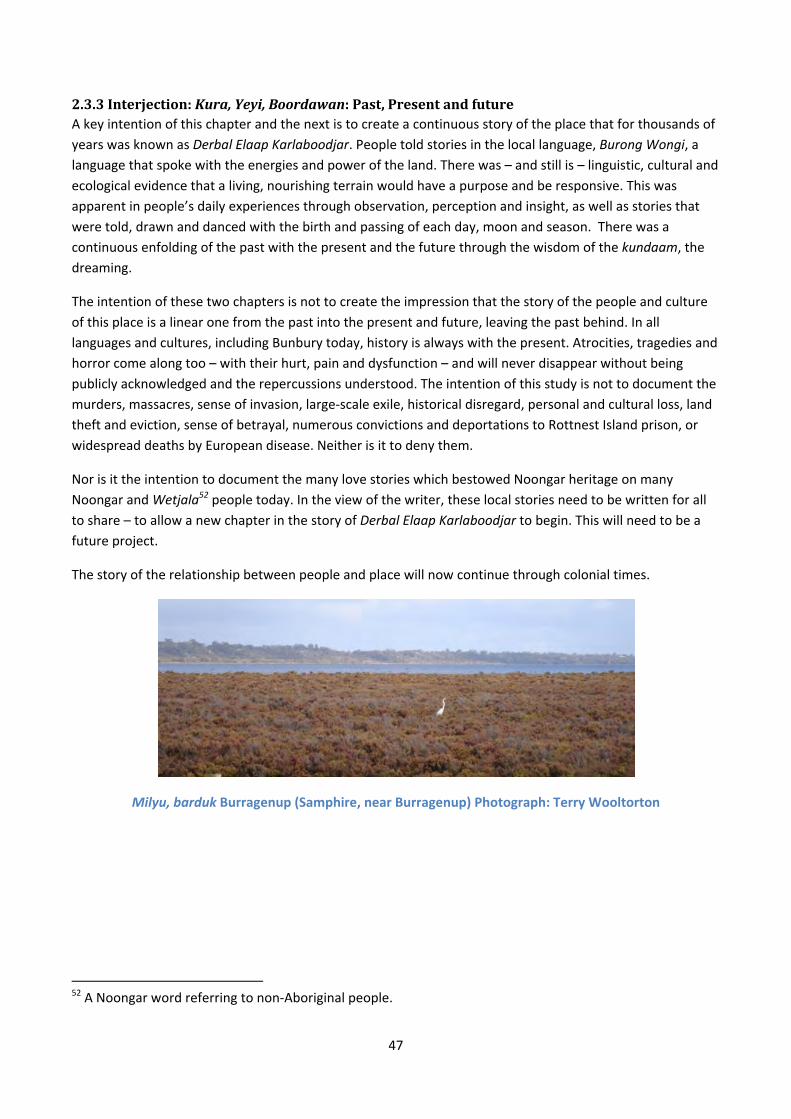
47
2.3.3Interjection:Kura,Yeyi,Boordawan:Past,PresentandfutureA key intention of this chapter and the next is to create a continuous story of the place that for thousands of
years was known as Derbal Elaap Karlaboodjar. People told stories in the local language, Burong Wongi, a language that spoke with the energies and power of the land. There was – and still is – linguistic, cultural and
ecological evidence that a living, nourishing terrain would have a purpose and be responsive. This was
apparent in people’s daily experiences through observation, perception and insight, as well as stories that
were told, drawn and danced with the birth and passing of each day, moon and season. There was a
continuous enfolding of the past with the present and the future through the wisdom of the kundaam, the
dreaming.
The intention of these two chapters is not to create the impression that the story of the people and culture
of this place is a linear one from the past into the present and future, leaving the past behind. In all
languages and cultures, including Bunbury today, history is always with the present. Atrocities, tragedies and
horror come along too – with their hurt, pain and dysfunction – and will never disappear without being
publicly acknowledged and the repercussions understood. The intention of this study is not to document the
murders, massacres, sense of invasion, large‐scale exile, historical disregard, personal and cultural loss, land
theft and eviction, sense of betrayal, numerous convictions and deportations to Rottnest Island prison, or
widespread deaths by European disease. Neither is it to deny them.
Nor is it the intention to document the many love stories which bestowed Noongar heritage on many
Noongar and Wetjala52 people today. In the view of the writer, these local stories need to be written for all
to share – to allow a new chapter in the story of Derbal Elaap Karlaboodjar to begin. This will need to be a future project.
The story of the relationship between people and place will now continue through colonial times.
Milyu, barduk Burragenup (Samphire, near Burragenup) Photograph: Terry Wooltorton
52 A Noongar word referring to non‐Aboriginal people.

48
PLACE‐BASEDSOCIALVALUESINCOLONIALTIMESThe west coast of Australia has been
visited by many voyagers – some of
whom were pirates – from China,
Portugal and Holland hundreds of years
before the French and British in the
1800s. The first recorded European visit
to the Bunbury area was by Captain Jacob
Peereboom in the ship Elburg in 1658 (O'Brien, 1981, p.20).
The Royal Commissions read to Captain
Arthur Phillip in 1788 when he was
appointed Governor of New South Wales,
aligned that British colony’s western
boundary to the meridian 135°E. This was
expanded to 129°E in 1824 due to
concerns about Dutch and French
intentions for the northern coast, taking
the size of New South Wales to over half
of the continent. However sovereignty of
the western part of Australia remained
undecided by the dominant colonial
powers. (Taylor, 2011) The French
proceeded: “... to buzz like bees about
the shore‐line of West Australia...”
(Millett, 1980, p.306)53.
The British and French were at war in
March 1803 when Captain Nicolas Baudin
returned from France for his second visit to the south western coast of New Holland. He anchored the
Géographe in Koombana Bay and sent a party into the Inlet. The Leschenault Inlet and Port Leschenault
were named in honour of the expedition’s botanist Jean Baptiste Leschenault de La Tour (O'Brien, 1981,
p.30; Sanders, 1975, p.2). The expedition was purportedly for scientific research but was widely believed by
the British to be espionage (Millett, 1980, p.307). On a world scale, the industrial revolution was fuelling a
voracious demand for raw materials and new markets to serve European economic interests.
Frequent visits by whalers and sealers added to imperial anxieties which led to Major Edmund Lockyer taking
possession of King George Sound in 1826, and Captain Fremantle taking formal possession of the western
coast of New Holland on 2nd May, 1829. Ensign McLeod established the military contingent at Port
Leschenault the following year in March, 1830 (O'Brien, 1981, p.37).
53 The book by Mrs Edward Millett (Janet) was first published in 1872 and facsimile printed by the University
of Western Australia Press in 1980.
Plate 10: Eastern portion of Australia (Arrowsmith, 1841). Map shows New South Wales and the new South Australian colony which was defined by a British Act of Parliament in 1834.
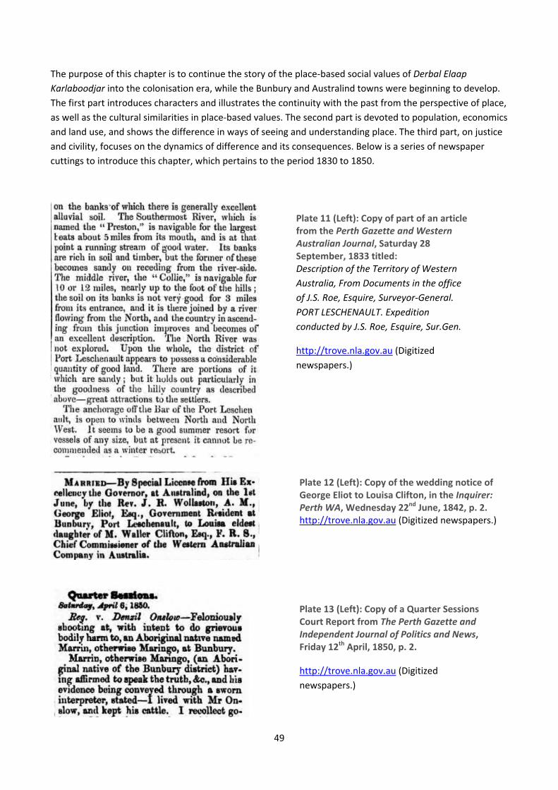
49
The purpose of this chapter is to continue the story of the place‐based social values of Derbal Elaap Karlaboodjar into the colonisation era, while the Bunbury and Australind towns were beginning to develop. The first part introduces characters and illustrates the continuity with the past from the perspective of place,
as well as the cultural similarities in place‐based values. The second part is devoted to population, economics
and land use, and shows the difference in ways of seeing and understanding place. The third part, on justice
and civility, focuses on the dynamics of difference and its consequences. Below is a series of newspaper
cuttings to introduce this chapter, which pertains to the period 1830 to 1850.
Plate 11 (Left): Copy of part of an article from the Perth Gazette and Western Australian Journal, Saturday 28 September, 1833 titled: Description of the Territory of Western Australia, From Documents in the office of J.S. Roe, Esquire, Surveyor-General. PORT LESCHENAULT. Expedition conducted by J.S. Roe, Esquire, Sur.Gen.
http://trove.nla.gov.au (Digitized
newspapers.)
Plate 12 (Left): Copy of the wedding notice of George Eliot to Louisa Clifton, in the Inquirer: Perth WA, Wednesday 22nd June, 1842, p. 2. http://trove.nla.gov.au (Digitized newspapers.)
Plate 13 (Left): Copy of a Quarter Sessions Court Report from The Perth Gazette and Independent Journal of Politics and News, Friday 12th April, 1850, p. 2.
http://trove.nla.gov.au (Digitized
newspapers.)
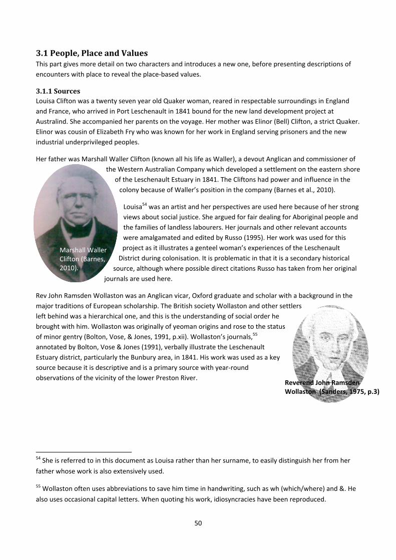
50
3.1People,PlaceandValuesThis part gives more detail on two characters and introduces a new one, before presenting descriptions of
encounters with place to reveal the place‐based values.
3.1.1SourcesLouisa Clifton was a twenty seven year old Quaker woman, reared in respectable surroundings in England
and France, who arrived in Port Leschenault in 1841 bound for the new land development project at
Australind. She accompanied her parents on the voyage. Her mother was Elinor (Bell) Clifton, a strict Quaker.
Elinor was cousin of Elizabeth Fry who was known for her work in England serving prisoners and the new
industrial underprivileged peoples.
Her father was Marshall Waller Clifton (known all his life as Waller), a devout Anglican and commissioner of
the Western Australian Company which developed a settlement on the eastern shore
of the Leschenault Estuary in 1841. The Cliftons had power and influence in the
colony because of Waller’s position in the company (Barnes et al., 2010).
Louisa54 was an artist and her perspectives are used here because of her strong
views about social justice. She argued for fair dealing for Aboriginal people and
the families of landless labourers. Her journals and other relevant accounts
were amalgamated and edited by Russo (1995). Her work was used for this
project as it illustrates a genteel woman’s experiences of the Leschenault
District during colonisation. It is problematic in that it is a secondary historical
source, although where possible direct citations Russo has taken from her original
journals are used here.
Rev John Ramsden Wollaston was an Anglican vicar, Oxford graduate and scholar with a background in the
major traditions of European scholarship. The British society Wollaston and other settlers
left behind was a hierarchical one, and this is the understanding of social order he
brought with him. Wollaston was originally of yeoman origins and rose to the status
of minor gentry (Bolton, Vose, & Jones, 1991, p.xii). Wollaston’s journals,55
annotated by Bolton, Vose & Jones (1991), verbally illustrate the Leschenault
Estuary district, particularly the Bunbury area, in 1841. His work was used as a key
source because it is descriptive and is a primary source with year‐round
observations of the vicinity of the lower Preston River.
54 She is referred to in this document as Louisa rather than her surname, to easily distinguish her from her
father whose work is also extensively used.
55 Wollaston often uses abbreviations to save him time in handwriting, such as wh (which/where) and &. He
also uses occasional capital letters. When quoting his work, idiosyncracies have been reproduced.
Marshall Waller Clifton (Barnes, 2010).
Reverend John Ramsden Wollaston (Sanders, 1975, p.3)

51
Plate 14: Painting by Louisa Clifton, titled: View of Leschenault Bay 1841. The Parkfield and the American whaler Jefferson are at anchor in the bay. (Barnes et al., 2010, p.57)
The dunes in the background are part of the Leschenault Peninsula, the western periphery of the Estuary.
3.1.2EncounterswithPlaceAt the time the British arrived at Goomburrup, there were many hundreds of Elaap people at home in the
district. Below is Bunbury’s account of first sight of the estuary, after leaving Myalup:
... we followed our guides along Native paths visible to none but themselves through an undulating country timbered principally with Tooats with some Red Gum & Mahogany... & saw a thick tea tree swamp about half a mile on our right, forming the head of the Estuary upon which we soon arrived ourselves by a well beaten Native path through a most rich and luxuriant crop of grass & sow thistles. The tide was out & a considerable extent of sand & mud was left bare round the head of the Estuary upon which were congregated to feed immense flocks of Brown Ducks & Teal while the water was equally covered with Swans & Pelicans ... (Bunbury, 1930, pp.16‐19)
Bunbury recognised the biodiversity values and the aesthetic of picturesque pastoral country. He also
recognised the observation skills of the Noongar guides.
Swans, Leschenault Estuary. Photo: Mike Whitehead.
The quote (below) shows the aesthetic values assigned to the estuary, and acknowledges the groups of
Elaap people along the estuary. A beautiful scene now presented itself as we looked down the Estuary to the southward. The vast extent of water before us lay smooth & still like a glassy lake, the sea breeze having fallen with the
Grey teal duck, Leschenault Estuary. Photo: Chris Tate.

52
setting sun which threw out in dark relief the pointed & steep sand hills on our right over which were sprinkled a few large gum trees & Peppermints, & the shadows of these hills gradually lengthening stretched across the Estuary, .... Ahead of us point after point of land appeared jutting into the Estuary or "Derbal" becoming gradually more & more indistinct untill lost in the dim distance while beyond a little on the right appeared a high remarkable hill or promontory forming the south head of the Port Leschenault Inlet, now glowing with the warm tints of evening. The Natives with us kindled a large fire on the bank to announce our coming to the Tribes in the vicinity & it was speedily answered by several fires from different spots ... (Bunbury, 1930, pp.16‐19)
Leschenault Estuary: Karragarrup. Photo: Kaye Handley. Leschenault Estuary. Photograph: Chris Tate.
Upon arrival of the British and for at least one or two decades afterwards, the Leschenault district was the
karlap (home territory) of particular Elaap families56 whose identities are not yet known. However Bates
(1985, p.327) incidentally refers to Woondan as the eeko or biderr (a leader, teacher or important person) of
Goomburrup at around the turn of the 20th century. At the time the British arrived, Bates estimated that
there were at least 40,000 Noongars 57 in the South West (1985, p.54). Overleaf is a map of the Estuary as it
was when the British settled in 1841, surveyed by Captain Stokes RN.
Here is one of Bunbury’s many observations of Noongar fishing and food preparation, written at the ford
over the lower Preston River. It illustrates the assigning of life‐sustaining values:
... They also spear on the flats great numbers of cobblers ... very good to eat. Mullet are also caught by the Natives in immense numbers...The Opossum is very white but has a strong oromatic [sic] taste from the leaves of the Eucalyptus on which it feeds; but the Kangaroo Rat is much better although not equal to the little Bandicoot which is delicious... (Bunbury, 1930 p.12)
Elaap was an extremely biodiverse endemic landscape. Its first colonial establishment was at Didunup,58 a habitat of black swans and ducks (marked on Stokes’ map overleaf, with a red D). Elaap included
56 Conclusion drawn using the work of Collard (1994, p.25), Wollaston (1991) and Clifton (2010).
57 This is far more than other estimates however, some of which were less than 5000.
58 Didunup is located on the north shore of the Inlet. At the time it was the south‐western tip (the end) of the
Leschenault Peninsular, where the Inlet entered Koombana Bay. It was the site of the military post set up in
1830 under the authority of Ensign McLeod which lasted only six months (Barker & Laurie, 1992, p.8;
Sanders, 1975, p.3). The Noongar meaning of Didunup is herring fishing spot (derived from Moore, 1850).

53
Goomburrup (Koombana Bay), Didunup and Gwenilup (marked on Stokes’ map below with a red G) and all other Leschenault localities. In 1836 the colonials renamed the area Bunbury, after the young lieutenant.
Plate 15: 1841 map by surveyor Forsyth, for Captain Stokes RN. From the Brendan Kelly Collection.
Here is a section of Wollaston’s description in which he describes the landscape around his place near the
Preston in all directions:
To give the best idea I can of our Place upon Paper; – our House and premises are situated on the side of a Sand Hill, surrounded on the West at intervals with Eucalypti, especially the Red Gum. – Our
D G

54
Verandah faces the River on the East, but we do not see it from the House, in consequence of another lower hill of red earth & loam intervening, & which forms the best part of our Garden, & is in fact the high bank of the Preston. … On the North & South we see nothing but Forest…(Wollaston, 1991, p.130)
In this statement Wollaston acknowledged the magnitude of the biodiversity and what he later called
‘wilderness’ in which he is situated.
Plate 16. Impression of the settlement c1840 (Barnes, 2001, p.28). The artist is unknown, but the sketch is in the style of the Reverend John Ramsden Wollaston (Barnes, personal communication, 2013). Scott Farm (in foreground of the sketch) is near the current location of the Eelup (Elaap) Interchange.
To this point in this chapter, an introduction to place‐based values has been provided. These were aesthetic
values in the beauty of the estuary and the value of the grasslands, the life‐sustaining values of food
provision, and the biodiversity and wilderness values in the different vegetation. The intention was to
illustrate place as the continuous linkage between the Noongar story and the colonisation story. The focus
will now shift from place to the people’s perception and sense of place. From 1830 to about 1850, the British
lived in a place still characterised by a Noongar lifeway.
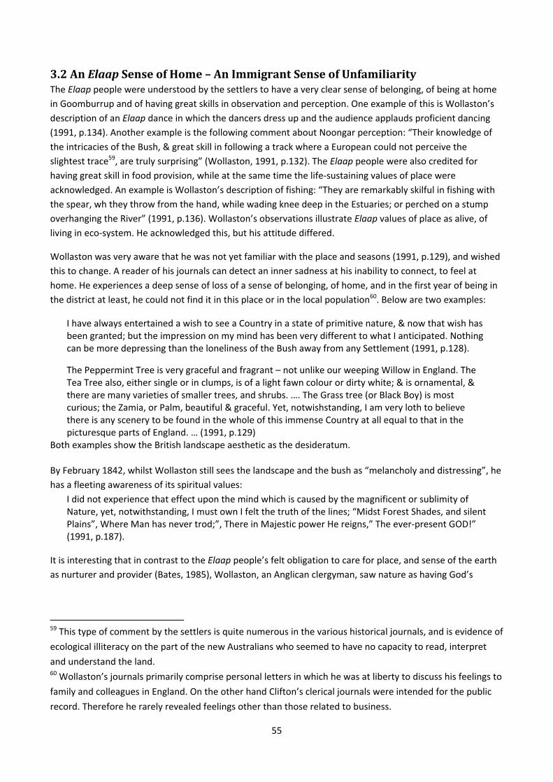
55
3.2AnElaapSenseofHome–AnImmigrantSenseofUnfamiliarityThe Elaap people were understood by the settlers to have a very clear sense of belonging, of being at home
in Goomburrup and of having great skills in observation and perception. One example of this is Wollaston’s
description of an Elaap dance in which the dancers dress up and the audience applauds proficient dancing (1991, p.134). Another example is the following comment about Noongar perception: “Their knowledge of
the intricacies of the Bush, & great skill in following a track where a European could not perceive the
slightest trace59, are truly surprising” (Wollaston, 1991, p.132). The Elaap people were also credited for having great skill in food provision, while at the same time the life‐sustaining values of place were
acknowledged. An example is Wollaston’s description of fishing: “They are remarkably skilful in fishing with
the spear, wh they throw from the hand, while wading knee deep in the Estuaries; or perched on a stump
overhanging the River” (1991, p.136). Wollaston’s observations illustrate Elaap values of place as alive, of living in eco‐system. He acknowledged this, but his attitude differed.
Wollaston was very aware that he was not yet familiar with the place and seasons (1991, p.129), and wished
this to change. A reader of his journals can detect an inner sadness at his inability to connect, to feel at
home. He experiences a deep sense of loss of a sense of belonging, of home, and in the first year of being in
the district at least, he could not find it in this place or in the local population60. Below are two examples:
I have always entertained a wish to see a Country in a state of primitive nature, & now that wish has been granted; but the impression on my mind has been very different to what I anticipated. Nothing can be more depressing than the loneliness of the Bush away from any Settlement (1991, p.128).
The Peppermint Tree is very graceful and fragrant – not unlike our weeping Willow in England. The Tea Tree also, either single or in clumps, is of a light fawn colour or dirty white; & is ornamental, & there are many varieties of smaller trees, and shrubs. …. The Grass tree (or Black Boy) is most curious; the Zamia, or Palm, beautiful & graceful. Yet, notwishstanding, I am very loth to believe there is any scenery to be found in the whole of this immense Country at all equal to that in the picturesque parts of England. … (1991, p.129)
Both examples show the British landscape aesthetic as the desideratum.
By February 1842, whilst Wollaston still sees the landscape and the bush as “melancholy and distressing”, he
has a fleeting awareness of its spiritual values:
I did not experience that effect upon the mind which is caused by the magnificent or sublimity of Nature, yet, notwithstanding, I must own I felt the truth of the lines; “Midst Forest Shades, and silent Plains”, Where Man has never trod;”, There in Majestic power He reigns,” The ever‐present GOD!” (1991, p.187).
It is interesting that in contrast to the Elaap people’s felt obligation to care for place, and sense of the earth as nurturer and provider (Bates, 1985), Wollaston, an Anglican clergyman, saw nature as having God’s
59 This type of comment by the settlers is quite numerous in the various historical journals, and is evidence of
ecological illiteracy on the part of the new Australians who seemed to have no capacity to read, interpret
and understand the land. 60 Wollaston’s journals primarily comprise personal letters in which he was at liberty to discuss his feelings to
family and colleagues in England. On the other hand Clifton’s clerical journals were intended for the public
record. Therefore he rarely revealed feelings other than those related to business.
56
majesty on account of it being ‘without people’61. His loneliness appeared to have been eased to some
extent by his spirituality. The ‘majestic power’ seemed to be in the form of a person (He) which does appear
to be embedded in nature but dedicated to ‘improving’ place. For example:
I have been almost tempted to shed tears at the desolateness of the Scene, had I not called to mind the ubiquity of the God of Nature, who can make “a wilderness like Eden & a desert like the Garden of the Lord.” – Can cause “joy and gladness to be found therein, thanksgiving, & the voice of melody.” (1991, p.128)
It is also interesting that he wrote this and then commented on the “moral wilderness of the world62” which
must be “broken up & cultivated” (Wollaston, 1991, p.128). Several philosophers have proposed that having
a view of God as above earth leads to desecration of the earth – which would be less likely with a view of the
earth as sacred (Abram, 1996; Harding, 2006; Macy & Young Brown, 1998). From an ecological philosophy
point of view, Wollaston did not realise he was in ‘a Garden of Eden’.
When connected, the two stories of one place show continuity over time. The place known for aeons as
Derbal Elaap Karlaboodjar63, also has a two century modern history, at the beginning of which it was
renamed Leschenault to reflect its French connection. The land to the south of the Estuary was renamed
Bunbury, and north of the Collie River and to the east of the Estuary, the land was renamed Australind after
the Australia‐India company (Barker & Laurie, 1992). At least one of the early settlers was lonely and sad,
however. He had a strong connection to a place in another land. The British set about selecting and clearing
land in the Leschenault District, to make it more like ‘home’.
3.2.1PlaceforProfitThe purpose of this section is to overview colonial economic development in order to elucidate the place‐
based values that underpin it. The following excerpt from The Australind Prospectus of July 1840 (Barnes, 2010), shows economic development as the primary objective.
A new era for [Western Australia] has ... now commenced... by the investment of capital in the acquirement of land, and the conveyance of settlers and emigrants to the most favourable point which could be selected upon the Western coast...
With these objects in view, the Company have purchased extensive blocks of land near Leschenault, in the maritime county of Wellington, in which district some few settlers have already established themselves. One of these tracts, containing more that [sic] 100,000 acres, is beautifully situated on the inlet formed by the embouchure of four Rivers, which pass through this property, or form its boundary, at the mouth of which Inlet there is one of the best ports on the Western coast of New Holland. Here the chief town of the new settlement, to be called Australind, will be established. The selection of this spot has been the result of careful investigation (Barnes et al., 2010, p. 684).
61 This is the erroneous notion of ‘terra nullius’, empty land, upon which Australia’s constitution was based
and which was overturned by the Mabo Decision of the High Court of Australia in 1992. It allowed the use of
problematic terms (still in use in history books) such as discoverers and explorers even though these people
were guided and provided for by Aboriginal people. 62 He was most likely referring to his parishioners, many of whom did not attend his Anglican services
regularly.
63 Kallabudjor means “property in land” (Moore, 1850, p. 33).
57
...Spontaneous products of value Amongst the natural productions of the district may be instanced ship timber, Acacia bark, and flax of extraordinary length. This, hereafter, may be produced in considerable quantities for exportation. I am not aware whether any of the gums are of value in commerce, but there are several varieties in great abundance. Fish and game are very plentiful, and also nutritious grasses of various sorts. Very good hay may be made on the meadow lands without previous cultivation64. (Barnes et al., 2010, p.686)
In the 1830s to early 1840s the colonials were very dependent upon the Elaap people for such basic tasks as guidance through the bush, particularly when travelling to Perth or Busselton, assisting with river crossings
and portage (Bunbury, 1930, p.35) retrieving lost horses (Wollaston, 1991) or running the mail. For example
Sanders used information from Mrs Dorinda Davis, nee Clifton, to write the following:
The first postman at Australind was a native known as King Peter. He had an aboriginal [sic] name but, sadly, this name is lost to us and in the records he is known as King Peter. He ran with the mail and was very proud of his position. He had two runs, the most important was between Australind and Pinjarrah [sic], a distance of about fifty miles. The other run was between Australind and the Vasse, about forty miles. He was not very punctual. Being a King and a ruler, he sometimes found business of his own needing attention as he travelled along the route. He never lost a letter and took great care of the “paper jabba”. (1975, p.97)
Australind65 was planned using the colonisation principles of Edward Gibbon Wakefield66, a cousin of Elinor
Clifton (who was Louisa’s mother and Waller’s wife). Whilst still in England, Marshall Waller Clifton had been
awarded the position of chief commissioner of the Western Australian Company, an investment firm which
purchased 103,000 acres from Colonel Peter Lautour67. The land stretched from the Leschenault Estuary
eastward into the hills and north of the Collie River to today’s Waroona. The intention was for the land to be
divided into blocks of 100 acres for farming, and 3000 acres to be put aside for subdivision into housing
blocks for the Australind township and further subdivision into ¼ acre blocks. (Barnes, 2001, pp. 17‐20;
2013a)
It was anticipated that the company would attract capital investment in land. Only ‘gentlemen of capital’
were to be selected, who would bring their own servants – each of whom would receive a free passage for
their labour (Barnes, 2013a; Barnes et al., 2010). This reveals a valuing of people based on social hierarchy, a
view which allocates superiority and inferiority according to acquisition of capital and social class.
Once a substantial amount of land was sold, the plan was for the shipments of people to leave England
bound for Australind. William Hutt, brother of the governor of Western Australia at the time, advised Waller
that the company had already made a reasonable profit by pre‐selling 400 rural blocks. He also said that
other buyers were wanting the blocks (Russo, 1995, pp.51‐53). The financial proposal fitted the culture of
the time as it was in line with Victorian ideals of work; and was reinforced by the Anglican church which
64 Discussions were planned on 12 September 1847, to consider a tax on sandalwood (Barnes, 2010).
65 Australind was named due to the parent company’s connected investments in India.
66 Well known for his work in founding South Australia.
67 Colonel Lautour was one of several investors in the W.A. Company who was granted land in the Colony but
never came to Australia, in fact he ended up bankrupt. (Barnes, 2013, personal communication.)
58
taught that the lower classes were to “work and labour truly to get their own living” as it was God’s calling
(Russo, 1995, p.52).
Since Wakefield disliked the idea of members of the lower classes owning land, the price was recommended
to be sufficiently high to prevent this and maintain British property ownership traditions68 (Russo, 1995,
p.85). This illustrates the valuing of place as property for economic gain. The first ship was to leave before
Christmas 1840, and Waller employed surveyors and commissioned the ship “Island Queen” to take them to
Australind. Subsequent ships were commissioned in England. Meanwhile not long before the Cliftons’
departure from England things were beginning to go wrong for the company. It was reported that the grant
to Lautour had expired and that the company did not own the land because it had reverted to the crown.
The Colonial Office granted permission for the settlement to be at Port Grey and Clifton was asked to collect
the surveyors and transfer them to there. This caused a crash in investor confidence in the company and
many people withdrew their money – a calamity from which it never recovered. After the Parkfield arrived at Bunbury, Clifton consulted the governor, who assured him that the Company's title to the land was secure
and the settlers remained at Leschenault. (Barnes, 2010)
Wollaston was originally recruited by Clifton as the Anglican clergyman to take up the role of Anglican
chaplain for the voyage and new settlement however he was one of those to withdraw due to loss of
confidence in the company. He emigrated to Bunbury under his own auspices. (Wollaston, 1991)
Upon arrival of the Parkfield within sight of the Western Australian coast near what is now Cape Naturaliste,
Waller explained his intentions about law, order and following directions for the Australind Corps (the
captain of which was his son, Pearce). He reminded everyone to observe Lord’s Day for the preservation of
religion and morals, and he advised them to conduct themselves well in their “treatment of the natives”, to
be sober and industrious and to preserve the wildlife (Barnes, 2013a, p.6). Clifton was abiding by the old
British class system by which everyone had a role and knew it had to be performed. From childhood the
labouring classes were prepared for a life of service, and in this case Waller believed it was up to him to
mould a people of character and spirit, led by the exemplary conduct of himself and his family (Barnes et al.,
2010, pp.20‐28). This section illustrates the values of human compassion together with biodiversity values,
within an overarching values system of place and people for profit. Thus, there was an implicit values conflict
between biodiversity, human compassion and profit.
In 1841 employment for settlers in the Leschenault district was afforded by agriculture, storekeeping69,
general agency and auctioneering (Wollaston, 1991, p.132) and medical care70. Wollaston was not paid by
the government or the church as a clergyman, and he regarded these tasks as his duty to God. He was to be
paid £100 per annum once he had built the church at Picton (Bolton et al., 1991).
68 In his later years when Clifton was a MLC, he promoted the rights of ordinary citizens (Barnes, 2013a).
69 Which Wollaston referred to as a “dishonest and degrading trade, and too often iniquitously carried on”
(1991, p.131).
70Dr Carpenter died on March 18th, 1842 at Belvedere, on the Leschenault Peninsula. He was attended by Dr
Green from the Vasse, who in Wollaston’s words was “but a sad incorrigible drunkard” (1991, p.195).

59
Reading these documents leads to an impression of a sense of striving amongst the British. There was
continual striving for achievement of goals, for development, to complete a building or to organise a village.
This required people with a similar orientation or a meaningful understanding of the aspiration – such as the
servants who accompanied the British, who well understood their own allocated role.
Food was a different story, however. It seems that the Elaap people were plentifully endowed with food, apparently securing it with little effort. Their diet, according to Wollaston, included a white grub, kangaroos,
birds, fish, whale meat, lizards and snakes, possums, various roots, bulbs and a white gum (1991, p.135,
149). Intending to ignore the Elaap people’s skills and bio‐cultural needs, the British set out to produce their food by farming traditional British crops and animals. However the challenging conditions, heat and not‐yet
established fruit trees, meant that by February when the land was very dry, they could not sustain the
vegetables in the gardens and had little variety. Also sometimes the supply ships were months late, allowing
stocks in the settlement to run very low (Wollaston, 1991, p.189). For example, while discussing the issue of
fasting for Ash Wednesday, Wollaston said that his diet was too scanty to bother to do this (1991, p.188). He
said that at that time of year they had rice, a boiled onion and occasional bread to make dinner.
Therefore as well as being co‐located in Leschenault, another commonality between the two groups of
people was food. Throughout his journal Wollaston refers to eating such foods as kangaroos, wallabies, birds
such as swans, cockatoo soup, fish, shark and whale. It is clear that the British also valued the Leschenault
Estuary district for its nurturing, life‐sustaining qualities. However, the British aspired towards the
production of culturally familiar foods. Their intention was to change the place so that it felt to them like
home.
Wollaston’s account gives no indication of having asked the Elaap people about bush foods to gather or plant and yet many of the plants the settlers cleared would have been edible ‐ particularly the various orchid
tubers and yams that still grow around the same area, that is now called Wollaston. In the early days of his
time in the Leschenault, Wollaston was on good terms with the Noongars and was interested in learning to
speak Noongar but he was unable to:
…I am upon very good terms with them all. I must try & pick up some of their words, but the rapid jabber of their language is a sad impediment with my slowness of hearing. I can always make them understand common things by signs wh delights them amazingly (Wollaston, 1991, p.134).
In this section it was pointed out that the colonisers moved in to Derbal Elaap Karlaboodjar with an attitude to land and people as property for development and profit. They did value the aesthetic qualities of the
place, and fleetingly recognised its spiritual values. They acknowledged its life‐sustaining values. However
economic gain was a higher value.
The settlers had a hierarchical social organisation, such that the gentry – who were expected to model exemplary
practice to others – owned land and ordered the people whose lives were expected to be dedicated to service. This
Victorian ideal was culturally reinforced by the Anglican church71. On the other hand, the Elaap people were living with their environment in a relational way. They lived with abundance however the settlers found great challenges in
obtaining the food they wanted. This antithesis was not resolved easily.
71 At the same time, Thomas Little, a Catholic, established a farm for the Prinseps which they named
Belvedere, on the Leschenault Peninsula. Relations between the Catholics and the Anglicans were cordial but
in the late 1840s Little established an Irish Catholic community at Dardanup.
60
3.2.2BackgroundingofPlaceThe purpose of this section is to show the difference in the ways the British and the Elaap people went about their daily lives. The colonial notion of social order and ideas of civility caused social justice issues that were
ongoing in the settlement. This, together with concerns about profit making and aspiration towards
development of a place‐like‐home for cultural familiarity, distracted settlers from place. They took the
Leschenault District for granted and ‘backgrounded’ it. By and large it was used for its recreation values and
was appreciated for its aesthetic values but was not a primary concern. They did not seem to be overly
interested in the great stories of place and time, and the Elaap people were seen by the immigrants as a
hindrance to development.
In Wollaston’s view, the settlement was misleadingly advertised to emigrants in England in that the land was
not as well suited to farming as sales agents claimed. Specifically, the choice lots were often already taken
and an British style of farming was very difficult to put into practice due to the often unsuitable soils as well
as the expense and labour required to bring heavily timbered blocks into cultivation. Thus larger estates
were often useless and burdensome (Wollaston, 1991, p.128‐9). Moreover the distance from markets and
lack of good roads added to the burden. Wollaston stated the belief that capitalists might do well there,
although generally these were not the people who emigrate (1991, p.214). After one year of living close to
the western bank of the Preston River, Wollaston wrote:
As to making rapid fortunes, it is the exception rather than the rule. For the most part it is all humbug. I do not mean to imply that Agriculture, Sheep Farming & stock keeping with small means will not eventually answer – for I think it is almost the only sure (& I was going to add honest –) means of living in this Country, but it must be at the expense of great labour & many privations for the first 3 or 4 years. Once established, & his land under cultivation the farmer may have every necessary of life about him in a plain way’ but, as things are now, saving money to any extent is out of the question…. As to production not strictly agricultural, W. Australia presents a fine field to the Wine grower. Vines thrive wonderfully here, & their produce when attended to, is beyond all calculation… There is also a fine opening for whaling. Timber likewise may form a profitable export. (1991, p.214)
Upon arrival and in their early years, life was very hard for the new settlers who were homesick for the
British countryside and uncomfortable in the environment. For example, while still being accommodated
aboard the “Parkfield” on which she arrived in Australia towards the end of March 1841, Louisa talked with
some of the surveyors of the area which became known as Australind. In her diary, she wrote:
Everyone I find to whom I have hitherto conversed on their prospects have unanimously the same wish to return to England as soon as their circumstances permit (Russo, 1995, p.132).
Notions of civility and incivility within the socially hierarchical worldview were referred to frequently by
Wollaston, and this appeared to underpin some of his angst in the new settlement. He would have preferred
that the work he was required to do be undertaken by servants, however these were difficult to secure .
Further, he observed that the colonial life ‘uncivilises’ the young who did not feel their hardships so much
(Wollaston, 1991, P.131). Civility, thus, was associated with a distance from land whereas working on the
land was less civilised which depressed him, but his faith enabled him to keep going. He writes:
The young do not so much feel their hardships – but a colonial life uncivilizes them most lamentably – and while we are compelled to live as day labourers, literally earning our bread in the sweat of our brow some omission of civilized forms cannot be avoided. I must own, Mary & I are often so oppressed with the weight of labour (Wollaston, 1991, p.132).
61
From the point of view of connection with place, young colonials who worked the land would have been
seen by Wollaston as uncivilised, as would the Noongar people for this reason and others.
The Elaap people increasingly took the burden of the escalating number of conflicts caused by their
welcoming the British to their place, but then being refused use of it or stores produced from it. The law was
applied in a one‐sided way, with convicted Noongar prisoners being sent to Rottnest for such
misdemeanours as stealing flour from the store. Louisa appreciated what she saw as their simple, natural
ways and she was incensed by this injustice. She felt that white men who profess Christianity were not living
up to Christianity’s first principles (Russo, 1995 p.229). Here is a quote from her writing after two Elaap men
were led in to the Australind settlement:
Their distress and terror appeared great. After trying to elicit as much as possible from them, Papa determined to send them down to Mr Eliot, and he to proceed thither himself tomorrow to be present at their examination. Some of them will be sent, I fear, to Rottnest island; a dreadful punishment it is; their heads are shaved and they become convicts in fact; but being deprived of liberty and independence so dear to wild man, they soon die of broken hearts (Russo, 1995, p.229).
On the other hand, the Scotts worked with the Elaap people in such a way as to help themselves as well as
the Elaap people. John and Helen Scott spoke some Noongar language, and their son Robert was quite fluent
in the local dialect. They farmed the land to the south west of what is now the Eelup Interchange, at the time
believing it was granted to them by Governor Stirling but years later it was taken back. Mrs Scott was known
as a nurse and midwife to whom everyone – Elaap72 and settler women – turned for help, assistance, advice
or food when they were hungry. On the morning in 1841 when Louisa visited her to talk over her concerns
about injustice she found the Scott’s place very busy, like a clinic, and many Noongar children and women
there for food and to have their wounds treated. Often Robert Scott went hunting with the Elaap people and returned with one or two kangaroos so they rarely went hungry, and there were usually vegetables and
meat but no money to give away when anyone came looking for food (Russo, 1995, p.230,1).
After this visit Louisa was quite reflective about her own limitations. She had money, but she found it
difficult to communicate with the Elaap people or servants, possibly because of the class barrier. However in Quaker spirit she worked to overcome this. She later heard her future husband, George Eliot, talking of more
difficulty with the Elaap people so she explained that they were suffering due to “our ideas of justice, not theirs”. However this was to no avail because he responded that everyone must obey the law and it was his
job to see that everyone did (Russo, 1995, p.231,2).
There was also great sickness and much premature death amongst the Elaap and the immigrants in
Leschenault in the 1840s. Tuberculosis was common, and people were not necessarily quarantined when
they had the disease. For example an account is given of the death from tuberculosis in 1845 of the young
man George Hamilton. He tried to live a normal life which included visiting the Elaap people which he liked doing, and horse riding freely in the bush however he soon weakened and died. The Elaap people had no resistance to many of the diseases brought by the settlers and they succumbed in big numbers (Russo, 1995,
pp.269,70).
72 A good number of half‐caste [term used by Bates] babies were born in 1841, but it is not known how
many.
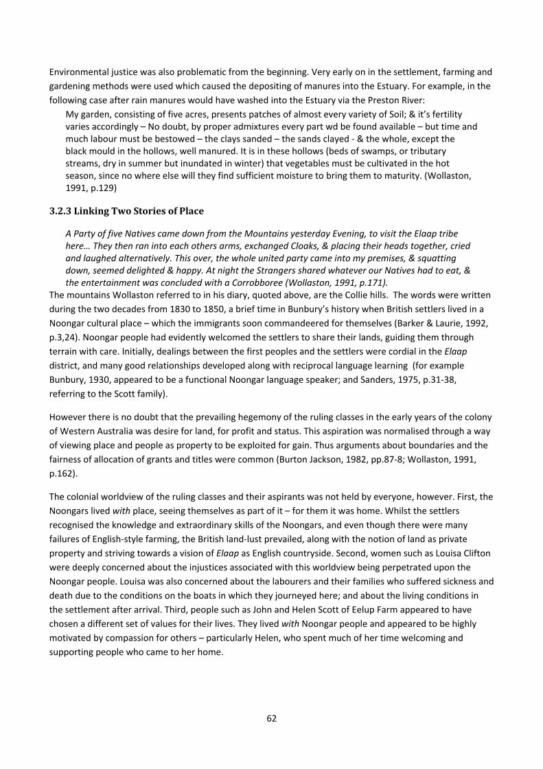
62
Environmental justice was also problematic from the beginning. Very early on in the settlement, farming and
gardening methods were used which caused the depositing of manures into the Estuary. For example, in the
following case after rain manures would have washed into the Estuary via the Preston River:
My garden, consisting of five acres, presents patches of almost every variety of Soil; & it’s fertility varies accordingly – No doubt, by proper admixtures every part wd be found available – but time and much labour must be bestowed – the clays sanded – the sands clayed ‐ & the whole, except the black mould in the hollows, well manured. It is in these hollows (beds of swamps, or tributary streams, dry in summer but inundated in winter) that vegetables must be cultivated in the hot season, since no where else will they find sufficient moisture to bring them to maturity. (Wollaston, 1991, p.129)
3.2.3LinkingTwoStoriesofPlace
A Party of five Natives came down from the Mountains yesterday Evening, to visit the Elaap tribe here… They then ran into each others arms, exchanged Cloaks, & placing their heads together, cried and laughed alternatively. This over, the whole united party came into my premises, & squatting down, seemed delighted & happy. At night the Strangers shared whatever our Natives had to eat, & the entertainment was concluded with a Corrobboree (Wollaston, 1991, p.171).
The mountains Wollaston referred to in his diary, quoted above, are the Collie hills. The words were written
during the two decades from 1830 to 1850, a brief time in Bunbury’s history when British settlers lived in a
Noongar cultural place – which the immigrants soon commandeered for themselves (Barker & Laurie, 1992,
p.3,24). Noongar people had evidently welcomed the settlers to share their lands, guiding them through
terrain with care. Initially, dealings between the first peoples and the settlers were cordial in the Elaap district, and many good relationships developed along with reciprocal language learning (for example
Bunbury, 1930, appeared to be a functional Noongar language speaker; and Sanders, 1975, p.31‐38,
referring to the Scott family).
However there is no doubt that the prevailing hegemony of the ruling classes in the early years of the colony
of Western Australia was desire for land, for profit and status. This aspiration was normalised through a way
of viewing place and people as property to be exploited for gain. Thus arguments about boundaries and the
fairness of allocation of grants and titles were common (Burton Jackson, 1982, pp.87‐8; Wollaston, 1991,
p.162).
The colonial worldview of the ruling classes and their aspirants was not held by everyone, however. First, the
Noongars lived with place, seeing themselves as part of it – for them it was home. Whilst the settlers
recognised the knowledge and extraordinary skills of the Noongars, and even though there were many
failures of English‐style farming, the British land‐lust prevailed, along with the notion of land as private
property and striving towards a vision of Elaap as English countryside. Second, women such as Louisa Clifton
were deeply concerned about the injustices associated with this worldview being perpetrated upon the
Noongar people. Louisa was also concerned about the labourers and their families who suffered sickness and
death due to the conditions on the boats in which they journeyed here; and about the living conditions in
the settlement after arrival. Third, people such as John and Helen Scott of Eelup Farm appeared to have
chosen a different set of values for their lives. They lived with Noongar people and appeared to be highly motivated by compassion for others – particularly Helen, who spent much of her time welcoming and
supporting people who came to her home.
63
3.3ConclusionIn this chapter the lifeway of the immigrant population of the Leschenault District in colonial times was
sketched. The description illustrated place as ground from which to make a living and provide a familiar and
comfortable lifestyle. It revealed a colonial notion of people as an element separate from the ecosystem –
having the intention to ‘improve’ it to make it do as they wished. Aesthetic qualities, life‐sustaining
attributes and pastoral potential were highly valued, as were places expected to be conducive of economic
development and growth. The idea was to select places according to capacity to produce the cultural goods
to which they were accustomed. This conclusion provides a review of place‐based colonial values, followed
by an abridgement of Leschenault estuarine place‐based activities of the 1900s in the form of images, maps
and a table.
3.3.1ValuesThe overarching question for this chapter was: what were the place‐based socio‐cultural values of the
population of the Leschenault District in colonial times? The answer is summarised as follows:
Aesthetic values – the beauty of the waterways, particularly in the mornings and evenings. Green
pastures and other indications of economic potential were also seen as aesthetically pleasing.
Economic values – land was valued for its potential to achieve goals particularly those related to the
acquisition of wealth and further property. This value required the cooperation of people who also
understood the values, even though they had limited capacity to achieve the goals for themselves.
For example servants understood that employers needed their servitude to acquire wealth and
property. All employees knew their role in assisting employers to profit.
Human compassion values73 – for Aboriginal peoples as well as lower classes of people and wildlife.
Spiritual values – the presence of God could sometimes be sensed. God was seen to be in heaven,
which is separate from Earth, and in wilderness, which was understood as place without people.
Recreation values – particularly boating, swimming and fishing.
Life‐sustaining values – included the provision of fish and birds for food. This value was sometimes
associated with wilderness.
Home/heart/hearth qualities – these were highly valued elements, particularly a sense of home, and
were significant aspirations in the early years.
Biodiversity values – evident in the journals of Bunbury and Wollaston in particular, particularly in
relation to fish, small mammals and birds.
To summarise the chapter, during the first fifteen years after colonisation the immigrants were
dependent upon the Elaap people of the Derbal Elaap Karlaboodjar for guidance through bushland and
forests, and for services such as shepherding and retrieving animals (Wollaston, 1991). Both groups were
connected to the Leschenault district in vastly different ways. The two culturally different populations of
people co‐existed, and each having very different place‐based values. They both had different
motivations towards the land: the Elaap people were obliged to care for it and in return it provided
nourishment, while the immigrants sought to exploit it to increase economic and material wealth. Both
groups used it for its life‐sustaining, aesthetic and recreation values, and they acknowledged its
73 These were expected to be shown at all times and tended to conflict with economic values.
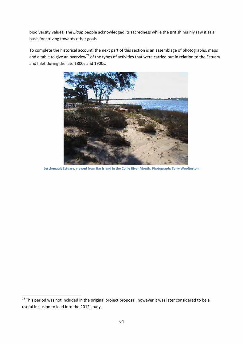
64
biodiversity values. The Elaap people acknowledged its sacredness while the British mainly saw it as a
basis for striving towards other goals.
To complete the historical account, the next part of this section is an assemblage of photographs, maps
and a table to give an overview74 of the types of activities that were carried out in relation to the Estuary
and Inlet during the late 1800s and 1900s.
Leschenault Estuary, viewed from Bar Island in the Collie River Mouth. Photograph: Terry Wooltorton.
74 This period was not included in the original project proposal, however it was later considered to be a
useful inclusion to lead into the 2012 study.
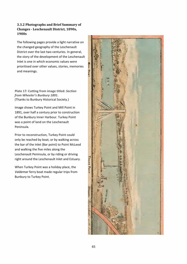
65
3.3.2PhotographsandBriefSummaryofChanges‐LeschenaultDistrict,1890s,1900s
The following pages provide a light narrative on
the changed geography of the Leschenault
District over the last two centuries. In general,
the story of the development of the Leschenault
Inlet is one in which economic values were
prioritised over other values, stories, memories
and meanings.
Plate 17: Cutting from image titled: Section from Wheeler’s Bunbury 1891. (Thanks to Bunbury Historical Society.)
Image shows Turkey Point and Mill Point in
1891, over half a century prior to construction
of the Bunbury Inner Harbour. Turkey Point
was a point of land on the Leschenault
Peninsula.
Prior to reconstruction, Turkey Point could
only be reached by boat, or by walking across
the bar of the Inlet (Bar point) to Point McLeod
and walking the five miles along the
Leschenault Peninsula, or by riding or driving
right around the Leschenault Inlet and Estuary.
When Turkey Point was a holiday place, the
Valdemar ferry boat made regular trips from
Bunbury to Turkey Point.
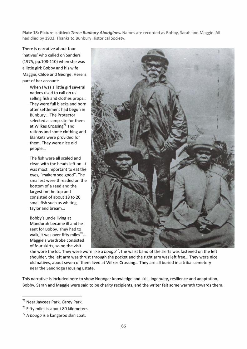
66
Plate 18: Picture is titled: Three Bunbury Aborigines. Names are recorded as Bobby, Sarah and Maggie. All had died by 1903. Thanks to Bunbury Historical Society.
There is narrative about four
‘natives’ who called on Sanders
(1975, pp.108‐110) when she was
a little girl: Bobby and his wife
Maggie, Chloe and George. Here is
part of her account:
When I was a little girl several natives used to call on us selling fish and clothes props… They were full blacks and born after settlement had begun in Bunbury… The Protector selected a camp site for them at Wilkes Crossing75 and rations and some clothing and blankets were provided for them. They were nice old people…
The fish were all scaled and clean with the heads left on. It was most important to eat the eyes, “makem see good”. The smallest were threaded on the bottom of a reed and the largest on the top and consisted of about 18 to 20 small fish such as whiting, taylor and bream…
Bobby’s uncle living at Mandurah became ill and he sent for Bobby. They had to walk, it was over fifty miles76… Maggie’s wardrobe consisted of four skirts, so on the visit she wore the lot. They were worn like a booga77, the waist band of the skirts was fastened on the left shoulder, the left arm was thrust through the pocket and the right arm was left free… They were nice old natives, about seven of them lived at Wilkes Crossing… They are all buried in a tribal cemetery near the Sandridge Housing Estate.
This narrative is included here to show Noongar knowledge and skill, ingenuity, resilience and adaptation.
Bobby, Sarah and Maggie were said to be charity recipients, and the writer felt some warmth towards them.
75 Near Jaycees Park, Carey Park. 76 Fifty miles is about 80 kilometers. 77 A booga is a kangaroo skin coat.

67
TheBunburyLagoonThis narrative summarises the last years of the lagoon located where Bunbury Centrepoint and the Bunbury
Bus Station now stand. The lagoon had swampy edges known to the Elaap people as Yangenup (O'Brien, 2003). Its purpose is to illustrate the lagoon’s low place‐based social value to the Bunbury population.
Plate 19: Town Centre Detail from Wheeler’s 1891. Lagoon can be clearly seen in centre‐right. Thanks to Bunbury Historical Society.
Here is a notice from Bunbury’s Southern Times newspaper, of 7th May, 1892:
In future, no rubbish must be thrown in Prinsep Street as the Bunbury Municipal Council has now approved the East end of Wellington Street as the place for depositing all refuse and rubbish from the town, which must be thrown into the lagoon in the said street. By Order George Teede, Town Clerk. (Thanks to Norm Flynn.)
Below: The Daily News, 11th February, 1892 p.3. News From Bunbury (By a Correspondent.) Summary: debate about cutting a drain or channel between the estuary and the lagoon, for creation of a bathing place.
Below: The Bunbury Herald, 2121st February, 1894 p.3. The Lagoon Summary: The contract for the railway line did not include complete in‐filling of the lagoon, which appeared unhealthy and unsightly.
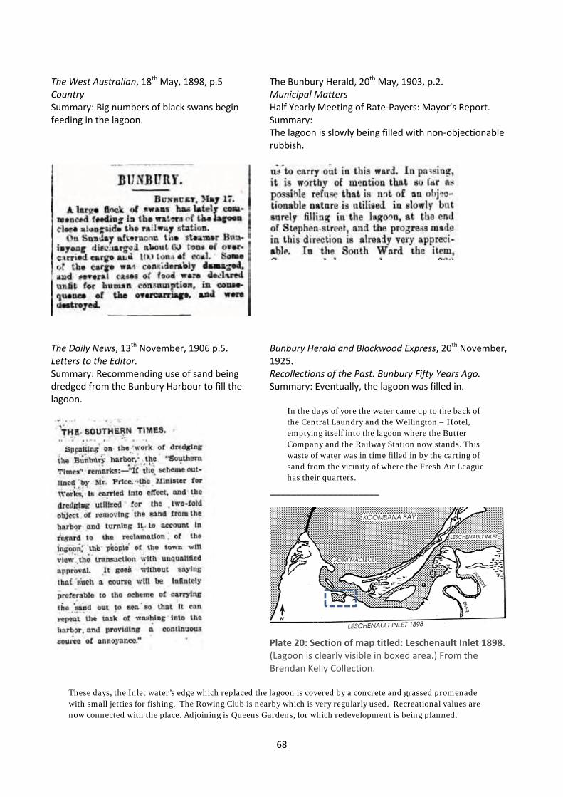
68
The West Australian, 18th May, 1898, p.5 Country Summary: Big numbers of black swans begin feeding in the lagoon.
The Bunbury Herald, 20th May, 1903, p.2. Municipal Matters Half Yearly Meeting of Rate‐Payers: Mayor’s Report. Summary: The lagoon is slowly being filled with non‐objectionable rubbish.
The Daily News, 13th November, 1906 p.5. Letters to the Editor. Summary: Recommending use of sand being dredged from the Bunbury Harbour to fill the lagoon.
Bunbury Herald and Blackwood Express, 20th November, 1925. Recollections of the Past. Bunbury Fifty Years Ago. Summary: Eventually, the lagoon was filled in.
In the days of yore the water came up to the back of the Central Laundry and the Wellington – Hotel, emptying itself into the lagoon where the Butter Company and the Railway Station now stands. This waste of water was in time filled in by the carting of sand from the vicinity of where the Fresh Air League has their quarters.
_____________________
Plate 20: Section of map titled: Leschenault Inlet 1898. (Lagoon is clearly visible in boxed area.) From the Brendan Kelly Collection.
These days, the Inlet water’s edge which replaced the lagoon is covered by a concrete and grassed promenade with small jetties for fishing. The Rowing Club is nearby which is very regularly used. Recreational values are now connected with the place. Adjoining is Queens Gardens, for which redevelopment is being planned.
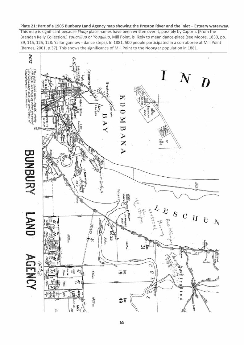
69
Plate 21: Part of a 1905 Bunbury Land Agency map showing the Preston River and the Inlet – Estuary waterway. This map is significant because Elaap place names have been written over it, possibly by Caporn. (From the Brendan Kelly Collection.) Yougrillup or Yougillup, Mill Point, is likely to mean dance‐place (see Moore, 1850, pp. 39, 115, 125, 128: Yallor gannow ‐ dance steps). In 1881, 500 people participated in a corroboree at Mill Point (Barnes, 2001, p.37). This shows the significance of Mill Point to the Noongar population in 1881.
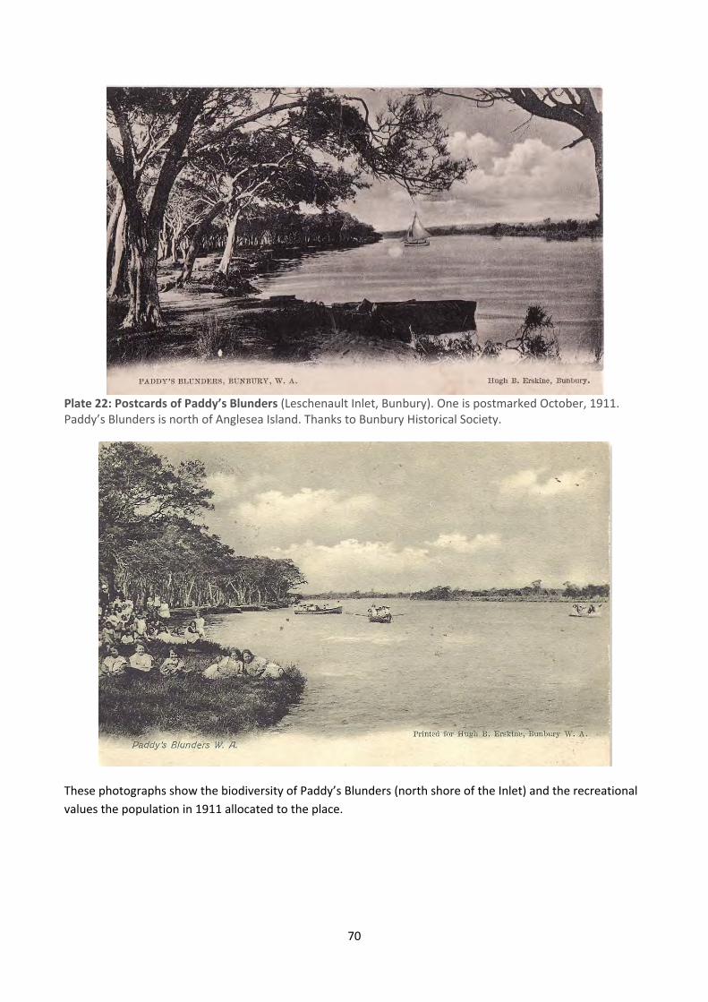
70
Plate 22: Postcards of Paddy’s Blunders (Leschenault Inlet, Bunbury). One is postmarked October, 1911. Paddy’s Blunders is north of Anglesea Island. Thanks to Bunbury Historical Society.
These photographs show the biodiversity of Paddy’s Blunders (north shore of the Inlet) and the recreational
values the population in 1911 allocated to the place.
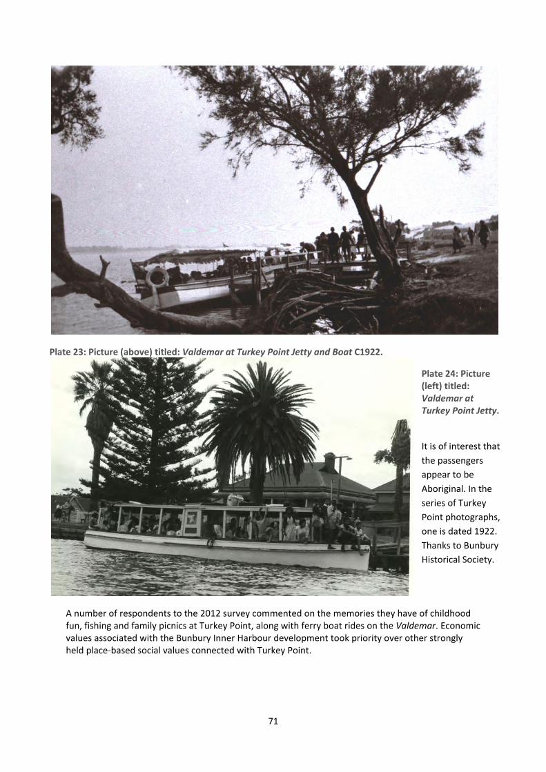
71
Plate 23: Picture (above) titled: Valdemar at Turkey Point Jetty and Boat C1922.
A number of respondents to the 2012 survey commented on the memories they have of childhood fun, fishing and family picnics at Turkey Point, along with ferry boat rides on the Valdemar. Economic values associated with the Bunbury Inner Harbour development took priority over other strongly held place‐based social values connected with Turkey Point.
Plate 24: Picture (left) titled: Valdemar at Turkey Point Jetty.
It is of interest that
the passengers
appear to be
Aboriginal. In the
series of Turkey
Point photographs,
one is dated 1922.
Thanks to Bunbury
Historical Society.
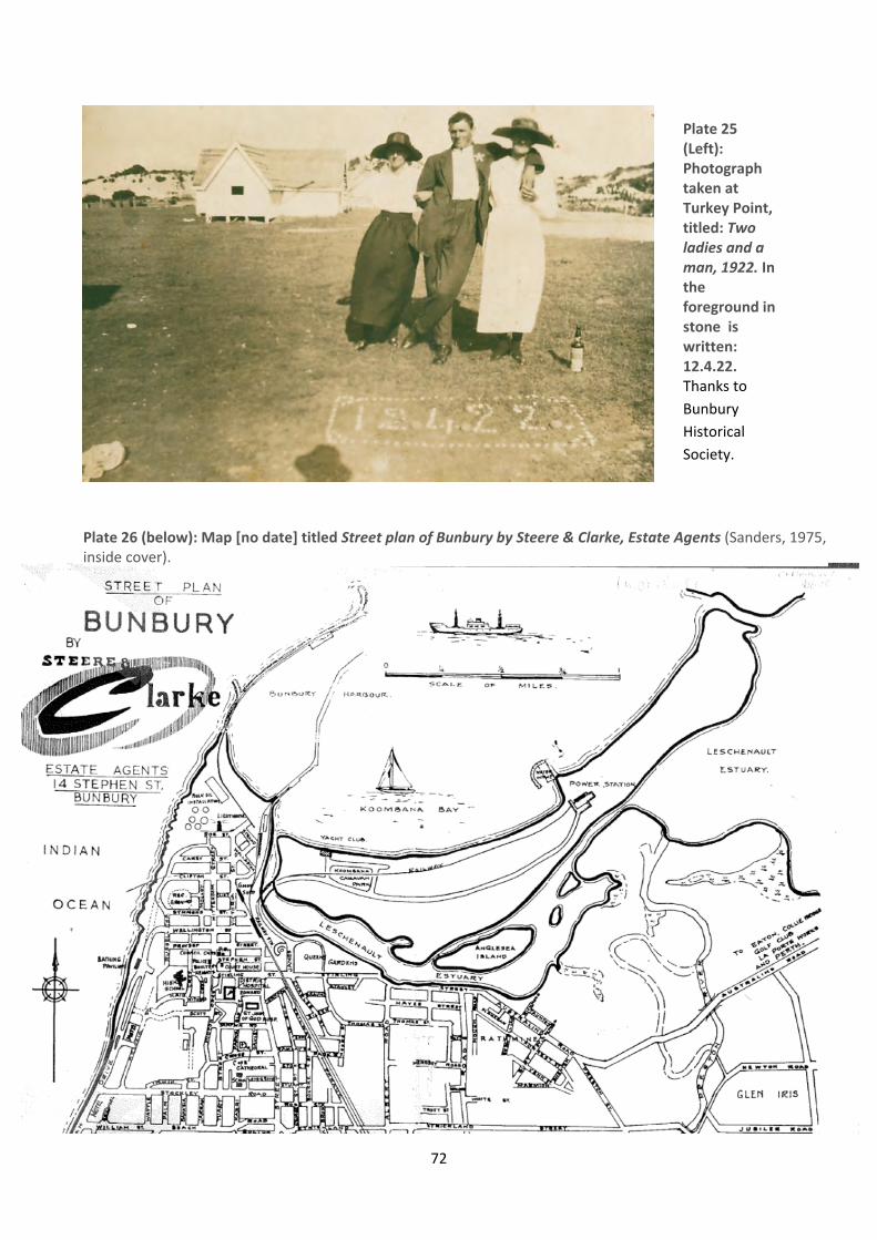
72
Plate 26 (below): Map [no date] titled Street plan of Bunbury by Steere & Clarke, Estate Agents (Sanders, 1975, inside cover).
Plate 25 (Left): Photograph taken at Turkey Point, titled: Two ladies and a man, 1922. In the foreground in stone is written: 12.4.22. Thanks to
Bunbury
Historical
Society.

73
Plate 27: Aerial photograph entitled: ‘Mouth’, dated 9/2/1958. The meandering course and the extensive delta of the Preston River are clearly visible as is the power station and jetty on the Leschenault Peninsula. This area has now substantially changed due to the Preston River realignment associated with the Bunbury Inner Harbour Development. Thanks to Bunbury Historical Society.
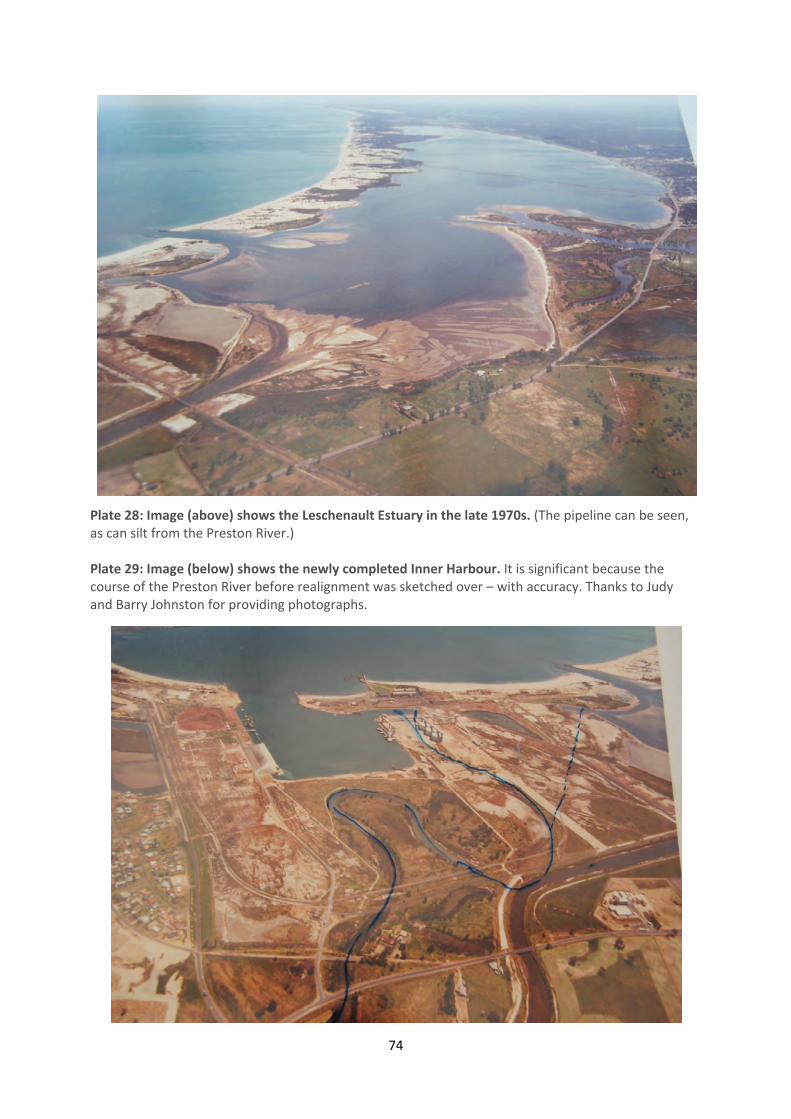
74
Plate 28: Image (above) shows the Leschenault Estuary in the late 1970s. (The pipeline can be seen, as can silt from the Preston River.) Plate 29: Image (below) shows the newly completed Inner Harbour. It is significant because the course of the Preston River before realignment was sketched over – with accuracy. Thanks to Judy and Barry Johnston for providing photographs.
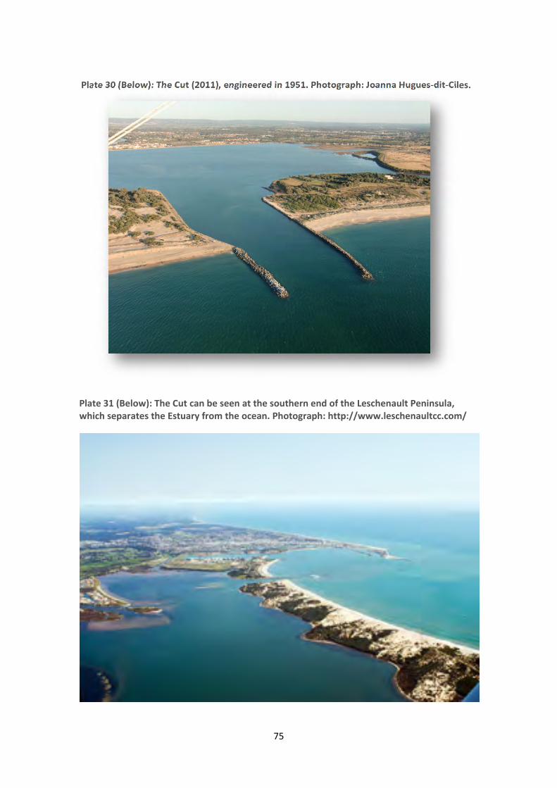
75
Plate 30 (Below): The Cut (2011), engineered in 1951. Photograph: Joanna Hugues‐dit‐Ciles.
Plate 31 (Below): The Cut can be seen at the southern end of the Leschenault Peninsula, which separates the Estuary from the ocean. Photograph: http://www.leschenaultcc.com/
76
Table 2: Summary of Alterations to the Leschenault Estuary; Provided by Hugues‐dit‐Ciles (2011a). Slight amendments to the original have been made where marked *. Summary of major alterations to the Leschenault estuary and its waterways since settlement (information
extracted from McKenna, 2007, McKenna and Derrington 2005, Brearly 2005, Schwinghammer, 1978,
English & Boudikin 1994, Water Authority of Western Australia 1994, Semeniuk C & V 2005a, 2005b.)
Year Alterations to the Leschenault
landscape, waterways and estuary
Key impact of change
1838* Settlement and commencement of
clearing and subsequent agricultural
farming.
1910 – 1912
Brunswick, Collie, Wellesley,
Mornington, Ferguson and Preston
Rivers snags and vegetation were cleared
for the first time to improve drainage
and reduce flooding (Water Authority of
Western Australia 1994).
Altered hydrology and ecology.
1910: path of the Ferguson river was re‐
established and deepened by the cutting
of a small drain and exploding charges at
a depth of 4 or 5 feet below the surface.
1933
Wellington Dam was constructed;
originally built on the Collie River in 1933
as a source of water for irrigation on the
coastal plain and to facilitate the
development of the Collie irrigation area.
It provided a reliable water supply for an
increasing number of towns in the region
from 1953 to 1990 (Heritage Council of
Western Australia 2003).
1951 ‐ 1953 *Original Outlet to the estuary was filled
(now known as Koombana Channel and
“The Plug”).
1941 – 1989 Loss of fringing vegetation through land
clearing and development.
Loss of half of fringing vegetation
(around 350 hectares).
1951 "The Cut” was opened.
This significantly changed the
dynamics of the estuary and the
lower Collie and Brunswick river
with increase marine influence and
marine sediment accumulation in
the estuary. This has altered the
estuarine landforms, hydrodynamics
and hydrochemistry.
77
Year Alterations to the Leschenault
landscape, waterways and estuary
Key impact of change
1960 Wellington Dam was raised.
Reduced the flows, particularly
freshwater flows in winter, into the
Lower Collie River and estuary.
Following
1964
Following the 1964 widespread flood,
the Brunswick, Collie, Ferguson and
Preston Rivers were enlarged and their
levee bank strengthened.
1967 – 1976 Inner Harbour development.
Destruction of large areas of
samphire along the southern end of
the estuary.
1964
Following widespread floods in 1964, the
Harvey, Brunswick, Collie and Ferguson
and Preston rivers were enlarged
(English and Boudikin 1994).
1967 – 1976 Reclamation of old inlet channel near
inner harbor.
1969 – 1970 Preston River Channel was redirected. Alteration of natural river delta.
1974 Dredging of boat channel from lower
estuary to Koombana bay.
1977 Parkfield Drain was constructed. Draining water from agricultural
land use.
1990 to
present
Further loss of fringing vegetation with
the development of Pelican point canals
and lakes estates housing developments
as well as land use changes due to the
port.
Fringing vegetation was reduced by
half, and reduction is continuing.
There are current plans to expand the Bunbury Inner Harbour (Bunbury Port Authority, 2011a). ***
Following these historical chapters which illustrate the divergence between pre‐colonial relationships with place compared to those of the population in the colonial era, the question of the 2012 place‐based social values of the Leschenault Inlet and Estuary will be addressed.
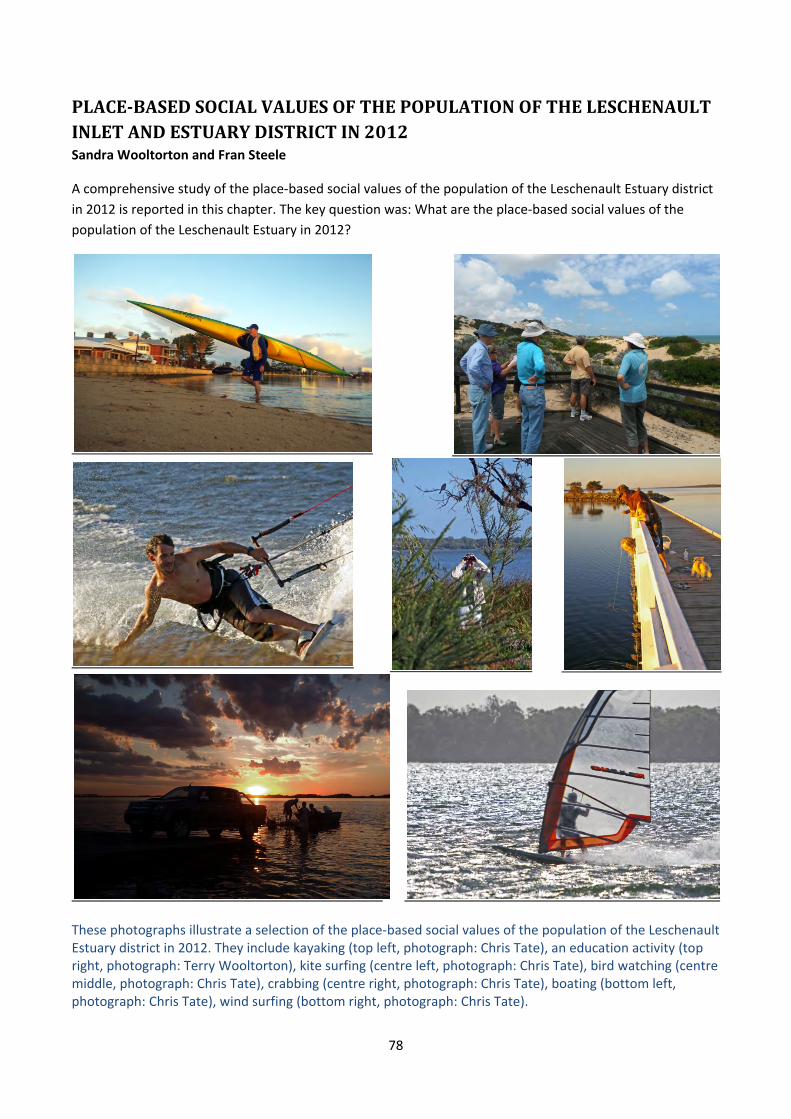
78
PLACE‐BASEDSOCIALVALUESOFTHEPOPULATIONOFTHELESCHENAULTINLETANDESTUARYDISTRICTIN2012Sandra Wooltorton and Fran Steele
A comprehensive study of the place‐based social values of the population of the Leschenault Estuary district
in 2012 is reported in this chapter. The key question was: What are the place‐based social values of the
population of the Leschenault Estuary in 2012?
These photographs illustrate a selection of the place‐based social values of the population of the Leschenault Estuary district in 2012. They include kayaking (top left, photograph: Chris Tate), an education activity (top right, photograph: Terry Wooltorton), kite surfing (centre left, photograph: Chris Tate), bird watching (centre middle, photograph: Chris Tate), crabbing (centre right, photograph: Chris Tate), boating (bottom left, photograph: Chris Tate), wind surfing (bottom right, photograph: Chris Tate).

79
For consistency in place‐name references, an earlier version of the map below was provided as part of data collection. (The hard copy of the survey which includes the map is appended at the end of this report.)
Plate 32: Map shows Leschenault Estuary and Inlet, adapted from the Leschenault Inlet Management Authority (1993). Thanks to George Mardon and Mike Whitehead for their advice on place‐locations, and to Tu Ly for graphic design.
80
The purpose of this chapter is to present the quantitative results of the 2012 place‐based social values study
of the population of the Leschenault Estuary district. There are three sections: method; findings; and an
interpretation of the outcomes.
4.1ResearchMethodA mixed quantitative and qualitative survey was designed following consideration of other place‐based social
values studies and after consultation with stakeholders. The survey instrument was extensively trialed and
amended before being distributed in hard copy and online via the electronic platform: Qualtrics. The survey
was open for public participation for a period of 12 weeks, between 17 July 2012 and 15 October 2012. 947
survey responses were received by the electronic close‐off date. For ethical reasons there was no
participation incentive such as entry in a prize draw. As completed hard copies of the survey were returned
to the research team, the data was entered into Qualtrics and combined with data from the electronic
survey; the results do not differentiate between data sources. Of the 947 surveys, 753 were completed and
the average number who completed any particular question was 620.
This section briefly reviews the relevant research literature before discussing the instrument, the method,
the implementation strategies used and the issues encountered. This chapter presents only the analyses of
the quantitative data. The qualitative data is presented in the following chapter.
4.1.1LiteratureReview:MethodA review of methods used to conduct place‐based social values studies was conducted. Summaries of five
studies are presented here: Community survey of future values and aspirations for the Swan and Canning Rivers (Research Solutions, 2007); Measuring change in place values using public participation GIS (G. Brown & Weber, 2012); Mapping Place Meanings on the Bitterroot National Forest – a landscape-level assessment of personal and community values as input to fuel hazard reduction treatments (Gunderson et al., 2004); Mapping the social landscape values of New Zealand (G. Brown & Brabyn, 2012); and Health and the nature of urban green spaces (Carter, 2009).
CommunitysurveyoffuturevaluesandaspirationsfortheSwanandCanningRiversResearch Solutions (2007) used focus groups and a telephone survey of 400 people to explore and measure
river values and aspirations amongst Perth community members. The social values assessed were:
ecosystem health and biodiversity, recreation, landscape, culture, navigation, fishing and water supply. The
key findings were that the rivers were seen to be a significant feature of Perth’s recreation, social and
cultural landscape. In terms of overarching attitudes, the highest priorities were the rivers’ natural areas and
overall health.
Aspirational values included water recreation such as swimming, and walking and cycling access all the way
around the rivers; as well as fishing, including the availability of fish, prawns and crabs that are healthy
enough to eat. The rivers were regarded as an intergenerational resource for children of the future to
experience river play in a similar way to present and past generations. Attitudes towards commercial
development were mixed, and those living nearest the rivers were opposed to more cafes and kiosks along
the river foreshore. However, there was strong approval for ‘nodal’ developments such as East Perth away
from the shore rather than along the foreshore. This study seemed to regard those living within 5km of the
foreshores as ‘locals’, who tended to visit the rivers more often. Overall, respondents deemed water quality
to be the highest priority for the rivers, followed by the protection/conservation of flora and fauna and
recreational opportunities.
81
MeasuringchangeinplacevaluesusingpublicparticipationGISBrown & Weber (2012) conducted two studies of place‐values on Kangaroo Island, South Australia – a
baseline study in 2004, and another in 2010 to measure changes in the importance and spatial distribution of
landscape values. The study commenced by defining as landscape values, those that are variously called
place values, forest values, environment values, ecosystem values or wilderness values. Brown & Weber
(2012) refer to ‘held’ values and ‘assigned’ values. Held values are important to people and form enduring
beliefs about a mode of conduct or particular end state, such as valuing pristine natural areas over built
human environments. Assigned values include the attribution of a held value to a particular environmental
feature, such as a particular area of scenic beauty. A typology of 13 landscape values was used, comprising:
aesthetic, recreation, biodiversity, life‐supporting, economic, learning, historic, cultural, future, intrinsic,
spiritual, therapeutic and subsistence.
Public Participation GIS (PPGIS) merges participatory action learning and GIS mapping, and is similar to the
process of mapping of traditional cultural and ecological knowledge of Indigenous people. The 2010 study
involved inviting the original participants to the new study. Participants were asked to place particular
descriptors of landscape values on places on the map, to show meaning for them. By comparing the
difference in spatial distribution of markers between the two studies, change can be calculated. With the
qualifier that a reduced number participated in the 2010 study, there were relatively few changes. Aesthetic
and recreation values were the most important in both studies. Biological and life‐sustaining values
appeared to have slightly increased, while economic values slightly decreased. Changes in landscape value
did occur around a major tourist development though, showing that altering physical landscapes at small
and large scale invariably change landscape values, and that land use conflicts are invariably conflicts over
particular human values.
MappingplacemeaningsontheBitterrootNationalForest–andlandscape‐levelassessmentofpersonalandcommunityvaluesasinputtofuelhazardreductiontreatmentsThis study of the people of the Bitterroot Wilderness in Ravalli County, Montana (Gunderson et al., 2004)
was conducted some time after a forest fire devastated houses, property and 350,000 acres of Bitterroot
forest in an area that depended upon the forest for its sense of place, aesthetic values, tourist values and
identity. People had been connected to their locality through a strong sense of their place in nature. Their
dreams – and life‐savings – had been connected to their homes, their properties and the land around them.
The Bitterroot watershed, river, mountains and wilderness had been undergoing human population change
due to evolving attitudes to forestry, which had commenced scaling down operations in 1969. Before the
fire, the area had been experiencing an influx of new people and the population was sustained by a variety
of economic activities. This meant that rebuilding following the fire demanded development of a new
relationship with nature, which included regarding people as part of nature and now, as part of fuel hazard
reduction. Thus, the intention of the research was to understand the relationship between people and place,
firstly because there was a severe lack of trust between the people and the Forest Service in making
decisions that affect local values, and secondly because there was a need to modify forest stewardship
practices.
The first objective of the study was to more accurately understand meanings and values attached to
Bitterroot places, while the second objective was to “integrate places, their meanings, uses and landscape
values into existing ecological modeling to include the relationship between humans and the Bitterroot Front
as a basis for evaluating alternative fuel hazard treatments” (Gunderson et al., 2004, p.2). Several methods
82
to achieve these were developed. Participants were asked to circle places on a map and explain meanings
and impact of fire treatments, to enable construction of a data base on human values about places.
Interdisciplinary teams used anthropological methods to visit a locale and in a few days collect triangulated
information using semi‐structured interviews, focus groups and key informant focus groups. Gunderson et
al., (2004) question the reliability of quantitative surveys since people tend not to explain their views.
MappingthesociallandscapevaluesofNewZealandThis study mapped social landscape values across New Zealand and compared their attribution to physical
landscape features. A correlation was evident. In their introduction, the authors state: “The mapping of
social landscape values reveal human connection to place and the complexity of human/landscape
relationships that may paradoxically, seek to exploit and degrade land in one location while protecting and
preserving it in another” (G. Brown & Brabyn, 2012, p.84). The method used was Public Participation GIS
(Geographic Information Systems), which in this case began with a typology of 13 landscape values (listed
previously, on page 81 in the method review titled: “Measuring change in place values…”). There are seven
regions in New Zealand and a separate data‐gathering website for each one was produced.
People were then invited into the project by mail on a random selection basis. They were supplied with a
google maps application and on‐screen they used it to drag and drop values markers to places. After this
phase was completed, the data was compared to the landscape classification data, which produced a
correlation. Hence the study shows that landscape classifications tend to be associated with human
landscape values. Generally, high value areas are protected conservation areas including national parks,
reserves and recreation parks. The important question they ask in conclusion is: in landscape changes,
anthropogenic or of other origin, which human values will be affected?
HealthandthenatureofurbangreenspacesThis PhD research (Carter, 2009) used a mixed‐method design to determine whether there is any
relationship between engaging with nature in urban green spaces, and human health. The study aimed to
discover whether people’s attitudes to nature influence their perception of nearby green spaces, and
whether people who have positive attitudes to nature and positive perceptions of nearby green spaces, also
have better health. The study design involved a cross‐sectional survey after which respondents were invited
to participate in a semi‐structured interview. 440 surveys and 25 interviews were analysed.
The findings were that feelings about nature did influence perception of green spaces. People with positive
views about nature tended to appreciate and care for their urban green space. In some cases, this was the
basis upon which the suburb was selected to live in. Finally, there was a connection between appreciation of
urban green spaces and health. People who appreciated green spaces saw their places as healthier. The
urban green spaces enabled socialisation, walking and exercise, and these people reported better general
health, mental and emotional health, and feelings of energy and liveliness.
Along with stakeholder requirements, these five studies influenced the design of the current study and the
rationale for some of the survey questions. Key points taken forward were as follows:
a) People assign values and meanings to places.
b) Respondent‐location in relation to the place being studied is likely to be significant.
c) Natural areas and environmental health were prioritised by respondents in each of these studies.
d) There is a wide range of definitions, terminology and classifications for place‐based social values.
e) It is likely that ‘held’ place‐based social values do not change much over time, but ‘assigned’ values –
those attributed to specific places – do change with land‐use modifications.
83
f) Depending upon their attitudes to nature, green spaces can affect people deeply and have positive health‐
based consequences.
g) Quantitative and qualitative data collection methods used together can produce reliable and descriptive
data about place‐based social values.
4.2.2TheInstrumentandImplementationThe hard‐copy version of the study instrument has been placed at Appendix One at the end of this report.
The online survey used identical questions to the hard copy version, but had a different appearance due to
the Qualtrics platform structure. The survey dispersal method was public distribution and easy availability
combined with multi‐media promotion. A website was created at http://www.leschenaultproject.org.au to
enable online access. This was followed by extensive promotions. Construction of a Facebook site at
http://www.facebook.com/LeschenaultProject was launched in early August, 2012 and enabled daily use.
During the data collection period Edith Cowan University produced three media statements that were
published in local newspapers and widely circulated by email, by university websites, by the project partners
and by a wide range of local organisations which supported the project. Project advertisements were
published in local newspapers, letters were written to the Editor of the South West Times and a full article
was published in the South Western Times in early August 2012, in the Bunbury Dolphin Centre column.
Each project partner promoted the electronic survey independently and extensively. Volunteers also
forwarded emails through their distribution lists, and several organisations including the WA Science
Network produced online news articles for their distribution lists. (For example, see
http://www.sciencewa.net.au/topics/environment‐a‐conservation/item/1655‐leschenault‐estuary‐future‐
hinged‐on‐survey‐data.html.)
The project convenor was interviewed on 7th August on ABC South West morning radio by announcer Ron
Tate. Perry Home, the 6.30AM South West ABC radio Saturday morning leisure fishing announcer spoke for
over three minutes promoting the survey on Saturday 15th September. Several small public presentations
about the project were made by the project convenor, with one larger one to an audience of about 35
Bunbury Rotarians.
Distribution points for the survey hard copies were advertised in the papers and A3 flyers were posted on
notice boards around the University, in the Bunbury City Library, the Australind library, the Withers library,
Sports Marine Boat Centre in Strickland Street Bunbury, the Bunbury Dolphin Centre and the Bunbury City
Council. Each of these organisations also held copies for public distribution, and worked as collection points
for surveys. These were picked up weekly by volunteers then returned to the University for data processing.
In addition to this, five volunteers distributed flyers promoting the project in letterboxes in their local areas
within the study location, and others took surveys with them on their daily routines – such as walking along
the estuary – and invited passers‐by to take one.
Whilst this sounds like extensive promotion, it does not imply that everyone in Bunbury knew about the
project. Unfortunately it proved very difficult to get the message about the survey to people. Distribution of
messages through newspapers and other media outlets and prominently placed posters does not mean that
people will read or even notice them. For example in the last week of the survey data collection period, a
morning walk along the Inlet by the project convenor to hand out leaflets revealed that only two of the ten
people had heard of the project (and both had forgotten to do the survey so took leaflets to follow up the
84
discussion). Several weeks after the survey data collection period had closed people were still finding out
about the project and requesting survey copies.
Other project promotion difficulties were associated with the three other Leschenault Estuary or Inlet‐
related projects that were open for data collection at the same time. The most confusing one for potential
Bunbury participants was the Bunbury City Council consultation study about the future development of the
Inlet foreshore near the Central Business District. There was also a Ridley Place consultation conducted by
consultants to Harvey Shire Council to determine how Australind locals would like to see the Ridley place
Estuary foreshore developed. Finally, there was an Aboriginal Cultural Mapping exercise taking place at the
same time. All these projects considered together helped to make the current research context quite
complex in terms of promotion and attracting people’s attention.
Many people who were invited to participate in this survey, particularly older people, confidently advised
volunteers that they had completed a survey but further questions revealed that they had in fact
participated in one of the other studies. It is not known how common this project confusion was. Further to
this, a very small amount of research resistance was detected, but it cannot be ascertained how widespread
this was. One email message stated in essence that social research on the population of the Estuary district is
a waste of money, because it is procrastination and the money should have been used to fix the health of
the estuary instead. Another message left on the Project’s Facebook site declared that the survey was too
biased to make it worthwhile for the individual to bother completing it.
The final issue, caused by an oversight, was that the hard copies of the survey did not include the due date.
Whilst the electronic distribution methods were able to publicise the closing date, there was no way to let
people who had already collected a hard copy know to return them quickly. Whilst there could not be any
quantitative analysis of the 52 late ones received (as at November 30th, 201278), a light analysis of their
qualitative sections was completed to ensure there was no perspective that was not already represented.
In conclusion, this section described the method, the distribution mechanisms, the promotion strategies and
some associated issues. The survey comprised a mixed quantitative and qualitative instrument, available
both online and in hard copy format. A large multi‐modal media campaign widely promoted survey
availability and distribution points in both electronic and hard copy format. Issues were: bringing media
notices to people’s active attention; competition from other Leschenault Estuary and Inlet social surveys
being conducted simultaneously; some resistance to research and the accidental omission of the due date
from the hard copies.
4.1TheQuantitativeStudyThis section presents the quantitative data, together with analysis and discussion. The respondents’
background is presented first followed by their relationship with the Estuary and Inlet. The final sub‐section
reports respondents’ opinions on a range of place‐based issues.
78 Statistically, the late submissions would not make a difference to the outcomes.
85
4.2.1DemographicDataQuestions 10 – 17 asked respondents information about their gender, heritage, age, residential area and
residential status. This is presented first, to provide an understanding of the people who contributed to the
study.
Gender,HeritageandResidentialStatusRespondents comprised roughly similar numbers of males and females and there was not a significant
variation between male and female responses to any question. Therefore male and female data has been
aggregated. Two percent of the respondents said they were of Aboriginal heritage, which is roughly similar
to the composition of the general population. However the number of responses in this category is not a
representative sample for extrapolating responses, therefore these responses have not been differentiated.
Eighty six percent of the respondents stated they were residents, and 13% indicated they were regular
visitors. The remaining 1% said they were one‐off visitors.
AgeSeventy six percent of the respondents said they were over 36 years of age, of whom 55% were over 45
years of age. Only 11 responses were received from the group who were under‐18 years old, so those
responses cannot be used to represent that group. Similarly, the 18 – 25 age range is not well represented in
the data set. Representatives of the latter group participated in a focus group which compensates this
statistical weakness in the study overall, whilst a group of school children participated in an innovative
photo‐elicitation qualitative study.
LocalityofResidenceandResidentialAreaTwenty seven percent of the respondent group stated that they live within 499 metres of the Estuary or
Inlet. Altogether 58% of the respondent group said they live within two kilometres of the Leschenault
Estuary or the Leschenault Inlet. Even though this survey was advertised across Greater Bunbury in news
media and public outlets such as libraries, the greatest response rate was from the group of people who live
nearby. Interestingly, over half of the respondents lived in the residential corridor east of the Leschenault
Estuary.
LengthofResidenceorRegularVisitationintheDistrictWhilst 36% of the respondents stated they have lived in or regularly visited the district for more than 20
years, it is of interest that another 36% of the respondents have lived in or regularly visited the district for 10
years or less. It is clear that the respondents are a mixed group of newer and older residents of the district.
OccupationForty six percent of the respondents nominated their occupations as manager or professional, and 18%
stated they were retired or unemployed. Twelve percent of respondents stated they were a technical and
trades worker. Altogether 64% of the respondents stated they were professionals, managers or
retired/unemployed.
4.2.2Place‐BasedSocialValuesQuestions one, two and four asked about respondents’ place‐based social values. Questions inquired into
usage patterns, feelings for the Estuary and Inlet and the values they uphold.
UseoftheEstuaryandInletIn question one, respondents were asked to respond to each category of use provided, by declaring they
were either frequent, occasional or never users of the Estuary or Inlet in that category. In the survey
86
question, frequencies of use (frequent, occasional or never) were left undefined because in the trials, self‐
declaration seemed to be easier for people to deal with.
The analysis shows that 40% of respondents reported that they frequently use the estuary for walking,
jogging or running. The next most frequent use was foreshore recreation, followed by walking the dog,
crabbing, contemplation or meditation, fishing, bird‐watching, and photography or artistic pursuits.
Interestingly, more than 50% of the respondents reported that they occasionally engage in foreshore
recreation, and occasionally engage in walking, jogging or running. More than 40% of respondents reported
that they occasionally use the Estuary for crabbing, fishing, cycling, photography or artistic pursuits, bird‐
watching, contemplation or meditation, kayaking, swimming and kayaking, canoeing or rowing.
Another way of reading this data is to say that more than 80% of respondents use the Estuary or Inlet
sometimes for walking, jogging or running, and foreshore recreation. Similarly, more than 50% of
respondents use the Estuary or Inlet sometimes for walking the dog, crabbing, contemplation or meditation,
bird‐watching, fishing, photography or artistic pursuits, kayaking, canoeing or rowing, swimming, motor‐
boating, camping and outdoor pursuits. As well, more than 25% of respondents use the Estuary or Inlet
sometimes for nature studies or science activities, education‐type activities, markets or local trading
activities and off‐road driving. The category ‘other’ has been excluded from this analysis due to its low
frequency and wide variance. It can be concluded that the Estuary is well used by respondents, most
frequently for walking, jogging or running and foreshore recreation.
FeelingsfortheEstuaryandInletQuestion 2 asked about feelings for the Estuary and Inlet. The great majority of respondents indicated that
they like the estuary. From a philosophical and historical perspective, it is significant that 402 of 624
respondents strongly agreed with the statement: “I cherish the estuary”, plus a further 173 agreed with the
statement. That is, 84% of respondents agreed that they cherish the estuary.
The other two parts to this question are also of particular interest. Four hundred and sixty respondents
agreed or strongly agreed with the statement that “I feel a sense of being at home when I am close to the
estuary”, and 335 respondents agreed or strongly agreed with the statement: “for me, the estuary is a
spiritual place to be”. Spiritual values and home‐heart‐hearth values indicate an emotional relationship with
place.
Place‐BasedSocialValuesQuestion 4 asked about sense of place values. The great majority of respondents indicated that they value
the estuarine system for its natural open space. In Table 3 overleaf which shows survey respondents’ sense
of place values, for clarity of presentation the two agreement categories (agree and strongly agree) were
combined into one ‘agree’ category. The two disagreement categories were merged in a similar way. Values
have been ordered from greatest to least level of agreement with the statement.
The top ten values were: natural open space, being close to nature, dolphin habitat, recreational space,
appealing landscape, a place for socialising with friends, species diversity, a place for peacefulness/relaxation
and raising children close to nature. These reflect intrinsic values, use values and aesthetic values.
Educational values and economic values (tourism) were also highly placed.
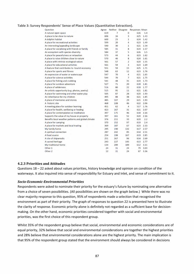
87
Table 3: Survey Respondents’ Sense of Place Values (Quantitative Extraction).
4.2.3PrioritiesandAttitudesQuestions 18 – 22 asked about values priorities, history knowledge and opinion on condition of the
waterways. It also inquired into sense of responsibility for Estuary and Inlet, and sense of commitment to it.
Socio‐Economic‐EnvironmentalPrioritiesRespondents were asked to nominate their priority for the estuary’s future by nominating one alternative
from a choice of seven possibilities. (All possibilities are shown on the graph below.) While there was no
clear majority response to this question, 95% of respondents made a selection that recognised the
environment as part of their priority. The graph of responses to question 22 is presented here to illustrate
the clarity of response. Economic priority alone is definitely not regarded as a sufficient base for decision‐
making. On the other hand, economic priorities considered together with social and environmental
priorities, was the first choice of this respondent group.
Whilst 35% of the respondent group believe that social, environmental and economic considerations are of
equal priority, 32% believe that social and environmental considerations are together the highest priorities
and 28% believe that environmental considerations alone are the highest priority. The main implication is
that 95% of the respondent group stated that the environment should always be considered in decisions

88
made that relate to the district. Only 563 respondents answered this question – perhaps this was because
there was no ‘undecided’ category.
Figure 3: Graph Showing Question 22 Responses as Environmental, Economic and/or Social Priorities
HistoryandOpiniononWaterwaysConditionSixty seven percent of respondents reported that they did not have sufficient local history knowledge.
Eighteen percent of the respondents believe the Estuary waterways to be in poor condition, 41% believe it to
be in average condition, and 26% believe it to be in good condition.
CollaborativeandPersonalResponsibilityandSenseofCommitmenttotheEstuaryandInletMost respondents stated they would support stronger policies to improve the estuary, and 69% of
respondents believe that responsibility for improving the estuary should be shared between the various
jurisdictions.
In terms of personal commitment, 68% said they would be willing to work with a community group to
improve Leschenault Estuary and Inlet health and 48% responded that they would happily make individual
changes to improve the estuary. Altogether 80% of the respondents said they would be happy to make
individual changes within limits as they are busy.
4.2.4DiscussionandConclusionThe quantitative sections of the survey revealed that a cross‐section of the community has participated in
this study. Roughly half of the participants were male, and there was no statistically significant difference
between male and female responses. Two percent of the respondents were of Aboriginal heritage however
generalisation across the group of Aboriginal people resident in Greater Bunbury would not be valid.
76% of respondents were over 36 years of age, and 55% were over 45 years of age. Eighteen percent of the
population were residents and 13% were regular visitors. Sixty five percent of the respondents have lived in
the area for more than 10 years, and 37% have lived in the area for less than ten years. Forty six percent of
the respondents were employed in professional or management occupations, while the next biggest group
was retired or unemployed.
The majority (more than 52%) reported that they live in the corridor to the east of the Leschenault Estuary,
while the next biggest group live in the area east and south of the Leschenault Inlet. Fifty eight percent
reported that they live within two kilometres of the Estuary or Inlet, and 80% reported that they live within
seven kilometres of one of the waterways. Although this survey was advertised quite widely, the majority of
the people who participated lived within the vicinity of the Estuary or Inlet.
89
The Estuary and Inlet were reported to be well‐used by respondents. Walking, jogging or running and
foreshore recreation were the two most popular activities, which more than 80% of respondents stated that
they do frequently or occasionally. Similarly, more than 50% of respondents frequently or occasionally walk
the dog, go crabbing, use contemplation or meditation, go bird‐watching, go fishing, undertake photography
or artistic pursuits, go kayaking, and go canoeing or rowing, swim, go motor‐boating, or participate in
camping and outdoor pursuits.
Eighty four percent of the respondents agreed or strongly agreed with the statement: ‘I cherish the estuary’.
Given a range of options including improved health facilities, improved roads, improved job opportunities
and improved local schooling, the most highly ranked priority by the respondents was improved estuary
environment (over 45%). Respondents’ highest place‐based social value is the Leschenault Estuary and Inlet
as a natural open space. No respondent disagreed with this. This value was followed closely by: a place to be
close to nature, a dolphin habitat, a place for recreation activities, an interesting or appealing landscape, a
place for socialising with friends or family, and an ecosystem with species diversity, a place for peacefulness
or relaxation, and a place to raise children close to nature.
In response to the question about perception of Estuary and Inlet health, 41% of respondents said they
believe it to be in average condition, and 28% said they believe it to be in good or very good condition. Sixty
seven percent of the respondents indicated that they need to know more about the history of the area.
Most people would support stronger policies to improve the health of the Estuary, and 68% would be willing
to work with a community group to improve the Estuary health. Forty eight percent of the respondents are
happy to make changes for the good of the Estuary and altogether 80% of the respondents are happy to
make changes within limits.
In allocating responsibility for problem‐solving in the Estuary, 69% believe it is the responsibility of a
combination of governments, industry and environmental groups, community groups and individuals
working together. Twenty eight percent believe it to be the responsibility of local and state governments.
Finally, 99% of the respondent group believe that the environment should always been considered in all
decision‐making in the district.
In other words, interpreting the findings together, we can say that the Estuary and Inlet are central to
respondents’ sense of place. These quantitative results are in line with those of Research Solutions (2007)
relating to the community survey of future values and aspirations for the Swan and Canning Rivers. A deeper
exploration of the respondent groups’ values is reported in the following chapter.
At present, the data is pointing to an interesting, unanticipated conclusion about a localised sense of place.
Therefore it is recommended that a follow‐on study carry out further interrogation of the data using SPSS, a
statistical analysis package, to determine whether it can be concluded that there is a localised sense of place
in the respondent group. That is, to inquire into whether it is true that the closer people live to the Estuary
or Inlet, the more likely they are to feel a strong sense of connection to the waterways79. It is also
recommended that further analysis be conducted to determine whether any patterns accompany the criteria
of age and of socio‐economic indicators.
79 It is possible that a strong sense of connection to the waterways might cause people to move closer to the
waterways.
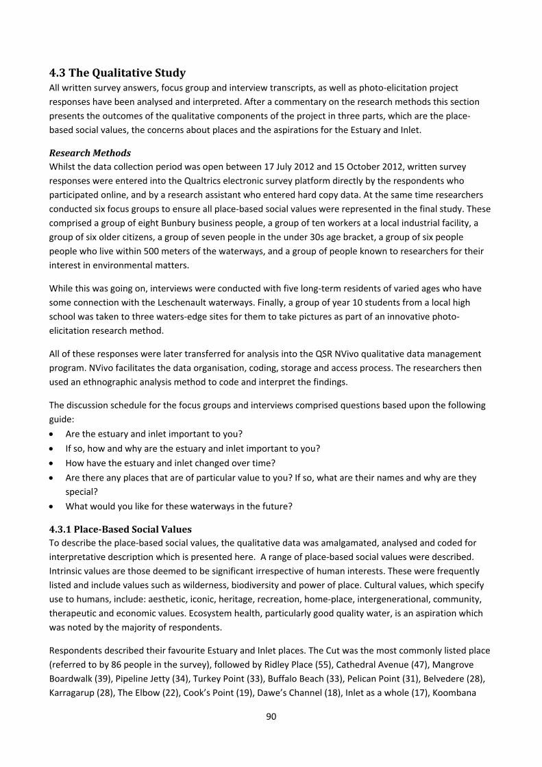
90
4.3TheQualitativeStudyAll written survey answers, focus group and interview transcripts, as well as photo‐elicitation project
responses have been analysed and interpreted. After a commentary on the research methods this section
presents the outcomes of the qualitative components of the project in three parts, which are the place‐
based social values, the concerns about places and the aspirations for the Estuary and Inlet.
ResearchMethodsWhilst the data collection period was open between 17 July 2012 and 15 October 2012, written survey
responses were entered into the Qualtrics electronic survey platform directly by the respondents who
participated online, and by a research assistant who entered hard copy data. At the same time researchers
conducted six focus groups to ensure all place‐based social values were represented in the final study. These
comprised a group of eight Bunbury business people, a group of ten workers at a local industrial facility, a
group of six older citizens, a group of seven people in the under 30s age bracket, a group of six people
people who live within 500 meters of the waterways, and a group of people known to researchers for their
interest in environmental matters.
While this was going on, interviews were conducted with five long‐term residents of varied ages who have
some connection with the Leschenault waterways. Finally, a group of year 10 students from a local high
school was taken to three waters‐edge sites for them to take pictures as part of an innovative photo‐
elicitation research method.
All of these responses were later transferred for analysis into the QSR NVivo qualitative data management
program. NVivo facilitates the data organisation, coding, storage and access process. The researchers then
used an ethnographic analysis method to code and interpret the findings.
The discussion schedule for the focus groups and interviews comprised questions based upon the following
guide:
Are the estuary and inlet important to you?
If so, how and why are the estuary and inlet important to you?
How have the estuary and inlet changed over time?
Are there any places that are of particular value to you? If so, what are their names and why are they
special?
What would you like for these waterways in the future?
4.3.1Place‐BasedSocialValuesTo describe the place‐based social values, the qualitative data was amalgamated, analysed and coded for
interpretative description which is presented here. A range of place‐based social values were described.
Intrinsic values are those deemed to be significant irrespective of human interests. These were frequently
listed and include values such as wilderness, biodiversity and power of place. Cultural values, which specify
use to humans, include: aesthetic, iconic, heritage, recreation, home‐place, intergenerational, community,
therapeutic and economic values. Ecosystem health, particularly good quality water, is an aspiration which
was noted by the majority of respondents.
Respondents described their favourite Estuary and Inlet places. The Cut was the most commonly listed place
(referred to by 86 people in the survey), followed by Ridley Place (55), Cathedral Avenue (47), Mangrove
Boardwalk (39), Pipeline Jetty (34), Turkey Point (33), Buffalo Beach (33), Pelican Point (31), Belvedere (28),
Karragarup (28), The Elbow (22), Cook’s Point (19), Dawe’s Channel (18), Inlet as a whole (17), Koombana
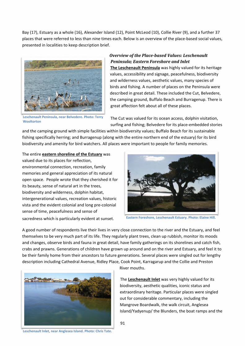
91
Bay (17), Estuary as a whole (16), Alexander Island (12), Point McLeod (10), Collie River (9), and a further 37
places that were referred to less than nine times each. Below is an overview of the place‐based social values,
presented in localities to keep description brief.
OverviewofthePlace‐basedValues:LeschenaultPeninsula;EasternForeshoreandInletThe Leschenault Peninsula was highly valued for its heritage
values, accessibility and signage, peacefulness, biodiversity
and wilderness values, aesthetic values, many species of
birds and fishing. A number of places on the Peninsula were
described in great detail. These included the Cut, Belvedere,
the camping ground, Buffalo Beach and Burragenup. There is
great affection felt about all of these places.
The Cut was valued for its ocean access, dolphin visitation,
surfing and fishing; Belvedere for its place‐embedded stories
and the camping ground with simple facilities within biodiversity values; Buffalo Beach for its sustainable
fishing specifically herring; and Burragenup (along with the entire northern end of the estuary) for its bird
biodiversity and amenity for bird watchers. All places were important to people for family memories.
The entire eastern shoreline of the Estuary was
valued due to its places for reflection,
environmental connection, recreation, family
memories and general appreciation of its natural
open space. People wrote that they cherished it for
its beauty, sense of natural art in the trees,
biodiversity and wilderness, dolphin habitat,
intergenerational values, recreation values, historic
vista and the evident colonial and long pre‐colonial
sense of time, peacefulness and sense of
sacredness which is particularly evident at sunset.
A good number of respondents live their lives in very close connection to the river and the Estuary, and feel
themselves to be very much part of its life. They regularly plant trees, clean up rubbish, monitor its moods
and changes, observe birds and fauna in great detail, have family gatherings on its shorelines and catch fish,
crabs and prawns. Generations of children have grown up around and on the river and Estuary, and feel it to
be their family home from their ancestors to future generations. Several places were singled out for lengthy
description including Cathedral Avenue, Ridley Place, Cook Point, Karragarup and the Collie and Preston
River mouths.
The Leschenault Inlet was very highly valued for its
biodiversity, aesthetic qualities, iconic status and
extraordinary heritage. Particular places were singled
out for considerable commentary, including the
Mangrove Boardwalk, the walk circuit, Anglesea
Island/Yadyenup/ the Blunders, the boat ramps and the
Eastern Foreshore, Leschenault Estuary. Photo: Elaine Hill.
Leschenault Inlet, near Anglesea Island. Photo: Chris Tate.
Leschenault Peninsula, near Belvedere. Photo: Terry Wooltorton
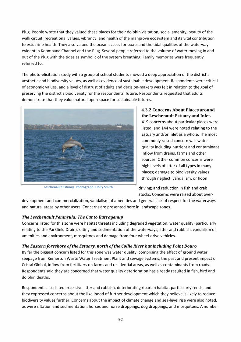
92
Plug. People wrote that they valued these places for their dolphin visitation, social amenity, beauty of the
walk circuit, recreational values, vibrancy; and health of the mangrove ecosystem and its vital contribution
to estuarine health. They also valued the ocean access for boats and the tidal qualities of the waterway
evident in Koombana Channel and the Plug. Several people referred to the volume of water moving in and
out of the Plug with the tides as symbolic of the system breathing. Family memories were frequently
referred to.
The photo‐elicitation study with a group of school students showed a deep appreciation of the district’s
aesthetic and biodiversity values, as well as evidence of sustainable development. Respondents were critical
of economic values, and a level of distrust of adults and decision‐makers was felt in relation to the goal of
preserving the district’s biodiversity for the respondents’ future. Respondents requested that adults
demonstrate that they value natural open space for sustainable futures.
4.3.2ConcernsAboutPlacesaroundtheLeschenaultEstuaryandInlet.419 concerns about particular places were
listed, and 144 were noted relating to the
Estuary and/or Inlet as a whole. The most
commonly raised concern was water
quality including nutrient and contaminant
inflow from drains, farms and other
sources. Other common concerns were
high levels of litter of all types in many
places; damage to biodiversity values
through neglect, vandalism, or hoon
driving; and reduction in fish and crab
stocks. Concerns were raised about over‐
development and commercialization, vandalism of amenities and general lack of respect for the waterways
and natural areas by other users. Concerns are presented here in landscape zones.
TheLeschenaultPeninsula:TheCuttoBurragenupConcerns listed for this zone were habitat threats including degraded vegetation, water quality (particularly
relating to the Parkfield Drain), silting and sedimentation of the waterways, litter and rubbish, vandalism of
amenities and environment, mosquitoes and damage from four wheel‐drive vehicles.
TheEasternforeshoreoftheEstuary,northoftheCollieRiverbutincludingPointDouroBy far the biggest concern listed for this zone was water quality, comprising the effect of ground water
seepage from Kemerton Waste Water Treatment Plant and sewage systems, the past and present impact of
Cristal Global, inflow from fertilizers on farms and residential areas, as well as contaminants from roads.
Respondents said they are concerned that water quality deterioration has already resulted in fish, bird and
dolphin deaths.
Respondents also listed excessive litter and rubbish, deteriorating riparian habitat particularly reeds, and
they expressed concerns about the likelihood of further development which they believe is likely to reduce
biodiversity values further. Concerns about the impact of climate change and sea‐level rise were also noted,
as were siltation and sedimentation, horses and horse droppings, dog droppings, and mosquitoes. A number
Leschenault Estuary. Photograph: Holly Smith.
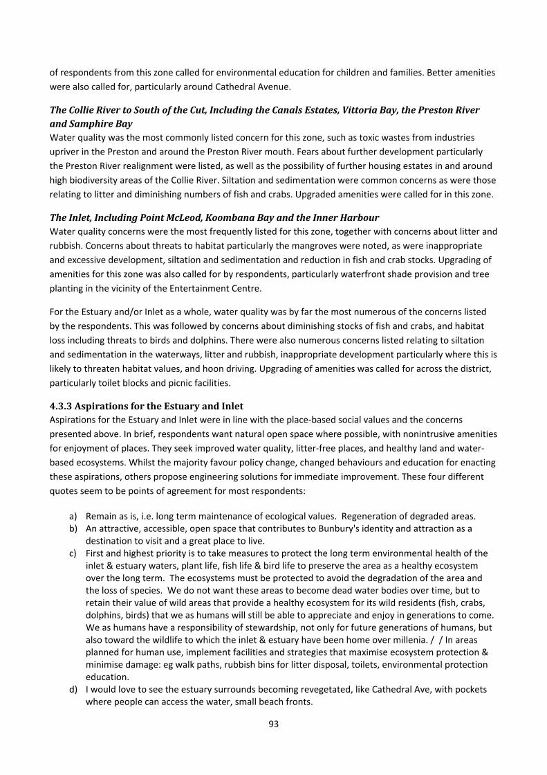
93
of respondents from this zone called for environmental education for children and families. Better amenities
were also called for, particularly around Cathedral Avenue.
TheCollieRivertoSouthoftheCut,IncludingtheCanalsEstates,VittoriaBay,thePrestonRiverandSamphireBayWater quality was the most commonly listed concern for this zone, such as toxic wastes from industries
upriver in the Preston and around the Preston River mouth. Fears about further development particularly
the Preston River realignment were listed, as well as the possibility of further housing estates in and around
high biodiversity areas of the Collie River. Siltation and sedimentation were common concerns as were those
relating to litter and diminishing numbers of fish and crabs. Upgraded amenities were called for in this zone.
TheInlet,IncludingPointMcLeod,KoombanaBayandtheInnerHarbourWater quality concerns were the most frequently listed for this zone, together with concerns about litter and
rubbish. Concerns about threats to habitat particularly the mangroves were noted, as were inappropriate
and excessive development, siltation and sedimentation and reduction in fish and crab stocks. Upgrading of
amenities for this zone was also called for by respondents, particularly waterfront shade provision and tree
planting in the vicinity of the Entertainment Centre.
For the Estuary and/or Inlet as a whole, water quality was by far the most numerous of the concerns listed
by the respondents. This was followed by concerns about diminishing stocks of fish and crabs, and habitat
loss including threats to birds and dolphins. There were also numerous concerns listed relating to siltation
and sedimentation in the waterways, litter and rubbish, inappropriate development particularly where this is
likely to threaten habitat values, and hoon driving. Upgrading of amenities was called for across the district,
particularly toilet blocks and picnic facilities.
4.3.3AspirationsfortheEstuaryandInletAspirations for the Estuary and Inlet were in line with the place‐based social values and the concerns
presented above. In brief, respondents want natural open space where possible, with nonintrusive amenities
for enjoyment of places. They seek improved water quality, litter‐free places, and healthy land and water‐
based ecosystems. Whilst the majority favour policy change, changed behaviours and education for enacting
these aspirations, others propose engineering solutions for immediate improvement. These four different
quotes seem to be points of agreement for most respondents:
a) Remain as is, i.e. long term maintenance of ecological values. Regeneration of degraded areas. b) An attractive, accessible, open space that contributes to Bunbury's identity and attraction as a
destination to visit and a great place to live. c) First and highest priority is to take measures to protect the long term environmental health of the
inlet & estuary waters, plant life, fish life & bird life to preserve the area as a healthy ecosystem over the long term. The ecosystems must be protected to avoid the degradation of the area and the loss of species. We do not want these areas to become dead water bodies over time, but to retain their value of wild areas that provide a healthy ecosystem for its wild residents (fish, crabs, dolphins, birds) that we as humans will still be able to appreciate and enjoy in generations to come. We as humans have a responsibility of stewardship, not only for future generations of humans, but also toward the wildlife to which the inlet & estuary have been home over millenia. / / In areas planned for human use, implement facilities and strategies that maximise ecosystem protection & minimise damage: eg walk paths, rubbish bins for litter disposal, toilets, environmental protection education.
d) I would love to see the estuary surrounds becoming revegetated, like Cathedral Ave, with pockets where people can access the water, small beach fronts.
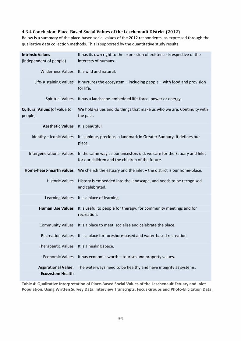
94
4.3.4Conclusion:Place‐BasedSocialValuesoftheLeschenaultDistrict(2012)Below is a summary of the place‐based social values of the 2012 respondents, as expressed through the
qualitative data collection methods. This is supported by the quantitative study results.
Intrinsic Values
(independent of people)
It has its own right to the expression of existence irrespective of the
interests of humans.
Wilderness Values It is wild and natural.
Life‐sustaining Values It nurtures the ecosystem – including people – with food and provision
for life.
Spiritual Values It has a landscape‐embedded life‐force, power or energy.
Cultural Values (of value to
people)
We hold values and do things that make us who we are. Continuity with
the past.
Aesthetic Values It is beautiful.
Identity – Iconic Values It is unique, precious, a landmark in Greater Bunbury. It defines our
place.
Intergenerational Values In the same way as our ancestors did, we care for the Estuary and Inlet
for our children and the children of the future.
Home‐heart‐hearth values We cherish the estuary and the inlet – the district is our home‐place.
Historic Values History is embedded into the landscape, and needs to be recognised
and celebrated.
Learning Values It is a place of learning.
Human Use Values It is useful to people for therapy, for community meetings and for
recreation.
Community Values It is a place to meet, socialise and celebrate the place.
Recreation Values It is a place for foreshore‐based and water‐based recreation.
Therapeutic Values It is a healing space.
Economic Values It has economic worth – tourism and property values.
Aspirational Value:
Ecosystem Health
The waterways need to be healthy and have integrity as systems.
Table 4: Qualitative Interpretation of Place‐Based Social Values of the Leschenault Estuary and Inlet Population, Using Written Survey Data, Interview Transcripts, Focus Groups and Photo‐Elicitation Data.
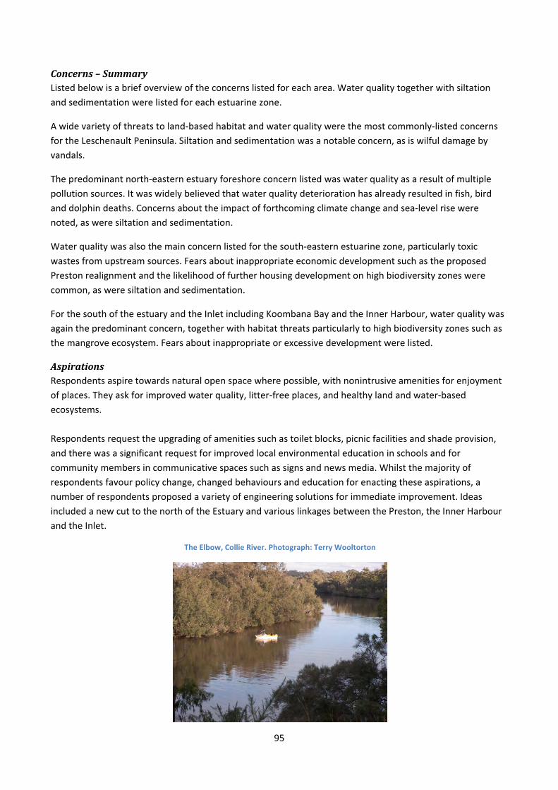
95
Concerns–SummaryListed below is a brief overview of the concerns listed for each area. Water quality together with siltation
and sedimentation were listed for each estuarine zone.
A wide variety of threats to land‐based habitat and water quality were the most commonly‐listed concerns
for the Leschenault Peninsula. Siltation and sedimentation was a notable concern, as is wilful damage by
vandals.
The predominant north‐eastern estuary foreshore concern listed was water quality as a result of multiple
pollution sources. It was widely believed that water quality deterioration has already resulted in fish, bird
and dolphin deaths. Concerns about the impact of forthcoming climate change and sea‐level rise were
noted, as were siltation and sedimentation.
Water quality was also the main concern listed for the south‐eastern estuarine zone, particularly toxic
wastes from upstream sources. Fears about inappropriate economic development such as the proposed
Preston realignment and the likelihood of further housing development on high biodiversity zones were
common, as were siltation and sedimentation.
For the south of the estuary and the Inlet including Koombana Bay and the Inner Harbour, water quality was
again the predominant concern, together with habitat threats particularly to high biodiversity zones such as
the mangrove ecosystem. Fears about inappropriate or excessive development were listed.
AspirationsRespondents aspire towards natural open space where possible, with nonintrusive amenities for enjoyment
of places. They ask for improved water quality, litter‐free places, and healthy land and water‐based
ecosystems.
Respondents request the upgrading of amenities such as toilet blocks, picnic facilities and shade provision,
and there was a significant request for improved local environmental education in schools and for
community members in communicative spaces such as signs and news media. Whilst the majority of
respondents favour policy change, changed behaviours and education for enacting these aspirations, a
number of respondents proposed a variety of engineering solutions for immediate improvement. Ideas
included a new cut to the north of the Estuary and various linkages between the Preston, the Inner Harbour
and the Inlet.
The Elbow, Collie River. Photograph: Terry Wooltorton
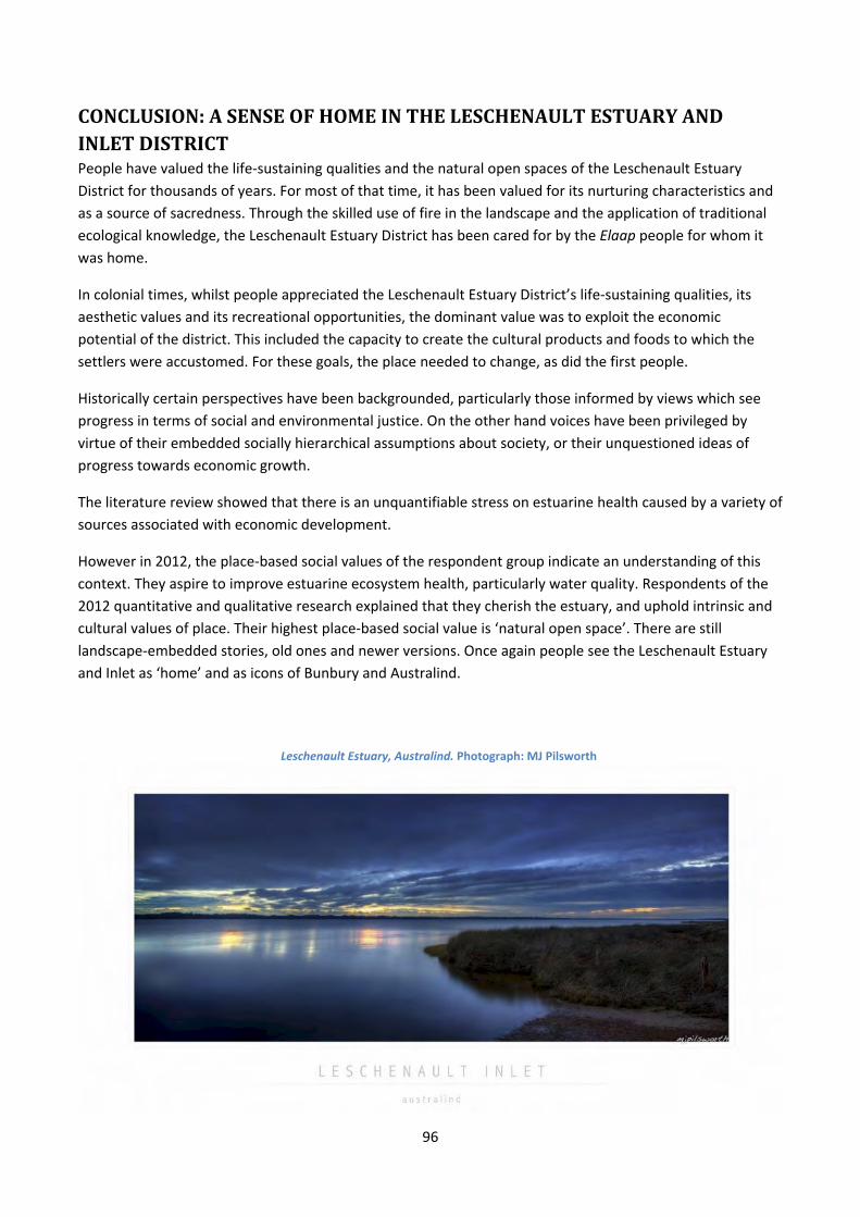
96
CONCLUSION:ASENSEOFHOMEINTHELESCHENAULTESTUARYANDINLETDISTRICTPeople have valued the life‐sustaining qualities and the natural open spaces of the Leschenault Estuary
District for thousands of years. For most of that time, it has been valued for its nurturing characteristics and
as a source of sacredness. Through the skilled use of fire in the landscape and the application of traditional
ecological knowledge, the Leschenault Estuary District has been cared for by the Elaap people for whom it
was home.
In colonial times, whilst people appreciated the Leschenault Estuary District’s life‐sustaining qualities, its
aesthetic values and its recreational opportunities, the dominant value was to exploit the economic
potential of the district. This included the capacity to create the cultural products and foods to which the
settlers were accustomed. For these goals, the place needed to change, as did the first people.
Historically certain perspectives have been backgrounded, particularly those informed by views which see
progress in terms of social and environmental justice. On the other hand voices have been privileged by
virtue of their embedded socially hierarchical assumptions about society, or their unquestioned ideas of
progress towards economic growth.
The literature review showed that there is an unquantifiable stress on estuarine health caused by a variety of
sources associated with economic development.
However in 2012, the place‐based social values of the respondent group indicate an understanding of this
context. They aspire to improve estuarine ecosystem health, particularly water quality. Respondents of the
2012 quantitative and qualitative research explained that they cherish the estuary, and uphold intrinsic and
cultural values of place. Their highest place‐based social value is ‘natural open space’. There are still
landscape‐embedded stories, old ones and newer versions. Once again people see the Leschenault Estuary
and Inlet as ‘home’ and as icons of Bunbury and Australind.
Leschenault Estuary, Australind. Photograph: MJ Pilsworth
97
RecommendationsforFurtherResearchThere are recommendations for further historical and quantitative research.
HistoricResearchFurther research is needed to augment claims made in the pre‐colonial and the colonial/post‐colonial history
sections.
NoongarTimesFirst is the issue of Elaap territory which appears to contradict established understandings about the history of Bunbury Noongar people. In this study it has been shown that the first people of the Leschenault Inlet
from its mouth to the lower Preston River were known as the Elaap, as was their place. This is unambiguous:
Bunbury was known for aeons as Elaap. There is evidence in this document to support the proposition that
the Leschenault Estuary and the district north to about Myalup, eastward up the hill slopes and south of
Dalyellup was also Elaap district. However two other groups of people were referred to by Bunbury (1930), one to the north of the Collie River and one to the north of Burragenup. It was argued in this report that the
other groups were also Elaap people due to their close association with the Estuary and the notion of family
properties in land, but more work is needed to establish their identities and the extent of Elaap territory.
Second is the matter of Elaap ownership and belonging (as in ‘this is our place’). It was argued in this report that Elaap people belonged in the place that they were obliged to care for, their karlap (which means home‐
place), whereas they visited other people and places for shorter seasonal tasks such as harvesting fruit and
tubers and attending meetings, trading, dances and celebrations. This is quite different in effect to the
impression of temporary occupancy associated with the idea of ‘continually shifting’. Using the methods
applied in this project together with ethnographic research with Noongar elders, more evidence needs to be
acquired to describe and illustrate the nature of Elaap tenure and in the process, garner considerably more
knowledge of place‐based relationships in the Leschenault District. The first step will be piecing together
direct and ‘throw‐away’ comments from a wide variety of historic sources to establish Noongar seasonal
routines over geographic space.
ColonialandPost‐ColonialTimesDue to time constraints there are notable omissions in the report that need rectifying through further
research, to more clearly document the richness and diversity of the place‐based social values of colonial
and post‐colonial times. The first – and very important – question is: what happened to the Elaap people and their place‐based knowledge over time?
QuantitativeResearchAt present, the data is pointing to an interesting, unanticipated conclusion about a localised sense of place.
Therefore it is recommended that further interrogation of the data using SPSS, a statistical analysis package,
is conducted to determine whether it can be concluded that there is a localised sense of place in the
respondent group. It is also recommended that further analysis is carried out to determine whether any
patterns accompany the criteria of age and of socio‐economic indicators.
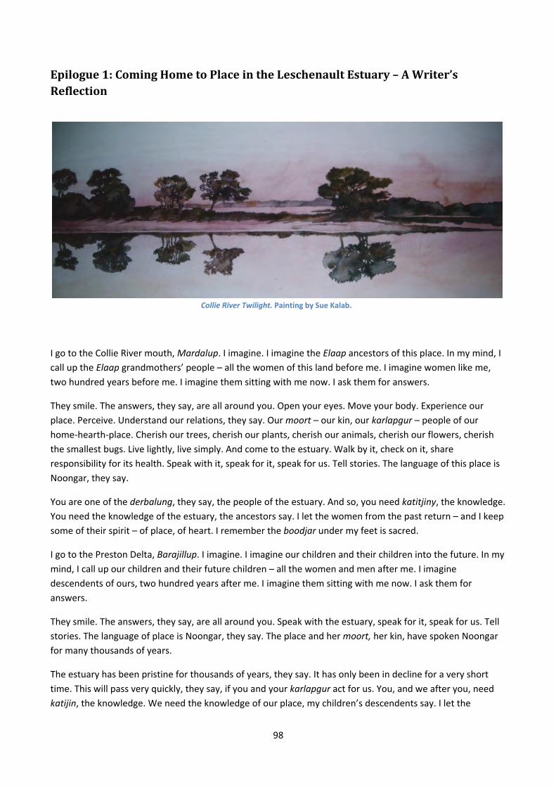
98
Epilogue1:ComingHometoPlaceintheLeschenaultEstuary–AWriter’sReflection
Collie River Twilight. Painting by Sue Kalab.
I go to the Collie River mouth, Mardalup. I imagine. I imagine the Elaap ancestors of this place. In my mind, I
call up the Elaap grandmothers’ people – all the women of this land before me. I imagine women like me,
two hundred years before me. I imagine them sitting with me now. I ask them for answers.
They smile. The answers, they say, are all around you. Open your eyes. Move your body. Experience our
place. Perceive. Understand our relations, they say. Our moort – our kin, our karlapgur – people of our home‐hearth‐place. Cherish our trees, cherish our plants, cherish our animals, cherish our flowers, cherish
the smallest bugs. Live lightly, live simply. And come to the estuary. Walk by it, check on it, share
responsibility for its health. Speak with it, speak for it, speak for us. Tell stories. The language of this place is
Noongar, they say.
You are one of the derbalung, they say, the people of the estuary. And so, you need katitjiny, the knowledge. You need the knowledge of the estuary, the ancestors say. I let the women from the past return – and I keep
some of their spirit – of place, of heart. I remember the boodjar under my feet is sacred.
I go to the Preston Delta, Barajillup. I imagine. I imagine our children and their children into the future. In my
mind, I call up our children and their future children – all the women and men after me. I imagine
descendents of ours, two hundred years after me. I imagine them sitting with me now. I ask them for
answers.
They smile. The answers, they say, are all around you. Speak with the estuary, speak for it, speak for us. Tell
stories. The language of place is Noongar, they say. The place and her moort, her kin, have spoken Noongar for many thousands of years.
The estuary has been pristine for thousands of years, they say. It has only been in decline for a very short
time. This will pass very quickly, they say, if you and your karlapgur act for us. You, and we after you, need katijin, the knowledge. We need the knowledge of our place, my children’s descendents say. I let the
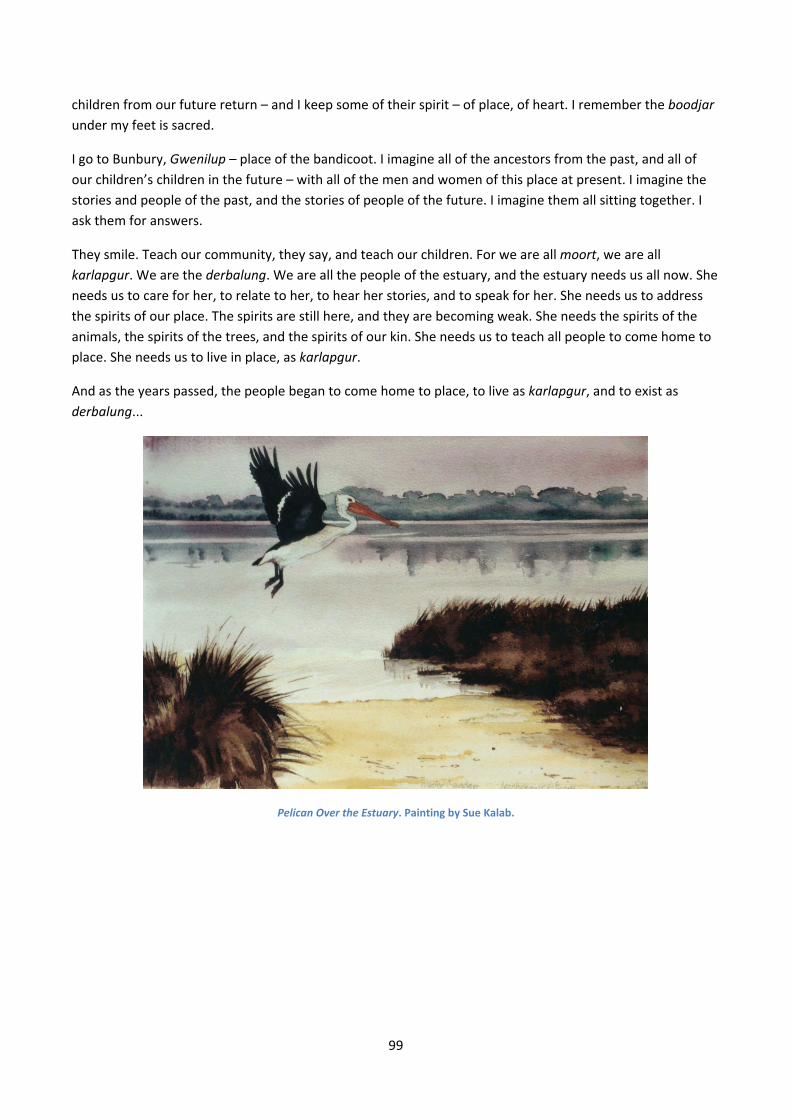
99
children from our future return – and I keep some of their spirit – of place, of heart. I remember the boodjar under my feet is sacred.
I go to Bunbury, Gwenilup – place of the bandicoot. I imagine all of the ancestors from the past, and all of
our children’s children in the future – with all of the men and women of this place at present. I imagine the
stories and people of the past, and the stories of people of the future. I imagine them all sitting together. I
ask them for answers.
They smile. Teach our community, they say, and teach our children. For we are all moort, we are all karlapgur. We are the derbalung. We are all the people of the estuary, and the estuary needs us all now. She
needs us to care for her, to relate to her, to hear her stories, and to speak for her. She needs us to address
the spirits of our place. The spirits are still here, and they are becoming weak. She needs the spirits of the
animals, the spirits of the trees, and the spirits of our kin. She needs us to teach all people to come home to
place. She needs us to live in place, as karlapgur.
And as the years passed, the people began to come home to place, to live as karlapgur, and to exist as derbalung...
Pelican Over the Estuary. Painting by Sue Kalab.
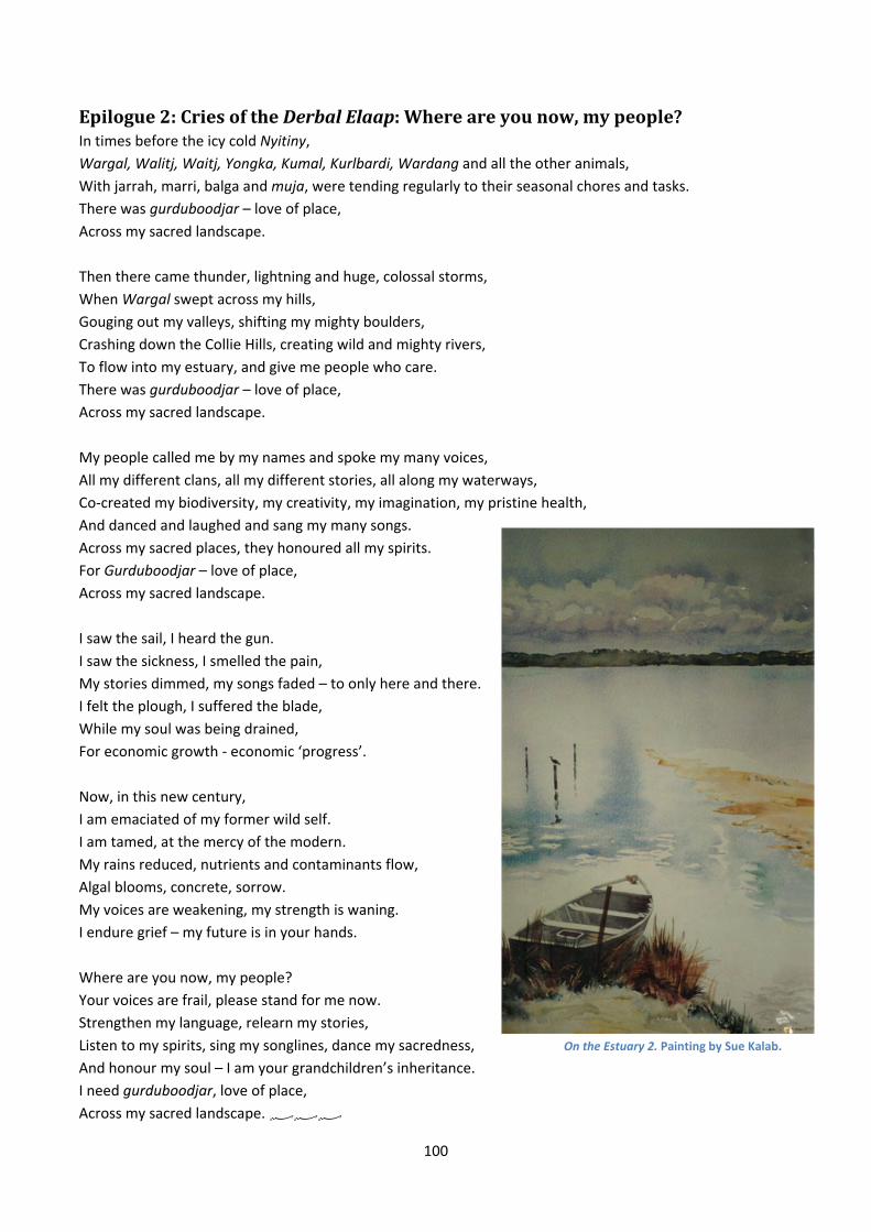
100
Epilogue2:CriesoftheDerbalElaap:Whereareyounow,mypeople?In times before the icy cold Nyitiny, Wargal, Walitj, Waitj, Yongka, Kumal, Kurlbardi, Wardang and all the other animals,
With jarrah, marri, balga and muja, were tending regularly to their seasonal chores and tasks. There was gurduboodjar – love of place, Across my sacred landscape.
Then there came thunder, lightning and huge, colossal storms,
When Wargal swept across my hills,
Gouging out my valleys, shifting my mighty boulders,
Crashing down the Collie Hills, creating wild and mighty rivers,
To flow into my estuary, and give me people who care.
There was gurduboodjar – love of place, Across my sacred landscape.
My people called me by my names and spoke my many voices,
All my different clans, all my different stories, all along my waterways,
Co‐created my biodiversity, my creativity, my imagination, my pristine health,
And danced and laughed and sang my many songs.
Across my sacred places, they honoured all my spirits.
For Gurduboodjar – love of place, Across my sacred landscape.
I saw the sail, I heard the gun.
I saw the sickness, I smelled the pain,
My stories dimmed, my songs faded – to only here and there.
I felt the plough, I suffered the blade,
While my soul was being drained,
For economic growth ‐ economic ‘progress’.
Now, in this new century,
I am emaciated of my former wild self.
I am tamed, at the mercy of the modern.
My rains reduced, nutrients and contaminants flow,
Algal blooms, concrete, sorrow.
My voices are weakening, my strength is waning.
I endure grief – my future is in your hands.
Where are you now, my people?
Your voices are frail, please stand for me now.
Strengthen my language, relearn my stories,
Listen to my spirits, sing my songlines, dance my sacredness,
And honour my soul – I am your grandchildren’s inheritance.
I need gurduboodjar, love of place, Across my sacred landscape.
On the Estuary 2. Painting by Sue Kalab.
101
ReferencesAbram, D. (1996). The spell of the sensuous: Perception and language in a more-than-human world. New
York: Pantheon Books. Abram, D. (2010). Becoming animal: an earthly cosmology. New York: Pantheon Books. Arrowsmith, J. (Cartographer). (1841). Eastern portion of Australia. Retrieved 22/7/2012, Melbourne:
http://repository.unimelb.edu.au/10187/4334. Barker, A., & Laurie, M. (1992). Excellent connections: A history of Bunbury, Western Australia 1836-1990.
Bunbury, Australia: City of Bunbury. Barnes, P. (2001). Marlston Hill and all that. Bunbury, Australia: Published by the Author. Barnes, P., Cameron, J., & Willis, H. (2010). The Australind journals of Marshall Waller Clifton 1840 - 1861.
Victoria Park, Australia: Hesperian Press. Barnes, P. (2013a). Marshall Waller Clifton. Unpublished Essay. Barnes, P. (2013b). Personal Communication. Bates, D. (1985). The native tribes of Western Australia. Canberra, Australia: National Library of Australia. Bates, D. (1992). Aboriginal Perth and Bibbulmun biographies and legends. Perth: Hesperian Press. Beckwith Environmental Planning. (2008). Lower Collie River social values study. Bunbury: Department of
Water. Beckwith Environmental Planning. (2009). Nyungar values of the Collie River. Bunbury Department of Water. Bird Rose, D. (1996). Nourishing terrains: Australian Aboriginal views of landscape and wilderness. Canberra:
Australian Heritage Commission. Bolton, G., Vose, H., & Jones, G. (1991). Introduction. In G. Bolton, H. Vose & G. Jones (Eds.), The Wollaston
journals volume 1. Nedlands: University of Western Australia Press. Brearley, A. (2005). Ernest Hodgkin's Swanland: Estuaries and coastal lagoons of South-western Australia.
Perth: University of Western Australia Press. Brown, G., & Brabyn, L. (2012). The extrapolation of social landscape values to a national level in New
Zealand using landscape character classification. Applied geography, 2012(35), 84‐94. Brown, G., & Weber, D. (2012). Measuring change in place values using public participation GIS (PPGIS).
Applied geography, 34, 316‐324. Brown, V., Harris, J., & Russell, J. (2010). Tackling wicked problems through the transdisciplinary imagination.
Washington, DC: Earthscan. Bunbury, H. W. (1930). Early days in Western Australia: Being the letters and journal of Lieut. H.W. Bunbury /
edited by Lieut.-Col. W. St. Pierre Bunbury and W. P. Morrell. London, UK: Oxford University Press. Bunbury Port Authority. (2011a). Bunbury Port Authority Annual Report 2011. Bunbury: Bunbury Port
Authority. Bunbury Port Authority. (2011b). Bunbury Port inner harbour structure plan: scoping document. Bunbury:
Bunbury Port Authority. Burton Jackson, J. (1982). Not an idle man: Biography of John Septimus Roe, Western Australia's first
surveyor-general (1797-1878). Fremantle, Australia: Fremantle Arts Centre Press. Bussell, A. J. (1930s). South West Aboriginal language or dialect - what the Aboriginals term: 'Dornderup
Wongie' and other things concerning Australia generally.Unpublished manuscript, Perth. Carter, M. (2009). Health and the nature of urban green spaces. Perth: Doctor of Philosophy Dissertation,
Edith Cowan University. Chouinard, V. (2008). Reinventing radical geography: Is all that's left right? In H. Bauder & S. Engle‐Di Munro
(Eds.), Critical geographies: A collection of readings. Kelowna, British Columbia: Praxis (e) Press. Collard, L. (1994). A Nyungar interpretation of Ellensbrook and Wonnerup homesteads. Mount Lawley,
Australia: National Trust of Western Australia. Collard, L. (2011). Understanding place names in SouthWest Australia: Katitjin Ngulluckiny Boodjera.
Retrieved 24/1/2013, from: http://soac2011.com.au/files/slides/Len‐Collard.pdf. Collard, L. (2013). Personal communication.
102
Collard, L., Harben, S., & van den Berg, R. (2004). Nitja beeliar boodjar noonookurt nyininy: A Nyungar interpretive history of the use of boodjar (country) in the vicinity of Murdoch University. Murdoch, Western Australia: Murdoch University.
Convention on Wetlands [Ramsar 1971] Culture Working Group. (2008). Culture and wetlands: a Ramsar Guidance Document.
Dennison, W. C., Carruthers, T. J. B., Thomas, J. E., & Glibert, P. M. (2004). Management approaches in Moreton Bay, Australia and Chesapeake Bay, USA. In M. H. Wong (Ed.), Wetlands ecosystems in Asia: Function and Management. Amsterdam: Elsevier.
Department of Fisheries. (2012). Status reports of the fisheries and aquatic resources of Western Australia 2011/12: state of the fisheries. Perth: Government of Western Australia.
Fagerholm, N., & Kayhko, N. (2009). Participatory mapping and geographical patterns of the social landscape values of rural communities in Zanzibar, Tanzania. Fennia, 187(1).
Gardner, G. (2010). Traditions old and new. In L. Starke & L. Mastny (Eds.), State of the World, 2010: Transforming cultures from consumerism to sustainability: A WorldWatch Institute report on progress toward a sustainable society. New York: W.W. Norton and Company.
Gerritsen, R. (1998). Early records of the Wardandi language. Canberra: IP Publications, Australian National University.
Gibbs, C. (2011). Environmental organisations in the Bunbury area. Bunbury: Unpublished. Giblett, R. (2011). People and places of nature and culture. Bristol, UK: Intellect. Gunderson, K., Watson, A., Nelson, R., & Titre, J. (2004). Mapping place meanings on the Bitterroot National
Forest: A landscape‐level assessment of personal and community values as input to fuel hazard reduction treatments: Research project summary. Retrieved 3/11/2012, from: http://leopold.wilderness.net/unpublished/UNP105.pdf
Hallam, S. (1975). Fire and hearth: a study of Aboriginal usage and European usurpation in south-western Australia Canberra: Australian Institute of Aboriginal Studies.
Harding, S. (2006). Animate earth: Science, intuition and Gaia. Totnes, Devon: Green Books. Head, L. (2000). Second nature: The historical implications of Australia as Aboriginal landscape. Syracuse:
Syracuse University Press. Head, L. (2008). Is the concept of human impacts past its use‐by date? The holoscene, 18(3), 373‐377. Heron, J. (1996). Cooperative inquiry: Research into the human condition. London: Sage Publications. Horton, D. (Cartographer). (1994). Indigenous language map. Retrieved 22/7/2013, from:
http://www.abc.net.au/indigenous/map/ Horwitz, P., Sommer, B., & Thomas, R. (Manuscript). Sustainability of wetland restoration in a drought‐
affected water resource catchment: ecological and economic costs and benefits. To be advised, Not yet available.
Hugues‐dit‐Ciles, J. (2011a). Appendix A: Catchment characteristics. In J. Hugues‐dit‐Ciles (Ed.), Leschenault Estuary water quality improvement plan: draft for public comments. Bunbury: Department of Water.
Hugues‐dit‐Ciles, J. (2011b). Leschenault Estuary Water Quality Improvement Plan: Draft for Public Comments. Bunbury: Department of Water.
Kincheloe, J., & McLaren, P. (2002). Rethinking critical theory and qualitative research. In Y. Zou & E. Trueba (Eds.), Ethnography and schools: qualitative approaches to the study of education: Bowman and Littlefield.
Le Souef, S. (1993). Aborigines of King George Sound. In B. K. E. de Garis (Ed.), Portraits of the South West: Aborigines, women and the environment. Nedlands WA: University of Western Australia Press.
Lee, P. (1996). The Whorf theory complex: a critical reconstruction. Amsterdam, Philadelphia: J. Benjamins Pub.
Macaulay, C. (2007). 'Human hand' in south‐west WA rainfall reduction. Media Release: 07/56 Retrieved 19/12/2010, from http://www.csiro.au/news/ps2y3.html.
Macy, J., & Young Brown, M. (1998). Coming back to life: Practices to reconnect our lives, our world. Canada: New Society Publishers.
Mathews, F. (2005). Reinhabiting reality: Towards a recovery of culture. Sydney: University of New South Wales Press.
103
McFarlane, D. J. (2005). Context Report on South West Water Resources for Expert Panel examining Kimberley Water Supply Options. Retrieved 22/11/2012, from: http://www.csiro.au/files/files/p3uh.pdf: CSIRO: Water for a Healthy Country National Research Flagship Canberra.
McKenna, M. (2007). The Leschenault Estuarine System, South-Western Australia: Condition statement and recommendations for management. Bunbury: Department of Water.
Millett, E. (1980). An Australian parsonage or, the settler and the savage in Western Australia. Nedlands, Western Australia: University of Western Australia.
Moore, G. F. (1850). Descriptive Australian vocabulary. London: WM. S. Orr & Co. O'Brien, T. (1981). Some abridged history of Bunbury 1658 - 1995. Bunbury: Leslie O'Brien Publishing. O'Brien, T. (Cartographer). (2003). Compilation of early surveys, topographical features and Aboriginal names
of regions covering original townsite of Bunbury. Bunbury: Brendan Kelly Collection. Plumwood, V. (2002). Environmental culture: The ecological crisis of reason. London: Routledge. Pocewicz, A., Nielsen‐Pincus, M., Brown, G., & Schnitzer, R. (2012). An evaluation of internet versus paper‐
based methods for Public Participation Geographic Information Systems (PPGIS). Transactions in GIS: 16(1).
Ramsar Convention Secretariat. (2008). Ramsar: The convention on wetlands? Brochure. Retrieved 22/11/2012, from: http://www.ramsar.org/pdf/about/about_brochure_2008_e.pdf
Ramsar COP09. (2005). Resolution IX.1 Annex A: A Conceptual Framework for the wise use of wetlands and the maintenance of their ecological character. Paper presented at the 9th Meeting of the Conference of the Parties to the Convention on Wetlands (Ramsar, Iran, 1971). Retrieved 21/6/2011, from: http://www.ramsar.org/pdf/key_guide_framework_wiseuse_e.pdf.
Research Solutions. (2007). Community survey of future values and aspirations for the Swan and Canning Rivers. Perth: Swan River Trust.
Roth, W. (1902). Notes of savage life in the early days of West Australian settlement: Based on reminiscences collected from F. Robert Austin, Civil Engineers, late Assistant Surveyor, WA, late Sergeant‐at‐Arms, Parliament of Queensland, discoverer of the Kimberley Goldfields, WA. Brisbane: Read before the Royal Society of Queensland, 8th March.
Russo, G. (1995). A friend indeed: Louisa Clifton of Australind WA. Perth: Vanguard Press. Sanders, T. (1975). Bunbury: some early history. Canberra: Roebuck Society. Scientific and Technical Advisory Committee. (2011). Bay's restoration needs all the sciences, including the
social ones. Chesapeake Bay Journal, May(2011), http://www.bayjournal.com/article.cfm?article=4112.
Scott, H. (2004). Cultural turns. In J. Duncan, N. Johnson & R. Schein (Eds.), A companion to cultural geography. Oxford: Blackwell Publishing.
Semeniuk, V. (2000). Sedimentology and holocene stratigraphy of Leschenault Inlet. Journal of the Royal Society of Western Australia, 83(4).
Shaw, M. (2011). A branch from the lightning tree: Ecstatic myth and the grace in wildness. Ashland, Oregon: White Cloud Press.
Smith, H. (2012). Population dynamics and habitat use of bottlenose dolphins (tursiops aduncus), Bunbury, Western Australia. Murdoch University, Murdoch.
South West Development Commission. (2011). South West Development Commission: Annual Report 2011. Staples, A. C. (1979). They made their destiny: history of settlement of the Shire of Harvey 1829-1929.
Bunbury: Shire of Harvey. Taylor, D. (2011). A nation sub‐divided. Australian Heritage Online. Tindale, N. B. (Cartographer). (1974). Tribal boundaries in Aboriginal Australia. Retrieved 22/11/2012, from:
http://trove.nla.gov.au/work/18734105. Turner, N. J. (2005). The earth's blanket: Traditional teachings for sustainable living. Vancouver: Douglas and
McIntyre. Ward, M. (2011). The comfort of water: A river pilgrimmage. Yarraville, Australia: Transit Lounge.
104
Weir, J. (2009). Murray River country: an ecological dialogue with traditional owners. Canberra: Aboriginal Studies Press.
Western Australian Planning Commission (Cartographer). (2007). Greater Bunbury Regional Scheme: Map 9. Retrieved 22/11/2012, from: http://www.planning.wa.gov.au/1224.asp.
Western Australian Planning Commission. (2011). The Preston River to Ocean Regional Park: Establishment Plan Proposal Final Report. Perth: Author.
Whittlesey, D. (1929). Sequent occupance. Annals of the Association of American Geographers, 19(3), 162‐165.
Whorf, B. (1956). Language, thought, and reality : selected writings of Benjamin Lee Whorf. Cambridge, Mass.: MIT Press.
Wollaston, J. R. (1991). Picton: May 1841 ‐ December 1842. In G. Bolton, H. Vose & G. Jones (Eds.), The Wollaston Journals Volume 1. Nedlands, Australia: University of Western Australia Press.
Wooltorton, S. (1993). Noongar our way: a Noongar language course. Bunbury: Noongar Language Centre. Wooltorton, S. (2004). School as community: Bridging the gap to sustainability. Unpublished Doctor of
Philosophy Dissertation, Murdoch University, Perth.

105

106
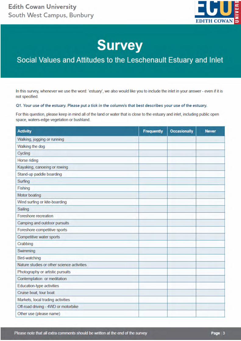
107
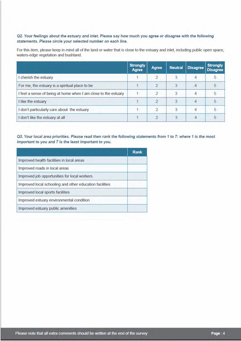
108
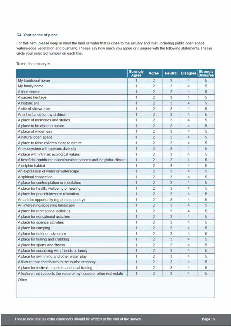
109
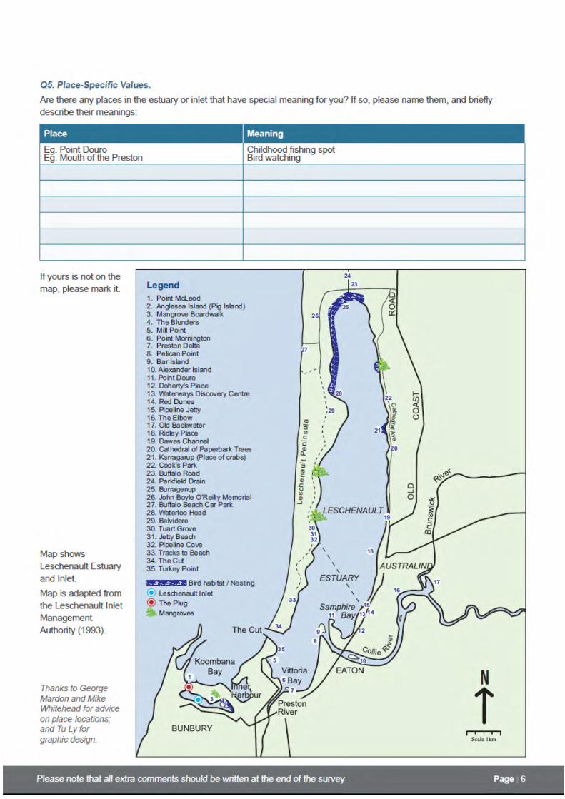
110

111

112

113

114

115
AppendixTwo:MakingaBwokorBooga(Coat)Below is a substantial quote from Bunbury (Bunbury, 1930, page numbers marked with /#) to extend the
information provided about Elaap clothes‐making and conceptions of personal adornment for ‘looking
handsome’ on page 35 of this document. Since this is a direct quotation, spelling of Noongar and English
words have been left as per original text. Thanks to Phyllis Barnes for permission to use these transcripts
prior to her own publication of this material.
I halted for about an hour & a half on the left bank of the "Preston" in a rich flat where my horses soon filled themselves with grass… A very large party of Natives collected round me during my halt & sat down in circles around the fires they kindled watching all my movements most carefully & making at the same time an overpowering noise talking & laughing most vehemently. As I could spare but a very small piece of damper, my stock being barely sufficient to last till my return I boiled them a piece of Pork & gave them what please them still more, the greasey water in which it was boiled: skimming the floating fat off with their hands they mixed a large quantity of "Wilghi" with which they smeared not only their heads, but faces, bodies & legs. This "Wilghi" which is a preparation of red earth & grease constituted their favourite ornament & covering, when smeared with this
/37
they consider themselves particularly handsome & discard the Booga, the small apology for clothes they usually wear. I observed at Port Leschenault that most of them used the red earth alone, fat being difficult to obtain so they appeared particularly delighted to get some. The Natives here do not differ in either manners or appearance from the tribes farther north, they are like the Murray men, stout & generally well made having apparently plenty to eat & many of the young women are extremely good looking, with particularly fine teeth & an open pleasing expression, but as scantily clad and as dirty as usual. The only clothes worn by any of the Natives of Western Australia that I have seen is the "booga" or cloak, made of Kangaroo skin. They generally use & prefer the skin of the female Kangaroo "Waroo", as being softer & closer in texture & finer that that of the Male "Yowert"& I have also though very rarely seen skins of the Brush Kangaroo & Wallobi used by
/38
them, which are the prettiest by far, with closer fur, of a grey color inclining to white at the tips, which gives it a silvery hue. The skins are first pegged out on the ground, fur undermost to dry & then the fleshy & greasy parts are scraped off by the women with small tools on purpose, consisting of a short stick tipped with the hard "Beever" or Grass tree Gum in which is inserted a fragment of glass or Quartz with the necessary shape & edge. With this instrument they scrape the skin all over several times crossing the former marks diagonally, until the skin is sufficiently soft & pliable. Four to six skins are necessary to form a cloak, each one being cut obliquely from the head increasing in width very gradually to the hind quarters & they are sown together with the sinews extracted from the tail of the Kangaroo, holes being made with a sharp pointed bone or stick but they have no needle. The sinews which must be drawn from the tail of the Yowert
/39
or male Kangaroo as being the largest are obtained by cutting round the skin about two or three inches from the extremity sufficiently to obtain a hold & then twisting & turning until the joint of the bone is seperated [sic] when by a strong pull the sinews of the whole length of the tail are drawn out when they must be wound diagonally round a spear of "Wonna" to prevent their shrinking in drying. They then form the best Material that can possibly be obtained for strong sewing. The cloak is fastened round the neck by a bit of grass or more often by a little stick or bone thrust through two or

116
three holes in the front, & a narrow cape or collar above hangs over in an irregular manner as the skin of the head is often left & not cut square. It is worn in different ways, but oftenest over the left shoulder & back, hiding the hand which carries the spears & "Mero" & the knife "Dalba" & Hammer "Kadjoo" stuck in the belt or "Noolaban". If it is very cold however when walking they jerk their cloaks
/40
forward, so as to cover their chest and belly & with the disengaged hand carry underneath it the firestick which is as constant companion as the spears. These grasped by the middle are usually carried with the "Mero" in the left hand with the points to the rear, or if likely to be wanted in one of them the right hand, fixed in the throwing stick & the point upright or leaning against the shoulder. A man never carries more than one cloak & often not even that but the women have frequently more skins & on their backs they carry one or two bags "Cotto", of Kangaroo skin slung round the neck & shoulders, containing the child & any tools, spare skins, roots, or other provisions or stores they may possess. In travelling or moving their camp the young children are always carried by the Women in these bags & one frequently sees another somewhat larger seated astride on her shoulders, but the men also will sometimes condescend to carry a boy on his shoulders if he is tired, where he sits quite at his ease grasp‐
/41
‐ing tight by their hair: this is the only burthen except their spears that the men will ever carry, the women being not only compelled to carry everything, but to make the huts & fires when they halt for the night. The belt of Noolaban consists of a very great length of roughly spun opossum hair but slightly twisted & not strong, this is wound round & round the body even many dozen of times & its beauty is estimated according to its length; it is usually made tight & seems equally prized for supporting the stomarch when empty or confining it when full, & in it are stuck the hammer & knife, the former generally behind with the head in the small of the back & the handle sticking straight down. Their hair is often confined by a piece of Noolaban, in which are stuck the Mannuite(?) tufts, or bunches of white cockatoo feathers which are highly prized as ornaments as indeed are all white or gray coloured feathers, these are prepared by
/42
tearing the feathery parts from the quills & tail & fastening them together on a little bit of stick so as [to] form a little bunch drooping all round and really very picturesque, sometimes white sometimes black with red stripes (the tail of the black Cockatoo) or at other times reddish brown when saturated with Wilghi. These are worn on the head or as armlets & occasionally when plentiful in the belt: well adorned with these & smeared with grease & red ochre a warrior is fully drest ...