a collection of circular walks in, and around, the village · 1 thornton le dale walks a collection...
TRANSCRIPT
1
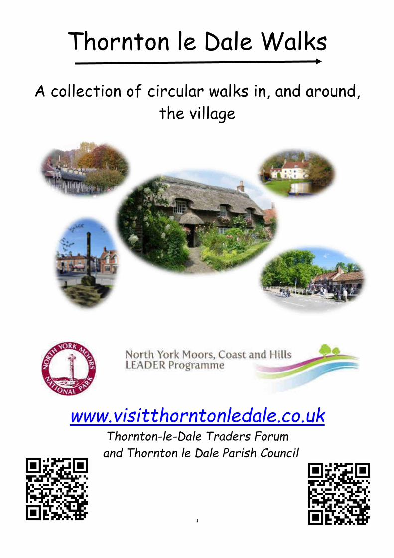
Thornton le Dale Walks
A collection of circular walks in, and around,
the village
www.visitthorntonledale.co.uk Thornton-le-Dale Traders Forum
and Thornton le Dale Parish Council
2
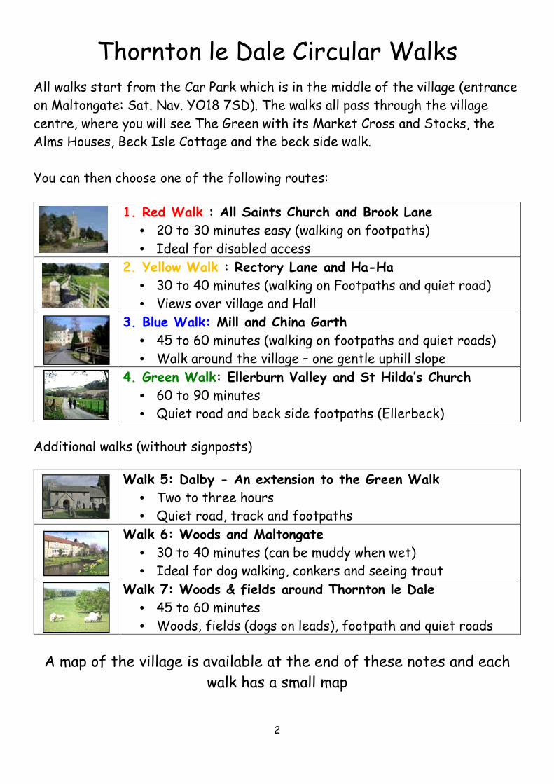
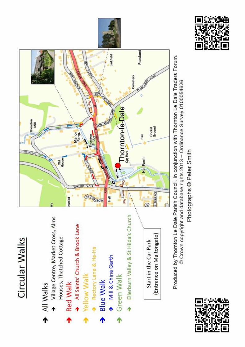
Thornton le Dale Circular Walks
All walks start from the Car Park which is in the middle of the village (entrance
on Maltongate: Sat. Nav. YO18 7SD). The walks all pass through the village
centre, where you will see The Green with its Market Cross and Stocks, the
Alms Houses, Beck Isle Cottage and the beck side walk.
You can then choose one of the following routes:
1. Red Walk : All Saints Church and Brook Lane
• 20 to 30 minutes easy (walking on footpaths)
• Ideal for disabled access
2. Yellow Walk : Rectory Lane and Ha-Ha
• 30 to 40 minutes (walking on Footpaths and quiet road)
• Views over village and Hall
3. Blue Walk: Mill and China Garth
• 45 to 60 minutes (walking on footpaths and quiet roads)
• Walk around the village – one gentle uphill slope
4. Green Walk: Ellerburn Valley and St Hilda’s Church
• 60 to 90 minutes
• Quiet road and beck side footpaths (Ellerbeck)
Additional walks (without signposts)
Walk 5: Dalby - An extension to the Green Walk
• Two to three hours
• Quiet road, track and footpaths
Walk 6: Woods and Maltongate
• 30 to 40 minutes (can be muddy when wet)
• Ideal for dog walking, conkers and seeing trout
Walk 7: Woods & fields around Thornton le Dale
• 45 to 60 minutes
• Woods, fields (dogs on leads), footpath and quiet roads
A map of the village is available at the end of these notes and each
walk has a small map
3
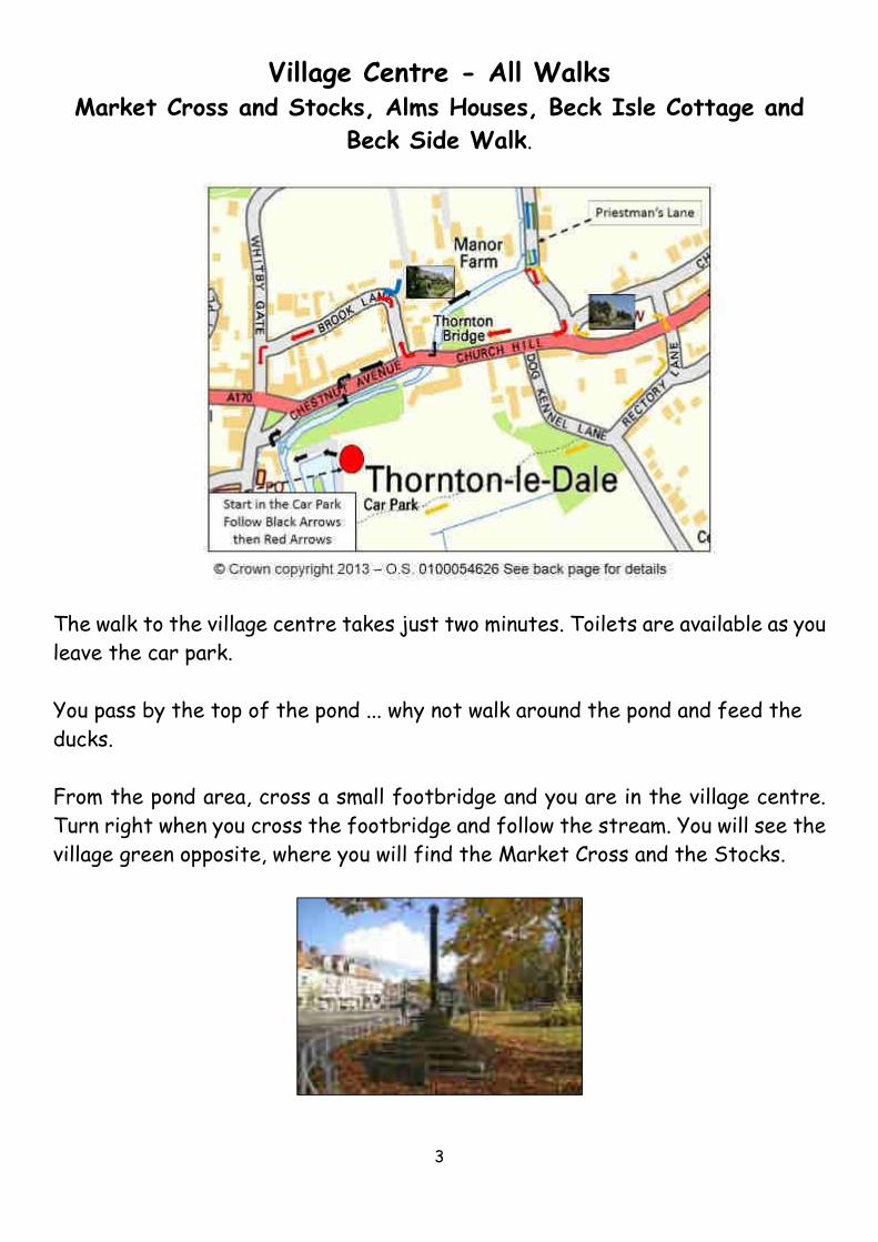
Village Centre - All Walks Market Cross and Stocks, Alms Houses, Beck Isle Cottage and
Beck Side Walk.
The walk to the village centre takes just two minutes. Toilets are available as you
leave the car park.
You pass by the top of the pond ... why not walk around the pond and feed the
ducks.
From the pond area, cross a small footbridge and you are in the village centre.
Turn right when you cross the footbridge and follow the stream. You will see the
village green opposite, where you will find the Market Cross and the Stocks.
4
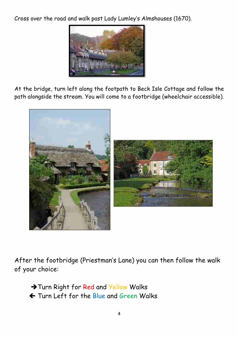
Cross over the road and walk past Lady Lumley’s Almshouses (1670).
At the bridge, turn left along the footpath to Beck Isle Cottage and follow the
path alongside the stream. You will come to a footbridge (wheelchair accessible).
After the footbridge (Priestman’s Lane) you can then follow the walk
of your choice:
�Turn Right for Red and Yellow Walks
Turn Left for the Blue and Green Walks
5
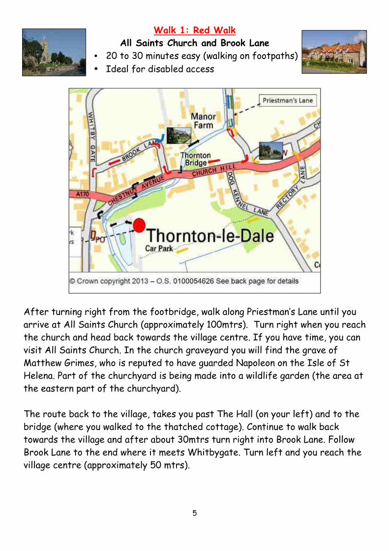
Walk 1: Red Walk
All Saints Church and Brook Lane
• 20 to 30 minutes easy (walking on footpaths)
• Ideal for disabled access
After turning right from the footbridge, walk along Priestman’s Lane until you
arrive at All Saints Church (approximately 100mtrs). Turn right when you reach
the church and head back towards the village centre. If you have time, you can
visit All Saints Church. In the church graveyard you will find the grave of
Matthew Grimes, who is reputed to have guarded Napoleon on the Isle of St
Helena. Part of the churchyard is being made into a wildlife garden (the area at
the eastern part of the churchyard).
The route back to the village, takes you past The Hall (on your left) and to the
bridge (where you walked to the thatched cottage). Continue to walk back
towards the village and after about 30mtrs turn right into Brook Lane. Follow
Brook Lane to the end where it meets Whitbygate. Turn left and you reach the
village centre (approximately 50 mtrs).

6
Walk 2 Yellow Walk
Rectory Lane and Ha-Ha
� 30 to 40 minutes (walking on footpaths and
quiet road)
� Views over village and Hall
After turning right from the footbridge, walk along Priestman’s Lane until you
arrive at All Saints Church (approximately 100mtrs). Walk up the steps to the
church and follow the elevated path past the lych gate. If you have time, you
can visit All Saints Church. In the church graveyard you will find the grave of
Matthew Grimes, who is reputed to have guarded Napoleon on the Isle of St
Helena. Part of the churchyard is being made into a wildlife garden (the area at
the eastern part of the churchyard).
Walk past the churchyard and follow the path which slopes down to road level.
Cross over to Rectory Lane and after approximately 50 mtrs turn right.

7
Follow this lane to the junction with Dog Kennel Lane. Directly opposite you will
see a break in the stone wall and a footpath. This will take you back to the car
park. As you go down the hill on the footpath keep to the gravel path, as there
is a Ha-Ha (ditch) which can be overgrown in the summer and is easy to fall into!

8
Walk 3: Blue Walk
Thornton le Dale Mill and China Garth
• 45 to 60 minutes – footpaths and quiet roads
• Wheelchair accessible but one gentle uphill section
After turning left from the footbridge, walk along Priestman’s Lane with the
beck on your left. Walk past Victoria Mill (on your right) and the bowling green
(on your left) continue up the hill.
Pass the turning on your right (this is the green walk to Ellerburn). You will see
a kissing gate on the left hand side. Go through the gate and follow the path
into China Garth. This takes you between houses and gardens until you come to
Brook Lane. Turn right and follow Brook Lane to the end where you turn left
into the village centre.
For wheelchair users, or as an alternative route, continue up the hill and DO
NOT go through the kissing gate. Turn left at the junction and walk down the
hill to the village centre via Whitbygate.
9
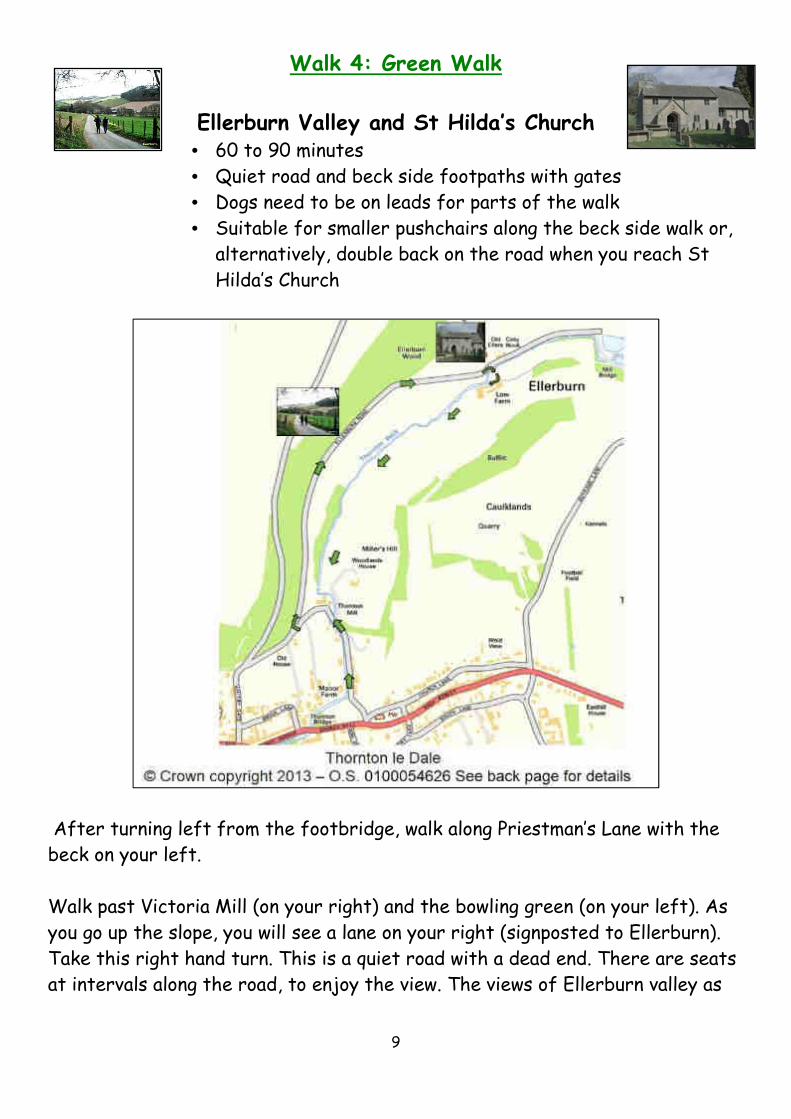
Walk 4: Green Walk
Ellerburn Valley and St Hilda’s Church • 60 to 90 minutes
• Quiet road and beck side footpaths with gates
• Dogs need to be on leads for parts of the walk
• Suitable for smaller pushchairs along the beck side walk or,
alternatively, double back on the road when you reach St
Hilda’s Church
After turning left from the footbridge, walk along Priestman’s Lane with the
beck on your left.
Walk past Victoria Mill (on your right) and the bowling green (on your left). As
you go up the slope, you will see a lane on your right (signposted to Ellerburn).
Take this right hand turn. This is a quiet road with a dead end. There are seats
at intervals along the road, to enjoy the view. The views of Ellerburn valley as
10
the road bends right are superb. In spring, the route is lined with daffodils and
the fields normally have sheep and lambs.
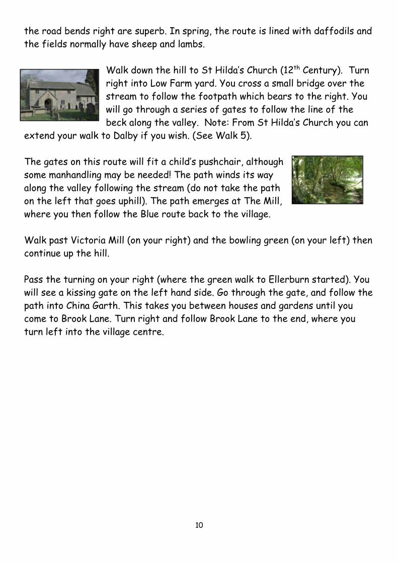
Walk down the hill to St Hilda’s Church (12th Century). Turn
right into Low Farm yard. You cross a small bridge over the
stream to follow the footpath which bears to the right. You
will go through a series of gates to follow the line of the
beck along the valley. Note: From St Hilda’s Church you can
extend your walk to Dalby if you wish. (See Walk 5).
The gates on this route will fit a child’s pushchair, although
some manhandling may be needed! The path winds its way
along the valley following the stream (do not take the path
on the left that goes uphill). The path emerges at The Mill,
where you then follow the Blue route back to the village.
Walk past Victoria Mill (on your right) and the bowling green (on your left) then
continue up the hill.
Pass the turning on your right (where the green walk to Ellerburn started). You
will see a kissing gate on the left hand side. Go through the gate, and follow the
path into China Garth. This takes you between houses and gardens until you
come to Brook Lane. Turn right and follow Brook Lane to the end, where you
turn left into the village centre.

11
Walk 5
Dalby - An extension to the Green Walk
• Two to three hours
• Quiet roads, forest tracks, stiles and footpaths
• Obey signs: Dogs need to be on leads – livestock in some areas
Follow the Green Walk to St Hilda’s Church (12th
Century) and continue, along the road, following the line
of the stream until you get to a right hand bend where
you will see an entry gate to the fish farm. To the left of
the gate there is a stile and a footpath. Take the
footpath with the trout farm below you, on the right hand side. You will pass
another stile and enter a field. Follow the footpath across the field (staying in
the lower part/right hand side of the field). You will see a stile ahead of you
which leads into the forest.
The forest path opens out to a wider path/forest
road with pine trees. There may be mountain bike
riders from here onwards; although the paths are
wide and are designated for both pedestrian and
cycle use. Continue until you see a clear, made up,
footpath on your right hand side (almost doubling
back on yourself).
The footpath leads down to a stream and crosses a footbridge. Follow the path
uphill where it winds its way to a broader forest road track. Turn right here on
to the forest track, which will take you back towards Thornton le Dale.
(At this point you could extend your walk by turning left and following this
track to Dalby village, and double back to return.)
When you turn right, follow the track back out of the forest, into Ellerburn
valley, with the stream on your right. You will see a fork in the track with a sign
12
saying Sand Dale. Here, go straight ahead (do not bear left up the hill). You will
see a bird hide on your right.
Follow the track through several gates (remember to close these as there is
often livestock in the fields). You will pass the trout farm again (on your right
hand side). The track becomes a tarmac road.
When you reach Ellerburn Church, turn left into Low Farm yard. You are now on
the Green Walk. See the notes for this walk regarding the route back to the
village.
13
Walk 6
Thornton le Dale Woods and Maltongate 30 – 40 minutes
• Ideal for dog walking (woods two minutes from car park)
• Good for conker collecting in autumn
• See brown trout in the streams
From the car park, walk along the entrance road with the playing field on your
left hand side. Immediately before the small bridge, you will see a pedestrian
entrance on your left. Enter the woods and follow the footpath. The paths get
muddy in winter. This is a good place to collect conkers in the Autumn.
Follow the paths along the line of the stream. There two possible paths, but
both follow the same basic route. On your right, alongside the stream, you will
see a field which normally has sheep, chickens and a horse.
Follow the path, past a beech hedge, which leads to a five bar gate. Turn right
at the gate and cross two pedestrian bridges over the stream.
This is a good place for dogs (and children) to paddle. There is a
dog waste bin located between the two footbridges.
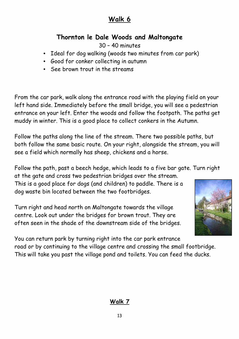
Turn right and head north on Maltongate towards the village
centre. Look out under the bridges for brown trout. They are
often seen in the shade of the downstream side of the bridges.
You can return park by turning right into the car park entrance
road or by continuing to the village centre and crossing the small footbridge.
This will take you past the village pond and toilets. You can feed the ducks.
Walk 7

14
Woods and Fields
30 – 40 minutes
• Ideal for dogs but they must be kept on a lead in the fields.
• See sheep and lambs, plus a model village
From the car park, walk along the entrance road with the playing field on your
left hand side. Immediately before the small bridge, you will see a pedestrian
entrance on your left. Go into the woods and follow the footpath. The woods
are a good place to collect conkers in the autumn.
Follow the paths along the line of the stream. There two possible paths but
both follow the same basic route. On your right, alongside the stream, you will
see the field which normally has sheep, chickens and a horse.
Follow the path, past a beech hedge, which leads to a five bar gate. Turn left
and follow the track (Bottons Lane). Note: There is a dog waste bin which you
will find by turning right at this point and then doubling back. The bin is located
between the two footbridges.
15
After about two hundred metres, you will see a footpath sign pointing to a
kissing gate. Go through the gate into the field (your dog must be on a lead at
this point). Follow the path diagonally across the fields with the old railway
station on your right. Pass through a second kissing gate and bear left, which
will lead directly up the hill. Do not follow the sign on the gate post, which
points straight ahead; as this will take you on a longer walk, which comes out on
the Marishes Road.
As you go up the hill you will see three trees on the left and a
clear path. There are frequently sheep in this field and the
lambs are very trusting. This is a lovely route for children.
At the brow of the hill, go through a third kissing gate and turn left on a quiet
road. You will come to a small junction, where you will turn left to
walk along passing allotments and the cemetery. The view to the left
is glorious.
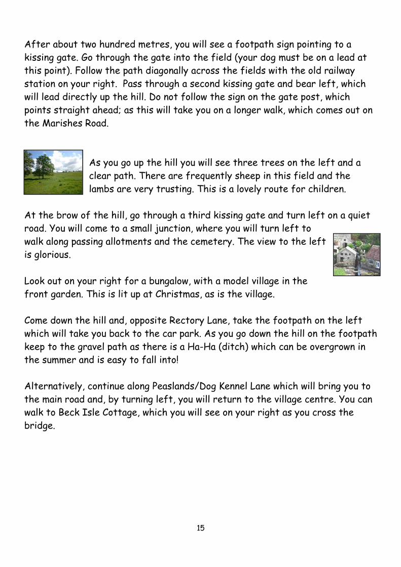
Look out on your right for a bungalow, with a model village in the
front garden. This is lit up at Christmas, as is the village.
Come down the hill and, opposite Rectory Lane, take the footpath on the left
which will take you back to the car park. As you go down the hill on the footpath
keep to the gravel path as there is a Ha-Ha (ditch) which can be overgrown in
the summer and is easy to fall into!
Alternatively, continue along Peaslands/Dog Kennel Lane which will bring you to
the main road and, by turning left, you will return to the village centre. You can
walk to Beck Isle Cottage, which you will see on your right as you cross the
bridge.
16