5.4.1.—human settlement and the natural regions of the ... · bulldozers came to prepare the land...
TRANSCRIPT

California Education and the Environment InitiativeStudent Edition
Human Settlement and the Natural Regions
of the Eastern Seaboard
History-Social Science Standard
5.4.1.
5

California Education and the Environment InitiativeApproved by the California State Board of Education, 2010
The Education and the Environment Initiative Curriculum is a cooperative endeavor of the following entities:California Environmental Protection Agency
California Natural Resources Agency
California State Board of Education
California Department of Education
Department of Resources Recycling and Recovery (CalRecycle)
Key Partners:Special thanks to Heal the Bay, sponsor of the EEI law, for their partnership
and participation in reviewing portions of the EEI curriculum.
Valuable assistance with maps, photos, videos and design was provided by the
National Geographic Society under a contract with the State of California.
Office of Education and the Environment1001 I Street • Sacramento, California 95814 • (916) 341-6769
http://www.CaliforniaEEI.org
© Copyright 2011 by the California Environmental Protection Agency© 2018 Third Edition
All rights reserved. This publication, or parts thereof, may not be used or reproduced without
permission from the Office of Education and the Environment.
These materials may be reproduced by teachers for educational purposes.

Lesson 1 Coast to Coast Connections: Settlement and Natural Resources
California Connections: Settling Temecula 2
Lesson 2 The Role of the Naturalist
None required for this lesson
Lesson 3 An Ocean of Services
None required for this lesson
Lesson 4 The Development of Colonial Economies
Colonial Economies 6
Lesson 5 Colonial Differences
None required for this lesson
Contents

2 CALIFORNIA EDUCATION AND THE ENVIRONMENT INITIATIVE I Unit 5.4.1. I Human Settlement and the Natural Regions of the Eastern Seaboard I Student Edition
Between Newport Beach and San Diego, there is a beautiful valley. It lies twenty-two miles from the ocean. Sunny days and cool nights have made this valley a favorable place to live. Over time, many different people have moved to this valley. It is a place with a mild climate, rich soil, and peaceful hills. In the valley, there is a small city. Its founders named it after an American Indian word meaning “where the Sun shines
through the mist.” They called the city, “Temecula.”
California Connections: Settling TemeculaLesson 1 | page 1 of 4
Settling Temecula
Temecula Valley sign
The desert valleys that lie east of Temecula are warm and dry. The warm air from the desert rises and pulls moist air from the coast inland to Temecula. The cool air keeps Temecula warm during the day but not hot. At night, it is cool but not often cold. It rains about eleven inches per year. Most rain falls in the winter months.
Settling the ValleyNative people have lived in
Temecula for thousands of years. The Pechanga Band of the Luiseño Indians moved there more than ten thousand years ago. They lived off the natural resources of the valley. They hunted deer and other game. They gathered plants, nuts, and seeds. In the fall, the Pechanga Band of Indians
collected different kinds of acorns from oak trees. They made a mush called weewish from these acorns. They also collected willow branches along the rivers. They used them to build huts for sleeping.
In 1769, Spanish padres
arrived in San Diego. They were looking for a new place to build a mission. The padres soon found this valley. Like the Pechanga Indians, they thought the valley was a good place to live. It had many natural resources. It had rich soil that they could

CALIFORNIA EDUCATION AND THE ENVIRONMENT INITIATIVE I Unit 5.4.1. I Human Settlement and the Natural Regions of the Eastern Seaboard I Student Edition 3
California Connections: Settling TemeculaLesson 1 | page 2 of 4
plant with wheat and other crops. There was plenty of water in its creeks and rivers. Soon, Temecula became an important agricultural center for the Spanish mission.
The First RanchoA Pechanga Indian named
Pablo Apis went to school at the mission. In 1821, Mexico took over California from Spain. Citizens could apply to get land for farming or ranching. This was called a land grant. Pablo applied for land of his own. He chose a few acres with soil good for farming. It was also close to his native village. The land had plenty of water. A creek
ran through the middle if it. Pablo called it Little Temecula Rancho. Rancho is the Spanish name for a large ranch.
Pablo built an adobe home for his family. He planted grains, grapes, and other fruits. He bought horses, cows, and sheep. Then he opened a store. The store was built at the crossroads of many emigrant trails. His store was a busy place where native people and settlers could buy food and other goods.
After America’s war with Mexico ended in 1848, the region became part of the United States of America.
Then more settlers moved to Temecula. The ways that people used the land changed. Two more stores opened up near Pablo’s family store. The stage coach even stopped at one of them. A post office opened. Pablo and his family continued to do well. They grew hay and food on their ranch which they sold in their store. More people moved in. There was enough business for everyone.
More People Come to the Valley
By 1880, Temecula was connected to the rest of the United States by the railroad. It brought even more people to Temecula. They came from the eastern United States and other countries. They soon outnumbered the American Indians in this area.
The United States government did not let the American Indians own just any land—mostly they wanted them to stay on land set aside by treaty. Many Pechanga Indians in this area left their homes. They moved to a small canyon. It also had plenty of
Aerial view of Temecula Valley

4 CALIFORNIA EDUCATION AND THE ENVIRONMENT INITIATIVE I Unit 5.4.1. I Human Settlement and the Natural Regions of the Eastern Seaboard I Student Edition
California Connections: Settling TemeculaLesson 1 | page 3 of 4
water. The people that moved there planted crops. They also took care of the land. This land would become the Pechanga Indian Reservation.
By 1900, the Vail family owned most of Temecula’s land. The family soon had a huge ranch. Over the years, the ranch grew even larger. By 1947, the Vail family ranch covered 87,000 acres. Land use in the valley changed once again. The Vails used the land for farming and ranching. The cowboys branded their cattle and horses with the shape of a heart. This was the symbol of their ranch.
After World War II, Orange County and San Diego County grew very fast. People from the larger cities
wanted quieter places to live and work. They wanted their homes to be near cities but not in them. The town of Temecula was a good choice.
Changes in the ValleyIn 1964, the Vail
Ranch was sold to a land development company. Cement trucks and bulldozers came to prepare the land for homes and buildings. Horses, cattle, and ranch hands moved out. The ranch was split into smaller pieces of land. Some of this land was bought and turned into small farms. Temecula soon became known for its vineyards and other crops. The weather there was perfect for growing grapes,
avocados, and citrus fruits.Interstate 15 (I-15) is a
highway that begins in San Diego. It connects California with states east and goes up through Montana, all the way to the Canadian border. It goes right through Temecula. Many people drive through this valley and some of them decide to stay.
The people in the town raised money in the 1980s to build baseball fields. President Ronald Reagan told the world about it in a speech. He said that he liked Temecula’s “volunteer spirit.” Then, even more people wanted to move to Temecula.
Temecula was a good place to raise children. Real estate agents saw this. They sold land for new family homes. They sold larger areas of land for stores and shopping malls. The town’s economy had changed. In 1989, Temecula became a city. Around 28,000 people lived there then.
Film and television businesses also found Temecula. The Outdoor Channel, on the Cable Network, is currently located there.Grapes

CALIFORNIA EDUCATION AND THE ENVIRONMENT INITIATIVE I Unit 5.4.1. I Human Settlement and the Natural Regions of the Eastern Seaboard I Student Edition 5
California Connections: Settling TemeculaLesson 1 | page 4 of 4
Continuing to GrowDuring the last twenty years,
Temecula has grown fast. It has been hard to keep track of how many people live there. In 2000, around 57,000 people lived there. By 2007, 97,935 people lived in the city. Land where crops grew is now used for roads, parking lots, and shopping malls. Natural resources are disappearing.
In spite of the changes, many people want to live in Temecula. Most people no longer use the plants and animals for food, clothing, and housing. But, people still like the nature of the place. They enjoy the quiet valley with its good climate and rich soil. They come to Temecula for other reasons as well.
The Pechanga Indian leaders watched Temecula grow. Their people shared land and water with those who came to live in the valley. A few years ago, a federal law gave 303 acres to the Pechanga people. The tribe has the right to use this land how they want. The City of Temecula has its own ideas about how the land should be used. Both the Pechanga leaders and
the City of Temecula want the economy to grow. They know that Temecula’s future depends on the decisions they make today.
Temecula Valley strawberries

6 CALIFORNIA EDUCATION AND THE ENVIRONMENT INITIATIVE I Unit 5.4.1. I Human Settlement and the Natural Regions of the Eastern Seaboard I Student Edition
ATLANTICOCEAN
Miles
0 125 250
N
S
EW
Boston
Colonial EconomiesLesson 4 | page 1 of 13
MassachusettsJohn Winthrop began the
colony of Massachusetts in 1630. The first town was built along the Charles River. This town became the city of Boston. The weather in Massachusetts is very cold in the winter. Early colonists had to build warm houses right away to survive. They used the oak and pine trees in the area to build wooden houses. They also used them to repair their ships.
With rocky soil and a short growing season, farming was difficult in this colony. So, the colonists had to find ways to make money so they could buy or trade for the food they needed. They decided to use the wood (timber) from the trees around them. They began to use much of this timber to make siding, house frames, and ship building supplies. The first trading ship that left Boston for Europe carried some beaver pelts, but the rest of the ship was filled to overflowing with “clap board” siding made from Massachusetts’ trees.
Wood was an important resource for early colonists for another reason. People in the Massachusetts burned wood to heat their homes. A single family might burn 40 cords of wood in a year. That’s a wood pile four feet high, two feet deep, and over 300 feet long! Between what they were cutting for building, heating, and to trade, the land in Massachusetts very quickly changed as the original forests were cut down.
The native animals were very important to the colonists, too. They traded
with American Indians for beaver furs. These furs were sold to people in Europe to make hats and coats. The colonists also fished in the ocean. The fish was salted and dried, and then traded with other colonies for other foods. The bays of Massachusetts were good harbors for ships, which made trade easy.

CALIFORNIA EDUCATION AND THE ENVIRONMENT INITIATIVE I Unit 5.4.1. I Human Settlement and the Natural Regions of the Eastern Seaboard I Student Edition 7
Colonial EconomiesLesson 4 | page 2 of 13
New HampshireThis colony was originally
part of the colony of Massachusetts. In 1623, Captain John Mason from England asked the king of England for permission to begin the colony of New Hampshire. He wanted it to be a fishing colony. The king separated New Hampshire from Massachusetts in 1671, but Captain Mason died before he ever saw it.
New Hampshire had only a very small area of coastline with the Atlantic Ocean, but most of the colonists settled there in a town called Little Harbor. Many of the people that came to settle the colony were from Scotland. They were fisherman, shipbuilders, and traders. They also were skilled weavers. Some brought their spinning wheels and looms with them. New Hampshire soon became famous for its wool cloth.
The soil of New Hampshire is rocky and the growing season is very short. The people in New Hampshire had small
family farms and grew small amounts of potatoes, corn, and beans. They used the wood from the forests of pine and oak trees to build houses and ships. Cranberries grew near these forests, and although they were new to the colonists, the people of New Hampshire soon learned to use them and harvest them to trade.
Many animals lived in the forests of this area. Colonists
in New Hampshire made money by trading with American Indians for beaver and otter furs. They traded the furs to people in Europe to be made into hats and coats. The many rivers in the area helped move people and goods from inland to the sea.
ATLANTICOCEAN
Miles
0 125 250
N
S
EW
Little Harbor

8 CALIFORNIA EDUCATION AND THE ENVIRONMENT INITIATIVE I Unit 5.4.1. I Human Settlement and the Natural Regions of the Eastern Seaboard I Student Edition
Colonial EconomiesLesson 4 | page 3 of 13
Rhode IslandTwo colonists, Roger
Williams and Anne Hutchinson, were thrown out of the Massachusetts colony for speaking out against the church there. They founded the “Providence Plantations” in 1636, which later became the colony of Rhode Island. It was the only colony that promised freedom of religion to any one that settled there. It also did not allow slavery. The main town was Portsmouth.
Rhode Island was a very small colony, but had a lot of coastline. There are also many small islands off the coast on which the colonists settled. People in Rhode Island fished a lot. They mostly caught and ate codfish. They traded codfish for other things they needed.
The land in Rhode Island is flat, but the soil is rocky. The weather is cold in the winter and the growing seasons are short. Farms were small, and grew just enough food to feed the people living in the colony. American Indians from the Narragansett nation were
friends with the colonists of Rhode Island and taught the colonists how to grow corn, squash, and beans on the land. When other colonies got in arguments with the American Indian nations, the leaders of Rhode Island would try to help settle the arguments peacefully.
There were plenty of forests in the area where Rhode Island was founded. The trees were used to build ships. Rhode Island soon became famous for shipbuilding. There are also
many streams and rivers in the northeast and the colonists in Rhode Island used them for power. People built mills with water wheels over the rivers to grind corn and wheat into f lour. Many of the other colonies around Rhode Island did this, too.
ATLANTICOCEAN
Miles
0 125 250
N
S
EW
Portsmouth

CALIFORNIA EDUCATION AND THE ENVIRONMENT INITIATIVE I Unit 5.4.1. I Human Settlement and the Natural Regions of the Eastern Seaboard I Student Edition 9
Colonial EconomiesLesson 4 | page 4 of 13
ConnecticutEnglish colonists settled the
River Colony— later called, Connecticut— in 1636. The Connecticut River that ran through the middle of the colony helped the colonists go places and trade with the colonists in Massachusetts. They also used the river for water, which allowed them to grow some crops. The first main town in the colony was Saybrook, located where the Connecticut river meets the ocean.
One of the things the colonists used to trade in the early 1600s was wampum that they acquired from the Wampanoag Indians of coastal Massachusetts. Wampum was the “mother of pearl” inside of oyster shells that the Indians made into beads. The beads were used like “money” in the colonies until coins began to be used in the 1660s.
The colonists would acquire the wampum through trade with the Wampanoag, and take it inland to trade with other tribes for beaver and otter furs. As a natural resource,
wampum was important. It was only found on the coast in that area, so the colonists fought a war with the Pequot Indians to get control of the land there. During the war, almost all the Pequot Indians were killed.
The colonists had small farms, because the growing season was short in Connecticut and the soil was rocky. They could not grow enough crops to sell, so they traded other natural resources instead. The Connecticut colonists traded the furs with
people in England. People in England turned the furs into hats and coats. The colonists also built ships and houses, using wood from the forests around them. People in Connecticut spent a lot of time fishing. They also sailed to other colonies to trade.
ATLANTICOCEAN
Miles
0 125 250
N
S
EW
Saybrook

10 CALIFORNIA EDUCATION AND THE ENVIRONMENT INITIATIVE I Unit 5.4.1. I Human Settlement and the Natural Regions of the Eastern Seaboard I Student Edition
Colonial EconomiesLesson 4 | page 5 of 13
New YorkNew York was founded in
1625 by colonists from Holland. But after five years, only 300 people had moved there, mostly onto Manhattan Island. The Dutch West India Company offered large pieces of free land to anyone 15 years-old or older who would come over and settle in the colony. The Company wanted to make the colony the fur-trading center of the world. Soon, the people began farming on their large pieces of land and more colonists arrived from Europe. The main city was New Amsterdam.
The Dutch fought many bloody battles with the Algonquin Indians for control over the land and the fur trade. The colony was taken over by the English in 1674 and renamed “New York” after the Duke of York, who was the brother of the king of England.
Even in colonial times, New York was home to more people than any other settlement on the eastern seaboard. Settlers from Holland, Sweden, England, Scotland, Ireland,
Germany, Norway, Poland, and Portugal came to New York.
The soil of New York was good for farming. Wheat grew well there. Colonists traded timber, furs, fish, and wheat at the many ports all around the coast of Manhattan Island. The Hudson River was the most important river to the colonists. It ran through the middle of the colony on the mainland, connecting Manhattan Island
to the resources inland. The American Indians had taught the colonists how to grow the
“Three Sisters”—squash, corn, and beans. This was important knowledge because when these three vegetables are eaten together as a regular part of the diet, they are extremely nutritious, helping the colony survive.
ATLANTICOCEAN
Miles
0 125 250
N
S
EW
Manhattan
CALIFORNIA EDUCATION AND THE ENVIRONMENT INITIATIVE I Unit 5.4.1. I Human Settlement and the Natural Regions of the Eastern Seaboard I Student Edition 11
ATLANTICOCEAN
Miles
0 125 250
N
S
EW
Philadelphia
Colonial EconomiesLesson 4 | page 6 of 13
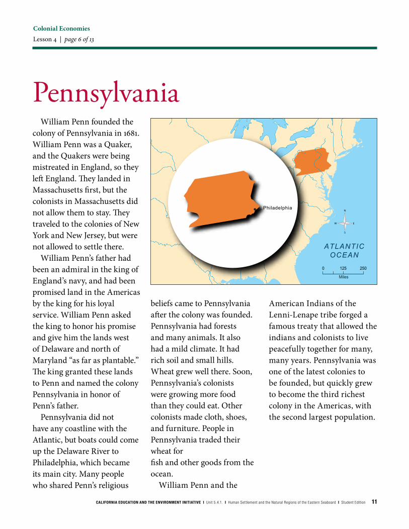
PennsylvaniaWilliam Penn founded the
colony of Pennsylvania in 1681. William Penn was a Quaker, and the Quakers were being mistreated in England, so they left England. They landed in Massachusetts first, but the colonists in Massachusetts did not allow them to stay. They traveled to the colonies of New York and New Jersey, but were not allowed to settle there.
William Penn’s father had been an admiral in the king of England’s navy, and had been promised land in the Americas by the king for his loyal service. William Penn asked the king to honor his promise and give him the lands west of Delaware and north of Maryland “as far as plantable.” The king granted these lands to Penn and named the colony Pennsylvania in honor of Penn’s father.
Pennsylvania did not have any coastline with the Atlantic, but boats could come up the Delaware River to Philadelphia, which became its main city. Many people who shared Penn’s religious
beliefs came to Pennsylvania after the colony was founded. Pennsylvania had forests and many animals. It also had a mild climate. It had rich soil and small hills. Wheat grew well there. Soon, Pennsylvania’s colonists were growing more food than they could eat. Other colonists made cloth, shoes, and furniture. People in Pennsylvania traded their wheat for fish and other goods from the ocean.
William Penn and the
American Indians of the Lenni-Lenape tribe forged a famous treaty that allowed the indians and colonists to live peacefully together for many, many years. Pennsylvania was one of the latest colonies to be founded, but quickly grew to become the third richest colony in the Americas, with the second largest population.
12 CALIFORNIA EDUCATION AND THE ENVIRONMENT INITIATIVE I Unit 5.4.1. I Human Settlement and the Natural Regions of the Eastern Seaboard I Student Edition
ATLANTICOCEAN
Miles
0 125 250
N
S
EW
Elizabethtown
Colonial EconomiesLesson 4 | page 7 of 13
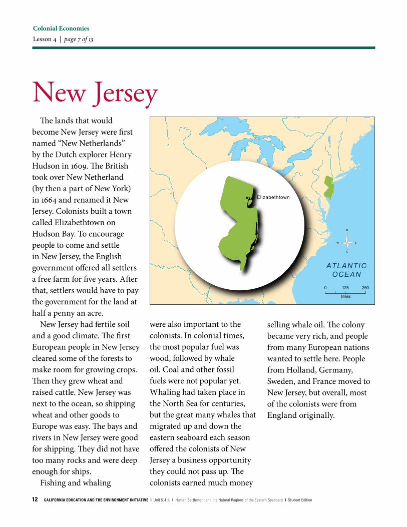
New JerseyThe lands that would
become New Jersey were first named “New Netherlands” by the Dutch explorer Henry Hudson in 1609. The British took over New Netherland (by then a part of New York) in 1664 and renamed it New Jersey. Colonists built a town called Elizabethtown on Hudson Bay. To encourage people to come and settle in New Jersey, the English government offered all settlers a free farm for five years. After that, settlers would have to pay the government for the land at half a penny an acre.
New Jersey had fertile soil and a good climate. The first European people in New Jersey cleared some of the forests to make room for growing crops. Then they grew wheat and raised cattle. New Jersey was next to the ocean, so shipping wheat and other goods to Europe was easy. The bays and rivers in New Jersey were good for shipping. They did not have too many rocks and were deep enough for ships.
Fishing and whaling
were also important to the colonists. In colonial times, the most popular fuel was wood, followed by whale oil. Coal and other fossil fuels were not popular yet. Whaling had taken place in the North Sea for centuries, but the great many whales that migrated up and down the eastern seaboard each season offered the colonists of New Jersey a business opportunity they could not pass up. The colonists earned much money
selling whale oil. The colony became very rich, and people from many European nations wanted to settle here. People from Holland, Germany, Sweden, and France moved to New Jersey, but overall, most of the colonists were from England originally.

CALIFORNIA EDUCATION AND THE ENVIRONMENT INITIATIVE I Unit 5.4.1. I Human Settlement and the Natural Regions of the Eastern Seaboard I Student Edition 13
ATLANTICOCEAN
Miles
0 125 250
N
S
EW
Fort Christina
Colonial EconomiesLesson 4 | page 8 of 13
DelawareThe land that became the
colony of Delaware was some of the most fought over in all the 13 colonies. The area had a great river (the Delaware), a large bay (the Delaware), and a valley with very good soil for farming. American Indians had lived there for centuries.
It was first claimed by the Dutch (1631), then by the Swedes (1638), and then by the English, in 1664. In 1681, Delaware was given to William Penn, the founder of Pennsylvania, but in 1701 it became its own, separate colony. Colonists from Sweden were the first to build a town there, called Fort Christina. Fort Christina was renamed Wilmington when Delaware was part of Pennsylvania, in honor of Pennsylvania’s leader, William Penn. The colony did not get the official name “Delaware” until 1776. Wilmington became a very important city during the Revolutionary War.
The colonists in Delaware built some of the first log cabins in America, using
timber from the many forests there. Many German farmers settled the land, clearing some of the forest so that they could grow crops, like wheat. Delaware was one of the smallest colonies, but it is next to the Atlantic Ocean. Most of the colonists came to depend on the ocean for survival. Some colonists hunted whales for their oil. They used the whale oil as fuel, to light lamps.
They also traded and sold whale oil to other colonies and to Europe. Delaware’s colonists sold, ate, and traded fish and harvested trees for their wood. They used the wood to build fishing boats and homes.

14 CALIFORNIA EDUCATION AND THE ENVIRONMENT INITIATIVE I Unit 5.4.1. I Human Settlement and the Natural Regions of the Eastern Seaboard I Student Edition
ATLANTICOCEAN
Miles
0 125 250
N
S
EW
St. Mary’s
Colonial EconomiesLesson 4 | page 9 of 13
MarylandThe founder of Maryland
was George Calvert, also known as Lord Baltimore. He had visited the colony of Virginia and was angered by the fact that the colonists in Virginia did not practice the Catholic religion. He asked King Charles for a large piece of land in the Americas, north of the Potomac river, which he promised to name Maryland, after the Queen of England (Henrietta Maria). Lord Baltimore died before the king gave him the land. His son, who became the second Lord Baltimore, was given the land by the king. All the king asked is that he be given one-fifth of any profit that the colony made from the goods and resources produced there.
However, some of the land that the king gave Lord Baltimore had already been settled (in Pennsylvania and Delaware). As the first settlers arrived in Maryland in 1634, fights broke out between the leaders of Pennsylvania, Virginia, Delaware, Lord Baltimore, and the king. Still,
the colony did well and the town of St. Mary’s was built on a small island where the Potomac River meets the Chesapeake Bay. The colony promised freedom of religion to anyone who came there.
Colonists in Maryland grew tobacco in the rich soil. Most of the tobacco was sent to Europe. Wheat and corn grew well there, too. Most people in Maryland lived on large farms called, “plantations.” People raised cattle, hogs, and chickens for food and trade. American Indians
traded the skins and pelts of beavers, otters, muskrats, raccoons, and wildcats with the colonists. The colonists sent most of these furs and skins to Europe. There were many rivers in the area of Maryland, which made moving goods and people easy. The Chesapeake Bay was an excellent harbor for ships.
CALIFORNIA EDUCATION AND THE ENVIRONMENT INITIATIVE I Unit 5.4.1. I Human Settlement and the Natural Regions of the Eastern Seaboard I Student Edition 15
Colonial EconomiesLesson 4 | page 10 of 13
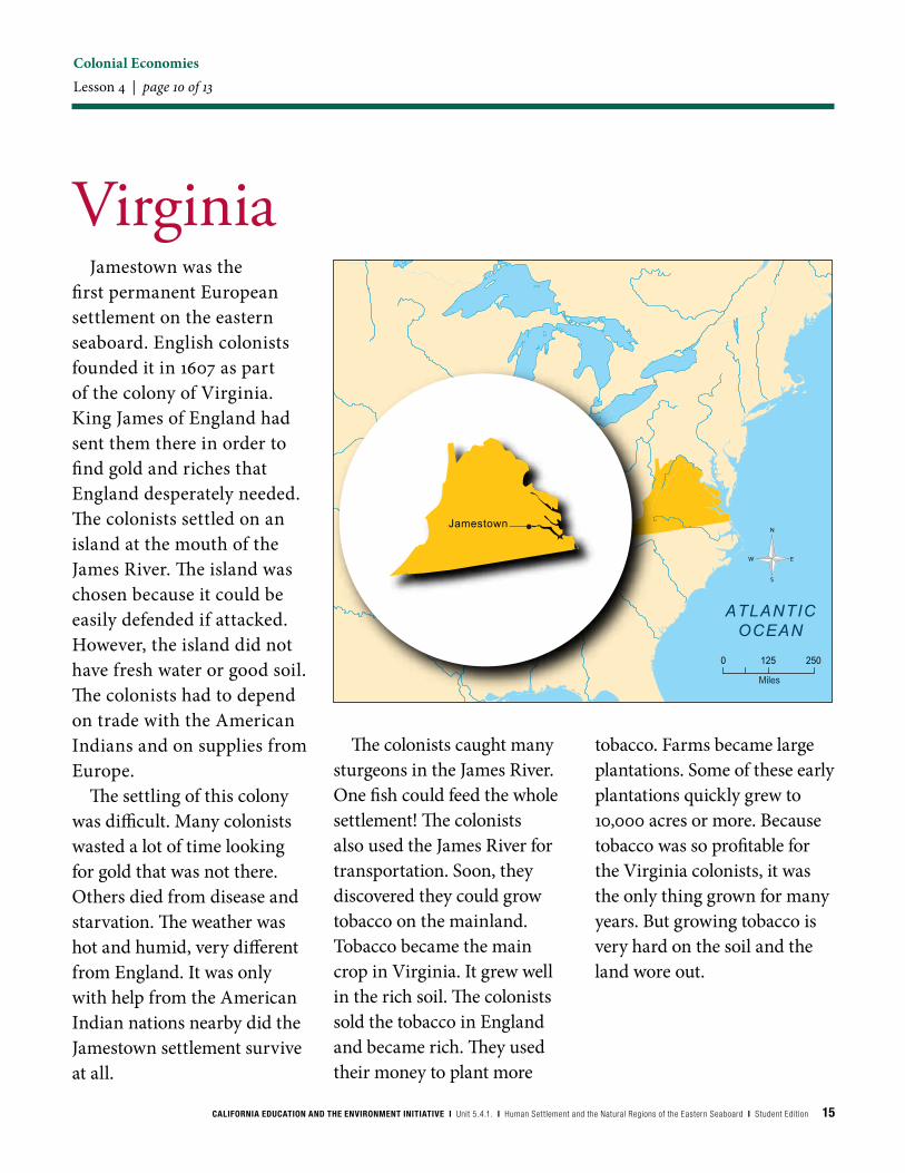
VirginiaJamestown was the
first permanent European settlement on the eastern seaboard. English colonists founded it in 1607 as part of the colony of Virginia. King James of England had sent them there in order to find gold and riches that England desperately needed. The colonists settled on an island at the mouth of the James River. The island was chosen because it could be easily defended if attacked. However, the island did not have fresh water or good soil. The colonists had to depend on trade with the American Indians and on supplies from Europe.
The settling of this colony was difficult. Many colonists wasted a lot of time looking for gold that was not there. Others died from disease and starvation. The weather was hot and humid, very different from England. It was only with help from the American Indian nations nearby did the Jamestown settlement survive at all.
The colonists caught many sturgeons in the James River. One fish could feed the whole settlement! The colonists also used the James River for transportation. Soon, they discovered they could grow tobacco on the mainland. Tobacco became the main crop in Virginia. It grew well in the rich soil. The colonists sold the tobacco in England and became rich. They used their money to plant more
tobacco. Farms became large plantations. Some of these early plantations quickly grew to 10,000 acres or more. Because tobacco was so profitable for the Virginia colonists, it was the only thing grown for many years. But growing tobacco is very hard on the soil and the land wore out.
ATLANTICOCEAN
Miles
0 125 250
N
S
EW
Jamestown

16 CALIFORNIA EDUCATION AND THE ENVIRONMENT INITIATIVE I Unit 5.4.1. I Human Settlement and the Natural Regions of the Eastern Seaboard I Student Edition
Colonial EconomiesLesson 4 | page 11 of 13
North CarolinaNorth Carolina might have
been the first of the English colonies to be founded in the Americas, but a storm blew the colonists away from North Carolina and to the James River, where Jamestown and Virginia became the first English settlement and colony. Instead, North Carolina was established in 1653 by settlers that left the Virginia colony. They settled the area of Clarendon on the Cape Fear River.
Many large rivers and swamps ran through this colony that was next to the Atlantic Ocean. The weather was hot and humid. There were many hickory and oak trees in the forest. Pigs and deer ate the nuts and acorns from the trees. Colonists hunted and trapped these animals for food and for skins.
People also used the trees of the area for lumber and their sap. The sap was collected and boiled, becoming “tar.” The tar was a very sticky substance that, when cooled, was waterproof. Shipbuilders used
tar from North Carolina to stop leaks between the planks of wood. The colonists that collected the sap and made the tar were called “tar heels” because of the tar that stuck to their shoes. Even today, people from North Carolina are called
“Tar Heels.”Colonists grew many
crops in North Carolina’s fertile soil. Rice grew very well in the wet, swampy areas. The colonists traded tobacco and rice mainly
with other colonies, rather than with Europe. Farmers in the colony also grew indigo. Indigo is a plant that produces a dark blue dye, used to color cloth. Large farms, known as plantations, that grew indigo and rice developed in North Carolina.
ATLANTICOCEAN
Miles
0 125 250
N
S
EWClarendon
CALIFORNIA EDUCATION AND THE ENVIRONMENT INITIATIVE I Unit 5.4.1. I Human Settlement and the Natural Regions of the Eastern Seaboard I Student Edition 17
Colonial EconomiesLesson 4 | page 12 of 13
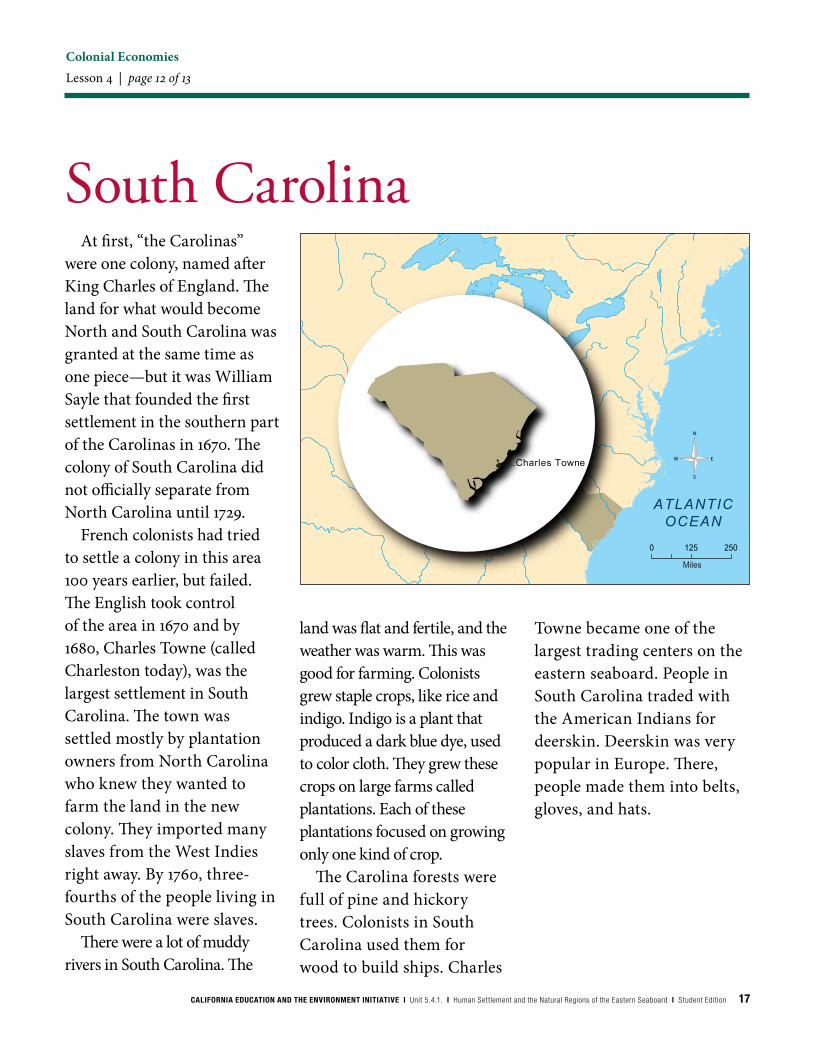
South CarolinaAt first, “the Carolinas”
were one colony, named after King Charles of England. The land for what would become North and South Carolina was granted at the same time as one piece—but it was William Sayle that founded the first settlement in the southern part of the Carolinas in 1670. The colony of South Carolina did not officially separate from North Carolina until 1729.
French colonists had tried to settle a colony in this area 100 years earlier, but failed. The English took control of the area in 1670 and by 1680, Charles Towne (called Charleston today), was the largest settlement in South Carolina. The town was settled mostly by plantation owners from North Carolina who knew they wanted to farm the land in the new colony. They imported many slaves from the West Indies right away. By 1760, three-fourths of the people living in South Carolina were slaves.
There were a lot of muddy rivers in South Carolina. The
land was flat and fertile, and the weather was warm. This was good for farming. Colonists grew staple crops, like rice and indigo. Indigo is a plant that produced a dark blue dye, used to color cloth. They grew these crops on large farms called plantations. Each of these plantations focused on growing only one kind of crop.
The Carolina forests were full of pine and hickory trees. Colonists in South Carolina used them for wood to build ships. Charles
Towne became one of the largest trading centers on the eastern seaboard. People in South Carolina traded with the American Indians for deerskin. Deerskin was very popular in Europe. There, people made them into belts, gloves, and hats.
ATLANTICOCEAN
Miles
0 125 250
N
S
EWCharles Towne

18 CALIFORNIA EDUCATION AND THE ENVIRONMENT INITIATIVE I Unit 5.4.1. I Human Settlement and the Natural Regions of the Eastern Seaboard I Student Edition
Colonial EconomiesLesson 4 | page 13 of 13
GeorgiaThe colony of
Georgia was the last of the 13 Colonies to be founded. An Englishman, named James Oglethorpe, wanted to give prisoners in England a chance to start a new life. He asked the King of England for land in the Americas and was granted the area south of the Carolinas. Oglethorpe named the colony Georgia, after King George II, and sailed with 35 families to the colony in 1733. They founded the first settlement in the colony, Savannah, where the river meets the ocean.
The soil in Georgia was very fertile. The land was mostly f lat, with low, rolling hills. The weather was hot and humid, which created a long growing season, but organisms that caused diseases also liked the Georgia climate. Many colonists got sick and died shortly after arriving to the colony.
At first, the colonists in Georgia tried to grow crops like grapes for making wine,
and silkworms for making silk. Soon, farmers started to grow staple crops like rice and indigo to trade. Indigo is a plant that produces a dark blue dye, used to color cloth. The colonists also grew sugar cane. In the West Indies sugar cane was also grown and much of it was made into rum. At first, the colonists of Georgia were not allowed to make rum from the sugar they grew. Later, that law was changed, as was the law about not having slaves in the Georgia colony.
Colonists in Georgia also
depended on timber from trees like the Eastern white pine, to trade. The forests in Georgia were not as large as those in the north, and Georgia quickly ran out of trees. Most of the colonists began farming full time, on large farms called, “plantations.” They imported slaves to work on the plantations. By 1776, over half of the people in Georgia were slaves.
ATLANTICOCEAN
Miles
0 125 250
N
S
EW
Savannah


California Education and the Environment InitiativePrinted on post-consumer recycled paper541SE