4p v ui xf mm $p n n v o juz3ftjmjfodf )boecppl
TRANSCRIPT

How can I be resilient?page 7
Community Resilienceand Emergency Planpage 9
Looking after Southwellpage 13
What do I do in anemergency?page 18
Road Closure Mappage 10
SouthwellCommunity Resilience Handbook

I was delighted to be invited to join the Southwell FloodForum as Chair in September 2015. This dynamic andinfluential community action group was formed followingthe major flood in July 2013. It’s a challenge I welcome,especially to continue the hard work of Co-Chairs RobJordan and Mark Bertolini with the dedicated coreteam and highly motivated volunteers who have put inthousands of hours.
We have collated survey information; harnessed thevaluable local technical expertise to support the floodconsultants; campaigned and lobbied Government,Local Authorities and national agencies and wereinstrumental in obtaining the Repair and Renew Grant.Volunteers worked hard to clear watercourses after the2013 flood which was much appreciated by riparianowners and resulted in much improved flow.
We are determined to achieve the outcome thatSouthwell needs and deserves – a mitigation schemethat makes us less vulnerable to flooding.
The safety of Southwell depends on community andpersonal resilience. We must ‘be ready to act, respondand recover’ when an emergency happens.
Southwell is a vibrant community with wide-rangingskills and people who are interested in maintaining ourbeautiful environment and historic town. Furthermore,alongside the Forum is a committed and supportiveTown Council.
We have produced this Handbook for you to keep forfuture reference. We hope you find it a useful resource,which leads you to a range of websites (highlightedin blue) with further information. Some weblinkshave been shortened (with a ‘goo’ preface) for yourconvenience.
Please help us to support a Resilient Southwell – we,our families and visitors will all benefit.
Tim FarrSouthwell Flood ForumCo-Chair
2 Community Resilience Handbook
Forewords
Emergencies happen! At timesthere may be an emergency butyour life is not in danger, so it iscrucially important for everyone tobe prepared for any local situationwhich might occur.
Everyone needs to have the confidence to be able todeal with these events and also to take responsibilityfor their own property and personal safety as well beinggood neighbours to others who may need help.
Whilst Southwell Town Council has no statutoryauthority and no funding to deal with emergencies, it isthe body which represents, supports and listens to thewhole community. As such, it has given considerablebacking and assistance to Southwell Flood Forumsince its formation. The Town Council has workedtogether with the Forum on this Community ResilienceHandbook, which includes a list of emergency contactnumbers.
Beryl PrenticeSouthwell Town CouncilChairman 2015-16
“Some good things haveundoubtedly come out of thefloods, particularly in Southwell,which I hope gives a glimmer ofhope to other communities. Thatcommunity was brought togetherwonderfully by those events. Avery important and award-winningflood forum was founded.”Robert Jenrick MP for Newark
SOUTHWELLTOWN COUNCIL

Community Resilience Handbook 3
Jargon Buster
From Flood to Resilience
What is Community Resilience...
... and what does it mean for me?
Understanding weather
Community Resilience Emergency Plan
Road Closure Map
Road Closure Scheme
Looking after Southwell
“The Academic View” - University of Nottingham
Emergency Services
Responsibilities of Local Authorities and Agencies
Flood Mitigation
SuDS
Natural Flood Management
“The Academic View” - Nottingham Trent University
Care of Watercourses
What to do in an emergency
Quick Emergency Guide
Acknowledgements and Web Site Links
4
5
6
7
8
9
10
12
13
13
14
15
16
16
17
17
18
18
19
Back Page
Contents

Flood Mitigation
4 Community Resilience Handbook
Balancing pondA pond designed to attenuateflows by storing runoff duringheavy rainfall and releasing it at acontrolled rate during and after therainstorm to slow the passage ofwater downstream.
Bow waveWave caused by a vehicle drivingthrough water.
Bund (for flood alleviation)A raised bank built along contourlines mostly on agricultural land tocollect and slow down surface waterrunoff, increase water infiltrationand prevent soil erosion.
CatchmentBasin-shaped area from whichsurface and subsurface water flowsinto watercourses and collects inthe lowest area downstream.
Cost benefitThe overall value for money of aproject or scheme.
CulvertA channel or pipe that carries waterbelow ground level.
Resilience is not just about flooding - however flooding is one emergency for which we can takesteps to alleviate. Here’s a guide to flood-related terminology.
ExceedanceThe amount by which the capacityof a drainage system carryingstorm water (including the result ofa blockage to an inlet) has beenexceeded.
Fluvial floodingFlooding from a river or watercourse
Flood Risk Assessment (FRA)Required for development in aFlood Zone. May include floodmodelling, testing of strategies anddesigns to mitigate flood risk andflood response plans.goo.gl/OROX7q
Flood ZoneZones 1 to 3 numbered on the basisof areas with a likelihood of floodingfrom rivers and the sea at anylocation and based on the presenceand effect of all flood defences,predicted flood levels, and groundlevels. goo.gl/VvoFCq
French drainA trench filled with gravel or rockor containing a perforated pipethat redirects surface water andgroundwater away from an area.
GripShallow ditch connecting the roadedge to a roadside ditch to drainrain water from the highway.
GulliesGrating grids in tarmac/hardsurface (horizontal) to drain roads/pavements.
Flood MitigationA scheme designed to manage andreduce flood risk.
Neighbourhood PlanThis plan describes how muchand what sort of land developmentshould happen and in broad termswhere this should take place. Itincludes policies that define thedevelopment it will or will notsupport.
OffletsVertical drainage inlets in kerbs.
Surface waterSurface water collects on thesurface of the ground. Localisedflooding may occur when rainwaterdoes not drain away throughdrainage systems or soak into theground. Depends on the relationshipbetween hard, impermeable andsoft or permeable surfaces, thestate of the watercourses and‘health’ of the drainage system.
SwaleShallow, broad and vegetatedchannels designed to store and/or convey runoff and removepollutants.
Jargon Buster

Community Resilience
Community Resilience Handbook 5
The ‘Supporting a Resilient Southwell’ campaign aimsto raise awareness of how we personally and as a towncan improve our ability to withstand and recover fromadversity - be prepared, able to cope and reduce theimpact of an emergency.
The Southwell Flood Forum, affiliated to the NationalFlood Forum, set out to harness the town’s energy andcapacity to provide local experience and knowledge tothe Southwell Flood Mitigation Plan.
After attending the National Flood Forum Pathfinderconference in March 2014, we realised we were alreadydeveloping community resilience through the work onthe Community Resilience Emergency Plan (page 9).
Flooding is a risk our town has experienced andcontinues to face – one that the Southwell MitigationPlan seeks to reduce (page 16). However, as well assome residual flood risk, we may still be vulnerable toother emergencies, such as power cuts, water pollution,heavy snow etc.
It has been a steep learning curve from flood toresilience. We are volunteers, with wide-ranging skillsand experience and support from authorities andagencies.
We invite everyone to join in and continue in the samespirit that motivated the wider community particularly inthe months after the 2013 flood.
Comments and questions [email protected].
There is more information on our website aboutarticles in this Handbook.www.southwellfloodforum.org.uk
Flood23.7.13
Watercourseclearance
27.7.13 - 25.5.14
SFF formed9.8.13
Public meeting,volunteers recruited
10.9.13
First EmergencyPlanning Meeting
21.10.13
First Warden training26.11.13
Community ResilienceDrop-in event
18.6.14
Refresher training26.4.15
Road Closure Dry Run17.5.15
Communications HubDry Run31.1.16
CommunityResilience Day
15.5.16
How we arrivedat Resiliencefrom Flooding
Community Resilience
6 Community Resilience Handbook
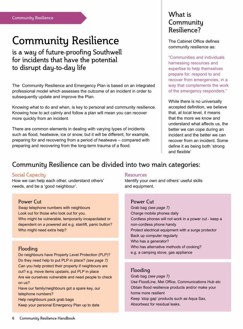
The Community Resilience and Emergency Plan is based on an integratedprofessional model which assesses the outcome of an incident in order tosubsequently update and improve the Plan.
Knowing what to do and when, is key to personal and community resilience.Knowing how to act calmly and follow a plan will mean you can recovermore quickly from an incident.
There are common elements in dealing with varying types of incidentssuch as flood, heatwave, ice or snow, but it will be different, for example,preparing for and recovering from a period of heatwave – compared withpreparing and recovering from the long-term trauma of a flood.
Community Resilience can be divided into two main categories:Social CapacityHow we can help each other, understand others’needs, and be a ‘good neighbour’.
FloodingDo neighbours have Property Level Protection (PLP)?Do they need help to put PLP in place? (see page 7)Can you help protect their property if neighbours areout? e.g. move items upstairs, put PLP in placeAre we ourselves vulnerable and need people to checkon us?Have our family/neighbours got a spare key, ourtelephone numbers?Help neighbours pack grab bagsKeep your personal Emergency Plan up to date
ResourcesIdentify your own and others’ useful skillsand equipment.
FloodingGrab bag (see page 7)Use FloodLine, Met Office, Communications Hub etcObtain flood resilience products and/or make yourhome more resilientKeep ‘stop gap’ products such as Aqua Sax,Absorbeez for residual leaks.
What isCommunityResilience?
The Cabinet Office definescommunity resilience as:
“Communities and individualsharnessing resources andexpertise to help themselvesprepare for, respond to andrecover from emergencies, in away that complements the workof the emergency responders.”
While there is no universallyaccepted definition, we believethat, at local level, it meansthat the more we know andunderstand what affects us, thebetter we can cope during anincident and the better we canrecover from an incident. Somedefine it as being both ‘strongand flexible’
Community Resilienceis a way of future-proofing Southwellfor incidents that have the potentialto disrupt day-to-day life
Power CutGrab bag (see page 7)Charge mobile phones dailyCordless phones will not work in a power cut - keep anon-cordless phone handyProtect electrical equipment with a surge protectorBack up computer regularlyWho has a generator?Who has alternative methods of cooking?e.g. a camping stove, gas appliance
Power CutSwap telephone numbers with neighboursLook out for those who look out for you.Who might be vulnerable, temporarily incapacitated ordependent on a powered aid e.g. stairlift, panic button?Who might need extra help?

Knowing yourneighbours createsa sociable, safe andsupportive street
How will people in your street worktogether before, during and after anincident?Who’s a First aider? Who hasalternative cooking facilities, a spareroom?Consider those who may need help.
Thinking aheadsaves time
Work through ‘in case of’ scenarios- emergency childcare, fetchingchildren from school, pet care, planyour route according to the NCConline gritting map, where to moveyour car to safety in the event of aflood.
Consider what you mayneed to do and in whatorder, depending onthe type of emergency- heatwave, snow andice, power cut, flooding,fire.
Bear in mind thathyperthermia andhypothermia can affectolder people and youngchildren very quickly.
If you have a particular medicalcondition, ensure your grab bagcontains necessary medication. Ifyou are medically dependent onelectricity (e.g. on dialysis) or arevulnerable, ensure you register ontoWestern Power’s Priority ServiceRegister.
Planning ahead saves a panic
Make a household emergency plan including any contingencyarrangements if you rely on services or aid e.g. homecare, childcare,stairlift, panic button. See suggested plans:• NCC - goo.gl/46m0mc• Fire Service - www.notts-fire.gov.uk• Police - www.nottinghamshire.police.uk/advice/planning• Local Resilience Forum - goo.gl/RHs7Bv• Western Power - goo.gl/htR6qb
Prepare a list of useful important phone numbers e.g. emergency services,insurance company, office, radio station frequency, family and neighbours,surgery, your local Road Closure Lead Warden if appropriate (see page 11).
Know how to turn off your gas, electricity and water. Mark taps or switcheswith stickers. Keep a non-cordless phone handy in case of a power cut.
Sign up for flood alerts, weather warnings; download the British Red CrossEmergency App
If you are in a flood risk area, make sure your insurancecovers flooding. See Flood Re www.floodre.co.uk
Grab bag – what you need in case youhave to be away from home for a fewdays. Check and update contentsannually – e.g. when your insuranceis renewed. Keep in a safe place.
Don’t overload it – you need to beable to carry it.
House protection - If you are ina flood risk area, consider floodresilient products or making your
home more flood resilient – seewww.bluepages.org.uk.
Sandbags should only be considered as alast resort. They are bulky to store, heavy
to handle and once contaminated have to bedisposed of correctly. NSDC only distribute them in certain
circumstances according to strict criteria – www.newark-sherwooddc.gov.uk/sandbags. The EA advise “...sandbags are relatively ineffective whencompared with purpose-designed flood protection products”.
There are other products such as Aqua Sax, Flood Sax, Absorbeez whichare easy to store and handle, although they too have to be disposed ofcorrectly after an event.
Community ResilienceWhat Community Resiliencemeans for me.
Community Resilience Handbook 7
Torch - wind-up/battery,spare batteries, whistle
Radio - wind-up/battery, sparebatteries
Warm waterproofclothing
Keys, cash/creditcards, copies ofinsurance documentsand emergency planin a waterproof wallet
First aid, medication,sanitary and toiletryitems
Notebook andpen/pencil
Mobile phone chargerWater, non-perishable snacks
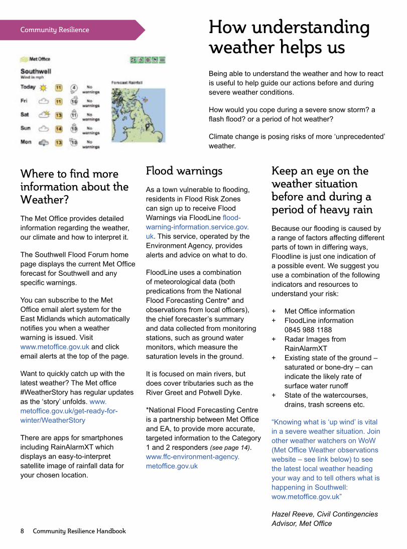
Where to find moreinformation about theWeather?
The Met Office provides detailedinformation regarding the weather,our climate and how to interpret it.
The Southwell Flood Forum homepage displays the current Met Officeforecast for Southwell and anyspecific warnings.
You can subscribe to the MetOffice email alert system for theEast Midlands which automaticallynotifies you when a weatherwarning is issued. Visitwww.metoffice.gov.uk and clickemail alerts at the top of the page.
Want to quickly catch up with thelatest weather? The Met office#WeatherStory has regular updatesas the ‘story’ unfolds. www.metoffice.gov.uk/get-ready-for-winter/WeatherStory
There are apps for smartphonesincluding RainAlarmXT whichdisplays an easy-to-interpretsatellite image of rainfall data foryour chosen location.
Being able to understand the weather and how to reactis useful to help guide our actions before and duringsevere weather conditions.
How would you cope during a severe snow storm? aflash flood? or a period of hot weather?
Climate change is posing risks of more ‘unprecedented’weather.
How understandingweather helps us
Flood warnings
As a town vulnerable to flooding,residents in Flood Risk Zonescan sign up to receive FloodWarnings via FloodLine flood-warning-information.service.gov.uk. This service, operated by theEnvironment Agency, providesalerts and advice on what to do.
FloodLine uses a combinationof meteorological data (bothpredications from the NationalFlood Forecasting Centre* andobservations from local officers),the chief forecaster’s summaryand data collected from monitoringstations, such as ground watermonitors, which measure thesaturation levels in the ground.
It is focused on main rivers, butdoes cover tributaries such as theRiver Greet and Potwell Dyke.
*National Flood Forecasting Centreis a partnership between Met Officeand EA, to provide more accurate,targeted information to the Category1 and 2 responders (see page 14).www.ffc-environment-agency.metoffice.gov.uk
Keep an eye on theweather situationbefore and during aperiod of heavy rain
Because our flooding is caused bya range of factors affecting differentparts of town in differing ways,Floodline is just one indication ofa possible event. We suggest youuse a combination of the followingindicators and resources tounderstand your risk:
+ Met Office information+ FloodLine information
0845 988 1188+ Radar Images from
RainAlarmXT+ Existing state of the ground –
saturated or bone-dry – canindicate the likely rate ofsurface water runoff
+ State of the watercourses,drains, trash screens etc.
“Knowing what is ‘up wind’ is vitalin a severe weather situation. Joinother weather watchers on WoW(Met Office Weather observationswebsite – see link below) to seethe latest local weather headingyour way and to tell others what ishappening in Southwell:wow.metoffice.gov.uk”
Hazel Reeve, Civil ContingenciesAdvisor, Met Office
Community Resilience
8 Community Resilience Handbook

Emergency Plan
Representatives of Southwell Flood Forum andSouthwell Town Council formed the EmergencyPlanning group to prepare and maintain a CommunityResilience and Emergency Plan. This will help usanticipate, assess, prevent, prepare, respond to andrecover from emergencies. The scope of this plan willexpand to cover emergencies other than flooding, suchas snow/ice, power failure and other incidents.
Emergency Communications Hub
This Hub based atthe Old Courthouse,on the Burgage willbe opened when anemergency occurs,staffed by designatedTown Councillors andmembers of the Forum.
During and after anincident, this Hubwill collate information from Wardens, residents andemergency services and report up-to-date ‘on theground’ information quickly and accurately to Districtand County emergency planners and first responders.
Thus we can maintain contact with Wardens andtheir huddles to ensure the Road Closure Schemeis operational and provide support and informationuntil the emergency services arrive and respondappropriately. To contact the Hub, call either of themobiles – 07467 208582, 07467 208584 or 01636816103. There will be a slight delay between the start ofan incident and the Hub being operational.
Flood and Road Closure Wardens
Flood and Road Closure wardens provide vitalsupport, working within the Community Resilience andEmergency Plan to ensure it is effective.
Trained Road Closure Wardens have a strict remit,with delegated legal authority to close roads.They will monitor trigger points at specific locationsduring heavy rainfall to assess if a road closure isneeded (see page 12).
Flood Wardens are trained in water safety etc, and theirrole will develop as the Plan expands to encompassother incidents.
All Wardens will know their neighbours, their localenvironment and have the skill to respond quicklyand appropriately. Depending on the nature of theemergency, Wardens may have differing roles - somemay look after a group of vulnerable people, some mayprovide tea and coffee or offer shelter.
Why should I volunteer?
We have been delighted that so many volunteers (60as at April 2016) have been willing to train, enabling theSouthwell Community Resilience and Emergency planto become a reality.
But we can’t rest on our laurels! People’s availabilitychanges, people move or become incapacitated, so weneed to maintain a large trained team to ensure we arefully prepared when an incident occurs.
As a volunteer, you can be involved as much or littleas you are able. At its most basic it requires about twohours a year to train and keep up-to-date. Thereafterit’s being willing to take up your role if an emergencyoccurs and you’re available.
It doesn’t matter if you work during day, or havecommitments in the evening. The more trainedvolunteer wardens there are, the more likely that amongthe ‘pool’ there will be enough people to respond whennecessary – which makes Southwell a safer place foreveryone. Contact Southwell Flood Forum if you areinterested.
“Most of Southwell witnessed the effectsof the July 2013 Flooding. While we can’tprevent a recurrence of that terribleweather, there are numerous steps wecan take as a community to mitigate itsimpact. That’s why I’ve taken an interest,got involved, and am “doing my bit”. Ibelieve that supporting the Flood Forum isabsolutely vital”.Colin Boulter, Lead Road Closure WardenNewark Road (NEW) huddle
Community Resilienceand Emergency Plan
Community Resilience Handbook 9

Emergency Plan
10 Community Resilience Handbook
These Road Closures do not necessarily indicate areas at risk of flooding. Check Flood Risk Zones on the EA website.
Road closure map
Contains Ordnance Survey Data © Crown copyright & database rights April 2016
14
20
13
12
1110
8
6
3
12
5
4
9
7

Key
Road Closure Point
Closed Road
Huddles(Road Closure points grouped together)
CHETChurch Street, EasthorpePoints: 19, 20
HALMHalam RoadPoints: 8, 9
KIRKKirklington RoadPoints: 10-12
LKRLower Kirklington RoadPoints: 13, 14
NEWNewark RoadPoints: 17, 18
NOTTNottingham RoadPoints: 1-5
STNStation RoadPoints: 15, 16a/b
WESTWestgatePoints: 6, 7
For contact details of the Lead Wardens in thesehuddles see:www.southwellfloodforum.org.uk/community/emergency/road-closure/
Emergency Plan
Community Resilience Handbook 11
16a
18
14
20
15
17
19
16b

Emergency Plan
12 Community Resilience Handbook
Some houses which may not be considered at risk offlooding can nevertheless become susceptible dueto traffic drving through floodwater causing it to surgeacross pavements and into properties.
The road closure scheme is designed to minimisedamage to properties from bow waves and to save livesby preventing people from entering the floodwater.
It is important to remember that floodwater
• should not be entered under any circumstances• can be fast-flowing, dirty, dangerous and deadly• can hide danger points such as open ditches and
manholes
In partnership with Nottinghamshire County Council, aCommunity Road Closure Scheme has been designed.Trained volunteers, with delegated legal power fromNCC, are able to close stretches of roads which areprone to flooding. The road closure signage is storedsafely near to the closure points and if an incidentthreatens, wardens can move it into a ‘standby’ positionnear the road closure point.(see centrefold map) andmonitor the trigger point.
Trigger points are where the floodwater reaches aparticular place/height in strategic locations, whichmight indicate properties are at imminent risk offlooding. Only when pre-determined specific triggersare met, can the wardens safely close the road. Driversand pedestrians need to respect the reasons for theclosures and co-operate with wardens in their voluntaryrole.
What does the Community RoadClosure Scheme mean for me?
When roads are closed, drivers need to be awarethat there will be temporary disruption to their journey.During an incident it may not be possible to find analternative route into town or to get home, so it wouldbe advisable to phone a neighbour to let them know ofyour situation.
Even after the floodwater has receded, the roadsmay still be dangerous due to debris deposited bythe floodwater. The roads can only be opened afterNCC Highways Dept has inspected and cleaned asnecessary, ensuring the highway is safe.
What training do I need to be awarden?
In order to be a road closure warden you need to betrained initially and attend annual refresher training tomaintain and update your skills (see page 9).
You will receive practical and theoretical training from:
• Nottinghamshire County Council, Highways - howto place signage safely on the road side.
• Nottinghamshire County Council, Health and Safely- manual handling.
• Nottingham Fire and Rescue Service - how to worksafely near water
• Nottinghamshire County Council, EmergencyPlanning - the emergency road closure scheme.

Being proud of our townKeeping Southwell clean and well-maintained benefits us all – seealso “Watercourses” (page 18).
• creates a nicer place to live• is a welcoming and pleasant
venue for tourists and visitors• reduces flood risk.
Drains are not waste bins!Sweeping UP debris, grit, litter,general waste and debris from thegutter and pavement outside yourproperty rather than sweeping itDOWN the drains or allowing therain to wash it into the gullies canhelp keep our drainage systemworking effectively.
If you have a gravel driveway,consider a border of honeycombgravel stabiliser to minimise spreadof grit into the roadway.
“Residents can play their part inkeeping drains and gullies clear bypicking up small amounts of litter,pulling up weeds and sweeping upmud and grit around their property.If you spot any bigger problemslet the Council know so that it canbe dealt with as soon as possible.”Matt Adey, Newark and SherwoodDistrict Council
The health of our sewersSevern Trent Water state that 75%of the sewer blockages across their
How we can alllook after Southwell
Shaun Maskrey, University of NottinghamModelling Flood Risk
At the mere mention of ‘modelling’ most people question whetherthey can contribute. Modelling is seen as complex, mathematicaland requiring specialist technical expertise.
Southwell Flood Forum and local residents took up the challengeand have been working with the University of Nottingham to modellocal flood risk knowledge from across the town.
Most people affected by flooding in Southwell are not modellers,but are without question those with the greatest knowledge of floodconsequences. Due to the complexities of traditional modelling, localknowledge and the role of the community are rarely captured.
This project needed to be a little different. It focussed on practical small-scale interventions that could beimplemented by individuals and the community, utilising their local knowledge to mitigate risk, reduce damage andspeed up recovery.
The project started by identifying eight ‘risk hotspots’ in Southwell, before questioning what was at risk, and howthese risks changed with flood water depth. The participants then considered measures that could reduce thoserisks. The model showed where community intervention (e.g. road closures, watercourse clearance) could befocussed to effect the greatest reduction in risk. It brought together people (and therefore pockets of knowledgefrom across the town) to discuss flood risk and share their experiences. This model helps the community reach aconsensus on which interventions to prioritise to reduce flood risk across the town.
region are caused by the wrongthings being flushed down the toiletor put down the sink.
Top tips for avoiding blocked drains:
• collect used cooking fats, oilsand grease in a container andput it in the bin
• only ever flush the 3 ‘P’s – pee,poo and toilet paper
• Never flush wipes – all kinds ofwipes (including the flushableones) cause big problems.Put them in the bin instead.
For more advice about keeping thedrains flowing – stwater.co.uk/sewer
Environmental Stewardship
Community Resilience Handbook 13

Nottinghamshire Fireand Rescue Service• put out fires and work
on fire prevention• come to our rescue in other emergencies• help minimise the impact of fire on the economy.• organise home fire safety visits for older and
vulnerable people• support regulatory compliance in the business
community
Nottinghamshire Police• Respond to civil emergencies
as set out in the NationalResilience Planning Assumptions
• reduce crime and anti-social behaviour• Protect, support and respond to victims, witnesses
and vulnerable people• Work on prevention, early intervention and
reduction in reoffending
East Midlands Ambulance Service• Provides emergency (999) and urgent
care and transport to patients• Provides telephone advice services
(for non-life threatening illnesses or injuries)• Responds to major incidents and emergencies with
support from its Hazardous Area Response Teamand air ambulance colleagues e.g. Lincolnshire &Nottinghamshire Air Ambulance
• Provides medical cover at major sporting, musicand social events
Southwell Community First Responders (CFRs)Local volunteers are dispatched to appropriateemergency calls by EMAS at the same time as anambulance vehicle. Because CFRs live locally, theycan be first on the scene providing essential treatmentwhile ambulance crews travel to the emergency. CFRscarry out medical checks on the patient, treat theirinjuries, give oxygen or operate a defibrillator(if necessary) and continue to monitor the patientuntil the paramedic arrives.
There are also Publicly Accessible Defibrillators outsideSouthwell Library and the Minster School. In casesinvolving heart attacks, the EMAS control operator willtell the caller how to provide immediate treatment to thepatient, advises them where the nearest defibrillatoris located and how to unlock the storage cabinet.Wherever possible, a second person then collects themachine. The defibrillator automatically gives verbaldirections on how to operate it. If you are interested involunteering to be a CFR, visitwww.emas.nhs.uk/get-involved/cfr/
“Major emergencies are dealt with by theemergency services, local authorities,health and environment agencies, utilitiesand voluntary agencies in a combinedresponse. In extreme conditions, such aslarge scale flooding, there is a possibilitythat these agencies may not be able toreach the scene immediately. In suchcircumstances, the initial responsemay rely largely on local people andcommunities.”Nottinghamshire Police.
Emergency Services provide advice on preparednessas well as help during an emergency.
Our responsibility is to build Community Resilience andfollow Community and Personal Emergency Plans.
The Civil Contingencies Act divides local respondersinto two categories with clear sets of duties, rolesand responsibilities for emergency preparation andresponse at local level.
Category 1 - at the core of the response to mostemergencies (the emergency services, local authorities,NHS bodies).Category 2 - ‘co-operating bodies’ (the Health andSafety Executive, transport and utility companies).
Local Resilience ForumLed by NottinghamshirePolice, the LRF consistsof senior managers fromthe principal emergency planning and responseorganisations. They co-ordinate the overall directionand policies of emergency planning and preparation inNottingham and Nottinghamshire and form the basis ofthe strategic multi-agency group that leads the overallresponse to any major emergency.
Emergency Services
Community Resilience
14 Community Resilience Handbook

Community Resilience
Their responsibilities include our safety andinfrastructure maintenance.
Southwell Town Council• The Town Council has no statutory
authority and no funding to deal withemergencies but works with SFF onthe Emergency Communications Hubwhich will provide a central point of communication,keep records and provide information to relevantagencies to enable them to assist and adviseaffected residents (see page 9). After an incidentit will endeavour to keep residents informed asappropriate.
• The Council’s part time employees work 10.00am –12.30 pm. Monday to Friday.
• Certain devolved responsibilities from NSDC – carparks, toilets and market.
• A lengthsman is employed, paid for by NCC to carryout maintenance works e.g.• grass cutting and cutting back overhanginghedges, ensuring visibility of traffic signs
• clearing drains and minor storm debris• tidying roadsides, digging out ditches in verges• repainting traditional finger and mile posts
• Safety issues will be reported to NCC.• Some grit buckets are available around town.
Newark & Sherwood District Council• Plan and prepare for possible
emergencies within the district.• Keep council land clear of litter
and refuse.• Action on fly-tipping when reported.• Local planning authority.
NottinghamshireCounty Council• Gully cleansing, footpath maintenance.• During winter weather NCC grit A and B roads
and major bus routes, plus some additional routesduring severe weather.
• NCC is the Lead Local Flood Authority, workingalongside partners to manage flooding from localsources: surface water, ordinary watercourses andgroundwater.
• NCC, as Highways Authority ensures that relevantstandards are applied to works undertaken and thatroad projects do not increase flood risk. You canfind more about publicly maintained roads atgoo.gl/Ud1IUZ.
• Maintain Emergency Plan for the whole County withdedicated staff.
Environment Agency• Build and maintain flood
banks on main rivers such as the River Greet andensure flood water can flow freely.
• Provide advice on climate change.• Protect the environment and respond to reports of
pollution.• Warn when flooding is expected from main rivers
and provide advice.
Severn Trent• Burst water mains.• Flooding from a public sewer.• Supply potable (drinkable) water.
Trent Valley Internal Drainage BoardThe work of TVIDBincludes themaintenance ofordinary watercourses and pumping stations, facilitatingdrainage for new development and advising on planningapplications.
Western Power Distribution• Responsible for the
safe delivery of areliable power supply.
• Not an electricitysupplier (to whom you pay your bill).
National Grid• Own and manage the
grids that deliver electricity.• All gas in the UK passes through National Grid’s
national transmission system.
They are there for usfrom day-to-day
Community Resilience Handbook 15
SOUTHWELLTOWN COUNCIL

Southwell has suffered major flooding events in 2007and 2013 when about 100 and 250 houses respectivelywere affected. As there had also been events suchas in 1922 and other minor flooding incidents when afew houses were affected, the community demandedaction. Nottinghamshire County Council as Lead FloodAuthority are working towards implementing measuresto reduce this risk.
The Flood Mitigation Plan for Southwell is based onthe framework as set out in the DEFRA Surface WaterManagement Plan (SWMP) Guidance (2010) followinga defined process of a) scoping and establishingpartnerships; b) assessing flood risk; c) identifying andassessing mitigation options; d) implementing andreviewing.
The flood Consultants AeCOM (previously URS)produced a detailed Flood Study which was publishedin its final form in February 2016. It includes a Floodmodel which replicates the impact of heavy rainfall onthe town and can be used to test potential mitigationoptions. It’s a long and complex process because of themany paths that floodwater takes from our upstreamrural catchment through our urban infrastructure plusthe presence of such risks as pinchpoints, potentialblockages or damaged drains. See Source Pathway,Receptor diagram (source: SWMP Technical annex –DEFRA)
JBA Consultants are continuing with the Mitigation Plan,working with residents and a Technical Sub-Group oflocal people with relevant expertise. The Forum hascollated survey information and provided valuable inputto the process to determine the most effective andbeneficial options that may be implemented, dependingon funding available which is based on a cost benefitratio. Potential options include engineered solutions aswell as natural flood management.
Any mitigation measures can be enhanced by everyonelooking at what is possible at local level - ensuringdriveways are permeable and adhering to planningregulations. The Neighbourhood Plan also aims tosupport sensible development.
What is mitigation?
Sustainable Drainage Systems(SuDS)
“On new developments, builders haveto ensure that the amount of stormwater which runs off is less than theamount which would have run off priorto the new homes being built. On aGreenfield site the run off must be keptdown to ‘Greenfield run off rates’. Thiscan be done with, for example, storageattenuation tanks with controlledoutflows as well as permeable drivewaysand soft landscaping.”Steff Wright – CEO, Gusto Group
It is now a planning requirement for individualhome owners not to increase their run off rates.Seek guidance about hardscaping front gardens– provision needs to be made for surface waterrunoff and planning permission may be needed fromPlanning Dept at NSDC. Even small changes onyour own property can help reduce the town’s floodrisk. Consider permeable paths and driveways,soakaways, water butts, rain gardens, tree planting,swale, french drain – they can all have an impact.
“Gardeners can create a ‘mini’mitigation area by planting a gravelgarden which is low maintenance anddrought tolerant or incorporating arainwater garden feature – every littlebit helps”Chrissie Dale, Mrs D Design, Southwell
Flood Mitigation
16 Community Resilience Handbook
Source Pathw
ay
Receptor
SewersOverland flows
Urban watercourseHighway drainage
PeopleCritical Infrastructure
EnvironmentProperty
Urbangreen space
Rainfall
Streets
Source, Pathway, Receptor Diagram

What is Natural Flood Managementand What Does it Achieve?
Natural flood management (NFM) aims toreduce flood risk by working with naturalprocesses to slow and store water in theupper catchment. This in turn reduces theamount of water reaching downstreamsettlements at a given point in time. The resultof such strategies can help to reduce floodpeaks. There are also wider benefits suchas habitat creation, sediment capture, waterquality improvements and combating climatechange that can be achieved as a result ofimplementing NFM.
My research aims firstly to assess the extent to whichnatural flood management (NFM) in the upstreamcatchment can help to reduce flood risk. This will beachieved by implementing NFM measures within theBrackenhurst land and monitoring the impacts on thehydrograph (water level rise and fall).
Flooding is a complex issue with social and economicimpacts so I am taking an integrated approach. Thisincludes identifying the key barriers to NFM andevaluating the extent to which stakeholder engagementcan influence the success of NFM in a wider context.This means I will be engaging with multiple agencies,authorities, the Southwell Flood Forum and residents ofSouthwell.
Natural Flood Management Flood Mitigation
Community Resilience Handbook 17
What are the methods of naturalfood management?
Tree planting and riparian buffer strips aim to increase waterinfiltration into the soils, whilst methods such as bunding andwetland creation aim to retain water over short periods of timeto be released slowly into the watercourses. Inserting largewooded debris into the upstream watercourses can hold backthe flow, forcing water onto the floodplain and increasing channelroughness, all of which slow the flow of water to downstreamreaches.
“We at Trent Rivers Trust (TRT) have experiencein delivering NFM projects by working withfarmers and landowners to develop schemes ontheir land to ensure farmers’ land and commercialinterests are maintained throughout any NFMwork. We have visited Southwell and are keen tolook at potential NFM opportunities”.Ruth Needham, Trent Rivers Trust
So far we have made good progress with NTU investingaround £60,000 into the project. In addition to the threeBrackenhurst rain gauges, five water level monitoringloggers have been installed within the Potwell Dykecatchment. A partnership with the Environment Agencyhas been set up which has funded the installation offour more water level loggers at a cost of £17,500,allowing for an increasingly detailed monitoring networkto be created.
“This project is a good example of howNottingham Trent University is committedto working in partnership with the localcommunity to understand and solve keyenvironmental issues. Our expertise inflooding combined with our ability to useour campus as an outdoor laboratory willprovide new insight into local floodingproblems.”Professor Rob Mortimer, Dean of the School of Animal,Rural and Environmental Sciences, Nottingham TrentUniversity, Brackenhurst Campus
Large woody debris dam at Belford
Josh taking flow readings
“Flooding in Southwell” – Josh Wells – PhD research

Environmental Stewardship
18 Community Resilience Handbook
What do I do inan emergency?Care of WatercoursesStay calm – being prepared helpsenormously.
Listen to your local radio station forupdates on the emergency situation,closures regarding bad weather etc.
Once you have an idea of the situation,you should follow your PersonalEmergency Plan and begin to actaccordingly.
• Contact the relevant emergencyservice if necessary and followtheir instructions. Give them yourname and number; time, detailsand location of emergency orincident.
• Switch off electricity and gassupplies at mains if necessary
• Pick up your pre-prepared grabbag
• Keep listening to local radio forupdates
• Help vulnerable people andneighbours, evacuating them tosafety if necessary
• Keep contact with your family andneighbours
In addition in the case of aflooding incident
• Prevent water from enteringproperty, if possible (see page 7).
• Move your car to safety• Move valuable possessions above
floor areas liable to be flooded.• Move to a safe area, if life is at risk.
e.g. higher ground, family, friends,neighbour, designated place ofsafety
• If appropriate contact theEmergency Communications Hub
• Call Floodline if you needclarification (see page 8)
Southwell lies in a basin with many springs, feeding dykes anddumbles which run through the town – these are natural ‘drains’.
We are all responsible for looking after our watercourses.
Do not use riverbanks to dispose of grass cuttings, garden orother waste. Such debris could be washed into the river andaccumulate, causing a potential blockage and pollution.
The nearest Recycling Centres are at Bilsthorpe, Newark andCalverton. You need to register at goo.gl/VFm7To
Use a composting bin or obtain a brown bin for garden wastefrom Mansfield District Council - 01623 463463
Report activity that could interfere with the flow of the water suchfly-tipping, wilful damage or blockages
People who own land adjoining a watercourse (Riparian Owners)have the direct responsibility to ensure water has free passagethrough their stretch, but we can all ‘do our bit’ to help.
Riparian Owners
If you own land adjoining an ordinary watercourse, you have legalresponsibilities. These include:
• allowing the flow of water to pass without obstruction• obtaining permission to do any work on a bank
If you are not sure what you have to do and/or are new to livingnear a watercourse, ask your risk management authority foradvice. goo.gl/mYpAIg
See a problem – report it* – don’t assumesomeone else has
• Blocked dykes, ditches and rain; water levels significantlyraised
• Drains bubbling over• Damage to pavement, road, cables• Fly-tipping
* Report to goo.gl/rHv6oR

Emergency Plan
Community Resilience Handbook 19
The most likely emergencies to arise in Southwell are flooding, heavy snow/ice and electricity interruptions. Othersinclude fire, explosion or chemical/biological escapes. Depending on the nature of the emergency, contact one ofthe numbers below.
Nottinghamshire County Council and HighwaysAgency• Put up flood warning signs and close roads and
divert traffic – this can be legally delegated to theRoad Closure Wardens (see page 9).
• Clear blockages on the road and in the drainagesystems.
• May help protect property from flooding (if floodingis due to failure of the highway drains)
• Provide emergency accommodation in appropriateplaces
Newark and Sherwood District Council• House people who are evacuated• Advise on home and food safety• Distribute sandbags but only in certain
circumstances (see page 7)
Environment Agency• Deal with emergency repairs and blockages on
main rivers, some bridges etc.• Respond to pollution incidents.• Receive and record details of all flooding incidents.• Issue flood alerts and warnings for main rivers
Who does what in an emergency?
Quick Emergency Guide
Fire and Rescue Service, Ambulance and Police• Respond to emergencies – e.g. fires, explosions,
accidents, floods etc.
Severn Trent Water• Pump and/or provide tankers in emergencies• Clear blockages in public sewers and outfall grills• Repair burst sewage and water mains• Protect property from flooding by water from mains
or sewers• Provide portable toilets (in some cases)• Provide safe water
Western Power Distribution• Respond to a power cut or damage to equipment
such as overhead line down or hanging low.
National Grid (Gas)• Respond to appropriate emergency incidents –
e.g. fires, explosions, floods etc.• Give advice on gas safety.
Information provided by Southwell Town Council.
Southwell Town Council Office (and Communications Hub in an emergency) 01636 816103Communications Hub (only when a town-wide incident occurs – there will be aslight delay between the start of an incident and the Hub being operational.)
07467 20858207467 208584
Environment Agency (Floodline emergency) e.g. rivers 0345 988 11 88Environment Agency (Incident Hotline) e.g pollution 0800 80 70 60Nottinghamshire County Council (Emergencies) e.g. explosion 0300 50 80 80Nottinghamshire County Council Highways Agency e.g. highways 01253 502 776Nottinghamshire County Council Fire and Rescue Control Room 0115 967 5903Newark & Sherwood District Council 01636 650000Fire and Rescue, Ambulance or Police (Emergencies) 999Police (Non-emergency) 101Severn Trent Water (Emergencies) 0800 783 4444NHS (non-emergency) 111National Grid (Gas Emergency) e.g. fire, explosion, gas safety 0800 111 999Western Power Distribution (Electricity Emergency) 0800 678 3105

Typeset and printed by Mortons Print Ltd, Morton Way, Horncastle LN9 6JR Tel (01507) 523456
Disclaimer – We have made every effort to ensure that the information in this Handbook was correct at time of publishing. We do not assumeand hereby disclaim any liability to any party for any loss, damage, or disruption caused by errors or omissions, whether such errors oromissions result from negligence, accident, or any other cause.
Acknowledgements and Website Links
The Postcode Community Trust is a grant-givingcharity funded entirely by players of People’sPostcode Lottery. Southwell Flood Forumreceived £2,000 from the Trust towards the costsof this handbook, plus items of equipment forFlood Wardens.
Our thanks to individuals and organisations who have contributed to the content of the Handbook.
Our thanks for financial support to the following organisations.
Published by Southwell Flood Forum as a ‘Supporting a Resilient Southwell’ initiative.For further information contact [email protected]
Department for Environment, Food and Rural Affairs (DEFRA) www.gov.uk/government/organisations/department-for-environment-food-rural-affairs
East Midlands Ambulance Service (EMAS) www.emas.nhs.uk/Environment Agency (EA) www.gov.uk/government/organisations/
environment-agencyFlood Re www.floodre.co.ukHazardous Area Response Team (EMAS) www.emas.nhs.uk/our-services/hartLincolnshire & Nottinghamshire Air Ambulance www.ambucopter.org.ukMet Office www.metoffice.gov.ukNational Grid www2.nationalgrid.com/UK/SafetyNewark and Sherwood District Council (NSDC) www.newark-sherwooddc.gov.ukNottinghamshire County Council (NCC) www.nottinghamshire.gov.ukNottinghamshire Fire and Rescue Service www.notts-fire.gov.uk/Nottinghamshire Police www.nottinghamshire.police.ukNottingham Trent University www.ntu.ac.uk/aresNottingham University www.nottingham.ac.ukSevern Trent Water (STW) www.stwater.co.uk/about-usSouthwell Community First Responders www.emas.nhs.uk/get-involved/cfr/Southwell Flood Forum (SFF) www.southwellfloodforum.org.ukSouthwell Town Council (STC) www.southwellcouncil.comTrent Rivers Trust (TRT) www.trentriverstrust.orgTrent Valley Internal Drainage Board (TVIDB) www.wmc-idbs.org.uk/TVIDBWestern Power www.westernpower.co.uk
SOUTHWELLTOWN COUNCIL
Read me or listen to me at: www.southwellfloodforum.org.uk/resilience-handbook/