40 years mangrove development in kiribati pacific islands gis&rs user conference 27 th to 30 th...
TRANSCRIPT

40 Years Mangrove Development in Kiribati
Pacific Islands GIS&RS User Conference 27th to 30th NovemberSuva
Kataebati Bataua
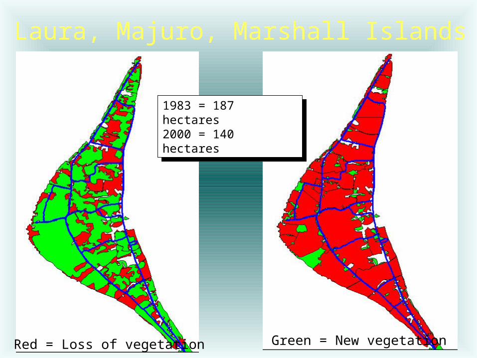
Laura, Majuro, Marshall Islands
Red = Loss of vegetation Green = New vegetation
1983 = 187 hectares2000 = 140 hectares
1983 = 187 hectares2000 = 140 hectares

Rectification of Historical Aerial Photographs, Majuro

Old Vegetation Maps & recent Satellite Images

Steps:
1. Scanning of map2. Linear geometric rectification
towards satellite image3. Delineation of vegetation classes on
map4. Rasterising map and satellite image
interpretation5. Overlay analysis

Overlay Analysis
2009
1969
Result
20 20 20 20 50 50 50
20 20 20 20 50 50 50
20 20 20 50 50 50 50
20 20 20 10 10 50 50
20 20 20 10 10 10 50
2 2 2 2 5 5 5
2 2 2 2 5 5 5
2 2 2 1 1 5 5
2 2 2 1 1 1 5
2 2 2 1 1 1 5
22 22 22 22 55 55 55
22 22 22 22 55 55 55
22 22 22 51 11 55 55
22 22 22 11 11 51 55
22 22 22 11 11 11 55

Results Overlay AnalysisID ClassName NoPixels Hectare %Sum
11 Water 2009 and Water 1969 199781 20 0.6
12 Settlement 2009 and Water 1969 65887 7 0.2
13 Bare land 2009 and Water 1969 11268 1 0
14 Dry Vegetation 2009 and Water 1969 36902 4 0.1
15 Mangrove 2009 and Water 1969 28456 3 0.1
04 Seawater 2009 and Dry Vegetation 1969 1236121 124 4
41 Water 2009 and Dry Vegetation 1969 129871 13 0.4
42 Settlement 2009 and Dry Vegetation 1969 4524788 452 14.7
43 Bare land 2009 and Dry Vegetation 1969 153056 22 0.5
44 Dry Vegetation 2009 and Dry Vegetation 1969 10415634 1042 33.9
45 Mangrove 2009 and Dry Vegetation 1969 218632 22 0.7
Sum (complete table!) 30753968 100

Table of Change (Butaritari)
ID Land Cover 1969 Hectare ID Land Cover 2011 Hectare
0 Seawater 1969 0 0 Seawater 2011 010 Water 1969 46 1 Water 2011 5120 Settlement 1969 157 2 Settlement 2011 15830 Bare land 1969 56 3 Bare land 2011 2340 Dry land
vegetation 19691047 4 Dry land
vegetation 2011 1025
50 Mangrove 1969 174 5 Mangrove 2011 270 Sum 1480 Sum 1527

Areas of ChangeButaritari

Increase MangroveButaritari (2)
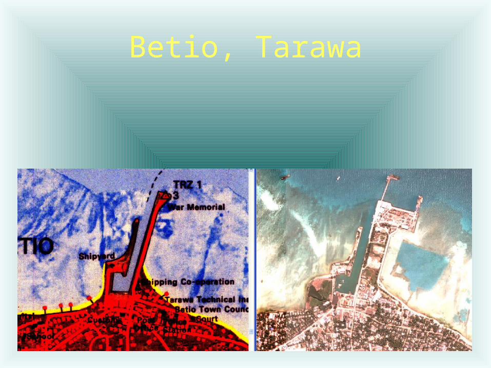
Betio, Tarawa

Tarawa
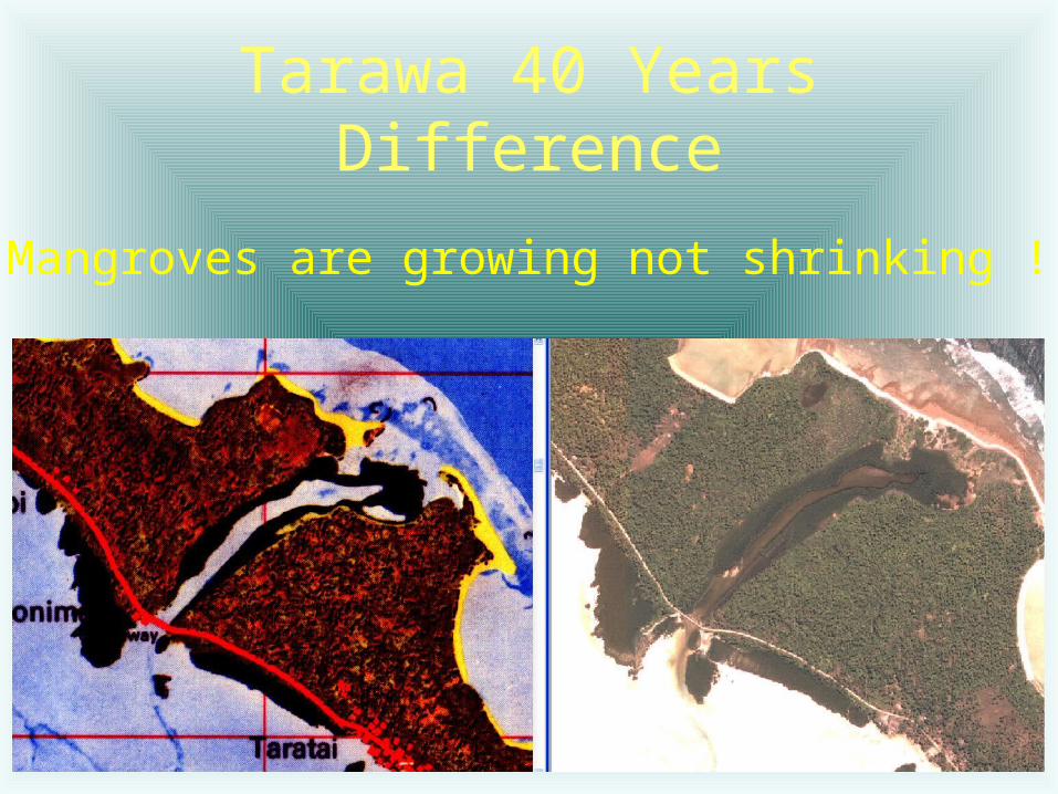
Tarawa 40 Years Difference
Mangroves are growing not shrinking !

Kiribati

Changes Tarawa

Mangrove Increase Marakei

Mangrove Increase Marakei

Mangrove Change Onotoa
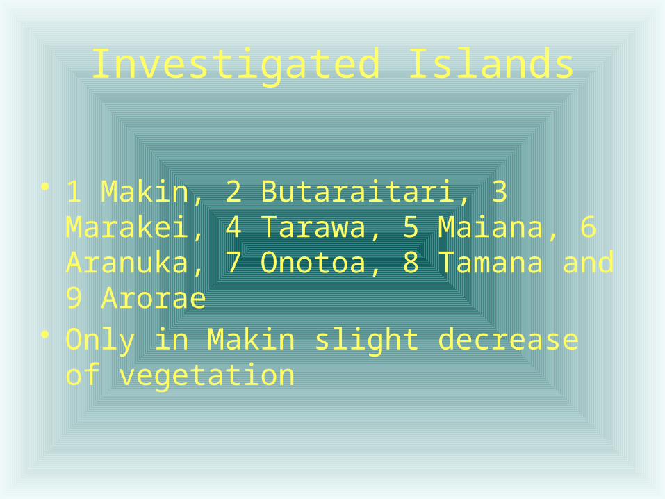
Investigated Islands
• 1 Makin, 2 Butaraitari, 3 Marakei, 4 Tarawa, 5 Maiana, 6 Aranuka, 7 Onotoa, 8 Tamana and 9 Arorae
• Only in Makin slight decrease of vegetation

Possible Sources of Vegetation Increase
• Sea level fall ?• Geometric correction wrong ?• Interpretation of black and white
aerial photographs 1969 partly wrong ?
• Satellite image interpretation wrong ?
• Changing water flow ?

Possible Human Influence for Vegetation Increase
• Environmental education ?• Coconut planting programmes after
1969• Less need for mangrove as fire
wood ?– Alternative fuel– Better drinking water
• Better living conditions for mangroves ?

Thanks Thanks
• Kiribati’s population is growing but the vegetation is growing as well (if trend continues)