321 brennand st info package - s.realtyninja.com
TRANSCRIPT
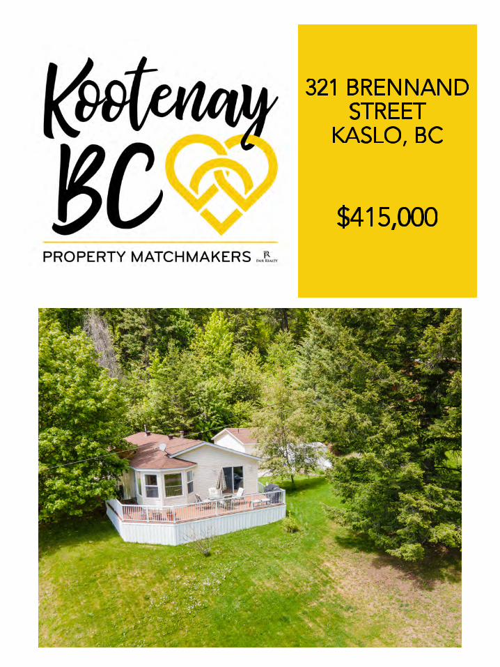

DETAILS
$415,000

TITLE
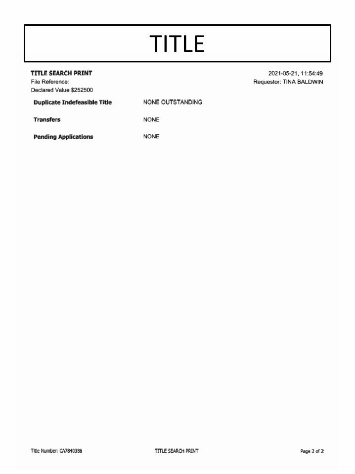
TITLE
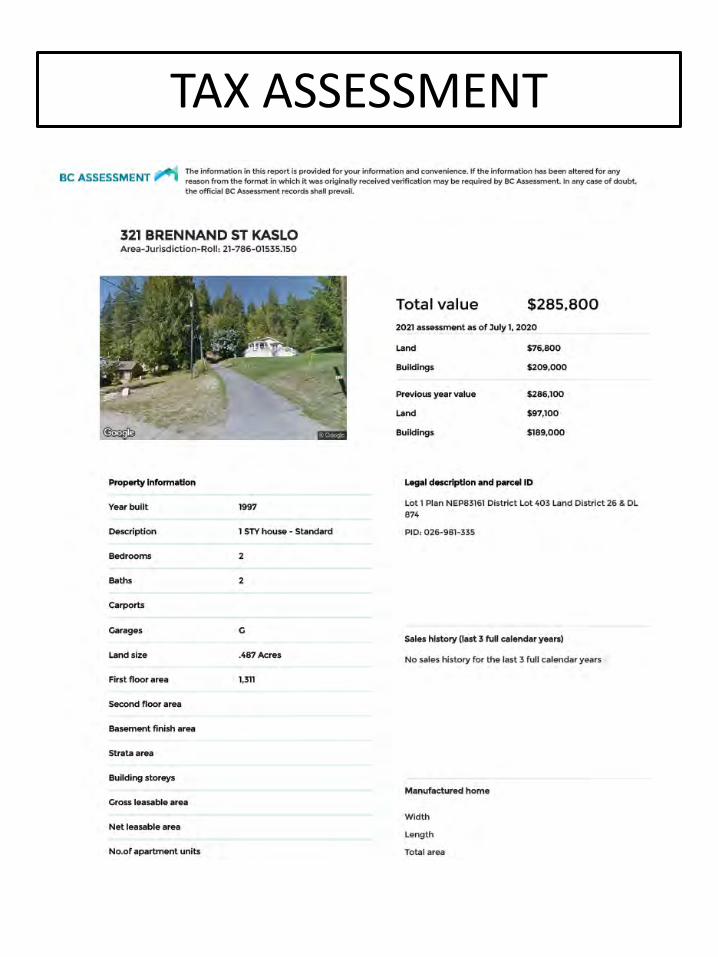
TAX ASSESSMENT
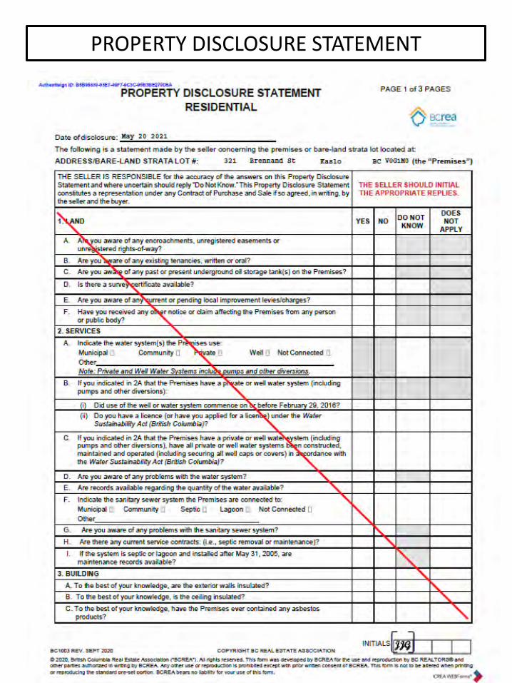
PROPERTY DISCLOSURE STATEMENT

PROPERTY DISCLOSURE STATEMENT
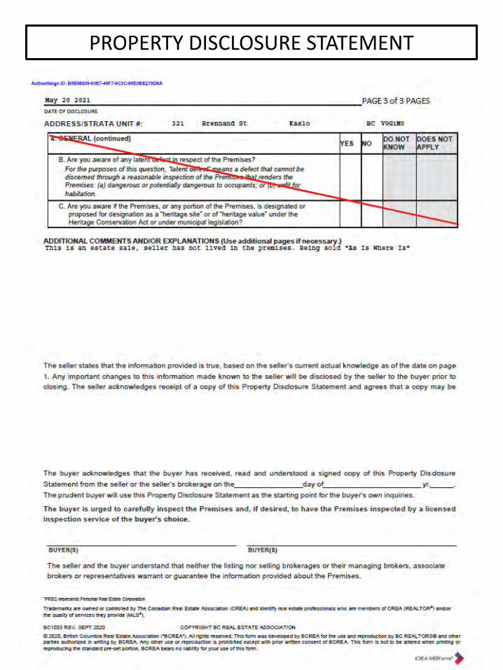
PROPERTY DISCLOSURE STATEMENT
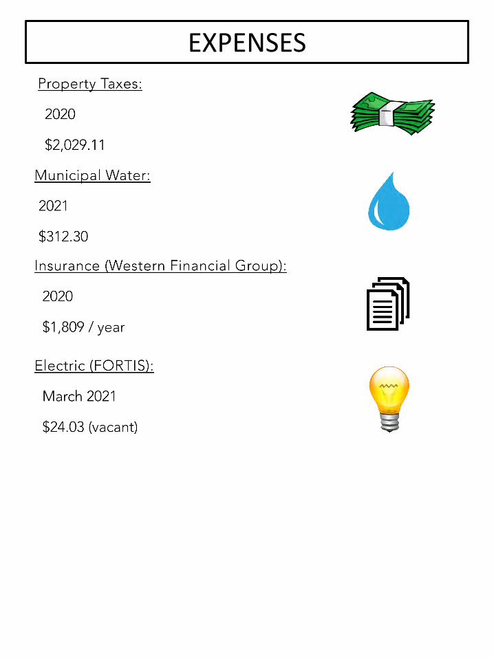
EXPENSES

FLOOR PLANS
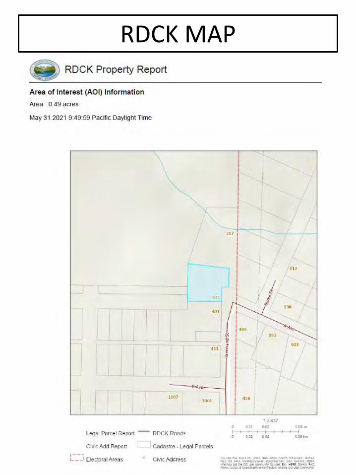
RDCK MAP

RDCK REPORT

LTSA MAP

UTILITIES MAP
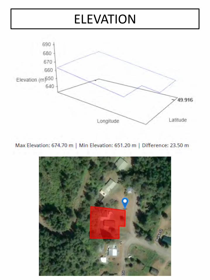
ELEVATION

FLOOD MAP
ZONINGZONING REGULATIONS – RDCK AREA D7.0 Residential – Suburban Residential (RS) PoliciesBackground
This section outlines the objectives and policies for Suburban Residential, Country Residential, Rural Residential, Remote Residential and Multi-Family Residential designations in the Plan area. A Comprehensive Development Zone is described under community specific policies for the area south of the Village of Kaslo and east of Highway 31.
The Plan area is dominated by single family dwellings, with some exceptions where secondary cottages or suites have been provided for family members, visitors, or as rental accommodation. Single family dwellings account for 91% of all household types in the area, modular or mobile homes account for another 7% of housing type, with duplexes and other types of housing accounting for only 2%. According to 2011 census data, there are 1,015 dwellings in Electoral Area D, 647 of which are occupied year round. Part-time residency is assumed to be growing based on non-resident property ownership. Rental housing is primarily found in the southern portion of the Plan area and a lack of such accommodation has been identified in the northern portion of the Plan area.
The amount of undeveloped residential property in the Plan area is difficult to determine. Many residential lots are incapable of on-site servicing without consolidation due to their small size in former town sites or terrain characteristics, or assessment values do not accurately reflect development on the property. In most communities, vacant land availability is low and larger lots are held in the Agricultural Land Reserve (ALR) or such lands are inaccessible or have barriers to development. However, the potential for creation of new residential lots through subdivision exists throughout the Plan area.
General Residential Objectives
1. Accommodate and direct residential development so its location, appearance and impact take into consideration the natural environment, community resources and existing land uses.
2. Ensure maintenance of natural green space in residential developments.
3. Explore and create opportunity for allowing senior residents to comfortably continue residing in their respective communities.
4. Manage residential growth in a manner that protects the rural character, environmental integrity, and the social and cultural diversity of the Plan area
5. Maintain the character and integrity of the riparian area of Kootenay Lake and Duncan Lake by redirecting high density residential development to alternative locations
Electoral Area ‘D’ Comprehensive Land Use Bylaw No. 2435, 2016 Schedule APage 13
ZONINGZONING REGULATIONS – RDCK AREA DSuburban Residential (RS) Policies6. Maintain flexibility with regard to the appropriate number of dwellings per lot to be determined on a community specific basis.
7. Recognize the importance of maintaining and enforcing public access to Kootenay and Duncan Lakes.
8. Encourage the creation of public access to Kootenay and Duncan Lakes, when and where there is public demand, and such access does not exist.
9. Take into consideration transportation needs and to incorporate pedestrian and bicycling facilities in new residential developments.
10. Take into consideration the service needs and resources required for new residential developments in recognition of limitations of water supply and sewage capabilities in localized areas within the Plan area.
General Residential Policies
The Regional Board:
11. Will assess and evaluate proposed residential development based on the following criteria, irrespective of land use designation:
a. capability of accommodating on-site domestic water and sewage disposal;
b. capability of the natural environment to support the proposed development, and its impact on habitat and riparian areas;
c. susceptibility to natural hazards including but not limited to flooding, slope instability or wildfire risk;
d. compatibility with adjacent land uses and designations, and how its form and character compliments the surrounding rural area;
e. proximity and access to existing road networks, and other community and essential services, if they exist;
f. mitigation of visual impacts where development is proposed on hillsides and other visually sensitive areas; and
g. type, timing and staging of the development.
.Electoral Area ‘D’ Comprehensive Land Use Bylaw No. 2435, 2016 Schedule A
Page 14
ZONINGZONING REGULATIONS – RDCK AREA DSuburban Residential (RS) Policies12. Encourages future residential development to maintain adequate setbacks from Kootenay and Duncan Lakes and other riparian areas, to protect these important natural resources, reducing human impact and maintaining water quality and natural habitat.
13. Encourages a variety of housing tenures and organizational frameworks, including affordable housing, seniors housing, lease, rental, strata title, and co-operative housing
14. Encourages senior levels of government to seek solutions to the effects of higher property assessments for certain properties to ensure long-time residents and property owners can affordably remain living within their homes.
The intent of the following residential land use designations is to provide general policy direction on the type of residential development appropriate to each community. Designations were based on existing use, community input and assessment of barriers and opportunities for development. The residential policies below provide the context to allow for further refinement of each of the land use designations if and when each community moves forward with the development of zoning or other land use regulation and are depicted in Schedule A.1 – Land Use Designation Maps. These designations do not limit opportunity for subdivision or development and can be re-examined and refined if a zoning bylaw is requested in the future
The Regional Board:
15. Directs that the principal use shall be single detached or duplex dwellings.
16. Supports medium density residential development with lot sizes for subdivision purposes being determined based on level of servicing, with density increasing with the provision of community water and/or sewer.
Electoral Area ‘D’ Comprehensive Land Use Bylaw No. 2435, 2016 Schedule APage 15

DIRECTIONS

Type CentreDistance (km)
Driving Time
School J.V. Humphries, Kaslo 850m 2 minShopping Front Street, Kaslo 1.5 3 min
AirportWest Kootenay Regional Airport, Castlegar 111 1 hr 31 minTrail Regional Airport 147 1 hr 59 min
Major Cities
Kelowna, BC 335 4 hr 37 minNelson, BC 68.6 1 hrSpokane, WA 307 4 hr 2 minCranbrook, BC 227 3 hr 30 minCalgary, AB 604 7 hr 12 minVancouver, BC 727 8 hr 26 min
Hospital/ Medical Centre
Victorian Community Health Centre, Kaslo 600m 1 minNorth Kootenay Lake Community Services 1.4 3 minKootenay Boundary Regional Hospital, Trail 140 1 hr 55 minKootenay Lake Hospital, Nelson 68.3 1 hr
DentistKootenay Lake Dental Clinic, Nelson 68.7 1 hr 1 minNelson Ave Dental Clinic, Nelson 66.5 57 minSilverton Dental Clinic, Silverton 51.6 45 min
Postal Services Canada Post, Kaslo 1.1 2 minLibrary Kaslo Library 1.3 3 min
COMMUNITY INFORMATION
Kaslo
Kaslo, with a population of just 1,000 is actually the largest community on the main body of Kootenay Lake. Kaslo is nestled in a valley, surrounded by a lush forest and Kootenay Lake. Downtown is thriving with artisans and artists, and a beautiful park with pristine beaches lines the village. Heritage buildings have been lovingly restored, along with the S.S. Moyie, the world's oldest intact sternwheeler.
The area’s waterways and surrounding mountains provide plenty of opportunity for outdoor adventure.
Outdoor RecreationExplore Kootenay Lake in a powerboat, sailboat, kayak, or canoe. Renting a houseboat from Kaslo’s Shipyard’s fleet is another option. Go hiking on groomed trails or wilderness terrain in provincial parks. There are no less than five of these (and one rugged conservancy) nearby, including the stunning Kokanee Glacier Provincial Park. Boating, sport fishing, swimming, water-skiing, kayaking, canoeing, scuba diving, hiking, mountain & tour biking, ATV touring, golfing, horseback riding, cross-country skiing, snowmobiling, cat-skiing, heli-skiing, paragliding.
Weather
Average Yearly Rainfall (mm): 698 Average Yearly Snowfall (cm): 188
Average Highest Temperature (c): 25 Average Lowest Temperature (c): -5

COMMUNITY INFORMATIONRecreational FacilitiesFacilities in and around Kaslo include a 9 hole golf course, Ice Arena for public skating, hockey and curling, a number of Provincial Parks and campgrounds, a skateboard park, public beaches, tennis courts and riding arena.
Historic and Heritage SitesKaslo village itself is home to several important historic and heritage sites including the SS Moyie, the world’s oldest intact passenger sternwheeler. Its restoration has been passionately pursued by spirited volunteers for more than half a century. Abroad the SS Moyie enter a world of classic Victorian design and engineering and learn a whole lot about Kootenay Lake history.
Festivals and EventsGive a big round of applause to this tiny community for hosting an exceptionally charming jazz event.
The Kaslo Jazz Festival draws music-lovers from far and wide in August, as people come to see live music from international swing, blues and jazz musicians. The music festival has been staged every August since 1991. Audiences line the beach to enjoy incredible jazz music performed from a floating stage.
The IDidaRide and Run is another popular event for keen runners and mountain bikers, held in August. The event offers five events–three rides and two runs. The 41km is a ride only, while the 20km and 8.5km are ride or run events.
May Days is a century old Kaslo tradition, featuring maypole dancing, loggers’ sports, and a parade that offers double the fun by circling the village centre twice.
GeographyThe village of Kaslo is the largest community located on the main body of Kootenay Lake. Most of the village of Kaslo sits on the floodplain formed by the outflow of the Kaslo River. The remainder of the village is located on bench land above the downtown core. The village is framed by the Purcell Mountain Range to the east and the Selkirk Mountain Range to the west. Mount Loki (2,779m/9,117ft) rises dramatically across Kootenay Lake and is a popular hike for locals. The Selkirks are home to the Goat Range and Kokanee Glacier Provincial Parks. Both parks offer a full range of four season recreational opportunities.
EconomyOverall, the average employment rate of Kaslo, BC is growing at an average of 0.14% per year over the past 15 years. In the last two census, its employment rate grew by 9 per cent, an average growth rate of 4.57% from 2011 to 2016. A growing employment rate signals that competition between job applicants are intensifying and that finding a job is becoming harder. It can also mean lower tax revenues for governments in the next few years, as people will have lower incomes to be taxed.
GovernmentThe Village of Kaslo is governed by a Mayor and four councillors and isadministered by three professional staff.
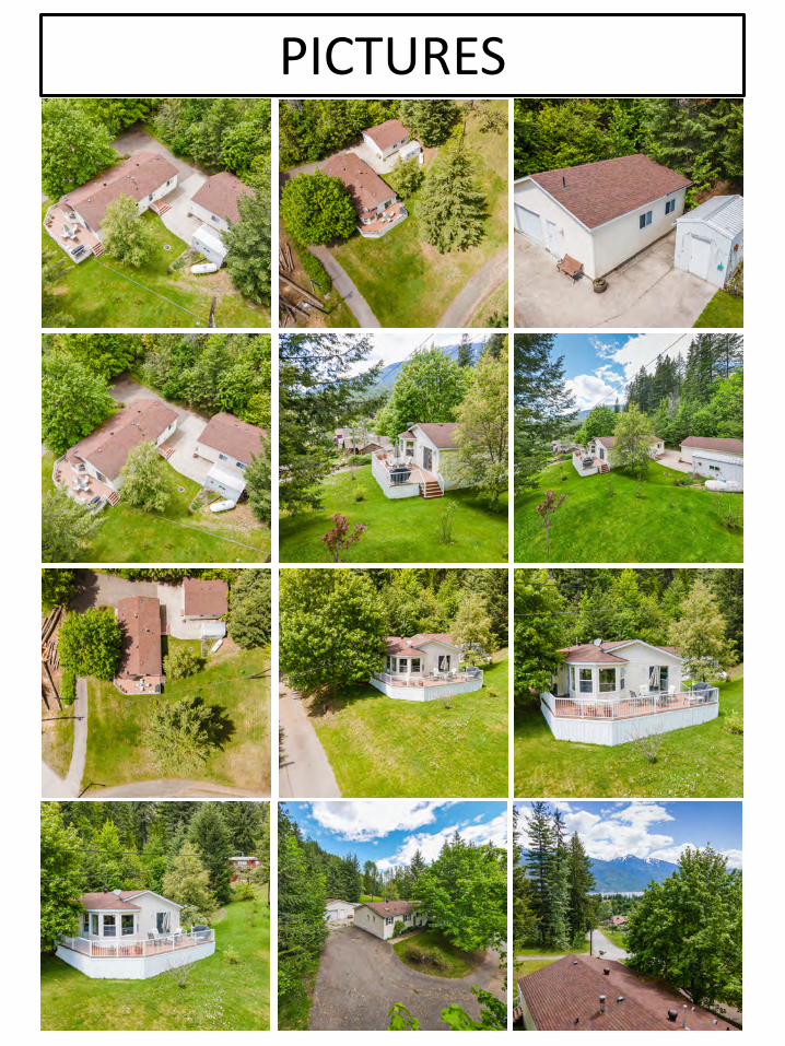
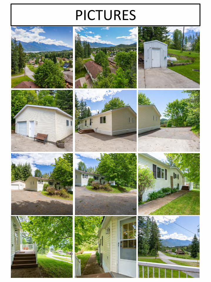
PICTURES
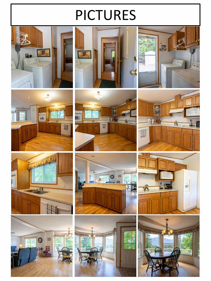
PICTURES

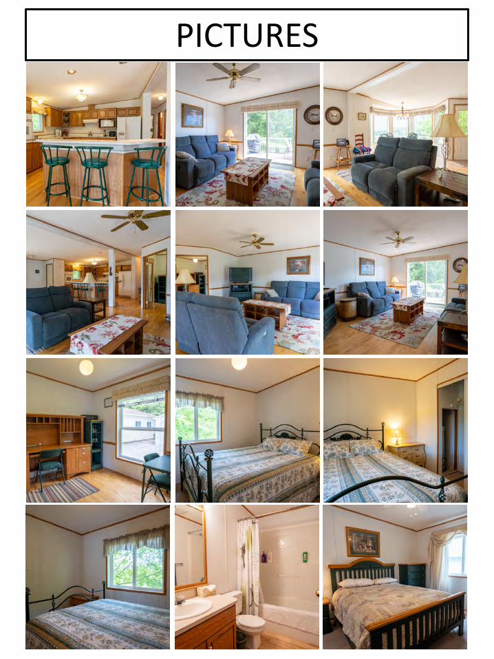
PICTURES
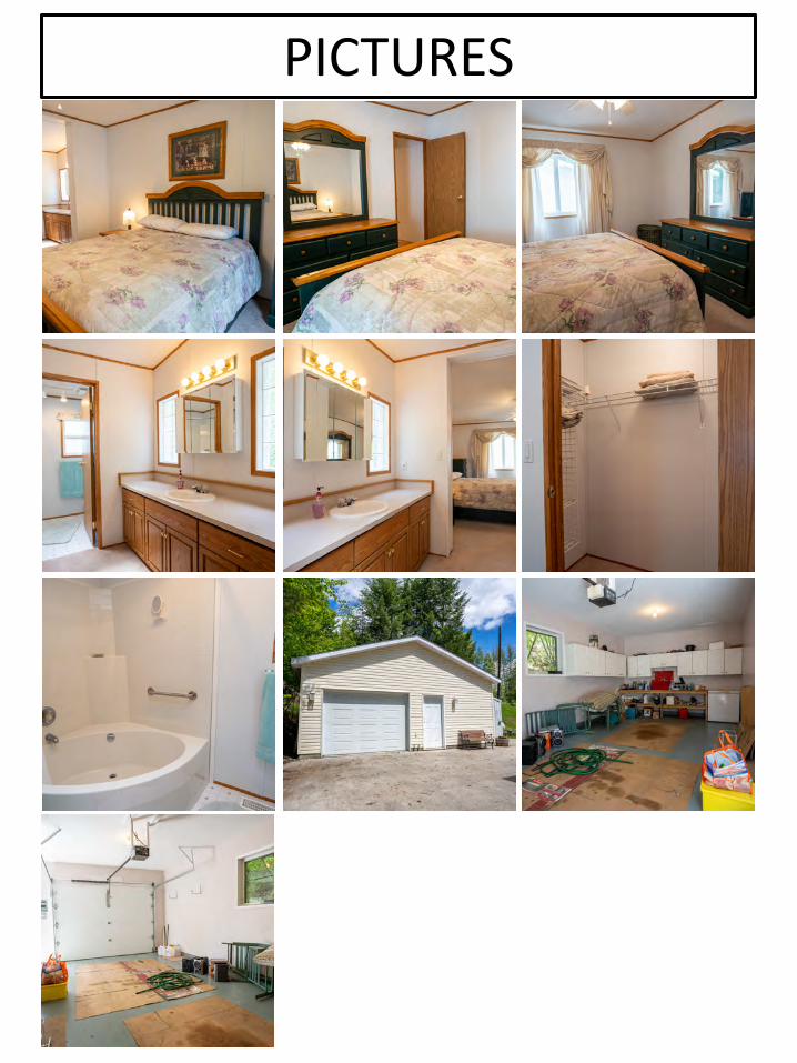
PICTURES
PICTURES
PICTURES
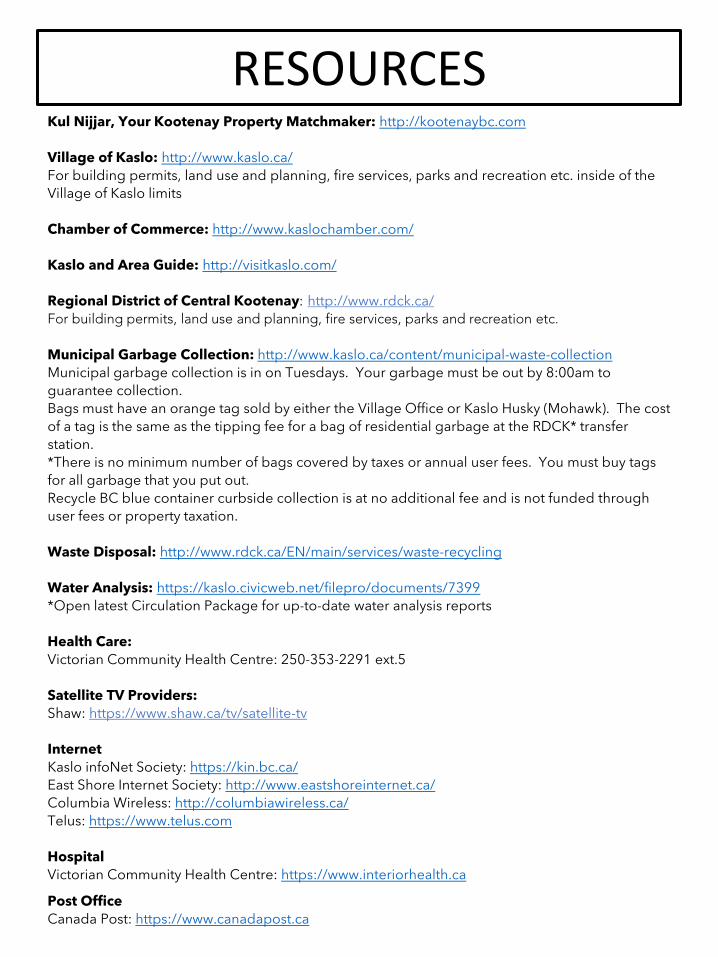
RESOURCESKul Nijjar, Your Kootenay Property Matchmaker: http://kootenaybc.com
Village of Kaslo: http://www.kaslo.ca/For building permits, land use and planning, fire services, parks and recreation etc. inside of the Village of Kaslo limits
Chamber of Commerce: http://www.kaslochamber.com/
Kaslo and Area Guide: http://visitkaslo.com/
Regional District of Central Kootenay: http://www.rdck.ca/For building permits, land use and planning, fire services, parks and recreation etc.
Municipal Garbage Collection: http://www.kaslo.ca/content/municipal-waste-collectionMunicipal garbage collection is in on Tuesdays. Your garbage must be out by 8:00am to guarantee collection.Bags must have an orange tag sold by either the Village Office or Kaslo Husky (Mohawk). The cost of a tag is the same as the tipping fee for a bag of residential garbage at the RDCK* transfer station. *There is no minimum number of bags covered by taxes or annual user fees. You must buy tags for all garbage that you put out.Recycle BC blue container curbside collection is at no additional fee and is not funded through user fees or property taxation.
Waste Disposal: http://www.rdck.ca/EN/main/services/waste-recycling
Water Analysis: https://kaslo.civicweb.net/filepro/documents/7399*Open latest Circulation Package for up-to-date water analysis reports
Health Care:Victorian Community Health Centre: 250-353-2291 ext.5
Satellite TV Providers:Shaw: https://www.shaw.ca/tv/satellite-tv
InternetKaslo infoNet Society: https://kin.bc.ca/East Shore Internet Society: http://www.eastshoreinternet.ca/Columbia Wireless: http://columbiawireless.ca/Telus: https://www.telus.com
HospitalVictorian Community Health Centre: https://www.interiorhealth.ca
Post OfficeCanada Post: https://www.canadapost.ca