3. qualities of historic route 66route66ca.server274.com/wp-content/uploads/2016/03/chapter-3... ·...
TRANSCRIPT
California Historic Route 66 CMP: Needles to Barstow Page 27
May 2015 Chapter 3: Intrinsic Qualities
Historic Route 66 is significant as the nation’s first all-weather highway linking Chicago to Los Angeles. The route was designated U.S. Highway 66 in November 1926, and was part of the first nationally designated highway system. More widely known as Route 66, the romance and nostalgia of the road was popularized in story, song, film and television. Nicknamed as the “Mother Road” in John Steinbeck’s The Grapes of Wrath, Route 66 became a principle east-west highway in America’s westward expansion. Historic Route 66:
“represents an outstanding example of the transition from dirt track to superhighway. Not only does Route 66 underscore the importance of the automobile as a technological achievement, but, perhaps equally important to the American psyche, it symbolized unprecedented freedom and mobility for every citizen who could afford to own and operate a car.”1
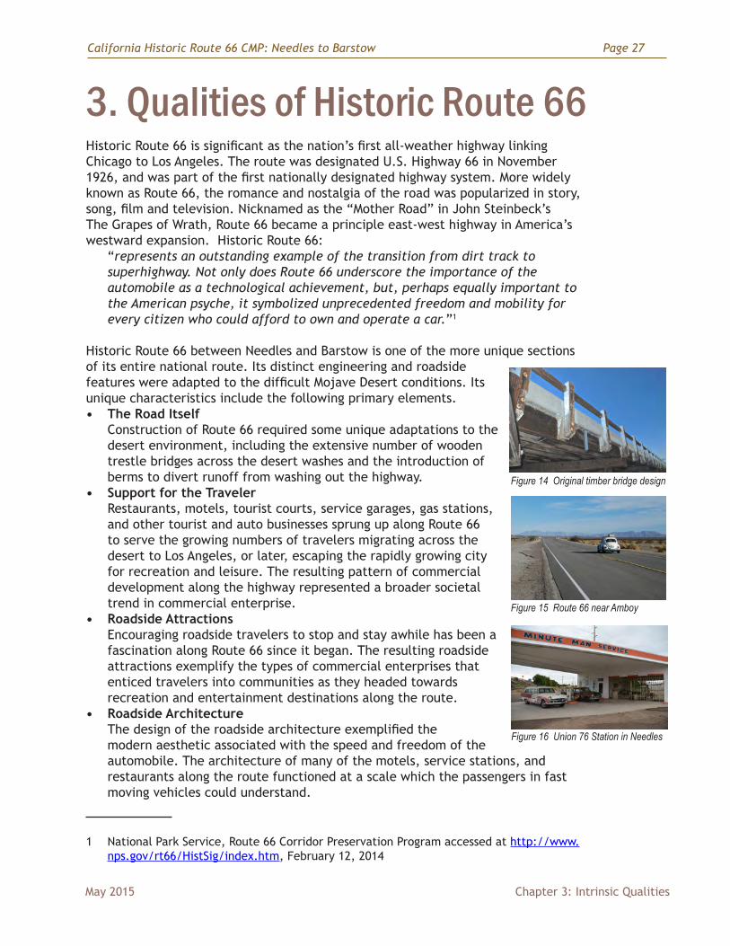
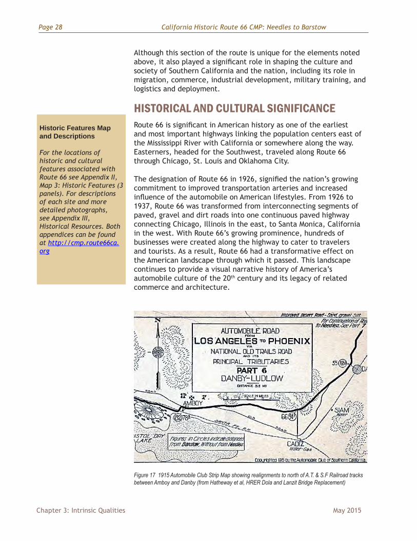
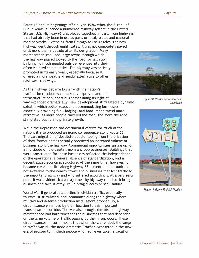
Historic Route 66 between Needles and Barstow is one of the more unique sections of its entire national route. Its distinct engineering and roadside features were adapted to the difficult Mojave Desert conditions. Its unique characteristics include the following primary elements.• The Road Itself
Construction of Route 66 required some unique adaptations to the desert environment, including the extensive number of wooden trestle bridges across the desert washes and the introduction of berms to divert runoff from washing out the highway.
• Support for the TravelerRestaurants, motels, tourist courts, service garages, gas stations, and other tourist and auto businesses sprung up along Route 66 to serve the growing numbers of travelers migrating across the desert to Los Angeles, or later, escaping the rapidly growing city for recreation and leisure. The resulting pattern of commercial development along the highway represented a broader societal trend in commercial enterprise.
• Roadside Attractions Encouraging roadside travelers to stop and stay awhile has been a fascination along Route 66 since it began. The resulting roadside attractions exemplify the types of commercial enterprises that enticed travelers into communities as they headed towards recreation and entertainment destinations along the route.
• Roadside Architecture The design of the roadside architecture exemplified the modern aesthetic associated with the speed and freedom of the automobile. The architecture of many of the motels, service stations, and restaurants along the route functioned at a scale which the passengers in fast moving vehicles could understand.
1 National Park Service, Route 66 Corridor Preservation Program accessed at http://www.nps.gov/rt66/HistSig/index.htm, February 12, 2014
Figure 14 Original timber bridge design
Figure 15 Route 66 near Amboy
Figure 16 Union 76 Station in Needles
3. Qualities of Historic Route 66
Page 28 California Historic Route 66 CMP: Needles to Barstow
Chapter 3: Intrinsic Qualities May 2015
Although this section of the route is unique for the elements noted above, it also played a significant role in shaping the culture and society of Southern California and the nation, including its role in migration, commerce, industrial development, military training, and logistics and deployment.
HISTORICAL AND CULTURAL SIGNIFICANCE Route 66 is significant in American history as one of the earliest and most important highways linking the population centers east of the Mississippi River with California or somewhere along the way. Easterners, headed for the Southwest, traveled along Route 66 through Chicago, St. Louis and Oklahoma City.
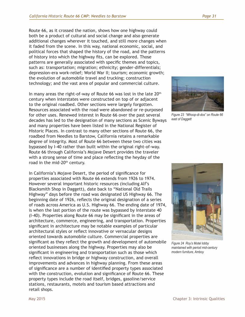
The designation of Route 66 in 1926, signified the nation’s growing commitment to improved transportation arteries and increased influence of the automobile on American lifestyles. From 1926 to 1937, Route 66 was transformed from interconnecting segments of paved, gravel and dirt roads into one continuous paved highway connecting Chicago, Illinois in the east, to Santa Monica, California in the west. With Route 66’s growing prominence, hundreds of businesses were created along the highway to cater to travelers and tourists. As a result, Route 66 had a transformative effect on the American landscape through which it passed. This landscape continues to provide a visual narrative history of America’s automobile culture of the 20th century and its legacy of related commerce and architecture.
Figure 17 1915 Automobile Club Strip Map showing realignments to north of A.T. & S.F Railroad tracks between Amboy and Danby (from Hatheway et al, HRER Dola and Lanzit Bridge Replacement)
Historic Features Map and Descriptions
For the locations of historic and cultural features associated with Route 66 see Appendix II, Map 3: Historic Features (3 panels). For descriptions of each site and more detailed photographs, see Appendix III, Historical Resources. Both appendices can be found at http://cmp.route66ca.org
California Historic Route 66 CMP: Needles to Barstow Page 29
May 2015 Chapter 3: Intrinsic Qualities
Route 66 had its beginnings officially in 1926, when the Bureau of Public Roads launched a numbered highway system in the United States. U.S. Highway 66 was pieced together, in part, from highways that had already been in use as parts of local, state, and national road networks. Extending from Chicago to Los Angeles, the new highway went through eight states. It was not completely paved until more than a decade after its designation. Many merchants in small and large towns through which the highway passed looked to the road for salvation by bringing much needed outside revenues into their often isolated communities. The highway was actively promoted in its early years, especially because it offered a more weather-friendly alternative to other east-west roadways.
As the highway became busier with the nation’s traffic, the roadbed was markedly improved and the infrastructure of support businesses lining its right of way expanded dramatically. New development stimulated a dynamic spiral in which better roads and accommodating businesses—especially providing fuel, lodging, and food—made travel more attractive. As more people traveled the road, the more the road stimulated public and private growth.
While the Depression had detrimental effects for much of the nation, it also produced an ironic consequence along Route 66. The vast migration of destitute people fleeing from the privation of their former homes actually produced an increased volume of business along the highway. Commercial opportunities sprung up for a multitude of low-capital, mom and pop businesses. Buildings that were constructed for these businesses reflected the independence of the operations, a general absence of standardization, and a decentralized economic structure. At the same time, however, it became clear that life along Highway 66 presented opportunities not available to the nearby towns and businesses that lost traffic to the important highway and who suffered accordingly. At a very early point it was evident that a major nearby highway could both bring business and take it away; could bring success or spell failure.
World War II generated a decline in civilian traffic, especially tourism. It stimulated local economies along the highway where military and defense production installations cropped up, a circumstance enhanced by their location to this important transportation corridor. The war also brought diminished highway maintenance and hard times for the businesses that had depended on the large volume of traffic passing by their front doors. These circumstances, in turn, meant that when the war ended, the surge in traffic was all the more dramatic. Traffic skyrocketed in the new era of prosperity in which people who had never taken a vacation
Figure 18 Roadrunner Retreat near Chambless
Figure 19 Route 66 Motel, Needles

Page 30 California Historic Route 66 CMP: Needles to Barstow
Chapter 3: Intrinsic Qualities May 2015
in their lives now had the opportunity to travel west. They traveled not in pursuit of a job to ease their desperation, but for the sheer enjoyment of it. As the traffic increased, once again the small businesses along the highway also boomed. The iconic Route 66 associated with the migration of Okies in the 1930s transformed to an icon of freedom and kicks. The bleak image of Steinbeck’s Grapes of Wrath faded and the upbeat sounds of Bobby Troup’s and Nat “King” Cole’s “get your kicks on Route 66” took over.
Just as hard times in the nation actually produced a modest level of prosperity for many businesses along Route 66 in the Depression, the enormous traffic on the highway in the decade after World War II led to its decline. Crowding of the nation’s highways, with Route 66 as an exemplary case, meant not the improvement of the highway, but its replacement with the interstate highway system written into law in 1956. With the dominance of the interstate system, older
U.S. Highways such as Route 66 lost their appeal for those only interested in getting to their destination as soon as possible. Many businesses along Route 66 were abandoned. Small communities dependent on the highway traveler often became ghost towns.
Over the years Route 66 became a legend in American popular culture not only as a focus of great nostalgia and romance but also as a source of inspiration for television entertainment, movies, literature, and graphic art. As a metaphor and cultural icon it has few parallels in twentieth century representations
of evolving social organization. Considered within the larger framework of technology, an arena that also includes television, nuclear energy, and space travel, the one obvious dominant image throughout the twentieth century that goes to the core of modern life would be the automobile, a factor to which Route 66 is intimately related and to the significance of which the road contributed enormously.
Figure 20 Bobby Troup’s Route 66
Figure 21 Remnants of Ludlow’s Main Street “ghost town”
Figure 22 Panoramic view from Cadiz Summit
California Historic Route 66 CMP: Needles to Barstow Page 31
May 2015 Chapter 3: Intrinsic Qualities
Route 66, as it crossed the nation, shows how one highway could both be a product of cultural and social change and also generate additional changes wherever it touched, and still more changes when it faded from the scene. In this way, national economic, social, and political forces that shaped the history of the road, and the patterns of history into which the highway fits, can be explored. Those patterns are generally associated with specific themes and topics, such as: transportation; migration; ethnicity; gender-differentials; depression-era work-relief; World War II; tourism; economic growth; the evolution of automobile travel and trucking; construction technology; and the vast area of popular and commercial culture.
In many areas the right-of-way of Route 66 was lost in the late 20th century when interstates were constructed on top of or adjacent to the original roadbed. Other sections were largely forgotten. Resources associated with the road were abandoned or re-purposed for other uses. Renewed interest in Route 66 over the past several decades has led to the designation of many sections as Scenic Byways and many properties have been listed in the National Register of Historic Places. In contrast to many other sections of Route 66, the roadbed from Needles to Barstow, California retains a remarkable degree of integrity. Most of Route 66 between these two cities was bypassed by I-40 rather than built within the original right-of-way. Route 66 through California’s Mojave Desert provides the traveler with a strong sense of time and place reflecting the heyday of the road in the mid-20th century.
In California’s Mojave Desert, the period of significance for properties associated with Route 66 extends from 1926 to 1974. However several important historic resources (including Alf’s Blacksmith Shop in Daggett), date back to “National Old Trails Highway” days before the road was designated US Highway 66. The beginning date of 1926, reflects the original designation of a series of roads across America as U.S. Highway 66. The ending date of 1974, is when the last portion of the route was bypassed by Interstate 40 (I-40). Properties along Route 66 may be significant in the areas of architecture, commerce, engineering, and transportation. Properties significant in architecture may be notable examples of particular architectural styles or reflect innovative or vernacular designs oriented towards automobile culture. Commercial properties are significant as they reflect the growth and development of automobile oriented businesses along the highway. Properties may also be significant in engineering and transportation such as those which reflect innovations in bridge or highway construction, and overall improvements and advances in highway planning. From these areas of significance are a number of identified property types associated with the construction, evolution and significance of Route 66. These property types include the road itself, bridges, gasoline/service stations, restaurants, motels and tourism based attractions and retail shops.
Figure 23 “Whoop-di-dos” on Route 66 east of Daggett
Figure 24 Roy’s Motel lobby maintained with period mid-century modern furniture, Amboy
Page 32 California Historic Route 66 CMP: Needles to Barstow
Chapter 3: Intrinsic Qualities May 2015
RELATED THEMES AND CONTEXTS SPECIFIC TO THE MOJAVE DESERT REGIONFour dominant themes characterize the historical and cultural significance of Route 66 through the Mojave Desert in southeastern California: American Indian history; the influence of the railroad; evolution of historic wagon roads to modern highways; and military training and installations. The historical and cultural resources of Route 66 between Needles and Barstow are represented under at least one of these themes.
American Indian HistoryHuman habitation of present-day North America dates to what archaeologists call the Paleo-indian period (13,000-8,500 BC). This period overlapped the end of the Ice Age, when ice across the Bering Strait created a land bridge for the migration of people and animals from the Asian continent. These people migrated east and south over several millennia. The earliest evidence of human
habitation in present-day California dates from around 11,000-10,000 BC. Scant archaeological evidence from this period has been discovered in the deserts of southern California along the shorelines of now-dry lake basins, called playas. These lakes provided fresh water to people and the animals they hunted, such as sloth, mammoth and other large herbivores. Bands or families hunted and foraged, rarely living in permanent structures. This way of life endured until around 7,000 BC. At that time, temperatures rose, resulting in a change from wet to dry conditions that impacted the ecology of the Mojave landscape, its flora, fauna and human inhabitants.2
Two lakes where artifacts have been found—Lake Manix and Lake Mojave—figured significantly in the development of the landscape and ecology of the Mojave National Preserve area. The Mojave National Preserve is roughly bound by I-40 on the south, the California-Nevada border on the east, I-15 on the north, and Highway 127 on the west. Its southern range, in the area of Route 66, is characterized by a landscape of alkali playas. Lake Mojave dried out by 8,700 years ago, becoming the playa that exists today.
These ecological changes influenced new subsistence patterns among California’s earliest peoples. They remained closely tied to water sources, but developed a diet based on seasonal resources in eco-niches. They also invented specialized tools and developed new social complexities. In general, people grouped together in larger bands, from 25 to 100. This Archaic Period lasted from approximately
2 “The Mojave River and Associated Lakes,” from http://pubs.usgs.gov/of/2004/1007/river.html accessed December 9, 2013.
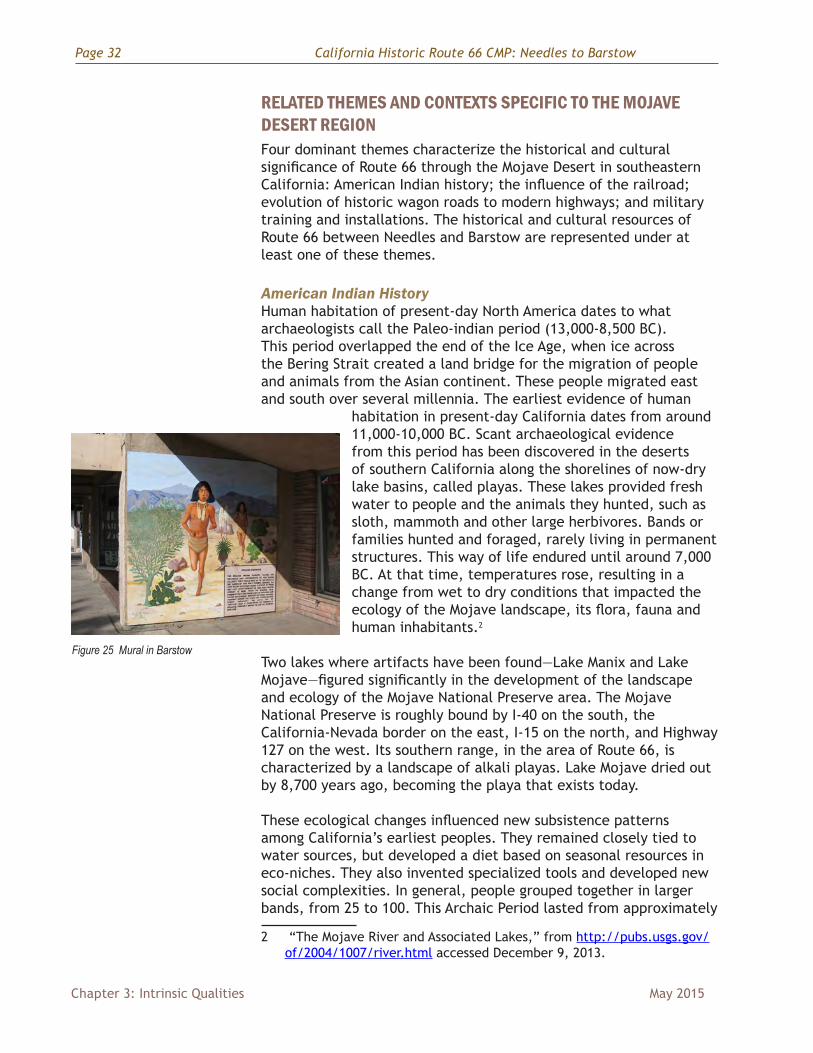
Figure 25 Mural in Barstow
California Historic Route 66 CMP: Needles to Barstow Page 33
May 2015 Chapter 3: Intrinsic Qualities
7,000-2,000 BC. There was regional variation; in the deserts of southeastern California, practices of the Archaic Period persisted into the 1800s AD. The desert conditions limited available resources, and evidence indicates that band size here was typically fewer than ten people. The desert dwellers had to adjust to a diet more reliant on plants and fish.
The final pre-historic period in California, from 2,500-1,500 BC, is known as the Formative Period. Native peoples gravitated to locales with overlapping environmental characteristics, affording them greater flexibility in use of resources. This migration resulted in larger settlement groups, which in turn influenced new social and political structures, especially stratified class systems. However, the peoples of the southeastern desert region were the exception to many of the developments among the majority population during the Formative Period. For example, desert conditions did not allow for growing population density, as elsewhere. The desert allowed for 0.5 persons per square mile, while more biologically abundant environments could support more than ten persons per square mile. In these more hospitable regions, the diets of American Indians became more focused on primary species supplemented by lesser ones. However, the limited resources of the desert environment restricted diet specialization. The peoples of desert cultures variably collected wild roots and seeds (mesquite beans in particular), hunted game, and netted fish. They relied heavily on the river for their survival and were known by the traditional name Pipa Aha Macav (“the people by the river”). They depended on its overflow for irrigation of crops they planted including corn and melons.3
The name Pipa Aha Macav was shortened and altered from Aha Macav to Mojave. They were the largest cultural group in the American Southwest. The Mojave tribe consisted of three regional groups of people: in the northern range from Black Canyon to the Mojave Valley were the Matha Ivathum; the Hutto-pah lived in the central Mojave Valley; and the Kavi Ivathum extended from the Mojave Valley beyond the Needles Peaks. Twenty-two patriarchal lines composed the Mojave tribe. The chief was called the aha macav pina ta-ahon, who jointly presided over the people along with one leader from each of the three regional groups.4
By the time of Spanish colonization, approximately 300,000 American Indians resided in present-day California. Their first encounters with Spanish explorers entering the area was in the 16th century.
3 “California’s Native People,” from http://www.cabrillo.edu/~crsmith/anth6_formative.html accessed December 10, 2013.
4 “Mojave Tribe: Culture,” from http://www.nps.gov/moja/historyculture/mojave-culture.htm accessed December 10, 2013.
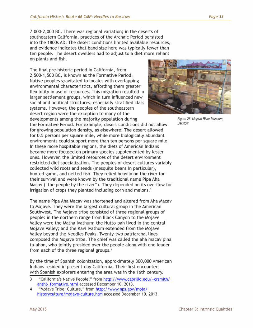
Figure 26 Mojave River Museum, Barstow
Page 34 California Historic Route 66 CMP: Needles to Barstow
Chapter 3: Intrinsic Qualities May 2015
Explorer Melchor Diaz forayed into the southeastern desert area in 1540, documenting his travels in writing. Other missionaries and explorers also encountered the Mojave Indians during the eighteenth and early nineteenth centuries. Father Francisco Garces traveled across the Mojave Desert in 1776, and attempted to keep peace between American Indians and Spanish settlers in violation of land treaty terms. Garces was among those killed in the Yuma uprising in July of 1781. Explorers travelling across the Mojave Desert during the early nineteenth century included Jedediah Smith in 1826, and John Fremont in 1844. As increasing numbers of European American settlers migrated to the region, the United States established a military outpost in 1859, on the Colorado River during the Mojave War. Initially, this fort was called Camp Colorado, which became Fort Mojave. Thus, those American Indians inhabiting the area were called the Fort Mojaves.
During the Civil War, the U.S. military abandoned Fort Mojave. Leadership among the tribe at this time was in disagreement over making peace or war with American settlers. The Great Chief Homoseh awahot abdicated to Yara tav, who favored peace. Yara tav had dealings with government representatives in Los Angeles, San Francisco, and Washington, DC where he met with President Lincoln. As leader, he consented to move 500 to 800 Mojaves to the Colorado Indian Reservation, created by the U.S. government in 1865. Tribal members who refused to move resumed acceptance of Homoseh awahot as chief. The tribe was split into two groups. Homoseh awahot’s son Empote awatacheech succeeded him in 1875.5
The government established the Fort Mojave Indian Reservation in 1870, near Needles, California. The reservation would grow to encompass 42,000 acres in the tri-state area of California, Nevada, and Arizona. The Mojave Tribe established their headquarters in Needles. The Mojave Fort remained in operation until 1891 and then became a boarding school until 1930. Today, only ruins remain.
During this period, acculturation of American Indians was the government’s goal in the boarding school and agricultural practices. However, many Mojaves found employment in mines, on river boats, or with the railroad, which came to Needles in 1883. Some Mojaves moved into Needles, where trains brought potential customers for their traditional bead and pottery crafts.6
In the early years of the twentieth century, the Mojaves were forced into accepting anglicized names and learning English in school. When
5 Mojave Fort Indian Tribe, “Mojave Tribe: History after 1860,” at web site http://www.nps.gov/moja/historyculture/mojave-tribe-late-history.htm accessed December 12, 2013.
6 Linda Fitzpatrick and James M. Conkle, Needles, (Charleston, SC: Arcadia Publishing, 2010), 15.
California Historic Route 66 CMP: Needles to Barstow Page 35
May 2015 Chapter 3: Intrinsic Qualities
the boarding school closed, Mojave children began attending school in Needles. In 1936, a great flood ravaged Needles and destroyed many Mojave homes in Arizona. The tribe purchased land for a new village near Needles in 1947. This area was made part of the reservation. In 1957, tribal leadership adopted the Fort Mojave Constitution, creating a new seven-member council. The inaugural council included tribal chairman Francis Stillman, vice chairman Hubert McCord, and council members Claude Lewis, Joe Davidson, Rudolph Bryan, and husband and wife Harwood and Minerva Jenkins.7
For millennia, the Mojave people have left their mark on the landscape in petroglyphs, pictographs, old trails and stone work. Numerous archaeological sites in the area have been identified and listed on the National Register. They range from 3000-4999 B.C. to 1750-1900 A.D. Today referred to as the Fort Mojave Indian Tribe, their descendants still reside in the area. Fort Mojave Indian Days, an annual celebration in Needles, keeps alive their heritage through cultural workshops, dancing, singing, and games.8
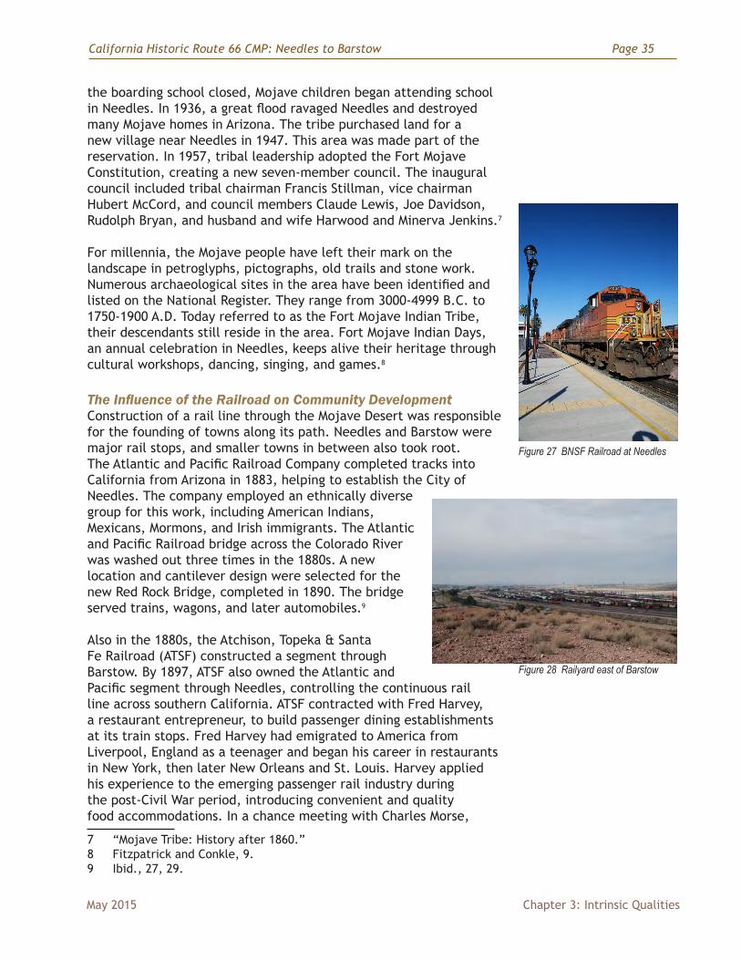
The Influence of the Railroad on Community DevelopmentConstruction of a rail line through the Mojave Desert was responsible for the founding of towns along its path. Needles and Barstow were major rail stops, and smaller towns in between also took root. The Atlantic and Pacific Railroad Company completed tracks into California from Arizona in 1883, helping to establish the City of Needles. The company employed an ethnically diverse group for this work, including American Indians, Mexicans, Mormons, and Irish immigrants. The Atlantic and Pacific Railroad bridge across the Colorado River was washed out three times in the 1880s. A new location and cantilever design were selected for the new Red Rock Bridge, completed in 1890. The bridge served trains, wagons, and later automobiles.9
Also in the 1880s, the Atchison, Topeka & Santa Fe Railroad (ATSF) constructed a segment through Barstow. By 1897, ATSF also owned the Atlantic and Pacific segment through Needles, controlling the continuous rail line across southern California. ATSF contracted with Fred Harvey, a restaurant entrepreneur, to build passenger dining establishments at its train stops. Fred Harvey had emigrated to America from Liverpool, England as a teenager and began his career in restaurants in New York, then later New Orleans and St. Louis. Harvey applied his experience to the emerging passenger rail industry during the post-Civil War period, introducing convenient and quality food accommodations. In a chance meeting with Charles Morse,
7 “Mojave Tribe: History after 1860.”8 Fitzpatrick and Conkle, 9. 9 Ibid., 27, 29.
Figure 27 BNSF Railroad at Needles
Figure 28 Railyard east of Barstow
Page 36 California Historic Route 66 CMP: Needles to Barstow
Chapter 3: Intrinsic Qualities May 2015
superintendent of the Atchison, Topeka & Santa Fe Railroad line, Harvey sold his idea to install affordable, clean, efficient dining counters in railroad depots. So-called Harvey Houses became fixtures along the rail line from Kansas to California in the late nineteenth century. Along the ATSF line between Needles and Barstow, California, two Harvey Houses were constructed. These historic buildings later served travelers along Route 66 and are significant resources along this corridor.
The railroad was responsible for the establishment of several towns through which Route 66 would later pass. Lewis Kingman, a locating engineer for the Atlantic and Pacific Railroad chose the location and names for towns that would serve the railroad with stations through the hot Mojave Desert.10 Kingman chose to alphabetize the names of the series of towns including, Amboy, Bristol, Cadiz, Danby, Essex, Fenner, Goffs and others. Most of these towns later grew into highway stops for Route 66 travelers. Thus, early railroad history had a direct influence on development along Route 66.
Evolution of Wagon Roads into Modern HighwaysThe desert’s natural resources were magnets for westward migration. Mining was the first industry to draw pioneers to the Mojave Desert of southeastern California. Fort Mojave was built in 1859 as an outpost to protect pioneers into California. Both silver and borax ore were mined and hauled out of the desert during the 1870s and 1880s. Borax wagons, 16’x 6’ and constructed of sturdy oak, were pulled by twenty-mule teams. Miners’ trails, etched in the rocky earth, evolved into rudimentary roads.
In California, such early roads became linked into what came to be called the National Old Trails Highway. Initially called the Ocean-to-Ocean Highway, this 3,096-mile road was established in 1912 and stretched from Baltimore, Maryland, to California. East of California, the National Old Trails road was a reinvention of the Santa Fe Trail (between Missouri and New Mexico) and the old National Road (east of the Mississippi River).
A rivalry developed for the southwest connection of the eventual National Old Trails Highway between a southern route (via Santa Fe, Socorro, and Las Cruces in New Mexico; via Douglas, Phoenix and Yuma in Arizona; via El Centro, San Diego, and Los Angeles in California) and a northern route (following the tracks of the Santa Fe Railroad from Kingman, Arizona, via Needles, Barstow, and Victorville, California, to Los Angeles). This northern route was referred to as
10 Glenn D. Bradley, “Builders of the Santa Fe,” in The Santa Fe Magazine, April 1914, at website accessed February 7, 2014, http://www.mohavemuseum.org/santafa.htm
Figure 29 Photo of Route 66 construction in 1926.
http
://w
ww.
dot.c
a.go
v/in
ters
tate
/ CA
inte
rsta
tes.
htm
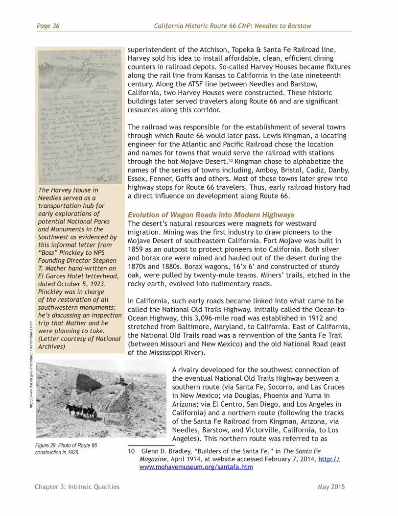
The Harvey House in Needles served as a transportation hub for early explorations of potential National Parks and Monuments in the Southwest as evidenced by this informal letter from “Boss” Pinckley to NPS Founding Director Stephen T. Mather hand-written on El Garces Hotel letterhead, dated October 5, 1923. Pinckley was in charge of the restoration of all southwestern monuments; he’s discussing an inspection trip that Mather and he were planning to take. (Letter courtesy of National Archives)

California Historic Route 66 CMP: Needles to Barstow Page 37
May 2015 Chapter 3: Intrinsic Qualities
the Santa Fe-Grand Canyon-Needles Highway. From Needles to Barstow, the road was already partially macadamized11. Signs along the route helped motorists find the road. The northern route was officially adopted as part of the National Old Trails Highway proposal in 1913, dropping the Ocean-to-Ocean Highway nomenclature12.
Constructed in 1926, Route 66 was representative of the Good Roads Movement that emerged in 1921. Prior to this period, road construction was funded by state and local governments and largely confined to New England states and California. These roads were built from the 1880s through the turn of the 20th century. With the increase of automobile as well as truck traffic, these water-bound madacam roads did not stand up well. California’s construction of concrete and bituminous macadam roads proved more durable. Automobile associations across the country championed for long-distance highways that ultimately facilitated tourism and economic development. From 1921 to 1956, federal funding of interstate highways like Route 66 encouraged travel through previously isolated locales.13 The towns originally established for railroad service through the Mojave Desert gained a second wind from the building of Route 66.
Route 66 became a major road of escape for migrants seeking to leave behind life in the Dust Bowl. During the 1930s, economic hardships of the Depression and droughts in the Central Plains sparked a mass migration westward. As winds swept away the over-farmed soil of Oklahoma, Texas, and Kansas and with the national economy in collapse, more than one million Americans turned to California as the land of opportunity. Route 66 is estimated to have carried 65 percent of westbound traffic to California during the 1930s.
John Steinbeck’s novel The Grapes of Wrath was intended as a critical commentary on the social conditions that created the mass migration and the harsh treatment of migrants on reaching California. In his description of the journey along Route 66 11 Macadam roads, pioneered by Scottish engineer John Loudon McAdam
around 1820, were built with layers of consistently sized aggregate—the top layer being the smallest to smooth out the ride.
12 For a detailed description of the competing northern and southern routes see: http://www.fhwa.dot.gov/infrastructure/trailsc.cfm
13 Peter J. Hugill, Good Roads Movement,” in Encyclopedia of the Great Plains at website accessed February 7, 2014, http://plainshumanities.unl.edu/encyclopedia/doc/egp.tra.013
Figure 30 Postcard from Chambless
Figure 31 Postcard from Murphy Brothers General Store, Ludlow
Figure 32 Postcard from the 1970s of the current Ludlow Cafe
Page 38 California Historic Route 66 CMP: Needles to Barstow
Chapter 3: Intrinsic Qualities May 2015
to California, he wrote of jalopy cars, stuffed with people, over-heating, blowing tires and breaking down.
Route 66 was “the path of a people in flight ... they come into 66 from the tributary side roads, from the wagon tracks and the rutted country roads. 66 is the mother road.” Steinbeck’s selection of language had a powerful effect of personifying the road. Despite a narrative of disillusionment—a miserable journey to a false dream—many Americans romanticized Route 66.
Route 66 opened the Golden State to seekers of the California dream, a paradise of palms and sunshine on the Pacific Ocean. Yet, as Steinbeck described the “terror between towns,” travelers along Route 66 had to be self-sufficient, as few accommodations existed. Overnight lodging usually meant camping, sometimes in small auto camps with other travelers. Through the California desert there were very few hotels and service stations. Route 66 kept many small towns and their businesses afloat during this time with the steady stream of westbound migrants.
After World War II, the national economy rebounded vigorously, creating a new consumer culture that included travel. Businesses along Route 66 that survived during the 1930s westward pilgrimage now flourished. The golden age of tourism reinforced Route 66’s influence on the built landscape, evident in the numerous automobile oriented businesses popping up along its path. The road created economic possibilities for tourist trade and the automobile service industry, in gas stations, motels, and diners. Novelty building design and neon signs colored the highway, creating a unique American roadside architecture. Route 66 became a destination unto itself.
A tangent of auto tourism and roadside architecture was postcard design. As Americans motored about the country, they wanted to collect or send souvenirs of their travels. Today, postcards are sometimes the only evidence of destinations and businesses along the early highways that were closed and abandoned after the installation of major interstate highways. In the post-war climate of disposable income, travelers along Route 66 into California were again seeking adventure, and in even greater numbers than during the Depression. Some visitors to California were on family vacations, others came to stay in the land of sun and palms. Again, American pop culture immortalized Route 66. The sad
WWII: Amboy and I-40:
The nation experienced new-found growth and prosperity after the war. New jobs brought wealth and prosperity to thousands of post war families, who now could afford leisure travel across the country on Route 66. The journey now became an adventure to discover the West, including the glitz and glamor of Hollywood, something called Disneyland, and the austere natural beauty of California’s landscapes.
Amboy, like so many of the desert communities, remained open 24-7 to greet and accommodate this new generation of Route 66 automobile adventurers. Amboy, like so many of its desert neighbors grew and prospered until the opening of Interstate 40 in 1973. The grand highway bypassed the vast majority of America’s Route 66 cities, towns and communities, many which slowly faded into obscurity.
Figure 33 Postcard depicting Roy’s full lunch counter during its heydays (http://www.66postcards.com/postcards/ca/CA015900.htm)
Figure 34 Amboy in 2014

California Historic Route 66 CMP: Needles to Barstow Page 39
May 2015 Chapter 3: Intrinsic Qualities
and remote mother road of plight for Steinbeck’s migrants became a symbol of the American road trip, in the song “Get Your Kicks on Route 66.” The 1946 tune was inspired during songwriter Bobby Troup’s cross-country adventure. The lyrics tick off the names of towns along the highway including Barstow in the California desert.
President Dwight D. Eisenhower signed the Federal-Aid Highway Act in 1956, which authorized construction of a national interstate system. Once completed, the new interstate 40 bypassed much of Historic Route 66, which was decommissioned in 1985. This led to the gradual decline of many of the small railroad communities and businesses along Route 66.
Desert Training CenterDuring World War II, in response to Germany’s success in North Africa, the U.S. War Department initiated an Army-training program in areas with a desert terrain and environment. Major General George S. Patton, Jr., commander of the I Armored Corps, was responsible for selecting the site. A native of southern California, Patton was familiar with the area and had also participated in Army maneuvers in the Mojave Desert in the 1930s. The Desert Training Center, later re-named the California-Arizona Maneuver Area (DTC/C-AMA) was created in 1942. Patton chose the small town of Desert Center as his headquarters.
The maneuver area would eventually expand to encompass more than 12 million acres, making it the largest training area in the world, covering some 18,000 square miles. Its range extended from the outskirts of Pomona, California, eastward to within fifty miles
Cour
tesy
San
Ber
nard
ino
Coun
ty L
ibra
ry, v
ia R
ick
Jack
son)
, http
://w
ww.
airfi
elds
-free
man
.com
/CA/
Airfi
elds
_ CA
_San
Bern
ardi
no_S
E.ht
m
http
://w
ww.
city
ofne
edle
s.co
m/P
ages
/Abo
ut-
Nee
dles
/Nee
dles
-bac
k-in
-the-
day.h
tml
Figure 35 Camp Essex Reservoir (courtesy of BLM)
Figure 36 Ca. 1943 photo of army troops in Needles, El Garces Harvey House is in the background.
Figure 37 1943 aerial view looking east at the Camp Ibis AAF.
Page 40 California Historic Route 66 CMP: Needles to Barstow
Chapter 3: Intrinsic Qualities May 2015
of Phoenix, Arizona, southward to the suburbs of Yuma, Arizona, and northward into the southern tip of Nevada. Soldiers training here had to contend with constant clouds of dust created during tank maneuvers. Sand found its way into tents, food, clothing, weapons, eyes and mouths. Diesel fuel had to be poured on the ground near living areas to keep away scorpions, tarantulas, and rattlesnakes. Temperatures in the desert ranged wildly from below freezing to over 100 degrees.
General Patton oversaw the training maneuvers from April to August of 1942. At that time he departed for “Operation Torch,” the Allied attack on German-occupied North Africa. More than one million troops trained in this area between 1942 and 1944. On April 30, 1944, two years after its inception, the U.S. Army closed the CAMA. During the past 70 years, the desert has slowly continued to reclaim the abandoned camp sites and airfields. Today, some remnants of these camps remain visible on the desert landscape.
Representative of Patton’s Desert Training Center, Camp Ibis was established near Needles during the spring of 1942 and ultimately occupied by the 4th Armored Division, followed by the 9th Armored Division, and lastly 11th Armored Division. Camp Ibis consisted primarily of temporary improvements including twenty-eight enlisted men’s shower buildings, fourteen officer’s shower buildings, 173 latrines, 234 wood tent frames, twenty-three firing ranges, and a 50,000-gallon wooden elevated storage tank. Equipment installed on the site included deep well pumps, a chlorinator, platform scales, three 700 gallon drums. The only permanent structure constructed on the site was one 500,000-gallon concrete reservoir. Route 66 served as one of the main highways for movement of supplies and materials.
HISTORIC SITES AND DISTRICTSThe significance of Historic Route 66 through the Mojave Desert has been recognized through listings and determinations of eligibility for the National Register of Historic Places (National Register). Although there are a limited number of recognized historic sites, the potential for additional designations is extensive and discussed in Chapter 4, Stewardship. The following are the existing listed properties:
NATIONAL REGISTER-LISTED PROPERTIES
Archeological Site No. D-4, D-7, D-12The native peoples of the southeastern California desert left cultural evidence upon the natural landscape that has helped to document their presence there. While the locations of these sites are restricted for their protection, they have been recognized for their significance to our nation’s pre-history through listing on the National Register
California Historic Route 66 CMP: Needles to Barstow Page 41
May 2015 Chapter 3: Intrinsic Qualities
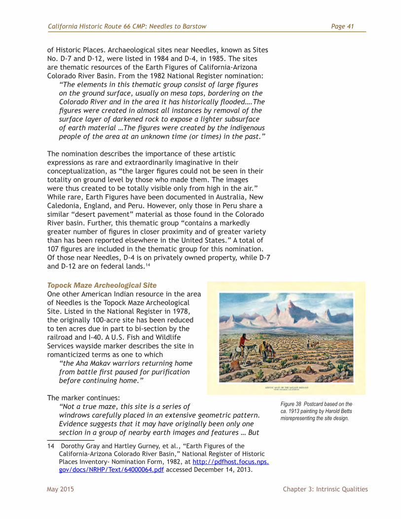
of Historic Places. Archaeological sites near Needles, known as Sites No. D-7 and D-12, were listed in 1984 and D-4, in 1985. The sites are thematic resources of the Earth Figures of California-Arizona Colorado River Basin. From the 1982 National Register nomination:
“The elements in this thematic group consist of large figures on the ground surface, usually on mesa tops, bordering on the Colorado River and in the area it has historically flooded….The figures were created in almost all instances by removal of the surface layer of darkened rock to expose a lighter subsurface of earth material …The figures were created by the indigenous people of the area at an unknown time (or times) in the past.”
The nomination describes the importance of these artistic expressions as rare and extraordinarily imaginative in their conceptualization, as “the larger figures could not be seen in their totality on ground level by those who made them. The images were thus created to be totally visible only from high in the air.” While rare, Earth Figures have been documented in Australia, New Caledonia, England, and Peru. However, only those in Peru share a similar “desert pavement” material as those found in the Colorado River basin. Further, this thematic group “contains a markedly greater number of figures in closer proximity and of greater variety than has been reported elsewhere in the United States.” A total of 107 figures are included in the thematic group for this nomination. Of those near Needles, D-4 is on privately owned property, while D-7 and D-12 are on federal lands.14
Topock Maze Archeological SiteOne other American Indian resource in the area of Needles is the Topock Maze Archeological Site. Listed in the National Register in 1978, the originally 100-acre site has been reduced to ten acres due in part to bi-section by the railroad and I-40. A U.S. Fish and Wildlife Services wayside marker describes the site in romanticized terms as one to which
“the Aha Makav warriors returning home from battle first paused for purification before continuing home.”
The marker continues:
“Not a true maze, this site is a series of windrows carefully placed in an extensive geometric pattern. Evidence suggests that it may have originally been only one section in a group of nearby earth images and features … But
14 Dorothy Gray and Hartley Gurney, et al., “Earth Figures of the California-Arizona Colorado River Basin,” National Register of Historic Places Inventory- Nomination Form, 1982, at http://pdfhost.focus.nps.gov/docs/NRHP/Text/64000064.pdf accessed December 14, 2013.
Figure 38 Postcard based on the ca. 1913 painting by Harold Betts misrepresenting the site design.

Page 42 California Historic Route 66 CMP: Needles to Barstow
Chapter 3: Intrinsic Qualities May 2015
whether or not the geoglyphs in this vicinity were associated with one another, this was clearly an area of symbolic and ritual significance.”
Though the site has been known locally as the Mystic Maze, its origin and age has been the subject of debate for many years. At question is whether the Mojave Indians constructed the rock feature, and if so, for what purpose; or rather, is it a historic construction resulting from laying of the railroad line? A recent essay studies the controversy through an analysis of various sources (notably lacking any railroad records on the matter).
Author Ruth Arlene Musser-Lopez claims that the controversy began after railroad magnate J. P. Morgan commissioned Edward S. Curtis to produce a photo-history of the North American Indian. Ethnologists have criticized Curtis’ work as manipulative, pointing to the proclivity of railroad promoters for appropriating American Indian imagery to drum up tourism. Despite the rock feature’s uniform rows of mounded gravel, its description as a maze or labyrinth took hold. Even early 20th-century postcards misrepresented the site through inaccurate drawings. These postcards were sold at railroad stops such as the Harvey House in Needles imparting credibility to idea of a mystical maze.
It is possible that the 1915-1916 Panama-California Exposition, and construction of roads to it, helped save the maze from destruction. The National Old Trails Road conveniently brought travelers to the Expo in San Diego directly through Needles and the by-then famous “Mystical Maze.” Needles’ Congressional Representative from 1913-1921, William Kettner, reportedly was aware of the value of the site as a tourist draw and worked to have the National Old Trails Road pass through the town. As Musser-Lopez’s essay concludes, the Topock site has by this point transcended the debate over origin and date of construction, stating it “has been a valuable roadside attraction for over 100 years.” Further, its “legend and mystery” enhance its significance “not only in the local culture but as a national monument to American ingenuity and entrepreneurial creativity.”15
While one portion of the maze is listed on the National Register, two other adjacent sections are currently under review for eligibility as a Traditional Cultural Property (TCP), pertaining to a Section 106 remediation project. A TCP is eligible for listing based on its “association with cultural practices or beliefs of a living community that are rooted in the community’s history, and important in maintaining the continuing cultural identity of the community.” 15 Ruth Arlene Musser-Lopez, “Mystic Maze” or “Mystic Maize:” The
Amazing Archaeological Evidence” at http://www.scahome.org/publications/proceedings/Proceedings.25Lopez.pdf accessed December 13, 2013.
California Historic Route 66 CMP: Needles to Barstow Page 43
May 2015 Chapter 3: Intrinsic Qualities
http
://w
ww.
66po
stca
rds.
com
/pos
tcar
ds/c
a/CA
0087
00.h
tml
http
://w
ww.
city
ofne
edle
s.co
m/P
ages
/Abo
ut-
Nee
dles
/Nee
dles
-bac
k-in
-the-
day.h
tml
Thus, the BLM, the California State Historic Preservation Office (SHPO), and the Advisory Council on Historic Preservation, in consultation with nine American Indian tribes, appear inclined to link the site with American Indian origin rather than to a late 19th century railroad origin.16
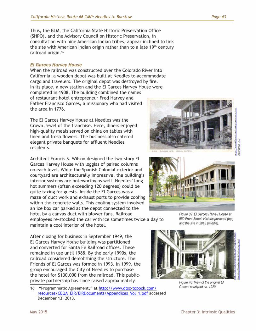
El Garces Harvey HouseWhen the railroad was constructed over the Colorado River into California, a wooden depot was built at Needles to accommodate cargo and travelers. The original depot was destroyed by fire. In its place, a new station and the El Garces Harvey House were completed in 1908. The building combined the names of restaurant-hotel entrepreneur Fred Harvey and Father Francisco Garces, a missionary who had visited the area in 1776.
The El Garces Harvey House at Needles was the Crown Jewel of the franchise. Here, diners enjoyed high-quality meals served on china on tables with linen and fresh flowers. The business also catered elegant private banquets for affluent Needles residents.
Architect Francis S. Wilson designed the two-story El Garces Harvey House with loggias of paired columns on each level. While the Spanish Colonial exterior and courtyard are architecturally impressive, the building’s interior systems are noteworthy as well. Needles’ long hot summers (often exceeding 120 degrees) could be quite taxing for guests. Inside the El Garces was a maze of duct work and exhaust ports to provide cooling within the concrete walls. This cooling system involved an ice box car parked at the depot connected to the hotel by a canvas duct with blower fans. Railroad employees re-stocked the car with ice sometimes twice a day to maintain a cool interior of the hotel.
After closing for business in September 1949, the El Garces Harvey House building was partitioned and converted for Santa Fe Railroad offices. These remained in use until 1988. By the early 1990s, the railroad considered demolishing the structure. The Friends of El Garces was formed in 1993. In 1999, the group encouraged the City of Needles to purchase the hotel for $130,000 from the railroad. This public-private partnership has since raised approximately
16 “Programmatic Agreement,” at http://www.dtsc-topock.com/resources/CEQA_EIR/EIRDocuments/Appendices_Vol_1.pdf accessed December 13, 2013.
Figure 39 El Garces Harvey House at 950 Front Street: Historic postcard (top) and the site in 2013 (middle).
Figure 40 View of the original El Garces courtyard ca. 1920.
Page 44 California Historic Route 66 CMP: Needles to Barstow
Chapter 3: Intrinsic Qualities May 2015
$10 million for the renovation, primarily through state and federal transportation grants. In recent years, it has been the focus of preservation efforts in Needles. The building was listed in the National Register in 2002.
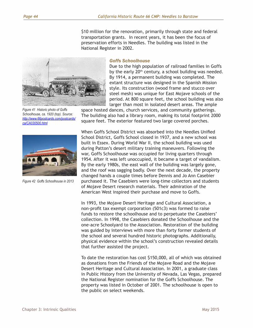
Goffs SchoolhouseDue to the high population of railroad families in Goffs by the early 20th century, a school building was needed. By 1914, a permanent building was completed. The extant structure was designed in the Spanish Mission style. Its construction (wood frame and stucco over steel mesh) was unique for East Mojave schools of the period. At 800 square feet, the school building was also larger than most in isolated desert areas. The ample
space hosted dances, church services, and community gatherings. The building also had a library room, making its total footprint 2000 square feet. The exterior featured two large covered porches.
When Goffs School District was absorbed into the Needles Unified School District, Goffs School closed in 1937, and a new school was built in Essex. During World War II, the school building was used during Patton’s desert military training maneuvers. Following the war, Goffs Schoolhouse was occupied for living quarters through 1954. After it was left unoccupied, it became a target of vandalism. By the early 1980s, the east wall of the building was largely gone, and the roof was sagging badly. Over the next decade, the property changed hands a couple times before Dennis and Jo Ann Casebier purchased it. The Casebiers were long-time collectors and students of Mojave Desert research materials. Their admiration of the American West inspired their purchase and move to Goffs.
In 1993, the Mojave Desert Heritage and Cultural Association, a non-profit tax exempt corporation (501c3) was formed to raise funds to restore the schoolhouse and to perpetuate the Casebiers’ collection. In 1998, the Casebiers donated the Schoolhouse and the one-acre Schoolyard to the Association. Restoration of the building was guided by interviews with more than forty former students of the school and several hundred historic photographs. Additionally, physical evidence within the school’s construction revealed details that further assisted the project.
To date the restoration has cost $150,000, all of which was obtained as donations from the Friends of the Mojave Road and the Mojave Desert Heritage and Cultural Association. In 2001, a graduate class in Public History from the University of Nevada, Las Vegas, prepared the National Register nomination for the Goffs Schoolhouse. The property was listed in October of 2001. The schoolhouse is open to the public on select weekends.
Figure 41 Historic photo of Goffs Schoolhouse, ca. 1920 (top). Source: http://www.66postcards.com/postcards/ca/CA030500.html
Figure 42 Goffs Schoolhouse in 2013
California Historic Route 66 CMP: Needles to Barstow Page 45
May 2015 Chapter 3: Intrinsic Qualities
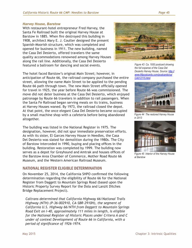
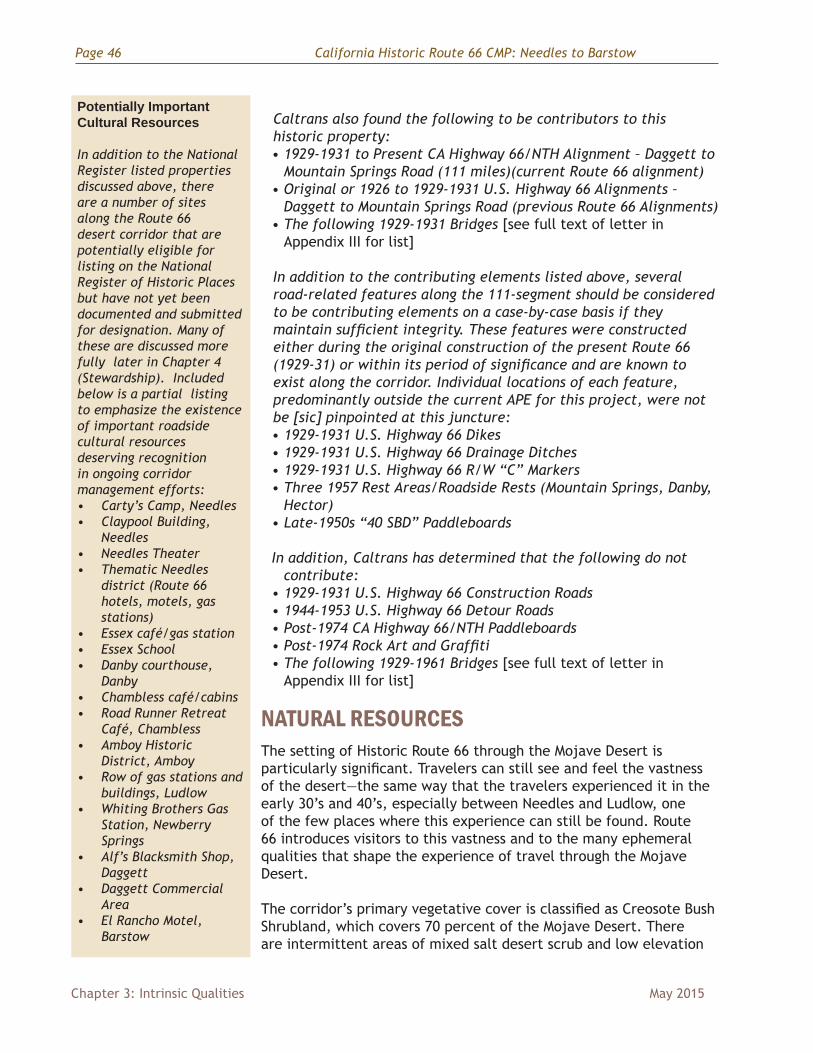
Harvey House, BarstowWith restaurant-hotel entrepreneur Fred Harvey, the Santa Fe Railroad built the original Harvey House at Barstow in 1885. When fire destroyed this building in 1908, architect Mary E. J. Coulter designed the present Spanish-Moorish structure, which was completed and opened for business in 1911. The new building, named the Casa Del Desierto, offered travelers the same quality accommodations renowned among Harvey Houses along the rail line. Additionally, the Casa Del Desierto featured a ballroom for dancing and social events.
The hotel faced Barstow’s original Main Street; however, in anticipation of Route 66, the railroad company purchased the entire street, allowing the name Main Street to be applied to the pending Route 66 path through town. The new Main Street officially opened for travel in 1925, the year before Route 66 was commissioned. The move did not deter business at the Casa Del Desierto, which enjoyed patronage by Route 66 travelers in addition to rail passengers. When the Santa Fe Railroad began serving meals on its trains, business at Harvey Houses waned. By 1973, the railroad closed the depot. At that point, the once elegant Casa Del Desierto became occupied by a small machine shop with a cafeteria before being abandoned altogether.
The building was listed in the National Register in 1975. The designation, however, did not spur immediate preservation efforts. As with its sister, El Garces Harvey House in Needles, the Casa Del Desierto was slated for demolition during the 1980s. The City of Barstow interceded in 1990, buying and placing offices in the building. Restoration was completed by 1999. The building now serves as a depot for Greyhound and Amtrak and houses offices of the Barstow Area Chamber of Commerce, Mother Road Route 66 Museum, and the Western American Railroad Museum.
NATIONAL REGISTER ELIGIBLE DETERMINATIONOn November 25, 2014, the California SHPO confirmed the following determination regarding the eligibility of Route 66 for the National Register from Daggett to Mountain Springs Road (based upon the Historic Property Survey Report for the Dola and Lanzit Ditches Bridge Replacement Project).
Caltrans determined that California Highway 66/National Trails Highway (NTH) (P-36-002910, CA-SBR-2910H), the segment of California U.S. Highway 66/NTH from Daggett to Mountain Springs Road Exit on I-40, approximately 111 miles in length, is eligible for the National Register of Historic Places under Critera A and C under of context Development of Route 66 in California, with a period of significance of 1926-1974.
Figure 43 Ca. 1930 postcard showing the full expanse of the Casa Del Desierto Harvey House. Source: http://www.66postcards.com/postcards/ca/CA012115.html
Figure 44 The restored Harvey House in 2013
Figure 45 Interior of the Harvey House at Barstow
Page 46 California Historic Route 66 CMP: Needles to Barstow
Chapter 3: Intrinsic Qualities May 2015
Caltrans also found the following to be contributors to this historic property: • 1929-1931 to Present CA Highway 66/NTH Alignment – Daggett to
Mountain Springs Road (111 miles)(current Route 66 alignment) • Original or 1926 to 1929-1931 U.S. Highway 66 Alignments –
Daggett to Mountain Springs Road (previous Route 66 Alignments) • The following 1929-1931 Bridges [see full text of letter in
Appendix III for list]
In addition to the contributing elements listed above, several road-related features along the 111-segment should be considered to be contributing elements on a case-by-case basis if they maintain sufficient integrity. These features were constructed either during the original construction of the present Route 66 (1929-31) or within its period of significance and are known to exist along the corridor. Individual locations of each feature, predominantly outside the current APE for this project, were not be [sic] pinpointed at this juncture: • 1929-1931 U.S. Highway 66 Dikes • 1929-1931 U.S. Highway 66 Drainage Ditches • 1929-1931 U.S. Highway 66 R/W “C” Markers • Three 1957 Rest Areas/Roadside Rests (Mountain Springs, Danby,
Hector) • Late-1950s “40 SBD” Paddleboards
In addition, Caltrans has determined that the following do not contribute:
• 1929-1931 U.S. Highway 66 Construction Roads • 1944-1953 U.S. Highway 66 Detour Roads • Post-1974 CA Highway 66/NTH Paddleboards • Post-1974 Rock Art and Graffiti• The following 1929-1961 Bridges [see full text of letter in
Appendix III for list]
NATURAL RESOURCESThe setting of Historic Route 66 through the Mojave Desert is particularly significant. Travelers can still see and feel the vastness of the desert—the same way that the travelers experienced it in the early 30’s and 40’s, especially between Needles and Ludlow, one of the few places where this experience can still be found. Route 66 introduces visitors to this vastness and to the many ephemeral qualities that shape the experience of travel through the Mojave Desert.
The corridor’s primary vegetative cover is classified as Creosote Bush Shrubland, which covers 70 percent of the Mojave Desert. There are intermittent areas of mixed salt desert scrub and low elevation
Potentially Important Cultural Resources
In addition to the National Register listed properties discussed above, there are a number of sites along the Route 66 desert corridor that are potentially eligible for listing on the National Register of Historic Places but have not yet been documented and submitted for designation. Many of these are discussed more fully later in Chapter 4 (Stewardship). Included below is a partial listing to emphasize the existence of important roadside cultural resources deserving recognition in ongoing corridor management efforts: • Carty’s Camp, Needles• Claypool Building,
Needles• Needles Theater• Thematic Needles
district (Route 66 hotels, motels, gas stations)
• Essex café/gas station• Essex School• Danby courthouse,
Danby• Chambless café/cabins• Road Runner Retreat
Café, Chambless• Amboy Historic
District, Amboy• Row of gas stations and
buildings, Ludlow• Whiting Brothers Gas
Station, Newberry Springs
• Alf’s Blacksmith Shop, Daggett
• Daggett Commercial Area
• El Rancho Motel, Barstow
California Historic Route 66 CMP: Needles to Barstow Page 47
May 2015 Chapter 3: Intrinsic Qualities
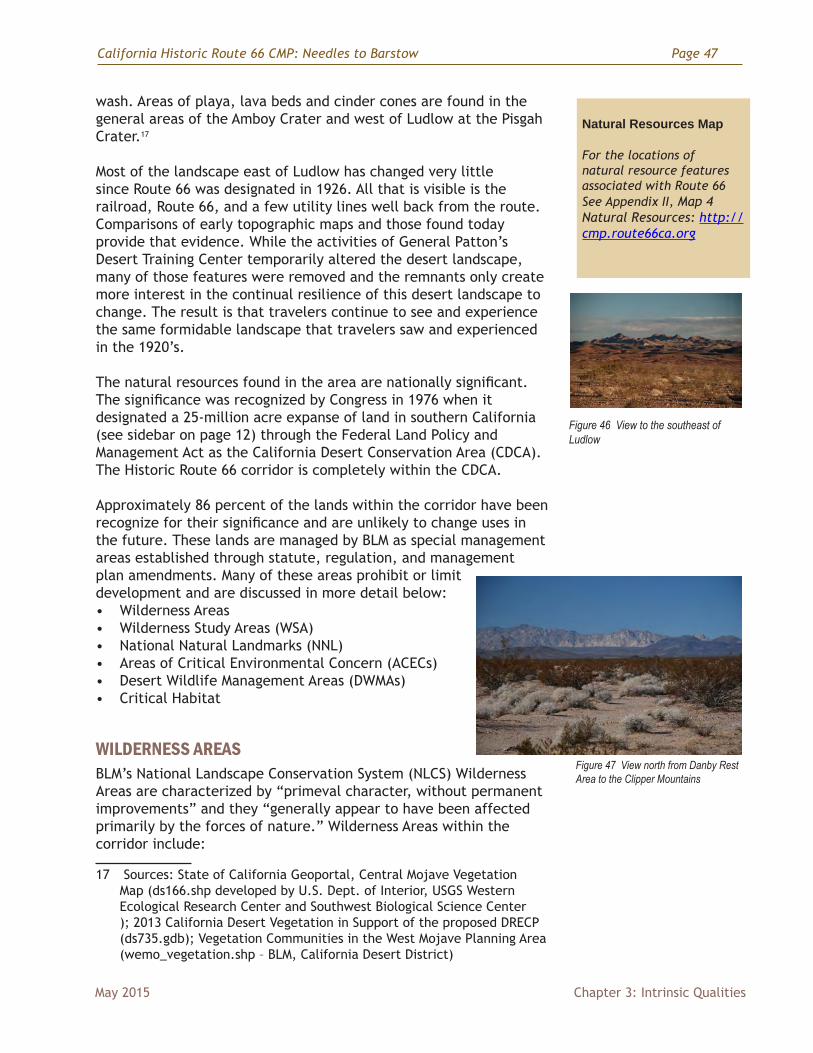
wash. Areas of playa, lava beds and cinder cones are found in the general areas of the Amboy Crater and west of Ludlow at the Pisgah Crater.17
Most of the landscape east of Ludlow has changed very little since Route 66 was designated in 1926. All that is visible is the railroad, Route 66, and a few utility lines well back from the route. Comparisons of early topographic maps and those found today provide that evidence. While the activities of General Patton’s Desert Training Center temporarily altered the desert landscape, many of those features were removed and the remnants only create more interest in the continual resilience of this desert landscape to change. The result is that travelers continue to see and experience the same formidable landscape that travelers saw and experienced in the 1920’s.
The natural resources found in the area are nationally significant. The significance was recognized by Congress in 1976 when it designated a 25-million acre expanse of land in southern California (see sidebar on page 12) through the Federal Land Policy and Management Act as the California Desert Conservation Area (CDCA). The Historic Route 66 corridor is completely within the CDCA.
Approximately 86 percent of the lands within the corridor have been recognize for their significance and are unlikely to change uses in the future. These lands are managed by BLM as special management areas established through statute, regulation, and management plan amendments. Many of these areas prohibit or limit development and are discussed in more detail below: • Wilderness Areas• Wilderness Study Areas (WSA)• National Natural Landmarks (NNL)• Areas of Critical Environmental Concern (ACECs)• Desert Wildlife Management Areas (DWMAs)• Critical Habitat
WILDERNESS AREASBLM’s National Landscape Conservation System (NLCS) Wilderness Areas are characterized by “primeval character, without permanent improvements” and they “generally appear to have been affected primarily by the forces of nature.” Wilderness Areas within the corridor include:
17 Sources: State of California Geoportal, Central Mojave Vegetation Map (ds166.shp developed by U.S. Dept. of Interior, USGS Western Ecological Research Center and Southwest Biological Science Center ); 2013 California Desert Vegetation in Support of the proposed DRECP (ds735.gdb); Vegetation Communities in the West Mojave Planning Area (wemo_vegetation.shp – BLM, California Desert District)
Natural Resources Map
For the locations of natural resource features associated with Route 66 See Appendix II, Map 4 Natural Resources: http://cmp.route66ca.org
Figure 46 View to the southeast of Ludlow
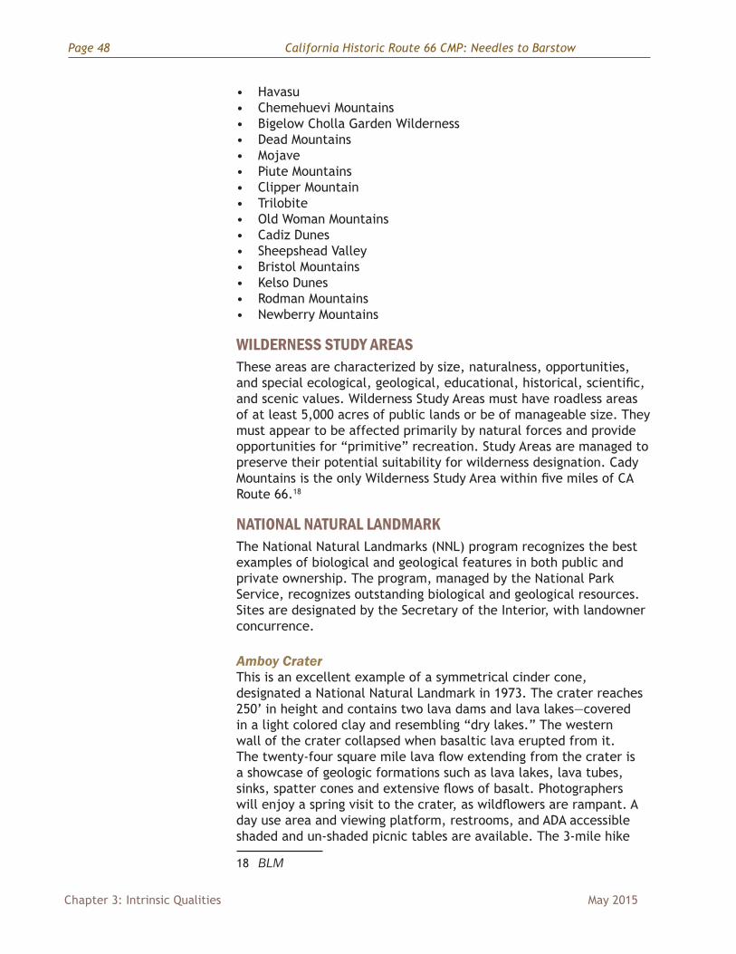
Figure 47 View north from Danby Rest Area to the Clipper Mountains
Page 48 California Historic Route 66 CMP: Needles to Barstow
Chapter 3: Intrinsic Qualities May 2015
• Havasu• Chemehuevi Mountains• Bigelow Cholla Garden Wilderness• Dead Mountains• Mojave• Piute Mountains• Clipper Mountain• Trilobite• Old Woman Mountains • Cadiz Dunes• Sheepshead Valley• Bristol Mountains• Kelso Dunes• Rodman Mountains• Newberry Mountains
WILDERNESS STUDY AREAS These areas are characterized by size, naturalness, opportunities, and special ecological, geological, educational, historical, scientific, and scenic values. Wilderness Study Areas must have roadless areas of at least 5,000 acres of public lands or be of manageable size. They must appear to be affected primarily by natural forces and provide opportunities for “primitive” recreation. Study Areas are managed to preserve their potential suitability for wilderness designation. Cady Mountains is the only Wilderness Study Area within five miles of CA Route 66.18
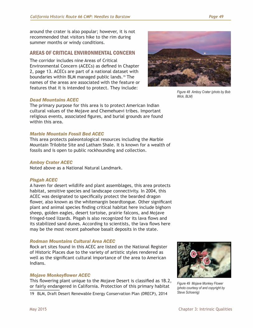
NATIONAL NATURAL LANDMARKThe National Natural Landmarks (NNL) program recognizes the best examples of biological and geological features in both public and private ownership. The program, managed by the National Park Service, recognizes outstanding biological and geological resources. Sites are designated by the Secretary of the Interior, with landowner concurrence.
Amboy CraterThis is an excellent example of a symmetrical cinder cone, designated a National Natural Landmark in 1973. The crater reaches 250’ in height and contains two lava dams and lava lakes—covered in a light colored clay and resembling “dry lakes.” The western wall of the crater collapsed when basaltic lava erupted from it. The twenty-four square mile lava flow extending from the crater is a showcase of geologic formations such as lava lakes, lava tubes, sinks, spatter cones and extensive flows of basalt. Photographers will enjoy a spring visit to the crater, as wildflowers are rampant. A day use area and viewing platform, restrooms, and ADA accessible shaded and un-shaded picnic tables are available. The 3-mile hike
18 BLM
California Historic Route 66 CMP: Needles to Barstow Page 49
May 2015 Chapter 3: Intrinsic Qualities
around the crater is also popular; however, it is not recommended that visitors hike to the rim during summer months or windy conditions.
AREAS OF CRITICAL ENVIRONMENTAL CONCERNThe corridor includes nine Areas of Critical Environmental Concern (ACECs) as defined in Chapter 2, page 13. ACECs are part of a national dataset with boundaries within BLM managed public lands.19 The names of the areas are associated with the feature or features that it is intended to protect. They include:
Dead Mountains ACECThe primary purpose for this area is to protect American Indian cultural values of the Mojave and Chemehuevi tribes. Important religious events, associated figures, and burial grounds are found within this area.
Marble Mountain Fossil Bed ACECThis area protects paleontological resources including the Marble Mountain Trilobite Site and Latham Shale. It is known for a wealth of fossils and is open to public rockhounding and collection.
Amboy Crater ACECNoted above as a National Natural Landmark.
Pisgah ACECA haven for desert wildlife and plant assemblages, this area protects habitat, sensitive species and landscape connectivity. In 2004, this ACEC was designated to specifically protect the bearded dragon flower, also known as the whitemargin beardtongue. Other significant plant and animal species finding critical habitat here include bighorn sheep, golden eagles, desert tortoise, prairie falcons, and Mojave fringed-toed lizards. Pisgah is also recognized for its lava flows and its stabilized sand dunes. According to scientists, the lava flows here may be the most recent pahoehoe basalt deposits in the state.
Rodman Mountains Cultural Area ACECRock art sites found in this ACEC are listed on the National Register of Historic Places due to the variety of artistic styles rendered as well as the significant cultural importance of the area to American Indians.
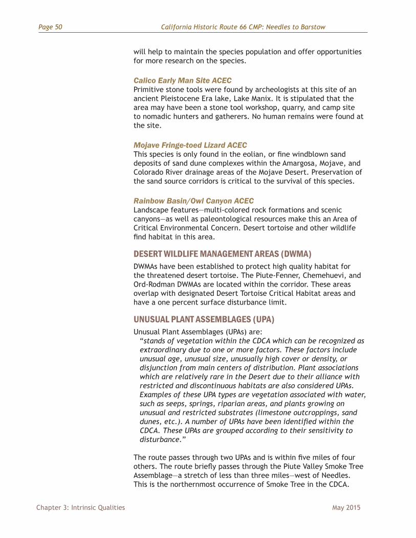
Mojave Monkeyflower ACECThis flowering plant unique to the Mojave Desert is classified as 1B.2, or fairly endangered in California. Protection of this primary habitat
19 BLM, Draft Desert Renewable Energy Conservation Plan (DRECP), 2014
Figure 48 Amboy Crater (photo by Bob Wick, BLM)
Figure 49 Mojave Monkey Flower (photo courtesy of and copyright by Steve Schoenig)
Page 50 California Historic Route 66 CMP: Needles to Barstow
Chapter 3: Intrinsic Qualities May 2015
will help to maintain the species population and offer opportunities for more research on the species.
Calico Early Man Site ACECPrimitive stone tools were found by archeologists at this site of an ancient Pleistocene Era lake, Lake Manix. It is stipulated that the area may have been a stone tool workshop, quarry, and camp site to nomadic hunters and gatherers. No human remains were found at the site.
Mojave Fringe-toed Lizard ACECThis species is only found in the eolian, or fine windblown sand deposits of sand dune complexes within the Amargosa, Mojave, and Colorado River drainage areas of the Mojave Desert. Preservation of the sand source corridors is critical to the survival of this species.
Rainbow Basin/Owl Canyon ACECLandscape features—multi-colored rock formations and scenic canyons—as well as paleontological resources make this an Area of Critical Environmental Concern. Desert tortoise and other wildlife find habitat in this area.
DESERT WILDLIFE MANAGEMENT AREAS (DWMA)DWMAs have been established to protect high quality habitat for the threatened desert tortoise. The Piute-Fenner, Chemehuevi, and Ord-Rodman DWMAs are located within the corridor. These areas overlap with designated Desert Tortoise Critical Habitat areas and have a one percent surface disturbance limit.
UNUSUAL PLANT ASSEMBLAGES (UPA) Unusual Plant Assemblages (UPAs) are:
“stands of vegetation within the CDCA which can be recognized as extraordinary due to one or more factors. These factors include unusual age, unusual size, unusually high cover or density, or disjunction from main centers of distribution. Plant associations which are relatively rare in the Desert due to their alliance with restricted and discontinuous habitats are also considered UPAs. Examples of these UPA types are vegetation associated with water, such as seeps, springs, riparian areas, and plants growing on unusual and restricted substrates (limestone outcroppings, sand dunes, etc.). A number of UPAs have been identified within the CDCA. These UPAs are grouped according to their sensitivity to disturbance.”
The route passes through two UPAs and is within five miles of four others. The route briefly passes through the Piute Valley Smoke Tree Assemblage—a stretch of less than three miles—west of Needles. This is the northernmost occurrence of Smoke Tree in the CDCA.
California Historic Route 66 CMP: Needles to Barstow Page 51
May 2015 Chapter 3: Intrinsic Qualities
The route also passes through the Yuha Desert/Cronese Valley/Ward-Chemehuevi Valley Crucifixion Thorn Assemblage a few miles east of Ludlow. Usually found in the Sonoran Desert, this stand of the species is outside its normal range. The other UPAs within five miles include the Mesquite Thicket north of Needles, Sacramento/Stepladder Mountains Teddy-bear Cholla Assemblage, Homer Mountain Ocotillo Assemblage, and the Ord Mountain Jojobas Assemblage.20
DESERT TORTOISE CRITICAL HABITATThese areas are essential for the conservation of Desert Tortoise. Notices are provided to alert land managers and the general public of the importance of these areas. The Route 66 corridor enters Desert Tortoise Critical Habitat west of Needles on U.S. 95 and a few miles east of the intersection with Goffs Road. It continues through the Critical Habitat Area until the boundary limit about five miles east of Chambless. Another expanse of Critical Habitat Area extends east of Newberry Springs (west of Pisgah) and continues south along the corridor to Barstow. A large expanse of Desert Tortoise Critical Habitat lies north of the Mojave River near Barstow.21
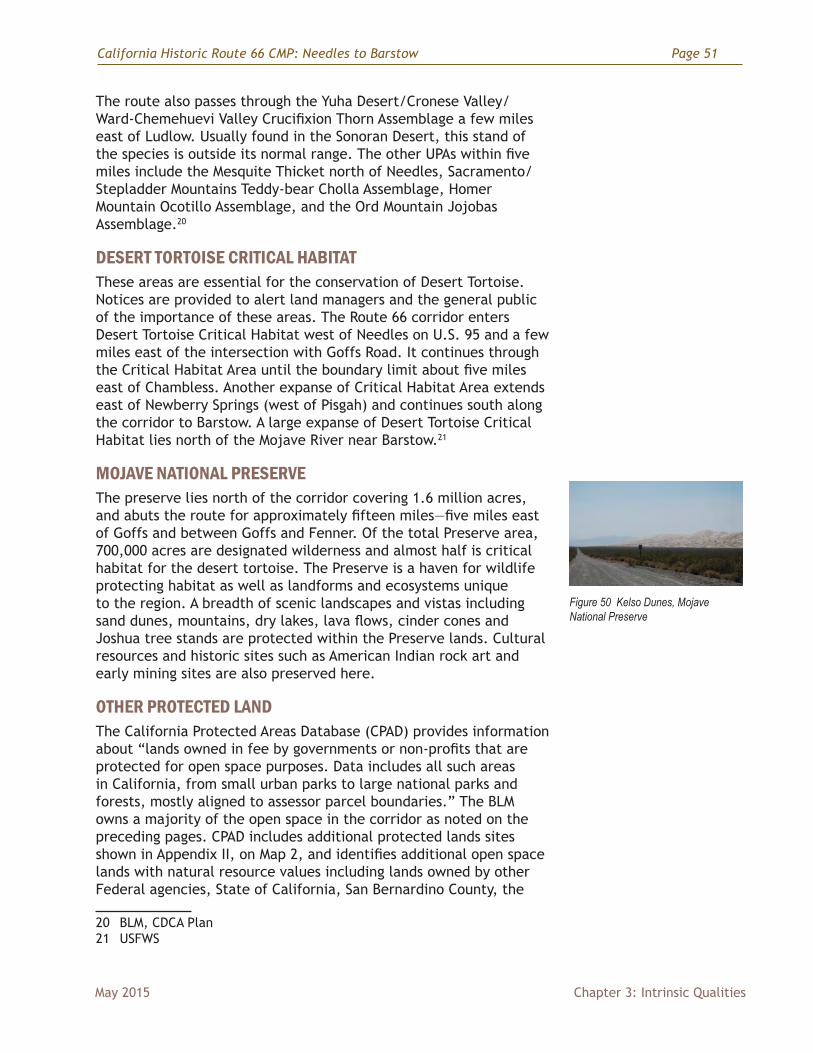
MOJAVE NATIONAL PRESERVEThe preserve lies north of the corridor covering 1.6 million acres, and abuts the route for approximately fifteen miles—five miles east of Goffs and between Goffs and Fenner. Of the total Preserve area, 700,000 acres are designated wilderness and almost half is critical habitat for the desert tortoise. The Preserve is a haven for wildlife protecting habitat as well as landforms and ecosystems unique to the region. A breadth of scenic landscapes and vistas including sand dunes, mountains, dry lakes, lava flows, cinder cones and Joshua tree stands are protected within the Preserve lands. Cultural resources and historic sites such as American Indian rock art and early mining sites are also preserved here.
OTHER PROTECTED LANDThe California Protected Areas Database (CPAD) provides information about “lands owned in fee by governments or non-profits that are protected for open space purposes. Data includes all such areas in California, from small urban parks to large national parks and forests, mostly aligned to assessor parcel boundaries.” The BLM owns a majority of the open space in the corridor as noted on the preceding pages. CPAD includes additional protected lands sites shown in Appendix II, on Map 2, and identifies additional open space lands with natural resource values including lands owned by other Federal agencies, State of California, San Bernardino County, the
20 BLM, CDCA Plan 21 USFWS
Figure 50 Kelso Dunes, Mojave National Preserve
Page 52 California Historic Route 66 CMP: Needles to Barstow
Chapter 3: Intrinsic Qualities May 2015
cities of Needles and Barstow, and Non-Profit Organizations or Special Districts.22
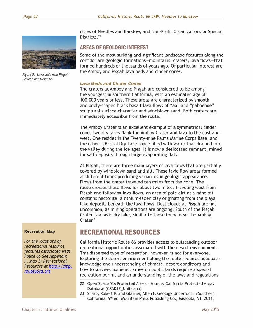
AREAS OF GEOLOGIC INTERESTSome of the most striking and significant landscape features along the corridor are geologic formations—mountains, craters, lava flows—that formed hundreds of thousands of years ago. Of particular interest are the Amboy and Pisgah lava beds and cinder cones.
Lava Beds and Cinder ConesThe craters at Amboy and Pisgah are considered to be among the youngest in southern California, with an estimated age of 100,000 years or less. These areas are characterized by smooth and oddly-shaped black basalt lava flows of “aa” and “pahoehoe” sculptural surface character and windblown sand. Both craters are immediately accessible from the route.
The Amboy Crater is an excellent example of a symmetrical cinder cone. Two dry lakes flank the Amboy Crater and lava to the east and west. One resides in the Twenty-nine Palms Marine Corps Base, and the other is Bristol Dry Lake—once filled with water that drained into the valley during the ice ages. It is now a desiccated remnant, mined for salt deposits through large evaporating flats.
At Pisgah, there are three main layers of lava flows that are partially covered by windblown sand and silt. These lavic flow areas formed at different times producing variances in geologic appearance. Flows from the crater traveled ten miles from the cone. The route crosses these flows for about two miles. Traveling west from Pisgah and following lava flows, an area of pale dirt at a mine pit contains hectorite, a lithium-laden clay originating from the playa lake deposits beneath the lava flows. Dust clouds at Pisgah are not uncommon, as mining operations are ongoing. South of the Pisgah Crater is a lavic dry lake, similar to those found near the Amboy Crater.23
RECREATIONAL RESOURCESCalifornia Historic Route 66 provides access to outstanding outdoor recreational opportunities associated with the desert environment. This dispersed type of recreation, however, is not for everyone. Exploring the desert environment along the route requires adequate knowledge and understanding of climate, desert conditions and how to survive. Some activities on public lands require a special recreation permit and an understanding of the laws and regulations
22 Open Space/CA Protected Areas – Source: California Protected Areas Database (CPAD17_Units.shp)
23 Sharp, Robert P. and Glazner, Allen F. Geology Underfoot in Southern California. 9th ed. Mountain Press Publishing Co., Missoula, VT. 2011.
Recreation Map
For the locations of recreational resource features associated with Route 66 See Appendix II, Map 5: Recreational Resources at http://cmp.route66ca.org
Figure 51 Lava beds near Pisgah Crater along Route 66
California Historic Route 66 CMP: Needles to Barstow Page 53
May 2015 Chapter 3: Intrinsic Qualities
governing access. The BLM-CDD Web site at http://www.blm.gov/ca/st/en/fo/cdd.html or the recreation page at http://www.blm.gov/ca/st/en/prog/recreation.html contain the most accurate and current information. The following recreational opportunities are found along the route or within the corridor.
INFORMATION VISITOR CENTERSIn addition to the Web sites noted above, contacting the BLM Needles or Barstow Field Office, or other agency visitor information center, in advance of the trip will lead to a more successful desert recreational experience. Hours of operations for any visitor facilities may vary by season and other factors. The following information and visitor centers are found within the corridor.
BLM Field Offices (Barstow and Needles)The BLM maintains visitor centers at its Barstow and Needles Field Offices. Visitor information and orientation is available for recreational and interpretive opportunities. The dividing line for the Barstow and Needles Field Offices is generally west and east of Ludlow.
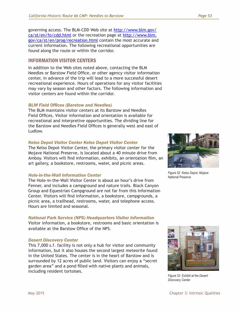
Kelso Depot Visitor Center Kelso Depot Visitor CenterThe Kelso Depot Visitor Center, the primary visitor center for the Mojave National Preserve, is located about a 40 minute drive from Amboy. Visitors will find information, exhibits, an orientation film, an art gallery, a bookstore, restrooms, water, and picnic areas.
Hole-in-the-Wall Information CenterThe Hole-in-the-Wall Visitor Center is about an hour’s drive from Fenner, and includes a campground and nature trails. Black Canyon Group and Equestrian Campground are not far from this Information Center. Visitors will find information, a bookstore, campgrounds, a picnic area, a trailhead, restrooms, water, and telephone access. Hours are limited and seasonal.
National Park Service (NPS) Headquarters Visitor InformationVisitor information, a bookstore, restrooms and basic orientation is available at the Barstow Office of the NPS.
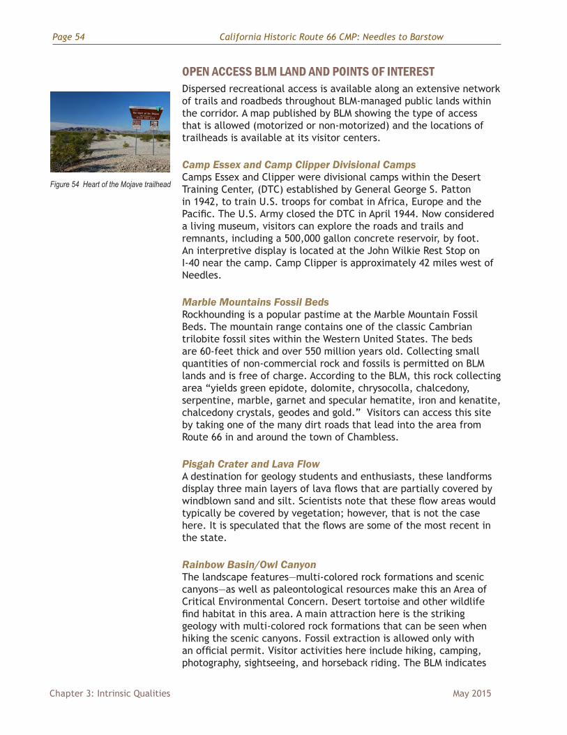
Desert Discovery CenterThis 7,000 s.f. facility is not only a hub for visitor and community information, but it also houses the second largest meteorite found in the United States. The center is in the heart of Barstow and is surrounded by 12 acres of public land. Visitors can enjoy a “secret garden area” and a pond filled with native plants and animals, including resident tortoises.
Figure 52 Kelso Depot, Mojave National Preserve
Figure 53 Exhibit at the Desert Discovery Center
Page 54 California Historic Route 66 CMP: Needles to Barstow
Chapter 3: Intrinsic Qualities May 2015
OPEN ACCESS BLM LAND AND POINTS OF INTERESTDispersed recreational access is available along an extensive network of trails and roadbeds throughout BLM-managed public lands within the corridor. A map published by BLM showing the type of access that is allowed (motorized or non-motorized) and the locations of trailheads is available at its visitor centers.
Camp Essex and Camp Clipper Divisional CampsCamps Essex and Clipper were divisional camps within the Desert Training Center, (DTC) established by General George S. Patton in 1942, to train U.S. troops for combat in Africa, Europe and the Pacific. The U.S. Army closed the DTC in April 1944. Now considered a living museum, visitors can explore the roads and trails and remnants, including a 500,000 gallon concrete reservoir, by foot. An interpretive display is located at the John Wilkie Rest Stop on I-40 near the camp. Camp Clipper is approximately 42 miles west of Needles.
Marble Mountains Fossil Beds Rockhounding is a popular pastime at the Marble Mountain Fossil Beds. The mountain range contains one of the classic Cambrian trilobite fossil sites within the Western United States. The beds are 60-feet thick and over 550 million years old. Collecting small quantities of non-commercial rock and fossils is permitted on BLM lands and is free of charge. According to the BLM, this rock collecting area “yields green epidote, dolomite, chrysocolla, chalcedony, serpentine, marble, garnet and specular hematite, iron and kenatite, chalcedony crystals, geodes and gold.” Visitors can access this site by taking one of the many dirt roads that lead into the area from Route 66 in and around the town of Chambless.
Pisgah Crater and Lava FlowA destination for geology students and enthusiasts, these landforms display three main layers of lava flows that are partially covered by windblown sand and silt. Scientists note that these flow areas would typically be covered by vegetation; however, that is not the case here. It is speculated that the flows are some of the most recent in the state.
Rainbow Basin/Owl CanyonThe landscape features—multi-colored rock formations and scenic canyons—as well as paleontological resources make this an Area of Critical Environmental Concern. Desert tortoise and other wildlife find habitat in this area. A main attraction here is the striking geology with multi-colored rock formations that can be seen when hiking the scenic canyons. Fossil extraction is allowed only with an official permit. Visitor activities here include hiking, camping, photography, sightseeing, and horseback riding. The BLM indicates
Figure 54 Heart of the Mojave trailhead

California Historic Route 66 CMP: Needles to Barstow Page 55
May 2015 Chapter 3: Intrinsic Qualities
that vehicle trespass is a major concern, so all routes not signed as “open” are closed to vehicles.
Rodman Mountains Wilderness/ Cultural AreaIn addition to its designation as an ACEC, this is a great place for hiking, camping, and horseback riding. The rugged landscape of the Rodman Mountains promises colorful, calico mountains and ridges from 2,000 feet to almost 5,000 feet, narrow and maze-like canyons, and scenic bajada views. Rock art sites found in this ACEC are listed on the National Register of Historic Places due to the variety of artistic styles rendered, as well as the significant cultural importance of the area to American Indians. Visitors are not permitted to remove geological or archeological artifacts. Hunting, fishing, and non-commercial trapping are permitted here.
Calico Early Man Archeology SitePrimitive stone tools were found by archeologists at this site of an ancient Pleistocene Era lake, Lake Manix. It is stipulated that the area may have been a stone tool workshop, quarry, and camp site to nomadic hunters and gatherers. No human remains were found at the site. Guided tours and interpretive activities are available to visitors for a small fee.
Afton Canyon Natural Area Afton Canyon, located 37 miles northeast of Barstow, is a recreation area and a designated Area of Critical Environmental Concern that protects plant and wildlife as well as the scenic riparian area within the canyon. The route through the area is also known as the Mojave Road, now a four-wheel drive scenic route, which was once traveled by early western explorers. With the rare occurrence of the Mojave River flowing above ground, birders and wildlife watchers can view much activity at the riparian areas at Afton Canyon. Other popular activities here include hiking, hunting, camping, nature study, rock hounding, horseback riding, and vehicle touring. Star-gazing from the canyon on a clear night is also a popular past-time. Visitors are asked to respect the rights of private land owners at Afton and to use Desert Access Guide maps that can be purchased at California Desert BLM offices.
FOUR-WHEELED, OFF-HIGHWAY VEHICLE AREASThree large desert areas for off-highway vehicle use are located within the corridor. These include Rasor OHV, at the western boundary of the Mojave National Preserve, Johnson Valley OHV, south of the Rodman Mountains and Newberry Springs, and Stoddard Valley OHV, bordering Barstow to the south. Other opportunities for off-highway vehicle recreation are intermittent along the route at various OHV trails and sites such as Park Moabi, Havasu National Wildlife Refuge, Camp Ibis, Fenner, and the Mojave Road (below.)24 24 BLM
Page 56 California Historic Route 66 CMP: Needles to Barstow
Chapter 3: Intrinsic Qualities May 2015
MOJAVE NATIONAL PRESERVEIn addition to the significant natural resources and its visitor centers noted above, the Mojave National Preserve also offers opportunities to explore a variety of unique and scenic desert landscapes including Joshua tree woodlands, desert dunes, pinyon-juniper woodlands, cactus-yucca scrub, cinder cones and lava beds. Campgrounds are centrally located in the preserve with self-guided hiking trails and unpaved and paved four-wheel-drive roads and two-wheel drive roads open for traveling. Other things to do at the Preserve include horseback riding, wildflower viewing, and hunting.
Mojave RoadOnce used by Indians to transport goods from the southwest for trade with other tribes, the Mojave Road is now a popular, rugged four-wheel drive scenic tour running from Fort Mojave on the Colorado River near Needles to Camp Cady near Harvard Road. A mile-by-mile guide by Dennis Casebier is available at park information centers or by mail from Western National Parks Association. Visitors are advised to travel only on existing roads and not cross-country.
PROVIDENCE MOUNTAINS STATE RECREATION AREALocated on the east side of the Providence Mountains, 56 miles from Needles and surrounded by the Mojave National Preserve, this state recreation area provides dramatic views to the desert landscape. Cacti, bright red rhyolite, bighorn sheep and pinyon pines find habitat in this SRA. The visitor center is a historic residence that once belonged to Jack and Ida Mitchell. Mitchell Caverns Natural Preserve and El Pakiva and Tecopa Caverns offer geologic interest with intricate limestone formations to be seen on cavern tours. As of the writing of the CMP, the park is closed until further notice.
U.S. FISH AND WILDLIFE SERVICE
Havasu National Wildlife RefugeLocated along the east and west bank of the Colorado River at the eastern terminus of California Historic Route 66, this refuge is a wintering habitat for migratory waterfowl, as well as a popular water recreation site. As forty-seven percent of the Havasu Refuge is designated wilderness, hikers will find a sense of primitiveness and quite during their visit. Other recreational opportunities include swimming, fishing, and wildlife watching. Camping facilities are available near the refuge in Needles, and in Bullhead City and Lake Havasu City, Arizona. The refuge office is located in Needles.
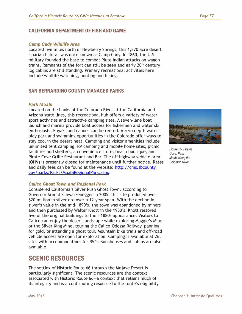
California Historic Route 66 CMP: Needles to Barstow Page 57
May 2015 Chapter 3: Intrinsic Qualities
CALIFORNIA DEPARTMENT OF FISH AND GAME
Camp Cady Wildlife AreaLocated five miles north of Newberry Springs, this 1,870 acre desert riparian habitat was once known as Camp Cady. In 1860, the U.S. military founded the base to combat Piute Indian attacks on wagon trains. Remnants of the fort can still be seen and early 20th century log cabins are still standing. Primary recreational activities here include wildlife watching, hunting and hiking.
SAN BERNARDINO COUNTY MANAGED PARKS
Park MoabiLocated on the banks of the Colorado River at the California and Arizona state lines, this recreational hub offers a variety of water sport activities and attractive camping sites. A seven-lane boat launch and marina provide boat access for fishermen and water ski enthusiasts. Kayaks and canoes can be rented. A zero depth water play park and swimming opportunities in the Colorado offer ways to stay cool in the desert heat. Camping and visitor amenities include unlimited tent camping, RV camping and mobile home sites, picnic facilities and shelters, a convenience store, beach boutique, and Pirate Cove Grille Restaurant and Bar. The off highway vehicle area (OHV) is presently closed for maintenance until further notice. Rates and daily fees can be found at the website: http://cms.sbcounty.gov/parks/Parks/MoabiRegionalPark.aspx.
Calico Ghost Town and Regional Park Considered California’s Silver Rush Ghost Town, according to Governor Arnold Schwarzenegger in 2005, this site produced over $20 million in silver ore over a 12-year span. With the decline in silver’s value in the mid-1890’s, the town was abandoned by miners and then purchased by Walter Knott in the 1950’s. Knott restored five of the original buildings to their 1880s appearance. Visitors to Calico can enjoy the desert landscape while exploring Maggie’s Mine or the Silver King Mine, touring the Calico-Odessa Railway, panning for gold, or attending a ghost tour. Mountain bike trails and off-road vehicle access are open for exploration. Camping is available at 265 sites with accommodations for RV’s. Bunkhouses and cabins are also available.
SCENIC RESOURCESThe setting of Historic Route 66 through the Mojave Desert is particularly significant. The scenic resources are the context associated with Historic Route 66—a context that retains much of its integrity and is a contributing resource to the route’s eligibility
Figure 55 Pirates Cove, Park Moabi along the Colorado River

Page 58 California Historic Route 66 CMP: Needles to Barstow
Chapter 3: Intrinsic Qualities May 2015
for designation on the National Register of Historic Places. Travelers can still see and feel the same vastness that original travelers felt back in the 30’s as they migrated westward to escape the dust bowl. The following pages describe the scenic resources associated with Historic Route 66 including: a description of its overall visual resource context; BLM evaluation of those scenic resources; and potential contextual changes that may alter those scenic resources.
OVERVIEW OF THE VISUAL RESOURCE CONTEXTThe entire length of Route 66 between Needles and Barstow is within the southern Mojave Desert, one of four major desert regions in the continental United States. The southern Mojave is characterized by broad, mostly level valleys and plains interrupted by discreet hills and relatively low mountain ranges, as compared with the Rockies, Sierras or Basin and Range physiographic regions, all of which have higher mountains and long, narrow valleys. Desert vegetation is sparse, and trees rare or completely absent. Along Route 66, vegetation cover, is for the most part, well-spaced, low shrubs, mostly creosote bush.
The alignment of Historic Route 66 between Needles and Barstow was originally laid out to follow the level terrain, avoiding steep ground and identifying the best places to cross over mountain ranges, such as over the Cadiz summit. Many mountain ranges and hills flank Route 66 along the way, including (from east to west): Chemeheuvi, Dead, Castle, Paiute, Stepladder, Old Woman, Clipper, Bristol, Cady, Rodman, and also Newberry Mountains among others. Some of these are fairly high and steep-sided. All of them taken together frame the view from the road. Other natural features with strong visual interest include volcanic cinder cones, lava fields, sand dunes and dry lake beds that shimmer in the distance.
Human intrusions are limited and concentrated mainly at the east and west ends of the route. For about two-thirds of the total distance, natural features dominate the view but for the occasional glimpse of a transmission line, a communication tower, the BNSF railroad, and long-distance views of I-40. The BNSF Railroad is an integral part of the history of Route 66 (having been the predecessor of the motor route), and therefore is not considered to be an intrusion on the scenic qualities, but a significant cultural feature.
BLM VISUAL RESOURCE MANAGEMENT SYSTEM AND ROUTE 66The BLM has been actively managing scenic and visual resources since the 1970s. They use a method known as the Visual Resource Management System, or VRM for short. The main purposes of VRM are to:• Inventory scenic values• Assign management classes that include objectives for scenery
conservation consistent with other resources in the area
BLM Objectives for Visual Resource ManagementVRM Class I Objective: To
preserve the existing character of the landscape. Allowed Level of Change: This class provides for natural ecological changes; however, it does not preclude very limited management activity. The level of change to the characteristic landscape should be very low and must not attract attention.
VRM Class II Objective: To retain the existing character of the landscape. Allowed Level of Change: The level of change to the characteristic landscape should be low. Management activities may be seen, but should not attract the attention of the casual observer. Any changes must repeat the basic elements of form, line, color, and texture found in the predominant natural features of the characteristic landscape.
VRM Class III Objective: To partially retain the existing character of the landscape. Allowed Level of Change: The level of change to the characteristic landscape should be moderate. Management activities may attract attention, but should not dominate the view of the casual observer. Changes should repeat the basic elements found in the predominant natural features of the characteristic landscape.
VRM Class IV Objective: To provide for management activities which require major modification of the existing character of the landscape. Allowed Level of Change: The level of change to the characteristic landscape can be high. Management activities may dominate the view and may be the major focus of viewer attention. However, the impact of these activities should be minimized through careful siting, minimal disturbance, and repeating the basic elements of form, line, color, and texture within the existing setting.
California Historic Route 66 CMP: Needles to Barstow Page 59
May 2015 Chapter 3: Intrinsic Qualities
• Evaluate proposed activities or projects to determine potential impacts
BLM employs various strategies and techniques to implement this system. Visual Resource Inventory (VRI) is used to rate the scenic quality of an area or unit of land. The Scenic Quality Rating process uses objective methods to rank lands according to their inherent scenic characteristics. For example: areas with diverse, steep topography rank higher than flat or rolling landscapes; diverse vegetation ranks higher than uniform vegetation; and presence of water or water features causes lands to be ranked more highly.
Public concern for scenery is another important component of visual inventory, and is determined through what is known as Sensitivity Analysis. The main factors considered are the number and type of users of a given area and how concerned they are about conservation of scenic resources.
Distance and visibility are also important factors in scenic inventory. Lands and features closer to observers generally rank as more important to conserve, while areas farther away are less so, primarily because changes to scenery are less noticeable as distance increases. However, highly contrasting elements can be seen from many miles away.
Scenic Inventories are combined with other resource information in land management planning to determine their level of protection. Lands are assigned to one of four Visual Resource Management Classifications (VRM). These levels are:
I = Preservation of sceneryII = High level of scenery conservationIII = Moderate level of scenery conservationIV = Low level of scenery conservation
Lands managed as VRM Class II allow multiple uses, but only if they do not impact scenery. Lands managed as VRM III allow uses that do impact scenery, but only to a modest extent. The standard used is that these uses have to be subordinate visually to the natural landscape character. Lands managed as VRM IV allow uses that may have significant impacts to scenery.
BLM lands along Route 66 have partly inventoried for scenic resources, and no VRM classes have been officially assigned (as of November 2014). A large portion of these lands are either wilderness or otherwise protected from development, so are, in effect, managed as VRM Class I. Along Historic Route 66 protected areas are shown in Appendix II, on Map 2, Land Ownership. These include • Dead Mountains• Bigelow Cholla Garden
Page 60 California Historic Route 66 CMP: Needles to Barstow
Chapter 3: Intrinsic Qualities May 2015
• Piute mountains• Homer Mountain• Mojave Preserve (National Park Service)• Clipper Mountain• Old Woman Mountains• Cadiz Dunes• Amboy Crater• Bristol Mountains• Newberry Mountains• Rodman Mountains• Cady Mountains• A number of smaller areas managed as Areas of Critical
Environmental Concern
Areas not fully protected have been generally managed as VRM II or III, reflecting the high priority local BLM managers have given to conserving scenery along Historic Route 66. Visual Resource Management classes will be designated as part of the proposed Desert Renewable Energy Conservation Plan (DRECP), which is also at a review stage in the process as of this CMP (May 2015).
Scenic InventoryA Scenic Resource Inventory (SRI) for some of the lands along Historic Route 66 was completed by the BLM in 2013. It divides lands into three general categories:
A- Highest scenic qualityB – Moderate scenic qualityC – Lowest scenic quality
Lands in protected status were not inventoried. These include primarily higher, more scenic mountains like those of the Mojave Preserve, Newberry Mountains, and Marble Mountains. It is reasonable to presume these areas would have ranked A or B had they been inventoried.
Most of the ranked lands along the corridor are rated C, lowest scenic quality. Very few areas rated as highest. The seven factors used to rate these lands are:
• Landform• Vegetation• Water• Color• Adjacent scenery• Scarcity• Cultural modifications
The preponderance of low ranked lands along Route 66 is due to an abundance of extended low and flat plains, lack of water and vegetation diversity, and more subtle variations in color than other
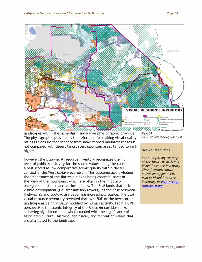
California Historic Route 66 CMP: Needles to Barstow Page 61
May 2015 Chapter 3: Intrinsic Qualities
landscapes within the same Basin and Range physiographic province. The physiographic province is the reference for making visual quality ratings to ensure that scenery from snow-capped mountain ranges is not compared with desert landscapes. Mountain areas tended to rank higher.
However, the BLM visual resource inventory recognizes the high level of public sensitivity for the scenic values along the corridor albeit scored as low comparative scenic quality within the full context of the West Mojave ecoregion. This outcome acknowledges the importance of the flatter plains as being essential parts of the view of the mountains, which are often in the middle or background distance across these plains. The BLM lands that lack visible development (i.e. transmission towers), as the case between Highway 95 and Ludlow, are becoming increasingly scarce. The BLM visual resource inventory revealed that over 50% of the inventoried landscape as being visually modified by human activity. From a CMP perspective, the scenic integrity of the Route 66 corridor ranks as having high importance when coupled with the significance of associated cultural, historic, geological, and recreation values that are attributed to the landscape.
Calif
orni
a H
isto
ric R
oute
66
Nee
dles
to B
arst
owVI
SUAL
RES
OU
RCE
INVE
NTO
RY
DRA
FT 0
4/22
/14
Lard
ner/
Klei
n La
ndsc
ape
Arch
itect
sin
ass
ocia
tion
with
: M
IG, I
nc.
Thom
ason
and
Ass
ocia
tes
and
Nat
iona
l Tru
st fo
r His
toric
Pre
serv
atio
n
Calif
orni
a Hi
stor
ic R
oute
66
Nee
dles
to B
arst
ow L
ocat
ion
!
!
!
! !
!!!
!
5 0 5 10 15 202.5 Miles[
A R I Z O N A
N E V A D A
CO
LORADO
RIVER
M O J A V E N A T I O N A L P R E S E R V E
J O S H U A T R E E N A T I O N A L P A R K
M OJAV
E RIVE R
Twentynine PalmsMarine Corps Air
Ground Combat Ctr.
Fort Irwin
Yucca Valley
Banning
Twentynine Palms
NEEDLES
GOFFS
FENNER
ESSEX
CHAMBLESSAMBOY
LUDLOWNEWBERRY SPRINGS
BARSTOW DAGGETT
DANBY
§̈¦40
£¤95
§̈¦40
CA R
OUTE
66
Mai
n To
ur R
oute
Coun
ty
City
Sphe
re o
f Inf
luen
ce
New
berr
y S
prin
gs C
omm
unity
Ser
vice
Dis
trict
Dep
artm
ent o
f Def
ense
Fiel
d Of
fice
Boun
dary
Visu
al R
esou
rce
Inve
ntor
y Cl
asse
s
VRI C
lass
I
VRI C
lass
II
VRI C
lass
III
VRI C
lass
IV
CART
66 7
mi b
uffe
r
CART
66 2
0 m
i buf
fer
NLC
S W
ilder
ness
Stu
dy A
reas
(Not
form
ally
pro
tect
ed)
NLC
S W
ilder
ness
Are
as
Des
ert T
orto
ise
Crit
ical
Hab
itat
ACEC
(Des
igna
ted)
California Historic Route 66Needles to Barstow
VISUAL RESOURCE INVENTORY
DRAFT 04/22/14
Lardner/Klein Landscape Architectsin association with: MIG, Inc.Thomason and Associates andNational Trust for Historic Preservation
California Historic Route 66 Needles to Barstow Location
!
!
!
!!
!!
!!
50
510
1520
2.5Miles
[
ARIZO
NA
NEVADA
COLORADORIVER
MO
JA
VE
N
AT
IO
NA
L
PR
ES
ER
VE
JO
SH
UA
T
RE
E
NA
TI
ON
AL
P
AR
K
M
OJAVERIVE
R
Twentynine Palm
sM
arine Corps AirG
round Combat Ctr.
Fort Irwin
Yucca Valley
Banning
Twentynine Palm
s
NEED
LES
GOFFS
FENN
ER
ESSEX
CHAM
BLESSAM
BOY
LUDLOW
NEW
BERRY SPRING
SBARSTOW
DAGG
ETT
DANBY
§̈¦ 40
£¤ 95
§̈¦ 40
CA ROUTE 66 Main Tour Route
County
City
Sphere of Influence
Newberry Springs Community Service District
Department of Defense
Field Office Boundary
Visual Resource Inventory Classes
VRI Class I
VRI Class II
VRI Class III
VRI Class IV
CART66 7 mi buffer
CART66 20 mi buffer
NLCS Wilderness Study Areas (Not formally protected)
NLCS Wilderness Areas
Desert Tortoise Critical Habitat
ACEC (Designated)
Figure 56 Visual Resource Inventory Map (BLM)
Scenic Resources
For a larger, digital map of the locations of BLM’s Visual Resource Inventory Classifications shown above see Appendix II, Map 6: Visual Resource Inventory at http://cmp.route66ca.org
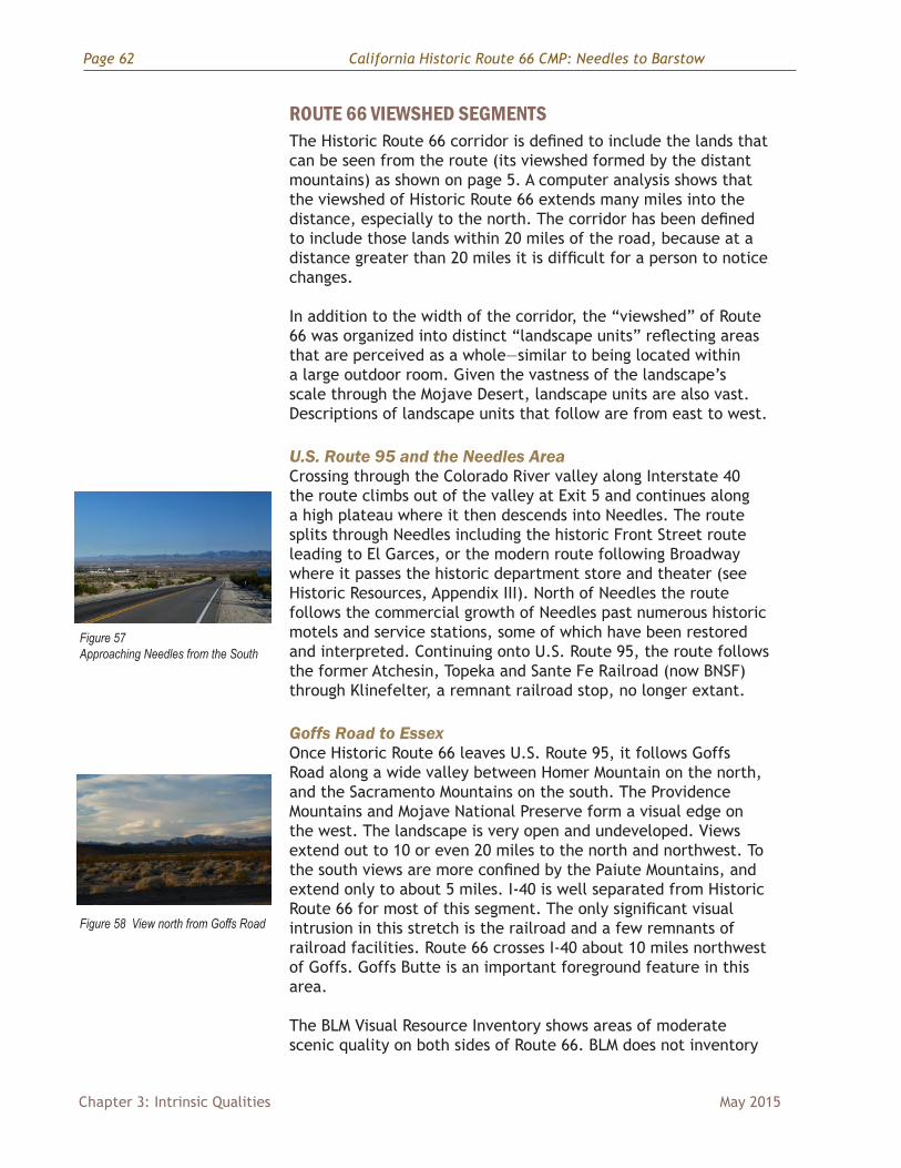
Page 62 California Historic Route 66 CMP: Needles to Barstow
Chapter 3: Intrinsic Qualities May 2015
ROUTE 66 VIEWSHED SEGMENTSThe Historic Route 66 corridor is defined to include the lands that can be seen from the route (its viewshed formed by the distant mountains) as shown on page 5. A computer analysis shows that the viewshed of Historic Route 66 extends many miles into the distance, especially to the north. The corridor has been defined to include those lands within 20 miles of the road, because at a distance greater than 20 miles it is difficult for a person to notice changes.
In addition to the width of the corridor, the “viewshed” of Route 66 was organized into distinct “landscape units” reflecting areas that are perceived as a whole—similar to being located within a large outdoor room. Given the vastness of the landscape’s scale through the Mojave Desert, landscape units are also vast. Descriptions of landscape units that follow are from east to west.
U.S. Route 95 and the Needles Area Crossing through the Colorado River valley along Interstate 40 the route climbs out of the valley at Exit 5 and continues along a high plateau where it then descends into Needles. The route splits through Needles including the historic Front Street route leading to El Garces, or the modern route following Broadway where it passes the historic department store and theater (see Historic Resources, Appendix III). North of Needles the route follows the commercial growth of Needles past numerous historic motels and service stations, some of which have been restored and interpreted. Continuing onto U.S. Route 95, the route follows the former Atchesin, Topeka and Sante Fe Railroad (now BNSF) through Klinefelter, a remnant railroad stop, no longer extant.
Goffs Road to EssexOnce Historic Route 66 leaves U.S. Route 95, it follows Goffs Road along a wide valley between Homer Mountain on the north, and the Sacramento Mountains on the south. The Providence Mountains and Mojave National Preserve form a visual edge on the west. The landscape is very open and undeveloped. Views extend out to 10 or even 20 miles to the north and northwest. To the south views are more confined by the Paiute Mountains, and extend only to about 5 miles. I-40 is well separated from Historic Route 66 for most of this segment. The only significant visual intrusion in this stretch is the railroad and a few remnants of railroad facilities. Route 66 crosses I-40 about 10 miles northwest of Goffs. Goffs Butte is an important foreground feature in this area.
The BLM Visual Resource Inventory shows areas of moderate scenic quality on both sides of Route 66. BLM does not inventory
Figure 57 Approaching Needles from the South
Figure 58 View north from Goffs Road
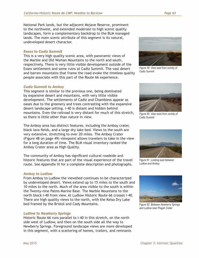
California Historic Route 66 CMP: Needles to Barstow Page 63
May 2015 Chapter 3: Intrinsic Qualities
National Park lands, but the adjacent Mojave Reserve, prominent to the northwest, and extended moderate to high scenic quality landscapes, form a complementary backdrop to the BLM managed lands. The main scenic attribute of this segment is its natural, undeveloped desert character.
Essex to Cadiz SummitThis is a very high quality scenic area, with panoramic views of the Marble and Old Woman Mountains to the north and south, respectively. There is very little visible development outside of the Essex settlement and some ruins at Cadiz Summit. The vast desert and barren mountains that frame the road evoke the timeless quality people associate with this part of the Route 66 experience.
Cadiz Summit to AmboyThis segment is similar to the previous one, being dominated by expansive desert and mountains, with very little visible development. The settlements of Cadiz and Chambless appear as oases due to the greenery and trees contrasting with the expansive desert landscape setting. I-40 is distant and hidden behind mountains. Even the railroad is very distant for much of this stretch, so there is little other than nature in view.
The Amboy area has distinct features, including the Amboy crater, black lava fields, and a large dry lake bed. Views to the south are very extensive, stretching to over 20 miles. The Amboy Crater (Figure 48 on page 49) viewpoint allows travelers to take in the view for a long duration of time. The BLM visual inventory ranked the Amboy Crater area as High Quality.
The community of Amboy has significant cultural roadside and historic features that are part of the visual experience of the travel route. See Appendix III for a complete description and photographs.
Amboy to LudlowFrom Amboy to Ludlow the viewshed continues to be characterized by undeveloped desert. Views extend up to 15 miles to the south and 10 miles to the north. Much of the area visible to the south is within the Twenty-nine Palms Marine Base. The Marble Mountains to the north block I-40 from view. At Ludlow Historic Route 66 crosses I-40. There are high quality views to the north, with the Kelso Dry Lake bed framed by the Bristol and Cady Mountains.
Ludlow to Newberry Springs Historic Route 66 runs parallel to I-40 in this stretch, on the north side west of Ludlow, and then on the south side all the way to Newberry Springs. Foreground landscape views are more developed in this segment, with a scattering of homes, trailers, and remnants
Figure 59 View east from vicinity of Cadiz Summit
Figure 60 View west from vicinity of Cadiz Summit
Figure 61 Looking east between Ludlow and Amboy
Figure 62 Between Newberry Springs and Ludlow near Pisgah Crater
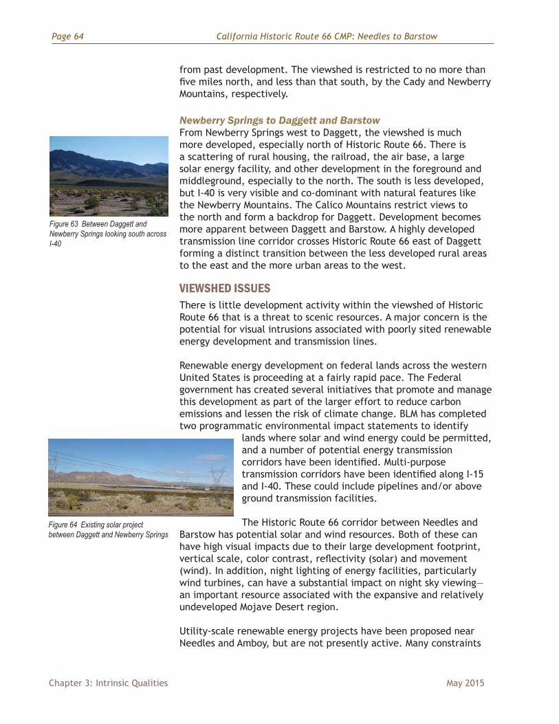
Page 64 California Historic Route 66 CMP: Needles to Barstow
Chapter 3: Intrinsic Qualities May 2015
from past development. The viewshed is restricted to no more than five miles north, and less than that south, by the Cady and Newberry Mountains, respectively.
Newberry Springs to Daggett and BarstowFrom Newberry Springs west to Daggett, the viewshed is much more developed, especially north of Historic Route 66. There is a scattering of rural housing, the railroad, the air base, a large solar energy facility, and other development in the foreground and middleground, especially to the north. The south is less developed, but I-40 is very visible and co-dominant with natural features like the Newberry Mountains. The Calico Mountains restrict views to the north and form a backdrop for Daggett. Development becomes more apparent between Daggett and Barstow. A highly developed transmission line corridor crosses Historic Route 66 east of Daggett forming a distinct transition between the less developed rural areas to the east and the more urban areas to the west.
VIEWSHED ISSUESThere is little development activity within the viewshed of Historic Route 66 that is a threat to scenic resources. A major concern is the potential for visual intrusions associated with poorly sited renewable energy development and transmission lines.
Renewable energy development on federal lands across the western United States is proceeding at a fairly rapid pace. The Federal government has created several initiatives that promote and manage this development as part of the larger effort to reduce carbon emissions and lessen the risk of climate change. BLM has completed two programmatic environmental impact statements to identify
lands where solar and wind energy could be permitted, and a number of potential energy transmission corridors have been identified. Multi-purpose transmission corridors have been identified along I-15 and I-40. These could include pipelines and/or above ground transmission facilities.
The Historic Route 66 corridor between Needles and Barstow has potential solar and wind resources. Both of these can have high visual impacts due to their large development footprint, vertical scale, color contrast, reflectivity (solar) and movement (wind). In addition, night lighting of energy facilities, particularly wind turbines, can have a substantial impact on night sky viewing—an important resource associated with the expansive and relatively undeveloped Mojave Desert region.
Utility-scale renewable energy projects have been proposed near Needles and Amboy, but are not presently active. Many constraints
Figure 63 Between Daggett and Newberry Springs looking south across I-40
Figure 64 Existing solar project between Daggett and Newberry Springs
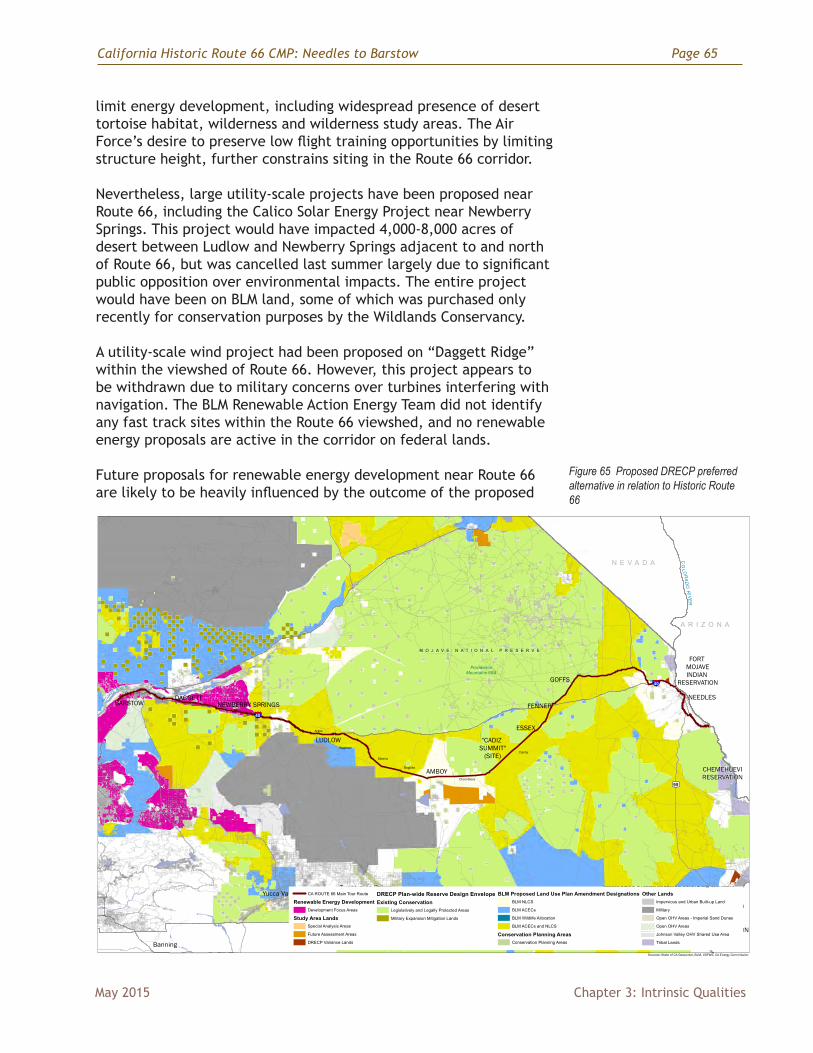
California Historic Route 66 CMP: Needles to Barstow Page 65
May 2015 Chapter 3: Intrinsic Qualities
limit energy development, including widespread presence of desert tortoise habitat, wilderness and wilderness study areas. The Air Force’s desire to preserve low flight training opportunities by limiting structure height, further constrains siting in the Route 66 corridor.
Nevertheless, large utility-scale projects have been proposed near Route 66, including the Calico Solar Energy Project near Newberry Springs. This project would have impacted 4,000-8,000 acres of desert between Ludlow and Newberry Springs adjacent to and north of Route 66, but was cancelled last summer largely due to significant public opposition over environmental impacts. The entire project would have been on BLM land, some of which was purchased only recently for conservation purposes by the Wildlands Conservancy.
A utility-scale wind project had been proposed on “Daggett Ridge” within the viewshed of Route 66. However, this project appears to be withdrawn due to military concerns over turbines interfering with navigation. The BLM Renewable Action Energy Team did not identify any fast track sites within the Route 66 viewshed, and no renewable energy proposals are active in the corridor on federal lands.
Future proposals for renewable energy development near Route 66 are likely to be heavily influenced by the outcome of the proposed
California Historic Route 66Needles to Barstow DRAFT 10/10/14
DRECP Perferred AlternativeSources: State of CA Geoportal, BLM, USFWS, CA Energy Commission
Yucca Valley
Banning
COLORADO RIVERINDIAN
RESERVATION
NEEDLES
GOFFS
ESSEX
FENNER
"CADIZ SUMMIT"
(SITE)
AMBOY
LUDLOW
NEWBERRY SPRINGSDAGGETT
BARSTOW
Twentynine PalmsMarine Corps Air
Ground Combat Ctr.
ProvidenceMountains SRA
A R I Z O N A
N E V A D A
Twentynine Palms
CO
LORADO
RIVER
FORT MOJAVEINDIAN
RESERVATION
CHEMEHUEVIRESERVATION
Fort Irwin
M OJAV
E RIVE R
M O J A V E N A T I O N A L P R E S E R V E
J O S H U A T R E E N A T I O N A L P A R K
Danby
Chambless
Bagdad
Siberia
Ragtown
Argos
CA ROUTE 66 Main Tour Route
Renewable Energy DevelopmentDevelopment Focus Areas
Study Area LandsSpecial Analysis Areas
Future Assessment Areas
DRECP Variance Lands
DRECP Plan-wide Reserve Design EnvelopeExisting Conservation
Legislatively and Legally Protected Areas
Military Expansion Mitigation Lands
BLM Proposed Land Use Plan Amendment DesignationsBLM NLCS
BLM ACECs
BLM Wildlife Allocation
BLM ACECs and NLCS
Conservation Planning AreasConservation Planning Areas
Other LandsImpervious and Urban Built-up Land
Military
Open OHV Areas - Imperial Sand Dunes
Open OHV Areas
Johnson Valley OHV Shared Use Area
Tribal Lands
§̈¦40
£¤95
§̈¦40
Figure 65 Proposed DRECP preferred alternative in relation to Historic Route 66
Page 66 California Historic Route 66 CMP: Needles to Barstow
Chapter 3: Intrinsic Qualities May 2015
Desert Renewable Energy Conservation Plan (DRECP). This plan covers seven counties and over 22 million acres (including San Bernardino County). The DRECP, released in draft form in the fall of 2014, has identified “focus areas”(shown in magenta on the map in Figure 65) where renewable energy development will be allowed or even encouraged with permitting expedited. One of these may be an area known as the “Daggett Triangle,” which is north of Route 66 and east of Daggett. Most or all of this development is expected to occur on private land. Height restrictions may be included west of the Mojave National Preserve due to use of the area by the military for low elevation training flights and navigation issues. Thus ground mounted photo voltaic panels may be the only type of development allowed there, with wind turbines and solar towers not permitted.
“Conservation Areas” are those where energy development will not be considered. Most areas designated for conservation in the proposed DRECP are already protected, such as the Mojave National Preserve and wilderness areas. Other areas designated for conservation in the proposed DRECP will be included as National Conservation Lands. Scenic resources, such as the Route 66 viewshed are not designated for conservation unless they overlap with other resource values.
“Variance areas” (brown areas, Figure 65 on page 65) will be those not designated either for conservation or development (if the Final DRECP participants approve of the designation). Energy development could be proposed in variance areas, but may be expensive to pursue. Scenic resource impacts would be considered as part of the project review. The expectation and suggested approach for approving entities is that energy developers will work in the focus areas until these are fully used before they pursue projects elsewhere. The area just south of Amboy and Chambless is one of the variance areas that may be an issue in relation to Historic Route 66.
Questions remain about how BLM will designate VRM levels for the Route 66 viewshed. This may be done through the proposed DRECP, but the mechanism is not clear as of the draft CMP release (January 2008).
Additional Viewshed IssuesWhile most of the land within the Route 66 viewshed, especially east of Newberry Springs is in federal ownership, there are state and private in holdings, some of which (south of Amboy and Cadiz) are significant in size. Energy or other projects proposed for these lands are subject to San Bernardino County and CEQA rules and review. Energy development on these lands would likely require above-ground transmission lines across BLM administered lands, and thus could fall under NEPA rules as well.
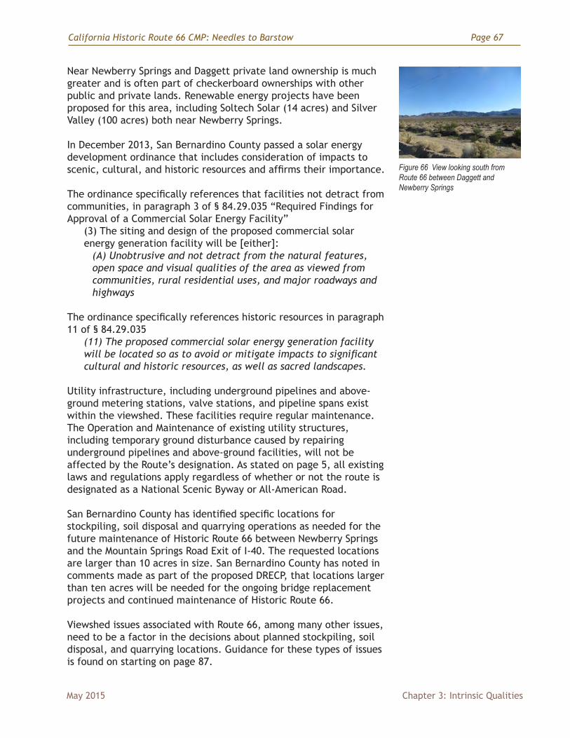
California Historic Route 66 CMP: Needles to Barstow Page 67
May 2015 Chapter 3: Intrinsic Qualities
Near Newberry Springs and Daggett private land ownership is much greater and is often part of checkerboard ownerships with other public and private lands. Renewable energy projects have been proposed for this area, including Soltech Solar (14 acres) and Silver Valley (100 acres) both near Newberry Springs.
In December 2013, San Bernardino County passed a solar energy development ordinance that includes consideration of impacts to scenic, cultural, and historic resources and affirms their importance.
The ordinance specifically references that facilities not detract from communities, in paragraph 3 of § 84.29.035 “Required Findings for Approval of a Commercial Solar Energy Facility”
(3) The siting and design of the proposed commercial solar energy generation facility will be [either]:
(A) Unobtrusive and not detract from the natural features, open space and visual qualities of the area as viewed from communities, rural residential uses, and major roadways and highways
The ordinance specifically references historic resources in paragraph 11 of § 84.29.035
(11) The proposed commercial solar energy generation facility will be located so as to avoid or mitigate impacts to significant cultural and historic resources, as well as sacred landscapes.
Utility infrastructure, including underground pipelines and above- ground metering stations, valve stations, and pipeline spans exist within the viewshed. These facilities require regular maintenance. The Operation and Maintenance of existing utility structures, including temporary ground disturbance caused by repairing underground pipelines and above-ground facilities, will not be affected by the Route’s designation. As stated on page 5, all existing laws and regulations apply regardless of whether or not the route is designated as a National Scenic Byway or All-American Road.
San Bernardino County has identified specific locations for stockpiling, soil disposal and quarrying operations as needed for the future maintenance of Historic Route 66 between Newberry Springs and the Mountain Springs Road Exit of I-40. The requested locations are larger than 10 acres in size. San Bernardino County has noted in comments made as part of the proposed DRECP, that locations larger than ten acres will be needed for the ongoing bridge replacement projects and continued maintenance of Historic Route 66.
Viewshed issues associated with Route 66, among many other issues, need to be a factor in the decisions about planned stockpiling, soil disposal, and quarrying locations. Guidance for these types of issues is found on starting on page 87.
Figure 66 View looking south from Route 66 between Daggett and Newberry Springs
Page 68 California Historic Route 66 CMP: Needles to Barstow
Chapter 3: Intrinsic Qualities May 2015