2020 census local update of census addresses … 2020... · “a” action code –address list:...
TRANSCRIPT

2020 CensusLocal Update of Census Addresses Operation
(LUCA)Training – Digital/Digital Participants

2020 LUCA scheduleTimeframe Activity
January 2017
Advance Notice mailing mailed to Highest Elected Officials (HEOs), Tribal Chairs (TCs), Governors and other potential 2020 LUCA contacts.
March 2017 2020 LUCA Promotional presentations began.
July 20172020 LUCA invitation and registration materials mailed to HEOs, TCs and Governors.
October 2017 2020 LUCA Training workshops began.
December 15, 2017 2020 LUCA registration deadline.
February - April 2018 Participants receive their 2020 LUCA materials.
March - September 2018 Census Bureau processes 2020 LUCA submissions.
April 2018 - May 2019 Census Bureau validates 2020 LUCA addresses.
Summer 2019 Census Bureau delivers 2020 LUCA feedback.
April 1, 2020 CENSUS DAY.
2

Things to consider• How much time can you devote to LUCA review?
o Only 120 calendar days to conduct review upon receipt of materials.
• Does your jurisdiction have an address list or access to an address list?
• Does the address list include multiunit structure identifiers (Apt 1, Unit A2, #4, etc.)?
• Does the address list include both residential and commercial addresses or include records that are not structures? If yes, are the residential records distinguishable?
3
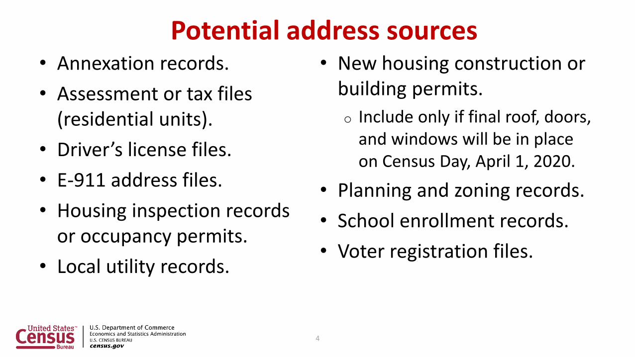
Potential address sources• Annexation records.
• Assessment or tax files (residential units).
• Driver’s license files.
• E-911 address files.
• Housing inspection records or occupancy permits.
• Local utility records.
• New housing construction or building permits.
o Include only if final roof, doors, and windows will be in place on Census Day, April 1, 2020.
• Planning and zoning records.
• School enrollment records.
• Voter registration files.
4

Identify priorities• Apartment buildings and/or areas
of concentrated multiunit housing.
• Areas along governmental
boundaries.
• Areas of new residential
construction.
• Blocks with the greatest differences
between the Census Bureau’s
address block count and your
address block count.
• E-911 address conversions.
• Group Quarters (e.g., housing such as college dorms and nursing homes).
• Mobile home parks or new, scattered mobile homes.
• Single-family homes converted to multifamily homes, and vice versa.
• Warehouses converted to residential lofts.
5

Title 13 U.S.C. – confidentiality and security• Information provided to/from LUCA is covered under
Title 13 of the United States Code which requires the U.S. Census Bureau:o Ensure confidential treatment of census-related information,
including individual addresses and map structure points.
o Maintain the confidentiality of all information it collects.
• LUCA requires all liaisons, reviewers, and anyone with access to Title 13 materials abide by the Confidentiality and Security Guidelines and requires all LUCA participants sign the Confidentiality Agreement Form (D-2005).
6

• Private information is NEVER published.
• Collect information ONLY to produce statistics.
• Sworn to maintain confidentiality for LIFE.
• Violating the law is a serious federal crime. Anyone who violates this law will face severe penalties, including a federal prison sentence of up to five years, a fine of up to $250,000, or both.
Title 13 U.S.C. – confidentiality and security (cont’d)
7

DVD(s) of LUCA digital materialsThree DVDs
• One with Title 13 data in “shape” folder.– “Shape folder”
» 2020LUCA_<EntityID>_DISK1of2.exe
• One with non-Title 13 data in “shape” folder.– Root directory
» 2020LUCA_digital_respondent_guide.pdf» 2020LUCA_GUPS_respondent_guide.pdf» 2020LUCA_header_file.txt» LUCA20_inventory.pdf» Readmefirst6.txt
– “Shape” folder» 2020LUCA_<EntityID>_DISK2of2.exe
• One with GUPS installation software.
8
Address list
Address count listShapefiles

Digital materials initial setup
• For digital/digital installation:
– Space requirement: recommend reserving 2 Gb
– RAM requirement: 4 Gb
• For GUPS installation:
– Space requirement: recommend reserving 4 Gb
– RAM requirement: 1.3 Gb
9

Digital materials initial setup• Ensure Confidentiality and Security Guidelines
followed and Title 13 security in place prior to installation of DVD material to local drive.
• Review the “readmefirst#” txt file on DVD.
• Review presentation again upon receipt of materials.
• Use presentation in conjunction with Respondent Guide and the 2020 LUCA Quick Start Guide.
10

Suggested setup of local system
• If DVDs damaged, incomplete, or files corrupted contact Geographic Programs Support Desk at: 1-844-344-0169.
• If DVDs ok, create folder named “2020LUCA”.
• Copy contents of DVD into “2020LUCA” folder.
• Execute the various .exe files (if present).
• Review the other files on DVD for additional instructions.
• Review the 2020 LUCA Respondent Guides for instructions on use.
11

Extracting 2020LUCA_<EntityID>_DISK1of2.exe• Navigate to the “2020LUCA” folder.
• If present, double click on the file named “2020LUCA_<EntityID>_DISK1of2.exe”.
• Command prompt opens, requests password & closes upon completion.
12

2020LUCA_<EntityID>_DISK1of2.exe – visual
13

Extracting 2020LUCA_<EntityID>_DISK2of2.exe
• Navigate to the “2020LUCA” folder.
• If present, double click on the file named “2020LUCA_<EntityID>_DISK2of2.exe”.
• Command prompt opens and closes upon completion.
14

2020LUCA_<EntityID>_DISK2of2.exe – visual
15

File naming convention – digital materials• Address List.
o 2020LUCA_XXyyyyyyyyyy_address_list.csv
o 2020LUCA_TRxxxxTAyyyy_address_list.csv
• Address Count List.
o 2020LUCA_XXyyyyyyyyyy_address_countlist.csv
o 2020LUCA_TRxxxxTAyyyy_address_countlist.csv
• TIGER Partnership shapefiles.
o PVS_17_v2_<layername>_SSCCC.shp
o PVS_17_v2_<layername>_SS.shp
16

File naming convention – Address List• 2020LUCA_XXyyyyyyyyyy_address_list.csv
o 2020LUCA_ST20_address_list.csv (State of Kansas).
o 2020LUCA_CO20001_address_list.csv (Allen County, KS).
o 2020LUCA_PL2000125_address_list.csv (Abilene city, KS).
o 2020LUCA_MC2000120550_address_list.csv (Elm township, KS).
• 2020LUCA_TRxxxxTAyyyy_address_list.csvo 2020LUCA_TR0197TA2980_address_list.csv (Prairie Band of
Potawatomi Nation Reservation).• TR0197 = Prairie Band Potawatomi Nation.
• TA2980 = Prairie Band of Potawatomi Nation Reservation.
17

File naming convention –TIGER Partnership shapefiles
• PVS_17_v2_<layername>_SSCCC.shpo PVS_17_v2_edges_20001.shp (edges for Allen County, KS).
o PVS_17_v2_tabblock2010_20001.shp (2010 Census tabulation blocks for Allen County, KS).
o PVS_17_v2_place_20001.shp (place boundaries for Allen County, KS).
o And numerous others.
• PVS_17_v2_<layername>_SS.shp (for reference and query only).
o PVS_17_v2_state_20.shp (Kansas state boundary).
o PVS_17_v2_county_20.shp (county boundaries within Kansas).
o PVS_17_v2_place_20.shp (place boundaries within Kansas).
o And numerous others.
18

Address List – Title 13• Census residential addresses.
o City style and non-city style.
• Contain census geographic codes.o State, county, census tract, and census block.
• Comma Delimited Text (.csv) format.o MUST import not simply open or “double-click”.
• 24 fields: Maximum 649 characters per record.
• First row = Header row.o Remove spaces from field names, if using Esri’s ArcGIS.
19

Address List record layout
• Refer to Table 3 located in your Respondent Guide for complete record layout.
20

Address List – Microsoft Excel example**No Title 13 Data Displayed**
21

Address Count List – not Title 13• Residential address census block tallies.
o Housing units and Group Quarters.
• Reference only.
o Identify inconsistencies between census block counts and your jurisdiction’s block counts.
• Comma Delimited Text (.csv) format.
o MUST import not simply open or “double-click”.
• 13 fields: Maximum 140 characters per record.
• First row = Header row.
• “Unable to Geocode” tally for state and county participants.
22

Address Count List record layout
• Refer to Table 4 located in your Respondent Guide for complete record layout.
23

Address Count List – Microsoft Excel example
24

TIGER Partnership shapefiles• Created from Master Address File/Topologically Integrated
Geographic Encoding and Referencing (MAF/TIGER) System.
• Require use of a Geographic Information Software (GIS).• County based shapefiles, regardless of entity.• Do not contain structure points, so not Title 13 material.
o Generate structure points using Census Bureau’s digital address list (Title 13 material); refer to Respondent Guide Chapter 6.
• Retain vintage for use in feedback products.
25

Edits to the TIGER Partnership shapefiles• Address focused operation, but updates to address list may
require updates to digital maps.
• Allow submission of linear feature updates electronically.o Importing shapefiles, editing features, and exporting shapefiles.
• Edges shapefile contains all linear features (road, rail, hydro).
o Used to Add Lines, Delete Lines, or Change Attribution for roads.
• Tabblock2010 shapefile contains tabulation blocks used for 2020 LUCA.o Used to geocode addresses.
• More details in Respondent Guide Chapter 5.
26

Getting started with LUCA digital materials
• Opening .csv files in Microsoft Excel.
• Opening .shp files in Esri ArcGIS.
27

Opening .csv files in Microsoft Excel:Data – Get External Data – From Text
• Launch Microsoft Excel and open a blank workbook.
• Choose Data – Get External Data – From Text.
28

Opening .csv files in Microsoft Excel:Navigate – Import
• Navigate to the “2020LUCA” folder, choose the .csv and then choose Import.
29

Opening .csv files in Microsoft Excel:Text Import Wizard
• Text Import Wizard appears.o Step 1 of 3 (Original data
type=Delimited and choose Next).
o Step 2 of 3 (Change Delimiters from Tab to Comma and choose Next).
o Step 3 of 3 (Select all fields in Data preview, Change the Column data format to Text and choose Finish).
• Import Data choose New worksheet and OK.
30

Opening .shp files in Esri ArcGIS:Launch ArcGIS – ArcMap
• From the Start Menu or a shortcut icon on desktop, launch ArcMap.
• A “Loading Document” window appears.
31

Opening .shp files in Esri ArcGIS:Setting up .mxd
• A blank Map Document (.mxd) will open.
• Click the Add button to add your data to the blank .mxd.
32

Opening .shp files in Esri ArcGIS:Browse and add data
• Browse for your data.
• Select the edges shapefileand the tabblock2010 shapefile and click Add.
33

Opening .shp files in Esri ArcGIS:Add Data resulting visual
• Something similar to this image appears after successfully adding the edges and tabblock2010 shapefiles.
34

Acceptable updates and examples
Edges shapefile change type codes (CHNG_TYPE):
• AL – Add Line.
• DL – Delete Line.
• CA – Change Attribute.
Address List action codes (ACTION):
• A – Add this address.• C – Correct this address.• D – Delete this address.• J – Address is not in this
jurisdiction.• N – Address is
nonresidential.
35

Acceptable updates and examples: “A” action code
Address List action codes (ACTION):
• A – Add this address.• C – Correct this address.• D – Delete this address.• J – Address is not in this
jurisdiction.• N – Address is
nonresidential.
Digital Map change type codes (CHNG_TYPE):
• AL – Add Line.• DL – Delete Line.• CA – Change Attribute.
36

“A” action code – Address List:city style addresses – adding HUs
**No Title 13 Data Displayed**
37

“AL” change type – edges shapefile:adding a street
38

“A” action code – Address List:non-city style addresses – adding HUs
**No Title 13 Data Displayed**
39

“A” action code – Address List: city style addresses – adding GQs
**No Title 13 Data Displayed**
40

Acceptable updates and examples: “C” action code
Address List action codes (ACTION):
• A – Add this address.• C – Correct this address.• D – Delete this address.• J – Address is not in this
jurisdiction.• N – Address is
nonresidential.
Edges shapefile change type codes (CHNG_TYPE):
• AL – Add Line.• DL – Delete Line.• CA – Change Attribute.
41

“C” action codeUse a “C” action code for the following situations:
• Incorrect state code.• Incorrect county code.• Incorrect census tract number.• Incorrect census block number.• Incorrect street name (including street directional and
street type information).• Incorrect ZIP code.• Include tract and block numbers (or latitude and longitude
coordinates) for “unable to geocode” address records*.*Unable to geocode (ungeocoded) address records are missing the tract and block geocode information. These records exist for state and county participants.
42

“C” action code – Address List:city style address – correcting block number
**No Title 13 Data Displayed**
43

“DL” and “AL” change type - edges shapefile:correcting block number
44

“C” action code – Address List:city style addresses – correcting street name
**No Title 13 Data Displayed**
45

“CA” change type – edges shapefile:correcting street name
46

“C” action code – Address List:city style addresses – correcting ungeocoded records
**No Title 13 Data Displayed**
47

Acceptable updates and examples: “D” action code
Address List action codes (ACTION):
• A – Add this address.• C – Correct this address.• D – Delete this address.• J – Address is not in this
jurisdiction.• N – Address is
nonresidential.
Edges shapefile change type codes (CHNG_TYPE):
• AL – Add Line.• DL – Delete Line.• CA – Change Attribute.
48

“D” action code• Use a “D” action code for the following situations:
o Residential address no longer exists, is uninhabitable, or is a duplicate.
o Street, or section of street, no longer exists (and addresses along street no longer exist).
o Incorrect house number or incorrect apartment/unit number.
o Housing Unit, Multiunit, or Group Quarters Conversions:• Housing unit converted to a multiunit structure or group quarters.
• Multiunit structure converted to a housing unit or group quarters.
• Group quarters converted to a housing unit or multiunit structure.
• Do not modify any other fields.
49

“D” action code – Address List:city style addresses – deleting addresses
**No Title 13 Data Displayed**
50

“D” and “A” action codes – Address List:city style addresses –incorrect apartment units
**No Title 13 Data Displayed**
51

“D” and “A” action codes – Address List:city style addresses – HU converted to multiunit
**No Title 13 Data Displayed**
52

“DL” change type – edges shapefile:deleting a street
53

Acceptable updates and examples: “J” action code
Address List action codes (ACTION):
• A – Add this address.• C – Correct this address.• D – Delete this address.• J – Address is not in this
jurisdiction.• N – Address is
nonresidential.
Edges shapefile change type codes (CHNG_TYPE):
• AL – Add Line.• DL – Delete Line.• CA – Change Attribute.
54

“J” action code
• Use a “J” action code to flag residential addresses that are not in your jurisdiction.
• Use for city style, non-city style, and ungeocoded address records.
• Do not make modifications to any other fields.
55

Acceptable updates and examples: “N” action code
Address List action codes (ACTION):
• A – Add this address.
• C – Correct this address.
• D – Delete this address.
• J – Address is not in this jurisdiction.
• N – Address is nonresidential.
Edges shapefile change type codes (CHNG_TYPE):
• AL – Add Line.
• DL – Delete Line.
• CA – Change Attribute.
56

“N” action code
• Use an “N” action code to flag addresses used for purposes other than residential such as:o Businesses, Schools, Churches, and Government offices.
• Ensure that the structure does not contain a housing unit.• Use for city style, non-city style, and ungeocoded address
records.• Do not make modifications to any other fields.
57

Summary of Address List updates
58
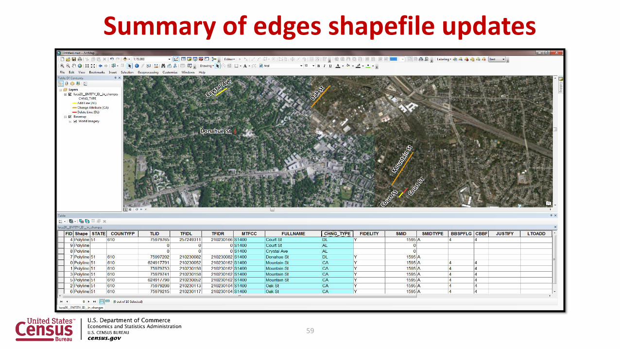
Summary of edges shapefile updates
59

Preparing updated materials for submission• Address materials.
• Map materials.
• Accompanying paperwork.
60

Address materials – sorting and saving• Ensure complete with all updates.
• Re-sort address list by ACTION field.
• Save only records with entry in ACTION field to new file.
• Name the new file “luca20_<EntityID>_changes_addresses.xxx” (where EntityID is entity identification code from LUCA materials and xxx is the file extension .csv, .txt, .xls, or .xlsx).
• Save to location for easy retrieval for submission and next steps.
61

Address materials – keeping secure• Make copy of new file for use during the feedback
phase.
• All address list materials (original and copy) are Title 13.
• Keep secure according to Confidentiality and Security Guidelines (D-2004).
62

Address materials – assembling and organizing• Navigate to directory where
“luca20_<EntityID>_changes_addresses.xxx” resides (where EntityID is entity identification code from LUCA materials and xxx is the file
extension .csv, .txt, or .xls).
• Zip the changes address file, name the zip file “luca20_<EntityID>_changes_addresses_return.zip”.o Password protection required because Title 13 material.
o Use case sensitive password provided with original materials.
• Copy the zip file to CD/DVD if shipping submission with paper map materials, or ready the zip file for submission via U.S. Census Bureau’s secure online web application.
63

Map materials – digital:Exporting updates
• Ensure complete with all updates.
• Select edges with value in CHNG_TYPE field.
• Export selected edges into new shapefile.
64

Map materials – digital:Saving updates
• Ensure “Selected features” in “Export Data” window.
• Name new shapefile“luca20_<EntityID>_ln_changes.shp”,
where EntityID matches entity identification code in LUCA materials and where “ln” is a lowercase “el”, not a capital “eye”.
• Save to location for easy retrieval for submission and next steps.
65

Map materials – digital:Example – updated edges shapefile
66

Map materials – digital:Assembling and organizing
• Navigate to directory where “luca20_<EntityID>_ln_changes.shp” resides.
• Zip the changes shapefile and all associated components (metadata, .cpg, .dbf, .sbx, .shx, .shp, etc.).o Esri customers use ArcCatalog to ensure all components are bundled correctly; other GIS
software customers must ensure all components are included within the zip file.
• Name zip file “luca20_<EntityID>_ln_changes_return.zip”.o Password protection not required, because not Title 13.
• Copy the zip file to CD/DVD if shipping submission, or stage the zip file for submission via Census Bureau’s secure online web application.
67

Accompanying paperwork• Inventory Form for the
Return/Submission of LUCA Updated Materials (D-2011).
• Provide with submission either as hardcopy or zipped on CD/DVD or with Secure Web Incoming Module (SWIM).
• Keep copies for your records.
68

Shipping instructions:Submissions with updated digital map materials
• Ensure to include:o CD/DVD of zipped updated address list and zipped updated
edges shapefile.
o Completed D-2011, either hardcopy or as its own zipped file on same CD/DVD.
• Use mailing label included with original materials to ship to National Processing Center in Jeffersonville, IN.
• For any shipping uncertainty, consult Respondent Guide or contact the help desk.
69

Shipping instructions:Title 13 details – double wrap visual
70

SWIM introduction• Official web portal for uploading materials to Census
Bureau.
• Used for other programs in addition to LUCA.
• Accounts are people based, not entity based.
• 12 digit registration token to establish account provided by Census Bureau.
• Only accepts .ZIP files.
• Size limitation of 250 megabytes.
71

Next steps – Census Bureau• Processes submission for validation.
• Ships feedback materials in Summer 2019.
• Begins outreach to close out LUCA operation.
o Must confirm destruction or return of all Title 13 materials, including originals and copies.
o Must receive signed Destruction or Return of Title 13 Materials Form(D-2012) that includes signatures from liaison and all reviewers.
• Confidentiality and Security Guidelines (D-2004) outlines approved destruction methods and process for return of materials.
72

Next steps – participant• Filing an appeal is optional.
• Agree with feedback materials, then participation ends.o Send D-2012 to confirm destruction, or if choose to return materials, do so
quickly.
• Notify OMB LUCA Appeals Office of disagreement with feedback materials.o Appeals Office works with participant and Census Bureau to resolve
disagreement.
o Once appeals process concludes, participants must destroy or return materials and submit signed Destruction or Return of Title 13 Materials Form (D-2012) that includes signatures from liaison and all reviewers.
73

Next steps – Destruction or Return of Title 13 Materials Form (D-2012)
74

Connect with us
Sign up for and manage alerts: https://public.govdelivery.com/accounts/USCENSUS/subscriber/new
More information on the 2020 Census Memorandum Series:https://www.census.gov/programs-surveys/decennial-census/2020-census/planning-management/memo-series.html
More information on the 2020 Census:https://www.census.gov/2020census
More information on the American Community Survey:https://www.census.gov/programs-surveys/acs/
facebook.com/uscensusbureau
twitter.com/uscensusbureau
youtube.com/user/uscensusbureau
instagram.com/uscensusbureau
pinterest.com/uscensusbureau
75

Support and assistance
• Visit the 2020 LUCA website:<https://www.census.gov/geo/partnerships/luca.html>
o Frequently Asked Questions document.
• Contact us:o Geographic Programs Support Desk toll-free telephone
number: 1-844-344-0169.
o Email <[email protected]>.
o New York Geography Office: (212) 584-3430, [email protected]
76