20090108-5011 ferc pdf (unofficial) 1/7/2009 6:16:11 pm ... study... · 20090108-5011 ferc pdf...
TRANSCRIPT

United StatesDepartment ofAgriculture
ForestService
Arapaho and RooseveltNational Forests andPawnee National Grassland
2150 Centre Avenue, Building EFort Collins, CO 80526-8119Voice: (970) 295-6600 TDD: (970) 295-6794Web: www.fs.fed.us/r2/arnfFax: (970) 295-6696
Caring for the Land and Serving People Printed on Recycled Paper
File Code: 2770Date: January 7, 2009
Travis BrayProject ManagerDenver Water1600 West 12th AvenueDenver, CO 80204-3412
Dear Mr. Bray:
Thank you for the time extension to comment and provide study requests to Denver Water’sproposal to increase storage capacity at Gross Reservoir. These comments and study requestsaddress Denver Water’s proposal letters dated May 1, June 18, July 21, October 16, andNovember 7, 2008, the Initial Consultation Document, and additional Hydrology information.
We are concerned about the statement in your October 16 letter, where it suggests that theFederal Energy Regulatory Commission (FERC) will not address impacts to western sloperesources. FERC is required by the National Environmental Policy Act (NEPA) to disclose alldirect, indirect, and cumulative effects of your proposal and the fact that a FERC projectboundary is in place, does not limit the area of effect.
I am requesting the following 9 studies, designed to disclose effects on National Forest Systemlands due to the proposed capacity increase to Gross Reservoir:
1. Cultural Resources - Complete pedestrian inventory of the area of potential effect
2. Fisheries - Provide physical description of project operation facilities
3. Fisheries - Perform IFIM-PHABSIM study on streams containing cutthroat trout
4. Fisheries - Perform R2Cross instream flow studies for non-cutthroat trout streams
5. Hydrology - Develop unregulated and regulated hydrology for project-affected streams
6. Fisheries/Hydrology - Aquatic, Riparian and Wetland Habitat loss due to inundation
7. Botany - Perform project area sensitive and rare plant survey
8. Terrestrial Wildlife – Special status terrestrial wildlife species and habitats
9. Invasive Plants – Evaluate invasive plant species
A complete description of each study request can be found in the following enclosure. Thesestudy requests were developed according to regulations found at 18 CFR 5.9. Study requestsmust address seven criteria. The USDA Forest Service is a resource managing agency; therefore,Criteria 3, which deals with requests from non-resource managing agencies, has not beenaddressed in the study requests.
20090108-5011 FERC PDF (Unofficial) 1/7/2009 6:16:11 PM

Please contact Mike Johnson of the Boulder Ranger District at 303-541-2534 if you have anyquestions.
Sincerely,
/s/ Susan B. Ford (for)GLENN P. CASAMASSAForest Supervisor
Enclosure
cc: Peter Yarrington - FERC
20090108-5011 FERC PDF (Unofficial) 1/7/2009 6:16:11 PM

USDA Forest Service Study RequestsGross Reservoir Hydroelectric Project, P-2035
Gross Reservoir Project Study Request No. 1
Title of Proposed Study: Cultural Resource Inventory - This study request is for a completepedestrian inventory of the area of potential effect for this project.
1.) Goals, Objectives and Information to be Obtained: In order for the Forest Service (FS)and Federal Energy Regulation Commission (FERC) to be in compliance with the NationalHistoric Preservation Act, as amended (NHPA), Archaeological Resources Protection Act(ARPA) and Native American Graves Protection and Repatriation Act (NAGPRA), anarchaeological inventory for cultural resources is required. A cultural resource inventory of theentire Area of Potential Effect (APE) will provide FERC and FS with up to date informationregarding cultural resources located within the APE and will allow the agencies to make arecommendation to the Colorado State Historic Preservation Office (COSHPO) as to thesignificance of these resources and the effect that this project may have on these resources. Thisconsultation is required by 36 Code of Federal Regulations (CFR) Part 800.
2.) Relevant Forest Service Resource Management Goals: The Forest Service ResourceManagement Goals are outlined in the Forest Service Manual (FSM) 2360- Heritage ProgramManagement. Specific management goals and objectives that are pertinent to this project areoutlined below.
FSM 2361.1 – Program Coordination
Programs are coordinated at the national, regional, and forest levels to implement thehistoric preservation activities outlined in NHPA Section 110. NHPA Section 110requires Federal agencies to develop a program that ensures:
1. Historic properties under the jurisdiction or control of the agency are identified,evaluated, and nominated to the National Register.
2. Historic properties are maintained in a way that considers the preservation of theirhistoric, archaeological, architectural, and cultural values.
3. Historic properties not under the jurisdiction or control of the agency, butpotentially affected by agency or agency-authorized activities, are fully consideredduring planning.
4. The agency’s preservation-related activities are carried out in coordination withother Federal, State, and local agencies, Indian tribes, Native Hawaiian organizations,and the private sector.
5. The agency’s procedures for compliance with NHPA Section 106 follow theimplementing regulations at 36 CFR 800.
20090108-5011 FERC PDF (Unofficial) 1/7/2009 6:16:11 PM

USDA Forest Service Study Requests, Gross Reservoir Hydroelectric Project, P-2035
Page 2 of 58
FSM 2360.6 – Heritage Program Activities
The study of cultural resources provides a broader understanding of past humaninteraction with the land. It helps guide actions that affect resources and the people whodepend on them, and creates a sense of time and place for all who enjoy and depend onNational Forest System (NFS) lands.
Heritage Program activities address three broad areas of responsibilities to:
1. Protect historic properties,
2. Share their values with the American people, and
3. Contribute relevant information and perspectives to natural resource management.
FSM 2360.63 – Protection and Stewardship
Once historic properties have been identified and evaluated, protection measureseliminate, reduce, or mitigate harm to those properties that result from natural processes,illegal activities, overuse, and effects of Forest Service or Forest Service-authorizedactivities.
4.) Existing Information and the Need for Additional Information: Cultural resourceinventories were conducted in 1997 (Gross Reservoir Hydroelectric FERC License) and 1998(Winiger Ridge Landscape Assessment). One site that is eligible for the National Register ofHistoric Places (NRHP) (5BL7019.1) the Resumption Flume has been recorded within thecurrent area of potential effect. Although these inventories were to standard when they werecompleted, they are now over ten years old and no longer current. In 2006, the Army Corps ofEngineers (Corps) conducted an additional cultural resource inventory for the Moffat CollectionSystem Environmental Impact Statement that may be sufficient for the Gross Reservoir FERClicensing project; however, the Forest Service has not been provided the opportunity to review,comment, or consult on this cultural resource inventory. Therefore it is unknown if the 2006Corps cultural resource inventory covered the entire APE of this project or that the report was toForest Service standards.
5.) NEXUS Between The Study And The Project: The Federal Energy RegulatoryCommission and the USDA Forest Service are required to comply with the National HistoricPreservation Act of 1966 (NHPA) (16 U.S.C. 470), and the 36 CFR Part 800. Cultural resourceinventories are required to locate and evaluate cultural resources prior to FERC issuing a licensefor the Gross Reservoir Hydroelectric Station.
6.) Study Methodology: A Literature search and 100% pedestrian inventory of the APE usingthe methods and standards as required by FERC, FS and Colorado SHPO will be required. Thearea of potential effect for this project includes the entire permit area and any FS and/or privatelyowned lands that may have indirect or cumulative effects from this project. Limited testing ofcultural resource sites will be conducted to assess project effects. The Principal Investigator, andfield personnel will be appropriately permitted as required by Forest Service.
20090108-5011 FERC PDF (Unofficial) 1/7/2009 6:16:11 PM

USDA Forest Service Study Requests, Gross Reservoir Hydroelectric Project, P-2035
Page 3 of 58
Definition of Cultural Resources Inventory Area of Potential Effect
The area of potential effect for this project is defined by the FS as the land located within thelicense boundary and all areas that may be directly, indirectly or cumulatively affected by theimplementation of this project.
Resource Definitions
Generally, archaeological sites are defined as follows:
A Prehistoric Site is 15 or more associated artifacts without associated features.Or a single feature without associated artifacts. Artifacts and/or features may becompletely deposited on the surface of the ground, may be partially on the surfaceand partially subsurface or buried, or may be completely buried.
A Historic Site is 15 or more associated artifacts with or without features. Ingeneral, cultural material recorded should be 50 years of age or older. One bottle51 years of age and broken into 50 pieces is not a historic site. Artifacts and/orfeatures, may be completely deposited on the surface of the ground, may bepartially on the surface and partially subsurface or buried, or may be completelyburied. Discarded modern trash adjacent to highways, roads and two-tracks is notto be recorded.
The Agency will review the justification and make the final determination. When anartifact is observed during inventory, it will be flagged, and an intensive examination ofan area of 30 meters (m) (100 ft) in radius, or greater, around the find will be undertakento determine if additional associated artifacts or features are present to determine theextent of the resource.
Field Inventory
The project area will be inventoried using a maximum of 15-m-wide (50-ft-wide) linear transectsto cover the entire APE. The ground surface will be examined for artifacts, features, or otherevidence of cultural occupation such as charcoal-stained sediments, with special attentionfocused on outcrops, cutbanks, eroded areas, anthills, animal burrows, and two-track roadexposures. Historic structures, including, but not limited to dugouts, trails/roads/canals, andhistoric camps will be recorded and evaluated. To conduct field surveys, 75 percent of theground surface must be visible with no more than 25 percent snow coverage is permitted.
Field Recording
All sites and Isolated Finds (Ifs) will be recorded on Colorado Cultural Resource InventoryForms (CCRIFs). Previously recorded sites will be recorded on the Colorado Re-evaluationform, if the previous site forms are not adequate, then the previously recorded sites will be re-recorded as are the newly recorded sites. Newly recorded sites will be mapped with a GlobalPositioning System (GPS) unit with sub-meter accuracy. All linear site features such as siteboundaries, roads, fence lines, and vegetation communities, as well as point features such as thesite datum, features, and tools, will be mapped with the GPS unit. Field GPS data for sites willbe post-processed using FS acceptable software and projected into Universal TransverseMercator (UTM), Zone 13 north, North American Datum (NAD) 1983 with electronic
20090108-5011 FERC PDF (Unofficial) 1/7/2009 6:16:11 PM

USDA Forest Service Study Requests, Gross Reservoir Hydroelectric Project, P-2035
Page 4 of 58
shapefiles. All GPS data will be exported into ArcMap 9.0 and/or 9.1 shapefiles and plotted ontothe associated geo-referenced U.S. Geological Survey (USGS) 7.5' quadrangle to ensureaccuracy and produce location maps of all resources. In addition to the site mapping, projectpersonnel will take overview photographs of each site. Associated features and diagnosticartifacts will be described, measured, recorded with GPS, and photographed, as appropriate. Theenvironmental setting, depositional context, structure, topography, and geographical location willbe noted for each site.
Limited Testing Methods
Following guidelines, eligibility for listing on the National Register of Historic Places (NRHP)of all sites within the project survey corridor will be first assessed based on surface evidence. Ifthe surface evidence is inadequate to assess the potential of the site to provide data important toanswering questions about the prehistory or history of the region. In such cases, limited testingwill be carried out for the following purposes:
1. Testing to evaluate significance, usually under criterion D.2. Testing to assess the effects of the undertaking on an eligible site.3. Testing to look for buried cultural remains when there is reason to expect a great
potential for significant cultural resources where surface evidence is absent.4. Testing to develop a data recovery plan for an affected National Register eligible site.
Methods of Evaluative Testing
A phased approach will be utilized for evaluating site eligibility. The type of evaluative testingthat is used can have variable impacts on a site, although when using mechanical testing(backhoe trenching) increased impact does not always result in greater data recovery. Evaluationbased on surface evidence, shovel or auger probes, and where necessary, limited formalexcavation will be carried out under Project Archaeologist’s existing permit for survey andlimited testing. Anything beyond this will be coordinated with the FERC and FS archaeologists,Colorado SHPO and the project proponent. Any testing beyond that specified in the permit willalso require consultation with the SHPO.
Evaluation from Surface Evidence
Where possible, evaluations from surface evidence will utilize existing exposures such ascutbanks, blowouts, or the windward side of dunes. Natural disturbances such as animal burrowsand backdirt, entrenched animal trails and ant beds, or human-caused disturbances such as road-cuts or trenches will also be examined. However, if the existing site conditions do not providesufficient evidence to determine NRHP eligibility or project effect, some form of subsurfaceinvestigation will be conducted using one or more of the specified methods. It will not beassumed that no subsurface deposits are present simply because none are visible in areas withsparse vegetation cover.
Collection
Collection of surface archaeological or related material during an initial cultural resources surveyor inventory is generally discouraged. Any artifact collection will be done in reference to anestablished datum point. A total surface collection policy will not be allowed. Diagnosticartifacts will be collected when found on FS-managed surfaces unless the FS states otherwise.
20090108-5011 FERC PDF (Unofficial) 1/7/2009 6:16:11 PM

USDA Forest Service Study Requests, Gross Reservoir Hydroelectric Project, P-2035
Page 5 of 58
All artifacts collected will be described within an Appendix of the main Class III report and allmaterials collected during evaluative and effects testing will be curated at a facility that meetsthe standards specified in 36 CFR part 79.
Non-Archaeological Historic Sites or Components
Non-archaeological historic sites or sites with non-archaeological historic components are thoseprimarily assessed for NRHP eligibility under Criteria A, B, or C, rather than Criterion D. Thesehistoric sites are known to mainly include linear historic features, such as transportation routesand water conduits, standing building and structure sites, and potentially extend to any historicfeature on an otherwise archaeological site, such as TCP features that may be NRHP-eligibleunder Criterion A. The integrity of historic sites will be addressed using the guidelines presentedin National Register Bulletin 15, which defines the seven elements of integrity as location,design, materials, workmanship, setting, feeling, and association.
Steps to recording and evaluating historical sites and site components will proceed with properqualitative and quantitative documentation of site features, bounds, and environment on siteforms, in photographs, and through site mapping, as for any other cultural property. Thisdocumentation will be used to assess physical integrity of site features and on-site setting.Documentation will use photography from key observation points to and from site locations andrely on other available tools to convey information for agency review, such as existing aerialphotographs, Government Land Office (GLO) or other historic map copies, and digitalelevation/viewshed models, where appropriate.
DISCOVERY OF HUMAN REMAINS
Although unlikely, it is possible that test excavations may reveal human remains. Cessation ofground-disturbing activity will encompass a sufficient area to protect the discovery and provide abuffer zone for adequate and safe investigation of any other associated features or artifacts. Abuffer area no smaller than 30 by 30 m (approximately 100 by 100 ft) around the discovery willbe established, but this area can be expanded if deemed necessary. Care will be taken to preventany further disturbance of the potential human remains.
After all testing activity around the discovery has been halted and while the notificationprocedure is being implemented, steps will be taken to protect the possible/known humanremains, including:
• ensuring that no other ground-disturbing activities occur within the buffer zone of thediscovery;
• preventing vehicle traffic through that portion of the undertaking beyond that necessaryto remove vehicles and equipment already within the area; and
• providing protection in the form of tarps, shoring, protection from the elements, andany other procedures necessary to ensure preservation of the remains.
The measure to protect the remains and any associated artifacts will remain in effect until DenverWater has received notice from the lead agency (FERC) to proceed with the site inventory,evaluation and/or testing in the buffer zone.
20090108-5011 FERC PDF (Unofficial) 1/7/2009 6:16:11 PM

USDA Forest Service Study Requests, Gross Reservoir Hydroelectric Project, P-2035
Page 6 of 58
For human remains and associated artifacts discovered on federal land, the project archaeologistwill stop testing in the vicinity of the discovery. The project archaeologist will immediatelynotify the USFS/Arapaho and Roosevelt archaeologist. The project archaeologist will also notifythe relevant county coroner or sheriff. The discovery will be secured and protected until suchtime as appropriate disposition has been determined, in accordance with applicable local, state,and federal statutes. For Native American human remains on federal land, funerary objects,sacred objects, and objects of cultural patrimony, the USFS and FERC will meet therequirements of the Native American Graves Protection and Repatriation Act for all inadvertentdiscoveries and discovery situations on a case-by-case basis in accordance with 43CFR10. Inaccordance with 43CFR10, testing may resume at the location 30 calendar days after certificationby the FERC Authorized Officer. All reasonable measures will be taken to resolve any issuesregarding affiliation and disposition of discovered remains within this 30-day period. For allother human remains and associated artifacts, the procedures identified in the 1989 Guidelines,Colorado Inadvertent Burial Discovery Procedures, will be followed.
If the human remains are found on private or state lands, archaeologists will follow therequirements of Colorado Revised Statutes (CRS) regarding the discovery of human remainsduring an anthropological investigation (CRS 24-80-1302). These read as follows:
(1) Except as provided in section 24-80-1303 with regard to anthropological investigations,any person who discovers on any land suspected human skeletal remains or whoknowingly disturbs such remains shall immediately notify the coroner of the countywherein the remains are located and the sheriff, police chief, or land managing agencyofficial.
(2) The coroner shall conduct an on-site inquiry within forty-eight hours of such notificationto attempt to determine whether such skeletal remains are human remains and todetermine their forensic value. If the coroner is unable to make such determinations, thepolice chief, the sheriff, the coroner, or the land managing agency official shall requestthe forensic anthropologist of the Colorado Bureau of Investigation to assist in makingsuch determinations. If it is confirmed that the remains are human remains but of noforensic value, the coroner shall notify the state archaeologist of the discovery. The statearchaeologist shall recommend security measures for the site.
(3) Prior to further disturbance, the state archaeologist shall cause the human remains to beexamined by a qualified archaeologist to determine whether the remains are more thanone hundred years old and to evaluate the integrity of their archaeological context.Complete documentation of the archaeological context of the human remains shall beaccomplished in a timely manner.
(4)a. If the on-site inquiry discloses that the human remains are Native American, the
state archaeologist shall notify the commission.b. The remains shall be disinterred unless the landowner, the state archaeologist, and
the chairman of the commission or his designee unanimously agree to leave theremains in situ.
c. Disinterment shall be conducted carefully, respectfully, and in accordance withproper archaeological methods and by an archaeologist who holds a permit issued
20090108-5011 FERC PDF (Unofficial) 1/7/2009 6:16:11 PM

USDA Forest Service Study Requests, Gross Reservoir Hydroelectric Project, P-2035
Page 7 of 58
under sections 24-80-405 and 24-80-406. In the event the remains are left in situ,they shall be covered over.
d. Without the landowner's express consent for an extension of time, disintermentshall be accomplished no later than ten consecutive days after the statearchaeologist has received notification from the coroner pursuant to subsection (2)of this section.
e. The archaeologist who conducts the disinterment will assume temporary custodyof the human remains, for a period not to exceed one year from the date ofdisinterment, for the purpose of study and analysis. In the event that a period inexcess of one year is required to complete such study and analysis, thecommission shall hold a hearing and may, based upon its findings, grant anextension. During the period that the human remains are in the temporary custodyof the archaeologist who conducted the disinterment, an archaeological analysisand report shall be prepared. At the same time, a physical anthropological studyshall be conducted to include, but not be limited to, osteometric measurement,pathological analysis, and age, sex, and cause of death determinations. The costof the disinterment, archaeological analysis, and physical anthropological studyshall be borne by the state archaeologist except when the human remains arerecovered from private lands. In the latter case, if no party can be identified whowill bear the cost of such scientific study; the state archaeologist shall bear suchcosts.
f. Upon completion of the studies pursuant to paragraph (e) of this subsection (4),the state archaeologist shall consult with the commission regarding reinterment.
(5) Those remains which are verifiably non Native American and are otherwise unclaimedwill be delivered to the county coroner for further conveyance to the Colorado stateanatomical board.
7.) Describe considerations of level of effort and cost and why any proposed alternativestudies would not be sufficient: Denver Water would be required to hire an archaeologicalcontractor to conduct the cultural resource inventories. Contracting costs range from $20 peracre to $50 dollars per acre for the inventory and report.
20090108-5011 FERC PDF (Unofficial) 1/7/2009 6:16:11 PM

USDA Forest Service Study Requests, Gross Reservoir Hydroelectric Project, P-2035
Page 8 of 58
Gross Reservoir Project Study Request No. 2
Title of Proposed Study: Provide Physical Description of Project Operation Facilities
1.) Goals, Objectives and Information to be Obtained: The goal of this study is to describeand spatially reference the existing infrastructure for the Moffat Collection System operated bythe licensee. The physical description and location of all structures owned or operated byDenver Water is necessary in understanding project operations. The results of this study arecritical to assessing how water is transported through the Moffat Collection System, and thepotential effects to Forest Service administered aquatic resources.
2.) Relevant Forest Service Resource Management Goals: These following standards andguidelines were taken from the 1997 revision of the Arapaho-Roosevelt National Forests andPawnee National Grasslands Land and Resource Management Plan. The additional managementmeasures come from the Watershed Conservation Practices handbook (effective 05/05/2006).
Forest-wide Goals for Biodiversity, Ecosystem Health, and Sustainability
� ST 4: Establish an upward trend for threatened, endangered, or sensitive plant and animalspecies (TES) and maintain sensitive species through management activities thatrecognize TES habitat needs across all levels or scales
� ST 6: Bring all 6th level watersheds to a functional conditiono None of the watersheds containing the Moffat Collection System are in a
functional condition, primarily attributed to water depletions.Watershed
Name Hydrologic Unit
Code Condition
Class Notes on Condition Class
Fraser River 140100010602 3 (non-functional)
partially due to Denver Water Department diversions
Vasquez Creek 140100010604 2 (functioning-
at-risk)
due to water depletions
Saint Louis Creek
140100010606 2 due to cumulative effects of water diversions, roading and
harvest Ranch Creek 140100010608 2 due to cumulative effects of
water diversions, roading and harvest
Fraser River Upper
composite
140100010610 2 due to heavy past disturbance
Bobtail Creek 140100011002 2 due to flow disruptions by Denver Water Department
South Boulder 101900051002 2 due to water augmentation from
20090108-5011 FERC PDF (Unofficial) 1/7/2009 6:16:11 PM

USDA Forest Service Study Requests, Gross Reservoir Hydroelectric Project, P-2035
Page 9 of 58
Creek Moffat Tunnel; Historic dredge mining
Upper S. Boulder
composite
101900051006 3 partially due to water augmentation
S. Boulder Middle
composite
101900051014 2 n/a
� ST 7: Maintain or improve water quality, stream processes, channel stability, and aquaticmanagement indicator species habitats, and riparian resources, while providing formunicipal and agricultural uses
Operational Goals, Standards and Guidelines� ST 9 (WCP Management Measure 4): Design and construct all stream crossings and
other instream structures to provide for passage of flow and sediment, withstand floodflows, and allow free movement of resident aquatic life.
� ST 10 (WCP Management Measure 5): Conduct actions so that stream pattern, geometry,and habitats are maintained or improved toward robust stream health.
� ST 12 (WCP Management Measure 7): Cooperate with state, tribal, and localgovernments and holders of water rights to manage water resources to minimize damageto scenic and aesthetic values, fish and wildlife habitat, and to otherwise protect theenvironment.
4.) Existing Information and the Need for Additional Information: There is limitedinformation on the licensee’s infrastructure. There is limited information on the physicaldimensions and diversion capacity of each diversion and maximum delivery capacity ofdistribution facilities at the local scale, and water transport through Moffat Collection System atthe project scale. The information at these two scales is important in assessing the cumulativeimpacts of project effects as well as the site-specific effects of the diversion structures to aquaticdependent resources.
Some information exists as to the general location of each instream diversion structure andinstream flow requirements for those stream segments with required flow releases.
� Gage records for South Boulder Creek: South Boulder Creek has a number of gages thatare maintained by Denver Water. The gages appear to be non-operational during thewinter months.
� Williams Fork Instream Flow Determination (Russel and Puffer, 1976)� Metropolitan Denver Water Supply Systemwide/Site-specific Environmental Impact
Statement� Hydrological Summary for the Williams Fork River Basin (DWD 1975)� Grand County Stream Management Plan (Tetra Tech et al. 2008)
There is no comprehensive source or compilation of information on the basic operation ofDenver Water Department’s Moffat Collection System. The Forest Service is primarily
20090108-5011 FERC PDF (Unofficial) 1/7/2009 6:16:11 PM

USDA Forest Service Study Requests, Gross Reservoir Hydroelectric Project, P-2035
Page 10 of 58
interested in the infrastructure that may impact National Forest System Lands. Diversions fromthe west slope (Williams Fork Basin and the Fraser River Basin) are transported across theContinental Divide and released into South Boulder Creek. The flow of water through westslope infrastructure is unknown and needs to be assessed during this proceeding. Understandingthe potential routes of water and all infrastructure associated with the project will provide theForest Service with the necessary information to determine the need or type of mitigationnecessary for the adequate protection and utilization of the Arapaho National Forest as requiredunder the Federal Power Act and other statutes governing the management of Forest Serviceadministered resources.
5.) NEXUS Between the Study and the Project: The diversions on approximately 35 westslope streams are the primary sources of water for Gross Reservoir. These 35 structures make upthe Moffat Collection System which transports water across the Continental Divide to SouthBoulder Creek which flows directly into Gross Reservoir. Therefore, streams on the west slopeare directly connected to the operations of Gross Reservoir. The results of this study will be usedto inform the Forest on the operations of Denver Water on Forest streams.
6.) Study Methodology: The study is to include the following components: (a) physicaldescription (height of structure, diversion capacity, any mitigation measures such as fish passagefacilities, fish screens, priority bypass flow devices, or sluice gates to pass sediment) andlocation of all diversion structures (which includes all intakes, tunnels, ditches, pipelines, holdingponds, etc.), and (b) a flow diagram of all potential routes of water through the Moffat CollectionSystem.
STUDY AREA
The proposed study area for describing the physical infrastructure includes all streams withdiversions and distribution facilities for the Moffat Collection System. This includes 31 streamsin the Upper Fraser River basin and four streams in the Upper Williams Fork River basin, as wellas the receiving stream, South Boulder Creek (upstream of Gross Reservoir).
ANALYSIS
The analysis will depend on the results of the operational hydrology study for the MoffatCollection System.
CONSISTENCY WITH GENERALLY ACCEPTED PRACTICE
The expected product of this request is the physical description of existing facilities and theirlocation in a GIS compatible database. The anticipated approach would be to collate existinginformation on all structures and then incorporate that information into a GIS compatible format.Collating and reporting information is a standard practice.
7.) Describe considerations of level of effort and cost and why any proposed alternativestudies would not be sufficient: The Forest Service assumes that the information requested onphysical structures is existing information. There would be minimal effort to collate thatinformation. Additional effort is needed to transfer some of this information into a GIS
20090108-5011 FERC PDF (Unofficial) 1/7/2009 6:16:11 PM

USDA Forest Service Study Requests, Gross Reservoir Hydroelectric Project, P-2035
Page 11 of 58
compatible format. Therefore, this is purely an office exercise. The estimated cost for a staffperson (equivalent to a GS-11 in Federal Service) would be around $3,200 (see table below).
Staff Level Role Cost per day Number of Days Total CostGS-11, step 5 Collate
information anddraft report
$352 8 $2816
GS-12, step 5 Review product $422 1 $422Estimated TotalCost
$3238
REFERENCES
USDA Forest Service. 1997. Revision of the Land and Resource Management Plan.Arapaho and Roosevelt National Forests and Pawnee National Grassland,Fort Collins, Colorado.
Weedin, E.K. 1970. Amendatory Decision to Board of Water Commissioners City and County ofDenver Right of Way. U.S. Department of the Interior Bureau of Land Management File306 Document 158. Denver, Colorado, USA.
Tetra Tech et al. 2008. Draft Report Grand County Stream Management Plan Phase II:Environmental and Water Users Flow Recommendations. Grand County, Colorado, USA
USDA Forest Service. Forest Service Handbook 2509.25 Watershed Conservation PracticesHandbook. 2006. R2 Amendment 2509.25-2006-2. Denver, Colorado.
20090108-5011 FERC PDF (Unofficial) 1/7/2009 6:16:11 PM

USDA Forest Service Study Requests, Gross Reservoir Hydroelectric Project, P-2035
Page 12 of 58
Gross Reservoir Project Study Request No. 3
Title of Proposed Study: Perform IFIM- PHABSIM study on streams containing cutthroat trout
1.) Goals, Objectives and Information to be Obtained: The goal of this study is to quantifyflow-habitat relationships over a range of discharges to assess the effects of project operations onresident trout habitat in the affected stream reaches. The objective of this study is to develop sitespecific flow-habitat relationships for each affected stream segment for resident trout. This studywill use the hydrographs developed in the “Develop Unimpaired and Regulated Hydrology forProject-affected Streams” study plan to evaluate the relationship between available fish habitatand stream flows, during project operations. The Forest Service is primarily interested inreviewing flow-habitat relationships on the 11 streams that contain resident cutthroat trout wherethey occupy National Forest Systems Lands. The streams of interest to the Forest Service arelisted below:
� Fraser River Basino Cabin Creeko North Fork Ranch Creeko South Fork Ranch Creeko Middle Fork Ranch Creeko Hamilton Creeko Jim Creeko Vasquez Creeko Little Vasquez Creek
� Williams Fork River Basino Bobtail Creeko Steelman Creeko McQueary Creek
2.) Relevant Forest Service Resource Management Goals: The following standards andguidelines were taken from the 1997 revision of the Arapaho-Roosevelt National Forests andPawnee National Grasslands Land and Resource Management Plan. The additional managementmeasures come from the Watershed Conservation Practices handbook (effective 05/05/2006).
Forest-wide Goals for Biodiversity, Ecosystem Health, and Sustainability� Goal 4: Establish an upward trend for threatened, endangered, or sensitive plant and
animal species (TES) and maintain sensitive species through management activities thatrecognize TES habitat needs across all levels or scales
� Goal 6: Bring all 6th level watersheds to a functional conditiono None of the watersheds containing the Moffat Collection System are in a
functional condition, primarily attributed to water depletions.
Watershed Name
Hydrologic Unit Code
Condition Class
Notes on Condition Class
Fraser River 140100010602 3 (non-functional)
partially due to Denver Water Department diversions
20090108-5011 FERC PDF (Unofficial) 1/7/2009 6:16:11 PM

USDA Forest Service Study Requests, Gross Reservoir Hydroelectric Project, P-2035
Page 13 of 58
Vasquez Creek 140100010604 2 (functioning-
at-risk)
due to water depletions
Saint Louis Creek
140100010606 2 due to cumulative effects of water diversions, roading and
harvest Ranch Creek 140100010608 2 due to cumulative effects of
water diversions, roading and harvest
Fraser River Upper
composite
140100010610 2 due to heavy past disturbance
Bobtail Creek 140100011002 2 due to flow disruptions by Denver Water Department
South Boulder Creek
101900051002 2 due to water augmentation from Moffat Tunnel; Historic dredge
mining
Upper S. Boulder
composite
101900051006 3 partially due to water augmentation
S. Boulder Middle
composite
101900051014 2 n/a
� Goal 7: Maintain or improve water quality, stream processes, channel stability, andaquatic management indicator species habitats, and riparian resources, while providingfor municipal and agricultural uses
Operational Goals, Standards and Guidelines� ST 10 (WCP Management Measure 5): Conduct actions so that stream pattern, geometry,
and habitats are maintained or improved toward robust stream health.� ST 12 (WCP Management Measure 7): Cooperate with state, tribal, and local
governments and holders of water rights to manage water resources to minimize damageto scenic and aesthetic values, fish and wildlife habitat, and to otherwise protect theenvironment.
� ST 50: Manage activities to avoid disturbance to sensitive species which would result in atrend toward federal listing or loss of population viability. The protection will varydepending on the species, potential for disturbance, topography, location of importanthabitat components and other pertinent factors. Special attention will be given during
20090108-5011 FERC PDF (Unofficial) 1/7/2009 6:16:11 PM

USDA Forest Service Study Requests, Gross Reservoir Hydroelectric Project, P-2035
Page 14 of 58
breeding, young rearing, and other times which are critical to survival of both flora andfauna.
Forest Service Manual (FSM) on National Species Viability and TES Management Direction:FSM 2670.22 states: Maintain viable populations of all native and desired nonnative wildlife,fish, and plant species in habitats distributed throughout their geographic range on NationalForest System lands. A viable population is further defined by FSM 2670.5 as one that has theestimated numbers and distribution of reproductive individuals to ensure the continued existenceof the species throughout its existing range (or range required to meet recovery for listed species)within the planning area.FSM 2670.12 – U.S. Department of Agriculture Directives.
Departmental Regulation 9500-4 directs the Forest Service to:1. Manage "habitats for all existing native and desired nonnative plants, fish, and wildlife
species in order to maintain at least viable populations of such species."2. Conduct activities and programs "to assist in the identification and recovery of threatened
and endangered plant and animal species."3. Avoid actions "which may cause a species to become threatened or endangered."
FSM 2670.22 - Sensitive Species states:
1. Develop and implement management practices to ensure that species do not becomethreatened or endangered because of Forest Service actions.
2. Maintain viable populations of all native and desired nonnative wildlife, fish, and plantspecies in habitats distributed throughout their geographic range on National Forest Systemlands.
3. Develop and implement management objectives for populations and/or habitat of sensitivespecies.
FSM 2670.31 - Threatened and Endangered Species
In part states: Identify and prescribe measures to prevent adverse modification or destruction ofcritical habitat and other habitats essential for the conservation of endangered, threatened, andproposed species. Protect individual organisms or populations from harm or harassment asappropriate.
4.) Existing Information and the Need for Additional Information:
� Grand County Stream Management Plan (TetraTech et al. 2008) – includesIFIM/PHABSIM analyses on the Fraser River, Colorado River, St. Louis Creek, andVasquez Creek.
� U.S. Forest Service stream surveys for all streams containing native cutthroat trout (usingHarig and Fausch methodology) collected in 1998-2002.
20090108-5011 FERC PDF (Unofficial) 1/7/2009 6:16:11 PM
USDA Forest Service Study Requests, Gross Reservoir Hydroelectric Project, P-2035
Page 15 of 58
There is no information currently available that allows the Forest Service to assess the effects ofproject operations to resident trout habitat over a range of discharges for affected streamsegments on National Forest System lands. Obvious effects of water diversions include thereduction in stream flow downstream of a diversion facility. The effect of a diversion depends onthe quantity being diverted. In addition, water augmentation can alter the hydrology of thereceiving stream and change the amount of available fish habitat depending on the amountdelivered. Flow-habitat relationships are different for different stream types (step-pool streams,pool-riffle streams, etc.). Therefore, it is preferable to conduct independent studies to developflow-habitat relationships for the affected stream reaches to assess the relative change in habitatavailability over a range of flows. Instream flow studies are an accepted technique to assess theaffects of project operations to hydrology and fish habitat in lieu of long-term population studiesthat establish relationships between project operations and fish populations. The requestedinstream flow studies will provide the Forest Service with the necessary information todetermine the need for and type of mitigation necessary for the adequate protection andutilization of the Arapaho National Forest as required under the Federal Power Act and otherstatutes governing the management of Forest Service administered resources.
5.) NEXUS Between the Study and the Project: The diversions on approximately 35 westslope streams are the primary sources of water for Gross Reservoir. These 35 structures make upthe Moffat Collection System which transports water across the Continental Divide to SouthBoulder Creek which flows directly into Gross Reservoir. Therefore, streams on the west slopeare directly connected to the operations of Gross Reservoir. The results of this study will be usedto assess the changes in fish habitat for resident cutthroat trout streams affected by projectoperations.
6.) Study Methodology: The most commonly used method to establish a flow-habitatrelationship to cover a range of discharges is the Physical Habitat Simulation (PHABSIM)(Trihey and Wegner 1981; Milhous et al. 1984). This approach allows the end user to assess theeffects of various flow scenarios on different fish species and life stages. In addition, PHABSIMis a component of the Instream Flow Incremental Methodology (IFIM) that facilitates negotiatinga range of solutions (Bovee et al. 1998). It is also a robust method that facilitates additionalanalyses that may be of interest such as assessing the effects of different operation scenarios oninvertebrate or riparian habitat. This method will be utilized on those streams containing nativecutthroat trout. Flow-habitat relationships should be developed for stream containing residentcutthroat trout above and below the diversion structure. Flow-habitat relationships for thejuvenile, adult and spawning life stages of resident cutthroat trout should also be developed foreach study stream.
There should be approximately 12-16 transects upstream and downstream of each diversionstructure for the 11 identified streams. The transect sites should capture representative habitattypes for each stream and include habitat types important for fish (i.e. pools and pool tailouts,low gradient riffles, and glide or run habitats). The representative habitat types should beselected at least 10 channel widths (upstream and downstream) from the diversion structure.
STUDY AREA
20090108-5011 FERC PDF (Unofficial) 1/7/2009 6:16:11 PM

USDA Forest Service Study Requests, Gross Reservoir Hydroelectric Project, P-2035
Page 16 of 58
The proposed study area for the development of flow-habitat relationships using IFIMPHABSIM includes those streams that contain resident cutthroat trout, which are:
� Fraser River Basino Cabin Creeko North Fork Ranch Creeko South Fork Ranch Creeko Middle Fork Ranch Creeko Hamilton Creeko Jim Creeko Vasquez Creeko Little Vasquez Creek
� Williams Fork River Basino Bobtail Creeko Steelman Creeko McQueary Creek
ANALYSIS
This study will develop a flow-habitat relationship for each of the 11 streams identified in “StudyArea.” The output from the models provided in the PHABSIM system will be study site specificWeighted Usable Area (WUA per 1,000 ft of stream) for each life stage at each simulated flow.WUA versus flow curves will be developed to aid in interpretation of the flow-habitatrelationships.
CONSISTENCY WITH GENERALLY ACCEPTED PRACTICE
The proposed study methodology to develop flow-habitat relationships using the PHABSIMmethod is widely used to assess the effects of project operations that alter the hydrology ofstreams and fish habitat and is commonly applied in mountain streams.
7.) Describe considerations of level of effort and cost and why any proposed alternativestudies would not be sufficient: Site-specific studies will only be needed on streams containingcutthroat trout. To conduct a PHABSIM of at least 12 transects on 11 streams will cost anestimated $15,000 per stream. Therefore, the estimated total cost is $165,000.
REFERENCES
Bovee, K.D., B.L. Lamb, J.M. Bartholow, C.D. Stalnaker, J. Taylor, and J. Henriksen. 1998.Stream habitat analysis using the Instream Flow Incremental Methodology. U.S.Geological Survey, Biological Resources Division, Technical Report USGS/BRD-1998-0004.
Milhous, R.T., D.L. Wegner, and T. Waddle. 1984. User’s guide to the Physical HabitatSimulation System (PHABSIM). Instream Flow Information Paper No. 11,
20090108-5011 FERC PDF (Unofficial) 1/7/2009 6:16:11 PM

USDA Forest Service Study Requests, Gross Reservoir Hydroelectric Project, P-2035
Page 17 of 58
U.S. Fish and Wildlife Service FWS/OBS-81/43.
Trihey, E.W. and D.L. Wegner. 1983. Field data collection procedures for use with PhysicalHabitat Simulation system of the Instream Flow Group. U.S. Fish and WildlifeService, Cooperative Instream Flow Service Group, Fort Collins, Colorado.
USDA Forest Service. 1997. Revision of the Land and Resource Management Plan.Arapaho and Roosevelt National Forests and Pawnee National Grassland,Fort Collins, Colorado.
Weedin, E.K. 1970. Amendatory Decision to Board of Water Commissioners City and County ofDenver Right of Way. U.S. Department of the Interior Bureau of Land Management File306 Document 158. Denver, Colorado, USA.
Tetra Tech et al. 2008. Draft Report Grand County Stream Management Plan Phase II:Environmental and Water Users Flow Recommendations. Grand County, Colorado, USA
USDA Forest Service. Forest Service Handbook 2509.25 Watershed Conservation PracticesHandbook. 2006. R2 Amendment 2509.25-2006-2. Denver, Colorado.
20090108-5011 FERC PDF (Unofficial) 1/7/2009 6:16:11 PM

USDA Forest Service Study Requests, Gross Reservoir Hydroelectric Project, P-2035
Page 18 of 58
Gross Reservoir Project Study Request No. 4
Title of Proposed Study: Perform R2Cross Instream Flow Studies for Non-Cutthroat TroutStreams
1.) Goals, Objectives and Information to be Obtained: The goal of this study is to quantifybaseflows in project-affected streams. In The objective of this study is to develop site-specificbaseflow needs using R2Cross methodology for the following streams in the Fraser River Basin.Of the remaining 24 streams affected by project operations, seven streams were chosen to beincluded in the R2Cross Instream Flow Study. The following streams were selected becausethey are of low fisheries value. In an effort to reduce the cost to the applicant, the Forest willaccept the risks associated using the less robust methodology on these seven streams.
o North Trail Creeko South Trail Creeko Hurd Creeko Little Cabin Creeko East St. Louis Creeko West St. Louis Creeko Fool Creek
This information is needed to validate existing or develop new information for flow needs in thelisted streams.
2.) Relevant Forest Service Resource Management Goals: These following standards andguidelines were taken from the 1997 revision of the Arapaho-Roosevelt National Forests andPawnee National Grasslands Land and Resource Management Plan. The additional managementmeasures come from the Watershed Conservation Practices handbook (effective 05/05/2006).
Forest-wide Goals for Biodiversity, Ecosystem Health, and Sustainability� ST 4: Establish an upward trend for threatened, endangered, or sensitive plant and animal
species (TES) and maintain sensitive species through management activities thatrecognize TES habitat needs across all levels or scales
� ST 6: Bring all 6th level watersheds to a functional conditiono None of the watersheds containing the Moffat Collection System are in a
functional condition, primarily attributed to water depletions (Table 1)
Table 1: Moffat Collection System 6th level watershed condition class determinationWatershed
Name Hydrologic Unit
Code Condition
Class Notes on Condition Class
Fraser River 140100010602 3 (non-functional)
partially due to Denver Water Department diversions
Vasquez Creek 140100010604 2 (functioning-
at-risk)
due to water depletions
Saint Louis 140100010606 2 due to cumulative effects of
20090108-5011 FERC PDF (Unofficial) 1/7/2009 6:16:11 PM

USDA Forest Service Study Requests, Gross Reservoir Hydroelectric Project, P-2035
Page 19 of 58
Creek water diversions, roading and harvest
Ranch Creek 140100010608 2 due to cumulative effects of water diversions, roading and
harvest Fraser River
Upper composite
140100010610 2 due to heavy past disturbance
Bobtail Creek 140100011002 2 due to flow disruptions by Denver Water Department
South Boulder Creek
101900051002 2 due to water augmentation from Moffat Tunnel; Historic dredge
mining
Upper S. Boulder
composite
101900051006 3 partially due to water augmentation
S. Boulder Middle
composite
101900051014 2 n/a
� ST 7: Maintain or improve water quality, stream processes, channel stability, and aquaticmanagement indicator species habitats, and riparian resources, while providing formunicipal and agricultural uses
Operational Goals, Standards and Guidelines� ST 10 (WCP Management Measure 5): Conduct actions so that stream pattern, geometry,
and habitats are maintained or improved toward robust stream health.� ST 12 (WCP Management Measure 7): Cooperate with state, tribal, and local
governments and holders of water rights to manage water resources to minimize damageto scenic and aesthetic values, fish and wildlife habitat, and to otherwise protect theenvironment.
� ST 50: Manage activities to avoid disturbance to sensitive species which would result in atrend toward federal listing or loss of population viability. The protection will varydepending on the species, potential for disturbance, topography, location of importanthabitat components and other pertinent factors. Special attention will be given duringbreeding, young rearing, and other times which are critical to survival of both flora andfauna.
Forest Service Manual on National Species Viability and TES Management Direction:FSM 2670.22 states: Maintain viable populations of all native and desired nonnative wildlife,fish, and plant species in habitats distributed throughout their geographic range on NationalForest System lands. A viable population is further defined by FSM 2670.5 as one that has the
20090108-5011 FERC PDF (Unofficial) 1/7/2009 6:16:11 PM

USDA Forest Service Study Requests, Gross Reservoir Hydroelectric Project, P-2035
Page 20 of 58
estimated numbers and distribution of reproductive individuals to ensure the continued existenceof the species throughout its existing range (or range required to meet recovery for listed species)within the planning area.
FSM 2670.12 - Secretary of Agriculture's Policy on Fish and Wildlife.Departmental Regulation 9500-4 directs the Forest Service to:
1. Manage "habitats for all existing native and desired nonnative plants, fish, and wildlifespecies in order to maintain at least viable populations of such species."
2. Conduct activities and programs "to assist in the identification and recovery of threatenedand endangered plant and animal species."
3. Avoid actions "which may cause a species to become threatened or endangered."
FSM 2670.22 - Sensitive Species states:1. Develop and implement management practices to ensure that species do not become
threatened or endangered because of Forest Service actions.
2. Maintain viable populations of all native and desired nonnative wildlife, fish, and plantspecies in habitats distributed throughout their geographic range on National Forest Systemlands.
3. Develop and implement management objectives for populations and/or habitat of sensitivespecies.
FSM 2670.31 - Threatened and Endangered SpeciesIn part states: Identify and prescribe measures to prevent adverse modification or destruction ofcritical habitat and other habitats essential for the conservation of endangered, threatened, andproposed species. Protect individual organisms or populations from harm or harassment asappropriate.
The Endangered Species Act (ESA) of 1976 directs federal agencies to protect plant, animaland fish species. All National Forests have standards and guidelines that require that theForests protect and manage habitat for the recovery and maintenance of viable and diversehabitat and populations of aquatic, terrestrial, and riparian dependent species. Thesestandards and guidelines include requirements for the perpetuation and recovery of plants andanimals which are listed as threatened or endangered (TES species) by the US Fish andWildlife Service (USFWS) or National Marine Fisheries Service (NFMS) under theEndangered Species Act (ESA) and sensitive (TES species) by US Forest Service.
4.) Existing Information and Need for Additional Information:� Grand County Stream Management Plan (Tetra Tech et al. 2008), which includes
information about current instream flow requirements for some project-affected streams.� Bureau of Sport Fisheries and Wildlife bypass flow recommendations (1970) for: Fraser
River, Vasquez Creek, St. Louis Creek, Ranch Creek, Meadow Creek, Cabin Creek,
20090108-5011 FERC PDF (Unofficial) 1/7/2009 6:16:11 PM

USDA Forest Service Study Requests, Gross Reservoir Hydroelectric Project, P-2035
Page 21 of 58
Hamilton Creek, Trail Creek, Hurd Creek, and Little Cabin Creek. Theserecommendations are not stipulations for Denver’s right-of-way.
There is little information available that allows the Forest Service to assess the effects of projectoperations on aquatic habitats or determine baseflow needs on streams flowing through NationalForest Systems Lands. The bypass flow provisions recommended by the Bureau of SportFisheries and Wildlife in 1970 used an unknown methodology, making it difficult to determine ifthey are adequate for the protection of habitat on Forest lands. One of the most obvious effectsof water diversions is the reduction in streamflow downstream of a diversion. The effect of adiversion depends on quantity diverted and amount released below the diversion facility. Inaddition, water diversions alter the hydrology of the diverted stream and change the amount ofavailable fish habitat depending on the amount of water diverted. Therefore, conductingindependent studies to develop site-specific standards for habitat protection at critical riffle sitesis preferred. The requested instream flow studies will provide the Forest Service with thenecessary information to determine mitigation necessary for the adequate protection andutilization of the Arapaho-Roosevelt National Forest as required under the Federal Power Actand other statutes governing the management of Forest Service administered resources.
5.) NEXUS Between the Study and the Project: The diversions on approximately 35 westslope streams are the primary sources of water for Gross Reservoir. Most of the diversions onthe Arapaho National Forest in Grand County, Colorado, make up the Moffat Collection Systemwhich transports the water across the continental divide to South Boulder Creek which flowsdirectly into Gross Reservoir. Therefore, streams on the West Slope are directly connected to theoperations of Gross Reservoir. The results of this study will be used to assess changes in fishhabitat (East Slope supplementation or West Slope depletion) in the project- affected channels.
6.) Study Methodology: A commonly accepted methodology to use for instream flow studies isthe R2Cross method. The Colorado Water Conservation Board (CWCB) Instream FlowProgram developed a standard-setting method that uses three hydraulic parameters as criteria todetermine the flows needed for habitat protection. Table 2 describes the hydraulic criteria foreach of the three parameters: mean depth, percent of bankfull wetted perimeter, and meanvelocity.
Table 2: R2Cross hydraulic criteria for protection of aquatic habitat (Espegren 1996)Stream top width(ft)
Mean depth (ft) Bankfull wetted perimeter(percent)
Mean velocity(ft/s)
1–20 0.2 50 1.0
21–40 0.2–0.4 50 1.0
41–60 0.4–0.6 50–60 1.0
61–10 0.6–1.0 > or equal to 70 1.0
The assumption with R2Cross is that a discharge to maintain habitat in the riffle is sufficient tomaintain habitat in nearby pools for most life stages of fish (Nehring 1979). R2Cross alsoaccounts for seasonal streamflow variability by establishing different streamflow requirementsfor summer and winter seasons. In the summer, the streamflow recommendations are based on
20090108-5011 FERC PDF (Unofficial) 1/7/2009 6:16:11 PM

USDA Forest Service Study Requests, Gross Reservoir Hydroelectric Project, P-2035
Page 22 of 58
meeting all 3 hydraulic criteria; while the winter flow recommendations are determined bymeeting 2 out of 3 criteria.
Critical riffle areas should be selected that are representative of natural riffle conditions. Usingthe definition as described by Bain and Stevenson (1999), “a riffle is a section of channel,usually between pools, that has a gravel to cobble bed material. The water surface is turbulentwith little or no whitewater having average water velocities in the range of .6 ft/s to 1.6 ft/s.” Theselection of appropriate riffle areas for R2Cross methods includes those riffles that extend acrossthe entire channel, are well defined, and maintain hydraulic control over a range of low tomoderate flows. Unnatural alterations to channels can affect the hydraulic parameters at eachsite, which should be a consideration in selection of riffle areas (Parker and Armstrong 2001).
STUDY AREA
The proposed study area for both the development of baseflow recommendations and thevalidation of existing baseflows will include the following streams:
� North Fork Trail Creek� South Fork Trail Creek� Little Cabin Creek� Hurd Creek� East St. Louis Creek� West St. Louis Creek� Fool Creek
ANALYSIS
This study will develop baseflow recommendations for summer and winter flows based on thethree criteria as recommended by CWCB. Flow recommendations are made based on the lowestflow which meets habitat retention criteria. As noted above, R2Cross is the primarymethodology used by the Colorado Water Conservation Board for the State’s instream flowprogram.
CONSISTENCY WITH GENERALLY ACCEPTED PRACTICE
The proposed study methodology to develop flow recommendations based on hydraulic criteriausing the R2Cross method is widely used and applied in mountain streams.
7.) Describe considerations of level of effort and cost and why any proposed alternativestudies would not be sufficient: Total cost to obtain the field data and conduct the hydraulicanalyses should not exceed $ 15,000.
REFERENCES
Espegren, G.D. 1996. Development of instream flow recommendations in Colorado usingR2CROSS. Colorado Water Conservation Board, Denver, Colorado.
20090108-5011 FERC PDF (Unofficial) 1/7/2009 6:16:11 PM

USDA Forest Service Study Requests, Gross Reservoir Hydroelectric Project, P-2035
Page 23 of 58
Nehring, R.B. 1979. Evaluation of instream flow methods and determination of waterquantity needs for streams in the State of Colorado. Colorado Division of Wildlife,Fort Collins, CO.
Parker, G.W., and D.S. Armstrong. 2001. Preliminary assessment of streamflow requirementsfor habitat protection for selected sites on the Assabet and Charles Rivers, EasternMassachusetts. U.S. Geological Survey Open File Report 02-340.
USDA Forest Service. 1997. Revision of the Land and Resource Management Plan.Arapaho and Roosevelt National Forests and Pawnee National Grassland,Fort Collins, Colorado.
Weedin, E.K. 1970. Amendatory Decision to Board of Water Commissioners City and County ofDenver Right of Way. U.S. Department of the Interior Bureau of Land Management File306 Document 158. Denver, Colorado, USA.
Tetra Tech et al. 2008. Draft Report Grand County Stream Management Plan Phase II:Environmental and Water Users Flow Recommendations. Grand County, Colorado, USA
USDA Forest Service. Forest Service Handbook 2509.25 Watershed Conservation PracticesHandbook. 2006. R2 Amendment 2509.25-2006-2. Denver, Colorado.
20090108-5011 FERC PDF (Unofficial) 1/7/2009 6:16:11 PM

USDA Forest Service Study Requests, Gross Reservoir Hydroelectric Project, P-2035
Page 24 of 58
Gross Reservoir Project Study Request No. 5
Title of Proposed Study: Develop Unregulated and Regulated Hydrology for Project-AffectedStreams
1.) Goals, objectives and Information to be Obtained: The goal of this study is to quantify theeffects of the Moffat Collection System (project) operations on the hydrology of affected streamsby quantifying unregulated, existing and proposed flow regimes downstream of diversion points.The objective of this study is to develop average daily flow statistics for each diverted andaugmented stream that supplies water to Gross Reservoir. A list of the streams is shown asattachment A. The results of this study are the cornerstone to assessing the effects of projectoperations to Forest Service administered aquatic resources; in particular project effects tostream channel conditions and fish habitat on affected streams (See Study Plan “PerformInstream Flow/Fish Habitat Studies” to quantify relationship between available fish habitat andstream flow during project operation).
2.) Relevant Forest Service Resource Management Goals: The following resourcemanagement goals were taken from the 1997 revision of the Arapaho-Roosevelt National Forestsand Pawnee National Grasslands Land and Resource Management Plan (LRMP). Design criteriafor the LRMP standards come from the Region 2 Watershed Conservation Practices Handbookor WCPH (FSH 2509.25-2006-2).
Forest-wide goals for Biodiversity, Ecosystem Health and Sustainability:Goal 6- Bring all sixth-level watersheds to a functional condition.
None of the 6th level watersheds containing the Moffat Collection System are in functionalcondition (Class 1), often due to flow disruptions.
WatershedName
Hydrologic UnitCode
ConditionClass
Notes on Condition Class
Fraser River 140100010602 3 (non-functional)
partially due to Denver WaterDepartment diversions
Vasquez Creek 140100010604 2(functioning-
at-risk)
due to water depletions
Saint Louis Creek 140100010606 2 due to cumulative effects of waterdiversions, roading and harvest
Ranch Creek 140100010608 2 due to cumulative effects of waterdiversions, roading and harvest
Fraser RiverUpper composite
140100010610 2 due to heavy past disturbance
Bobtail Creek 140100011002 2 due to flow disruptions by DenverWater Department
South BoulderCreek
101900051002 2 due to water augmentation fromMoffat Tunnel; Historic dredgemining
20090108-5011 FERC PDF (Unofficial) 1/7/2009 6:16:11 PM
USDA Forest Service Study Requests, Gross Reservoir Hydroelectric Project, P-2035
Page 25 of 58
Upper S. Bouldercomposite
101900051006 3 partially due to water augmentation
S. BoulderMiddle composite
101900051014 2 n/a
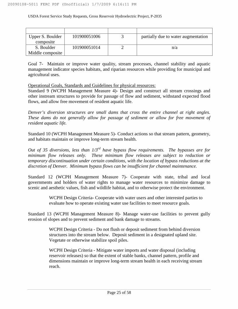
Goal 7- Maintain or improve water quality, stream processes, channel stability and aquaticmanagement indicator species habitats, and riparian resources while providing for municipal andagricultural uses.
Operational Goals, Standards and Guidelines for physical resources:Standard 9 (WCPH Management Measure 4)- Design and construct all stream crossings andother instream structures to provide for passage of flow and sediment, withstand expected floodflows, and allow free movement of resident aquatic life.
Denver’s diversion structures are small dams that cross the entire channel at right angles.These dams do not generally allow for passage of sediment or allow for free movement ofresident aquatic life.
Standard 10 (WCPH Management Measure 5)- Conduct actions so that stream pattern, geometry,and habitats maintain or improve long-term stream health.
Out of 35 diversions, less than 1/3rd have bypass flow requirements. The bypasses are forminimum flow releases only. These minimum flow releases are subject to reduction ortemporary discontinuation under certain conditions, with the location of bypass reductions at thediscretion of Denver. Minimum bypass flows can be insufficient for channel maintenance.
Standard 12 (WCPH Management Measure 7)- Cooperate with state, tribal and localgovernments and holders of water rights to manage water resources to minimize damage toscenic and aesthetic values, fish and wildlife habitat, and to otherwise protect the environment.
WCPH Design Criteria- Cooperate with water users and other interested parties toevaluate how to operate existing water use facilities to meet resource goals.
Standard 13 (WCPH Management Measure 8)- Manage water-use facilities to prevent gullyerosion of slopes and to prevent sediment and bank damage to streams.
WCPH Design Criteria - Do not flush or deposit sediment from behind diversionstructures into the stream below. Deposit sediment in a designated upland site.Vegetate or otherwise stabilize spoil piles.
WCPH Design Criteria - Mitigate water imports and water disposal (includingreservoir releases) so that the extent of stable banks, channel pattern, profile anddimensions maintain or improve long-term stream health in each receiving streamreach.
20090108-5011 FERC PDF (Unofficial) 1/7/2009 6:16:11 PM
USDA Forest Service Study Requests, Gross Reservoir Hydroelectric Project, P-2035
Page 26 of 58
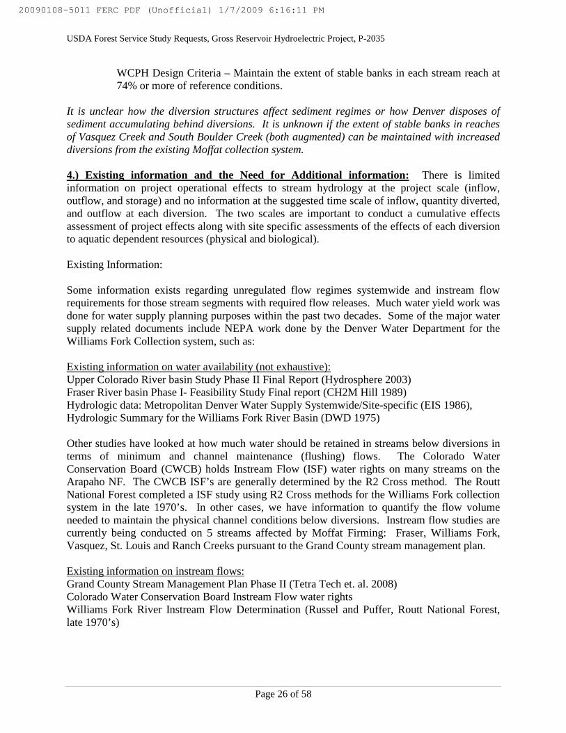
WCPH Design Criteria – Maintain the extent of stable banks in each stream reach at74% or more of reference conditions.
It is unclear how the diversion structures affect sediment regimes or how Denver disposes ofsediment accumulating behind diversions. It is unknown if the extent of stable banks in reachesof Vasquez Creek and South Boulder Creek (both augmented) can be maintained with increaseddiversions from the existing Moffat collection system.
4.) Existing information and the Need for Additional information: There is limitedinformation on project operational effects to stream hydrology at the project scale (inflow,outflow, and storage) and no information at the suggested time scale of inflow, quantity diverted,and outflow at each diversion. The two scales are important to conduct a cumulative effectsassessment of project effects along with site specific assessments of the effects of each diversionto aquatic dependent resources (physical and biological).
Existing Information:
Some information exists regarding unregulated flow regimes systemwide and instream flowrequirements for those stream segments with required flow releases. Much water yield work wasdone for water supply planning purposes within the past two decades. Some of the major watersupply related documents include NEPA work done by the Denver Water Department for theWilliams Fork Collection system, such as:
Existing information on water availability (not exhaustive):Upper Colorado River basin Study Phase II Final Report (Hydrosphere 2003)Fraser River basin Phase I- Feasibility Study Final report (CH2M Hill 1989)Hydrologic data: Metropolitan Denver Water Supply Systemwide/Site-specific (EIS 1986),Hydrologic Summary for the Williams Fork River Basin (DWD 1975)
Other studies have looked at how much water should be retained in streams below diversions interms of minimum and channel maintenance (flushing) flows. The Colorado WaterConservation Board (CWCB) holds Instream Flow (ISF) water rights on many streams on theArapaho NF. The CWCB ISF’s are generally determined by the R2 Cross method. The RouttNational Forest completed a ISF study using R2 Cross methods for the Williams Fork collectionsystem in the late 1970’s. In other cases, we have information to quantify the flow volumeneeded to maintain the physical channel conditions below diversions. Instream flow studies arecurrently being conducted on 5 streams affected by Moffat Firming: Fraser, Williams Fork,Vasquez, St. Louis and Ranch Creeks pursuant to the Grand County stream management plan.
Existing information on instream flows:Grand County Stream Management Plan Phase II (Tetra Tech et. al. 2008)Colorado Water Conservation Board Instream Flow water rightsWilliams Fork River Instream Flow Determination (Russel and Puffer, Routt National Forest,late 1970’s)
20090108-5011 FERC PDF (Unofficial) 1/7/2009 6:16:11 PM

USDA Forest Service Study Requests, Gross Reservoir Hydroelectric Project, P-2035
Page 27 of 58
There is no comprehensive source or compilation of information on the hydrology of projectaffected reaches to assess the effects of project operations to aquatic dependent resources. TheForest Service is primarily interested in project operational effects to the hydrology of the 35streams with project diversions on or affecting National Forest System Lands (see attached list).A subset of these 35 streams have populations of Colorado cutthroat trout, Regional Forestersensitive fish species, or greenback cutthroat trout, listed as threatened under the EndangeredSpecies Act. Diversions from the West Slope (Williams Fork basin and the Fraser River basin)are transported across the Continental Divide and released into South Boulder Creek. Theeffects of the large input of West Slope water to the aquatic dependent resources (fish, riparianvegetation, channel morphology, etc.) of South Boulder Creek are unknown and need to beassessed during this proceeding. Understanding project operational effects to the hydrology ofSouth Boulder Creek and the 35 affected stream reaches on the West Slope will provide theForest Service with the necessary information to determine the need for and type of mitigationnecessary for the adequate protection and utilization of the Arapaho National Forest as requiredunder the Federal Power Act and other statutes governing the management of Forest Serviceadministered resources.
5.) NEXUS Between the Study and the Project: The diversions on 35 West Slope streams arethe primary sources of water for Gross Reservoir. Most of the Moffat Collection Systemdiversions are on the Arapaho National Forest in Grand County, Colorado. The Moffat tunneltransports West Slope water under the Continental Divide to South Boulder Creek which flowsdirectly into Gross Reservoir. Therefore, streams on the West Slope are directly connected to theoperations of Gross Reservoir. The results of this study will be used to assess changes instreamflow (East Slope supplementation or West Slope depletion) in the affected channels. Theresults of this study will be used to inform the Forest on the effects of Denver Water operationson forest streams.
6.) Study methodology:
STUDY AREA
The proposed study area includes most streams diverted into the Moffat Collection System. Thisincludes 31 streams in the Fraser River basin and 4 streams in the Williams Fork River basin, aswell as the receiving streams, Vasquez and South Boulder Creek (upstream of Gross Reservoir).
METHODOLOGY
Depending on available existing information, several different methodologies may be needed tounderstand the regulated and unregulated hydrology of these watersheds.
The study is to include the following components for unregulated, existing and proposedhydrologic conditions: (a) hydrographs in cubic-feet-per-second (cfs) in a daily time step(inflow, amount diverted, and outflow) for 35 project diversions, Vasquez (augmented portion)and South Boulder Creeks for wet, average, and dry years (based on Berthoud Pass SNOTELsite snow water equivalency on April 1st between 1979-2007) and b) tables showing the rates ofinflow, diversion and outflow in cfs at each diversion for wet, average, and dry years. The
20090108-5011 FERC PDF (Unofficial) 1/7/2009 6:16:11 PM

USDA Forest Service Study Requests, Gross Reservoir Hydroelectric Project, P-2035
Page 28 of 58
following years should be evaluated: 1980 for wet (75th percentile), 1991 for average (50th
percentile) and 1999 for dry (25th percentile).
Historical flow data (reference time series) are needed to conduct additional hydrologic basedanalyses such as flood frequency and the creation of hydrologic alteration statistics. Projectoperation and stream gage information within the project area may be available for some affectedstream reaches. However, some streams may have insufficient measured information. For thesestreams, simulated hydrographs can be created using other accepted methodologies. There arethree basic approaches to creating the reference time series as listed by Hughes et. al. (1997).
• Observed rainfall-runoff time series.• Extrapolation of observed flow records of nearby unregulated watersheds.• Using suitable runoff simulation models.
The last two will probably be used the most in this study. Additional references of acceptedmethodology are: Vogel and Fennessey (1995) and Kircher et al (1985).
ANALYSIS
The results generated in the study should be analyzed in accordance with the approachesdeveloped by Richter et al. (1996, 1997, and 1998). Statistics should be generated that addressthe 5 groups identified by Richter in the development of the Indicators of Hydrologic Alterations(IHA) analysis.
1. Magnitude of monthly discharge conditions2. Magnitude and duration of annual extreme discharge conditions3. Timing of annual extreme discharge conditions4. Frequency and duration of high and low flow pulses5. Rate and frequency of hydrograph changes
These statistics should be evaluated for the project-affected reaches. In addition, a floodfrequency analysis should be performed to predict channel-forming discharges of the divertedstreams.
CONSISTENCY WITH GENERALLY ACCEPTED PRACTICE
The proposed study methodology to collate and report existing hydrologic information or createhydrographs at each diversion and for Vasquez & South Boulder Creeks is widely used andaccepted in the scientific and engineering communities.
7.) Describe considerations of level of effort and cost and why any proposed alternativestudies would not be sufficient: If the information is readily available based on project data,the estimated cost to compile and report the information is about 10 days effort for a GS-11($352 per day). Therefore, costs could be as low as $3,520 for existing information. If the datais not readily available and one has to construct simulated hydrographs based on the methodsabove, the costs could run as high as $26,750 based on government salary rates at the GS-11 andGS-12 levels and about 75-days to conduct the analysis and prepare the report.
20090108-5011 FERC PDF (Unofficial) 1/7/2009 6:16:11 PM

USDA Forest Service Study Requests, Gross Reservoir Hydroelectric Project, P-2035
Page 29 of 58
Staff level Role Cost per day Number of Days Total CostGS-11, step 5 Conduct
analysis$352 70 (~ 2 days per
diversion andstream)
$24,640
GS-12, step 5 Review finalreport
$422 5 $2,110
Estimated TotalCost
$26,750
REFERENCES
Hughes, D. A., J. O'Keeffe, V. U. Smakhtin, and J. King. 1997. Development of an operatingrule model to simulate time series of reservoir releases for instream flow requirements.Water SA 23:21-30.
Richter, B. D., J. V. Baumgartner, D. P. Braun, and J. Powell. 1998. A spatial assessment ofhydrologic alterations within a river network. Regulated Rivers: Research &Management 14:329-340.
Richter, B. D., J. V. Baumgartner, R. Wiginton, and D. P. Braun. 1997. How much water does ariver need? Freshwater Biology 37:231-349.
Richter, B. D., J. V. Baumgartner, J. Powell, and D. P. Braun. 1996. A method for assessinghydrologic alteration within ecosystems. Conservation Biology 10:1163-1174.
Vogel, R.M., and N.M. Fennessey. 1995. Flow duration curves II: a review of applications inwater resources planning. Journal of American Water Resources 31:1029-1039.
Kircher, J.E., A.F. Choquette, and B.D. Richter. 1985. Estimation of natural streamflowcharacteristics in western Colorado. USGS Water Resources Investigations Report85-4086.
USDA Forest Service. 1997. Revision of the Land and Resource Management Plan.Arapaho and Roosevelt National Forests and Pawnee National Grassland,Fort Collins, Colorado.
20090108-5011 FERC PDF (Unofficial) 1/7/2009 6:16:11 PM

USDA Forest Service Study Requests, Gross Reservoir Hydroelectric Project, P-2035
Page 30 of 58
Attachment A- Study stream list
Diverted StreamsI. Fraser basin Collection System (31 creeks)
West Side (from west to east towards Moffat Tunnel):
1. Mainstem St. Louis Creek2. Iron Creek3. Byers Creek4. Short Creek5. West St. Louis Creek6. East St. Louis Creek7. Fool Creek8. King Creek9. West Elk Creek10. West Fork Main Elk Creek11. Main Elk Creek12. East Elk Creek13. Vasquez Creek14. Little Vasquez Creek
East Side (from south to north towards Ranch Creek):
15. Mainstem Fraser River16. Jim Creek17. Buck Creek18. Cub Creek19. Wolverine20. South Fork Ranch Creek21. Middle Fork Ranch Creek22. Ranch Creek23. Dribble Creek24. North Fork Ranch Creek
Cabin-Meadow extension of East Side (from North Fork Ranch Creek to Meadow Creek):
25. Little Cabin Creek26. Cabin Creek27. Hamilton Creek28. Hurd Creek29. South Trail Creek30. North Trail Creek31. Meadow Creek
20090108-5011 FERC PDF (Unofficial) 1/7/2009 6:16:11 PM

USDA Forest Service Study Requests, Gross Reservoir Hydroelectric Project, P-2035
Page 31 of 58
II. Williams Fork Collection System (4 creeks)
South Side (from south to north):
32. Bobtail Creek33. Steelman Creek
North Side (from south to north):
34. McQuery Creek35. Jones Creek
Augmented Streams
1. Vasquez Creek2. South Boulder Creek
20090108-5011 FERC PDF (Unofficial) 1/7/2009 6:16:11 PM

USDA Forest Service Study Requests, Gross Reservoir Hydroelectric Project, P-2035
Page 32 of 58
Gross Reservoir Project Study Request No. 6
Title of Proposed Study: Aquatic, Riparian and Wetland Habitat Loss due to Inundation.
1.) Goals, Objectives and Information to be Obtained:
The Forest Service (Forest) is concerned about losing stream, riparian and wetland resources torising reservoir waters if the proposal is approved.
The goal of the “inundation” study is to inventory aquatic, riparian, and wetland resources onForest lands within the proposed reservoir enlargement area. Study objectives includemeasurement, classification and mapping of A) stream habitat B) riparian vegetationcommunities and C) wetlands (riparian and isolated) that are proposed for inundation. For eachresource listed in A-C, the Forest asks for detailed classifications of habitat and/or vegetationcommunities and the area of each class proposed for submergence under the expanded reservoir.
Information to be obtained from this study includes the location, type, and area of Forest streamhabitat, riparian vegetation and wetlands proposed for inundation by an enlarged GrossReservoir.
2.) Relevant Forest Resource Management Goals:
The following resource management goals were taken from the 1997 revision of the Arapaho-Roosevelt National Forests and Pawnee National Grasslands Land and Resource ManagementPlan (LRMP). Design criteria for the LRMP standards come from the Region 2 WatershedConservation Practices Handbook or WCPH (Forest Service Handbook 2509.25-2006-2).
Operational Goals, Standards and Guidelines for physical resources:
Standard 7 (WCPH Management Measure 3)- In the water influence zone next to perennial andintermittent streams, lakes, and wetlands, allow only those actions that maintain or improve long-term stream health and riparian ecosystem condition.
WCPH Design Criteria- Allow no action that will cause long-term change to a lowerstream health class in any stream reach. Allow no action that will cause long-termchange away from desired condition in any riparian or wetland vegetationcommunity.
Standard 10 (WCPH Management Measure 5)- Conduct actions so that stream pattern, geometry,and habitats maintain or improve long-term stream health.
Standard 11 (WCPH Management Measure 6)- Maintain long-term ground cover, soil structure,water budgets, and flow patterns of wetlands to sustain their ecological function.
WCPH Design Criteria- Avoid any loss of rare wetlands such as fens and springs.Avoid long-term reduction in organic ground cover and organic soil layers in anywetland (including peat in fens).
20090108-5011 FERC PDF (Unofficial) 1/7/2009 6:16:11 PM
USDA Forest Service Study Requests, Gross Reservoir Hydroelectric Project, P-2035
Page 33 of 58
Standard 12 (WCPH Management Measure 7)- Cooperate with state, tribal and localgovernments and holders of water rights to manage water resources to minimize damage toscenic and aesthetic values, fish and wildlife habitat, and to otherwise protect the environment.
WCPH Design Criteria- Cooperate with water users and other interested parties toevaluate how to operate existing water use facilities to meet resource goals.
The Forest Service Manual (FSM 2526) directs the Forest to, “Delineate and evaluate riparianareas prior to implementing any project activity. Determine geographic boundaries of riparianareas by onsite characteristics of water, soil, and vegetation”. It provides further direction to,“Give special attention to land and vegetation for approximately 100 feet from the edges of allperennial streams, lakes, and other bodies of water. This distance shall correspond to at least therecognizable area dominated by the riparian vegetation (36 CFR 219.27e). Give special attentionto adjacent terrestrial areas to ensure adequate protection for the riparian-dependent resources”.
The Forest Service Manual (FSM 2527) directs the Forest to, “Analyze proposed actionsaffecting floodplains or involving new construction in wetlands to assess the specific floodhazards; quantify floodplain or wetland values of the areas; determine the impacts of theproposal on those hazards and values; formulate and evaluate land and resource managementoptions; come up with a practicable alternative action or location; and determine whether the "noaction" option is practicable”. Further direction is provided to “Modify plans, activities, anddesigns to minimize impacts of the action and to mitigate its effects on the natural and beneficialvalues of the floodplain or wetland in all actions where an alternative to an action in or affectingthe floodplain or new construction in a wetland is not practicable”.
4.) Existing Information and the Need for Additional Information:
There is limited information on the extent and types of stream, riparian and wetland habitat thatwould be lost to inundation. The information is important to determine the loss of stream,riparian and wetland habitat from Forest lands that will be incurred if Gross Reservoir isenlarged.
A) Stream habitat- Existing information regarding stream habitat includes Colorado Division ofWildlife (CDOW) surveys from 1998 on South Boulder, Winiger and Forsythe Canyon creeks.The CDOW surveys contain qualitative information on stream habitat and fish abundanceestimates.
B) Riparian vegetation communities - At least one research paper has been published thatincluded information on riparian communities along South Boulder Creek above and belowGross Reservoir.
• Merritt, D. M., and E. E. Wohl. 2006. Plant dispersal along rivers fragmented by dams. RiverResearch and Applications 22:1-26.
20090108-5011 FERC PDF (Unofficial) 1/7/2009 6:16:11 PM

USDA Forest Service Study Requests, Gross Reservoir Hydroelectric Project, P-2035
Page 34 of 58
C) Wetlands- The US Fish and Wildlife Service National Wetlands Inventory (NWI) may haveinformation on wetlands around Gross Reservoir. The NWI website “wetlands mapper” showsthe area around Gross Reservoir as a non-digital inventory, with wetland data available byhardcopy only (http://www.fws.gov/wetlands/). United States Geological Survey 1:24,000 scaletopographic quadrangles may have general delineations of wet zones in the study area as well.
5.) NEXUS Between The Study And The Project:
The study will examine areas that would be inundated by an enlarged Gross Reservoir, so thestudy would be directly connected to the effects of the project. The results of this study will beused to inform the Forest the loss of stream, riparian and wetland habitats on National Forestlands.
6.) Study Methodology:
A) STREAM HABITAT
A hierarchical based approach developed by Hawkins et al. (1993) will be used to assist in theidentification of individual habitat units in the field. At the broadest level, Level I categorizeshabitats as “fast water” and “slow water”. Level II fast water is subdivided into two categories:turbulent and non-turbulent; slow water is also subdivided into two categories: scour pool anddammed pool. Level III categories are those categories that further describe the slow and fastwater units. Figure 1 shows the relationship between the three levels (see Figure 1).
Habitat mapping will be conducted by a pair of fishery biologists working as team. Thedrainages to be included in the habitat mapping study are: South Boulder Creek on Forest landupstream of reservoir, Winiger Gulch, and Forsythe Canyon. Each drainage will be mappedworking in an upstream direction where possible. Data will be recorded onto standardizeddatasheets. Aquatic habitats will be visually delineated based on the framework provided byHawkins et al. (1993) and McCain et al. (1990); each habitat unit will be uniquely identified.They will be identified at the finest scale (i.e. Level III) and recorded. All aquatic habitatsidentified will be spatially referenced using a combination of a GPS (UTM, WGS 84 datum) andhip chain methodology. Other parameters recorded for each aquatic habitat will include: meanwidth, mean depth, maximum depth, substrate composition (including spawning gravelcharacterization), riparian vegetation, woody debris, and cover.
20090108-5011 FERC PDF (Unofficial) 1/7/2009 6:16:11 PM

USDA Forest Service Study Requests, Gross Reservoir Hydroelectric Project, P-2035
Page 35 of 58
Figure 1. Three-tiered habitat mapping classification system adapted from Hawkins et al.(1993) and McCain et al. (1990).
During the habitat mapping, the location of spawning gravel deposits will be mapped using aGPS. The length and width of each spawning gravel deposit will be measured to the nearest tenthof a foot following the approach provided by Johnson and Kier (1998).
Describing and measuring each habitat type is labor intensive; an average of 0.75 miles can becovered each day by trained surveyors.
STREAM HABITAT ANALYSIS
All habitat data (including spatial referencing) will be entered into a spreadsheet and will bequality checked. Once the data is cleared, it will be entered into a database. The database formatwill allow the user to query specific information on a number of scenarios. The relative
Channel Geomorphic Unit
Fast Water
Slow Water
Scour Pool
Dammed Pool
Turbulent
Non-turbulent
FallCascade
Chute
Glide
Run
Step-runPocket Water
Edgewater
Debris
Channel (Convergence)
Main (Mid-) Channel
LateralCorner
Trench
Sheet
Rapid
Plunge
Riffle - Low/High Gradient
Beaver
Landslide
Backwater
Abandoned Channel
20090108-5011 FERC PDF (Unofficial) 1/7/2009 6:16:11 PM

USDA Forest Service Study Requests, Gross Reservoir Hydroelectric Project, P-2035
Page 36 of 58
abundance of each habitat unit will be used to determine the potential changes in stream habitatavailability caused by inundation.
Consistency with generally accepted practiceHabitat classification and inventories are a common approach in determining the availability andimportance of certain habitats to fish. The hierarchical based approach is widely used andapplied in mountain streams.
B) RIPARIAN VEGETATION COMMUNITIES
The study is to include the following components: (1) delineation of riparian areas that would beinundated by reservoir enlargement, using inundated channel length and regularly spacedtransects, perpendicular to the channel, to estimate riparian width, and (2) riparian vegetationplots within the area proposed for inundation to classify the riparian plant communities.
Aerial photography is often used to delineate aerial extent of riparian areas. However, theriparian zones along South Boulder Creek and other tributaries to Gross Reservoir are narrowand much of the riparian vegetation occurs as an understory to coniferous forest. Therefore,riparian width along the reach will be estimated using systematically placed transects orientedperpendicular to the channel, extending across the width of the riparian zone on either side of thechannel.
Transects should be located along the entire reach to be inundated (main channel and tributaries).Transect should be systematically placed from the upstream extent of the proposed inundatedarea along South Boulder Creek and tributaries every 50 meters down the channel to the currenttermination of the South Boulder Creek in Gross Reservoir (e.g., 40 transects in 2 km ofinundated stream).
Vegetation should be measured in 1x2m plots positioned systematically along selected channelcross sections within the study area. At least 6 vegetation plots should be located systematically(at set intervals) along the transect length within the riparian zone: plot nearest that channelalong the lowest extent of perennial vegetation. Percent cover of all vascular plant speciesshould be measured in each plot. Estimates of cover should be made using cover-classes (e.g.,Braun-Blanquet cover-class sclale; Mueller-Dombois and Ellenberg 1974).
Riparian areas should be categorized into coarse plant physiognomic classes (e.g., herbaceous-gramminoid meadow, shrubland, deciduous forested, and coniferous forested). Total length ofeach physiognomic class should be measured along each transect. Average length alongtransects occupied by each physiognomic class should then be converted to proportions and areaof each physiognomic class along the entire reach estimated. Total riparian area of the proposedinundated area should be calculated. The boundary of the riparian zone should be recorded usinggeographic positioning systems (GPS) and projected using geographic information systems(GIS).
20090108-5011 FERC PDF (Unofficial) 1/7/2009 6:16:11 PM

USDA Forest Service Study Requests, Gross Reservoir Hydroelectric Project, P-2035
Page 37 of 58
RIPARIAN VEGETATION STUDY AREA
The proposed study area includes the length of South Boulder Creek that would be inundated bythe enlarged reservoir. It would also include other Forest Service tributaries to Gross Reservoirthat would be inundated such as Winiger Gulch and Forsythe Canyon. Perennial, intermittent,and ephemeral tributaries that support riparian vegetation would be included.
RIPARIAN VEGETATION ANALYSIS
Vegetation plots should be classified into plant associations using conventional methods. Onesuch method is to utilize the dichotomous key to the wetlands and riparian plant associations ofColorado in Carsey et al. (2003). Once all plots are classified into one of the associations in thisguide, an assessment of frequency of various plant associations within each physiognomic classcan be determined. When combined with the global and state ranks of conservation status,assessments may be made of the following: 1) the types of plant associations and associatedhabitat lost due to inundation, 2) the species composition and species richness of thoseassociations, 3) the occurrence and frequency of rare and listed species, as well as other speciesof interest, 4) an approximation of the proportions of each physiognomic class occupied by eachplant association, and 5) an assessment of the aerial loss of plant associations and theirconservation status.
Data to be provided to the Forest Service: Cross-section end points and plot locations (recordedusing global positioning system (GPS)) including a GIS cpverage (e.g. shapefile or geodatabase),a spreadsheet matrix of percent cover of each species in each plot, plant associations that eachplot was classified into, percent length of each cross section falling into each physiognomicclass, and a detailed description of methods used to locate cross sections and plots along crosssections
Consistency with generally accepted practiceInventories are a common approach in determining the amounts and composition of riparianhabitats. The proposed vegetation classification is commonly used and is based upon publishedworks.
C) WETLANDS
The study is to include the following components: (1) Inventory of wetlands that would beinundated by reservoir enlargement, using aerial photography and/or field surveys along theentire the entire length of canyon proposed for inundation and within the proposed inundationarea, followed by 2) Wetland determination from data collected on vegetation (plots), hydrologyand soil (soil pits) within the wetland area 3) wetland classification following Cowardin et al1979 and 4) jurisdictional determination. It is recognized that there is overlap between theriparian vegetation and wetland studies. It is the intention of the wetland study to identify andclassify both riparian and non-riparian wetlands.
20090108-5011 FERC PDF (Unofficial) 1/7/2009 6:16:11 PM

USDA Forest Service Study Requests, Gross Reservoir Hydroelectric Project, P-2035
Page 38 of 58
WETLAND STUDY AREA
The study area is any Forest land between the current and proposed high water line of GrossReservoir subject to inundation.
WETLAND ANALYSIS
1) Location of wetlandsThe entire length of South Boulder Creek and tributaries should be walked by at least twoobservers. The observers should inspect the entire valley bottom from the creek (valley lowpoint) to the elevation of the proposed future reservoir level. Any wetlands should be recordedusing GPS.
Aerial photography is often used to delineate wetland areas. However, the wetlands aroundGross Reservoir may be too small to identify from air photos and, a ground survey would bemore suitable. Air may be useful to initially identify location of some wetlands, and could beused to supplement, but not replace ground surveys. If air photos are reviewed to identifywetland areas, use the largest-scale, most recent color or color infrared stereopairs available, butno smaller than 1:24,000 scale
2) Wetland determination, delineation and mappingIn the field, complete the “data form for routine wetland determination” which is Appendix B inthe Army Corps of Engineers (Corps) Wetlands Delineation manual (Corps of Engineers 1987).Collect data on wetland parameters of vegetation, hydrology and soils. A site is determined to bea wetland if at least one positive indicator of each wetland parameter is observed (i.e.hydrophytic vegetation or hydric soils etc.). If the site is determined to be a wetland, thendelineate the wetland perimeter, measure the wetlands dimensions (if practical) with a measuringtape and map using high precision GPS capable of sub-meter accuracy. Take photos ofrepresentative vegetation and any soil pits.
3) Jurisdictional determinationWetlands within the inundated area may be jurisdictional or non-jurisdictional. Receivejurisdictional determinations for each wetland from the Corps and include jurisdictionaldetermination for each wetland into the final wetland report.
4) Vegetation measurementsVegetation plots should be established within each wetland identified at a concentration of one0.5mx0.5m vegetation plot per 25m2 or no fewer than three plots per wetland. Plots should belocated within each wetland using randomly selected x-y coordinates that fall within the wetlandboundary. Percent cover of all vascular plant species should be measured in each plot.Estimates of cover can be made using cover-classes (e.g., Braun-Blanquet cover-class sclale;Mueller-Dombois and Ellenberg 1974). Plant associations should be classified using Carsey etal. (2003).
5) Detailed reportPrepare a report on the location, area and classification of each type of wetland proposed forinundation including maps and photos of each wetland. Include data forms used in wetlanddeterminations in the report. Plant associations represented should be listed along with a
20090108-5011 FERC PDF (Unofficial) 1/7/2009 6:16:11 PM

USDA Forest Service Study Requests, Gross Reservoir Hydroelectric Project, P-2035
Page 39 of 58
frequency of occurrence and global and state conservation status rankings. Total delineatedwetland area should be provided. Total area of wetland types (Cowardin et al. 1979) should alsobe provided. All vegetation inventory data will also be provided to the Forest.
Consistency with generally accepted practiceThe Corps wetland delineation procedure is a common approach used for identifying wetlandhabitats. The proposed wetland classification system is commonly used and is based uponpublished works.
7.) Describe considerations of level of effort and cost and why any proposed alternativestudies would not be sufficient:
A) Stream Habitat
There are approximately 2.1 stream miles to be included in the mapping study. A team of twotrained fishery biologists (a combination of GS-9 and GS-11) would be able to map 2.1 miles ofstream in approximately 2.5 days. This estimate is based on the general salary of both a GS-9and GS-11 at different step levels. The estimate for the total number of days includes both thefield data collection as well as the data entry.
Staff Level Cost Per Day Number of Days Total CostGS-9, step 1 $232 15 $3480GS-11, step 5 $352 10 $ 3520
Total Estimated Cost $ 7000
B) Riparian Vegetation Communities
Staff Level Cost Per Day Number of Days Total CostGS-9, step 1 $232 10 $2328GS-11, step 5 $352 20 $ 7040
Total Estimated Cost $ 9368
C) Wetlands
The level of effort and cost for the wetland inventory is directly related to the number and size ofwetlands existing in the study area. Most likely, the Corps is already aware of the location, areaand types of wetlands at risk but in the absence of such information, an air photo review of thestudy area could be completed in 2 days. A field team consisting of a soil scientist and abotanist (both GS-11 grade) would be able to make approximately two wetland determinationsand maps per day. Another 2-day field review with the Corps may be needed for jurisdictionaldeterminations. A final report could be completed in two days. Assuming 10 wetlands of < 1-acre area each are located via air photos and investigated in the field, including a 2-day Corps
20090108-5011 FERC PDF (Unofficial) 1/7/2009 6:16:11 PM

USDA Forest Service Study Requests, Gross Reservoir Hydroelectric Project, P-2035
Page 40 of 58
field review, the wetland study could take approximately 20 person-days at $352 per day or$7040.
Staff Level Cost Per Day Number of Days Total CostGS-11, step 5 $352 20 $ 7040
Total Estimated Cost $ 7040
References
Stream HabitatHawkins, C. P., J. L Kershner, P. A. Bisson, M. D. Bryant, L. M. Decker, S. V. Gregory, D. A.
McCullough, C. K. Overton, G. H .Reeves. R. J. Steedman, and M. K. Young. 1993. Ahierarchical approach to classifying habitats in small streams. Fisheries. 18(6): 3-12.
Johnson, J. and W. Kier. 1998. A preliminary assessment of the salmon habitat potential ofButte Creek, a tributary of the Sacramento River, between Butte Head Dam and theCenterville Diversion Dam, Butte County, California. Prepared for Institute for FisheriesResources, San Francisco, CA by William M. Kier Associates, Sausalito, CA. January1998.
McCain, M., D. Fuller, L. Decker, and K. Overton. 1990. Stream habitat classification andinventory procedures for northern California. FHR Currents: R-5’s fish habitatrelationships technical bulletin, No. 1. U.S. Forest Service, Pacific Southwest Region,Arcata, CA.
Riparian VegetationCarsey, K, G. Kittel, K. Decker, D.J. Cooper, and D. Culver. 2003. Field Guide to Wetland and
Riparian Plant Associations of Colorado. Colorado Natural Heritage Program, College ofNatural Resources, Colorado State University, Fort Collins, CO.
Mueller-Dombois, D. and H. Ellenberg. 1974. Aims and Methods of Vegetation Ecology. JohnWiley & Sons, New York.
Merritt, D.M and E.E. Wohl. 2006. Plant Dispersal along Rivers Fragmented by Dams. RiverResearch and Applications volume 22, pp. 1-26.
WetlandsCorps of Engineers, 1987. Wetlands Delineation Manual. Wetlands Research program
Technical Report Y-87-1. US Army Corps of Engineers Waterways Experiment Station.
Cowardin, L. M., Carter, V., Golet, F. C. and LaRoe, E. T. 1979. Classification of wetlands anddeepwater habitats of the United States. Performed for the US Department of the InteriorFish and Wildlife Service, Office of Biological Services. FWS/OBS-79/31, WashingtonD.C. 20240.
20090108-5011 FERC PDF (Unofficial) 1/7/2009 6:16:11 PM

USDA Forest Service Study Requests, Gross Reservoir Hydroelectric Project, P-2035
Page 41 of 58
Gross Reservoir Project Study Request No. 7
Title of Proposed Study: Denver Water FERC Amendment for Gross Reservoir, RooseveltNational Forest, Project Area Sensitive and Rare Plant Survey
1.) Goals, Objectives and Information to be Obtained: The following is a process tocomplete sensitive plant surveys for the project area. The objective of this process is to makesure that presence of rare plants and plant communities, and the effects of disturbance on andmitigation for rare plants and plant communities, can be determined in the most efficient mannerand is performed to adequate industry standards. “Rare plants” for this study is defined ascomprising 1) plants listed or proposed for listing under the Endangered Species Act, 2) the mostcurrent Forest Service Region 2 list of Sensitive Plants, and 3) all other rare Plants of LocalConcern, all three groups of which are as identified by the Forest that could occur in the projectarea or that could be impacted by proposed project activities, even if occurring outside theproject area (e.g., riparian plants potentially impacted by downstream water depletions orchanges in reservoir/downstream hydrology flow rates, levels, or timing; rare plants occupyingoff-site borrow pits; etc.). “Rare plant communities” include those identified by the Forest thatcould occur in the project area or that could be impacted by proposed project activities, even ifoccurring outside the project area. Note that these definitions do not necessarily include plantsthat are otherwise tracked by the Colorado Natural Heritage Program. The most current lists ofrare plants and communities to survey must be derived in concert with the Forest.
2.) Relevant Forest Service Resource Management Goals: The Arapaho and RooseveltNational Forests and Pawnee National Grassland (Forest) has goals to maintain viablepopulations of all native and desirable non-native plants and plant communities. When feasible,the Forest attempts to avoid or minimize impacts to rare plants or communities resulting frommanagement actions. Management options that could cause local extirpation of rare plants orcommunities are generally avoided.
The Forest Service has specific policy direction regarding Sensitive species, including:• Develop and implement management practices to ensure that species do not become
threatened or endangered because of Forest Service actions.• Maintain viable populations of all native and desired nonnative wildlife, fish, and plant
species in habitats distributed throughout their geographic range on National ForestSystem lands.
• Develop and implement management objectives for populations and/or habitat ofSensitive species (Forest Service Manual 2670.22).
• Assist States in achieving their goals for conservation of endemic species.• As part of the National Environmental Policy Act process, review programs and
activities, through a Biological Evaluation (BE), to determine their potential effect onSensitive species. On this Forest, a Specialist’s Report also assesses impacts to allpertinent listed and proposed species via a Biological Assessment (BA) as part of thespecialist’s report or as a stand-alone document, as well as to all other pertinent rareplants and plant communities that are not Sensitive.
• Avoid or minimize impacts to species whose viability has been identified as a concern.• If impacts cannot be avoided, analyze the significance of potential adverse effects on the
20090108-5011 FERC PDF (Unofficial) 1/7/2009 6:16:11 PM

USDA Forest Service Study Requests, Gross Reservoir Hydroelectric Project, P-2035
Page 42 of 58
population or its habitat within the area of concern and on the species as a whole. (TheForest Service line officer, with project approval authority, makes the decision to allowor disallow impact, but the decision generally must not result in loss of species viabilityor create significant trends toward Federal listing.)
• Establish management objectives in cooperation with the States when projects onNational Forest System lands may have a significant effect on Sensitive speciespopulation numbers or distributions. Establish objectives for Federal candidate species,in cooperation with the FWS or NMFS and the States (Forest Service Manual 2670.32).
4.) Existing Information and the Need for Additional information: A rare plant survey wasconducted in the Gross Reservoir area in June, July and August, 2001 (Brune 2001, ShapinsAssociates 2002). The survey was conducted to identify rare plants and plant associations thatcould be impacted by implementation of the Recreation Management Plan or by power linesassociated with Denver Water’s Gross Reservoir Hydroelectric Project, FERC Project Number2035-006. The survey found no listed plants, one Sensitive plant, five rare plants of LocalConcern, and one rare “plant association”.
Although the survey was substantial, it and the 2002 report are inadequate to meet assessmentneeds and plant protection formulation for the proposed re-licensing project associated with thisstudy request. Although the 2001 report has not been made available to the Forest for review,the 2002 report did not address all listed, Sensitive and rare Plants of Concern to the Forest, andno list of target rare plants and communities was disclosed. There are numerous rare plantspecies and communities of concern to the Forest that were not surveyed. For example,numerous new species have been added to the rare plant list since 2001, and Forest notesaccompanying the 2002 report indicate that potentially-occurring rare willows, includingSensitive species, were not considered in the original survey. Also, it is likely that the 2001effort may not have surveyed all areas that could be impacted by the proposed project underconsideration for this study request as it focused only on areas potentially impacted by theRecreation Management Plan and related activities. The survey did not survey for rare plantsdid not occur for all riparian areas within this project area, but it that may not be necessary,depending upon re-licensing scope. Shortcomings or information gaps in survey methods andresults, as well as recommendations for resurveys, were not identified in the 2002 report.Shapins Associates (2002) states that all rare plant sites encountered could be avoided for theproject under which the survey occurred, but it is unknown if implementation of avoidancemeasures actually occurred. It is also unknown how the observed sites could be impacted by theproposed new project under this study request. No final report of effects analysis for the plantsencountered has been presented to the Forest for review.
At this time, no plant species listed under the Endangered Species Act (ESA) are known orsuspected to within the project area. However, two listed species that could be impacted bywater depletions or changes in hydrology could occur in upstream corridors leading to reservoirinlets or downstream of the project area. There is medium to high potential of existence ofadditional undocumented sites of observed rare plants. There are roughly six additionalSensitive plants, five plants of Local Concern, and several rare plant communities that couldoccur in the project area that were not surveyed or that were under-surveyed.
20090108-5011 FERC PDF (Unofficial) 1/7/2009 6:16:11 PM

USDA Forest Service Study Requests, Gross Reservoir Hydroelectric Project, P-2035
Page 43 of 58
Large-sized project areas can be stratified by (1) intensity and/or duration of disturbance; and (2)the likelihood of rare plant occurrence. This information can be used to determine the intensityof survey needed to meet policy requirements for rare plants. Several of the un-surveyedSensitive plant species are associated with riparian habitats that can be impacted due to changesin water flows and timing of flows. Upland species for the proposed project may be in locationsthat could be impacted by disturbance, restoration, or on-going maintenance activities.
A new survey and results analysis are needed to meet Forest Service direction in completing aSpecialist’s Report, including a Biological Evaluation for Sensitive plants that are on the ForestService Region 2 Sensitive Species List, Biological Assessment for listed plants, and assessmentof impacts to other rare plants of Local Concern and rare plant communities. The Forest Serviceis required to assess potential affects of the project proposal to rare plant species. An appropriateupdated list of target species needs to be formulated. An intuitive controlled survey is needed forthis assessment. A re-survey of certain wetland areas surveyed by Brune (2001) may not benecessary. However, other riparian areas already surveyed by Brune and areas not surveyed mayneed to be surveyed. Numerous upland areas not surveyed may also need to be surveyed.
5.) NEXUS Between the Study and the Project: Results of the proposed survey will allow theForest Service to assess presence of, and impacts to, rare plants and plant communities, andwhether or not potential effects to Sensitive plant species would lead toward Federal listingunder the Endangered Species Act. Results would allow the Forest to determine if proposedactions would be in compliance with the Forest Plana and Forest Service policy regarding listed,Sensitive, and rare plants. Avoidance or mitigation measures to reduce adverse impacts for rareplants or communities may become part of License requirements.
6.) Study methodology: The presented methods and guidelines are standard operatingprocedure for the Forest Service project assessments. This Forest holds contractors to the samelevel of qualification, performance and documentation standards as efforts conducted internallyby the Forest. “Types of Surveys” Guidelines at the end of this document (Attachment A) areconsistent with literature provided on plant survey intensity levels and the article “Rare PlantSurveys: Techniques for Impact Assessment” by James R. Nelson, from the Natural AreasJournal (Vol. 5, No. 3)).
7.) Describe considerations of level of effort and cost and why any proposed alternativestudies would not be sufficient: Anticipated workloads and cost vary greatly as a function ofvendors and frequency of rare plants encountered. Vendor costs range from $300 to $1200 perday, inclusive of travel and field costs. It is estimated that there would be 10-16 field-persondays (2 people for 5-7 days or 4 people for 3-4 days, depending upon what was encountered) tosurvey all areas of suitable habitat for target species and 4 days of report writing.
The project area has been rated for likelihood of rare plant occurrence (high, moderate and low).There are known occurrences of rare plants in the project area; these may need additional re-surveys. Potential for additional undocumented target plants to occur is medium to high,depending upon target species. As a general rule, riparian areas have a high potential to supportrare plants.
20090108-5011 FERC PDF (Unofficial) 1/7/2009 6:16:11 PM

USDA Forest Service Study Requests, Gross Reservoir Hydroelectric Project, P-2035
Page 44 of 58
Under the Intuitive Controlled level of survey, the surveyor gives the area a closer look byconducting a complete survey through a specific area of the project that may contain rare plantsafter walking through the project area and perimeter or by walking more than once through thearea. Most of the project area is examined. Estimated Rate/Day: 15-100 acres per day.
Refer to the background information on each plant that indicates its phenology to determine thebest survey dates for the various species likely to be found in each area. In cases where two ormore plants may be present in the same area, but they cannot be identified at the same time, morethan one visit may be required to that area.
Sensitive plant survey and report specification guidelines:
The following guidelines are intended to assist project proponents and botanicalvendors/consultants to determine how field surveys should be conducted and what informationshould be included in the survey report for the Forest Service.
Cooperation with the Forest
Because a previous survey has been conducted, it is possible that not all target species or areaswould need to be surveyed. To ensure adequacy and efficiency of surveys and results, and thatminimum standards have been fulfilled that meet Forest Service requirements, the followingshall occur in the survey planning phase, well prior to field surveys:
1. Work with Forest Botany Representative to derive pertinent target rare species and rareplant community lists and habitats to be looked for in survey efforts, in consideration thata previous survey limited in species and areas has been conducted.
2. Work with Forest Botany Representative to derive pertinent survey intensities andprotocols, including survey timing.
3. Allow Forest Botany Representative to review all survey crew and report preparer’squalifications. If surveyors or report preparers change, notify Forest BotanyRepresentative prior to effective change date and allow review of qualifications.
4. Work with Forest Botany Representative to review current Forest information that can berelayed to Vendor/Contractor. The Forest may be aware of sites not known to outsidesources or the Colorado Natural Heritage program.
Guidelines
1. To ensure that the quality of work done by contract botanists meets ForestService standards the following list of qualifications are recommended. Thesequalifications will ensure a high degree of confidence in the quality of the workand will certainly provide us with valuable information on rare or other targetplants:
a. A degree in botany, plant ecology, or related natural resource field or underthe close supervision of such a qualified individual. Coursework in plant
20090108-5011 FERC PDF (Unofficial) 1/7/2009 6:16:11 PM

USDA Forest Service Study Requests, Gross Reservoir Hydroelectric Project, P-2035
Page 45 of 58
ecology and plant taxonomy required, additional coursework in soils,agrostology, and biological ecosystems would be desirable.
b. Skills in plant identification use of plant taxonomic keys, and use ofvegetation habitat guides. Strong knowledge of the flora of the area to beassessed is preferred.
c. Skills related to the art and science of conducting rare plant surveys, includingknowledge of conservation biology. A demonstrated commitment to thepreservation of natural diversity. Knowledge related to Forest Servicemethodology in conducting rare plants surveys.
d. Knowledge of agency procedures, including the procedures for completing theBiological Evaluation/Specialist’s Report process. Ability to coordinate workwith agency specialists. Ability to complete technical and analytical reports,such as biological evaluations, field review reports, and rare plant statusreports, as required.
e. Ability and willingness to apply professional integrity to the rare plant surveyprocess. Adherence to Forest Service guidelines for conducting rare plantsurveys, such as following windows for timing of surveys (generally May -September) when species can be identified with the greatest accuracy.Willingness to fully and accurately disclose results of survey.
f. Ability to collect geospatial data and use of GPS in the field.
2. Project personnel (i.e. proponent or Forest Service project coordinator) shall:
a. Inform potential consultants as to the full scope of work planned for theproject.
b. Provide a map of sufficient scale of the entire project area showing all areas ofimpact from direct and indirect land disturbance activities.
c. Where needed, have the project areas fully surveyed and flagged before thebotanical contractor begins work.
3. Botanical surveys shall be conducted in a manner that provides the highest probabilityof locating any rare plant species that may be present. Specifically, rare plant surveysshall be:
a. Conducted at the proper time of year when Sensitive species are identifiable.This should coincide with known flowering periods and/or periods ofphenological development necessary for identifying species of concern.
b. Conducted using systematic field techniques in all suitable habitats that may
20090108-5011 FERC PDF (Unofficial) 1/7/2009 6:16:11 PM

USDA Forest Service Study Requests, Gross Reservoir Hydroelectric Project, P-2035
Page 46 of 58
be impacted by project activities. In addition the surveyor needs to be awareof microsites within the project area that may contain suitable habitat forSensitive species.
4. Botanical survey reports shall be submitted to the Forest Service for review andapproval. It is suggested that the report format follow the most current ForestService Region 2 template as modified by the Forest, but any format can beaccepted as long as all requirements and discussions in the template have beenadequately addressed. The original report shall be submitted to the project proponent,with a copy of the report going to the Forest Botany Representative. The followinginformation should be included:
a. A description of the proposed project, including legal descriptions. Also, adescription of all ground-disturbing activities that may affect plant species orhabitats. Include a good quality, legible topography map (scale 1:24,000) ofthe project area with the botanical survey area clearly marked. Highlightingthe survey boundaries often helps delineate the area.
b. A detailed description of survey methodology. Include the names of allbotanist(s)/technicians conducting the field work and the date of the fieldsurvey(s). The intensity of the botanical survey will vary according to thehabitat encountered and degree of disturbance anticipated during projectactivities.
c. In areas of potential habitat, botanical surveys should cover the entire areaproposed for disturbance as well as an additional area to address the indirecteffects associated with the project.
d. A narrative description of the vegetation communities and/or habitats foundwithin the project area. Mention should be made of the dominant and co-dominant species (e.g., Ponderosa pine/Idaho Fescue-Bluebunch Wheatgrass).Also, it should be specified whether this description is for community types(existing plant communities) or whether a guide has been used to describeplant associations (climax natural plant communities).
e. A description of soil types, land use patterns or past disturbances, and anysmall inclusion communities or microniches within the overall landscape(riparian areas or wetlands, woody draws, rock outcrops, clay downwashes,sandhill, etc.).
f. A list of all target plant species and communities that may have habitat withinthe project area or areas potentially impacted by proposed project activities(i.e., all the target plants, communities, and habitats searched). Habitatrequirements for the species should accompany the list to provide rationale forthe species having the potential for occurring in the project area.
20090108-5011 FERC PDF (Unofficial) 1/7/2009 6:16:11 PM

USDA Forest Service Study Requests, Gross Reservoir Hydroelectric Project, P-2035
Page 47 of 58
g. A complete floristic list of all plant species identified during the field survey.
h. A determination of whether the project area is likely to contain any rare plantspecies/communities or habitat for rare plant species. If the project impactsany unique or unusual habitat types, this should also be mentioned. This mayinclude riparian/wetland areas, or pristine woody draw situations, or anymicroniche containing an unusual community of unique species, whether theyare officially listed as rare or not.
i. The survey report should document any pre-field scoping done with theColorado Natural Heritage Program for any documented known occurrencesof rare plants/communities in the project area and general vicinity. If scopingfor rare plants/communities included information from agency specialists, thescientific community, or known botanical experts for this area, this shouldalso be mentioned.
j. The report should include any recommendation the contractor feels wouldenhance project implementation or avoid unnecessary disturbance to the targetcommunities. This may include recommendation for preserving certain plantsor communities, avoiding specific target plant species (including noxiousweeds), enhancing habitat for observed wildlife species, etc. It may alsoinclude reclamation recommendations.
k. Photographs of the habitats searched have proved extremely useful in the pastand have helped clarify certain problem situations after field season hasended.
l. Bibliography of literature or references cited.
m. The Forest’s customized Rare Plant/Community Survey Form shall becompleted in the field at time of survey for all field work. The originals shallbe submitted to the proponent with color copies submitted to the ForestService with the botanical survey report.
5. If any Sensitive or other target species or communities are found, the report shallcontain:
a. An assessment of the population (size, vigor, number of reproducingindividuals, etc.), habitat condition, and acreage occupied by the population.
b. Geospatial map showing location relative to project area. All rare plant orcommunity sites shall be GPS’d in the field in UTM, NAD 83.
c. An assessment of potential impacts to the population by proposed projectactivities.
20090108-5011 FERC PDF (Unofficial) 1/7/2009 6:16:11 PM

USDA Forest Service Study Requests, Gross Reservoir Hydroelectric Project, P-2035
Page 48 of 58
d. A discussion of the importance of this population with consideration of nearbypopulations and total species distribution.
e. Any observations of the response of the population to past managementactivities or land use disturbance.
f. Recommended mitigation measures to reduce or avoid impacts to thepopulation.
g. Collections of target species will be allowed only when such actions do notjeopardize the continued existence of the population and in accordance withapplicable state and federal regulations, and with prior approval from theForest if on USFS lands.
h. When a target species is located, The Forest’s customized Rare PlantOccurrence Form shall be completed in the field at time of observation. Theoriginal shall be submitted to the proponent with color copies submitted to theColorado Natural Heritage Program and the Forest Service with the botanicalsurvey report.
i. Photographs of the target plant encountered and their occupied sites haveproved extremely useful in the past and have helped clarify certain problemsituations after field season has ended.
j. Contractors are encouraged to keep in close communication with the ForestBotany Representative during project work on the National Forest.Contractors should notify the Forest Botany Representative immediately ifany Sensitive species are located or if any unusual species are discovered. Inaddition, contractors are encouraged to work with the Forest BotanyRepresentative if plant species found on projects are difficult to identify due totime of season or phenology stage of the species. Specimens of problemspecies are often submitted to a University herbarium for assistance inidentification.
20090108-5011 FERC PDF (Unofficial) 1/7/2009 6:16:11 PM

USDA Forest Service Study Requests, Gross Reservoir Hydroelectric Project, P-2035
Page 49 of 58
Literature Cited
Brune, Rick. 2001. A Vegetation Survey of the Gross Reservoir Area. Prepared for DonKennedy, Environmental Planning, Denver Water Dept., Denver, CO.
Shapins Associates. 2002. Article 410 (Plan to Protect Rare & Sensitive Plant Species). In:Gross Reservoir Recreation Management Plan 2002 Draft. Gross Reservoir HydroelectricProject, FERC Project Number 2035-006.
20090108-5011 FERC PDF (Unofficial) 1/7/2009 6:16:11 PM

USDA Forest Service Study Requests, Gross Reservoir Hydroelectric Project, P-2035
Page 50 of 58
Attachment A
Types of Surveys
Field Check: The surveyor gives the area a quick field visit but does not walk completelythrough the project area. The entire project area has not been examined. Estimated Rate/Day:Varies
Cursory: The surveyor gives the area a quick “once over” by walking through the project area.The entire project area has not been examined. Estimated Rate/Day: Varies
Limited Focus: The surveyor closely checks one or more habitat-specific locations within theproject area but does not examine the rest of the area. Estimated Rate/Day: 100-500 acres perday.
General: The surveyor gives the area a closer look by walking through the project area andperimeter or by walking more than once through the area. A significant portion of the projectarea is examined. Estimated Rate/Day: 100-160 acres per day.
Intuitive Controlled: The surveyor has given the area a closer look by conducting a completesurvey through a specific area of the project after walking through the project area and perimeteror by walking more than once through the area. Most of the project area is examined. EstimatedRate/Day: 15-100 acres per day.
Complete: The surveyor has walked throughout the area being examined until all of the area hasbeen examined. Estimated Rate/Day: 10-50 acres per day.
20090108-5011 FERC PDF (Unofficial) 1/7/2009 6:16:11 PM

USDA Forest Service Study Requests, Gross Reservoir Hydroelectric Project, P-2035
Page 51 of 58
Gross Reservoir Project Study Request No. 8
Title of Proposed Study: Special-Status Terrestrial Wildlife Species and Habitats, IncludingAmphibians and Invertebrates. Plants, natural communities, and fish are covered in other studyrequests.
1.) Goals, Objectives and Information to be Obtained:
The purpose of the study is to assess the potential for effects to special-status wildlife species,including amphibians, and their habitats, based on known occurrences and/or the likelihood ofoccurrence, and the scope of project activities. Assessments may include field evaluations ofhabitat suitability and surveys for species that could be affected by project activities. Studyresults should be used in analyses of impacts of project activities on special-status species.
Analysis of effects to special-status species should include ESA-listed (endangered, threatened,and candidate) taxa; USFS sensitive species based on the current Region 2 list, and managementindicator species (MIS) for the Arapaho and Roosevelt National Forests and Pawnee NationalGrassland (ARP); all categories currently tracked by the Colorado Natural Heritage Program(CNHP), including plants, birds, mammals, fish, invertebrates, and natural communities (plants,natural communities, and fish are covered in other study requests); species of local concernspecific to the project, if any, and migratory birds not included in the above categories.Determining the need for on-the-ground studies should be based on (1) defining the proposedaction, (2) evaluating the potential for impact, and (3) tailoring any studies to the scope ofpotential impacts.
The Forest Service recommends completion of a Biological Report addressing potential effectsto federally listed or proposed species; Forest Service Region 2 sensitive species (Forest ServiceManual 2672.4 – Biological Evaluations, Region 2 Supplement 2600-2007-1 June 8, 2007);MIS; and, as applicable to the project, CNHP-tracked species, local species of concern, andmigratory birds not included in other categories. This analysis should include identification ofresource protection and/or mitigation measures, if needed, to reduce or eliminate negativeimpacts and effects. If requested, the Forest Service will provide additional information andexamples to assist in completion of the Biological Report.
Analysis should also include an assessment of project impacts to the following habitats and/orcomponents which provide habitat for special-status species, and/or are covered by Forest PlanStandards and Guidelines:
• cover types *• forested and open corridors *• effective habitat *• interior forests *• old growth, developing old growth, identified old growth development areas, and other
forest structural stages *• streams and stream crossings• other important habitats that are defined by animals or vegetation in the project area, for
example winter range or production areas
20090108-5011 FERC PDF (Unofficial) 1/7/2009 6:16:11 PM

USDA Forest Service Study Requests, Gross Reservoir Hydroelectric Project, P-2035
Page 52 of 58
Most habitats indicated by “*” are mapped and available as GIS layers.
2.) Relevant Forest Service Resource Management Goals:
Management goals and objectives for public lands administered by the USFS are derived fromthe 1997 Revision of the Land and Resource Management Plan for the Arapaho and RooseveltNational Forests and Pawnee National Grassland (USDA Forest Service 1997; Forest Plan) andthe Forest Plan is developed from a variety of sources, including the National ForestManagement Act (NFMA), as amended, the Endangered Species Act of 1974, as amended, theForest Service Manual (FSM), and local forest planning documents, including the Forest Plan.The NFMA includes direction to preserve and enhance the diversity of plant and animalcommunities, including endemic and desirable naturalized plant and animal species, so that theirdiversity is at least as great as that which would be expected in a natural forest (36 CFR § 219.26and § 219.27). The NFMA also requires the maintenance of plant and animal diversitycommensurate with the overall multiple-use objectives of the USFS. The FSM requires reviewof projects that may affect species listed as Sensitive, and preparation of a Biological Evaluationto ensure that activities do not increase the likelihood of future Endangered Species listing. TheForest Plan identifies MIS.
The USDA Forest Service also has specific policy direction regarding sensitive species (USDAForest Service Manual [FSM] 2670), habitat management (FSM 2620) and cooperative relationswith state and other federal agencies (FSM 2610), including but not limited to:
• Develop and implement management practices to ensure that species do not becomethreatened or endangered.
• Maintain viable populations of all native and desired nonnative wildlife, fish, and plantspecies in habitats distributed throughout their geographic range.
• Develop and implement conservation strategies for sensitive species and their habitats, incoordination with other Forest Service units, managing agencies, and landowners, andcoordinate management objectives to conserve sensitive species with state and federalagencies, tribes and other cooperators as appropriate (FSM 2670.22).
• Assist States in achieving their goals for conservation of endemic species.• As part of the National Environmental Policy Act process, review programs and
activities, through a biological evaluation, to determine their potential effect on sensitivespecies.
• Avoid or minimize impacts to species whose viability has been identified as a concern.• If impacts cannot be avoided, analyze the significance of potential adverse effects on the
population or its habitat within the area of concern and on the species as a whole.
In addition, the USFWS is required under the authority of the Endangered Species Act to reviewand provide comment on federally authorized projects that may affect listed or proposed species.
4.) Existing Information and Need for Additional Information:
Wildlife surveys were conducted in the 1990’s for the Winiger Ridge Ecosystem Pilot AreaVegetation Management Project and for the Gross Reservoir Hydroelectric FERC Relicensingproject. However, both the USFS Region 2 Sensitive Species List and the ARP MIS list have
20090108-5011 FERC PDF (Unofficial) 1/7/2009 6:16:11 PM

USDA Forest Service Study Requests, Gross Reservoir Hydroelectric Project, P-2035
Page 53 of 58
changed since those surveys, and CNHP species tracking is updated each year. Therefore,updated information is needed.
Additional site-specific information is necessary to evaluate the effects of inundation and anyassociated ground-disturbing activities, including but not limited to vegetation removal, newtemporary or permanent roads including changes in traffic patterns, and relocation of recreationfacilities including roads and/or trails, on special status species and habitats. Where new ground-disturbing activities are proposed, additional information to evaluate the effects of thoseactivities may also be required when existing site-specific information on the condition ofhabitats and the occurrence of special-status species is lacking or out-of-date.
Evaluations of proposed ground-disturbing activities would address habitat suitability forspecial-status species, the scope of the proposed activity, and the degree to which special-statusspecies rely on habitats affected by the proposed activity. The need for additional site-specificinformation will be contingent on the potential for effects to special-status species and habitats.
Additional information is also needed regarding the potential for changes to riparian habitats onthe West Slope as a result of increased depletions and/or changes in timing of water flows, andthe potential for changes to riparian habitat on the East Slope as a result of changes to water flowamounts and/or timing. Many special-status species inhabit riparian habitats and associatedstreams, and could be affected. If the project will result in changes to water flow amount and/ortiming downstream from Gross Reservoir, an assessment of impacts to downstream Threatenedand Endangered species in the Platte River will be needed.
5.) NEXUS Between the Study and the Project:
As discussed above, various laws and regulations require analysis of special-status speciespotentially affected by the proposed project. In order to properly assess impacts to special-statusspecies, field surveys are needed commensurate with expected impacts of the proposed action tothese species and their habitats. As discussed above and below, potential impacts include newinundation around Gross Reservoir, changes in amount and/or timing of water flows, andground-disturbing activities such as vegetation removal, new temporary or permanent roads ifany are proposed, and relocation of recreation facilities.
6.) Study Methodology:
All areas within the Project Boundary that are subject to ground-disturbing activities related toproject operations or maintenance, new inundation including associated vegetation removal andproposed new roads if any, and/or changes in water flow amount and/or timing should beassessed for their potential to support special-status wildlife. Special-status species and habitatsare defined as those listed by the USFWS, USFS, and/or CNHP.
Wildlife assessments should review the habitats present in the area subject to ground disturbance,new inundation, and/or water flow changes, in relation to species distributions, habitatrequirements and life history information. Species information should be obtained from the bestavailable science, including Species Conservation Assessments prepared for the Forest Service
20090108-5011 FERC PDF (Unofficial) 1/7/2009 6:16:11 PM

USDA Forest Service Study Requests, Gross Reservoir Hydroelectric Project, P-2035
Page 54 of 58
Rocky Mountain Region (USDA Forest Service 2008). This information should be used toassess (1) the availability of appropriate habitat within the proposed activity area and (2) thepotential for each species to be affected by the proposed activity. Wildlife assessments should beconducted by individuals with: (1) experience conducting wildlife surveys, (2) knowledge ofwildlife taxonomy and wildlife community ecology and classification, and (3) familiarity withthe wildlife of the area, (4) familiarity with appropriate state and federal statutes related towildlife, and (5) experience with analyzing impacts to wildlife and wildlife communities.Survey methods will vary greatly by species, and should be based on accepted protocols for eachspecies if available. Survey techniques are discussed for some species in Species ConservationAssessments.
If special status species or habitats are documented or likely to occur in the study area, or may beaffected by water flow changes, project effects on each species should be assessed withconsideration of the size of the affected area, the timing and duration of disturbance, the type ofactivity, the reliance of the individual species on a given habitat, and the degree to which suchhabitats are disturbed or otherwise affected. If warranted, these considerations should beincorporated into management and/or mitigation efforts developed in consultation with theresource agencies.
7.) Describe considerations of level of effort and cost and why any proposed alternativestudies would not be sufficient:
Anticipated workloads and cost vary greatly, depending on different survey protocols for special-status species and varying costs for contractors/consultants. Survey protocols for some species,particularly Threatened or Endangered, are intensive and costly and require specific surveyorqualifications to be acceptable to the USFWS. Consultant costs may range from $300 to $1200per day, inclusive of travel and field costs. Level of effort and cost for initial field studies forthis study would be based on these factors. The level of effort required to evaluate future areasof ground disturbance will be evaluated at the time such activities are proposed or specificallydefined and located on the ground.
No alternative studies have been proposed.
Data Analysis and Reporting
Study reporting should include study objectives, study area, methods, survey results, assessmentof project effects on special-status species and habitats, and recommendations for resourceprotection measures, if warranted. The report should also include species summaries (e.g., lifehistory, habitat requirements, current status and threats) for special-status species documented orwith potential to occur within the study area.
20090108-5011 FERC PDF (Unofficial) 1/7/2009 6:16:11 PM

USDA Forest Service Study Requests, Gross Reservoir Hydroelectric Project, P-2035
Page 55 of 58
References
USDA Forest Service. 1997. 1997 Revision of the Land and Resource Management Plan.Arapaho and Roosevelt National Forests and Pawnee National Grassland.
USDA Forest Service. 2008. Species conservation program: species conservation assessments.http://www.fs.fed.us/r2/projects/scp/assessments/index.shtml
20090108-5011 FERC PDF (Unofficial) 1/7/2009 6:16:11 PM

USDA Forest Service Study Requests, Gross Reservoir Hydroelectric Project, P-2035
Page 56 of 58
Gross Reservoir Project Study Request No. 9
Title of Proposed Study: Invasive Plant Species Evaluation
1.) Goals, Objectives and Information to be Obtained:
Several Colorado-listed noxious weed species are documented to occur in the project area,including at least nine species within the FERC boundary and four or more outside the boundarybut within fairly close proximity. Information needed includes further surveys for noxious weedor other potentially invasive plant infestations where new inundation or ground disturbance areexpected, and evaluation of the potential for project activities to introduce or spread noxiousweeds or other invasive plants, including recommendation of mitigation measures to reduceintroduction and/or spread. The term “noxious weeds” generally refers to species listed as suchby the State of Colorado. Invasive plants include listed noxious weeds as well as other nonnativeplant species with the potential to invade local ecosystems.
2.) Relevant Forest Service Resource Management Goals:
This study is consistent with relevant agency resource management goals. Management goalsand objectives for public lands administered by the Arapaho and Roosevelt National Forests andPawnee National Grassland (ARP) are derived from the 1997 Revision of the Land and ResourceManagement Plan for the Arapaho and Roosevelt National Forests and Pawnee NationalGrassland (USDA Forest Service 1997; Forest Plan).
Forest Plan direction includes the following Goal:• Manage undesirable vegetation, including noxious weeds, using an integrated pest
management approach.
Forest Plan direction includes the following Standards:• Control undesirable nonnative and noxious plants throughout the Forests, with priority
given to new species (new to Colorado or the ARP), and to wilderness areas.• Use only certified “noxious weed-free” hay or straw for feed or revegetation projects
anywhere on the ARP• For all proposed project or activities, determine the risk of noxious weed introduction or
spread, and implement appropriate mitigation measures.
The ARP developed a Noxious Weed Management Plan which was finalized in April 2003.Noxious weed management activities conducted on National Forest lands must be consistentwith this Plan.
Activities on National Forest lands must adhere to the Weed Free Forage Products Order, USFSRocky Mountain Region Special Order Number R2-2005-01 which can be found athttp://www.fs.fed.us/r2/news/weed_free_order/WEED_FREE_ORDER_06202005.shtm
20090108-5011 FERC PDF (Unofficial) 1/7/2009 6:16:11 PM

USDA Forest Service Study Requests, Gross Reservoir Hydroelectric Project, P-2035
Page 57 of 58
In addition, the Colorado Noxious Weed Act §§35-5.5-101 – 119 C.R.S (2003) states thatnoxious weed management is in the public interest, finding that “certain undesirable plantsconstitute a present threat to the continued economic and environmental value of the lands of thestate and if present in any area of the state must be managed.”
4.) Existing Information and Need for Additional Information:
After the 2001 FERC Relicensing for Gross Reservoir, Denver Water created a WeedManagement and Pesticide Use Plan which was reviewed by the USFS and Boulder County andsubmitted to FERC in 2005 (Denver Water 2005). This document contains a detailed history ofnoxious weed surveys, lists and maps of Colorado-listed noxious weed species found in and nearthe Gross Reservoir area, and general plans for weed management activities to be conducted bythe Forest Service and Denver Water in the area.
Since 2005, Denver Water has submitted an annual Noxious Plant Monitoring Report, reviewedby the USFS and Boulder County. Invasive plant inventories were conducted in the GrossReservoir vicinity from 1998 through 2001. The USFS has added new infestations as they havebeen discovered but has not conducted any further specific surveys in the area. Denver Waterand the USFS have treated priority weed species each year, with efforts depending on availableresources.
The Weed Management and Pesticide Use Plan does not reflect an infestation of leafy spurge(Euphorbia esula), a Colorado List B species and a high priority species for the USFS andBoulder County, along Gross Dam road near the railroad crossing, about a mile or less from theFERC boundary. In addition, an infestation of orange hawkweed, a Colorado List A species andhigh priority for the USFS and Boulder County, was found since 2005 about two miles west ofthe western FERC boundary.
Additional site-specific noxious weed occurrence information is necessary to evaluate the effectsof inundation and any associated ground-disturbing activities, including but not limited tovegetation removal, new temporary or permanent roads, and relocation of recreation facilitiesincluding roads and/or trails, on noxious weed infestation, spread, and management. Existinginventories provide baseline information; however the information is somewhat outdated becauseinvasive plants spread continuously, and these inventories did not focus on areas to be affectedby new inundation and ground disturbance for the current project.
Evaluation of project effects on the invasive plant situation should include, at a minimum,historic and newly gathered information regarding noxious weed occurrences (including maps),the potential for project activities to introduce or spread noxious weeds, mitigation measures toreduce the potential for introduction and spread, and recommendations for follow up treatmentand monitoring after project implementation. Appropriate mitigations to reduce or eliminatenew infestation or spread include, but are not limited to, survey for and treatment of noxiousweeds in areas proposed for new ground disturbance and/or inundation prior to these activitiesoccurring, measures regarding use of clean equipment on National Forest lands, reclamation andrevegetation of disturbed areas, and use of certified weed-free materials such as straw forrevegetation (required on National Forest lands by Special Order, see #2 above).
20090108-5011 FERC PDF (Unofficial) 1/7/2009 6:16:11 PM

USDA Forest Service Study Requests, Gross Reservoir Hydroelectric Project, P-2035
Page 58 of 58
5.) NEXUS Between the Study and the Project:
Multiple occurrences of noxious weeds are documented in and near the project area and have thepotential to be spread further by project activities, particularly ground-disturbing activities.Newly disturbed ground will create areas susceptible to new invasion or spread of existingspecies, and equipment brought in to perform such activities has the potential to spread existinginfestations and/or bring in noxious weed species that do not currently occur in the area.
6.) Study Methodology:
The Forest Service has established protocols for noxious weed surveys which should be followedfor data compatibility. The Forest Service has provided Denver Water with field survey formsand data requirements in the past and will provide updated specifications on request. Datashould be collected using GPS technology which can be loaded into the Forest Service InvasivePlants database. Surveys should be conducted at all locations planned for inundation and/ortemporary or permanent ground disturbance, prior to beginning project implementation. Surveysshould be conducted as soon as possible to allow time for evaluation of data and one or moretreatments of weed infestations prior to project implementation. Surveys should be conducted atappropriate times of the year for the best detection probability based on noxious weed speciesknown to occur in and near the area and other species with potential to occur.
Surveys should be conducted by individuals familiar with noxious weeds on USFS and Coloradolists, including the ability to recognize these species at various life stages. Surveyors should befamiliar with GPS technology and have experience with noxious weed surveying and mapping.Surveyors should be familiar with local native plant communities, which facilitates recognitionof plant species out of place in the area.
7.) Describe considerations of level of effort and cost and why any proposed alternativestudies would not be sufficient:
Depending on the extent of inundation and ground-disturbing activities, several days to severalweeks may be needed for surveys, especially considering the rough terrain to be inundated.Additional time will be required to download GPS data, and prepare maps and reports. Noalternative studies have been proposed.
References
Denver Water. 2005. FERC article 406 USFS conditions 107 and 108, weed management planand pesticide use plan, Gross Reservoir Hydroelectric Project, P-2035-046. 10 pages plusappendices.
USDA Forest Service. 1997. 1997 Revision of the Land and Resource Management Plan.Arapaho and Roosevelt National Forests and Pawnee National Grassland.
20090108-5011 FERC PDF (Unofficial) 1/7/2009 6:16:11 PM

Document Content(s)
FS_Comnts-StdyRqsts_1-7-09.DOC........................................1-2
Enclosure_FS_Study_Requests2.DOC......................................3-60
20090108-5011 FERC PDF (Unofficial) 1/7/2009 6:16:11 PM