2009 cmas conference, 20 october 2009, chapel hill, nc. fei chen, mukul tewari, kevin manning:...
TRANSCRIPT

2009 CMAS Conference, 20 October 2009, Chapel Hill, NC.
Fei Chen, Mukul Tewari, Kevin Manning: National Center For Atmospheric Research (NCAR), Boulder, CO
Hiroyuki Kusaka: University of Tsukuba, Japan
Shiguan Miao: Institute of Urban Meteorology, Beijing, China
Alberto Martilli: Centro de Investigaciones Energeticas, Madrid, Spain
Jason Ching: USEPA, Research Triangle Park, NC,
Susanne Grossman Clarke: Arizona State University, Tempe, AZ
XueMei Wang: Sun Yat-Sen University, Guangzhou, China
Applications of the Integrated WRF/Urban Modelling System to
Regional Air Quality
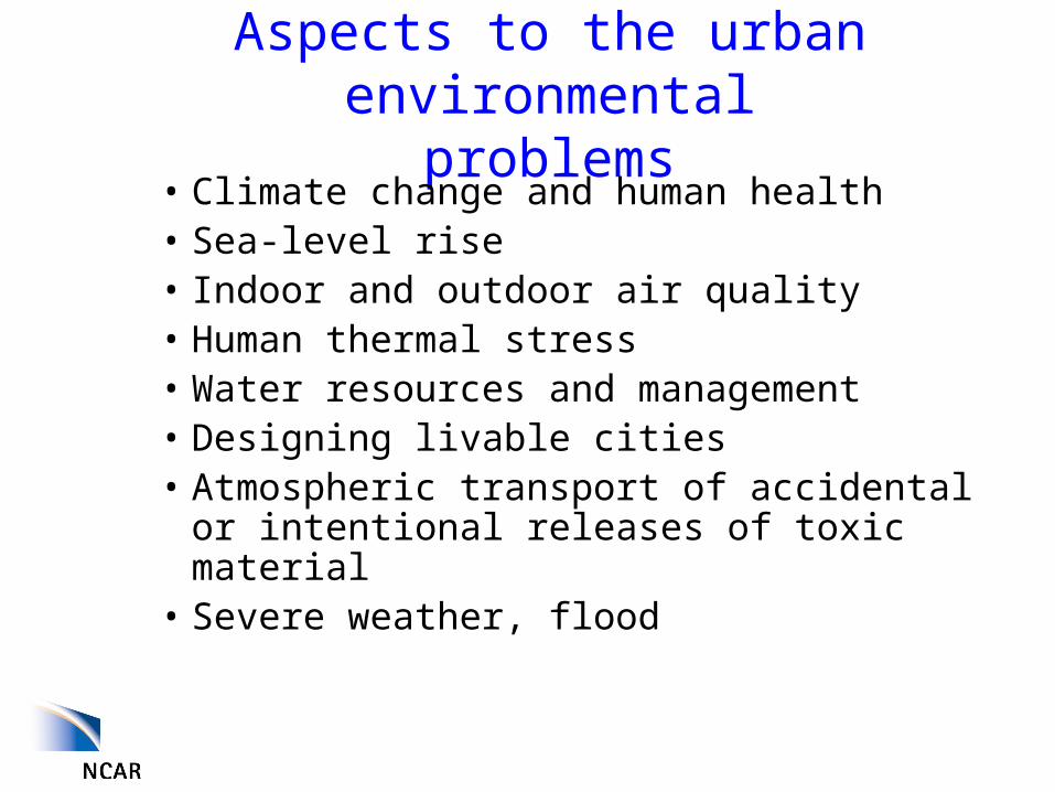
Aspects to the urban environmental problems
• Climate change and human health• Sea-level rise• Indoor and outdoor air quality• Human thermal stress• Water resources and management• Designing livable cities• Atmospheric transport of accidental or
intentional releases of toxic material• Severe weather, flood

The factors that influence urban
environmental risk
Population Increase/
City Growth
Regional and Global Climate Change
and
Extreme Weather

Population Change
City Growth
Urban Physical Effects
on Local Climate and Weather
Regional and Global Climate Change
and Extreme Weather
The factors that influence urban environmental risk

The physical modeling system – A spectrum of coupled scales
Global ScalesGlobal Scales
Continental ScalesContinental Scales
Regional ScalesRegional Scales
Local ScalesLocal Scales
Long Island
Urban ScalesUrban Scales
Current technology for operational weather and climate prediction

Urban Modeling for Weather Research and Forecast (WRF) Model
• WRF is widely used in both operational and research community.
• We can now bridge the gap between traditional mesoscale (~ 10 km) and fine-scale urban transport and dispersion modeling (~ 10 m)
– WRF, new generation NWP model, running with 1-4 km grid spacing
– Availability of new data at urban scales, urban canopy models
– Land data assimilation techniques – Techniques to couple mesoscale and CFD (LES) models.
• Hence, the WRF model is able to deal with regional climate, fine-scale weather forecast, and urban scales air quality and transport and diffusion (T&D).
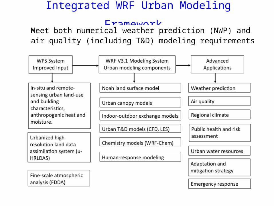
Integrated WRF Urban Modeling Framework Meet both numerical weather prediction (NWP) and air quality (including T&D) modeling requirements

The Noah Land Model• Noah LSM primarily for NWP, air
pollution, and regional hydrology applications.
• Noah has been implemented in NCEP, AFWA, and oversea-agency operational models.
• Two urban canopy models (UCM)– Single layer urban-canopy
model (SLUCM, based on Kusaka 2001). Released in WRF V2.2 (Dec. 2006).
– Multi-layer UCM (Building Effect Parameterization, BEP) by Martilli et al. (2002). Released in WRF V3.1 (April 2009).
Natural surface
Urban canopy models: Man-made surface Coupled through ‘urban fraction’
Chen et al., 2009, Intl. J. Climatology

IU+1
IU
IU-1
Vertical levels in the UCP BEM
The Building Energy Model (BEM) is inlcued in the Multi-layer BEP
For each floor, BEM solves prognostic equations for indoor air temperature and air moisture by considering:
• generation of heat due to the occupants and equipments.• radiation entering from the windows• interchange of heat and moisture with the exterior through ventilation• heat diffusion through the walls.
!! We do not attempt to simulate a specific building, rather an average behaviour over the grid cell!! Salamanca and Martilli (2009, Theoreti. Appli. Climatol.)
Indoor-outdoor exchange model

Requires detailed mappings of buildingsNational Urban Database and Access Portal Tool
(NUDAPT), led by Jason Ching (USEPA)
Ching et al., 2009, Bull. American Meteorol. Soc.
Example of NUDAPT gridded urban canon parameters for Houston, Texas. Plan area density (PAD), frontal area density of the buildings (FAD).

Applications of Coupled WRF-Urban Models
Houston: Diurnal cycle of wind profile (TexAQS-2000)
Hong Kong: 10-day surface wind
Beijing, Taipei, and Tokyo: surface weather, precipitation
Salt Lake City: Diurnal wind direction (URBAN-2000)
Liu, Chen, Warner, and Basara: 2006, J Appli. Meteorol.Lo, Lau, Chen, and Fung, 2007: J. Appli. Meteorol.Lo, Lau, Fung, and Chen, 2007: J Geophys. Res.Miao and Chen, 2008: Atm. Res. Lin et al., 2008: Atm. Environ.Jiang et al. 2008: J Geophys. Res.Miao et al., 2009: J. Appli. Meteorol. Climatol.Zhang et al., 2009: J Geophys. Res.Tewari et al., 2009: Atm. Res..
Oklahoma City: 2-m temperature (JU-2003)

WRF/urban 4-km regional climate simulation are able to capture urban heat islandsMonthly mean surface air temperatureat 2 m in the Tokyo area at 0500 JST in August averaged for 2004-2007
Observations WRF-Slab land model WRF-Noah-SLUCM
Kusaka et al., 2009, ICUC-7

Rapid Urban Growth in China
YRD: Yangtze River Delta region PRD: Pearl River Delta region

Such urban growth resulted in ozone increaseWRF 12-km monthly (March 2001) averaged difference (urban - preurban)
of the surface ozone (in ppbv) and relative 10-m wind vectors
Daytime Nighttime
Wang et al., 2009, Adv. Atmosp. Physics

2000
2030
industrial or commercialhigh intensity residential low intensity residential
How does future climate change and urban growth modify air pollution in Houston?
Urban expansion Impacts• meteorology:
Temperature Boundary layer depth
•Emissions Biogenic emissions Anthropogenic emissions
Houston in 2000
Projected Houston growth in 2030

2.6
3.5
6.2
4.9
4.2
9.1
0
1
2
3
4
5
6
7
8
9
10
Climate effect Land-use effect Combined effect
Ozo
ne I
ncre
ase
(ppb
)
Zone A Zone B
Results:Results: Land-use change (urbanization) has similar effect on future 8-hour Ozone concentrations to climate change, based on 4-km WRF-Chem simulations.
Jiang et al., 2008, JGR.
Increase of surface ozone by climate change along Increase of surface
ozone by urban growth
Increase of surface ozone by urban growth and climate change

WRF downscale and upscale coupling strategies
Mesoscale modeling system:WRF-Noah/UCM forecast model
Urban T&D modeling system:EULAG LES/CFD model
WRF provides initial and lateral boundary conditions for EULAG in two modes • Isolated sounding data mode – short term, quasi steady conditions, small scale urban domain• Unsteady (temporal-based coupling) mode – linear interpolation of the WRF data in time and space→ Building geometry flow features resolved explicitly with immersed boundary (IB) approach
Coupler:
MCEL Library
Turbulence and wind fields explicitly resolved by EULAG are feedback to WRF-urban• EULAG fields are volumetrically averaged to (coarser) WRF mesh• WRF urban framework introduce source terms in the momentum and turbulence equations→ The coupling impact urban and downstream weather forecast
Upscale data transfer:
Downscale data transfer

Coupled WRF/urban-LES/CFD model results
Dispersion footprint for IOP6 0900 CDT release for Oklahoma City downtown area, Oklahoma) calculated with WRF/EULAG.
Density of SF6 tracer gas (in parts per thousand) 60 minutes after the third release, CFD-urban simulations are contoured. The dots represent the observed density at sites throughout the downtown area of Salt Lake City, Utah. Tewari et al. (2009).
CFD-urban use single sounding
CFD-urban use WRF 12-hforecast

Summary• An international, collaborative effort has developed an
integrated, cross-scale WRF/urban modeling capability, and evaluated it against surface and PBL observations obtained from major cities.
• WRF/urban (WRF-Chem/uban) is a useful tool for addressing various indoor and outdoor air quality problems in cities.
• Muck work remains to be done: identify model and parameter uncertainties, to incorporate urban canopy parameters (detailed building data, remote-sensing, and extrapolation approach.
• The AMS 9th Symposium on the Urban Environment will be held in August 2010, Co-chaired by Fei Chen and Julie Lundquist.