2009 cap category 2 synopsis: behind the gos portal doug nebert fgdc may 11, 2010
TRANSCRIPT

2009 CAP Category 2 Synopsis:Behind the GOS Portal
Doug NebertFGDC
May 11, 2010
Four Projects
• NASA WorldWind Java integration with GOS catalog for Search and Rescue clients
• CarbonTools desktop widget and gadget for GOS feeds and data services
• GMU/ESIP Geoscience portal access to the geodata.gov catalog
• GeoFinder for the Environment

Leveraging GOS Map and Data Services for Search and Rescue Operations using NASA WorldWind Open Source
3D Visualization Platform • Objective
– Enhancing the NASA Goddard Search and Rescue (SAR) Mission Office’s Decision Support Tools with access to data from GOS using NASA WorldWind-based application
• Technical Approach– Discover SAR relevant data via the GOS portal catalog– Access, exploit and visualize discovered data in WorldWind’s 3D
environment– Inform the SAR user of relevant resource updates from GOS
• Project duration– July 25 2009 – July 23 2010
• Team– Nadine Alameh, Project Manager– David Collins, WorldWind Software Engineer
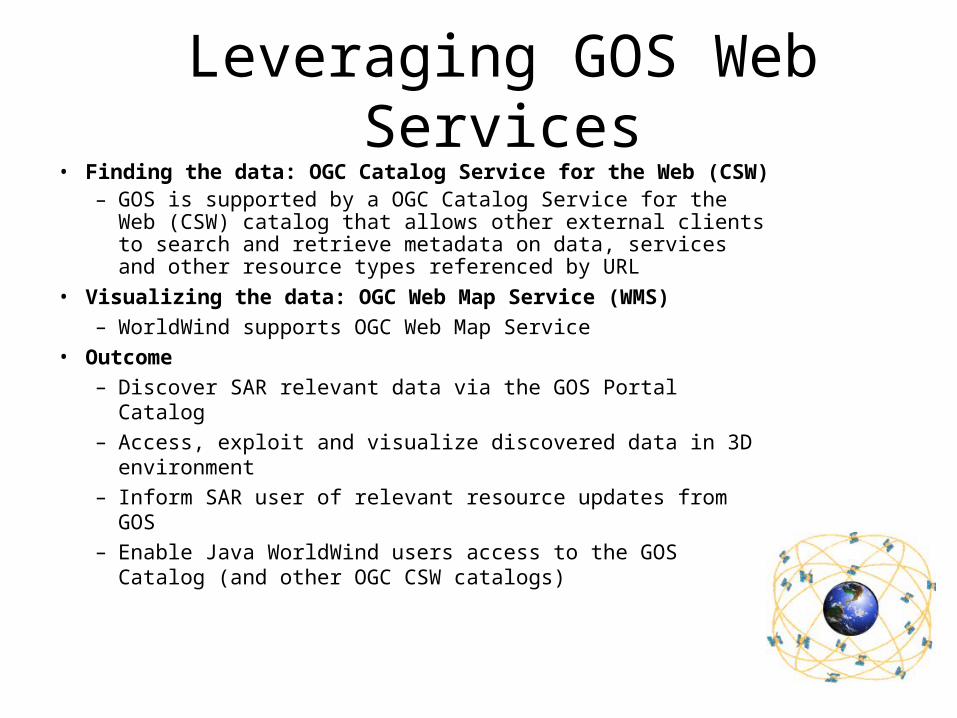
Leveraging GOS Web Services• Finding the data: OGC Catalog Service for the Web (CSW)
– GOS is supported by a OGC Catalog Service for the Web (CSW) catalog that allows other external clients to search and retrieve metadata on data, services and other resource types referenced by URL
• Visualizing the data: OGC Web Map Service (WMS)– WorldWind supports OGC Web Map Service
• Outcome– Discover SAR relevant data via the GOS Portal Catalog– Access, exploit and visualize discovered data in 3D
environment– Inform SAR user of relevant resource updates from GOS– Enable Java WorldWind users access to the GOS Catalog
(and other OGC CSW catalogs)
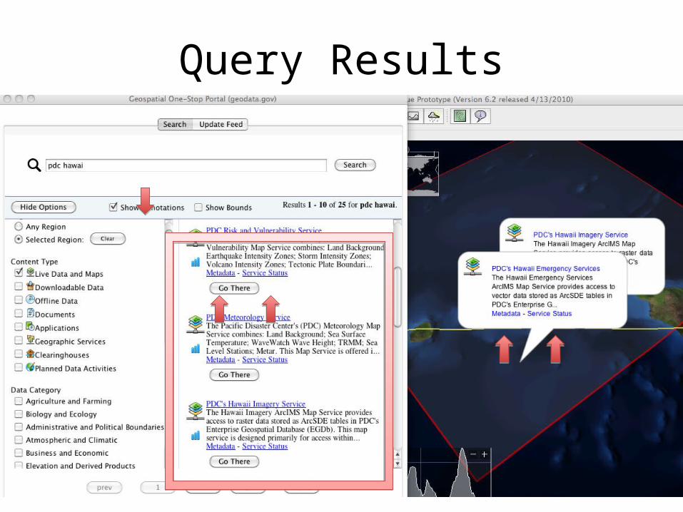
Query Results

Visualization of Data via WMS
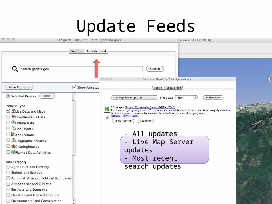
Update Feeds
- All updates- Live Map Server updates- Most recent search updates
- All updates- Live Map Server updates- Most recent search updates

Benefits to SAR• Enhanced discovery, integration and visualization of data
– Tapping rich data services of the NSDI including data that SAR personnel may not have otherwise been able to locate or use in time
– Combine data (recent and historical) on-demand at various levels– Get latest data directly from its custodians hence alleviating the data
assembly overhead in SAR situations
Power of Web Services and Standards• Access to NSDI = access to needed data!
– Access to official sources of information – Quality information through FGDC Status Checker– Ease of integration into new markets and domains
• Catalog + 3D visualization + Open Source Java SDK = Powerful combination– Open source solution based on standards and web services = sustainability,
more users, easier integration within applications, wider reuse, etc. – Updated by community as GOS evolves and standards mature/change– Inherits all the advances made by WorldWind community (e.g. support for KML)
• Catalog CSW = opening new doors for discovery and connections– Little effort to connect to other catalogs (such as GEOSS, ESA FedEO, etc)– Staying up-to-date with recent updates feature
Expanding Universe of Opportunities
Contact Information
– Nadine Alameh [email protected]
– David Collins [email protected]
GOS SAR code and application
– Code: worldwind.arc.nasa.gov/java
– App: http://worldwind.arc.nasa.gov/java/apps/SARApp/SARAppGOS.jnlp
– Forums: forum.worldwindcentral.com/forumdisplay.php?f=37
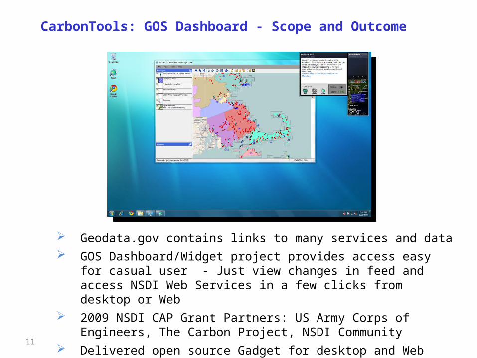
CarbonTools: GOS Dashboard - Scope and Outcome
11
Geodata.gov contains links to many services and data GOS Dashboard/Widget project provides access easy for casual user - Just
view changes in feed and access NSDI Web Services in a few clicks from desktop or Web
2009 NSDI CAP Grant Partners: US Army Corps of Engineers, The Carbon Project, NSDI Community
Delivered open source Gadget for desktop and Web Widget
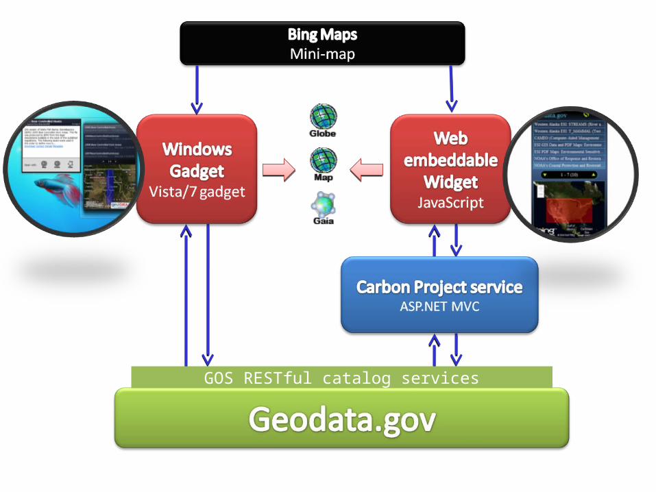
GOS RESTful catalog services
13
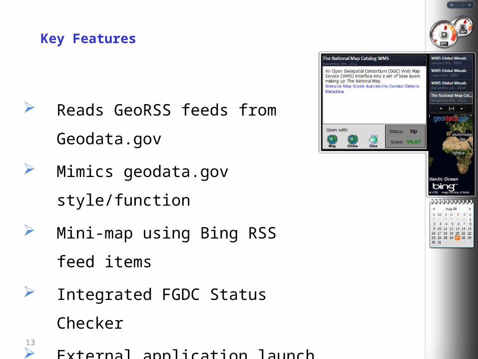
Key Features
Reads GeoRSS feeds from Geodata.gov
Mimics geodata.gov style/function
Mini-map using Bing RSS feed items
Integrated FGDC Status Checker
External application launch (ex. Gaia)
Works in Windows desktop and Web
Open Source!
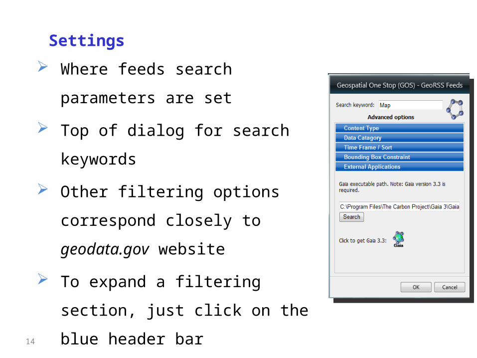
Where feeds search parameters are set
Top of dialog for search keywords
Other filtering options correspond
closely to geodata.gov website
To expand a filtering section, just click
on the blue header bar
Settings
14
15
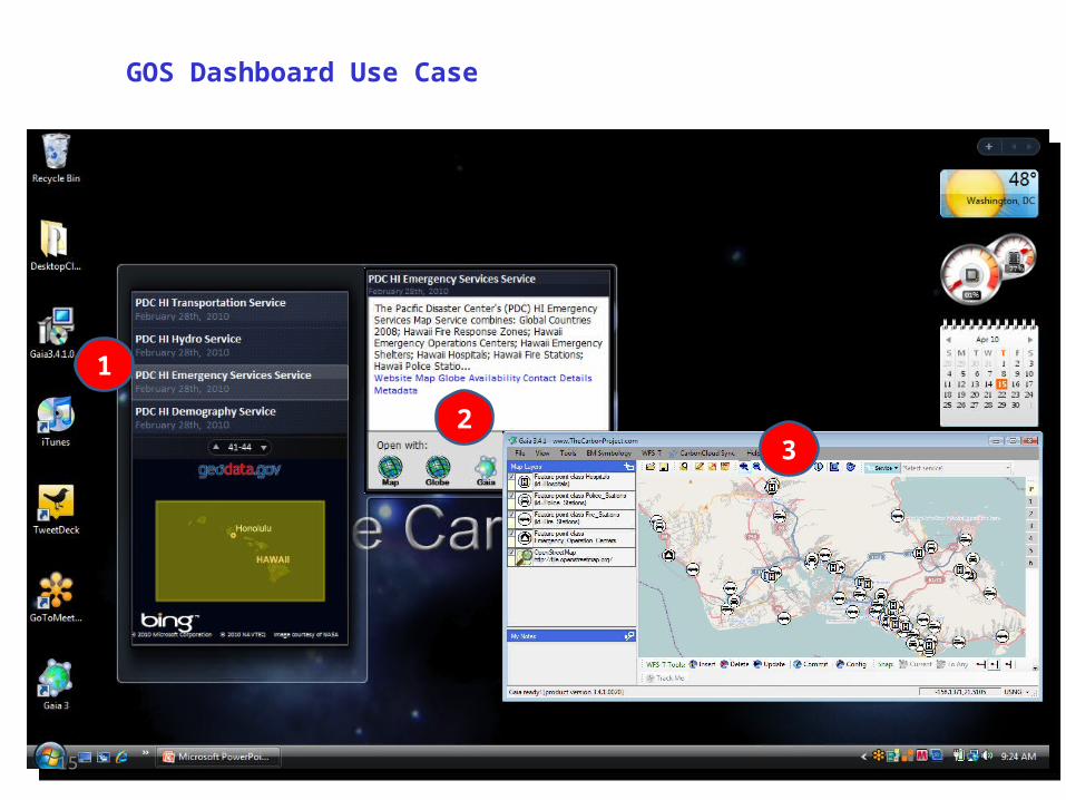
GOS Dashboard Use Case
1
23

16
GOS Widget Use Case
Copyright © 2010 Carbon Project Inc.
Utilizing GOS Map and Data Services for Cross-agency Earth Science and Geospatial Cyberinfrastructure Communities (GCI) - GMU
Scope The project is to develop open-source web portal to utilize the
GOS maps and data services to support Earth and geography science communities through the partnership of George Mason University’s Joint Center for Intelligent Spatial Computing (CISC), the Federation of Earth Science Information Partnership (ESIP), and the Cyberinfrastructure Specialty Group (CISG) within the American Association of Geographers (AAG).
Outcomes– An open source Spatial Web Portal connecting to GOS development
document and user manual– A category of over 20,000 WMS layers from GOS and other
communities.– Serve ESIP, AAG CISG, and NASA Earth Science Communities
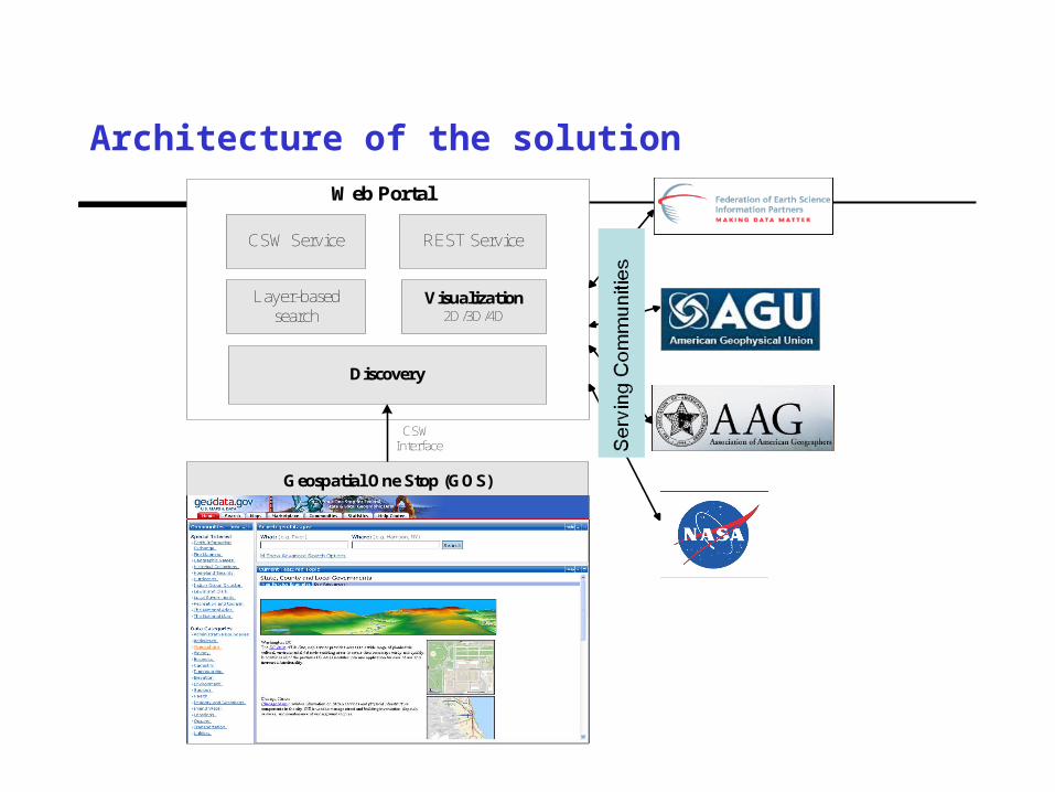
Architecture of the solution
Discovery
CSW Interface
Layer-based search
Visualization2D/3D/4D
REST Service
Geospatial One Stop (GOS)
CSW Service
Web Portal

Solution in action
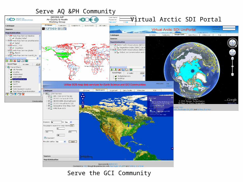
Serve AQ &PH CommunityVirtual Arctic SDI Portal
Serve the GCI Community

Project Background and Scope Core Partners:
Innovate!, Inc. Environmental Protection Agency (EPA) Coeur D’Alene Tribe (CDA) North Carolina Department of Environment and Natural
Resources (NCDENR) Created software that extends GOS services to include
new partners and features Called GeoFinder for the Environment (GFE) Extends GOS Capabilities through web-based API that
connects numerous distributed catalogs Provides numerous output formats and input parameters Core partners implemented the API for use in their
organizations Integration within EPA Earth (KML Output) Integration within CDA Tribe GIS Home Page (DHTML
Output) Provided free training to interested parties
45 participants: States, Federal Agencies, Tribes, Others
GeoFinder for the Environment

Key Software Features
Metadata search and discovery tool Federated search model Supports many catalog implementations Easy to plug into new partner catalogs
Basic Components Web based front end Simple, URL-based API (more detail in upcoming slides) Easy to use outputs and parameters
Extends GOS Extends the basic capabilities of GOS Targeted catalog search (GOS, States, etc.) Additional capabilities to customize output
GFE Capabilities
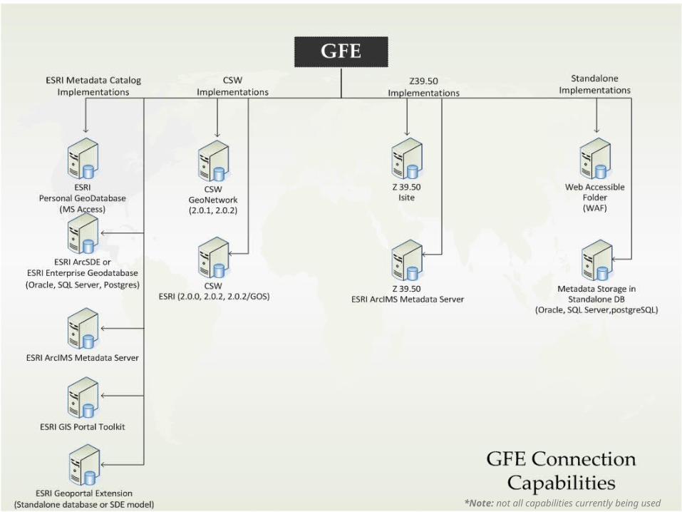
GFE Capabilities
*Note: not all capabilities currently being used

Accessing the GFE: Web Interface: http://dev.innovateteam.com/GFE/
Can be used as a basic search and discovery interface Can also be used as a test environment for constructing API URLs
API Base URL: http://dev.innovateteam.com/GFE/search/get? API Parameters:
SearchServices (target specific catalog provider) Michigan GIS = MI_GIS MN Land Management = MN_LMIC MN Dept of Natural Resources = MN_DNR MN Metro GIS MN_MGIS Geospatial One Stop = GOS2 GEOSS = GEOSS GMU One Geology = GMUOneGeology
Keywords (specify the keywords you’re looking for) f (output format: kml, georss, html, html_static)
http://dev.innovateteam.com/GFE/search/get?SearchServices=GOS2&Keywords=water&f=html
GFE Capabilities
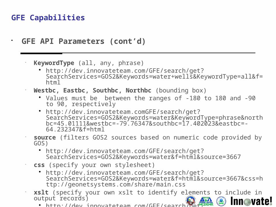
GFE API Parameters (cont’d)
KeywordType (all, any, phrase) http://dev.innovateteam.com/GFE/search/get?
SearchServices=GOS2&Keywords=water+wells&KeywordType=all&f=html
Westbc, Eastbc, Southbc, Northbc (bounding box) Values must be between the ranges of -180 to 180 and -90 to 90,
respectively http://dev.innovateteam.comGFE/search/get?
SearchServices=GOS2&Keywords=water&KeywordType=phrase&northbc=45.01111&westbc=-79.76347&southbc=17.402023&eastbc=-64.232347&f=html
source (filters GOS2 sources based on numeric code provided by GOS) http://dev.innovateteam.com/GFE/search/get?
SearchServices=GOS2&Keywords=water&f=html&source=3667 css (specify your own stylesheet)
http://dev.innovateteam.com/GFE/search/get?SearchServices=GOS2&Keywords=water&f=html&source=3667&css=http://geonetsystems.com/share/main.css
xslt (specify your own xslt to identify elements to include in output records)
http://dev.innovateteam.com/GFE/search/get?SearchServices=GOS2&Keywords=superfund&KeywordType=all&f=html&source=10787&xsl=http://geonetsystems.com/share/htmlJZ.xsl
GFE Capabilities
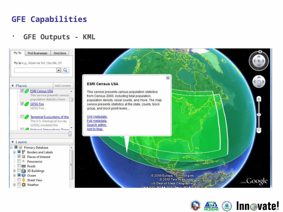
GFE Outputs - KML
GFE Capabilities
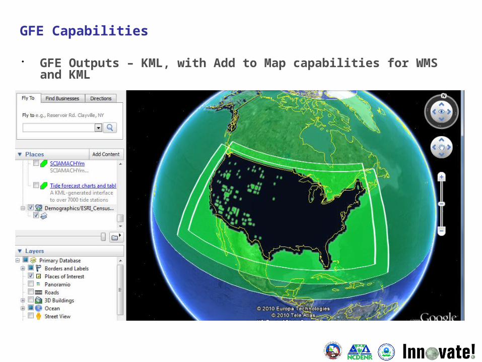
GFE Outputs – KML, with Add to Map capabilities for WMS and KML
GFE Capabilities

GFE Outputs GeoRSS output displayed in Google Maps:
GFE Capabilities

GFE Outputs WMS shown on web-based map viewer
GFE Capabilities
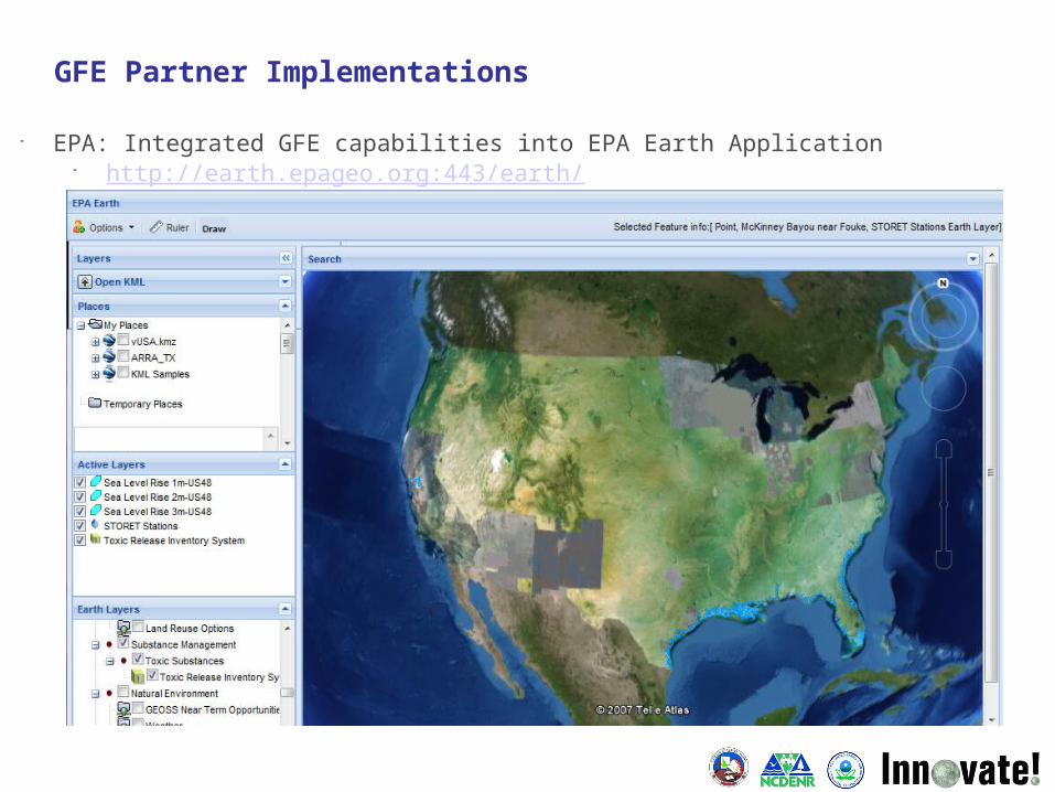
GFE Partner Implementations
EPA: Integrated GFE capabilities into EPA Earth Application http://earth.epageo.org:443/earth/

GFE Partner Implementations
CDA: Integrated GFE capabilities directly into their main GIS Data Home Page http://gis.cdatribe-nsn.gov/SearchGISData.aspx
• GFE API developed as a flexible, web-based service that can interface with numerous catalog types and provide many outputs
Software is available for any user to access at http://dev.innovateteam.com/GFE/
Core Partners have implemented and extended* the GFE for their own use
Implementations are currently functional and in production Partners were able to retire older software and make use of
existing resources through this effort
*Some partners are discussing ways for taking this software even further as a next step
Training provided on the use of GFE and GOS services
45 attendees from numerous different agencies Feedback on training was very positive
Project Outcomes
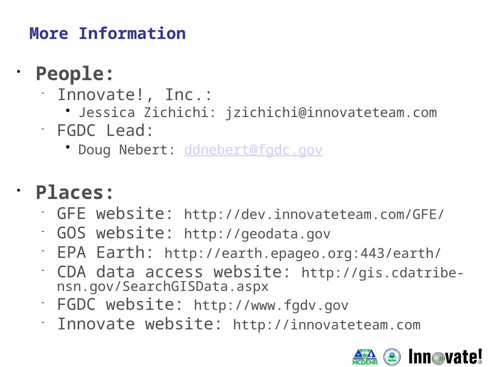
People: Innovate!, Inc.:
Jessica Zichichi: [email protected] FGDC Lead:
Doug Nebert: [email protected]
Places: GFE website: http://dev.innovateteam.com/GFE/ GOS website: http://geodata.gov EPA Earth: http://earth.epageo.org:443/earth/ CDA data access website:
http://gis.cdatribe-nsn.gov/SearchGISData.aspx FGDC website: http://www.fgdv.gov Innovate website: http://innovateteam.com
More Information