150°w 80°n place-based summary - audubon...
TRANSCRIPT

100°W110°W160°E150°E 170°E 120°W180° 130°W
170°W
170°W
140°W
140°W
160°W
160°W
150°W
150°W
80°N
80°N
75°N75°N
70°N70°N
65°N65°N
September 2011
Place-based Summary
Arctic Marine SynthesisAtlas of the Chukchi and Beaufort Seas
Text
of the

Place-based Summar y
of the
Arctic Marine Synthesis
Melanie A. Smith
Contributors
Henry HuntingtonRaychelle Daniel
Beth PelusoPamela A. Miller
Audubon Alaska
441 West Fifth AvenueSuite 300
Anchorage, AK 99501
September 2011
Author

Place-based Summary of the Arctic Marine Synthesis
Audubon Alaska 1 September 2011
INTRODUCTION
In early 2010, Audubon Alaska, in cooperation with Oceana, completed the Arctic Marine
Synthesis: Atlas of the Chukchi and Beaufort Seas. The project area included the southern
Beaufort, southern Chukchi, and northern Bering seas. The atlas provided a holistic look at
the dynamic Arctic Ocean ecosystem through 44 maps describing the region’s physical
oceanography, water column and benthic life, fish, birds, mammals, and human influences.
The Arctic Marine Synthesis has become a valuable tool for scientists and policymakers
seeking to better understand the region’s physical attributes, ecological interactions, and the
distribution and concentration of marine wildlife. Other organizations have also found this
useful for setting conservation priorities and providing information for designing balanced
management plans in the Arctic region. The US Geological Survey also featured information
from the Synthesis in a recent report on scientific research needed to inform decisions about
leasing the Outer Continental Shelf (OCS).
This document builds upon the original synthesis, which was organized by topics, each
presented on a map covering the whole project area. In the Place-based Summary of the
Arctic Marine Synthesis, the information has been reorganized into “factsheets” that tell how
the ecological layers fit together for each area described. Current uses, conservation status,
and threats are all discussed. Each factsheet summarizes the important physical and
biological attributes in the area, forming a base for more in-depth research. This new
document was developed to highlight important information and to make that information
even more user-friendly.
Through the process of collecting and mapping data for the original Arctic Marine Synthesis,
certain patterns and places became evident as important to the marine ecosystem. With the
available information we attempted to identify and draw boundaries around those places,
then summarize the physical and biological setting within those boundaries. Not every place
mapped is of equal ecological significance. Likewise, places not mapped are not intended to
be construed as unimportant. Some places were not included where there are major data
deficiencies and the true importance of the area is not yet known (for example, the Chukchi
Sea OCS Program Area between Hanna and Herald Shoals, and the Canada Basin). Drawing
boundaries for each place was done using professional judgment informed by the
approximately 125 spatial data layers and 400 articles and reports collected for the Arctic
Marine Synthesis. Boundaries reflect a blending of various attributes: bathymetry, location of
the ice edge throughout the year, ocean currents, pelagic and benthic productivity hotspots,
migration corridors, haulout areas, nesting colonies, and foraging areas.
While there are significant limitations on the quality and quantity of data available to describe
the Arctic marine ecosystem, this document summarizes what is known and provides the
type of information that can be useful when identifying important places of conservation
concern. Several such projects are currently underway. The International Union for the
Conservation of Nature (IUCN) and the Natural Resources Defense Council (NRDC)
recently released their report on Ecologically and Biologically Significant Areas (EBSAs) in
the Arctic Ocean. Audubon participated in that effort, and this Place-based Summary of the
Arctic Marine Synthesis provides finer-scale boundaries and a deeper level of ecological

Place-based Summary of the Arctic Marine Synthesis
Audubon Alaska 2 September 2011
information for EBSAs identified in the Chukchi, Beaufort, and northern Bering seas.
Audubon Alaska, Audubon California, BirdLife International, and Bird Studies Canada are
using the latest pelagic survey and seabird colony data for the North Pacific to identify
marine Important Bird Areas from Alaska’s Beaufort Sea to Baja California in Mexico.
Oceana continues to work with Native communities to map local and traditional knowledge
and subsistence areas, and to use Marxan modeling to identify Important Ecological Areas.
We encourage others to use these place-based summaries for planning and education, and to
help guide additional scientific data collection and analysis for the extraordinary resources in
this region. From shipping, to energy development, to fisheries management, to climate
change, exceptional pressures are anticipated in the Arctic marine environment. We created
the original Arctic Marine Synthesis and this Place-based Summary to provide scientists,
educators, policymakers, and land managers with information they need to make sound,
science-based decisions for management and conservation of the Arctic Ocean.
Table 1 Places Described
Place Name Location Ownership
St. Lawrence Island Bering Sea US, Russia
Chirikov Basin Bering Sea US, Russia
Norton Sound Bering Sea US
Southeastern Chukotka Peninsula1 Bering Sea Russia
Bering Strait Bering Sea, Chukchi Sea US, Russia
Diomede Islands Bering Sea, Chukchi Sea US, Russia
Seward Peninsula Bering Sea, Chukchi Sea US
Kotzebue Sound Chukchi Sea US
Hope Basin Chukchi Sea US, Russia
Northern Chukotka Peninsula1 Chukchi Sea Russia
Wrangel & Herald Islands1 Chukchi Sea Russia
Herald Shoal1 Chukchi Sea Russia, US
Cape Thompson & Cape Lisburne Chukchi Sea US
Ledyard Bay Chukchi Sea US
Kasegaluk Lagoon Chukchi Sea US
Chukchi Lead System Chukchi Sea US
Hanna Shoal Chukchi Sea US
Peard Bay Chukchi Sea US
Barrow Canyon Beaufort Sea, Chukchi Sea US
Dease Inlet & Elson Lagoon Beaufort Sea US
Smith & Harrison Bays Beaufort Sea US
Western Beaufort Shelf & Lead System Beaufort Sea US
Beaufort Lagoons & Barrier Islands Beaufort Sea US, Canada
Eastern Beaufort Shelf & Lead System1 Beaufort Sea Canada
MacKenzie River Delta1 Beaufort Sea Canada
1Factsheets describing areas in non-US waters have not yet been completed.

Place-based Summary of the Arctic Marine Synthesis
Audubon Alaska 3 September 2011
ARCTIC MARINE SYNTHESIS:
ATLAS OF THE CHUKCHI AND BEAUFORT SEAS
(Click on text below to hyperlink to report chapters and maps)
Cover, Title Page
INTRODUCTION
PHYSICAL OCEANOGRAPHY
1. Project Area
2. Bathymetry
3. Ecoregions
4. Ocean Circulation
5. Sea Ice Dynamics
6. Sea Floor Substrate
7. Sea Surface Temperature
8. Observed Climate Change
WATER COLUMN AND BENTHIC LIFE
9. Chlorophyll-a
10. Net Primary Productivity
11. Zooplankton
12. Benthic Biomass
13. Opilio Crab
FISH
Oceanodromous
14. Capelin
15. Pacific Herring
16. Saffron Cod
Anadromous
17. Pink Salmon
18. Chum Salmon
BIRDS
Audubon Alaska WatchList
19. Yellow-billed Loon
20. Red-throated Loon
21. Spectacled Eider
22. Steller’s Eider
23. King Eider
24. Common Eider
25. Long-tailed Duck
26. Ivory Gull
27. Kittlitz’s Murrelet
Other Species
28. Northern Fulmar
29. Short-tailed Shearwater
Concentration Areas
30. Seabird Colonies
31. Important Bird Areas
MAMMALS
Terrestrial/Marine
32. Polar Bear
33. Arctic Fox
Pinnepeds
34. Pacific Walrus
35. Ribbon Seal
36. Spotted Seal
37. Ringed Seal
38. Bearded Seal
Cetaceans
39. Bowhead Whale
40. Beluga Whale
41. Gray Whale
PEOPLE
42. Energy Development and Protected
Areas
43. Human Impact
44. Predicted Climate Change
REFERENCES

A R C T I C O C E A N
Teshekpuk L.
CA
NA
DA
UN
ITE
D S
TA
TE
S
Colville R, Mackenz ie R.
Noatak R.
Koyukuk R.
Yukon R.
B e r i n g S e a
B e a u f o r tS e a
C h u k c h iS e a
CamdenBay
KolyuchinBay
MackenzieBay
KugmallitBay
LiverpoolBay
S T A T E O F
A L A S K AC H U K O T S K I Y
A U T O N O M O U SO K R U G
Y U K O N
T E R R I TO R Y
UN
ITED
STA
TES
(M
arin
e B
ou
nd
ary
Cl a
ime
d b
y U
.S.)
Old Crow
(In
tern
ati
on
a l D
ate
Lin
e)
RU
SSIA
Inch oun R.
Mechig-menskBay
Am gue ma R.
DemarcationBay
StefanssonSound
N O R T H W E S T
T E R R I TO R I E S
ARCTIC CIRCLE
ARCTIC CIRCLE
ARCTIC CIRCLE
Cann in g R.
Kobuk R.
Tanana R.
Yukon
R.
Yukon R.
C a n a d aB a s i n
Long Strait
Western Beaufort Shelf & Lead System
Beaufort Lagoons & Barrier Islands
Smith & Harrison Bays
BarrowCanyon
HannaShoal
ChukchiLeadSystem
KasegalukLagoon
LedyardBay
Cape Thompson &Cape Lisburne
HopeBasin
KotzebueSound
Seward Peninsula
DiomedeIslands
Bering Strait
ChirikovBasin
NortonSound
St. LawrenceIsland
PeardBay Dease Inlet
& Elson Lagoon
HeraldShoal
Wrangel &Herald Islands
NorthernChukotkaPeninsula
SoutheasternChukotkaPeninsula
Eastern Beaufort Shelf & Lead System
MacKenzieRiver Delta
Nome
Barrow
Kotzebue
Fairbanks
Tok
Savoonga
Kivalina
Diomede
Unalakleet
Emmonak
Gambell
BrevigMission
Koyuk
Arctic
Village
Kaktovik
Nuiqsut
Atqasuk
PointHope
PointLay
Wainwright
Shishmaref
Noatak
Noorvik
AnaktuvukPass
PrudhoeBay
Provideniya
Inuvik
Enmelen
Enurmino
Inchoun
UelenMechigmen
Chaplino
Ryrkaypiy
Vankarem
Tuktoyaktuk
128°0'0"W132°0'0"W136°0'0"W140°0'0"W144°0'0"W148°0'0"W152°0'0"W156°0'0"W160°0'0"W164°0'0"W168°0'0"W172°0'0"W176°0'0"W180°0'0"176°0'0"E
72°0'0"N
70°0'0"N
68°0'0"N
66°0'0"N
64°0'0"N
62°0'0"N
Arctic Marine Synthesis:Atlas of the Chukchi and Beaufort Seas
150 0 150 30075Miles
Place-based Summary ofthe Arctic Marine Synthesis
Features
Sources: (1) Audubon Alaska. 2011. Area boundaries based on data in the Arctic Marine Synthesis. GISfeature class; (2) Alaska State Geospatial Data Clearinghouse. 2008. B ase data. GIS shapefiles.<http://www. asgdc.state.ak.us/>. Accessed June 2008; (3) G.W. Johnson, A.G. Gaylord, J.J. B rady, M.
Dover, D. Garcia-Lavigne, W.F. Manley, R. Score, and C.E. Tweedie. 2009. Arctic Research MappingApplication (ARMAP). CH2M HILL Polar Services, Englewood, Colorado. <http://www.armap.org>.Accessed January 2010. (4) AOOS. 2009. 1 km topographic/bathymetric map of Alaska. Raster dataset.<http://ak.aoos.org/aoos/tools.html>. Accessed February 2009; (5) Audubon Alaska. 2009.
Bathymetric contour lines. GIS feature class (based on AOOS 2009).
September 2011
Area Boundary1
Populated Area2 3
Exclusive Economic Zone Boundary2
This map is based on the best available data, which varies in quality across the project area. Areas not included generallyhave le ss available information. For more information on data quality and knowledge gaps, see the Arctic M arine Synthesisand the factsheets associated with this map.
A descriptio n of biologic al values
wit hin sele cted are as of th eCh ukc hi, Beau fort, and nor thern Berin g seas
Bathymetric Contour Line4 5
Place-based Summary of the Arctic Marine Synthesis
Audubon Alaska 1 September 2011
ST. LAWRENCE ISLAND
MARINE
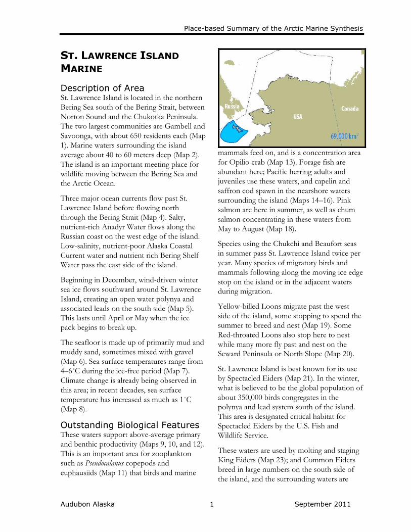
Description of Area St. Lawrence Island is located in the northern
Bering Sea south of the Bering Strait, between
Norton Sound and the Chukotka Peninsula.
The two largest communities are Gambell and
Savoonga, with about 650 residents each (Map
1). Marine waters surrounding the island
average about 40 to 60 meters deep (Map 2).
The island is an important meeting place for
wildlife moving between the Bering Sea and
the Arctic Ocean.
Three major ocean currents flow past St.
Lawrence Island before flowing north
through the Bering Strait (Map 4). Salty,
nutrient-rich Anadyr Water flows along the
Russian coast on the west edge of the island.
Low-salinity, nutrient-poor Alaska Coastal
Current water and nutrient rich Bering Shelf
Water pass the east side of the island.
Beginning in December, wind-driven winter
sea ice flows southward around St. Lawrence
Island, creating an open water polynya and
associated leads on the south side (Map 5).
This lasts until April or May when the ice
pack begins to break up.
The seafloor is made up of primarily mud and
muddy sand, sometimes mixed with gravel
(Map 6). Sea surface temperatures range from
4–6˚C during the ice-free period (Map 7).
Climate change is already being observed in
this area; in recent decades, sea surface
temperature has increased as much as 1˚C
(Map 8).
Outstanding Biological Features These waters support above-average primary
and benthic productivity (Maps 9, 10, and 12).
This is an important area for zooplankton
such as Pseudocalanus copepods and
euphausiids (Map 11) that birds and marine
mammals feed on, and is a concentration area
for Opilio crab (Map 13). Forage fish are
abundant here; Pacific herring adults and
juveniles use these waters, and capelin and
saffron cod spawn in the nearshore waters
surrounding the island (Maps 14–16). Pink
salmon are here in summer, as well as chum
salmon concentrating in these waters from
May to August (Map 18).
Species using the Chukchi and Beaufort seas
in summer pass St. Lawrence Island twice per
year. Many species of migratory birds and
mammals following along the moving ice edge
stop on the island or in the adjacent waters
during migration.
Yellow-billed Loons migrate past the west
side of the island, some stopping to spend the
summer to breed and nest (Map 19). Some
Red-throated Loons also stop here to nest
while many more fly past and nest on the
Seward Peninsula or North Slope (Map 20).
St. Lawrence Island is best known for its use
by Spectacled Eiders (Map 21). In the winter,
what is believed to be the global population of
about 350,000 birds congregates in the
polynya and lead system south of the island.
This area is designated critical habitat for
Spectacled Eiders by the U.S. Fish and
Wildlife Service.
These waters are used by molting and staging
King Eiders (Map 23); and Common Eiders
breed in large numbers on the south side of
the island, and the surrounding waters are

Place-based Summary of the Arctic Marine Synthesis
Audubon Alaska 2 September 2011
important year-round for foraging (Map 24).
The island is an important molting and staging
area for Long-tailed Ducks that breed in the
Yukon-Kuskokwim Delta in Western Alaska
(Map 25). This is one of the few places in the
study area where Ivory Gulls are known to
occur in abundance, often found on the
shores of the island near Gambell in late April
to early June (Map 26). Northern Fulmars that
breed on the southeastern coast of Chukotka
are abundant foragers in the waters around St.
Lawrence Island from April to December
(Map 28). Short-tailed Shearwaters are
likewise found foraging in very high numbers
here from June to September (Map 29). The
island is a major area for colonial nesting
seabirds (Map 30). There are 27 colonies of
substantial size, some with as many as 13
breeding species. Six colonies have over
100,000 birds, and the largest has about 1.2
million birds. Consequently, this area is home
to two globally significant Important Bird
Areas (Map 31).
St. Lawrence Island is regularly used by polar
bears for feeding and denning (Map 32). The
waters are designated critical feeding habitat
by the U.S. Fish and Wildlife Service, and
much of the island’s coastline is no
disturbance zone critical habitat. This is a
haulout for tens of thousands of Pacific
walrus, which concentrate at the east end of
the island and at Gambell (Map 34).
Surrounding waters are used year-round by
walrus that are feeding, courting, or migrating.
All four species of ice seals—ribbon, spotted,
ringed, and bearded—concentrate here.
Ribbon seals are present from January to
June, and in higher concentration from May
to June (Map 35). There are three known
spotted seal haulouts on the south end of the
island; these seals are found in surrounding
waters year-round, but in higher
concentration in May and June (Map 36).
Ringed and bearded seals are present
November to June; bearded seals are highly
concentrated in these waters in winter, from
October to April (Maps 37–38).
Bowhead whales (Map 39) occur in high
numbers near the island in winter (November
to April) and this is an Alaska Eskimo whaling
community sensitive bowhead whale quiet
area. Beluga whales concentrate in waters
along the west and south side of the island
from January to April (Map 40). This is the
heart of the feeding grounds of gray whales
that migrate more than 16,000 kilometers
from northern Mexico each year to feed in
these Arctic waters. They occur in high
concentrations here from May to November
(Map 41).
Current Resource Use Subsistence uses include hunting for bowhead
whales, walrus, seals, Steller sea lions, polar
bears, and seabirds. Fishing is also important,
including a small commercial halibut fishery
based on St. Lawrence Island. Hunting and
fishing occur all around St. Lawrence Island,
with boat journeys more than 80 kilometers
from shore.
Conservation Status Bowhead whale subsistence hunting
quiet area designated by Alaska’s
North Slope Borough (Map 39).
Designated critical habitat for
Spectacled Eiders by the U.S. Fish and
Wildlife Service (Map 21).
Saint Lawrence Island and Saint
Lawrence Island Marine are globally
significant Important Bird Areas
designated by the National Audubon
Society and BirdLife International
(Map 31).
Not currently open to oil and gas
leasing by the U.S. Bureau of Ocean
Energy Management or the State of
Alaska (Map 42).

Place-based Summary of the Arctic Marine Synthesis
Audubon Alaska 3 September 2011
The St. Lawrence Island Habitat
Conservation Area is indefinitely
closed to bottom trawling, and
adjacent waters surrounding the
Habitat Conservation Area are part of
the Northern Bering Sea Research
Area, which is currently closed to
bottom trawling by the U.S. North
Pacific Fishery Management Council.
Designated no disturbance zone
critical denning and feeding habitat for
polar bears by the U.S. Fish and
Wildlife Service (Map 32).
Current and Future Threats Possibility of flatfish fishery in the
Northern Bering Sea Research Area
(outside the Habitat Conservation
Area) following approval of modified
bottom trawling gear by the U.S.
North Pacific Fishery Management
Council.
Disturbance or pollution from
shipping traffic (Map 43).
Future increased vessel traffic due to
shipping, tourism, or fishing as the
ice-free season continues to lengthen.
High air temperature increases (up to
3.8˚ C) projected by the end of the
century (Map 44).
Expected, but not well understood,
changes in marine productivity due to
changes in timing and extent of sea
ice.

Place-based Summary of the Arctic Marine Synthesis
Audubon Alaska 4 September 2011
Place-based Summary of the Arctic Marine Synthesis
Audubon Alaska 1 September 2011
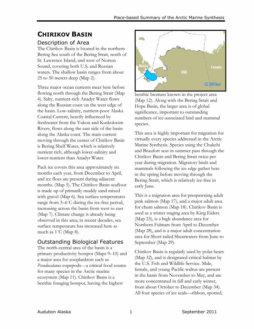
CHIRIKOV BASIN Description of Area The Chirikov Basin is located in the northern
Bering Sea south of the Bering Strait, north of
St. Lawrence Island, and west of Norton
Sound, covering both U.S. and Russian
waters. The shallow basin ranges from about
25 to 50 meters deep (Map 2).
Three major ocean currents meet here before
flowing north through the Bering Strait (Map
4). Salty, nutrient-rich Anadyr Water flows
along the Russian coast on the west edge of
the basin. Low-salinity, nutrient-poor Alaska
Coastal Current, heavily influenced by
freshwater from the Yukon and Kuskokwim
Rivers, flows along the east side of the basin
along the Alaska coast. The main current
moving through the center of Chirikov Basin
is Bering Shelf Water, which is relatively
nutrient rich, although lower-salinity and
lower-nutrient than Anadyr Water.
Pack ice covers this area approximately six
months each year, from December to April,
and ice floes are present during adjacent
months. (Map 5). The Chirikov Basin seafloor
is made up of primarily muddy sand mixed
with gravel (Map 6). Sea surface temperatures
range from 3–6˚C during the ice-free period,
increasing across the basin from west to east
(Map 7). Climate change is already being
observed in this area; in recent decades, sea
surface temperature has increased here as
much as 1˚C (Map 8).
Outstanding Biological Features The north-central area of the basin is a
primary productivity hotspot (Maps 9–10) and
a major area for zooplankton such as
Pseudocalanus copepods—a critical food source
for many species in the Arctic marine
ecosystem (Map 11). Chirikov Basin is a
benthic foraging hotspot, having the highest
benthic biomass known in the project area
(Map 12). Along with the Bering Strait and
Hope Basin, the larger area is of global
significance, important to outstanding
numbers of ice-associated bird and mammal
species.
This area is highly important for migration for
virtually every species addressed in the Arctic
Marine Synthesis. Species using the Chukchi
and Beaufort seas in summer pass through the
Chirikov Basin and Bering Strait twice per
year during migration. Migratory birds and
mammals following the ice edge gather here
in the spring before moving through the
Bering Strait, which is relatively ice-free in
early June.
This is a migration area for prespawning adult
pink salmon (Map 17), and a major adult area
for chum salmon (Map 18). Chirikov Basin is
used as a winter staging area by King Eiders
(Map 23), is a high abundance area for
Northern Fulmars from April to December
(Map 28), and is a major adult concentration
area for Short-tailed Shearwaters from June to
September (Map 29).
Chirikov Basin is regularly used by polar bears
(Map 32), and is designated critical habitat by
the U.S. Fish and Wildlife Service. Male,
female, and young Pacific walrus are present
in the basin from November to May, and are
more concentrated in fall and early winter,
from about October to December (Map 34).
All four species of ice seals—ribbon, spotted,

Place-based Summary of the Arctic Marine Synthesis
Audubon Alaska 2 September 2011
ringed, and bearded—concentrate in Chirikov
Basin in May and June before the ice recedes
into the Chukchi Sea (Maps 35–38). This is an
Alaska Eskimo whaling community sensitive
bowhead whale quiet area during spring and
fall migration. Beluga whales concentrate
along the west side of the basin in January to
April, and migrate south through the area in
September and October (Map 40). Chirikov
Basin is the heart of the feeding grounds of
gray whales that migrate more than 16,000
kilometers from northern Mexico each year to
feed in these Arctic waters. They occur in
high concentration here from May to
November (Map 41).
Current Resource Use Subsistence uses from St. Lawrence Island
include hunting for walrus, and for bowhead
whales in fall and winter. From mainland
Alaska, seal and walrus hunting also take place
in the Chirikov Basin area.
Conservation Status Bowhead whale subsistence hunting
quiet area designated by Alaska’s
North Slope Borough (Map 39).
Designated no disturbance zone
critical denning and feeding habitat for
polar bears by the U.S. Fish and
Wildlife Service (Map 32).
The St. Lawrence Island Habitat
Conservation Area is indefinitely
closed to bottom trawling, and
adjacent waters surrounding the
Habitat Conservation Area are part of
the Northern Bering Sea Research
Area, which is currently closed to
bottom trawling by the U.S. North
Pacific Fishery Management Council.
Not currently open to oil and gas
leasing by the U.S. Bureau of Ocean
Energy Management (Map 42).
Current and Future Threats Disturbance or pollution from
shipping traffic (Map 43).
Future increased vessel traffic due to
shipping, tourism, or fishing as the
ice-free season continues to lengthen.
High air temperature increases (up to
3.8˚ C) projected by the end of the
century (Map 44).
Expected, but not well understood,
changes in marine productivity due to
changes in timing and extent of sea
ice.
Possibility of flatfish fishery in the
Northern Bering Sea Research Area
following approval of modified
bottom trawling gear by the U.S.
North Pacific Fishery Management
Council.

Place-based Summary of the Arctic Marine Synthesis
Audubon Alaska 1 September 2011
NORTON SOUND Description of Area Norton Sound lies between Nome, on the
Seward Peninsula, and the village of
Emmonak, located in the Yukon River Delta.
Nome is the largest Bering Sea community
within the project area, and is home to
approximately 3500 residents. Emmonak is
home to about 800 residents. Many other
small Native communities dot the coast of
Norton Sound.
The water here is very shallow, ranging from
sea level to 25 meters deep, but averaging 15
meters deep (Map 2). The Alaska Coastal
Current passes through the sound. This low-
salinity, low-nutrient current is fed by
freshwater from the Yukon and Kuskokwim
Rivers (Map 4). Ice break-up begins in April,
and the sound is generally ice free from May
to November (Map 5). The seafloor substrate
is mostly mud, gravelly mud, and muddy sand
(Map 6). The water is the warmest in the
project area, from 7–8.5˚C during the ice-free
period (Map 7). Climate change is already
being observed in this area; in recent decades,
sea surface temperature has increased here as
much as 0.75˚C (Map 8).
Outstanding Biological Features Norton Sound—especially the eastern
waters—is the most productive area in the
northern Bering Sea (Maps 9–10). These
waters are very important fish habitat. Along
the coast, this is the highest known
concentration of spawning capelin in the
project area, and the waters of the sound are a
major adult area for this species (Map 14).
This is a spawning and major juvenile use area
for Pacific herring (Map 15); the sound is a
major adult concentration area year-round,
and a major spawning area from December to
February (Map 16). A huge number of
anadramous fish spawning streams flow into
the sound, which is a major adult area for
pink and chum salmon (Maps 17–18).
The coast near Nome is a primary breeding
and nesting area for Red-throated Loons,
which migrate through the sound in autumn
(Map 20). Norton Sound is designated critical
habitat for Spectacled Eiders, which use the
sound as a fall staging area in high numbers
before migrating to the south of St. Lawrence
Island (Map 21). The same area is a globally
significant Important Bird Area (Map 31) for
this species. Steller’s Eiders also migrate
through the sound in unknown abundance
(Map 22). King and Common eiders and
Long-tailed Ducks forage in nearshore waters
in summer (Maps 23–25). The sound is a
foraging area for Northern Fulmars, and is a
major adult foraging area for Short-tailed
Shearwater (Maps 28–29). There are more
than a dozen seabird colonies on the coast of
Norton Sound. The largest has about 65,000
birds of 8 species (Map 30).
Polar bear use of this area is irregular;
however, the sound is designated critical
feeding habitat and selected portions of the
coast are designated no disturbance zone
habitat (Map 32) by the U.S. Fish and Wildlife
Service. Arctic fox are plentiful in terrestrial
areas surrounding the sound; they likely use
the sound itself for foraging during the ice-
covered months, as they are known to do
further north (Map 33). Pacific walrus are
present from November to May, and three

Place-based Summary of the Arctic Marine Synthesis
Audubon Alaska 2 September 2011
haulouts are known to be used by up to 1,000
animals (Map 34).
All four species of ice seals—ribbon, spotted,
ringed, and bearded—occur in the sound
throughout the year. There are three known
spotted seal haulouts here; the seals are highly
concentrated in Golovin Bay (Map 36).
Ringed seals concentrate in nearshore areas
from February to June (Map 37). Beluga
whales are highly concentrated throughout
virtually the entire sound (Map 40). Gray
whales can be found here from April to
December (Map 41).
Current Resource Use Subsistence uses include hunting of seals,
walrus, beluga whales, occasional polar bears,
and seabirds from all the coastal and near-
coastal communities along Norton Sound.
Fishing is prevalent through the region for a
variety of marine and anadromous species,
including commercial salmon fishing
conducted by small boats and the regional
community development quota (CDQ)
organization. Herring fishing used to take
place in eastern Norton Sound, but the
market has disappeared in recent years.
Conservation Status East Norton Sound Marine is a
globally significant Important Bird
Area designated by the National
Audubon Society and BirdLife
International. Norton Bay, Golovin
Lagoon, Bluff Colonies, Safety Sound,
and Mouth of Yukon River Marine are
state-significant Important Bird Areas
(Map 31).
Designated critical habitat for
Spectacled Eiders by the U.S. Fish and
Wildlife Service (Map 21).
As part of the Northern Bering Sea
Research Area, these waters are
currently closed to bottom trawling by
the U.S. North Pacific Fishery
Management Council.
Yukon Delta National Wildlife Refuge
is adjacent on the south side of
Norton Sound (Map 42).
Designated no disturbance zone
critical denning and feeding habitat for
polar bears by the U.S. Fish and
Wildlife Service (Map 32).
Not currently open to oil and gas
leasing by the U.S. Bureau of Ocean
Energy Management or the State of
Alaska (Map 42).
Current and Future Threats Disturbance or pollution from heavy
shipping traffic to Nome and other
communities (Map 43).
Future increased vessel traffic due to
shipping, tourism, or fishing as the
ice-free season continues to lengthen.
High air temperature increases (up to
3.8˚ C) projected by the end of the
century (Map 44).
Expected, but not well understood,
changes in marine productivity due to
changes in timing and extent of sea
ice.
Possibility of flatfish fishery in the
Northern Bering Sea Research Area
following approval of modified
bottom trawling gear by the U.S.
North Pacific Fishery Management
Council.

Place-based Summary of the Arctic Marine Synthesis
Audubon Alaska 1 September 2011
BERING STRAIT Description of Area The Bering Strait is located at the narrowest
point between Asia and North America,
straddling both U.S. and Russian ownership
(Map 1). The strait is about 90 kilometers
wide and is the only marine corridor
connecting the Pacific and Arctic oceans. The
strait funnels millions of seabirds and
hundreds of thousands of marine mammals
between the Bering and Chukchi seas, making
it one of the most important wildlife areas in
the whole Arctic Ocean.
Typical of the area’s shallow continental shelf,
Bering Strait is about 60 meters at its deepest
(Map 2), rising to above sea level in the center
where the Diomede Islands emerge.
Here nutrient-rich Bering Sea waters flow
north through the Bering Strait into the
Chukchi Sea. Three major ocean currents
meet: salty, nutrient-rich Anadyr Water;
lower-salinity, lower-nutrient Bering Shelf
Water; and warm, low-salinity, nutrient-poor
Alaska Coastal Current, heavily influenced by
freshwater from the Yukon and Kuskokwim
rivers (Map 4).
Pack ice covers this area approximately six
months each year (Map 5), from December to
May, and ice floes are present during adjacent
months. The Bering Strait seafloor is made up
of mixed mud, gravel, and sand (Map 6). Sea
surface temperatures are stratified into three
distinct north-south columns reflecting the
three ocean currents flowing through;
temperatures increase across Bering Strait
from west to east, averaging 4–6˚C during the
ice-free period (Map 7).
Outstanding Biological Features This is a primary productivity hotspot (Maps
9–10) and has some of the highest benthic
biomass anywhere in the project area (Map
12), making this a highly important foraging
hotspot for wildlife. Along with the Chirikov
and Hope basins, the larger area is of global
significance, important to outstanding
numbers of ice-associated bird and mammal
species.
The U.S. side of the strait falls within the
National Marine Fisheries Service essential
fish habitat for Opilio crab (Map 13) and
saffron cod, which concentrate and spawn in
the Bering Strait. (Map 16). Coastal waters are
capelin spawning habitat, an important forage
fish for marine birds (Map 14). This is also a
major adult area for chum salmon (Map 18).
The Diomede Islands support over 4.5 million
nesting seabirds, which forage in Bering Strait
(Map 30). Colonial nesters of 11 different
species include Black-legged Kittiwake,
Common and Thick-billed murres, Parakeet
Auklet, Least Auklet, Crested Auklet, and
Horned Puffin. In addition to colonial nesters,
multiple other seabird species visit these
waters during migration through the Bering
Strait. Those species include all four species of
eider, Long-tailed Duck, Northern Fulmar,
and Short-tailed Shearwater (Maps 21–25, 28–
29). King Island is home to about 250,000
colonial nesting seabirds (Map 30).
This constricted waterway is a greatly
important migration bottleneck. Seabirds that
breed on the North Slope generally migrate
around, rather than over, the Alaskan
landmass, as of course do marine mammals.

Place-based Summary of the Arctic Marine Synthesis
Audubon Alaska 2 September 2011
Virtually every species addressed in the Arctic
Marine Synthesis passes through the Bering
Strait twice per year during migration to and
from the Chukchi and Beaufort seas.
This is a polar bear denning and feeding area,
and a U.S. Fish and Wildlife Service critical
habitat area (Map 32). Tens of thousands of
Pacific walrus haul out on the Diomede
Islands, Fairway Rock, King Island, and
coastal Russia, and concentrate in late fall to
early winter in surrounding waters (Map 34).
This is an Alaska Eskimo whaling community
hunting and search area, and a sensitive
bowhead whale quiet area during spring and
fall migration. Bowhead whales pass by the
Russian coast in both spring and fall, and
concentrate there during fall feeding (Map
39). Beluga whales concentrate in Russian
waters from January to April (Map 40), and
gray whales that winter in northern Mexico
concentrate across the area in summer (Map
41).
Current Resource Use Subsistence uses include hunting of bowhead
whales, walrus, seals, polar bears, and
seabirds. Fishing is also common.
Conservation Status Bowhead whale subsistence hunting
quiet area designated by Alaska’s
North Slope Borough (Map 39).
Designated essential fish habitat for
Opilio crab and saffron cod by the
U.S. National Marine Fisheries Service
(Map 13).
Much of the Russian portion of the
Bering Strait is a national zakaznik, or
wildlife sanctuary (Map 42).
The Bering Strait is an Important Bird
Area designated by the National
Audubon Society and BirdLife
International; King Island is a state-
significant Important Bird Area (Map
31).
Designated no disturbance zone
critical denning and feeding habitat for
polar bears by the U.S. Fish and
Wildlife Service (Map 32).
As part of the Northern Bering Sea
Research Area, U.S. waters are
currently closed to bottom trawling by
the U.S. North Pacific Fishery
Management Council.
Not currently open to oil and gas
leasing by the U.S. Bureau of Ocean
Energy Management or the State of
Alaska (Map 42).
Current and Future Threats A proposed Bering Strait Bridge
connecting Russia and the U.S.
Disturbance or pollution from
shipping traffic (Map 43).
Future increased vessel traffic due to
shipping, tourism, or fishing as the
ice-free season continues to lengthen.
High air temperature increases (up to
3.8˚ C) projected by the end of the
century (Map 44).
Expected, but not well understood,
changes in marine productivity due to
changes in timing and extent of sea
ice.
Possibility of flatfish fishery in the
Northern Bering Sea Research Area
following approval of modified
bottom trawling gear by the U.S.
North Pacific Fishery Management
Council.

Place-based Summary of the Arctic Marine Synthesis
Audubon Alaska 1 September 2011
DIOMEDE ISLANDS Description of Area The Big and Little Diomede Islands are
located in the Bering Strait between mainland
Russia and Alaska. Only about 3 kilometers
apart, Big Diomede Island is owned by Russia
and Little Diomede Island is owned by the
U.S. This is the closest point between Asia
and North America. Constricted, nutrient-rich
Bering Sea waters flow north past these small,
mountainous islands at the gateway to the
Chukchi Sea (Map 4). Big Diomede Island is
uninhabited except for a limited Russian
military presence. Little Diomede Island is
home to approximately 170 Inuit residents in
the village of Diomede.
Outstanding Biological Features Marine waters surrounding these islands are a
hotspot for phytoplankton (Maps 9–10), and
the seafloor is high in benthic biomass (Map
12), making this an excellent foraging area for
seabirds and other wildlife.
Little Diomede Island falls within the
National Marine Fisheries Service essential
fish habitat zone for Opilio crab (Map 13) and
saffron cod (Map 16). This is home to the
largest seabird colony in the project area.
There are approximately 4.1 million nesting
seabirds of 11 different species nesting on Big
Diomede Island, and another 500,000 colonial
nesters on Little Diomede Island (Map 30).
Dominant species at both sites include Black-
legged Kittiwake, Common and Thick-billed
murres, Parakeet Auklet, Least Auklet,
Crested Auklet, and Horned Puffin. In
addition to colonial nesters, multiple other
seabird species visit adjacent waters during
migration through Bering Strait. Some of
those species include all four species of eider,
Long-tailed Duck, Northern Fulmar, and
Short-tailed Shearwater (Maps 21–25, 28–29).
This island is also a polar bear denning and
feeding area, and a U.S. Fish and Wildlife
Service critical habitat no disturbance zone
(Map 32). Thousands of Pacific walrus use the
two islands as haulouts, and concentrate in
late fall to early winter in surrounding waters
(Map 34). This is an Alaska Eskimo whaling
community hunting and search area, and a
sensitive bowhead whale quiet area during
spring and fall migration (Map 39).
Current Resource Use Subsistence uses include hunting of bowhead
whales, walrus, seals, polar bears, and
seabirds. Coastal fishing is also practiced.
Conservation Status Bowhead whale subsistence hunting
quiet area designated by Alaska’s
North Slope Borough (Map 39).
Designated essential fish habitat for
Opilio crab and saffron cod by the
U.S. National Marine Fisheries Service
(Map 13).
Russian waters surrounding Big
Diomede Island are a national
zakaznik, or wildlife sanctuary (Map
42).
Little Diomede Island & Fairway
Rock as well as Ratmanov Island (Big
Diomede) are globally significant
Important Bird Areas designated by

Place-based Summary of the Arctic Marine Synthesis
Audubon Alaska 2 September 2011
the National Audubon Society and
BirdLife International (Map 31).
Designated no disturbance zone
critical denning and feeding habitat for
polar bears by the U.S. Fish and
Wildlife Service (Map 32).
As part of the Northern Bering Sea
Research Area, U.S. waters are
currently closed to bottom trawling by
the U.S. North Pacific Fishery
Management Council.
Not currently open to oil and gas
leasing by the U.S. Bureau of Ocean
Energy Management or the State of
Alaska (Map 42).
Current and Future Threats A proposed Bering Strait Bridge
connecting Russia and the U.S.
Disturbance or pollution from
shipping traffic (Map 43).
Future increased vessel traffic due to
shipping, tourism, or fishing as the
ice-free season continues to lengthen.
High air temperature increases (up to
3.8˚ C) projected by the end of the
century (Map 44).
Expected, but not well understood,
changes in marine productivity due to
changes in timing and extent of sea
ice.
Possibility of flatfish fishery in the
Northern Bering Sea Research Area
following approval of modified
bottom trawling gear by the U.S.
North Pacific Fishery Management
Council.

Place-based Summary of the Arctic Marine Synthesis
Audubon Alaska 1 September 2011
SEWARD PENINSULA Description of Area Guarded by low lying spits and barrier islands,
the northern coast of the Seward Peninsula is
home to the community of Shishmaref, with
approximately 550 residents. Between Cape
Prince of Wales (at Bering Strait) and Nome is
the town of Brevig Mission with
approximately 275 residents. Many other
small Native communities dot the coast of the
peninsula. These waters are characterized by
shallow (less than 10 meters deep) brackish
lagoons and inlets, and shallow (less than 20
meters deep) marine waters (Map 2). The
Alaska Coastal Current passes through this
area, bringing low-nutrient, low-salinity water
that is a mix of Bering Shelf Water and the
Yukon and Kuskokwim Rivers (Map 4). Most
of the marine waters near the Seward
Peninsula are covered by landfast ice for
several months of the year; a polynya
sometimes forms off the west end (Map 5).
The seafloor here is sand and muddy sand and
sea surface temperatures average 4–6˚C
during ice-free months (Maps 6–7).
Outstanding Biological Features Seward Peninsula nearshore marine waters are
very productive, with some of the highest
primary productivity values in the Chukchi
Sea occurring in Shishmaref Inlet and Port
Clarence (Map 9). Little is known about
benthic resources in this area, although very
limited data seems to indicate that benthic
resources are low to moderate compared to
the nearby waters of the Bering Strait and
Hope Basin (Map 12).
These waters are very important for fish; this
is a spawning area for capelin, Pacific herring,
and saffron cod, as well as essential fish
habitat for saffron cod (Maps 14–16).
Anadramous streams flowing from the
Seward Peninsula are spawning areas for pink
and chum salmon (Maps 17–18).
The area is one of two places in Alaska where
Yellow-billed Loons nest in high densities;
and those that migrate on to the North Slope
likely pass through this area on their way
(Map 19). The same is true for Red-throated
Loons (Map 20). Threatened Spectacled
Eiders are found in these waters as they move
between their wintering area south of St.
Lawrence Island and their summer breeding
area on the North Slope (Map 21). Limited
data indicates that Steller’s Eiders also stop in
the northern Seward Peninsula lagoons during
migration (Map 22). King and Common
eiders feed in the nearshore waters, as do
Long-tailed Ducks, which are found in high
concentrations in the lagoons (Maps 23–25).
Adjacent terrestrial areas are some of the only
known Kittlitz’s Murrelet nesting areas in the
Arctic. It is expected, but not known, that
they forage in these waters (Map 26). There
are three seabird colonies along the western
coast of the peninsula. Sledge Island is home
to nearly 5000 birds, primarily Common and
Thick-billed murres, Black-legged Kittiwakes,
and Pelagic Cormorants (Map 30).
This is no disturbance zone critical habitat for
the polar bear, which dens and feeds in these
waters, but in much lower numbers than areas
farther north (Map 32). Several thousand
Pacific walrus haul out on Sledge Island,
which is part of the Alaska Maritime National
Wildlife Refuge (Map 34). All four species of
ice seals live here. The most abundant are
spotted seals, which haul out in several

Place-based Summary of the Arctic Marine Synthesis
Audubon Alaska 2 September 2011
locations along the Seward Peninsula and
concentrate in large numbers in the inlets and
lagoons; they are generally present from June
to December (Map 36). This is a ringed seal
concentration area in spring and early
summer, from February to June (Map 37).
Large numbers of bearded seals can be found
in Shishmaref Inlet and associated lagoons
during winter, approximately October to April
(Map 38). Beluga whales use these waters
occasionally; this is a gray whale concentration
area in summer and fall, from May to
November (Maps 39–40).
Current Resource Use Subsistence uses include hunting of walrus,
seals, polar bears, and seabirds, as well as
fishing for anadromous fishes.
Conservation Status Ikpek Lagoon is part of the Bering
Land Bridge National Preserve
managed by the U.S. National Park
Service (Map 42).
Small portions of the Seward
Peninsula coast and Sledge Island are
part of the Alaska Maritime National
Wildlife Refuge (Map 42).
Not currently open to oil and gas
leasing by the U.S. Bureau of Ocean
Energy Management or the State of
Alaska (Map 42).
Currently closed to commercial
fishing by the U.S. North Pacific
Fishery Management Council.
Shishmaref Inlet is a state-significant
Important Bird Area designated by the
National Audubon Society and Bird
Life International (Map 31).
Designated no disturbance zone
critical denning and feeding habitat for
polar bears by the U.S. Fish and
Wildlife Service (Map 32).
Current and Future Threats The area is heavily traveled by ships
rounding the peninsula from the
Bering Strait, headed to Kotzebue and
other points north (Map 43).
Future increased vessel traffic due to
shipping, tourism, or fishing as the
ice-free season continues to lengthen.
High air temperature increases (up to
3.8˚ C) projected by the end of the
century (Map 44).

Place-based Summary of the Arctic Marine Synthesis
Audubon Alaska 1 September 2011
KOTZEBUE SOUND Description of Area Kotzebue Sound is a shallow marine area
bounded by the Seward Peninsula to the
south, the Baldwin Peninsula and Kobuk
River delta to the east, and the Noatak River
delta and Krusenstern Lagoon to the north
(Map 1). The sound is home to the city of
Kotzebue, the largest community on Alaska’s
Chukchi Sea coast. A few other small Native
communities line the coast.
The sound averages less than 20 meters deep
(Map 2). Marine waters here are part of the
Alaska Coastal Current, which travels north
from the Bering Sea, through the sound, and
then north along the Chukchi and Beaufort
coasts (Map 4). Kotzebue Sound is filled with
landfast ice many months of the year,
approximately November to May (Map 5).
The seafloor is mostly gravelly mud with
some sandy mud (Map 6). Temperatures in
the sound are some of the warmest in the
Chukchi Sea, averaging 5–7˚C during the ice-
free months (Map 7).
Outstanding Biological Features Phytoplankton is very concentrated in
Kotzebue Sound compared to other Arctic
waters, making this a primary productivity
hotspot (Maps 9–10). Benthic resources
values are not known, but near the coast
where surveys have been done, the values are
very low (Map 12).
The sound is very important for fish; this is a
spawning area for capelin, Pacific herring, and
saffron cod, and is home to adult herring and
cod year-round (Maps 14–16). Pink and chum
salmon feed in the sound, and migrate up the
Noatak and Kobuk rivers to spawn (Maps 17–
18). The area is essential fish habitat for
Opilio crab and saffron cod (Maps 13, 16).
Yellow-billed Loons nest along the entire
coast of Kotzebue Sound, as do Red-throated
Loons, which are particularly concentrated in
the sound compared to other parts of the
project area (Maps 19–20). Populations of
King and Common eiders and Long-tailed
Ducks also nest and feed here (Maps 23–25).
There are 13 seabird colonies along the coast,
the largest with 24,000 nesting birds present.
Species include Common Eiders, Glaucous
Gulls, Black-legged Kittiwakes, Arctic and
Aleutian terns, Common and Thick-billed
murres, and Tufted and Horned puffins (Map
30). Five state-level Important Bird Areas are
identified along the coast, which are
important for Common Eider, Dunlin, Brant,
Black-legged Kittiwake, Horned Puffin, and
Aleutian Tern (Map 31).
Much of the Kotzebue Sound coastline is
designated no disturbance zone critical habitat
for polar bears (Map 32), including all of the
Baldwin Peninsula; the area is suitable
denning habitat but may not be used for
denning except on occasion. All four species
of ice seals are present in the sound. Spotted
seals haul out along Krusenstern Lagoon, the
Noatak River delta, the tip of the Baldwin
Peninsula, and Cape Espenberg between June
and December (Map 36). Ringed and bearded
seals are concentrated here in October and
November (Maps 37–38). The sound is a high
concentration area for beluga whales between
May and September (Map 40). Gray whales
also feed in the area from May to November
(Map 41).

Place-based Summary of the Arctic Marine Synthesis
Audubon Alaska 2 September 2011
Current Resource Use Subsistence uses include hunting of seals,
beluga whales, some walrus and polar bears,
and seabirds. Fishing is common, including a
sporadic commercial salmon fishery based out
of Kotzebue, as well as subsistence fisheries
for a variety of species.
Conservation Status Five state-significant Important Bird
Areas designated by the National
Audubon Society overlap the land-
water interface in Kotzebue Sound:
Krusenstern Lagoon, Noatak River
Delta, Puffin Island, Nugnugalurtuk
River Mouth, and Cape Espenberg
(Map 31).
Kotzebue Sound is bordered by the
Cape Krusenstern National
Monument and the Bering Land
Bridge National Preserve which are
managed by the U.S. National Park
Service, and the Selawik National
Wildlife Refuge, managed by the U.S.
Fish and Wildlife Service (Map 42).
Designated essential fish habitat for
Opilio crab and saffron cod by the
U.S. National Marine Fisheries Service
(Maps 13, 16).
Designated no disturbance zone
critical denning and feeding habitat for
polar bears by the U.S. Fish and
Wildlife Service (Map 32).
Currently closed to commercial
fishing by the U.S. North Pacific
Fishery Management Council.
Not currently open to oil and gas
leasing by the U.S. Bureau of Ocean
Energy Management or the State of
Alaska (Map 42).
Current and Future Threats Disturbance or pollution from
shipping traffic (Map 43).
Future increased vessel traffic due to
shipping, tourism, or fishing as the
ice-free season continues to lengthen.
High air temperature increases (up to
3.8˚ C) projected by the end of the
century (Map 44).
Expected, but not well understood,
changes in marine productivity due to
changes in timing and extent of sea
ice.
Place-based Summary of the Arctic Marine Synthesis
Audubon Alaska 1 September 2011
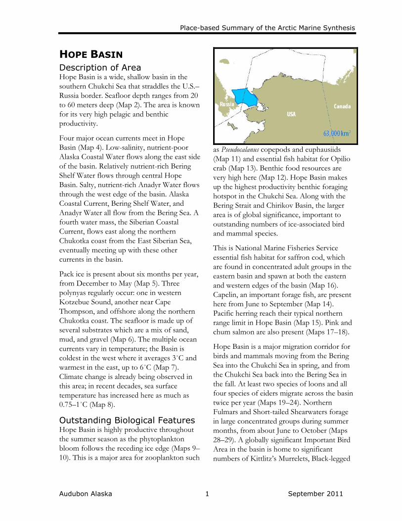
HOPE BASIN Description of Area Hope Basin is a wide, shallow basin in the
southern Chukchi Sea that straddles the U.S.–
Russia border. Seafloor depth ranges from 20
to 60 meters deep (Map 2). The area is known
for its very high pelagic and benthic
productivity.
Four major ocean currents meet in Hope
Basin (Map 4). Low-salinity, nutrient-poor
Alaska Coastal Water flows along the east side
of the basin. Relatively nutrient-rich Bering
Shelf Water flows through central Hope
Basin. Salty, nutrient-rich Anadyr Water flows
through the west edge of the basin. Alaska
Coastal Current, Bering Shelf Water, and
Anadyr Water all flow from the Bering Sea. A
fourth water mass, the Siberian Coastal
Current, flows east along the northern
Chukotka coast from the East Siberian Sea,
eventually meeting up with these other
currents in the basin.
Pack ice is present about six months per year,
from December to May (Map 5). Three
polynyas regularly occur: one in western
Kotzebue Sound, another near Cape
Thompson, and offshore along the northern
Chukotka coast. The seafloor is made up of
several substrates which are a mix of sand,
mud, and gravel (Map 6). The multiple ocean
currents vary in temperature; the Basin is
coldest in the west where it averages 3˚C and
warmest in the east, up to 6˚C (Map 7).
Climate change is already being observed in
this area; in recent decades, sea surface
temperature has increased here as much as
0.75–1˚C (Map 8).
Outstanding Biological Features Hope Basin is highly productive throughout
the summer season as the phytoplankton
bloom follows the receding ice edge (Maps 9–
10). This is a major area for zooplankton such
as Pseudocalanus copepods and euphausiids
(Map 11) and essential fish habitat for Opilio
crab (Map 13). Benthic food resources are
very high here (Map 12). Hope Basin makes
up the highest productivity benthic foraging
hotspot in the Chukchi Sea. Along with the
Bering Strait and Chirikov Basin, the larger
area is of global significance, important to
outstanding numbers of ice-associated bird
and mammal species.
This is National Marine Fisheries Service
essential fish habitat for saffron cod, which
are found in concentrated adult groups in the
eastern basin and spawn at both the eastern
and western edges of the basin (Map 16).
Capelin, an important forage fish, are present
here from June to September (Map 14).
Pacific herring reach their typical northern
range limit in Hope Basin (Map 15). Pink and
chum salmon are also present (Maps 17–18).
Hope Basin is a major migration corridor for
birds and mammals moving from the Bering
Sea into the Chukchi Sea in spring, and from
the Chukchi Sea back into the Bering Sea in
the fall. At least two species of loons and all
four species of eiders migrate across the basin
twice per year (Maps 19–24). Northern
Fulmars and Short-tailed Shearwaters forage
in large concentrated groups during summer
months, from about June to October (Maps
28–29). A globally significant Important Bird
Area in the basin is home to significant
numbers of Kittlitz’s Murrelets, Black-legged

Place-based Summary of the Arctic Marine Synthesis
Audubon Alaska 2 September 2011
Kittiwakes, and Short-tailed Shearwaters (Map
31).
The area has been identified by local hunters
as a feeding area for polar bears; on the U.S.
side of the border, the basin is designated
critical feeding habitat, and is part of the core
use area identified for the Chukchi/Bering Sea
population (Map 32). Arctic foxes satellite-
collared at Teshekpuk Lake on Alaska’s North
Slope have been observed traveling as far
away as Hope Basin to scavenge atop the
winter sea ice (Map 33).
The area is a destination for benthic foraging
Pacific walrus as they follow the ice edge
northward in spring and south in fall (Map
34). All four species of ice seals live in Hope
Basin. Ribbon seals concentrate here from
June to December (Map 35), and bearded
seals are more concentrated from March to
June (Maps 35, 38). Spotted seals forage from
August to December, and ringed seals are
present all year (Maps 36–37).
This is an important migration and feeding
area for bowhead whales (Map 39). The
whales migrate north from the Bering Strait
past Point Hope in the spring, and south
along the Chukotka coast in the fall, stopping
to feed along the way. Similarly, beluga whales
also migrate through and feed in the area
from May to November (Map 40). Hope
Basin is an important benthic feeding area for
gray whales, which migrate from Mexico and
California each year to feed in these waters
(Map 41).
Current Resource Use Subsistence uses include hunting of bowhead
whales, walrus, and seals by communities
located near the area (Shishmaref, Kivalina,
Point Hope).
Conservation Status Much of the U.S. part of Hope Basin
is a bowhead whale subsistence
hunting quiet area designated by
Alaska’s North Slope Borough (Map
39).
Cape Lisburne–Thompson Marine is a
globally significant Important Bird
Area designated by the National
Audubon Society and BirdLife
International (Map 31).
Designated essential fish habitat for
Opilio crab and saffron cod by the
U.S. National Marine Fisheries Service
(Maps 13, 16).
Designated no disturbance zone
critical denning and feeding habitat for
polar bears by the U.S. Fish and
Wildlife Service (Map 32).
Currently closed to commercial
fishing by the U.S. North Pacific
Fishery Management Council.
Not currently open to oil and gas
leasing by the U.S. Bureau of Ocean
Energy Management (Map 42).
Current and Future Threats Disturbance or pollution from
shipping traffic (Map 43).
Future increased vessel traffic due to
shipping, tourism, or fishing as the
ice–free season continues to lengthen.
High air temperature increases (up to
3.8˚ C) projected by the end of the
century (Map 44).
Expected, but not well understood,
changes in marine productivity due to
changes in timing and extent of sea
ice.

Place-based Summary of the Arctic Marine Synthesis
Audubon Alaska 1 September 2011
CAPE THOMPSON & CAPE
LISBURNE Description of Area The Lisburne Peninsula extends westward
into the Arctic Ocean at the base of the
Brooks Range. Cape Lisburne is the rugged
northern extent of the peninsula, while Cape
Thompson is a low-lying wetland area
forming the south end of the peninsula.
Between these two capes lies Point Hope, a
significant geographic feature, and a Native
village which is home to about 850 residents
(Map 1). The Kukpuk and Ipewik rivers join
just before Aiautak Lagoon, then drain into
the Arctic Ocean near Point Hope. A couple
of other small settlements and the town of
Kivalina, with about 375 residents, also line
the coast in this area.
Marine waters around the Lisburne Peninsula
are primarily of the Alaska Coastal Current,
which carries low-salinity water north from
coastal areas in the Bering Sea (Map 4).
Shallow coastal waters are covered in landfast
ice several months per year, from about
December to June, while somewhat deeper
waters (less than 50 meters) are covered by
pack ice from about December to May. In
winter, two polynyas form along the
peninsula, one between Point Hope and Cape
Lisburne, and one offshore of Cape
Thompson (Map 5). The nearshore seafloor is
made up of muddy gravel with relatively low
benthic food resources (Maps 6, 12). Water
temperatures average 4–6˚ C during the ice
free season (Map 7). Marine waters around
the Lisburne Peninsula are a migration
bottleneck for marine mammals and birds.
Outstanding Biological Features The warm coastal waters that surround the
Lisburne Peninsula have relatively high pelagic
productivity compared to offshore areas
(Maps 9–10). This is the northern extent of
the National Marine Fisheries Service essential
fish habitat identified for Opilio crab (Map
13). Capelin spawn in the shallow coastal
water (Map 14). Saffron cod spawn here in
large numbers, and this area is identified as
the National Marine Fisheries Service essential
fish habitat for them as well (Map 16). Pink
and chum salmon are present; pink salmon
are also present in the Kukpuk and Kivalina
rivers, and spawn in the Wulik River (Maps
17–18).
Nearly all bird species that migrate to the
North Slope for summer breeding migrate
around Point Hope and north toward Barrow.
This is primary breeding range for Red-
throated Loons (Map 20), and overlaps part of
the Spectacled Eider critical habitat in
Ledyard Bay (Map 21). The Lisburne
Peninsula is one of only two known breeding
areas in the Alaskan Arctic for Kittlitz’s
Murrelet (Map 27). They have been observed
in the waters around Cape Lisburne and Point
Hope. Of the three globally significant
Important Bird Areas here, Cape Lisburne–
Thompson Marine is designated for the
Kittlitz’s Murrelet (Map 31). The Cape
Lisburne and Cape Thompson terrestrial
IBAs are designated for the several hundred
thousand Thick-billed and Common murres
nesting there. Shearwaters and fulmars also
congregate to feed on abundant forage fish in
these waters (Maps 28–29).
There are five seabird colonies between Cape
Lisburne and Point Hope, another five at
Cape Thompson, and another three at Cape

Place-based Summary of the Arctic Marine Synthesis
Audubon Alaska 2 September 2011
Krusenstern (Map 30). At Cape Lisburne
(about 40 kilometers north of Point Hope),
habitat for cliff-nesting seabirds consists of
about 7 kilometers of limestone and shale sea-
cliffs south of the cape. The cliffs range from
about 15 to 200 meters high. Similar cliffs
make up the coastline at Cape Thompson.
Over 800,000 seabirds of ten different species
nest along these cliffs.
Polar bears den and feed along the whole
coast of the Lisburne Peninsula, with
designated critical habitat from Point Hope to
Cape Thompson (Map 32). Arctic foxes
satellite-collared at Teshekpuk Lake on the
North Slope have been observed traveling as
far as the Lisburne Peninsula (Map 33). The
peninsula is a major Pacific walrus haulout
(Map 34). Five known haulouts are used, with
10 to 10,000 animals present. All four species
of ice seals use the nearshore waters around
the peninsula, with ringed and bearded seals
concentrating in the open waters in the spring,
generally March to June (Maps 35–38).
Point Hope is a spring whaling community
(Map 39); nearly the entire Bering-Chukchi-
Beaufort bowhead whale stock passes by
Point Hope each spring. Waters within 40
kilometers of the village are a designated quiet
zone for these whales. Likewise, this is a
concentration area for gray whales and a high
concentration area for beluga whales (Maps
40–41).
Current Resource Use Subsistence uses include hunting of bowhead
and beluga whales, seals, walrus, polar bears,
and seabirds. Fishing is also practiced along
the coast.
Conservation Status Cape Thompson, Cape Lisburne, and
Cape Lisburne–Thompson Marine are
three globally significant Important
Bird Areas designated by the National
Audubon Society and BirdLife
International (Map 31).
Cape Lisburne and Cape Thompson
are part of the Alaska Maritime
National Wildlife Refuge–Chukchi Sea
Unit, which is managed by the U.S.
Fish and Wildlife Service (Map 42).
Bowhead whale subsistence hunting
quiet area designated by Alaska’s
North Slope Borough (Map 39).
Designated essential fish habitat for
Opilio crab and saffron cod by the
U.S. National Marine Fisheries Service
(Maps 13, 16).
Designated no disturbance zone
critical denning and feeding habitat for
polar bears by the U.S. Fish and
Wildlife Service (Map 32).
Not currently open to oil and gas
leasing by the U.S. Bureau of Ocean
Energy Management or the State of
Alaska (Map 42).
Currently closed to commercial
fishing by the U.S. North Pacific
Fishery Management Council.
Current and Future Threats Expected, but not well understood,
changes in marine productivity due to
changes in timing and extent of sea
ice.
Future increased vessel traffic due to
shipping, tourism, or fishing as the
ice-free season continues to lengthen.
High air temperature increases (up to
3.0˚ C) projected by the end of the
century (Map 44).
Disturbance or pollution from
shipping traffic (Map 43).

Place-based Summary of the Arctic Marine Synthesis
Audubon Alaska 1 September 2011
LEDYARD BAY Description of Area Stretching from Cape Lisburne to central
Kasegaluk Lagoon, Ledyard Bay is the largest
bay on Alaska’s Chukchi Sea coast (Map 1).
This area is also part of the greater Chukchi
Sea lead system. The bay is very shallow, even
by Chukchi Sea standards, averaging 15–25
meters depth (Map 2). The main ocean
current in Ledyard Bay is the Alaska Coastal
Current, which carries low-salinity water north
from coastal areas in the Bering Sea (Map 4).
The bay is not often covered in pack ice;
instead, the nearshore areas are covered in
landfast ice several months per year, while
farther offshore is a recurring system of
polynyas and leads (Map 5).
The seafloor is made up mostly of muddy
gravel (Map 6). Sea surface temperatures
range from 3–5° C during ice-free months
(Map 7). Analysis of sea surface temperature
anomalies in recent decades indicates the bay
has not been affected by climate change as
drastically as other Chukchi Sea waters (Map
8).
Outstanding Biological Features The nearshore area of Ledyard Bay is very
productive—with large phytoplankton
blooms similar to the Bering Strait region
(Maps 9–10). Benthic productivity appears to
be fairly average for the Chukchi Sea, which
could be misleading since only a couple of
survey points have been sampled in this area
(Map 12).
These waters are home to capelin from June
to September, and coastal waters are a capelin
spawning area (Map 14). Ledyard Bay is also
National Marine Fisheries Service essential
fish habitat for saffron cod, which occur year-
round (Map 16). Both pink and chum salmon
are also present (Maps 17–18).
Ledyard Bay is very important for birds,
especially eiders. This is critical habitat for
migrating, staging and foraging Spectacled
Eiders (Map 21). The area is also a
concentrated staging area for King Eiders
during spring and fall migration. The entire
breeding population of King Eiders in
western North America—about half of a
million birds—is believed to use this area
(Map 23). The bay is a staging area for
Common Eiders as well, which breed along
the coastline leading to Kasegaluk Lagoon
(Map 24). Steller’s Eiders migrate through the
bay in unknown numbers (Map 22). All four
eider species breed just inland of the bay and
northward, as do Yellow-billed Loons, Red-
throated Loons, and Long-tailed Ducks (Maps
19–20, 25). All of these species migrate
through and forage in the bay on the way to
their breeding grounds. Kittlitz’s Murrelets are
present, but abundance data in this region is
very poor (Map 27). Fulmars and shearwaters
forage in the offshore waters of the bay (Maps
28–29). Because of these spectacular bird
values, this is designated as a globally
significant Important Bird Area (Map 31).
The bay is also home to significant mammal
populations. Polar bears regularly den and
feed in Ledyard Bay (Map 32). Arctic foxes
forage atop the landfast ice in winter (Map
33). Pacific walrus migrate through, and also
haul out in small numbers (Map 34). All four
species of ice seals are present (Maps 35–38).
Spotted seals use the coastal waters and

Place-based Summary of the Arctic Marine Synthesis
Audubon Alaska 2 September 2011
haulouts in summer and fall, from about June
to December. Ringed and bearded seals
concentrate in the bay in winter and spring,
from about February to June.
The bay is a spring migration area for
bowhead whales (Map 39), a migration and
nearshore concentration area for beluga
whales (Map 40), and is also a feeding area for
gray whales (Map 41).
Current Resource Use Subsistence uses include hunting of seals,
walrus, and seabirds, as well as bowhead
whales at times.
Conservation Status Ledyard Bay is a globally significant
Important Bird Area designated by the
National Audubon Society and
BirdLife International (Map 31).
Designated critical habitat for
Spectacled Eiders by the U.S. Fish and
Wildlife Service (Map 21).
Designated essential fish habitat for
saffron cod by the U.S. National
Marine Fisheries Service (Map 16).
Designated critical feeding habitat for
polar bears by the U.S. Fish and
Wildlife Service (Map 32).
Bowhead whale subsistence hunting
quiet area designated by Alaska’s
North Slope Borough (Map 39).
Currently closed to commercial
fishing by the U.S. North Pacific
Fishery Management Council.
Waters within 40 kilometers of the
Chukchi coast and Point Barrow are
not currently open to oil and gas
leasing by the U.S. Bureau of Ocean
Energy Management or the State of
Alaska (Map 42).
Current and Future Threats Disturbance or pollution from
shipping traffic (Map 43).
Future increased vessel traffic due to
shipping, tourism, or fishing as the
ice-free season continues to lengthen.
High air temperature increases (up to
3.0˚ C) projected by the end of the
century (Map 44).
Expected, but not well understood,
changes in marine productivity due to
changes in timing and extent of sea
ice.

Place-based Summary of the Arctic Marine Synthesis
Audubon Alaska 1 September 2011
KASEGALUK LAGOON Description of Area This 200-kilometer-long lagoon on the
Chukchi Sea coast is a gathering place for a
diverse set of wildlife. The lagoon is about 6
kilometers across at its widest point. The spits
and barrier islands that enclose these shallow
(less than 4 meters), brackish waters are
nesting, denning, and haulout areas for many
species. Two communities are associated with
the lagoon: Point Lay (population ~250) at
the southern end, and Wainwright (population
~550) just past the far north end.
Part of the regularly occurring landfast ice-
pack, the shallow water here is frozen in
winter for several months (Map 5). Gravel
and muddy gravel make up the bottom (Map
6). Sea surface temperatures average 2–4° C
during ice-free months (Map 7).
Outstanding Biological Features Primary productivity is very high compared to
nearby waters (Map 11), although limited
benthic sampling seems to indicate lower
values than waters outside the lagoon (Map
12).
Kasegaluk Lagoon is essential fish habitat for
saffron cod (Map 15). At least three
anadramous rivers flow into the lagoon, which
are used by pink and chum salmon (Maps 17–
18).
These waters are summer marine feeding or
migration stopover sites for a long list of bird
species. Yellow-billed and Red-throated
Loons; Spectacled, Steller’s, King, and
Common eiders; and Long-tailed Ducks all
breed in medium to high densities near the
lagoon (Maps 19–25). Common Eiders nest in
colonies of up to 500 birds on the spits and
barrier islands (Map 24). This is a particularly
important area for King Eiders, which
concentrate both in and outside of the lagoon.
Nearly all of the Western North
American breeding population of these birds
stops here and in Ledyard and Peard bays
during spring and fall migrations (Map 23).
Because of the diversity and abundance of
birds here, Kasegaluk Lagoon is a globally
significant Important Bird Area (Map 31).
This is U.S. Fish and Wildlife Service no
disturbance zone critical habitat for polar
bears, which den and feed along the barrier
islands, coast, and landfast ice (Map 32).
Arctic foxes captured at Teshekpuk Lake
traveled to Kasegaluk Lagoon and beyond in
winter months (Map 33). Pacific walrus use
the barrier islands as a haulout, particularly at
Wainwright, Point Lay, and Icy Cape; their
use of this area has increased in recent years
as the minimum sea ice extent continues to
move north due to climate change (Map 34).
Ribbon and bearded seals can be found in the
lagoon (Maps 35, 38), but only spotted and
ringed seals occur in large numbers. This is a
major spotted seal haulout along nearly the
entire length of the lagoon (Map 36). Ringed
seals are found in high concentrations in the
winter and spring, from approximately
October to July (Map 37). These shallow
brackish waters are an important concentrated
calving and molting area for beluga whales
(Map 40).
Current Resource Use Subsistence uses include hunting of beluga
whales, seals, polar bears, and seabirds.
Fishing is also practiced in the lagoon system.

Place-based Summary of the Arctic Marine Synthesis
Audubon Alaska 2 September 2011
Conservation Status Kasegaluk Lagoon is a globally
significant Important Bird Area
designated by the National Audubon
Society and BirdLife International
(Map 31).
Designated Special Area within the
National Petroleum Reserve–Alaska
which is managed by the U.S. Bureau
of Land Management.
Designated essential fish habitat for
saffron cod by the U.S. National
Marine Fisheries Service (Map 16).
Designated no disturbance zone
critical denning and feeding habitat for
polar bears by the U.S. Fish and
Wildlife Service (Map 32).
Waters within 40 kilometers of the
Chukchi coast and Point Barrow are
not currently open to oil and gas
leasing by the U.S. Bureau of Ocean
Energy Management or the State of
Alaska (Map 42).
Currently closed to commercial
fishing by the U.S. North Pacific
Fishery Management Council.
Current and Future Threats Potential for development of a port
for bringing offshore oil to a future
pipeline across the National
Petroleum Reserve.
High air temperature increases (up to
3.0˚ C) projected by the end of the
century (Map 44).

Place-based Summary of the Arctic Marine Synthesis
Audubon Alaska 1 September 2011
CHUKCHI LEAD SYSTEM Description of Area Along the entire Alaskan Chukchi Sea coast is
a system of open water leads and polynyas
that are critical for migrating wildlife and, in
turn, subsistence hunters. These shallow
waters range from 5 to 50 meters deep (Map
2), made up primarily of the relatively warm
Alaska Coastal Current, and also the nutrient-
rich Bering Shelf Water (Map 4). Winds and
currents push the shifting sea ice offshore, as
well as create a flaw zone between the landfast
ice and the pack ice, creating open water
areas–leads and polynyas–that allow wildlife
to migrate up and down the coast in spring
and fall when other areas are frozen solid
(Map 5).
The seafloor is a mixture of gravel, mud, and
sand (Map 6). Water temperatures range from
1–5° C during ice-free months (Map 7).
Outstanding Biological Features The area has moderate to high water column
and benthic productivity (Maps 9–10, 12).
Zooplankton such as euphausiids and
Pseudocalanus copepods, concentrated in these
waters, provide an important foraging
resource (Map 11). Opilio crab are present but
their range has been only partially mapped
and their abundance is unknown (Map 13).
Capelin are present and spawn near shore
(Map 14). Saffron cod are abundant, so this is
National Marine Fisheries Service essential
fish habitat for this species (Map 16). Pink
and chum salmon are also present (Maps 17–
18).
Most bird species that breed on Alaska’s
North Slope migrate along the lead system in
spring and fall when heading to their breeding
or wintering grounds. Two species of loons,
all four species of eiders, other waterfowl such
as Long-tailed Ducks, and Ivory Gulls pass
through and forage in these open waters
(Maps 19–26). Kittlitz’s Murrelets are
believed to use these waters as well when
migrating to breeding areas inland of Peard
Bay, but their use here is not well documented
(Map 27). Groups of hundreds to thousands
of Short-tailed Shearwaters are found foraging
in these waters (Map 29). Portions of the lead
system are designated globally significant
Important Bird Areas (Map 31).
This is a prominent polar bear feeding and
denning area (Map 32). The area is frequented
by ringed seals using breathing holes and
haulouts in winter (Map 37). The bears hunt
seals along the open leads and den on the
pack ice in this critical habitat area. Pacific
walrus are concentrated in summer and fall in
this area, offshore of Icy Cape past Point
Barrow (Map 34); their use of these waters has
increased in recent years as they spend more
time in the fall at haulouts on the Chukchi
coast. All four species of ice seals are present
(Maps 35–38). Ringed and bearded seals are
present year-round, and are particularly
concentrated from February to June.
This is a major bowhead whale area where
virtually the entire stock moves through in
spring (March to June). Areas offshore of
Point Lay, Wainwright, and Barrow are
whaling community hunting areas, and this is
a North Slope Borough-designated quiet area
for this species (Map 39). Beluga whales
migrate through in May and June (Map 40);
gray whales are present in summer and fall
(Map 41).

Place-based Summary of the Arctic Marine Synthesis
Audubon Alaska 2 September 2011
Current Resource Use Subsistence uses include hunting of bowhead
whales, occasional beluga whales, walrus,
seals, polar bears, and seabirds. Fishing occurs
along the coast or in estuaries.
Conservation Status The Chukchi Lead System intersects
the Ledyard Bay and Kasegaluk
Lagoon globally significant Important
Bird Areas, designated by the National
Audubon Society and BirdLife
International (Map 31).
Designated critical habitat for
Spectacled Eiders by the U.S. Fish and
Wildlife Service (Map 21)
Designated essential fish habitat for
saffron cod by the U.S. National
Marine Fisheries Service (Map 16).
Designated no disturbance zone
critical denning and feeding habitat for
polar bears by the U.S. Fish and
Wildlife Service (Map 32).
Bowhead whale subsistence hunting
quiet area designated by Alaska’s
North Slope Borough (Map 39).
Currently closed to commercial
fishing by the U.S. North Pacific
Fishery Management Council.
A portion of this area—waters within
40 kilometers of the Chukchi coast
and Point Barrow—is not currently
open to oil and gas leasing by the U.S.
Bureau of Ocean Energy Management
or the State of Alaska (Map 42).
Current and Future Threats Oil and gas seismic exploration,
exploratory drilling, production well
development, and/or oil spills (Map
42).
Disturbance or pollution from
shipping traffic (Map 43).
Future increased vessel traffic due to
shipping, tourism, or fishing as the
ice-free season continues to lengthen.
High air temperature increases (up to
3.0˚ C) projected by the end of the
century (Map 44).
Expected, but not well understood,
changes in marine productivity due to
changes in timing and extent of sea
ice.

Place-based Summary of the Arctic Marine Synthesis
Audubon Alaska 1 September 2011
HANNA SHOAL Description of Area Hanna Shoal is located approximately 125
kilometers northwest of Barrow. The shoal
sits between 15 to 40 meters below the
surface. (Map 2).
This shallow topographic feature diverts large,
warm water masses flowing northward from
the Bering Sea, thereby holding onto colder
water long into the summer season. As a
result, sea ice persists there longer into the
season as well (Maps 2, 4–5). A pack ice
feature near Hanna Shoal called Post Office
Point was historically known for its reliable
ice all summer long. Recent decades of
warming have changed this persistent lobe of
ice, and the minimum September sea ice
extent has come this far south only once in
the last decade (Map 5). Although no longer
known for reliable, summer-long pack ice,
today Hanna Shoal is an area of broken ice
and persistent ice floes, which are relied on by
ice-associated wildlife through late summer.
Water temperatures over the shoal are
generally 0–2° C during ice-free months (Map
7). Climate change has affected the shoal
greatly; the minimum sea ice extent
historically was just south of, and included,
the shoal. Today the minimum extent is far
north and east over the 4000 meter deep
Canada Basin (Map 8).
Outstanding Biological Features Hanna Shoal has low primary productivity
(Maps 9–10) but concentrated zooplankton
(Map 11). The area is thought to have only
moderate benthic productivity (Map 12);
however, likely because of the persistent ice,
this area has almost no direct sampling of
benthic fauna—a significant data gap for an
area so intensively used by ice-dependent
wildlife. Likewise, there is no comprehensive
data mapped for fish in this area.
Some bird species such as Steller’s and King
eiders are known to migrate through the area
when passing from Alaska to Chukotka, but
similar migration pathway information for
many other Arctic bird species is not known.
The area appears to be significant for Ivory
Gulls—one of the only documented
concentration areas for this species in U.S.
waters. These birds were observed in groups
of up to 30 individuals in surveys completed
30 years ago (Map 26). Northern Fulmars and
Short-tailed Shearwaters forage in the area in
summer and fall months in unknown
numbers (Maps 28–29).
The shoal is part of the core use area of polar
bears, as well as a documented denning area
(Map 32). Satellite-collared Arctic foxes have
been tracked wandering as far offshore as
Hanna Shoal to forage atop the winter pack
ice (Map 33).
This is a very important area for pinnipeds.
Ice-dependent Pacific walrus rely on the late-
summer persistent ice at Hanna Shoal as the
last ice haulout after all other Chukchi Sea
waters are ice-free (Map 34). When Hanna
Shoal ice melts in August the walrus are
forced to haul out on land and forage from
shore. Ringed and bearded seals concentrate
at Hanna Shoal in late summer, from July to
September (Maps 37–38). Ribbon seals are
also present (Map 35).
The shoal is an important, regularly-used
migration area for bowhead and beluga whales

Place-based Summary of the Arctic Marine Synthesis
Audubon Alaska 2 September 2011
in the fall (September to November) when
moving from Alaskan to Russian waters
(Maps 39–40). This is also the northern extent
of gray whales which migrate to the Chukchi
Sea from Mexico each year (Map 41).
Current Resource Use The area is leased for oil exploration and
development.
Conservation Status Currently closed to commercial
fishing by the U.S. North Pacific
Fishery Management Council.
Current and Future Threats Oil and gas seismic exploration,
exploratory drilling, production well
development, and/or oil spills (Map
42).
Future increased vessel traffic due to
shipping, tourism, or fishing as the
ice-free season continues to lengthen.
High air temperature increases (up to
2.0˚ C) projected by the end of the
century (Map 44).
Expected, but not well understood,
changes in marine productivity due to
changes in timing and extent of sea
ice.

Place-based Summary of the Arctic Marine Synthesis
Audubon Alaska 1 September 2011
PEARD BAY Description of Area Peard Bay is located on the northern Chukchi
Sea coast near Barrow (Map 1). This area is
also part of the greater Chukchi Sea lead
system. The bay runs from the coast to the
edge of Barrow Canyon at about 50 meters
depth (Map 2). The Alaska Coastal Current is
the main water mass moving through the bay
(Map 3). Water temperatures range from 0–2°
C during ice-free months (Map 7). The area is
characterized by landfast ice from Point
Franklin inland (from November through
May), and a system of open leads farther
offshore (Map 5). The seafloor substrate here
is unmapped, but it is speculated that a
boulder patch may be present (Map 6).
Boulder patches are a type of biodiversity
hotspot that is rare on this otherwise muddy,
gravelly, and sandy sea bottom; large rock
substrate provides a stable area for kelp and
associated wildlife to take hold.
Outstanding Biological Features Peard Bay waters have low to moderate water
column and benthic productivity (Maps 9–10,
12). Opilio crab are present but their range
has been only partially mapped and their
abundance is unknown (Map 13).
Capelin live in the bay from June to
September, and spawn in high numbers along
the coast, particularly near Barrow where
more detailed surveys exist (Map 14). The bay
is also National Marine Fisheries Service
essential fish habitat for saffron cod which are
present year-round (Map 16). Pink and chum
salmon are present from approximately May
to August; these salmon spawn in the Kugrua
River which drains into Peard Bay (Maps 17–
18).
The bay is a key migration route and stopover
site for many bird species migrating to and
from breeding grounds on Alaska’s North
Slope. Two species of loons, all four species
of eiders, other waterfowl such as Long-tailed
Ducks, and Ivory Gulls pass through and
forage in these waters (Maps 19–26). Red-
throated and Yellow-billed Loons breed in
small but highly concentrated areas just inland
of the bay (Maps 19–20). This is a
continentally significant Important Bird Area
for Spectacled Eiders, which have their
highest known breeding concentration in
Alaska just inland of the Peard Bay coastline,
and forage in the adjacent marine waters (Map
21). Steller’s Eider aerial surveys and satellite
tag tracking data shows significant use of the
Peard Bay coast and spits during migration
(Map 22). The bay is a highly concentrated
staging area for King Eiders, used by possibly
the entire western North America breeding
population as they migrate up the Chukchi
coast to their breeding grounds on Alaska’s
North Slope and in Canada (Map 23).
Common Eiders also breed along the
coastline and spits (Map 24). From Point
Franklin to Kugrua Bay is a marine
concentration area for Long-tailed Ducks,
which also breed all along the coast in very
high numbers (Map 25). Kittlitz’s Murrelets
are believed to use these waters as well when
migrating to breeding areas inland of Peard
Bay, but their use here is not well documented
(Map 27).
This is a very prominent polar bear feeding
and denning area (Map 32) which is
frequented by ringed seals in late winter and
spring (Map 37). The spits of Peard Bay,

Place-based Summary of the Arctic Marine Synthesis
Audubon Alaska 2 September 2011
including Point Franklin, are designated U.S.
Fish and Wildlife Service no disturbance zone
critical habitat for polar bears. Pacific walrus
are concentrated here in summer and fall;
their use of this area (especially around Point
Franklin) has increased in recent years as the
minimum sea ice extent continues to move
north due to climate change (Map 34). All
four species of ice seals are present (Maps 35–
38). Point Franklin is a spotted seal haulout
(Map 36). Ringed and bearded seals are
present year-round; this is a bearded seal
concentration area from March to September
(Map 38).
Peard Bay is a bowhead whale spring
migration and concentration area. Waters
offshore of Wainwright and Barrow are
whaling community hunting areas, and this is
a North Slope Borough–designated quiet area
for this species (Map 39). Beluga whales
migrate through in May and June (Map 40);
gray whales are present in summer and fall
(Map 41).
Current Resource Use Subsistence uses include hunting of bowhead
whales, seals, walrus, polar bears, and
seabirds.
Conservation Status Peard Bay is a continentally significant
Important Bird Area designated by the
National Audubon Society and Bird
Life International (Map 31).
Designated essential fish habitat for
saffron cod by the U.S. National
Marine Fisheries Service (Map 16).
Designated no disturbance zone
critical denning and feeding habitat for
polar bears by the U.S. Fish and
Wildlife Service (Map 32).
Bowhead whale subsistence hunting
quiet area designated by Alaska’s
North Slope Borough (Map 39).
Currently closed to commercial
fishing by the U.S. North Pacific
Fishery Management Council.
Waters within 40 kilometers of the
Chukchi coast and Point Barrow are
not currently open to oil and gas
leasing by the U.S. Bureau of Ocean
Energy Management or the State of
Alaska (Map 42).
Current and Future Threats Oil spills or seismic exploration
disturbance from nearby energy
development areas (Map 42).
Disturbance or pollution from
shipping traffic (Map 43).
Future increased vessel traffic due to
shipping, tourism, or fishing as the
ice-free season continues to lengthen.
High air temperature increases (up to
3.8˚ C) projected by the end of the
century (Map 44).
Expected, but not well understood,
changes in marine productivity due to
changes in timing and extent of sea
ice.

Place-based Summary of the Arctic Marine Synthesis
Audubon Alaska 1 September 2011
BARROW CANYON Description of Area Barrow Canyon is a canyon and upwelling
area which influences the marine ecosystem
dynamics offshore of Point Barrow. The
canyon itself runs along the Chukchi Sea
coast, approximately 10 to 25 kilometers
offshore, from Point Franklin to Point
Barrow, then cuts through the shelf break and
drains into the Canada Basin (Map 2). The
low-salinity Alaska Coastal Current follows
the Alaska coast, eventually through Barrow
Canyon and around Point Barrow, and finally
disperses into the Beaufort Gyre and through
Amundsen Gulf and M’Clure Strait in the
Beaufort Sea (Map 4).
Much of the southern nearshore canyon is
open water through the winter due to
persistent leads, and the northern offshore
portion has concentrated ice present for about
nine months (November–July), making this
area accessible to migrating wildlife most of
the year (Map 5). The canyon bottom is
classified as gravelly mud and gravelly muddy
sand (Map 6). Temperatures in ice-free
months average 0–2° C (Map 7).
Outstanding Biological Features Waters around Point Barrow are very
productive compared to areas farther offshore
(Maps 9 and 10). Zooplankton species such as
Pseudocalanus copepods and euphausiids
concentrate off Point Barrow to the shelf
break (Map 11); these concentrated
zooplankton are a very important food source
for bowhead whales feeding here in the fall.
Benthic resources are not well known in this
area (Map 12), but were dominated by brittle
stars and Opilio crab in recent surveys (Map
13). Saffron cod are found throughout this
area, and the southern canyon is considered
essential fish habitat for this species (Map 16).
Pink and chum salmon inhabit the area as well
(Maps 17 and 18).
Barrow Canyon straddles the boundary
between the Beaufort and Chukchi seas. As
wildlife move from one sea to the other, they
must round Point Barrow and pass through
here. Therefore, the Barrow Canyon area is a
migration bottleneck for birds and marine
mammals—virtually all of which pass here
during both spring and fall migration.
Nearshore areas by Point Barrow are marine
feeding areas for many species of birds
including Yellow-billed and Red-throated
loons; Spectacled, Steller’s, King, and
Common eiders; Long-tailed Ducks;
Northern Fulmars; and Short-tailed
Shearwaters (Maps 19–25, 28–29). Like
marine mammals, these and other bird species
migrate through this area twice each year
when moving between the Beaufort and
Chukchi seas in spring and fall.
Barrow Canyon is a concentrated nearshore
feeding area for polar bears, and is designated
critical habitat by the U.S. Fish and Wildlife
Service (Map 32). Ringed seals, the primary
food source of polar bears, and bearded seals,
a secondary food source, also concentrate in
the Barrow Canyon area during the same
period from about July to September (Maps
37–38). This is also a concentrated feeding
area for female walrus and their young in June
to October (Map 34). Ribbon seals and gray
whales are present in the area in unknown
numbers (Maps 35, 41).

Place-based Summary of the Arctic Marine Synthesis
Audubon Alaska 2 September 2011
Bowhead whales migrate northeast up the
Chukchi coast in spring, passing Point Barrow
and Barrow Canyon in April and May before
heading far offshore on their way to the
Canadian Beaufort Sea for summer feeding.
In the fall they follow the Alaskan Beaufort
Sea coast back west and stop at Barrow
Canyon for fall feeding between late August
and early November (Map 39). Much like
bowhead whales, beluga whales pass through
this area twice each year during migration, and
concentrate in large numbers in the fall to
feed on fish (Map 40).
Current Resource Use Subsistence uses include hunting of bowhead
whales, occasional beluga whales, seals,
walrus, polar bears, and seabirds.
Conservation Status Waters within 40 kilometers of the
Chukchi coast and Point Barrow are
not currently open to oil and gas
leasing by the U.S. Bureau of Ocean
Energy Management or the State of
Alaska (Map 42).
Currently closed to commercial
fishing by the U.S. North Pacific
Fishery Management Council.
Designated no disturbance zone
critical denning and feeding habitat for
polar bears by the U.S. Fish and
Wildlife Service (Map 32).
Bowhead whale subsistence hunting
quiet area designated by Alaska’s
North Slope Borough (Map 39).
Current and Future Threats Oil and gas seismic exploration,
exploratory drilling, production well
development, and/or oil spills (Map
42).
Disturbance or pollution from
shipping traffic (Map 43).
Future increased vessel traffic due to
shipping, tourism, or fishing as the
ice-free season continues to lengthen.
High air temperature increases (up to
2.5˚ C) projected by the end of the
century (Map 44).
Expected, but not well understood,
changes in marine productivity due to
changes in timing and extent of sea
ice.

Place-based Summary of the Arctic Marine Synthesis
Audubon Alaska 1 September 2011
DEASE INLET & ELSON
LAGOON Description of Area Dease Inlet and Elson Lagoon are protected
by a series of barrier islands and spits that
separate this brackish/estuarine area from the
greater Beaufort Sea (Map 1). The sea bottom
is less than 5 meters deep (Map 2), and
summer water temperatures average 1–2° C
(Map 7). Several low-elevation, slow-moving
rivers, including the Meade, Topagoruk,
Alaktak, Chipp, and Inaru, flow into the inlet.
Landfast ice covers these waters about nine
months per year (October to June), causing
rivers flowing into the inlet to flood over the
top of the ice when it is present (Map 5).
Outstanding Biological Features Dease Inlet has moderate to moderately high
primary productivity (Maps 9–10), but low
benthic productivity (Map 12). Capelin live in
the inlet from June to September, and spawn
in high numbers along the coast, particularly
near Barrow where more detailed surveys
exist (Map 14). Saffron cod, pink salmon, and
chum salmon also inhabit the inlet (Maps 16–
18). Salmon spawn in the Alaktak and Meade
rivers which drain into Dease Inlet.
Yellow-billed and Red-throated loons, all four
species of eiders, Long-tailed Ducks, and
other waterfowl forage in this area in summer,
approximately June to September, as well as
breed in high concentrations near the coast of
the inlet (Maps 19–25). King Eiders use Elson
Lagoon as a summer staging area (Map 23).
The lagoon is also a concentrated marine use
area for Long-tailed Ducks (Map 25). Ivory
Gulls and Kittlitz’s Murrelets may
occasionally visit these waters, but data for
these species is very poor (Maps 26–27). Over
100 Arctic Terns and as many as 400 Black
Guillemots nest in a colony on Cooper Island
(Map 31), although polar bears have destroyed
most guillemot nests in recent years.
Dease Inlet and Elson Lagoon are major
maternal denning concentration areas for
polar bears, and are designated critical habitat
(Map 32). All four species of ice seals occur
here, but only ringed and spotted occur in
large concentrations. This is a spotted seal
haulout in summer and fall, and a ringed seal
concentration area in spring and summer
(Maps 36–37). Beluga whales also can be
found in the shallow lagoon (Map 40).
Current Resource Use Subsistence uses include fishing in Elson
Lagoon and Dease Inlet, as well as seabird
hunting.
Conservation Status Elson Lagoon is a state-significant
Important Bird Area designated by the
National Audubon Society (Map 31).
Currently closed to commercial
fishing by the U.S. North Pacific
Fishery Management Council.
Designated no disturbance zone
critical denning and feeding habitat for
polar bears by the U.S. Fish and
Wildlife Service (Map 32).
Current and Future Threats Oil and gas seismic exploration,
exploratory drilling, production well
development, and/or oil spills (Map
42).

Place-based Summary of the Arctic Marine Synthesis
Audubon Alaska 2 September 2011
High air temperature increases (up to
2.5˚ C) projected by the end of the
century (Map 44).
Expected, but not well understood,
changes in marine productivity due to
changes in timing and extent of sea
ice.

Place-based Summary of the Arctic Marine Synthesis
Audubon Alaska 1 September 2011
SMITH & HARRISON BAYS Description of Area Smith and Harrison bays lie along the far
western Beaufort Sea coast near the area of
Teshekpuk Lake (Map 1). These two bays
average less than 20 meters deep (Map 2),
with summer water temperatures around 0–2°
C (Map 7). The Alaska Coastal Current is the
main water mass flowing across these bays
(Map 4). Large freshwater inputs include the
Ikpikpuk River which flows into Smith Bay
and the Colville River which flows into
Harrison Bay. Landfast ice covers these
waters nine months of the year (October to
June), causing rivers flowing into these bays to
flood over the top of the ice when it is
present (Map 5). The seafloor here is made of
mud and sand, but the substrate is mostly
unmapped in Smith Bay (Map 6).
Outstanding Biological Features Both bays have moderate to moderately high
concentrations of phytoplankton, (Maps 9–
10), but low benthic productivity (Map 12).
Capelin are present from June to September,
and spawn along the coast (Map 14). Saffron
cod, pink salmon, and chum salmon also
inhabit the bays (Maps 16–18). Both salmon
species are present in the Ikpikpuk and
Colville rivers; pink salmon also use the
Ikpikpuk as a rearing area.
Yellow-billed and Red-throated loons, all four
species of eiders, Long-tailed Ducks, and
other waterfowl forage in this area in summer,
approximately June to September, as well as
breed in high concentrations just inland of
these bays (Maps 19–25). King Eiders use
Smith and Harrison bays as a summer staging
area (Map 23). The deltas of the Ikpikpuk and
Colville rivers are highly important areas for
shorebirds (Map 31).
This is a major maternal denning
concentration area for polar bears, and is
designated critical habitat for feeding and
denning (Map 32). Just inland, Arctic fox
populations are dense; they use these bays in
winter by scavenging atop the sea ice (Map
33). Pacific walrus occasionally travel to the
Beaufort Sea and haul out here in small
numbers (Map 34). All four species of ice
seals occur here, but only ringed and spotted
occur in large concentrations. Smith Bay is the
largest spotted seal haulout on the Beaufort
Sea coast; a second smaller haulout is located
along the Colville River delta at Harrison Bay
(Map 36). These bays are ringed seal
concentration areas from February to
September (Map 37), and bearded seal
concentration areas from July to September
(Map 38). Bowhead whales migrate east across
the bays in the fall in high to very high
concentrations, feeding on zooplankton (Map
39). Smith Bay is part of the fall hunting area
for Native Alaskan whalers from Barrow.
Beluga and gray whales also inhabit these bays
in summer and fall (Maps 40–41).
Current Resource Use Some seal hunting takes place in this area, and
bowhead whales have occasionally been
harvested this far east of Barrow. Fishing
occurs from Nuiqsut, though primarily for
anadromous fish in the Colville River rather
than in the ocean itself.
Conservation Status Teshekpuk Lake is a globally
significant Important Bird Area and

Place-based Summary of the Arctic Marine Synthesis
Audubon Alaska 2 September 2011
Colville River Delta is a continentally
significant Important Bird Area, both
designated by the National Audubon
Society and BirdLife International
(Map 31).
Designated no disturbance zone
critical denning and feeding habitat for
polar bears by the U.S. Fish and
Wildlife Service (Map 32).
Bowhead whale subsistence hunting
quiet area designated by Alaska’s
North Slope Borough (Map 39).
Currently closed to commercial
fishing by the U.S. North Pacific
Fishery Management Council.
Current and Future Threats Oil and gas seismic exploration,
exploratory drilling, production well
development, and/or oil spills (Map
42).
Disturbance or pollution from
shipping traffic (Map 43).
Future increased vessel traffic due to
shipping, tourism, or fishing as the
ice-free season continues to lengthen.
High air temperature increases (up to
3.8˚ C) projected by the end of the
century (Map 44).
Expected, but not well understood,
changes in marine productivity due to
changes in timing and extent of sea
ice.

Place-based Summary of the Arctic Marine Synthesis
Audubon Alaska 1 September 2011
WESTERN BEAUFORT SHELF
& LEAD SYSTEM Description of Area This area covers the continental shelf in the
Beaufort Sea from the edge of Smith and
Harrison bays and the Beaufort barrier islands
to approximately 80 kilometers offshore
where the seafloor quickly drops from 200
meters to more than 3000 meters deep (Map
2). Much smaller than the Chukchi Sea shelf,
this narrow band is an area of recurring leads
in the sea ice. These factors make this an
important wildlife concentration area year-
round.
The Alaska Coastal Current flows east at the
edge of the shelf, but recirculates and heads
west again in waters more near shore (Map 4).
Approximately nine months per year, from
November to July, water near the coast is
covered with landfast ice (Map 5). Unable to
flow freely into the sea, fresh water from the
Meade, Ikpikpuk, Colville, and Canning rivers
backs up and floods over the landfast ice. A
system of open leads occurs regularly along
the edge where the stable landfast ice and the
drifting pack ice meet. The seafloor here is
mostly gravel and mud, with small areas of
sand (Map 6). Water temperatures are 0-2° C
during the short ice-free season from mid-July
through October (Map 7).
Historically the summer sea ice did not recede
far from the Beaufort coast, remaining over
the continental shelf in late summer, then
meeting back up with the coast in early fall.
Sea surface temperatures have not changed as
drastically in this area as in the Chukchi Sea,
but the extent of summer sea ice has moved
offshore about 400 kilometers or more
compared to the historical average (Map 8).
Outstanding Biological Features Primary production in this area is low to
moderate (Maps 9–10). There is little large-
scale data available on zooplankton in this
area (Map 11), although bowhead whales and
other wildlife appear to be selecting for this
area due to high forage value. Benthic
productivity is virtually unsampled here (Map
12). Opilio crab may inhabit the Beaufort
shelf, but research on their distribution is
incomplete (Map 13).
Capelin, an important forage fish for birds
and marine mammals, are known to be
present from June to September across the
shelf (Map 14). This is the eastern extent of
saffron cod distribution in U.S. Arctic waters,
although this information has not been
recently updated (Map 16). Both pink and
chum salmon inhabit these waters in summer
(Maps 17–18).
Birds heading to Alaska’s North Slope migrate
and forage along the open leads in early
summer before moving inland to their nesting
grounds, as well as after the breeding season.
This includes loons, eiders, and other
waterbirds (Maps 19–25). King Eiders,
especially, are known to concentrate in these
waters during summer.
The Beaufort Sea shelf is hugely important for
polar bears, which den on the sea ice and feed
on seals. This area is part of the core use area
for these marine bears (Map 32). Arctic foxes
tagged on the North Slope were observed
foraging atop the winter pack ice (Map 33);
these scavengers often pick up scraps left over
from polar bear kills. Ringed and bearded
Place-based Summary of the Arctic Marine Synthesis
Audubon Alaska 2 September 2011
seals are present year-round, and are
particularly concentrated over the shelf from
July to September (Maps 37–38). This is a
bowhead whale migration and concentration
area in the fall, and is heavily used by Eskimo
whalers during this time (Map 39). Beluga
whales migrate through in both spring and
fall, and are particularly concentrated in
September (Map 40). Gray whales from
Mexico migrate to these waters to feed in
summer and fall as well (Map 41).
Current Resource Use Most of this area has been available for oil
and gas leasing. The only current oil
production in this area is at the Northstar
facility.
Subsistence uses include hunting for bowhead
whales by residents of Nuiqsut and Kaktovik
from Cross Island and Barter Island, seals,
occasional walrus, and polar bear. Fishing is
practiced by residents of Kaktovik and
Nuiqsut, and at other locations along the
coast.
Conservation Status Near Kaktovik, a portion of the
federal Beaufort Sea Outer
Continental Shelf Program Area is
closed to leasing for protection of
whaling waters (Map 42).
Designated critical habitat for feeding
polar bears by the U.S. Fish and
Wildlife Service (Map 32).
Bowhead whale subsistence hunting
quiet area designated by Alaska’s
North Slope Borough (Map 39).
Currently closed to commercial
fishing by the U.S. North Pacific
Fishery Management Council.
Current and Future Threats Oil and gas seismic exploration,
exploratory drilling, production well,
production facility, and pipeline
development, associated aircraft and
vessel support, and oil spills (Map 42).
Disturbance or pollution from
shipping traffic (Map 43).
Future increased vessel traffic due to
shipping, tourism, or fishing as the
ice-free season continues to lengthen.
High air temperature increases (up to
3.0˚ C) projected by the end of the
century (Map 44).
Expected, but not well understood,
changes in marine productivity due to
changes in timing and extent of sea
ice.

Place-based Summary of the Arctic Marine Synthesis
Audubon Alaska 1 September 2011
BEAUFORT LAGOONS &
BARRIER ISLANDS Description of Area A series of long, thin barrier islands and spits
lines the Beaufort Sea coast from the Colville
River to Demarcation Bay (Map 1). The
islands are close to shore (1 to 15 kilometers
away), helping protect the coastline from
storms and erosion. Between the islands and
the coast, shallow lagoons and bays (less than
10 meters deep) act as a large estuary due to
many large rivers which drain into the sea in
this area (Map 2).
The Alaska coastal current flows east at the
edge of the continental shelf, but recirculates
and heads west again in waters more near
shore (Map 4). About nine months per year,
from November to July, this area is covered
with landfast ice (Map 5). Unable to flow
freely into the sea, fresh water from the
Meade, Ikpikpuk, Colville, and Canning rivers
flows over the top of the ice.
The seafloor here is mud and sand, with rare
boulder patches present in Stefansson Sound
and Camden Bay (Map 6). Water temperatures
are 0-2° C during the short ice-free season
from mid-July through October (Map 7).
Outstanding Biological Features Stefansson Sound and Camden Bay are home
to boulder patch communities, which are very
rare. They are the only known places capable
of supporting kelp forests, and in turn a
unique assemblage of associated organisms.
This is the most biologically diverse
community discovered in Alaska’s Beaufort
Sea (Map 6).
Phytoplankton concentration is moderate
compared to the Chukchi Sea, but is a hotspot
for the Beaufort Sea (Maps 9–10). Benthic
productivity in the Beaufort Lagoons and
Barrier Islands area is very high for this region
(Map 12).
This is an important area for many species of
fish, some of which were not mapped in the
Arctic Marine Synthesis, such as Arctic cisco
and dolly varden. Capelin, an important
forage fish for birds and marine mammals, are
known to be present from June to September
across the shelf (Map 14). This is the eastern
extent of saffron cod distribution in U.S.
Arctic waters, although this information has
not been recently updated (Map 16). Both
pink and chum salmon inhabit these waters in
summer (Maps 17–18), and are present in the
Colville, Itkillik, Sagavanirktok, and Canning
rivers which flow into the sea here.
Birds heading to Alaska’s North Slope migrate
and forage in these waters in early summer
before moving inland to their nesting
grounds, as well as after the breeding season.
This is a marine concentration area for Long-
tailed Ducks (Map 25), and the site of a
globally significant Important Bird Area for
this species (Map 31). Red-throated Loons,
Spectacled Eiders, King Eiders, and Long-
tailed Ducks nest in high concentrations just
inland of this section of the Beaufort Sea
coast (Maps 20–21, 23, 25).
The barrier islands are a refuge for nesting
and foraging birds and resting mammals.
Common Eiders nest in colonies of up to 500
birds throughout this area (Map 24), as well as
several other species such as Arctic Terns,
Place-based Summary of the Arctic Marine Synthesis
Audubon Alaska 2 September 2011
Glaucous Gulls, and Snowy Owls. In winter
the sea ice stacks up along the islands and
coast, where polar bears dig dens. This is the
highest-known polar bear denning
concentration area in the U.S. Arctic Ocean,
especially along the coast of the Arctic
National Wildlife Refuge. The barrier islands
and coastline are designated no disturbance
zone critical habitat, and the marine waters are
designated critical feeding habitat (Map 32).
Pacific walrus occasionally visit the Beaufort
Sea; there are three known haulouts along this
area of coastline, which are used in low
numbers (Map 34). This is a spotted seal
foraging area from June to December, with
one known haulout just east of the Colville
River (Map 36). Ringed and bearded seals are
present year-round, and are particularly
concentrated in the shallow lagoons from
about February to September. (Maps 37–38).
Some bowhead whales migrate near shore,
and feed in the passes between barrier islands
and off the Jago and Okpilak Rivers. Waters
from Nuiqsut to Cross Island and around
Kaktovik are important areas for Eskimo
whalers during this time (Map 39). Beluga
whales migrate through in both spring and fall
(Map 40). Gray whales from Mexico migrate
to these waters to feed in summer and fall as
well (Map 41).
Current Resource Use The Alaska state-owned waters between the
Colville River and Stefansson Sound are the
center of intense energy exploration with
most production occurring immediately
offshore of the existing onshore development.
A large number of exploration wells have
been drilled here, and several sites are in
production. The area has been altered by the
building of artificial gravel drilling islands and
the Endicott and West Dock causeways and
trenched, buried undersea pipelines.
From the Canning River east to the Canadian
border the barrier islands and lagoons are
located within the Arctic National Wildlife
Refuge, a conservation area protected for
wilderness, wildlife, recreation, and
subsistence.
Subsistence hunting and fishing for marine
mammals, fish, birds, and caribou takes place
on barrier islands and in the lagoons by
residents of Nuiqsut and Kaktovik.
Conservation Status
Designated no disturbance zone
critical denning and feeding habitat for
polar bears by the U.S. Fish and
Wildlife Service (Map 32).
Eastern Beaufort Sea Lagoons &
Barrier Islands is a globally significant
Important Bird Area designated by the
National Audubon Society and
BirdLife International (Map 31).
The eastern section of the area is
within the Arctic National Wildlife
Refuge which is managed by the U.S.
Fish and Wildlife Service for
wilderness, wildlife and their habitats,
recreation, subsistence, upholding
international treaties, subsistence, and
water quality. The lagoon/barrier
island system east of the Aichilik River
and Demarcation Bay is also
designated within the National
Wilderness Preservation System.
Although oil and gas drilling is a
continual threat for its contested
Coastal Plain, oil and gas leasing,
exploration and production are
prohibited by law (Map 42).
Near Kaktovik, a portion of the
State’s Beaufort Sea Areawide Lease
Sale Area has been deferred from
leasing for protection of whaling

Place-based Summary of the Arctic Marine Synthesis
Audubon Alaska 3 September 2011
waters but this is subject to change at
any time (Map 42).
Bowhead whale subsistence hunting
quiet area designated by Alaska’s
North Slope Borough (Map 39).
Currently closed to commercial
fishing by the U.S. North Pacific
Fishery Management Council.
Current and Future Threats A continued threat of potential oil
exploration and development in the
Coastal Plain (1002 Area) of the Arctic
National Wildlife Refuge. (Map 42).
Oil and gas seismic exploration,
exploratory drilling, production well,
production facilities, pipelines and
development, and oil spills, including
spills from activities in adjacent State
of Alaska and federal Beaufort Sea
Outer Continental Shelf Lease
Program Area (Map 42).
Disturbance or pollution from
shipping traffic (Map 43).
Future increased vessel traffic due to
shipping, tourism, or fishing as the
ice-free season continues to lengthen.
High air temperature increases (up to
3.0˚ C) projected by the end of the
century (Map 44).
Expected, but not well understood,
changes in marine productivity due to
changes in timing and extent of sea
ice.

Place-based Summary of the Arctic Marine Synthesis
Audubon Alaska 4 September 2011
Place-based Summary of the Arctic Marine Synthesis
Audubon Alaska 1 September 2011
APPENDIX A
REFERENCES SECTION
FROM THE ARCTIC MARINE SYNTHESIS

Place-based Summary of the Arctic Marine Synthesis
Audubon Alaska 2 September 2011
TEXT CITATIONS
ADFG (Alaska Department of Fish and
Game). 1994. Tanner crabs. In
Wildlife notebook series. Public
Communication Section, ADFG,
Juneau, Alaska.
ADFG. 2009. Summary maps of fall
movements of bowhead whales in the
Chukchi Sea.
<http://www.wildlife.alaska.gov/man
agement/mm/bow_move_chukchi_se
a.pdf>. Accessed February 2009.
Ahlnas, K., and G.R. Garrison. 1984. Satellite
and oceanographic observations of
the warm coastal current in the
Chukchi Sea. Arctic 37:244-254.
Aldrich, H.L. 1915. Lands in the Arctic: what
may be beyond ice as old as the year
one. New York Times.
<http://query.nytimes.com/mem/arc
hive-
free/pdf?_r=1&res=9C00E0D8113
8E633A25757C2A96F9C946496D6C
F>. Accessed October 2008.
Amstrup, S. 1997. Polar bear populations and
denning in the Beaufort Sea. Pages 7-
9, 7-11, in NPR-A symposium
proceedings: science, traditional
knowledge, and the resources of the
Northeast Planning Area of the
National Petroleum Reserve-Alaska.
K.L. Mitchell, report preparer.
Department of Interior, MMS,
Anchorage, Alaska.
Amstrup, S. 2000. Polar bear. Pages 133-157
in The natural history of an Arctic oil
field. J.C. Truett and S.R. Johnson,
editors. Academic Press, San Diego,
California.
Amstrup, S., and C. Gardner. 1994. Polar bear
maternity denning in the Beaufort Sea.
Journal of Wildlife Management 58:1-
10.
Amstrup, S., and D.P. DeMaster. 1988. Polar
bear. Pages 39-56 in Selected marine
mammals of Alaska. J.W. Lentfer,
editor. Marine Mammal Committee,
Washington, D.C.
Amstrup, S.C., G.M. Durner, I. Stirling, and
T.L. McDonald. 2005. Allocating
harvests among polar bear stocks in
the Beaufort Sea. Arctic 58:247-259.
Angliss, R.P., and R.B. Outlaw. 2008. Alaska
marine mammal stock assessments,
2007. U.S. Department of Commerce.
Report Technical Memo NMFS-
AFSC-180.
Ashjian, C.J., R.G. Campbell, H.E. Welch, M.
Butler, and D. Van Keuren. 2003.
Annual cycle in abundance,
distribution, and size in relation to
hydrography of important copepod
species in the western Arctic Ocean.
Deep-Sea Research Part I-
Oceanographic Research Papers
50:1235-1261.
Audet, A.M., C.B. Robbins, and S. Lariviere.
2002. Mammalian species: Aloplex
lagopus. American Society of
Mammalogists 713:1-10.
Audubon Alaska. 2002. Alaska’s western
Arctic: a summary and synthesis of
resources. J. Schoen and S. Senner,
editors. Audubon Alaska, Anchorage.
Audubon Alaska. 2009. Important Bird Areas.
GIS feature class.
Babaluk, J.A., J.D. Reist, J.D. Johnson, and L.
Johnson. 2000. First records of
sockeye (Onchorhynchus nerka) and pink
salmon (O. gorbuscha) from Banks
Island and other records of Pacific

Place-based Summary of the Arctic Marine Synthesis
Audubon Alaska 3 September 2011
salmon in Northwest Territories,
Canada. Arctic: 53(2): 161-164.
Barber, W.E., R.L. Smith, and T.J.
Weingartner. 1994. Fisheries
oceanography of the northeast
Chukchi Sea—final report. MMS,
Alaska OCS Region, Anchorage,
Alaska.
Barr, J.F., C. Eberl, and J.W. Mcintyre. 2000.
Red-throated Loon (Gavia stellata). In
The birds of North America Online.
A. Poole, editor. Cornell Lab of
Ornithology, Ithaca, New York.
<http://bna.birds.cornell.edu/bna/sp
ecies/513>. Accessed January 2010.
Bengtson, J.L., L.M. Hiruki-Raring, M.A.
Simpkins, and P.L. Boveng. 2005.
Ringed and bearded seal densities in
the eastern Chukchi Sea, 1999-2000.
Polar Biology 28:833-845.
Benter, B./USFWS. 2009. Personal
communication with M.
Smith/Audubon Alaska. 21 August.
Berner, J., et al. 2005. Arctic Climate Impact
Assessment. Cambridge University
Press, New York, NY.
<http://www.acia.uaf.edu/pages/scie
ntific.html>. Accessed January 2010.
Bird Studies Canada and Canadian Nature
Federation. 2004. Important Bird
Areas of Canada database. Bird
Studies Canada, Port Rowan, Ontario.
BirdLife International. 2005. Seabirds in the
North Sea: victims of climate change?
<http://www.birdlife.org/news/featu
res/2005/01/north_sea_seabirds.html
>. Accessed January 2010.
BirdLife International. 2007. Important Bird
Areas. GIS shapefile.
BirdLife International. 2009. Common Eider
fact sheet.
<http://www.birdlife.org/datazone/
species/index.html?action=SpcHTM
Details.asp&sid=484&m=0>.
Accessed January 2010.
BirdLife International. 2009. Ivory Gull fact
sheet.
<http://www.birdlife.org/datazone/s
pecies/
index.html?action=SpcHTMDetails.as
p&sid=3251&m=0#>. Accessed
January 2010.
BirdLife International. 2009. King Eider fact
sheet.
<http://www.birdlife.org/datazone/s
earch/
species_search.html?action=SpcHTM
Details.asp&sid=485&m=0#>.
Accessed January 2010.
BirdLife International. 2009. Kittlitz’s
Murrelet fact sheet.
<http://www.birdlife.org/datazone/
species/index.html?action=SpcHTM
Details.asp&sid=3310&m=0>.
Accessed December 2009.
BirdLife International. 2009. Long-tailed
Duck fact sheet.
<http://www.birdlife.org/datazone/
species/index.html?action=SpcHTM
Details.asp&sid=490&m=0>.
Accessed January 2010.
BirdLife International. 2009. Red-throated
Loon fact sheet.
<http://www.birdlife.org/datazone/
species/index.html?action=SpcHTM
Details.asp&sid=3865&m=0>.
Accessed January 2010.
BirdLife International. 2009. Spectacled Eider
fact sheet.
<http://www.birdlife.org/datazone/
species/index.html?action=SpcHTM
Details.asp&sid=486&m=0>.
Accessed December 2009.

Place-based Summary of the Arctic Marine Synthesis
Audubon Alaska 4 September 2011
BirdLife International. 2009. Steller’s Eider
fact sheet.
<http://www.birdlife.org/datazone/
species/index.html?action=SpcHTM
Details.asp&sid=487#>. Accessed
December 2009.
BirdLife International. 2009. Yellow-billed
Loon fact sheet.
<http://www.birdlife.org/datazone/s
earch/species_search.html?action=
SpcHTMDetails.asp&sid=3869&m=0
#>. Accessed December 2009.
BLM (Bureau of Land Management). 1998.
Northeast National Petroleum
Reserve-Alaska: final integrated
activity plan/environmental impact
statement. Department of Interior,
BLM, Anchorage, Alaska.
Bluhm, B. A., K. O. Coyle, B. Konar, and R.
Highsmith. 2007. High gray whale
relative abundances associated with an
oceanographic front in the south-
central Chukchi Sea. Deep Sea
Research Part II: 54:2919-2933.
Bluhm, B., K. Dunton, J. Grebmeier, and B.
Sirenko. 2008. Benthos. In Arctic
Ocean synthesis: analysis of climate
change impacts in the Chukchi and
Beaufort Seas with strategies for
future research. R. Hopcroft, B.
Bluhm, and R. Gradinger, editors.
Institute of Marine Sciences,
University of Alaska Fairbanks.
Bluhm, B., K. Iken, S.M. Hardy, B.I. Sirenko,
and B.A. Holladay. 2009. Community
structure of epibenthic megafauna in
the Chukchi Sea. Aquatic Biology
7:269-293.
Bockstoce, J.R. 1986. Whales, men and ice:
the history of whaling in the western
Arctic. University of Washington
Press, Seattle, Washington.
Boveng, P.L., J.L. Bengtson, T.W. Buckley,
M.F. Cameron, S.P. Dahle, B.A.
Megrey, J.E. Overland, and N.J.
Williamson. 2008. Status review of the
ribbon seal (Histriophoca fasciata). U.S.
Department of Commerce, NOAA.
Boveng, P.L., J.L. Bengtson, T.W. Buckley,
M.F. Cameron, S.P. Dahle, B.P. Kelly,
B.A. Megrey, J.E. Overland, and N.J.
Williamson. 2009. Status review of the
spotted seal (Phoca largha). U.S.
Department of Commerce, NOAA.
Buklis, L. 1994. Pink salmon. In Wildlife
notebook series. Public
Communication Section, ADFG,
Juneau, Alaska.
Burns, J.J. 1973. Marine mammal report.
ADF&G Pittman-Roberston Project
Report W-17-3, W-17-4, W-17-5.
Burns, J.J. 1994. Bearded seal. In Wildlife
notebook series. Public
Communication Section, ADFG,
Juneau, Alaska.
Burns, J.J. 1994. Ribbon seal. In Wildlife
notebook series. Public
Communication Section, ADFG,
Juneau, Alaska.
Burns, J.J. 1994. Ringed seal. In Wildlife
notebook series. Public
Communication Section, ADFG,
Juneau, Alaska.
Burns, J.J. 1994. Spotted seal. In Wildlife
notebook series. Public
Communication Section, ADFG,
Juneau, Alaska.
Burns, J.J. 1994. Walrus. In Wildlife notebook
series. Public Communication Section,
ADFG, Juneau, Alaska.
Carmack, E.C., and R. MacDonald. 2002.
Oceanography of the Canadian shelf
Place-based Summary of the Arctic Marine Synthesis
Audubon Alaska 5 September 2011
of the Beaufort Sea: a setting for
marine life. Arctic 55:29-45.
Carroll, G. 1994. Bowhead whale. In Wildlife
notebook series. Public
Communication Section, ADFG,
Juneau, Alaska.
Comiso, J.C. 2002. A rapidly declining
perennial sea ice cover in the Arctic.
Geophysical Research Letters 29.
Day, R.H., K.J. Kuletz, and D.A. Nigro. 1999.
Kittlitz’s Murrelet (Brachyramphus
brevirostris). In The birds of North
America online. A. Poole, editor.
Cornell Lab of Ornithology, Ithaca,
New York.
<http://bna.birds.cornell.edu/bna/sp
ecies/435doi:10.2173/bna.435>.
Accessed January 2010.
Drew, G.S., and J.F. Piatt. 2003. North Pacific
pelagic seabird database, version 1.0.
Alaska Science Center, USGS,
Anchorage.
Dunton, K.H., and S.V. Schonberg. 2000. The
benthic faunal assemblage of the
boulder patch kelp community. Pages
371-397 in The Natural History of an
Arctic Oil Field: Development and the
Biota. J.C. Truett, and S. R. Johnson,
editors. Academic Press.
Dunton, K.H., E. Reimnitz, and S.
Schonberg. 1982. An Arctic kelp
community in the Alaskan Beaufort
Sea. Arctic 35(4):465-484.
Dunton, K.H., J.L. Goodall, S.V. Schonberg,
J.M. Grebmeier, and D.R. Maidment.
2005. Multi-decadal synthesis of
benthic-pelagic coupling in the
western Arctic: role of cross-shelf
advective processes. Deep Sea
Research Part II: Topical Studies in
Oceanography 52:3462-3477.
Dunton, K.H., J.M. Grebmeier, D.R.
Maidment, and S.V. Schonberg. 2003.
Benthic community structure and
biomass in the western Arctic: linkage
to biological and physical properties.
SBI I Final Report.
Durner, G.M., D.C. Douglas, R.M. Nielson,
S.C. Amstrup, and T.L. McDonald.
2007. Predicting the future
distribution of polar bear habitat in
the Polar Basin from resource
selection functions applied to 21st
century general circulation model
projections of sea ice. USGS, Reston,
Virginia.
Durner, G.M., S.C. Amstrup, and T.L.
McDonald. 2000. Estimating the
impacts of oil spills on polar bears.
Arctic Research 14:33-37.
Eicken, H., L.H. Shapiro, A.G. Gaylord, A.
Mahoney, and P.W. Cotter. 2005.
Mapping and characterization of
recurring spring leads and landfast ice
in the Beaufort and Chukchi seas.
OCS Study MMS 2005-068. MMS,
Anchorage, Alaska.
EPA (U.S. Environmental Protection
Agency). 2010. Ecoregion maps and
GIS resources.
<http://www.epa.gov/wed/pages/ec
oregions.htm>. Accessed January
2010.
Fay, F.H. 1982. Ecology and biology of the
Pacific walrus, Odobenus rosmarus
divergens. North American Fauna 74:1-
279.
Feder, H.M., S.C. Jewett, and A. Blanchard.
2005. Southeastern Chukchi Sea
(Alaska) epibenthos. Polar Biology
28:402-421.
Feder, H.M., S.C. Jewett, and A.L. Blanchard.
2007. Southeastern Chukchi Sea

Place-based Summary of the Arctic Marine Synthesis
Audubon Alaska 6 September 2011
(Alaska) macrobenthos. Polar Biology
30:261-275.
Fischbach, A.S., S.C. Amstrup, and D.C.
Douglas. 2007. Landward and
eastward shift of Alaskan polar bear
denning associated with recent sea ice
changes. Polar Biology 30(11):1395-
1405.
Frost, K. 1994. Gray whale. In Wildlife
notebook series. Public
Communication Section, ADFG,
Juneau, Alaska.
Frost, K./Retired biologist. 2010. Personal
communication with M.
Smith/Audubon Alaska. 31 January.
Frost, K.J., and L.F. Lowry. 1990.
Distribution, abundance, and
movements of beluga whales,
Delphinapterus leucas, in coastal waters
of western Alaska. Pages 39-57 in
Advances in research on the beluga
whale, Delphinapterus leucas. T.G. Smith,
D.J. St. Aubin, and J.R. Geraci,
editors. Canadian Bulletin of Fisheries
and Aquatic Science 224.
Frost, K.J, L.F. Lowry, and G. Carroll. 1992.
Part III: marine mammals. Pages 511-
627 in Use of Kasegaluk Lagoon,
Chukchi Sea, Alaska, by marine birds
and mammals. Report to MMS,
Herndon, Virginia, by LGL Alaska
Research Associates and ADFG.
Frost, K.J., L.F. Lowry, and G. Carroll. 1993.
Beluga whale and spotted seal use of a
coastal lagoon system in the
northeastern Chukchi Sea. Arctic 46:8-
16.
Funk. F. 1994. Pacific herring. In Wildlife
notebook series. Public
Communication Section, ADFG,
Juneau, Alaska.
Gagaev, S.Y. 2007. Unusual abundance of
macrobenthos and Pacific species
invasions into the Chukchi Sea.
Biologiya Morya 33:399-407.
George, J.C.C., J. Zeh, R. Suydam, and C.
Clark. 2004. Abundance and
population trend (1978–2001) of
western Arctic bowhead whales
surveyed near Barrow, Alaska. Marine
Mammal Science 20:755-773.
Gosselin, M., M. Levasseur, P. Wheeler, R.
Horner, and B. Booth. 1997. New
measurements of phytoplankton and
ice algal production in the Arctic
Ocean. Deep Sea Research Part II:
Topical Studies in Oceanography
44:1623-1644.
Goudie, R.I., G.J. Robertson and A. Reed. 2000. Common Eider (Somateria mollissima), In The birds of North America online. A. Poole, editor. Cornell Lab of Ornithology, Ithaca, New York. < http://bna.birds.cornell.edu/bna/species/546>. Accessed January 2010.
Gradinger, R. 2008. Sea ice. In Arctic Ocean
synthesis: analysis of climate change
impacts in the Chukchi and Beaufort
seas with strategies for future research.
R. Hopcroft, B. Bluhm, and R.
Gradinger, editors. Institute of Marine
Sciences, University of Alaska
Fairbanks.
Grebmeier, J.M., and H.R. Harvey. 2005. The
western Arctic shelf-basin interactions
(SBI) project: an overview. Deep Sea
Research Part II: Topical Studies in
Oceanography 52:3109-3115.
Grebmeier, J.M., C.P. McRoy, and H.M.
Feder. 1988. Pelagic-benthic coupling
on the shelf of the northern Bering
and Chukchi Seas. I: Food supply
source and benthic biomass. Marine
Ecology Progress Series 48:57-67.

Place-based Summary of the Arctic Marine Synthesis
Audubon Alaska 7 September 2011
Grebmeier, J.M., H.M. Feder, and C.P.
McRoy. 1989. Pelagic-benthic
coupling on the shelf of the northern
Bering and Chukchi seas – II: benthic
community structure. Marine
Ecology-Progress Series 51:253-269.
Grebmeier, J.M., L.W. Cooper, H.M. Feder,
and B.I. Sirenko. 2006. Ecosystem
dynamics of the Pacific-influenced
northern Bering and Chukchi seas in
the Amerasian Arctic. Progress in
Oceanography 71:331-361.
Grebmeier, J.M., J.E. Overland, S.E. Moore,
E.V. Farley, E.C. Carmack, L.W.
Cooper, K.E. Frey, J.H. Helle, F.A.
McLaughlin, and S.L. McNutt. 2006b.
A major ecosystem shift in the
northern Bering Sea. Science
311:1461-1464.
Halpern, B., S. Walbridge, K. Selkoe, C.
Kappel, F. Micheli, C. D’Agrosa, et al.
2008. A global map of human impact
on marine ecosystems. Science
319:948-952.
Hatch, S.A., and D.N. Nettleship. 1998.
Northern Fulmar (Fulmarus glacialis). In
The birds of North America Online.
A. Poole, editor. Cornell Lab of
Ornithology, Ithaca, New York.
<http://bna.birds.cornell.edu/bna/sp
ecies/361>. Accessed January 2010.
Hearon, G., D. Dickins, K. Ambrosius, and
K. Morris. 2009. Mapping sea ice
overflood using remote sensing: Smith
Bay to Camden Bay. Report prepared
by DF Dickins Associates, Coastal
Frontiers Corporation, Aerometric,
and University of Alaska, The
Geophysical Institute, for U.S.
Department of Interior, MMS, Alaska
OCS Region.
Hopcroft, R. 2008. Zooplankton. In Arctic
Ocean synthesis: analysis of climate
change impacts in the Chukchi and
Beaufort Seas with strategies for
future research. R. Hopcroft, B.
Bluhm, and R. Gradinger, editors.
Institute of Marine Sciences,
University of Alaska Fairbanks.
Hopcroft, R., B. Bluhm, and R. Gradinger,
editors. 2008. Arctic Ocean synthesis:
analysis of climate change impacts in
the Chukchi and Beaufort seas with
strategies for future research. Institute
of Marine Sciences, University of
Alaska Fairbanks.
Hopcroft, R.R., K.N. Kosobokova, and A.I.
Pinchuk. In press. Zooplankton
community patterns in the Chukchi
Sea during summer 2004. Deep Sea
Research II.
Horner, R., and D. Murphy. 1985. Species
composition and abundance of
zooplankton in the nearshore
Beaufort Sea in winter-spring. Arctic
38:201-209.
Horner, R., and G.C. Schrader. 1982. Relative
contributions of ice algae,
phytoplankton, and benthic
microalgae to primary production in
nearshore regions of the Beaufort Sea.
Arctic 35:485-503.
Huntington, H.P., and the communities of
Buckland, Koyuk, Point Lay, and
Shaktoolik. 1999. Traditional
knowledge of the ecology of beluga
whales (Delphinapterus leucas) in the
eastern Chukchi and northern Bering
seas, Alaska. Arctic 52:49-61.
Huse, G., G.O. Johansenb, B. Bogstada, and
H. Gjøsætera. 2004. Studying spatial
and trophic interactions between
capelin and cod using individual-based
modelling. Journal of Marine Science
61:1201-1213.

Place-based Summary of the Arctic Marine Synthesis
Audubon Alaska 8 September 2011
IUCN (International Union for Conservation
of Nature). 2008. Arctic fox (Aloplex
lagopus). In Canid species accounts.
<http://www.canids.org/species/Alo
pex_lagopus.htm>. Accessed January
2010.
IUCN. 2009. Ursus maritimus. In The IUCN
Red List of threatened species.
<http://www.iucnredlist.org/apps/re
dlist/details/22823/0>. Accessed
January 2010.
Johnson, S. 2008. Capelin counts from beach
seine surveys near Barrow, 2004–
2008. Excel spreadsheet. NOAA,
Juneau, Alaska.
Kalxdorff, S. 1997. Collection of local
knowledge regarding polar bear
habitat use in Alaska. Technical report
MMM 97-2. USFWS, Marine Mammal
Management, Anchorage, Alaska.
Kaufman, K. 1996. Lives of North American
birds. Houghton Mifflin Company,
New York, NY.
Kelly, B.P. 1988. Bearded seal. Pages 79-94 in
Selected marine mammals of Alaska.
J.W. Lentfer, editor. Marine Mammal
Committee, Washington, D.C.
Kelly, B.P. 1988. Ringed seal. Pages 57-75 in
Selected marine mammals of Alaska.
J.W. Lentfer, editor. Marine Mammal
Committee, Washington, D.C.
Kendall, S.J. 2005. Surveys of breeding birds
on barrier islands in the Arctic
National Wildlife Refuge, 2003–2004.
USFWS, Arctic National Wildlife
Refuge, Fairbanks, Alaska.
Kingsbury, A. 1994. Pink salmon. In Wildlife
notebook series. Public
Communication Section, ADFG,
Juneau, Alaska.
Kirchhoff, M.D. 2010. Audubon Alaska
WatchList 2010: highlighting declining
and vulnerable bird species in Alaska.
Audubon Alaska, Anchorage.
Laidre, K.L., I. Stirling, L.F. Lowry, O. Wiig,
M.P. Heide-Jorgensen, and S.H.
Ferguson. 2008. Quantifying the
sensitivity of Arctic marine mammals
to climate-induced habitat change.
Ecological Applications 18(2),
Supplement S97-S125.
Lane, P.V.Z, L. Llinas, S.L. Smith, and D.
Pilz. 2008. Zooplankton distribution
in the western Arctic during summer
2002: hydrographic habitats and
implications for food chain dynamics.
Journal of Marine Systems 70:97-133.
Lentfer, J., and R. Hensel. 1980. Alaskan polar
bear denning. International
Conference on Bear Research and
Management 3:101-108.
Lowry, L. 1994. Beluga whale. In Wildlife
notebook series. Public
Communication Section, ADFG,
Juneau, Alaska.
Lowry, L.F., and J.J. Burns. 1980. Foods
utilized by bowhead whales near
Barter Island, Alaska, autumn 1979.
Marine Fisheries Review 42:88-91.
Lowry, L.F., and K.J. Frost. 1984. Foods and
feeding of bowhead whales in western
and northern Alaska. Scientific
Reports of Cetacean Research 35:1-16.
Lowry, L., V.N. Burkanov, K.J. Frost, M.A.
Simpkins, R. Davis, D.P. DeMaster, R.
Suydam, and A. Springer. 2000.
Habitat use and habitat selection by
spotted seals (Phoca largha) in the
Bering Sea. Canadian Journal of
Zoology 78:1959-1971.
Lowry, L.F., K.J. Frost, R. Davis, D.P.
DeMaster, and R.S. Suydam. 1998.

Place-based Summary of the Arctic Marine Synthesis
Audubon Alaska 9 September 2011
Movements and behavior of satellite-
tagged spotted seals (Phoca largha) in
the Bering and Chukchi seas. Polar
Biology 19:221-230.
Mallory, M.L., I.J. Stenhouse, G. Gilchrist, G.
Robertson, J.C. Haney, and S.D.
Macdonald. 2008. Ivory Gull
(Pagophila eburnea). In The birds of
North America Online. A. Poole,
editor. Cornell Lab of Ornithology,
Ithaca, New York.
<http://bna.birds.cornell.edu/
bna/species/175>. Accessed January
2010.
MarineBio. 2010. Zooplankton.
<http://marinebio.org/Oceans/Zoop
lankton.asp>. Accessed January 2010.
Martin, S. and R. Drucker. 1997. The effect of
possible Taylor columns on the
summer ice retreat in the Chukchi Sea.
Journal of Geophysical Research
102:10473–10482.
Mecklenburg, C., and T. Mecklenburg. 2009.
Saffron cod: Eleginus gracilis. In Arctic
Ocean diversity.
<http://www.arcodiv.org/Fish/Elegi
nus_gracilis.html>. Accessed
December 2009.
Mecklenburg, C.W., B.L. Norcross, B.A.
Holladay, and T. A. Mecklenburg.
2008. Fishes. In Arctic Ocean
synthesis: analysis of climate change
impacts in the Chukchi and Beaufort
seas with strategies for future research.
R. Hopcroft, B. Bluhm, and R.
Gradinger, editors. Institute of Marine
Sciences, University of Alaska
Fairbanks.
Moore, S.E., and J.T. Clarke. 2002. Potential
impact of offshore human activities
on gray whales (Eschrichtius robustus).
Journal of Cetacean Research and
Management 4:19-25.
Moore, S.E., and H.P. Huntington. 2008.
Arctic marine mammals and climate
change: impacts and resilience.
Ecological Applications 18(2),
Supplement S157-S165.
Moore, S.E., J.C. George, K.O. Coyle, and
T.J. Weingartner. 1995. Bowhead
whales along the Chukotka coast in
autumn. Arctic 48:155-160.
Moore, S. E., J.M. Grebmeier, and J. R.
Davies. 2003. Gray whale distribution
relative to forage habitat in the
northern Bering Sea: current
conditions and retrospective
summary. Canadian Journal of
Zoology-Revue Canadienne De
Zoologie 81:734-742.
Moore, S.E., D.P. DeMaster, and P.K.
Dayton. 2000. Cetacean habitat
selection in the Alaskan Arctic during
summer and autumn. Arctic 53:432-
447.
Morel, A., and J.F. Berthon. 1989. Surface
pigments, algal biomass profiles, and
potential production of the euphotic
layer: relationships reinvestigated in
view of remote-sensing applications.
Limnology and Oceanography
34:1545-1562.
Mysak, L.A. 2001. Oceanography—patterns
of Arctic circulation. Science
293:1269-1270.
National Audubon Society. 2007. Kittlitz’s
Murrelet. In The 2007 Audubon
WatchList.
<http://web1.audubon.org/science/s
pecies/watchlist/index.php>.
Accessed January 2010.
National Audubon Society. 2007. Spectacled
Eider. In The 2007 Audubon
WatchList.
<http://web1.audubon.org/science/s

Place-based Summary of the Arctic Marine Synthesis
Audubon Alaska 10 September 2011
pecies/watchlist/index.php>.
Accessed January 2010.
National Audubon Society. 2007. Steller’s
Eider. In The 2007 Audubon
WatchList.
<http://web1.audubon.org/science/s
pecies/watchlist/index.php>.
Accessed January 2010.
National Audubon Society. 2007. Yellow-
billed Loon. In The 2007 Audubon
WatchList.
<http://web1.audubon.org/science/s
pecies/watchlist/index.php>.
Accessed January 2010.
National Center for Ecological Analysis. 2009.
A global map of human impacts to
marine ecosystems.
<http://www.nceas.ucsb.edu/global
marine>. Accessed January 2009.
National Ice Center. 2008. National Ice
Center Arctic sea ice charts and
climatologies in gridded format. GIS
datasets. F. Fetterer and C. Fowler,
editors. National Snow and Ice Data
Center, Boulder, Colorado.
National Snow and Ice Data Center. 2010. Monthly sea ice extent. GIS shapefile. <ftp://sidads.colorado.edu/DATASETS/NOAA/G02135/shapefiles/>. Accessed January 2010.
NCAR (National Center for Atmospheric
Research). 2009. Global CCSM data:
Scenario A1B – ensemble average for
air temperature at surface. GIS
shapefile. Geographic Information
Systems (GIS) Initiative.
<http://www.gisclimatechange.org/
CCSMDownloadWizard.htm>.
Accessed March 2009.
NMFS (National Marine Fisheries Service).
2005. Final environmental impact
statement for essential fish habitat
identification and conservation in
Alaska. NOAA National Marine
Fisheries Service, Alaska Region,
Anchorage.
NOAA (National Oceanic and Atmospheric
Administration). 2002. Environmental
sensitivity index, version 3.0. NOAA,
Seattle, Washington.
NOAA and MMS (Minerals Management
Service). 2008. Cruise report for the
2008 Beaufort Sea Survey, July 27-
August 30, 2008.
NOAA Fisheries. 2010. Bearded seal
(Erignathus barbatus).
<http://www.nmfs.noaa.gov/pr/spec
ies/mammals/pinnipeds/beardedseal.
htm.> Accessed January 2010.
NOAA Fisheries. 2010. Beluga whale
(Delphinapterus leucas).
<http://www.nmfs.noaa.gov/pr/
species/mammals/cetaceans/belugaw
hale.htm>. Accessed January 2010.
NOAA Fisheries. 2010. Beluga whale research
and reports.
<http://www.fakr.noaa.gov/protecte
dresources/whales/beluga/research.ht
m.>. Accessed January 2010.
NOAA Fisheries. 2010. Bowhead whale
(Balaena mysticetus).
<http://www.nmfs.noaa.gov/pr/
species/mammals/cetaceans/bowhea
dwhale.htm.> Accessed January 2010.
NOAA Fisheries. 2010. Ribbon seal
(Histriophoca fasciata).
<http://www.nmfs.noaa.gov/
pr/species/mammals/pinnipeds/ribb
onseal.htm.> Accessed January 2010.
NOAA Fisheries. 2010. Ringed seal (Phoca
hispida).
<http://www.nmfs.noaa.gov/pr/spec
ies/
mammals/pinnipeds/ringedseal.htm.
> Accessed January 2010.

Place-based Summary of the Arctic Marine Synthesis
Audubon Alaska 11 September 2011
North, M.R. 1994. Yellow-billed Loon (Gavia
adamsii). In The birds of North
America online. A. Poole, editor.
Cornell Lab of Ornithology, Ithaca,
New York.
<http://bna.birds.cornell.edu/bna/sp
ecies/121>. Accessed January 2010.
Nowacki, G., P. Spencer, T. Brock, M.
Fleming, and T. Jorgenson. 2001.
Ecoregions of Alaska and neighboring
territory. USGS, Reston, Virginia.
<http://agdc.usgs.gov/data/
projects/fhm/>. Accessed January
2010.
NPFMC (North Pacific Fisheries
Management Council). 2009. Fishery
management plan for fish resources of
the Arctic Management Area.
NRC (National Research Council). 1996. The
Bering Sea ecosystem. National
Academy Press, Washington, D.C.
O’Corry-Crowe, G.M., and L.F. Lowry. 1997.
Genetic ecology and management
concerns for the beluga whale
(Delphinapterus leucas). Pages 249-274 in
Molecular genetics of marine
mammals. A.E. Dizon, S.J. Chivers,
and W.F. Perrin, editors. Society for
Marine Mammalogy Special
Publication 3.
Oppel, S. 2008. King Eider migration and
seasonal interactions at the individual
level. Dissertation, University of
Alaska Fairbanks.
Oppel, S./University of Alaska Fairbanks.
2009. Personal communication with
M. Smith/Audubon Alaska.
September.
Oppel, S., D.L. Dickson, and A.N. Powell.
2009. International importance of the
eastern Chukchi Sea as a staging area
for migrating King Eiders. Polar
Biology 32:775-783.
Oregon State University. 2009. Ocean
Productivity. GIS datasets.
<http://www.science.oregonstate.edu
/ocean.productivity/index.php>.
Accessed April 2009.
Pamperin, N.J. 2008. Winter movements of
Arctic foxes in northern Alaska
measured by satellite telemetry.
University of Alaska Fairbanks.
Pamperin, N.J., E.H. Follman, and B.T.
Person. 2008. Sea-ice use by Arctic
foxes in northern Alaska. Polar
Biology 31:1421-1426.
Paul, J.M., and A.J. Paul. 1997. Reproductive
biology and distribution of the snow
crab from the northeastern Chukchi
Sea. American Fisheries Society
Symposium 19:287-294.
Petersen, M.R., J.B Grand and C.P. Dau.
2000. Spectacled Eider (Somateria
fischeri). The birds of North America
online. A. Poole, editor. Cornell Lab
of Ornithology, Ithaca, New York.
<http://bna.birds.cornell.edu/bna/sp
ecies/547/articles/introduction>.
Accessed January 2010.
Petersen, M.R., W.W. Larned, and D.C.
Douglas. 1999. At-sea distribution of
spectacled eiders: a 120-year-old
mystery resolved. Auk 116:1009-1020.
Piatt, J.F., and A.M. Springer. 2007. Marine
ecoregions of Alaska. Pages 522–526
in Long term ecological change in the
Northern Gulf of Alaska. R. Spies,
editor. Elsevier, Amsterdam.
<http://www.absc.usgs.gov/research
/NPPSD/marine_ecoregions.htm>.
Accessed July 2008.
Plourde, S., R.G. Campbell, C.J. Ashjian, and
D A. Stockwell. 2005. Seasonal and

Place-based Summary of the Arctic Marine Synthesis
Audubon Alaska 12 September 2011
regional patterns in egg production of
Calanus glacialis/marshallae in the
Chukchi and Beaufort Seas during
spring and summer, 2002. Deep Sea
Research Part II: Topical Studies in
Oceanography 52:3411-3426.
Portenko, L.A. 1981. Birds of the Chukchi
Peninsula and Wrangel Island
(translated from Russian). Published
for the Smithsonian Institution and
the National Science Foundation,
Washington, D.C. Amerind,
Springfield, Virginia.
Quakenbush, L. 1988. Spotted seal, Phoca
largha. Pages 107-124 in Selected
marine mammals of Alaska: species
accounts with research and
management recommendations. J.
Lentfer, editor. Marine Mammal
Commission, Washington, D.C.
Raloff, J. 2000. Cetacean seniors: whales that
give new meaning to longevity.
Science News 158:254.
Robertson, Gregory J., and Jean-Pierre L.
Savard. 2002. Long-tailed Duck
(Clangula hyemalis). In The birds of
North America Online. A. Poole,
editor. Cornell Lab of Ornithology,
Ithaca, New
York.<http://bna.birds.cornell.edu/b
na/species/651>. Accessed January
2010.
Rose, G.A. 2005. Capelin (Mallotus villosus)
distribution and climate: a sea
“canary” for marine ecosystem
change. ICES Journal of Marine
Science 62:1524-1530.
Rothe, T., and S. Matthews. 1994. Eiders. In
Wildlife notebook series. Public
Communication Section, ADFG,
Juneau, Alaska.
Rugh, D., W. Shelden, and D. Withrow. 1995.
Spotted seals sightings in Alaska 1992-
93. Annual report to the MMPA
Assessment Program, Office of
Protected Resources, NMFS, NOAA,
Silver Spring, Maryland.
Schliebe, S., J. Bridges, T. Evans, A.
Fischbach, S. Kalxdorff, and L.
Lierheimer. 2001. Polar bear
management in Alaska. Report to the
IUCN Polar Bear Specialist Group.
Schmutz, J. 2009. Red-throated Loon satellite
telemetry locations, 2002-09. Alaska
Science Center, USGS, Anchorage.
Schmutz, J. 2009. Yellow-billed Loon satellite
telemetry locations 2002-09. Alaska
Science Center, USGS, Anchorage.
Shaughnessy, P., and F. Fay. 1977. A review
of the taxonomy and nomenclature of
North Pacific harbour seals. Journal of
Zoology (London) 182:385-419.
Sibley, D.A. 2000. The Sibley guide to birds.
Alfred A. Knopf, New York, New
York.
Simpkins, M.A., L.M. Hiruki-Raring, G.
Sheffield, J.M. Grebmeier, and J.L.
Bengtson. 2003. Habitat selection by
ice-associated pinnipeds near St.
Lawrence Island, Alaska in March
2001. Polar Biology 26:577-586.
SNAP (Scenarios Network for Alaska
Planning). 2009. A1B GCM dataset:
air temperature – 5-model composite.
GIS raster dataset.
<http://www.snap.uaf.edu/download
s/alaska-climate-datasets>. Accessed
March 2009.
Spall, M.A. 2007. Circulation and water mass
transformation in a model of the
Chukchi Sea. Journal of Geophysical
Research 112.

Place-based Summary of the Arctic Marine Synthesis
Audubon Alaska 13 September 2011
Springer, A.M., and C.P. McRoy. 1993. The
paradox of pelagic food webs in the
northern Bering Sea – III: patterns of
primary production. Continental Shelf
Research 13:575-599.
Springer, A.M., C.P. McRoy, and K.R. Turco.
1989. The paradox of pelagic food
webs in the northern Bering Sea – II:
zooplankton communities.
Continental Shelf Research 9:359-386.
Steele, M., W. Ermold, and J. Zhang. 2008.
Arctic Ocean surface warming trends
over the past 100 years. Geophysical
Research Letters 35.
Stehn, R.A., C.P. Dau, B. Conant, and W.I.
Butler, Jr. 1993. Decline of spectacled
eiders nesting in western Alaska.
Arctic 46:264-277.
Stephenson, B. 1994. Arctic Fox. In Wildlife
notebook series. Public
Communication Section, ADFG,
Juneau, Alaska.
Stirling, I. 1997. The importance of polynyas,
ice edges, and leads to marine
mammals and birds. Journal of Marine
Systems 10:9-21.
Stirling, I., and N.A. Øritsland. 1995.
Relationships between estimates of
ringed seal and polar bear populations
in the Canadian Arctic. Canadian
Journal of Fisheries and Aquatic
Science 52:2594-2612.
Stirling, I., N. Lunn, and J. Iacozza. 1999.
Long-term trends in the population
ecology of polar bears in western
Hudson Bay in relation to climatic
change. Arctic 52:294-306.
Stirling, I., E. Richardson, G.W. Thiemann,
and A.E. Derocher. 2008. Unusual
predation attempts of polar bears on
ringed seals in the southern Beaufort
Sea: possible significance of changing
spring ice conditions. Arctic 61(1):14-
22.
Stishov, M. 1991. Results of aerial counts of
the polar bear dens on the Arctic
coasts of the extreme northeast Asia.
Pages 90-92 in International Union for
the Conservation of Nature and
Natural Resources, Species Survival
Commission. S. Amstrup and O. Wiig,
editors. Occasional Papers 7.
Stockwell, D. 2008. Phytoplankton (primary
productivity). In Arctic Ocean
synthesis: analysis of climate change
impacts in the Chukchi and Beaufort
seas with strategies for future research.
R. Hopcroft, B. Bluhm, and R.
Gradinger (Eds.). Institute of Marine
Sciences, University of Alaska
Fairbanks.
Stringer, W.J., and J.E. Groves. 1991.
Location and areal extent of polynyas
in the Bering and Chukchi seas. Arctic
44, Supplement 1:164-171.
Suydam, R.S. 2000. King Eider (Somateria
spectabilis). In The birds of North
America online. A. Poole, editor.
Cornell Lab of Ornithology, Ithaca,
New York.
<http://bna.birds.cornell.edu/bna/sp
ecies/491>. Accessed January 2010.
Suydam, R.S., L.F. Lowry, K.J. Frost, G.M.
O’Corry-Crowe, and D. Pikok. 2001.
Satellite tracking of eastern Chukchi
Sea beluga whales into the Arctic
Ocean. Arctic 54:237-243.
Tynan, C.T., and D.P. DeMaster. 1997.
Observations and predictions of
Arctic climatic change: potential
effects on marine mammals. Arctic
50:308-322.

Place-based Summary of the Arctic Marine Synthesis
Audubon Alaska 14 September 2011
USARC (U.S. Arctic Research Commission).
2005. Report on goals and objectives
for Arctic research.
<http://www.arctic.gov/files/USAR
CReportOnGoals2005.pdf>.
Accessed May 2008.
USFWS (U.S. Fish and Wildlife Service).
1994. Conservation plan for the
Pacific walrus in Alaska. Anchorage,
Alaska.
USFWS. 1995. Habitat conservation strategy
for polar bears in Alaska. USFWS,
Anchorage, Alaska.
USFWS. 1996. Spectacled Eider recovery
plan. USFWS, Anchorage, Alaska.
USFWS. 2006. Short-tailed Shearwater. In
Alaska seabird information series.
USFWS, Anchorage, Alaska.
USFWS. 2007. Yellow-billed Loon (Gavia
adamsii) fact sheet. May. USFWS,
Alaska Region, Anchorage.
USFWS. 2008. Beringian seabird colony
catalog. Microsoft Excel spreadsheet.
USFWS. 2008. Endangered and threatened
wildlife and plants; designation of
Critical Habitat for the polar bear
(Ursus maritimus) in the United States,
proposed rule. Federal Register
73(95):28306–28307.
USFWS. 2009. Pacific walrus and the
Endangered Species Act.
<http://alaska.fws.gov/fisheries/mm
m/walrus/pdf/esa_factsheet_oct_200
9.pdf>. Accessed January 2010.
USFWS. 2010. Pacific walrus (Odobenus
rosmarus divergens): Alaska stock. In
Stock assessment reports. Alaska
Region, Marine Mammals
Management, USFWS.
<http://alaska.fws.gov/fisheries/mm
m/stock/final_pacific_walrus_sar.pdf.
> Accessed January 2010.
USFWS. 2010. Polar bear (Ursus maritimus):
southern Beaufort Sea stock. In Stock
assessment reports. Alaska Region,
Marine Mammals Management,
USFWS.
<http://alaska.fws.gov/fisheries/mm
m/stock/final_sbs_polar_bear_sar.pd
f.> Accessed January 2010.
Wang, M., and J. E. Overland. 2009. A sea ice
free summer Arctic within 30 years?
Geophysical Research Letters 36.
Wang, J., G.F. Cota, and J.C. Comiso. 2005.
Phytoplankton in the Beaufort and
Chukchi Seas: distribution, dynamics,
and environmental forcing. Deep Sea
Research Part II: Topical Studies in
Oceanography 52:3355-3368.
Weingartner, T. 2006. Circulation,
thermohaline structure, and cross-
shelf transport in the Alaskan
Beaufort Sea. Report OCS Study
MMS 2006-031. MMS.
Weingartner, T. 2008. Physical oceanography.
In Arctic Ocean synthesis: analysis of
climate change impacts in the Chukchi
and Beaufort seas with strategies for
future research. R. Hopcroft, B.
Bluhm, and R. Gradinger, editors.
Institute of Marine Sciences,
University of Alaska Fairbanks.
Weingartner, T., K. Aagaard, R. Woodgate, S.
Danielson, Y. Sasaki, and D. Cavalieri.
2005. Circulation on the north central
Chukchi Sea shelf. Deep Sea Research
Part II: Topical Studies in
Oceanography 52:3150-3174.
Zeller, T./USFWS. 2010. Personal
communication with M.
Smith/Audubon Alaska. 22 January.

Place-based Summary of the Arctic Marine Synthesis
Audubon Alaska 15 September 2011
MAP DATA SOURCES
ADFG (Alaska Department of Fish and
Game). 1986. Alaska habitat
management guide. Division of
Habitat, Juneau, Alaska.
ADFG. 1997. Most Environmentally Sensitive
Area (MESA) Data. GIS shapefiles.
Habitat and Restoration Division.
ADFG. 2009. Anadramous waters catalog.
GIS shapefile.
ADFG. 2009. Summary maps of fall
movements of bowhead whales in the
Chukchi Sea.
<http://www.wildlife.alaska.gov/man
agement/mm/bow_move_chukchi_se
a.pdf>. Accessed February 2009.
Alaska Center for the Environment. 2009. Oil
and gas infrastructure. GIS
geodatabase.
Alaska Department of Natural Resources.
2008. Surface holes. GIS shapefile.
Alaska Department of Natural Resources.
2009. Oil and gas leases. GIS
shapefile.
Alaska Oil and Gas Conservation
Commission. 2009. Oil and gas wells.
GIS shapefile.
Alaska State Geospatial Data Clearinghouse.
2008. Base data. GIS shapefiles.
<http://www.asgdc.state.ak.us/>.
Accessed June 2008.
Alexander, S.A., D.L. Dickson, and S.E.
Westover. 1997. Spring migration of
eiders and other waterbirds in
offshore areas of the western Arctic.
In King and Common eiders of the
western Canadian Arctic. D.L.
Dickson, editor. Occasional Paper
Number 94. Canadian Wildlife
Service, Edmonton, Alberta.
Amstrup, S.C., G.M. Durner, I. Stirling, and
T.L. McDonald. 2005. Allocating
harvests among polar bear stocks in
the Beaufort Sea. Arctic 58:247-259.
Angliss, R.P., and R.B. Outlaw. 2008. Alaska
marine mammal stock assessments,
2007. U.S. Department of Commerce.
Report Technical Memo NMFS-
AFSC-180.
AOOS. 2009. 1 km topographic/bathymetric
map of Alaska. Raster dataset.
<http://ak.aoos.org/aoos/tools.html
>. Accessed February 2009.
Arctic Ocean Diversity. 2009. Kittlitz’s
Murrelet known nest locations in
Alaska (based on Day et al. 1999).
<http://www.arcodiv.org/Database/
Bird_datasets.html>. Accessed June
2009.
Audubon Alaska. 2009. Arctic fox. GIS
feature class (based on Pelletier 2000;
Nowacki et al. 2001; Patterson et al.
2007; Pamperin 2008; Northwest
Territories Environment and Natural
Resources Wildlife Division 2009;
IUCN 2009).
Audubon Alaska. 2009. Average seasonal
mean chlorophyll-a, May–October,
2004–2008. GIS raster dataset (based
on Feldman and McClain 2009).
Audubon Alaska. 2009. Average yearly mean
sea surface temperature, May–
October, 2004–2008. GIS raster
dataset (based on Feldman and
McClain 2009).
Audubon Alaska. 2009. Bathymetric contour
lines. GIS feature class (based on
AOOS 2009).
Audubon Alaska. 2009. Bearded Seal. GIS
feature class (based on NOAA 1988;
Bengtson et al. 2005; Angliss and

Place-based Summary of the Arctic Marine Synthesis
Audubon Alaska 16 September 2011
Outlaw 2008; MMS 2008; Boveng
2009).
Audubon Alaska. 2009. Benthic biomass. GIS
raster dataset (based on Grebmeier et
al. 2006; Shelf Basin Interaction 2008).
Audubon Alaska. 2009. Bowhead whale. GIS
feature class (based on North Slope
Borough 2003; ADFG 2009;
Quakenbush 2009).
Audubon Alaska. 2009. Chukchi Sea shoals.
GIS feature class (based on AOOS
2009).
Audubon Alaska. 2009. Common Eider. GIS
feature class (based on Drew and Piatt
2003; USFWS 1992–2008; NOAA
1988; Kendall 2005).
Audubon Alaska. 2009. Gray whale. GIS
feature class (based on NOAA 1988;
MMS 2008).
Audubon Alaska. 2009. Important Bird Areas.
GIS feature class.
Audubon Alaska. 2009. Ivory Gull. GIS
feature class (based on Portenko 1981;
Benter 2009).
Audubon Alaska. 2009. King Eider. GIS
feature class (based on NOAA 1988;
USFWS 1992-2008; Larned et al.
1995; Dickson et al. 1997; Larned
1999; Dickson and Gilchrist 2002;
Drew and Piatt 2003; Ridgely et al.
2007; Oppel 2008; Oppel 2009; Oppel
et al. 2009).
Audubon Alaska. 2009. Landfast ice (≥3
months per year). GIS feature class
(based on National Ice Center 2008).
Audubon Alaska. 2009. Mean yearly sum of
net primary productivity, 2003–2007.
GIS raster dataset (based on
Behrenfeld and Falkowski 1997;
Oregon State University 2009).
Audubon Alaska. 2009. MMS program areas,
2010–2015. GIS feature class (based
on MMS 2009).
Audubon Alaska. 2009. Monthly sea ice
concentration (≥50% based on
monthly median from 2003–2007).
GIS raster dataset (based on National
Ice Center 2008).
Audubon Alaska. 2009. Ocean circulation.
GIS feature class (based on
Weingartner et al. 2005; Weingartner
2006; MMS 2007; University of Alaska
Fairbanks, Institute of Marine Science
2009).
Audubon Alaska. 2009. Opilio crab. GIS
feature class (based on NOAA 1988;
Paul and Paul 1997; NOAA and MMS
2008).
Audubon Alaska. 2009. Pacific walrus. GIS
feature class (based on NOAA 1988;
MMS 2008).
Audubon Alaska. 2009. Predicted climate
change: increase in air temperature at
surface, mean for June - August,
2000–2009 versus 2090–2099. GIS
raster dataset (based on NCAR 2009;
SNAP 2009).
Audubon Alaska. 2009. Recurring leads and
polynyas. GIS feature class (based on
Stringer and Groves 1991; USFWS
1995; Carmack and MacDonald 2002;
Eicken et al. 2005).
Audubon Alaska. 2009. Red-throated Loon.
GIS feature class (based on Portenko
1981; Flint et al. 1984; USFWS 1992-
2008; Barr et al. 2000; Schmutz 2000-
09; Drew and Piatt 2003; Ridgely et al.
2007; Schmutz 2009).
Audubon Alaska. 2009. Ringed seal. GIS
feature class (based on NOAA 1988;
Harwood and Stirling 1992; MMS
2008).

Place-based Summary of the Arctic Marine Synthesis
Audubon Alaska 17 September 2011
Audubon Alaska. 2009. Saffron cod. GIS
feature class (based on NOAA 1988;
NOAA and MMS 2008; Wilson 2009)
Audubon Alaska. 2009. Spectacled Eider. GIS
feature class (based on USFWS 1992-
2008; Larned et al. 1995; Larned and
Tiplady 1997; Larned 1999; Petersen
et al. 1999; Petersen et al. 2000; Drew
and Piatt 2003; Petersen 2009).
Audubon Alaska. 2009. Spotted seal. GIS
feature class (based on NOAA 1988;
ADFG 1997; Rugh et al. 1997; Lowry
et al. 1998; Eningowuk 2002; NOAA
2002; Oceana 2008).
Audubon Alaska. 2009. Steller’s Eider. GIS
feature class (based on USFWS 1992-
2008; Fredrickson 2001; Drew and
Piatt 2003; Ridgely et al. 2007; Martin
2009).
Audubon Alaska. 2009. Yellow-billed Loon.
GIS feature class (based on USFWS
1992-2008; Schmutz 2002-09; Drew
and Piatt 2003; Fair 2009; Schmutz
2009).
Barr, J.F., C. Eberl, and J.W. Mcintyre. 2000.
Red-throated Loon (Gavia stellata). In
The birds of North America Online.
A. Poole, editor. Cornell Lab of
Ornithology, Ithaca, New York.
<http://bna.birds.cornell.edu/bna/sp
ecies/513>. Accessed June 2009.
Behrenfeld, M.J., and P.G. Falkowski. 1997.
Photosynthetic rates derived from
satellite-based chlorophyll
concentration. Limnology and
Oceanography 42:1-20.
Bengtson, J.L., L.M. Hiruki-Raring, M.A.
Simpkins, and P.L. Boveng. 2005.
Ringed and bearded seal densities in
the eastern Chukchi Sea, 1999–2000.
Polar Biology 28:833-845.
Benter, B./USFWS. 2009. Personal
communication with M.
Smith/Audubon Alaska. 21 August.
Bird Studies Canada and Canadian Nature
Federation. 2004. Important Bird
Areas of Canada database. Bird
Studies Canada, Port Rowan, Ontario.
BirdLife International. 2009. Important Bird
Areas. GIS feature class.
BLM. 2008. Oil and gas infrastructure. GIS
shapefiles.
Boveng, P./NOAA Alaska Fisheries Science
Center. 2009. Personal
communication with M.
Smith/Audubon Alaska. June.
Boveng, P.L., J.L. Bengtson, T.W. Buckley,
M.F. Cameron, S.P. Dahle, B.A.
Megrey, J.E. Overland, and N.J.
Williamson. 2008. Status review of the
ribbon seal (Histriophoca fasciata). U.S.
Department of Commerce, NOAA.
Day, R.H., K.J. Kuletz, and D.A. Nigro. 1999.
Kittlitz’s Murrelet (Brachyramphus
brevirostris). In The birds of North
America online. A. Poole, editor.
Cornell Lab of Ornithology, Ithaca,
New
York.<http://bna.birds.cornell.edu/b
na/species/435doi:10.2173/bna.435>.
Accessed January 2010.
Dickson, D.L., and H.G. Gilchrist. 2002.
Status of marine birds of the
southeastern Beaufort Sea. Arctic 55,
Supplement 1:46-58.
Dickson, D.L., R.C. Cotter, J.E. Hines, and
M.F. Kay. 1997. Distribution and
abundance of King Eiders in the
western Canadian Arctic. In
Occasional paper number 94. D.L.
Dickson, editor. Canadian Wildlife
Service, Edmonton, Alberta.

Place-based Summary of the Arctic Marine Synthesis
Audubon Alaska 18 September 2011
Drew, G.S., and J.F. Piatt. 2003. North Pacific
pelagic seabird database, version 1.0.
Alaska Science Center, USGS,
Anchorage.
Dunton, K.H., E. Reimnitz, and S.
Schonberg. 1982. An Arctic kelp
community in the Alaskan Beaufort
Sea. Arctic 35(4):465-484.
Eningowuk, J. 2002. Spotted seal (based on
local and traditional knowledge).
ESRI. 2009. StreetMap premium: North
America. GIS feature class.
Fair, J. 2009. Personal communication with
M. Smith/Audubon Alaska. 18
December.
Feldman, G.C., and C.R. McClain. 2009.
Ocean color web, aqua MODIS,
NASA Goddard Space Flight Center.
N. Kuring, S. Bailey, and W. April,
editors.
<http://oceancolor.gsfc.nasa.gov/>.
Accessed June 2009.
Flint, V.E., R.L. Boehme, Y.V. Kostin, and
A.A. Kuznetsov. 1984. A field guide
to birds of the USSR. NJ: Princeton
University Press, Princeton, New
Jersey.
Fredrickson, L.H. 2001. Steller's Eider
(Polysticta stelleri). In The Birds of
North America online. A. Poole,
editor. Cornell Lab of Ornithology,
Ithaca, New York.
<http://bna.birds.cornell.edu/bna/sp
ecies/571>. Accessed February 2009.
Geological Survey of Canada. In review.
Environmental atlas of the Beaufort
coastlands.
<http://gsc.nrcan.gc.ca/beaufort/fish
eries_e.php>. Accessed January 2010.
Grebmeier, J.M., L.W. Cooper, H.M. Feder,
and B.I. Sirenko. 2006. Ecosystem
dynamics of the Pacific-influenced
northern Bering and Chukchi seas in
the Amerasian Arctic. Progress in
Oceanography 71:331-361.
Grebmeier, J.M., J.E. Overland, S.E. Moore,
E.V. Farley, E.C. Carmack, L.W.
Cooper, K.E. Frey, J.H. Helle, F.A.
McLaughlin, and S.L. McNutt. 2006.
A major ecosystem shift in the
northern Bering Sea. Science
311:1461-1464.
Halpern, B., S. Walbridge, K. Selkoe, C.
Kappel, F. Micheli, C. D’Agrosa, et al.
2008. A global map of human impact
on marine ecosystems. Science
319:948-952.
Harwood, L.A., and I. Stirling. 1992.
Distribution of ringed seals in the
southeastern Beaufort Sea during late
summer. Canadian Journal of Zoology
70:891-900.
Hearon, G., D. Dickins, K. Ambrosius, and
K. Morris. 2009. Mapping sea ice
overflood using remote sensing: Smith
Bay to Camden Bay. Report prepared
by DF Dickins Associates, Coastal
Frontiers Corporation, Aerometric,
and University of Alaska, The
Geophysical Institute, for U.S.
Department of Interior, MMS, Alaska
OCS Region.
Horowitz, W.L. 2002. Evaluation of sub-sea
physical environmental data for the
Beaufort Sea OCS and incorporation
into a geographic information system
(GIS) database. OCS Study MMS
2002-017.
<http://www.mms.gov/itd/pubs/20
02/2002-
017/User_Manual_contract30985.pdf
>. Accessed June 2009.
Huntington, H. P., and the communities of
Buckland, Koyuk, Point Lay, and

Place-based Summary of the Arctic Marine Synthesis
Audubon Alaska 19 September 2011
Shaktoolik. 1999. Traditional
knowledge of the ecology of beluga
whales (Delphinapterus leucas) in the
eastern Chukchi and northern Bering
seas, Alaska. Arctic 52:49-61.
IUCN (International Union for Conservation
of Nature). 2009. Arctic fox (Alopex
lagopus) range map. Species Survival
Commission Canid Specialist
Group.<http://www.canids.org/speci
es/Alopex_lagopus.htm>. Accessed
June 2009.
G.W. Johnson, A.G. Gaylord, J.J. Brady, M.
Dover, D. Garcia-Lavigne, W.F.
Manley, R. Score, and C.E. Tweedie.
2009. Arctic Research Mapping
Application (ARMAP). CH2M HILL
Polar Services, Englewood, Colorado.
<http://www.armap.org>. Accessed
January 2010.
Kalxdorff, S. 1997. Collection of local
knowledge regarding polar bear
habitat use in Alaska. Technical report
MMM 97-2. USFWS, Marine Mammal
Management, Anchorage, Alaska.
Kendall, S.J. 2005. Surveys of breeding birds
on barrier islands in the Arctic
National Wildlife Refuge, 2003–2004.
USFWS, Arctic National Wildlife
Refuge, Fairbanks, Alaska.
Kochnev, A.A., V.M. Etylin, V.I. Kavry, E.B.
Siv-Siv, and I.V. Tanko. 2003.
Traditional knowledge of Chukotka
Native peoples regarding polar bear
habitat use. Prepared for U.S.
National Park Service by The
Chukotka Association of Traditional
Marine Mammal Hunters, The Alaska
Nanuuq Commission, The Pacific
Fisheries Research Center (Chukotka
Branch).
Larned, W.W. 1999. Ledyard Bay survey.
August. USFWS, Anchorage, Alaska.
Larned, W.W., and T. Tiplady. 1997. Late
winter population and distribution of
Spectacled Eiders (Somateria fischeri) in
the Bering Sea, 1996-97. October.
USFWS, Anchorage, Alaska.
Larned, W.W., G.R. Balogh, and M.R.
Petersen. 1995a. Distribution and
abundance of Spectacled Eiders
(Somateria fischeri) in Ledyard Bay,
Alaska, September 1995. November.
USFWS, Anchorage, Alaska.
Larned, W.W., G.R. Balogh, and M.R.
Petersen. 1995b. Late winter
distribution of Spectacled Eiders
(Somateria fischeri) in the Bering Sea,
1995. September. USFWS, Anchorage,
Alaska.
Larned, W.W., J.I. Hodges, and M.R.
Petersen. 1995c. Distribution and
abundance of Spectacled Eiders
(Somateria fischeri) in Mechigmenskiya
Bay, Chukotka, Russia, September
1995. November. USFWS,
Anchorage, Alaska.
Larned, W.W., M.R. Petersen, K. Laing, R.
Platte, and J.L. Hodges. 1995d.
Progress report: location and
characteristics or Spectacled Eider
molting and wintering areas, 1993-94.
February. USFWS, Anchorage, Alaska.
Lowry, L.F., K.J. Frost, R. Davis, D.P.
DeMaster, and R.S. Suydam. 1998.
Movements and behavior of satellite-
tagged spotted seals (Phoca largha) in
the Bering and Chukchi seas. Polar
Biology 19:221-230.
Mallory, M.L., I.J. Stenhouse, G. Gilchrist, G.
Robertson, J.C. Haney, and S.D.
Macdonald. 2008. Ivory Gull
(Pagophila eburnea). In The birds of
North America Online. A. Poole,
editor. Cornell Lab of Ornithology,
Ithaca, New York.

Place-based Summary of the Arctic Marine Synthesis
Audubon Alaska 20 September 2011
<http://bna.birds.cornell.edu/bna/sp
ecies/175>. Accessed June 2009.
Martin, P. 2009. Steller’s Eider satellite
telemetry locations 2000-02. USFWS,
Fairbanks, Alaska.
Martin, P./USFWS. 2009. Personal
communication with M.
Smith/Audubon Alaska. June.
McDonald, L.L., and D.G. Robertson. 2000.
Polar bear maternity den surveys in
the Russian Arctic: development of
protocols and standard operating
procedures. Western EcoSystem
Technologies, Cheyenne, Wyoming.
MMS (Minerals Management Service). 2007.
Chukchi Sea Planning Area, Oil and
Gas Lease Sale 193 and seismic
surveying activities in the Chukchi Sea
final environmental impact statement.
U.S. Department of the Interior,
MMS, Alaska OCS Region,
Anchorage, Alaska.
MMS. 2008. Bowhead whale aerial survey
program. Microsoft Access database.
MMS. 2009. Draft proposed Outer
Continental Shelf (OCS) oil and gas
leasing program, 2010–2015. January.
Mohr, J.L., N.J. Wilimovsky, and E.Y.
Dawson. 1957. An arctic Alaskan kelp
bed. Arctic 19:45-54.
Moore, S.E., and K.L. Laidre. 2006. Trends in
sea ice cover within habitats used by
bowhead whales in the Western
Arctic. Ecological Applications
16(3):932-944.
National Ice Center. 2008. National Ice
Center Arctic sea ice charts and
climatologies in gridded format. GIS
datasets. F. Fetterer and C. Fowler,
editors. National Snow and Ice Data
Center, Boulder, Colorado.
National Snow and Ice Data Center. 2010.
Monthly sea ice extent. GIS shapefile.
<ftp://sidads.colorado.edu/DATAS
ETS/NOAA/G02135/shapefiles/>.
Accessed January 2010.
NCAR (National Center for Atmospheric
Research). 2009. Global CCSM data:
Scenario A1B – ensemble average for
air temperature at surface. GIS
shapefile. Geographic Information
Systems (GIS) Initiative.
<http://www.gisclimatechange.org/C
CSMDownloadWizard.htm>.
Accessed March 2009.
NMFS (National Fisheries Management
Service). 2005. Final environmental
impact statement for essential fish
habitat identification and conservation
in Alaska. NOAA National Marine
Fisheries Service, Alaska Region,
Anchorage.
NOAA (National Oceanic and Atmospheric
Administration) and MMS. 2008.
Cruise report for the 2008 Beaufort
Sea Survey, July 27–August 30, 2008.
NOAA. 1988. Bering, Chukchi, and Beaufort
seas coastal and ocean zones strategic
assessment data atlas.
NOAA. 2002. Environmental sensitivity
index, version 3.0. NOAA, Seattle,
Washington.
Noongwook, G., H.P. Huntington, and J.C.
George. 2007. Traditional knowledge
of the bowhead whale (Balaena
mysticetus) around St. Lawrence Island,
Alaska. Arctic 60:47-54.
North Slope Borough. 2003. Bowhead whale
subsistence sensitivity. (The map
incorporates data from Moore and
Reeves 1993 and Richardson 1999.) In
Barrow, Alaska: North Slope
Borough. Department of Planning

Place-based Summary of the Arctic Marine Synthesis
Audubon Alaska 21 September 2011
and Community Services, Geographic
Information Systems Division.
North Slope Science Initiative. 2008. Polar
bear locations. GIS shapefile.
<http://www.gina.alaska.edu/projects
/nssi-catalog>. Accessed October
2008.
Northwest Territories Environment and
Natural Resources Wildlife Division.
2009. Arctic fox distribution. Digital
map.
<http://www.nwtwildlife.com/NWT
wildlife/foxes/arcticfox/distribution.h
tm>. Accessed June 2009.
Nowacki, G., P. Spencer, T. Brock, M.
Fleming, and T. Jorgenson. 2001.
Ecoregions of Alaska. GIS shapefile.
USGS, Reston, Virginia.
Oceana. 2008. Bowhead whale. GIS feature
class (based on local and traditional
knowledge).
Oceana. 2008. Spotted seal. GIS feature class
(based on local and traditional
knowledge).
Oppel, S. 2008. King Eider migration and
seasonal interactions at the individual
level. Dissertation, University of
Alaska Fairbanks, Fairbanks, Alaska.
Oppel, S./University of Alaska Fairbanks.
2009. Personal communication with
M. Smith/Audubon Alaska.
September.
Oppel. S., D.L. Dickson, and A.N. Powell.
2009. International importance of the
eastern Chukchi Sea as a staging area
for migrating King Eiders. Polar
Biology 32:775-783.
Oregon State University. 2009. Ocean
productivity. GIS datasets.
<http://www.science.oregonstate.edu
/ocean.productivity/index.php>.
Accessed April 2009.
Pamperin, N.J. 2008. Winter movements of
Arctic foxes in northern Alaska
measured by satellite telemetry.
University of Alaska Fairbanks.
Patterson, B.D., G. Ceballos, W. Sechrest,
M.F. Tognelli, T. Brooks, L. Luna, et
al. 2007. Digital distribution maps of
the mammals of the Western
Hemisphere, version 3.0. NatureServe,
Arlington, Virginia.
Paul, J.M., and A.J. Paul. 1997. Reproductive
biology and distribution of the snow
crab from the northeastern Chukchi
Sea. American Fisheries Society
Symposium 19:287-294.
Pelletier, B.R. 2000. Environmental atlas of
the Beaufort coastlands. Geological
Survey of Canada.
<http://gsc.nrcan.gc.ca/beaufort/ind
ex_e.php>. Accessed June 2009.
Petersen, M./USGS. 2009. Personal
communication with M.
Smith/Audubon Alaska. July.
Petersen, M.R., J.B Grand, and C.P. Dau.
2000. Spectacled Eider (Somateria
fischeri). In The birds of North America
online. A. Poole, editor. Cornell Lab
of Ornithology, Ithaca, New York.
<http://bna.birds.cornell.edu/bna/sp
ecies/547/articles/introduction>.
Accessed June 2009.
Petersen, M.R., W.W. Larned, and D.C.
Douglas. 1999. At-sea distribution of
spectacled eiders: A 120-year-old
mystery resolved. Auk 116:1009-1020.
Piatt, J.F., and A.M. Springer. 2007. Marine
ecoregions of Alaska. Pages 522–526
in Long term ecological change in the
Northern Gulf of Alaska. R. Spies,
editor. Elsevier, Amsterdam.

Place-based Summary of the Arctic Marine Synthesis
Audubon Alaska 22 September 2011
<http://www.absc.usgs.gov/research
/NPPSD/marine_ecoregions.htm>.
Accessed July 2008.
Portenko, L.A. 1981. Birds of the Chukchi
Peninsula and Wrangel Island
(translated from Russian). Published
for the Smithsonian Institution and
the National Science Foundation,
Washington, D.C. Amerind,
Springfield, Virginia.
Quakenbush, L./ADFG. 2009. Personal
communication with M.
Smith/Audubon Alaska. February.
Ridgely, R.S., T.F. Allnutt, T. Brooks, D.K.
McNicol, D.W. Mehlman, B.E.
Young, et al. 2007. Digital distribution
maps of the birds of the Western
Hemisphere, version 3.0. NatureServe,
Arlington, Virginia.
Robards, M., A. Kochnev, and S. Deming.
2007. Sharing knowledge about Pacific
walrus. Published map.
Rugh, D.J., K.E.W. Shelden, and D.E.
Withrow. 1997. Spotted seals, Phoca
largha, in Alaska. Marine Fisheries
Review 59:1-18.
Schmutz, J. 2009. Red-throated Loon satellite
telemetry locations, 2002-09. Alaska
Science Center, USGS, Anchorage.
Schmutz, J./USGS. 2009. Personal
communication with M.
Smith/Audubon Alaska. June.
Shelf Basin Interaction. 2008. Benthic
samples. Microsoft Access database.
<http://www.eol.ucar.edu/projects/s
bi/all_data.shtml>. Accessed July
2008.
SNAP (Scenarios Network for Alaska
Planning). 2009. A1B GCM dataset:
air temperature – 5-model composite.
GIS raster dataset.
<http://www.snap.uaf.edu/download
s/alaska-climate-datasets>. Accessed
March 2009.
Stishov, M.S. 1991. Results of aerial counts of
the polar bear dens on the Arctic
coasts of the extreme Northeast Asia.
In Polar bears: proceedings of the
tenth working meeting of the
IUCN/SSC Polar Bear Specialist
Group. S.C. Amstrup and O. Wiig,
editors. October 25-29. Sochi, USSR.
Stringer, W.J., and J.E. Groves. 1991.
Location and areal extent of polynyas
in the Bering and Chukchi seas. Arctic
44, Supplement 1:164-171.
Suydam, R., and ADFG. 2004. Bowhead
whale feeding areas. In North Slope
Borough. 2006. North Slope Borough
Area Wide Comprehensive Plan.
Barrow, Alaska.
University of Alaska Fairbanks, Institute of
Marine Science. 2009. Chukchi Sea
circulation. Digital map.
<http://www.ims.uaf.edu/chukchi/>
. Accessed March 2009.
USFWS (U.S. Fish and Wildlife Service) and
MMS. 1994. Conservation plan for the
polar bear in Alaska. June. USFWS,
Anchorage, Alaska.
USFWS. 1992–2005. Density polygons (based
on USFWS Eider breeding population
survey and USFWS Arctic Coastal
Plain aerial breeding pair survey).
USFWS. 1992–2006. Eider breeding
population survey.
USFWS. 1992–2008. Arctic Coastal Plain
aerial breeding pair survey.
USFWS. 1995. Habitat conservation strategy
for polar bears in Alaska. USFWS,
Anchorage, Alaska.

Place-based Summary of the Arctic Marine Synthesis
Audubon Alaska 23 September 2011
USFWS. 1998–2003. Arctic Coastal Plain
molting sea duck survey.
USFWS. 1999–2001. Beaufort Sea nearshore
and offshore waterbird aerial survey.
USFWS. 1999–2007. Common Eider survey.
USFWS. 2003–2004. Arctic Coastal Plain
Yellow-billed Loon survey.
USFWS. 2005–2007. Western Alaska Yellow-
billed Loon survey.
USFWS. 2007. Yellow-billed Loon (Gavia
adamsii) fact sheet. May. USFWS,
Alaska Region, Anchorage.
USFWS. 2008. Beringian seabird colony
catalog. Microsoft Excel spreadsheet.
USFWS. 2008. Critical Habitat portal:
Spectacled Eider Critical Habitat. GIS
shapefile. <http://crithab.fws.gov/>.
Accessed August 2008.
USFWS. 2009. Kittlitz’s Murrelet nesting
areas. USFWS, Anchorage Field
Office.
USFWS. 2009. Polar bear proposed critical
habitat. GIS shapefiles.
USGS (U.S. Geological Survey). 2002.
Confirmed polar bear den locations,
1919-2002. GIS shapefile. Biological
Resources Division.
Weingartner, T. 2006. Circulation,
thermohaline structure, and cross-
shelf transport in the Alaskan
Beaufort Sea. Report OCS Study
MMS 2006-031. MMS.
Weingartner, T., K. Aagaard, R. Woodgate, S.
Danielson, Y. Sasaki, and D. Cavalieri.
2005. Circulation on the north central
Chukchi Sea shelf. Deep Sea Research
Part II: Topical Studies in
Oceanography 52:3150-3174.
Wilson, Bill, NOAA. 2009. Personal
communication with Melanie Smith,
Audubon Alaska. 25 June.
World Wildlife Fund. 2009. Arctic-wide
human infrastructure. GIS
geodatabase.
World Wildlife Fund. 2009. Terrestrial
ecoregions. GIS shapefile. <
http://www.worldwildlife.org/science
/ecoregions/item1267.html>.
Accessed November 2009.
World Wildlife Fund. 2010. Protected areas in
eastern Russia. GIS shapefile.