139 · there are extensive, very steep rocky coastal faces along the southern side of the peninsula...
TRANSCRIPT

Wainuiototo Bay
Te Rehutae Point
Whangapoua Harbour Islands
0 1 km °
Legend
Extent of Coastal Environment
Coastal Terrestrial Area 8: Whangapoua
Whangapoua Coastal Natural Character Ratings: Level 4High
Very High
Whangapoua Harbour Islands
Map 13
SECTIO
N C
: WA
IKATO
’S EAST C
OA
ST MA
RIN
E AN
D TER
RESTR
IAL A
REA
S139
Natural Character Study of the Waikato Coastal Environment

OpitoCOASTAL TERRESTRIAL AREA 9:
0 3.4 km°
140
Natural Character Study of the Waikato Coastal Environment

Coastal Characteristics, Coastal Environment Extent and Coastal Context Area
This Coastal Terrestrial Area comprises the Kuaotunu peninsula which extends eastwards from
the central Coromandel Ranges. This Coastal Terrestrial Area includes the Ohinau Island group,
situated offshore of the eastern tip of the Peninsula. Its northern and eastern beaches and shores
are mostly modified and the most accessible, whilst its southern shores are more remote and
contain this Coastal Terrestrial Area’s greatest concentration of indigenous flora, protected by the
Coromandel Forest Park.
Key coastal characteristics include: highly modified and farmed coastal fringe at the northern
and eastern coasts; areas of manuka/ kanuka vegetation populate the southern extents; small
coastal bach settlements are located adjacent to white sandy beaches at the western to north-
eastern sides, which extend alongside the Te-Rerenga-Kuaotunu Road; the Coromandel Forest
Park Coastline which is inaccessible by road where sequences of native bush from hilltop to coast
thrive; Ohinau Island group comprising many small scattered rock stacks with three larger islands
cliffed islands; Motukoruenga Island, Ohinau Island and Flat Island.
The inland coastal context comprises of large areas of exotic forestry, with patches of pasture and
native forest. State Highway 25 winds its way south, through the hills of the western side of the
peninsula to the developed coastal settlement of Whitianga, on Mercury Bay.
Abiotic
The Opito Coastal Terrestrial Area encompasses the entire Kuaotunu Peninsula of steep and very
steep topography rising to 311 metres above sea level at Waitaia. Numerous offshore islets and
rocks are also associated with this Coastal Terrestrial Area. There are numerous watercourses
that drain this rugged peninsula which in turn have created alluvial deposits around the river
mouths. Notable alluvial flats within this undulating terrain include the area close to Kuaotunu
and that of Otama.
Formed of ancient volcanic activity, this Coastal Terrestrial Area retains many noted
Geopreservation Sites. The Waitaia Ridge sinter; Otama abandoned beach ridges; East Otama
basalt; Opito Point basalts and Tahanga Basalt prehistoric quarry, which all celebrate the
peninsulas active and dynamic past. Many of these sites are have been modified through human
occupation of the area.
Above: Kuaotunu Beach
SECTIO
N C
: WA
IKATO
’S EAST C
OA
ST MA
RIN
E AN
D TER
RESTR
IAL A
REA
S141
Natural Character Study of the Waikato Coastal Environment

There are extensive, very steep rocky coastal faces along the southern side of the peninsula
that are largely unmodified. There are also lower elevation rocky headlands northeast of
Kuaotunu, at the northern and eastern extents of Opito Bay and either side of Humbug Bay
with near-shore islands. These landforms are relatively unmodified however have highly
modified land cover.
Offshore, Geopreservation Sites include the Hole in the Wall at Needle Rock and the Ohinau
Island columnar rhyolite. Again, the principal focus is centred on the areas volcanic past.
Watercourses are either steep and short off the ridgelines or long and meandering across valley
floors. Wetlands would have originally been associated with these poorly drained river valleys,
but these areas are now extensively drained and the watercourses channelized. Road modifies
water movement and wetlands in some places and some stream channels are modified.
Biotic
Land cover analysis: The total land area of the Opito Coastal Terrestrial Area is 5,435ha. This
includes almost 54ha of islands. Of this, 42% of the land cover is indigenous shrubland, 26% is
rural production land, 16% is exotic treeland and 12% is indigenous forest. Of the remainder,
almost 2% is artificial surfaces and there are very small areas (<1% each) of bare surfaces,
indigenous wetlands and waterbodies, in aggregate covering only 0.6%. There is no exotic scrub
or mangroves. The total indigenous land cover is 55%.
There is a higher proportion of indigenous forest compared with native shrubland comprising the
indigenous cover. This vegetation cover is the dominant cover of the south-western quarter of the
peninsula. The very steep stream catchments on the southern side but less steep river valleys sloping
down to flat valley floors on the northern and eastern sides, resulting in more productive land use
around Kuaotunu, Rings Beach and Opito Bay. As a result substantial land drainage and stream
channelization in the river valleys with limited riparian cover exist on the northern side of this peninsula.
Fauna in the area is significant with roosting and breeding sites for migratory birds and small
populations of threatened wildlife, including the NZ dotterel and variable oyster catcher. North
Island Brown Kiwi are managed under Project Kiwi in the Coromandel Forest Park.
Extensive areas under formal protection in Conservation Areas, Forest Park and QEII covenants
Above: North Island Brown Kiwi (Photograph: Department of Conservation)
Main Image: Exotic forestry above Matapaua Bay
142
Natural Character Study of the Waikato Coastal Environment

Rating at Level 3
Degree of Natural
Character
Natural Character Attributes
Abiotic Biotic Experiential
Very High
High
Moderate to High Moderate Moderate to Low
Low
Very Low
Overall Natural Character Rating ModerateHigh
Experiential
Settlements on this peninsula are focused in the lower lying plains associated with the bays of
Kuaotunu, Kuaotunu West and Opito Bay. Associated with these areas is the rural farmland and
orchards that line the valleys and lower slopes. Human modification is apparent along with
the recreational activity associated with water based recreation. Boat access is gained from
Kuaotunu West and Opito.
The central range contains the kiwi sanctuary and is dominated with native bush cover providing
a sense of naturalness. Some productive forestry is interspersed with linear shapes and road
access that is visually apparent.
A strong sense of naturalness is gained from Sandy Bay to Waitaia Bay where access is limited
and native bush cover dominates the hill slopes right to the coastal edge.
Above: Opito Point
SECTIO
N C
: WA
IKATO
’S EAST C
OA
ST MA
RIN
E AN
D TER
RESTR
IAL A
REA
S143
Natural Character Study of the Waikato Coastal Environment

Coastal Terrestrial Area 9: Opito Specific Characteristics at Level 4
These are mapped with reference to Map 14
Area Rating Key Values Additional Comments
Motuhua Point and Otama Beach
High • Long, shallow headland, steep weathered seacliffs with rock platforms below.
• Manuka/ Kanuka with interspersed wilding pines.
• Some abiotic modification evident including Black Jack Road.
• Otama Beach barrier dune with associated saltmarsh
• Limited modification at Otama Beach holding high levels of perceived naturalness
• Incorporates Black Jack point at 212masl. Majority of the headland landform is incorporated in Black Jack Scenic Reserve.
• Otama Sand Dunes Recreation Reserve and backed by Conservation area around Otama River.
Offshore Islands Very High • Abiotically unmodified and noted for their Geopreservation site status, including: the Hole in the Wall at Needle Rock and the Ohinau Island columnar rhyolite.
• Ohinau and smaller surrounding islands are an important wildlife habitat and breeding site for birds.
• Larger islands feature unmodified native forest and shurbland.
• Comprises 10 islands: Sunk Rock; Motukoruenga Island; Needle Rock; Ohinau Island; Ohinauiti Island; Flat Island; Old Man Rock; Black Rocks; Whale Rock and Danger Rocks.
• Ohinau Island is owned by Ngati Hei.
• Excludes Rabbit Island due to pastoral modification on that island.
• Naturalness increases due to grouping of islands.
Waitaia High • Unbroken sequence of native shrubland with pockets of bush from Waitaha Peak and associated ridges seaward to a steep, short coastline.
• Largely inaccessible, isolated sandy beaches at the head of small Bays.
• High experiential values.
• Large area under DOC management including Horseshoe Bay Scenic Reserve and Coromandel State Forest Park. Access via walking tracks only.
• Some evidence of wilding pines.
Waitaia
Motuhua Point and Otama Beach
Offshore Islands
0 2 km °
Legend
Extent of Coastal Environment
Coastal Terrestrial Area 9: Opito
Opito Coastal Natural Character Ratings: Level 4High
Very High
Offshore Islands
144
Natural Character Study of the Waikato Coastal Environment

Waitaia
Motuhua Point and Otama Beach
Offshore Islands
0 2 km °
Legend
Extent of Coastal Environment
Coastal Terrestrial Area 9: Opito
Opito Coastal Natural Character Ratings: Level 4High
Very High
Offshore Islands
Map 14
SECTIO
N C
: WA
IKATO
’S EAST C
OA
ST MA
RIN
E AN
D TER
RESTR
IAL A
REA
S145
Natural Character Study of the Waikato Coastal Environment

WhitiangaCOASTAL TERRESTRIAL AREA 10:
0 2.6 km°
146
Natural Character Study of the Waikato Coastal Environment

Coastal Characteristics, Coastal Environment Extent and Coastal Context Area
This Coastal Terrestrial Area is centred on the Whitianga Harbour and surrounding land to
Mercury Bay. It includes the peninsulas largest town, Whitianga, as well as many well known and
picturesque destinations including the white sand beaches of Mercury Bay and Hahei Beach and
the coastal rock formation Cathedral Cove.
Key coastal characteristics include: undulating low modified coastal foothills; large scale and
open rolling hill farmland; small coastal plains and small vegetated peninsulas extending into
estuarine harbours; round, cliffed headlands and numerous small bays; offshore islands and
islets, including Mahurangi Island (Goat Island); settlements of Whitianga and the large bach
settlements of Cooks Beach and Hahei Beach; Waiwawa and Whenuakite Rivers drain into the
larger Whitianga Harbour; Purangi River drains the Purangi Estuary behind the township of Cooks
Beach; protected areas of native vegetation at Kaitoke on the eastern side of the Whitianga
Harbour, at the coastal bush at Cathedral Cove and the Mahurangi Island Group off Hahei Beach.
Beyond this Coastal Terrestrial Area, the Coastal Context land consists of lower elevation
headlands and ridgelines with extensive low-lying river valleys in the land systems extending
south and east from the principal ridges of the Coromandel Ranges. To the north, the more
elevated and steep land is predominantly covered in indigenous shrubland. To the west and
south, the land is predominantly rural production land with some plantation forestry.
Abiotic
The Whitianga Coastal Terrestrial Area forms part of the Whitianga Group of Late Miocene – Early
Pleistocene age of volcanic rocks and associated features. It includes many of the Coromandel’s
most recognisable landforms, including Cathedral Cove and the volcanic remnants associated
either end of Hahei Beach. Offshore, there are many small volcanic islands, islets and semi-
submerged rock reefs.
Central to this Coastal Terrestrial Area is Whitianga Harbour, one of the largest harbours on
the peninsula. The topography is reasonably flat, due principally to the build-up of alluvial
deposits of the radiating catchment that drains into the harbour. The largest rivers are the
Whangamaroro and Waiwawa. Beyond the flats of the harbour edge are the undulating low
foothills of the inland Coromandel Range, the highest of which reaches 316 metres above sea
level directly west of Whitianga.
The spectacular coastal arch, isolated stack (Te Horo Rock) and impressive cliffs of white
ignimbrite at Cathedral Cove cumulatively read as an extremely well defined set of landforms
Above: Hereheretaura Point at the southern part of Hahei Beach
SECTIO
N C
: WA
IKATO
’S EAST C
OA
ST MA
RIN
E AN
D TER
RESTR
IAL A
REA
S147
Natural Character Study of the Waikato Coastal Environment

of scientific and educational value. Formed from volcanic eruptions approximately eight million
years ago, these features are etched into the psyche of New Zealanders.
Other Geopreservation Sites include the Whitianga Ferry Landing ignimbrites; Maramaratotara
Bay coastal features; the Whitianga (Shakespeare Cliff) ignimbrite with clastic dikes, the Hahei
rhyolite dome; the Wigmore rhyolite dome and the Big Bay blowhole.
Dune systems have been generally modified by settlement and mall rocky headlands between
the sandy bays are often present, with a relatively flat gradient off the beaches.
Watercourses either steep and short off the ridgelines or long and meandering across valley
floors. Artificial waterways have been constructed into the low-lying land immediately west of
Whitianga for a marina.
Extensive wetlands and saltmarshes would originally have existed in the poorly drained flat-
gradient river valleys, many now drained and modified by road development
Biotic
Land cover analysis: The total land area of the Whitianga Coastal Terrestrial Area is 9,101ha. This
includes 31ha of islands. Of this, almost 57% of the land cover is rural production land, 17% is
indigenous shrubland, 8% is artificial surfaces, almost 8% is exotic treeland and 6% is indigenous
forest. Of the remainder, almost 2% is exotic scrub and there are very small areas (<1% each)
of bare surfaces, mangroves, indigenous wetlands and waterbodies, in aggregate covering only
1.5%. The total indigenous land cover is 25%.
Extensive rural production land dominates the land cover with some plantation forestry on rolling
to steep land around the Harbour. Pockets of indigenous shrubland exist around the margins
of Whitianga Harbour and Purangi Estuary, with more intact indigenous forest outcrops found
around the coastal edges of Cathedral Cove and Hahei.
Steep catchments in the Coastal Context Zone dropping to the very flat gradient and low elevation
land around the harbour with wetlands and saltmarsh more common throughout the plains area
of Whitianga Harbour. However much of the wetlands and indigenous cover has been lost to
extensive land drainage, infill and stream modification including at the harbour margins
Public conservation is minimal with larger areas around the Whitianga Harbour and QEII
covenants along the coastal edge of Cooks Bay.
Above: Whitianga and Whitianga Harbour
148
Natural Character Study of the Waikato Coastal Environment
Rating at Level 3
Degree of Natural
Character
Natural Character Attributes
Abiotic Biotic Experiential
Very High
High
Moderate to High
Moderate Moderate to Low Low
Very Low
Overall Natural Character Rating Moderate
Above: Wharekaho Experiential
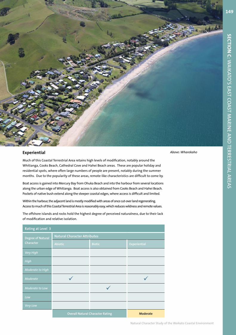
Much of this Coastal Terrestrial Area retains high levels of modification, notably around the
Whitianga, Cooks Beach, Cathedral Cove and Hahei Beach areas. These are popular holiday and
residential spots, where often large numbers of people are present, notably during the summer
months. Due to the popularity of these areas, remote-like characteristics are difficult to come by.
Boat access is gained into Mercury Bay from Ohuka Beach and into the harbour from several locations
along the urban edge of Whitianga. Boat access is also obtained from Cooks Beach and Hahei Beach.
Pockets of native bush extend along the steeper coastal edges, where access is difficult and limited.
Within the harbour, the adjacent land is mostly modified with areas of once cut-over land regenerating.
Access to much of this Coastal Terrestrial Area is reasonably easy, which reduces wildness and remote values.
The offshore islands and rocks hold the highest degree of perceived naturalness, due to their lack
of modification and relative isolation.
SECTIO
N C
: WA
IKATO
’S EAST C
OA
ST MA
RIN
E AN
D TER
RESTR
IAL A
REA
S149
Natural Character Study of the Waikato Coastal Environment

Coastal Terrestrial Area 10: Whitianga Specific Characteristics at Level 4
These are mapped with reference to Map 15
Area Rating Key Values Additional Comments
Mahurangi Island Group
Very High • Offshore Islands and rocks, retain very high levels of naturalness due to their lack of abiotic and biotic modification.
• Windswept and eroded offshore island group. Exposed rocky shores and headlands and associated islets and semi-submerged reefs.
• Comprises 10 islands: Te Karaka Island; Mahurangi Island (Goat Island); Te Tio Island; Okorotere Island; Waikaranga Island; Motueka Island (Pigeon Island); Poikeke Island; Moturoa Island (Tower Island); Motukorure Island (Centre Island) and Mahungarape Island (Round Island).
• Naturalness is amplified by grouping.
Eastern Whitianga Harbour
High • Regenerating harbourside hills, largely manuka kanuka with some wilding pines.
• Forms immediate south eastern backdrop to township of Whitianga, therefore has high experiential values.
• Majority of Kaitoke Scenic Reserve included and QEII lands in the northernmost part
Cathedral Cove High • Spectacular coastal arch, isolated stack (Te Horo Rock) and impressive cliffs of white ignimbrite at Cathedral Cove.
• Ribbon of indigenous bush skirts the steep coastal fringe. Includes vegetated hill west of Haihei.
• High experiential values due to the bush lined white sands and recognisable landforms of Te Horo Rock and Cathedral Cove.
• Some modification evident, including track and car parking area. Very popular beach which reduces experiential naturalness
Whitianga Harbour Islands
High • Small, low-lying islands within the harbour covered with indigenous vegetation.
• Abiotically and biotically, unmodified
• Refer to Coastal Marine Area C for further description of this estuary
Te Pupuha Point High • Forest clad island and peninsula with dramatic cliffs and rocky shores. Abiotically, unmodified;
• Part of Te Pupuha Recreation Reserve
• High experiential values due to remote-like qualities and limited modification
• Includes small area of modification on point and track
Eastern Whitianga HarbourCathedral Cove
Mahurangi Island Group
Te Pupuha Point
Whitianga Harbour Islands
0 2 km°
Legend
Extent of Coastal Environment
Coastal Terrestrial Area 10: Whitianga
Whitianga Coastal Natural Character Ratings: Level 4High
Very High
Cathedral Cove
Mahurangi Island Group
Te Pupuha Point
150
Natural Character Study of the Waikato Coastal Environment

Eastern Whitianga HarbourCathedral Cove
Mahurangi Island Group
Te Pupuha Point
Whitianga Harbour Islands
0 2 km°
Legend
Extent of Coastal Environment
Coastal Terrestrial Area 10: Whitianga
Whitianga Coastal Natural Character Ratings: Level 4High
Very High
Cathedral Cove
Mahurangi Island Group
Te Pupuha Point
Map 15
SECTIO
N C
: WA
IKATO
’S EAST C
OA
ST MA
RIN
E AN
D TER
RESTR
IAL A
REA
S151
Natural Character Study of the Waikato Coastal Environment

Hot Water BeachCOASTAL TERRESTRIAL AREA 11:
0 1.6 km°
152
Natural Character Study of the Waikato Coastal Environment

Coastal Characteristics, Coastal Environment Extent and Coastal Context Area
This Coastal Terrestrial Area includes the broad northerly located sandy bay of Hot Water Beach
and a steep and rocky coastline further south. The land use around the beach is highly modified
pastoral plains, while further south, the more rugged terrain is more remote in character, backed
by kanuka/manuka coastal hills which are sparsely inhabited.
Key coastal characteristics include: popular natural hot water springs at Hot Water Beach;
inaccessibility to the central rugged coastline; gently sloping ridgelines tending eastwards; small
stony beaches with rocky, exposed sea cliffs with rock platforms; short, steep streams draining
the narrow gullies; manuka/ kanuka which extends from the tops of ridgelines to the coast in
some areas, two small vegetated islands, Castle Island approximately 6km off Hot Water Beach
and Waipapa Island, 400m off the rugged mid-section of the coast.
Beyond the coastal environment, the coastal context land rises into the Coromandel Ranges to the
southwest and the Whenuakite River valley to the north-west, the former predominantly covered
in indigenous shrubland and forest within the conservation land, managed by the Department of
Conservation and the latter predominantly in rural production land and plantation forestry.
Abiotic
The Hot Water Beach Coastal Terrestrial Area includes rhyolitic and dacitic volcanic rocks and
landforms that characterise this coastline, rising to 277 metres above sea level at Tapuaetahi.
Comprising predominantly of volcanic material that erupted from massive calderas around eight
million years ago, the rocks have been sculpted both tectonically and through fluvial, climatic
and marine forces to create a unique area that comprises probably the Coromandel’s best know
Geopreservation Site: the popular Orua Hot Springs (or Hot Water Beach). This one of the very
few hot springs at sea level in New Zealand.
This Coastal Terrestrial Area is rocky, with sides and small catchments, where many of the
watercourses are ephemeral and typically steep and short. Some small river valleys extend inland
Above: Hills south of the settlement of Hot Water Beach
SECTIO
N C
: WA
IKATO
’S EAST C
OA
ST MA
RIN
E AN
D TER
RESTR
IAL A
REA
S153
Natural Character Study of the Waikato Coastal Environment

behind the volcanic headlands at Tairua and Hot Water Beach. Wetlands would have originally
been associated with these poorly drained river valleys, but are now drained.
Landforms are relatively unmodified except in valley floors. There are steep to very steep rocky
coastal faces with rocky outcrops and reefs. In some places roads truncate the slope to gain
access to the sea. Beaches tend to be sandy.
Biotic
Land cover analysis: The total land area of the Hot Water Beach Coastal Terrestrial Area is
2,326ha. This includes 3.8ha of islands. Of this, 55% of the land cover is indigenous shrubland,
23% is rural production land and 16% is indigenous forest, Of the remainder, almost 4% is
exotic treeland and there are very small areas (<1% each) of artificial surfaces, bare surfaces and
waterbodies, in aggregate covering only 1.7%. There is no exotic scrub, mangroves or indigenous
wetlands. The total indigenous land cover is 72%. Extensive indigenous forest/shrubland and
extensive riparian cover except in the river valleys
Rural production land dominates the northern extent of this area where the land is accessible
and rolling country. Pockets of indigenous cover exist along the coastal edge and notably the Hot
Water Beach Dunelands. Some modification of dune systems at Hot Water Beach has occurred
and rear dune wetlands drained. However indigenous coastal forest extends right to the dunes
at Te Karo Bay and Otara Bay.
Generally steep catchments and incised stream gullies dominate the land form south of Hot Water
Beach, supporting indigenous shrubland regeneration. Further south toward Te Ororoa Point the
vegetation cover becomes dense and connects to Coromandel Forest Park conservation land.
North Island Brown Kiwi are present in increasing numbers in the Whenuakite area and these
provide a population to migrate landward and recolonize indigenous shrubland in the Coastal
Context Zone.
Formal protection of larger areas of shrubland and forest in Forest Park and QEII covenantsBelow: Rugged and remote coastline south of Hot Water Beach
154
Natural Character Study of the Waikato Coastal Environment

Rating at Level 3
Degree of Natural
Character
Natural Character Attributes
Abiotic Biotic Experiential
Very High
High
Moderate to High Moderate
Moderate to Low
Low
Very Low
Overall Natural Character Rating Moderate to High
Experiential
Much of this Coastal Terrestrial Area is relatively isolated, rocky and remote with access restricted to only
a few points in the north and south. Of those, the most popular is Hot Water Beach in the north where
access is provided by Hot Water Beach Road. A small settlement is nestled at the southern end of the
beach. During the summer, this beach becomes extremely busy, eroding remote-like qualities. The beach
holds higher experiential values to the north, away from the modifications and people to the south.
Road access is provided to the southern half of this Coastal Terrestrial via Sailors Grave Road and
Pumpkin Hill Road. Walking access is available by the Lynch Stream Track, which leads people
through a community-based kiwi restoration project.
High perceived naturalness values are present where modifications are low, which include part of
the dramatic Orua Bay cliffs and those to the south around Tapuaetahi and Lynch Stream.
Below: Waipapa Island
SECTIO
N C
: WA
IKATO
’S EAST C
OA
ST MA
RIN
E AN
D TER
RESTR
IAL A
REA
S155
Natural Character Study of the Waikato Coastal Environment

Coastal Terrestrial Area 11: Hot Water Beach Specific Characteristics at Level 4
These are mapped with reference to Map 16
Area Rating Key Values Additional Comments
Hot Water Beach High • Geothermal hot springs at the southern end of Hot Water Beach.
• Hot Water beach has a largely intact dune system featuring a large area of spinifex.
• Virtually no abiotic or biotic modifications.
• Very popular beach due to the hot springs and surf break.
• Hot Water Beach dune system is a DOC recreation reserve.
Lynch Stream Very High • Wildness and remote experiential values along the rocky and indigenous bush-clad coastline.
• Exposed rocky cliffs, shores and beaches
• Exceptional vegetation sequence from ridge to shore
• Areas of development to the north and south of this area are excluded. Includes the Lynch Walking Track. Which along with several other smaller tracks, form the only access to this coastline.
• Comprised mainly of Coromandel State Forest Park (notably southern sections) and an area of QEII land in Otara Bay.
Tapuaetahi High • Although patchy, regrowth vegetation retains high levels of natural character.
• Numerous QEII covenants occupy this area
• Isolated and remote coastal area
• Excludes areas of pasture
• Occasional track evident.
Orua Bay Cliffs High • Narrow, cliffed headlands with rocky shores, semi submerged reefs and rock outcrops protrude from the mainland. Abiotically, unmodified.
• High experiential values due to low levels of modification.
• Excludes modified pasture beyond
Sailors Grave High • Indigenous vegetation with limited modification
• High experiential values due to low levels of modification.
• Includes Sailors Grave Road and the sporadically located house. Forms small part of DOC land.
Lynch Stream
Sailors Grave
Tapuaetahi
Orua Bay Cliffs
Hot Water Beach
0 1 km°Legend
Extent of Coastal Environment
Coastal Terrestrial Area 11: Hot Water Beach
Hot Water Beach Coastal Natural Character Ratings: Level 4High
Very High
156
Natural Character Study of the Waikato Coastal Environment

Lynch Stream
Sailors Grave
Tapuaetahi
Orua Bay Cliffs
Hot Water Beach
0 1 km°Legend
Extent of Coastal Environment
Coastal Terrestrial Area 11: Hot Water Beach
Hot Water Beach Coastal Natural Character Ratings: Level 4High
Very High
Map 16
SECTIO
N C
: WA
IKATO
’S EAST C
OA
ST MA
RIN
E AN
D TER
RESTR
IAL A
REA
S157
Natural Character Study of the Waikato Coastal Environment

TairuaCOASTAL TERRESTRIAL AREA 12:
0 3.2 km°
158
Natural Character Study of the Waikato Coastal Environment

Coastal Characteristics, Coastal Environment Extent and Coastal Context Area
This Coastal Terrestrial Area extends from the township of Tairua in the north and extends to
Whangamata in the south. The Coastal Terrestrial Area includes the harbours of Pauanui in
the north and Whangamata in the south and is generally modified for farming and commercial
forestry use, although some large areas are protected for conservation purposes.
Coastal characteristics include: eastern facing hill country interspersed with small gullies, short
streams and shallow indented rocky bays at the coast; generally a highly modified and easily
accessible coastline, with planted in exotic forestry, patches of manuka/kanuka and pasture; long
white sandy beaches; settlements of Tairua, Pauanui, Opoutere and Whangamata; Tairua River and
Harbour; Wharekawa River and Harbour; Whangamata Harbour; small vegetated offshore islands
groups including Shoe and Slipper Islands and the small group off the coast by Whangamata.
Beyond the coastal environment, the coastal context extends westwards slowly gaining in
elevation to the rugged, forest clad Coromandel Range.
Abiotic
The Tairua Coastal Terrestrial Area forms part of the Whitianga Group of Late Miocene – Early
Pleistocene age of volcanic rocks and associated features. The Paku rhyolite dome (located at
the northern entrance to Tairua Harbour) and perlite locality includes exposures of a multi stage
eruptive complex. It is mostly modified due to housing and roads however forms as a significant
local feature in this part of the Coastal Terrestrial Area.
The topography is steep, rising to 387 metres above sea level at Pauanui, however there are large
areas of alluvial deposits and coastal sands, which, like other Coastal Terrestrial Areas support the
main areas of settlement.
Immediately south of this are the Geopreservation Sites of Pauanui barrier spit (a superb example
of a large barrier spit) and Pauanui eroded columnar jointing, an example of progression of
different stages of erosion of a columnar jointed lava flow.
Further inland and adjacent to the Tairua Harbour is the Woody Hill Forest rhyolite, a well
exposed volcanic neck and dike system. To the south is the modified Whangamata cuspate
foreland that contains the whole township.
Offshore are the Geopreservation sites of Slipper Island boulder barrier and the Slipper Island
scoria cone. Of the numerous small islands off Whangamata, Whenuakura Island has a large
collapsed blow hole which has formed a small beach inside the island.
Tairua Harbour is a barrier enclosed river estuary, 6 km2 in area, 51 per cent of which is intertidal.
Above: Houses dominate Paku and is part of the settlement of Tairua
SECTIO
N C
: WA
IKATO
’S EAST C
OA
ST MA
RIN
E AN
D TER
RESTR
IAL A
REA
S159
Natural Character Study of the Waikato Coastal Environment

It is sheltered from the sea by the Pauanui sand spit and Paku Mountain. Sediment has built
up over time creating sand banks, especially at low tide. Modification to this catchment has to
varying extents altered natural patterns and processes, resulting in sedimentation issues and
increased erosion in some places.
Other key harbours in this Coastal Terrestrial Area include Wharekawa Harbour and Whangamata Harbour.
Biotic
Land cover analysis: The total land area of the Tairua Coastal Terrestrial Area is 8,030ha. This
includes 288ha of islands. Of this, almost 42% of the land cover is exotic treeland, 20% is rural
production land, 14% is artificial surfaces, 11% is indigenous shrubland and 10% is indigenous
forest. Of the remainder, almost 1% is indigenous wetland and there are very small areas (<1%
each) of bare surfaces, exotic scrub, mangroves and waterbodies, in aggregate covering only 1.3%.
The total indigenous land cover is 22%.
The indigenous land cover is mainly concentrated in the area of the Coromandel Forest Park that
extends into the Area and the Pauanui Conservation Area that extends around the headland
south of Pauanui. There are also small areas of QEII covenants and scenic reserves. Otherwise
the Area is dominated by plantation forestry on most rolling to steep land and rural production
land generally located on the flatter more accessible land in the river valleys. Where it exists, the
fringe of coastal forest on the steep rocky faces from Tairua to Ohui and from Ruahiwihiwi Point
to Whangamata, are very narrow and highly modified.
Although most waterways comprise short, steep catchments, they discharge into the larger
Tairua and Wharekawa Rivers and the Tairua, Wharekawa and Whangamata Harbours. Most
waterway and wetland habitat is associated with the harbours and their associated plains with
high groundwater and flat poorly drained soils. Moderate areas of mangrove and saltmarsh
vegetation remain but are much reduced from the historic extent and natural sequences to
freshwater wetlands and riparian forest have been lost. The same is true of Slipper Island which
has been subject to extensive drainage.
Channel modification, land drainage and infilling are common to facilitate both rural production
and settlement. There are artificial waterways at Pauanui.
There is extensive modification of dune systems at Whangamata and Pauanui and the few
remnants of coastal forest vegetation that would originally have existed are highly modified.
Above: Shoe Island (Motuhoa)
160
Natural Character Study of the Waikato Coastal Environment

Rating at Level 3
Degree of Natural
Character
Natural Character Attributes
Abiotic Biotic Experiential
Very High
High Moderate to High Moderate
Moderate to Low
Low
Very Low
Overall Natural Character Rating High
Most riparian cover is provided by plantation forestry. Indigenous riparian vegetation is limited
and highly modified, except where indigenous shrubland creates full cover on the ridgeline to the
south of Pauanui. Aquatic macroinvertebrate communities are likely to be relatively diverse and
comprised of sensitive species after plantation canopy closure is achieved, but will be affected by
the increased light penetration and increased erosion induced by harvesting. In rural production
areas, aquatic macroinvertebrate communities are likely to less diverse and be dominated by
pollution-tolerant fauna.
Whereas Slipper Island is almost entirely rural production land, Shoe (Motuhoa), Hauturu,
Whenuakura, Rawengaiti, Penguin and Rabbit islands are fully vegetated with indigenous forest
or shrubland cover. Tuatara roamed on Whenuakura Island until fairly recently.
Experiential
Boat access is gained into Tairua Harbour from a number of locations, including Tairua, Pauanui
and from off Tangitarori Lane. Further south, boat access is also gained into Whangamata
Harbour from Whangamata.
Associated with these areas is the rural farmland and orchards that line the valleys and lower slopes.
Human modification is apparent along with the recreational activity associated with water based
recreation and the residential settlements of Tairua, Pauanui, Opoutere, Onemana and Whangamata.
Between Tairua and Opoutere the coastline is dominated by native vegetation cover on steep terrain
at the edge with the remainder dominated by pine forestry plantation and associated access. Access
is limited and there is a strong sense of remoteness in this area at the coastal edge only.
Offshore, the small group of remote and unmodified islands off Whangamata (Hauturu Island,
Maukaha Rocks, Whenuakura Island and Rawengaiti Island) hold very high perceived naturalness
values. It is possible to wade out to Hauturu Island at low tide and is a popular for rock-pool
fossickers and kayakers.
SECTIO
N C
: WA
IKATO
’S EAST C
OA
ST MA
RIN
E AN
D TER
RESTR
IAL A
REA
S161
Natural Character Study of the Waikato Coastal Environment

Coastal Terrestrial Area 12: Tairua Specific Characteristics at Level 4
These are mapped with reference to Map 17
Area Rating Key Values Additional Comments
Motuhoa Shoe Island
Very High • Indigenous forest clad unmodified vegetation cover.
• Abiotically unmodified.
• Includes entire Island.
Western Tairua Slopes
High • Large area of indigenous vegetation on the slopes directly west of Tairua.
• High experiential values;
• Provides vegetated western backdrop to Pauanui and Tairua.
• Excludes houses at lower elevations
• Forms part of the broader central indigenous vegetation cover of central peninsula
• Managed as part of Coromandel State Forest Park and includes Red Bridge Walk.
Penguin & Rabbit Islands
Very High • Exposed Islands retaining intact indigenous vegetation. Abiotically unmodified.
• Very high experiential naturalness.
• Excludes modifed Slipper Island
• Naturalness amplified due to small grouping.
Pakahakaha High • Fringe of coastal forest on the steep rocky faces from Tairua to Ohui and from Ruahiwihiwi Point to Whangamata, hold high levels of abiotic and biotic naturalness.
• Excludes modified land further inland
Islands off Whangamata
Very High • Indigenous forest clad and unmodified islands.
• Spectacular, unmodified blow-hole on Whenuakura Island
• All islands collectively amplify experiential naturalness
• Comprises: Hauturu Island; Maukaha Rocks; Whenuakura Island and Rawengaiti Island.
• All four islands are part of the Whangamata Islands Wildlife Sanctuary.
Pauanui High • Pauanui Conservation Area
• Regenerating forest covered slopes with unmodified slopes.
• High levels of perceived naturalness
• Includes Pauanui Summit Walk, however excludes areas of settlement above Hikuai Settlement Road
162
Natural Character Study of the Waikato Coastal Environment

Pauanui
Western Tairua Slopes
Pakahakaha
Motuhoa Shoe Island
Islands off Whangamata
Penguin and Rabbit Islands
0 3 km °
Legend
Extent of Coastal Environment
Coastal Terrestrial Area 12: Tairua
Tairua Coastal Natural Character Ratings: Level 4High
Very High
Islands off Whangamata
Islands off Whangamata Group Level 4 Rating
Pakahakaha
Pakahakaha Level 4 Rating
Map 17
SECTIO
N C
: WA
IKATO
’S EAST C
OA
ST MA
RIN
E AN
D TER
RESTR
IAL A
REA
S163
Natural Character Study of the Waikato Coastal Environment

WhiritoaCOASTAL TERRESTRIAL AREA 13:
0 1.8 km°
164
Natural Character Study of the Waikato Coastal Environment

Coastal Characteristics, Coastal Environment Extent and Coastal Context Area
Extending from the southern banks of the Otahu River at Whangamata in the north to the region’s
boundary with the Bay of Plenty, this Coastal Terrestrial Area occupies the southernmost extent of
the Coromandel Peninsula’s Eastern Coast. The coastline is relatively straight and in places rugged.
Key coastal characteristics include: Gentle ridgelines and spurs that terminate at coastal cliffs;
narrow, linear rocky beaches; small sandy embayments boarded by narrow rock outcrops; small
areas of native forest that extend from the ridge summits to the coast at Homunga Bay and
Otonga Point, near Whiritoa; pastoral farming; blocks of exotic forestry dotting the hillsides;
regenerating scrub contained to gullies and hilltops; inaccessible coastline by vehicle; and a bach
settlement located behind the white sandy Whiritoa Beach.
Inland of this coastal environment, the coastal context contains pastoral farming land which
extends on the elevated hill country and narrow valleys beyond the first coastal ridge. Further
beyond this is the Coromandel Forest Park and Coromandel Range.
Above: Southern part of Whiritoa
SECTIO
N C
: WA
IKATO
’S EAST C
OA
ST MA
RIN
E AN
D TER
RESTR
IAL A
REA
S165
Natural Character Study of the Waikato Coastal Environment

Abiotic
The Whiritoa Coastal Terrestrial Area forms part of the Whitianga Group of Late Miocene – Early
Pleistocene age of volcanic rocks and activity. It includes steep and in places very steep terrain, rising to
324 metres above sea level just north of Homunga Bay, although areas of alluvial flats (notably around
Whiritoa) are also evident. Most of these steep coastal faces drain directly to the coastal marine area.
Of particular note is the Tunaiti caldera geology section, a well-exposed sequence of rhyolite
domes and flows, deformed sediments andesite and dacite lava flows, ignimbrites and pyroclastic
fall deposits, which are interpreted as a section across a caldera structure.
Other Geopreservation Sites include the Whiritoa blowhole, which is considered the most
spectacular active blowhole on the Coromandel Peninsula and Mataora Beach and abandoned
beach ridges which is classified as an extremely well defined landform of scientific and
educational value.
The coastline is rocky, with steep impressive coastal cliffs and short beaches, many of which
are unmodified. Rocky outcrops are particularly noticeable, especially in the northern part of
this Coastal Terrestrial Area. Alluvial deposits are concentrated at the mouths of the numerous
watercourses that drain this Coastal Terrestrial Area, the longest of which is the Ramarama Stream.
Above: Mataora Bay
Natural Character Study of the Waikato Coastal Environment
166

Biotic
Land cover analysis: The total land area of the Whiritoa Coastal Terrestrial Area is 2,384ha. This
includes 1.2ha of islands. Of this, 31% of the land cover is rural production land, 26% is exotic
treeland and almost 15% is indigenous shrubland. 11% and 10% is indigenous forest. Of the
remainder, 2% is artificial surfaces, 2% is exotic scrub and there are very small areas (<1% each) of
bare surfaces, indigenous wetlands and waterbodies, in aggregate covering only 0.8%. There are
no mangroves. The total indigenous land cover is 38%.
The indigenous shrubland and forest cover is mainly concentrated on the headlands south of
Whangamata (around Tunaiti and Opitoiti) and Whiritoa (around Te Keho) and the Orokawa Bay
Scenic Reserve. These large patches frame the vegetation patterns in this Area. Elsewhere, the
coastal forest and shrubland is generally present as very narrow/small, fragmented and highly
modified vegetation. In between the large patches, land cover dominated by rural production
and large patches of plantation forestry.
Most waterways comprise short, steep catchments draining directly to the coast in narrow valleys. These
Where the streams discharge at small beaches as at Whiritoa, Waimana Bay and Mataora Bay there is
often a small area of saltmarsh modified by infilling and land drainage. Historic sequences to freshwater
wetlands and coastal forest have been lost. Channel modification, land drainage and infilling are common
to facilitate both rural production and settlement. There are artificial waterways at Pauanui.
There is extensive modification of dune systems at most beaches due to settlement and rural
production. All natural sequences from dunes to coastal forest have been lost and the very small areas
with coastal forest adjacent to the beach are highly modified.
Riparian vegetation cover varies substantially through the area. Good riparian cover is provided in
the three main patches of indigenous shrubland. However, where the land cover is rural production,
most riparian vegetation has been removed. Where riparian cover is provided by plantation forestry,
the extent and quality of cover will depend on harvest cycles. Likewise, aquatic macroinvertebrate
communities will vary depending on land cover, with relatively diverse communities of sensitive
species in permanent shrubland and after plantation canopy closure is achieved. Aquatic
macroinvertebrate communities that are less diverse and dominated by pollution-tolerant fauna will
occur with increased light penetration, erosion and inputs from rural production.
Above: Rugged southern coastline. Pohutukawa coming into flower
SECTIO
N C
: WA
IKATO
’S EAST C
OA
ST MA
RIN
E AN
D TER
RESTR
IAL A
REA
S167
Natural Character Study of the Waikato Coastal Environment

168
Natural Character Study of the Waikato Coastal Environment

Experiential
Whiritoa settlement remains the only residential settlement in this area. The remainder of
the land is dominated by grazing farmland on the plains and rolling foothills with the steeper
slopes dominated by productive forestry. Remnant pohutukawa outcrops provide subtle and
intimate places high in perceived naturalness but on the whole this area is largely modified
by human land use change and recreational activity. Access to this Coastal Terrestrial Area is
limited to a few areas (such as at the settlement of Whiritoa) so the remaining coastal areas
retain high levels of remoteness.
Two offshore rocks, one at Waimama Bay and one south of Mataora Stream hold very high levels
of perceived naturalness due to their unmodified and eroded forms.
Natural processes are prevalent at the Blowhole at the southern end of Whiritoa Beach.
Rating at Level 3
Degree of Natural
Character
Natural Character Attributes
Abiotic Biotic Experiential
Very High
High
Moderate to High Moderate Moderate to Low
Low
Very Low
Overall Natural Character Rating Moderate
SECTIO
N C
: WA
IKATO
’S EAST C
OA
ST MA
RIN
E AN
D TER
RESTR
IAL A
REA
S169
Natural Character Study of the Waikato Coastal Environment

Coastal Terrestrial Area 13: Whiritoa Specific Characteristics at Level 4
These are mapped with reference to Map 18
Area Rating Key Values Additional Comments
Opitoiti High • Steep, unmodified rocky cliffs, rocky outcrops and beaches, including the Whiritoa Blow Hole.
• Remnant pohutukawa outcrops provide subtle and intimate places high in perceived naturalness
• The area is demarcated by the top of the ridge or where the cliffs interface with modified areas such as commercial forestry or pasture.
Homunga Bay High • Headlands and hillsides framing Homunga Bay form a modified sequence of indigenous coastal bush which in places stretches from the first ridge to the coast.
• Falls into part of Orokawa Bay Scenic Reserve.
• Scattered wilding pines present. Interspersed by pastoral farmland
Tunaiti High • Regenerating forest covered slopes
• High levels of perceived naturalness
• Extends to Otahu River
Whiritoa Offshore Rocks
Very High • Indigenous forest covered rocky islets
• Very high levels of perceived naturalness due to their unmodified and eroded forms.
• Includes entire rock group
Te Keho High • Regenerating forest covered slopes
• High levels of perceived naturalness
• Excludes modified lower lands and landfill. Includes tracks.
170
Natural Character Study of the Waikato Coastal Environment

Te Keho
Tunaiti
Homunga Bay
Opitoiti
Whiritoa Offshore Rocks
0 1 km °
Legend
Extent of Coastal Environment
Coastal Terrestrial Area 13: Whiritoa
Whiritoa Coastal Natural Character Ratings: Level 4High
Very High
Opitoiti
Whiritoa Offshore Rocks
Whiritoa Offshore Rocks Level 4 Rating
Map 18
SECTIO
N C
: WA
IKATO
’S EAST C
OA
ST MA
RIN
E AN
D TER
RESTR
IAL A
REA
S171
Natural Character Study of the Waikato Coastal Environment

Outer Island GroupsCOASTAL TERRESTRIAL AREA 14:
0 6 km °
172
Natural Character Study of the Waikato Coastal Environment

Coastal Characteristics, Coastal Environment Extent and Coastal Context Area
This Coastal Terrestrial Area comprises the outer island groups, which are located offshore of the
Coromandel’s eastern coastline. The islands include Cuvier (Repanga) Island, the Mercury Island
group and the Alderman Island group. These island vary in size, complexity and shape, however
form an important identity to Coromandel.
Situated at southern end of the Colville Channel between the Coromandel Peninsula and Great
Barrier Island, Cuvier Island is a Department of Conservation managed wildlife sanctuary and is
now largely vegetated in regenerating indigenous forest cover. The island is fringed by steep sea
cliffs and rocky shores with several prominent narrow headlands and steep peninsulas.
Further south are the Mercury Islands, located approximately 6km east of the Kuaotunu
Peninsula and comprise of some seven principal islands which include Great Mercury Island
(Ahuahu), Green Island, Atiu or Middle Island, Korapuki Island, Kawhitu or Stanley Island, Double
(Moturehu) Island and Red Mercury Island. The islands are of volcanic origin and are largely
fringed by rocky shores and small, shallow bays. Great Mercury Island is the only island where
people reside.
The Aldermen Island archipelago, located offshore from Pauanui comprises five main islands
which include Hongiora, Ruamahuanui, Nga Horo, Half and Ruamahuaiti Island. The islands
form a DOC managed nature reserve/wildlife sanctuary and are covered with regenerating native
bush. The islands are fringed with steep sea cliffs with rocky shores. Ridgelines rise to 100masl
at the middle of the larger islands.
Key coastal characteristics of these islands include: remote, mostly inaccessible islands with
modified vegetation that is recovering.
Above: Great Mercury Island (Ahuahu)
SECTIO
N C
: WA
IKATO
’S EAST C
OA
ST MA
RIN
E AN
D TER
RESTR
IAL A
REA
S173
Natural Character Study of the Waikato Coastal Environment

Abiotic
The Outer Island Groups Coastal Terrestrial Area are principally remnants from former
volcanic activity. All island groups form part of a gently arcuate line of offshore rhyolite
centres, extending from the Poor Knight Islands in the north through to Mayor Island in the
south. Particular focus is on the central group comprising Cuvier, Mercury and Aldermen
Islands that fall within this study area.
Due to exposure from the sea as well as other tectonic and fluvial forces, the islands have
been sculpted over time to hold an array of notable geological features, many of which are listed
as a geopreservation sites. Most have steep rock coasts, with cliffs, rocky outcrops and numerous
islets. The highest point is on Great Mercury Island of 231 metres above sea level at Mohi
Mountain.
Specifically the Cuvier Island tourmalinised rocks represents a good example of exposed large
black crystals of tourmaline evident from the shoreline.
On the Mercury Islands, there are several noted features, including the White Cliffs on Great
Mercury Island; the Korapuki Sea Arch; the Stanley Island basalt vents and cone; and Red Mercury
Island basalt.
The exposed parts of the Aldermen Islands form part of a larger submarine platform that has
been eroded almost entirely by wave action. Steep rhyolite features, including the Aldermen
Islands coastal features (a range of spectacular rocky coastal landforms such as spires, needles
and vertical bluffs that extend through the archipelago); and the Ruamahuaiti andesite flow on
Ruamahuaiti Island.
Due to the exposed location of these islands very few frosts, if any, are experienced here with
lower rainfall than the mainland.
Above: Giant weta (Photograph: Department of Conservation) Main Image: Exposed cliffs on Red Mercury Island (Whakau)
174
Natural Character Study of the Waikato Coastal Environment

Above: Coralie Bay on Great Mercury Island (Ahuahu)
Biotic
Land cover analysis: The total land area of the Outer Island Groups Coastal Terrestrial Area is
2,384ha which is entirely comprised of islands. Of this, 32 % of the land cover is exotic treeland,
29% is rural production land, 20% is indigenous shrubland, 14% is indigenous forest. Of the
remainder, 4% is bare surfaces, 2% is exotic scrub and there are very small areas (<1% each) of
bare surfaces and there are no artificial surfaces, exotic scrub, mangroves, indigenous wetlands,
or water bodies. The total indigenous land cover is 35%.
The larger Great Mercury Island has one sheltered inlet- Home Bay and is the only inhabited
island of the group. Great Mercury is highly modified with exotic forest covering the majority
of southern end of the island and rural production land covering the northern half of the island.
Although the short waterways and small wetlands on Great Mercury are relatively unmodified in
terms of drainage and channels, riparian cover has largely been removed on the northern half and
is comprised of plantation forestry on the southern half. The unique aquatic macroinvertebrate
fauna that could have existed in this combination of volcanic soils and coastal environment here
are likely to be largely lost.
The remainder of the islands form a DOC managed nature reserve and are important wildlife
habitats, largely covered in unmodified or regenerating native vegetation. The few small
waterways on these islands have full riparian cover.
Threatened and endangered species include tutatara, giant centipedes; lizards (geckos and
skinks) and tusked weta and giant weta. These islands also support large populations of seabirds,
notably petrels, storm petrels and shearwaters.
SECTIO
N C
: WA
IKATO
’S EAST C
OA
ST MA
RIN
E AN
D TER
RESTR
IAL A
REA
S175
Natural Character Study of the Waikato Coastal Environment
176
Natural Character Study of the Waikato Coastal Environment

Experiential
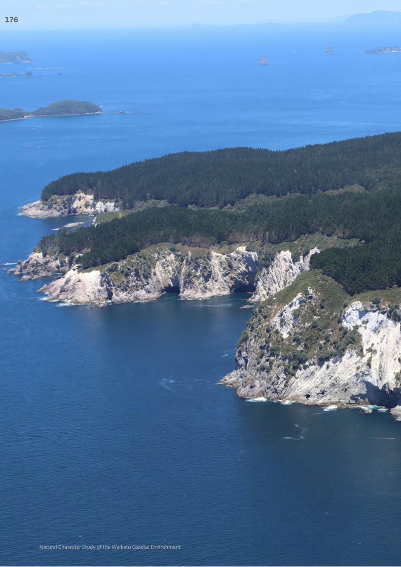
With the majority of the offshore islands being managed by DOC including the Mercury Group
(although excluding Great Mercury Island), Cuvier Island and the Aldermen Islands, these all
hold very high degrees of perceived naturalness values due to their lack of modification and
remoteness from the mainland. Many of these islands hold endangered fauna, including tuatara,
Middle Island tusked weta and the Duvaucel gecko. Due to these very high biotic values, people
are not permitted access to most of these islands.
Ephemeral activity such as the changing seasons and presence of wildlife amplifies the natural
processes of these islands which are accentuated by the lack of human presence. Overall, these
islands hold very high levels of perceived naturalness.
Rating at Level 3
Degree of Natural
Character
Natural Character Attributes
Abiotic Biotic Experiential
Very High High Moderate to High
Moderate
Moderate to Low
Low
Very Low
Overall Natural Character Rating Very High
Image below: Cuvier Island
Inset below: Castle Island
Left: White cliffs of Great Mercury Island
SECTIO
N C
: WA
IKATO
’S EAST C
OA
ST MA
RIN
E AN
D TER
RESTR
IAL A
REA
S177
Natural Character Study of the Waikato Coastal Environment

Coastal Terrestrial Area 14: Outer Island Groups Specific Characteristics at Level 4
These are mapped with reference to Map 19
Area Rating Key Values Additional Comments
Cuvier Island Very High • Cuvier Island is a nationally significant Geopreservation Society feature;
• Impressive tourmalinised rocks evident;
• Endangered flora and fauna evident on island and a DOC sanctuary;
• Very high degrees of perceived naturalness values due to the lack of modification and remoteness from the mainland
• Includes entire island.
Eastern Mercury Islands
Very High • Stanley Island and Red Mercury Island are regionally significant Geopreservation Society features;
• Endangered flora and fauna evident on islands and a DOC sanctuary;
• Very high degrees of perceived naturalness values due to the lack of modification and remoteness from the mainland
• Island include: Korapuki Island; Green Island; Atiu or Middle Island; Kawhitu or Stanley Island; Double Island (Moturehu) and Red Mercury Island (Whakau).
• The modified parts of Great Mercury Island are excluded from this rating
• Collectively these islands amplify abiotic, biotic and experiential naturalness.
Aldermen Islands
Very High • The Aldermen Island Group are a regionally significant Geopreservation Society’s feature;
• Endangered flora and fauna evident on islands and a DOC sanctuary;
• Very high degrees of perceived naturalness values due to the lack of modification and remoteness from the mainland
• Islands include: Hongiora; Middle Island; Ruamahuanui Island; The Spire; Nga Horo Island; Half Island; Ruamahuaiti Island and Big and Little Hump.
• Collectively these island amplify abiotic, biotic and experiential naturalness.
178
Natural Character Study of the Waikato Coastal Environment

Cuvier Island
Eastern Mercury Islands
Aldermen Islands
0 8 km °
Eastern Mercury Islands
Eastern Mercury Islands Level 4 Rating
Cuvier Island
Cuvier Island Level 4 Rating
Aldermen Islands
Aldermen Islands Level 4 Rating
Legend
Outer Island Groups Coastal Natural CharacterRatings: Level 4
Extent of Coastal Environment
Coastal Terrestrial Area 14: Outer Island Groups
High
Very High
Map 19
SECTIO
N C
: WA
IKATO
’S EAST C
OA
ST MA
RIN
E AN
D TER
RESTR
IAL A
REA
S179
Natural Character Study of the Waikato Coastal Environment

Overall Evaluation – Level 4At the more specific Level 4 scale, individual bays, estuaries, headlands and islands have been
mapped to illustrate those areas holding high or very high levels of natural character. This more
detailed mapping has only been undertaken where specific mention or detail has been included
about a smaller area within the broader ‘Area’ of Level 3 descriptions and evaluations. For
example, specific mention is made of the Chenier Plains and RAMSAR site at Miranda within both
the Hauraki Coastal Terrestrial Area and the Firth of Thames Coastal Marine Area. Despite much
of the Chenier Plain being modified, the Outstanding Natural Character Area has been carefully
delineated to capture the most unmodified parts, along with the entire RAMSAR site.
Within some of the least modified areas, the extent of the high and very high mapped areas
has been more straight forward. For example, the island group of Motukawao, just north of
Coromandel Town within the Coastal Terrestrial Area of Colville, retains mature indigenous bush
which has to all intents and purposes avoided the impact of humans. The coastal waters around
these islands also retains very high levels of naturalness, again due predominantly to the lack of
human change and the resultant high ecological habitats. All of the areas that are mapped as
high or very high natural character within the 17 different Level 3 ‘Areas’, at the Level 4 scale, are
shown collectively on the map (Map 20) opposite.
Refer to Section E of this study for the separate mapping of the Outstanding Natural Character
Areas, which used this Level 4 mapping as a basis for further consideration.
Above: The indigenous, forest-clad islands of the Motukawao Group retain very high levels of natural character at the Level 4 scale
180
Natural Character Study of the Waikato Coastal Environment