1 tsunami: phase 1 - wikieducatorwikieducator.org/images/c/cb/phase_1_book.pdf · the diagram below...
TRANSCRIPT

PDF generated using the open source mwlib toolkit. See http://code.pediapress.com/ for more information.PDF generated at: Thu, 30 Sep 2010 05:29:23 UTC
Tsunami: Phase 1Print Version for Teacher Support
1

Contents
1. Introduction2. Phase 1: Defining tsunami
• Lesson 1
1. Defining tsunami2. What is a tsunami?3. Waves4. Wave energy5. Tsunami height6. Height & run-up7. Simulation
• Lesson 2
1. Warning sign2. Natural signs3. Official warnings4. Unofficial warnings
• Lesson 3
1. Tsunami Signs2. Signs quiz3. Phase 1 summary
3. Phase 2: The waves have gone... What now?
• Lesson 1
1. What now?2. Effects3. Physical impact
• Lesson 2
1. Social impact: could this be us?2. Diary activity3. Phase 2 summary
4. Phase 3: Tsunami survivor'
• Lesson 1
1. Prepare for survival2. Emergency plan
• Lesson 2
1. Escape routes
• Lesson 3
1. Getaway kit2. Plan activity
• Lesson 4
1. Assess the risk2. Tsunami game3. Survival Agent summary
5. Teaching Guide
2

Tsunami
TsunamiMany people throughout the world live in coastal areas. This may be due to lifestyle choices or simply because of the shape or size of their country.A real threat to any coastal area is that of a tsunami. This learning resource has been designed and developed to teach students about tsunami.Students will discover what tsunami are and how they occur. They will be given the opportunity to describe the damage tsunami can do to thephysical location, environment and social situation. During the final stages students will be given the chance to plan and prepare a survival plan forthe threat of a tsunami.
ObjectivesStudents will be able to:
• Define tsunami, describe how it occurs and identify the warning signs - both man-made and natural.• Describe the physical and social effects that a tsunami can have.• Design and evaluate survival plans and precautions against the threat of tsunami for their local context and other contexts.
3

Tsunami/Phase 1
Defining tsunamiWatch this video of the 2004 Boxing Day tsunami. Note: The linkbelow will send you to an external website.
If you are unable to watch the video you will not be disadvantagedin your learning.
Boxing Day tsunami - 2004 [1]
In 1960, a massive magnitude 9.5 earthquake off the coast of Chilegenerated a Pacific-wide tsunami causing thousands of deaths inChile, and hundreds of deaths in Hawaii, Japan and the Philippines.It also caused widespread damage on the east coast of New Zealandeven though the tsunami arrived at low tide. The tsunami wouldhave been far more destructive in New Zealand if it had struck athigh tide. More recent events like the Boxing Day tsunami in 2004(Indian Ocean) and the Solomon Islands tsunami in April 2007didn’t cause any damage in New Zealand, however significant risesin water level were recorded.
Survival AgentListen here <playmp3>Survival Agent
References[1] http:/ / www. youtube. com/ watch?v=KPJh2CdgR0A
4

Tsunami/Phase 1/Lesson1 1
ObjectiveYou will be learning to define tsunami, describe how they occur and identify warning signs, man-made and natural.
Survival AgentIt is important for anyone to understand what a tsunami is, but as the SA for your region you also need to know what causes them: how and whythey occur. This information will not only help you to identify a tsunami, but will also help you guard against them in the most effective ways.
What is a tsunami?
Tsunami are fast-moving, dangerous waves or series of waves. They are caused by large volumes of ocean water being moved by a majordisturbance (such as a landslide, volcanic eruption, earthquake or meteorite.) When the wave or waves hit a shoreline, massive destruction to peopleand property can occur.The word tsunami is Japanese, meaning 'harbour wave'.
What causes a tsunami?
Tsunami occur due to:
• large underwater or coastal earthquakes, in which there is significant movement of the seafloor or coast• underwater landslides (which may be triggered by an earthquake or volcanic activity)• large coastal cliff or lakeside landslides• underwater volcanic eruptions.
Discuss [1]
References[1] http:/ / tsunamiwiki. wikispaces. com/ message/ view/ home/ 27535603
5

Tsunami/Phase 1/Lesson1 2
Tsunami WavesTsunami waves are different from the ordinary waves that you see at the beach. In ordinary waves the wave is created mostly from water near thesurface. The diagram below shows you the difference between an ordinary coastal wave and a tsunami wave:
Tsunami/Phase 1/Lesson1 3
Wave energy and speed
Tsunami waves have a lot of energy and travel much further than ordinary waves. Have a look at this animated model of the Chilean Tsunami [1]
(note: animation may take some time to load) to see how far the tsunami travelled from the earthquake location.
On the open ocean, tsunami waves are small and not easily noticed by aircraft or ships because they appear more like ordinary waves on the seasurface. But when the waves enter shallow water they will rise in height and move faster. Some tsunami can be very large and can rapidly andviolently swamp coastlines, such as a tsunami did to the island of Upolu (the most damaged island in Western Samoa in the 2009 SamoanTsunami), causing loss of life and property damage. Other tsunami can be small, but are still dangerous to people and property near or in thecoastal water.
For example, the tsunami that was generated by the earthquake in Chile (February 27 2010) travelled at hundreds of kilometres an hour all theway to New Zealand and beyond. Strong currents are also characteristic of tsunami waves, which means that even when the height of the water ina tsunami is not great, there is a lot happening beneath the surface that makes even the smallest tsunami dangerous.
It is important to remember that not all earthquakes will generate a tsunami, and that earthquakes are not the only sign of an impending tsunami. Itis also important to remember that tsunami can occur at any season of the year and at any time, day or night.
6

Tsunami/Phase 1/Lesson1 3 2
Survival AgentThis means that as the Survival Agent for your community, you will need to be aware of the facts about tsunami. Some people might believe that asmall tsunami is not dangerous, or that the only thing that can cause a tsunami is an earthquake. But both of these beliefs are false and it isimportant that you know the facts so that you can be prepared and help your community and others. Take this short quiz below to check that youunderstand all of the facts covered so far and to make sure you are starting out well as a Survival Agent.
Answer the following questions:<quiz display="simple"> {A tsunami is a series of giant waves generated by
Discuss [2]
References[1] http:/ / www. youtube. com/ watch?v=B4Ur2JhqnAY[2] http:/ / tsunamiwiki. wikispaces. com/ message/ view/ home/ 27535591
7

Quiz questions and answers. Stage 1, Lesson 1 Define tsunami and describe how they occur (incl wave energy and speed) Answer the questions below by selecting the correct option. Question Correct
Answer 1 A tsunami is a series of giant waves generated by:
a. High winds b. Stronger than normal tides c. Large disturbance on the ocean floor d. Storms
C
2 What does the word tsunami mean? a. Big wave b. Earthquake wave c. Harbour wave d. Tidal wave
C
3 What do tsunami look like in the open sea? a. Hardly noticeable waves b. Small cresting waves c. Huge cresting waves d. Huge non‐cresting waves
A
4 How far apart can the waves of a tsunami be?a. There is only one wave b. Only a few seconds c. Only a few minutes d. Up to an hour
D
5 Tsunami can occur: a. Only in the morning b. Only in the evening c. Any time of the day or night d. Only in the summer months
C
6 Tsunamis are known for their capacity to: a. Violently flood coastlines b. Cause devastating property damage c. Cause injury and loss of life d. All of the above
D
7 In what year did the Boxing Day tsunami occur in the Indian Ocean?a. 1999 b. 2004 c. 2010 d. 2007
B
8 Which of the following events do not cause a tsunami?a. Underwater or coastal earthquake b. Large coastal cliff or lakeside landslides c. Underwater volcanic eruptions d. A plane crash into the ocean.
D
9 Which island in Western Samoa suffered the most damage when the tsunami struck on 29 September 2009?a. Apia b. Upolu c. Savaii d. Stewart Island
B
10 Which statement below is not true? a. Tsunami waves are different from ordinary waves that you see at the beach. b. Tsunami waves have a lot of energy and travel much further than ordinary waves. c. Small tsunami waves are not dangerous d. Not all earthquakes will generate a tsunami.
C
8

Tsunami/Phase 1/Lesson1 4
Tsunami Height
Tsunami height is a measure of the vertical “trough-to-crest” height of a tsunami wave (the trough is the bottom of the wave and the crest is thevery top). This height is not constant – it increases substantially as the waves approach the shore. This is due to the ocean floor rising and pushingwater upwards and much further inland: releasing considerable energy and resulting in coastal inundation. This is why in an evacuation peoplemust either go to higher ground (ie: out of reach of the water) or as far inland as possible. Watch this animation to see how a tsunami gets higheras it gets closer to shore [1]
References[1] http:/ / www. seed. slb. com/ flash/ science/ features/ earth/ livingplanet/ tsunami_wave/ en/ index. htm?width=770& height=370&
popup=true
Tsunami/Phase 1/Lesson1 5
Height and Run UpTsunami waves are described by both their height and their “run-up”.Tsunami run-up is the maximum height that the tsunami reaches on land above normal sea level at the time (see diagram). For example, if there is ahouse across the street from the beach that sits 5 metres above the sea level at high tide: a tsunami, occurring at high tide, would have 5 metresrun-up if the water reached the doorstep of that house. Run-up is dependent on the type and size of tsunami, as well as coastal landscape and howthe land is being used. Run-up is a more useful measure than tsunami height as it relates more closely to the onshore effects of a tsunami. Run-up isthe most visibly destructive part of the tsunami as the water picks up debris along its way and with great force swamps the coastal landscape:causing damage to anything in its path (buildings, etc).
9

Tsunami/Phase 1/Lesson1 6
Physical process of tsunami
The Agency wants you to look at the following simulation of whathappens under the water when a tsunami occurs. As you watch thevideo, think about how this knowledge can help you to prepareyour community for surviving a tsunami.
Tsunami sometimes occur as a result of an underwater earthquake: Watch this video [1]
NOTE: A tidal wave is a term that is commonly used to mean thesame thing as a tsunami, but tidal waves and tsunami are actuallyquite different. Tsunami waves are not tidal waves. Waves that arecreated by the tides (tidal waves) are caused by the moon’s gravityinteracting with the earth’s gravity.
ActivityBathtub TsunamiListen here <playmp3>Survival Agent
Watch a video [2] of the simulation.
Discuss [3]
References[1] http:/ / www. youtube. com/ watch?v=RtsfhnmIVus[2] http:/ / www. youtube. com/ watch?v=WCVlx2F4TKY[3] http:/ / tsunamiwiki. wikispaces. com/ message/ view/ home/ 27535587
10

Tsunami Simulation – WorksheetPurpose: To simulate a tsunami wave and observe what happens.Equipment:● 1 x bath tub or other large rectangle shaped container that can contain up to 20cm of
water.● 1x chopping board● Water● Stones to simulate a shoreline beneath the water and the coastline above the water● Objects you can stand up to act as buildings, for example empty soft drink cans. Procedure:1 . Fill your bath tub or large rectangle shaped container with cold water to about 1/3 full
(or up to 20cm).2 . At one end of the tub/container pile your stones, ensuring that you have some stones
above the water line to act as the coastline.3 . Place your objects upright on the stones that are above the water line.4 . At the other end of the tub/container gently submerge your chopping board, holding it
flat on the bottom of the tub/container.
Your tub/container should look similar to the diagram below:
5 . Lift the chopping board up on one end to generate the wave.6 . Record your observations on the page overleaf.
11

ObservationsRecord your observations hereCan you answer the following questions based on your observations?
1. What happens when you lift the chopping board?2. Did your matchbox buildings remain in place?3. What happens if you make the stones steeper?4. What happens if you make the stones flatter?5. What happens if you place your match box buildings in the water and then lift the
chopping board up?6. How much ‘run up’ did your experiment create?7. How much horizontal flooding occurred?8. Was there significant damage to objects and structures on land?9. Were some objects affected more than others? Why?10. Think about what you have seen in this experiment. What do you think could happen
in a real-life tsunami?
12

Tsunami/Phase 1/Lesson2 1
Warning sign
So how do you know if a tsunami is coming?
Survival AgentKnowing about tsunami and how they happen is the first stage in Survival Agent training. The next stage is to learn about the signs that will warnyou about a tsunami before it happens. You can use these signs, either man-made or natural, to warn your community in case of a tsunami and tomake sure that they act quickly enough to avoid disaster.
Abbey Wutzler had learnt about tsunami at school and was able to save the lives of her family when a tsunami struck Samoa on 29 September 2009.As you listen to Abbey’s story in the video below, see if you can find answers to these questions:
• What did Abbey recognise as natural warning signs?• What about Max, Abbey’s brother – what did he say the tsunami looked like?
Abbey Wutzler Video [1]
References[1] http:/ / www. youtube. com/ watch?v=1B0asNBlPeI
13

Tsunami/Phase 1/Lesson2 2
Natural warning signals
Natural warning signals are of key importance in responding to a tsunami and in many cases may be the only warnings possible. One of the mostimportant aspects of your job as a Survival Agent will be to look out for natural warning signs so that when a tsunami is about to occur you have theforesight to warn people of the danger.
Natural warning signals include:
• Strong earthquake shaking (it’s really hard to stand up)• Weak, rolling earthquake shaking of unusually long duration (a minute or more)• Out of the ordinary sea behavior, such as an unusual and sudden sea level fall or rise (“the sea’s going out!”)• The sea making loud and unusual noises, especially roaring like a jet engine.
ActivityMedia Release
1. Review the interview with the Wutzler family and list the natural warning signals that were identified by Abbey or mentioned inthe animated video. [Abbey Wutzler Video [1]]
2. As a Survival Agent what will you advise people to do if natural warning signals are experienced? Prepare a media release thatcould have been read out over the radio during the Samoan Tsunami in 2009 using this template to establish your public educationmessages. Here is an example.
Tsunami/Phase 1/Lesson2 3
Official warnings
The International Tsunami Information Centre [1] describes where tsunami warnings originate from for most countries that are at risk from tsunami.Many countries such as New Zealand also have official warning systems that are used to warn the public. These warnings are distributed locally byemergency authorities (the Ministry of Civil Defence & Emergency Management in New Zealand) and may be delivered via siren, telephone, txt,loud hailer or other local arrangements.
Click here to hear [2] the tsunami warning siren.
ActivitySituation Report
1. Go to the Pacific Tsunami Warning Centre [3] website and find out what the definition of a tsunami warning is. (Have a look in theFAQ link on the left side.)
2. In groups of Survival Agents, review the Pacific Tsunami Warning Centre website and find out when the last tsunami message wasissued and for what area, where the earthquake epicenter was located and what magnitude the earthquake was.
3. Complete the situation report for this event using the tsunami situation report (sitrep) template.
Discuss [4]
14

Media Release[Insert date and time]Tsunami Warning - Threat to [insert location]There is a tsunami risk to [insert location] from the 8.3 magnitude earthquake that occurred of the coast of the Samoan Islands Region today at 0648 hours NZDT 30 September 2009.A tsunami warning for [insert location] has been issued.Information from the Pacific Tsunami Warning Centre is that the earthquake is likely to have generated a tsunami. The Government has activated the National Crisis Management Centre and is co-ordinating central government response.Communities must activate their emergency plans. People should act on promptly. If told to evacuate they should:[insert actions people should take]The tsunami expert panel and all available data about the earthquake and sea levels are being monitored and analysed.The warning follows an earthquake at:
Location: Samoa Islands Region
Time & Date: 1748 Zulu 29 SEPTEMBER 2009
NZ Time: 0648 NZDT 30 SEPTEMBER 2009
Co-ordinates: 15.3 South 171.0 West
Depth: 33 km
Magnitude: 8.3 (Is provisional and may be adjusted)
More information will be released as soon as it becomes available.Media contact:Survival Agent Duty Manager:
Telephone:
E-mail:
(1) Time as Zulu or Greenwich Mean Time
15
Media Release
Tsunami Warning - Threat to
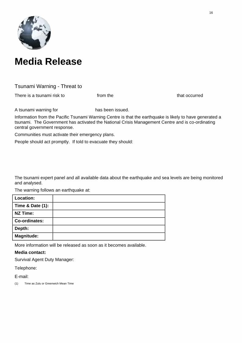
There is a tsunami risk to from the that occurred A tsunami warning for has been issued. Information from the Pacific Tsunami Warning Centre is that the earthquake is likely to have generated a tsunami. The Government has activated the National Crisis Management Centre and is co-ordinating central government response. Communities must activate their emergency plans. People should act promptly. If told to evacuate they should: The tsunami expert panel and all available data about the earthquake and sea levels are being monitored and analysed. The warning follows an earthquake at:
Location:
Time & Date (1):
NZ Time:
Co-ordinates:
Depth:
Magnitude:
More information will be released as soon as it becomes available. Media contact:
Survival Agent Duty Manager:
Telephone:
E-mail: (1) Time as Zulu or Greenwich Mean Time
16

Go to the Pacific Tsunami Warning Centre website: http://www.weather.gov/ptwc/
Find information on the website (the whole site, not just one page) to complete this situation report. Definition of a tsunami warning (one line summary):
Definition of a tsunami information bulletin (one line summary):
Date of most recent tsunami message: Day Month Year
Level/type of tsunami message: Pacific Ocean-wide Tsunami Warning
Expanding Regional Tsunami Warning
Fixed Regional Tsunami Warning
Tsunami Information Bulletin
Region that this message applied to:
Magnitude of related earthquake: (under “details”)
Epicentre of the related earthquake: (official)
Latitude Longitude
Depth of the related earthquake:
Summarise the “Evaluation” given in the text message (one line summary):
What circumstances would cause the evaluation to change (to become more or less urgent):
Circumstances changed Example
17

References[1] http:/ / ioc3. unesco. org/ itic/ categories. php?category_no=163[2] http:/ / www. getthru. govt. nz/ web/ GetThru. nsf/ vwluResources/ Siren/ $file/ Siren. wav[3] http:/ / www. weather. gov/ ptwc/[4] http:/ / tsunamiwiki. wikispaces. com/ message/ view/ home/ 27535579
Tsunami/Phase 1/Lesson2 4
Unofficial/informal warnings
You may also be notified of an impending tsunami through media coverage, particularly international media coverage. News travels particularlyquickly over the internet. You may even receive informal warnings from friends and family overseas who have heard a broadcast. People nearest tothe coastline may also be able to relay messages that a tsunami has arrived. Warnings from friends, other members of the public, internationalmedia, internet etc may be correct. Recently, many people have received the most up to date information in an emergency via twitter and SMS.Below are some social media sites with emergency services information:
New Zealand Civil Defence [1]
Australian Emergency [2]
Steele County [3]
Can you find a twitter feed or facebook page about emergency services in your area?
Discuss [4]
References[1] http:/ / twitter. com/ nzcivildefence[2] http:/ / twitter. com/ AussieEmergency[3] http:/ / twitter. com/ SteeleCty[4] http:/ / tsunamiwiki. wikispaces. com/ message/ view/ home/ 27535567
18

Tsunami/Phase 1/Lesson3 1
Tsunami Signage
How do you know if the area you are in is at risk of tsunami?
The large loss of life during the Boxing Day 2004 Indian Ocean Tsunami highlighted to many countries the potential threat posed by tsunami. As aresult, many countries have taken steps to increase safety by creating recognisable tsunami signage and erecting it in key places. Check out thesignage used in California [1], and in other places [2], and see what differences exist, if any.
Having recognisable tsunami signage in locations that are at risk of tsunami helps increase public awareness of tsunami and the risks they pose.Because the signs look very similar wherever you go it doesn’t matter if the words are in a different language to your own. In New Zealand, tsunamisignage must be consistent with the national standard for tsunami signage.
There are five categories of tsunami signs in New Zealand to support public education and the response to tsunamis:
• Evacuation zone• Information board• Evacuation route• Evacuation safe-location• Previous event (impact/elevation)
The evacuation zone, information board, and evacuation route signs are essential for Survival Agents to achieve effective tsunami education.Evacuation safe locations and previous event signage provide additional means to assist public education.
This picture below shows three different categories of tsunami signs you will find throughout coastal parts of New Zealand. Evacuation zone,Evacuation route, and Evacuation Safe Location.
If you feel the threat is real, then evacuate to higher ground or inland: don’t wait!
References[1] http:/ / www. dot. ca. gov/ hq/ traffops/ signtech/ signdel/ tsunami. htm[2] http:/ / www. tsunami. org/ signs. html
19

Tsunami/Phase 1/Lesson3 2
ActivityTsunami SignsHave a go at the quiz below to test your knowledge of natural tsunami warning signs, official and unofficial warnings and tsunamisignage.
Discuss [1]
References[1] http:/ / tsunamiwiki. wikispaces. com/ message/ view/ home/ 27535531
Tsunami/Phase 1/Lesson3 3
Activity1. What tsunami warning signs can you find in the area you live in? Take photographs of a couple of locations and mark them on a
map of the area.2. Design your own tsunami warning sign poster to be used in your community. Where would you put these signs? - mark the
locations on a map of the area you live in? How many do you think you would need? What would you make them out of? Whatcolours would you use?
Discuss [1]
Survival AgentListen here <playmp3>Survival Agent
20

Quiz questions and answers. Stage 1, Lesson 2 Define tsunami and describe how they occur (incl wave energy and speed) Answer the questions below by selecting the correct option. Question Correct
Answer 1 Which of the following is a tsunami warning sign?
a. Water falling back quickly from the beach. b. Pets and animals act in a strange manner. c. The weather gets stormy. d. None of the above.
A
2 What should you do if there is a tsunami warning issued?a. Pack your belongings and leave as soon as possible. b. Head immediately to higher ground or inland. c. Go down to the shore to check if it is correct. d. Look for your pets and put them away first.
B
3 How far inland should you go if there is a warning of a tsunami?a. Go down to the beach to look. b. One hundred metres. c. Five hundred metres. d. As far inland as you can.
D
4 How high above sea level should you try to get if there is warning of a tsunami?a. 5 metres above sea level. b. 10 metres above sea level. c. As high up as you can go. d. Just high enough to get a good view of the beach.
C
5 What should you never do if there is a tsunami warning?a. Listen to the radio for more information. b. Check your family emergency plan. c. Head to the beach to check if the tsunami is coming. d. Stay calm.
C
6 What should you do if there is a large or slow earthquake while you are on the beach?a. Stay put and wait for instructions b. Ignore it c. Move inland or uphill in a few minutes. d. Move inland or uphill immediately.
D
7 What colours are used on tsunami warning signage in New Zealand?a. Green and yellow. b. White and blue. c. White and green. d. Red, green and yellow.
B
8 What does the sign below tell you?
a. That you are in a tsunami evacuation zone.b. That you are currently on a tsunami evacuation route. c. That you don’t need to worry about tsunami in this
area. d. That public toilets are nearby.
A
9 Which of the following is not a category of tsunami signage?a. Evacuation zone. b. Information board c. Evacuation route. d. Watch wave from this location.
D
10 What information should be on a tsunami information board at the beach?a. Tsunami hazard characteristics. b. Tsunami evacuation guidance. c. Local information and tsunami history. d. All of the above.
D
21

Class Mode Extension Activity 1: Tsunami Signage – 1.32 From the teaching guide of http://wikieducator.org/Tsunami
Builds on:
Lesson 1.31 - Knowledge of official tsunami signage Lesson 1.1X - Understanding of physical attributes of
tsunami, especially run-up Future connections:
Lesson 3.21 – escape routes Lesson 3.42 – tsunami game
Connection to Learning Outcomes:
Define tsunami, describe how it occurs and identify the warning signs - both man-made and natural.
Describe the physical and social effects that a tsunami can have.
Design and evaluate survival plans and precautions against the threat of tsunami for their local context and other contexts.
Collaborative Activity: Students work in groups to assess tsunami risk of local area (or select a coastal region if local area is unsuitable), produce relevant signage and plot its placement. Each group will place one of each type of sign according to the three displayed in lesson 1.31: http://wikieducator.org/Tsunami/Phase_1/Lesson3_1
Preparation:
1. Print (or record coordinates online for students to display on screen) maps of local coastal areas. The class will be divided into groups for this activity and the number of maps available should be the same as the number of groups. Minimum group size is 3 students, larger groups mean students share roles.
2. Refer to official tsunami signage online (New Zealand signage, California Signage or other places) 3. Print a set of paper slips per group with the following role descriptions (or write on the board)
Roles & Responsibilities: Team Leader (TL): Communicates with other leaders and teacher if needed. Keeps group on task and supports
others in group where needed. Will manage presentation.
Chief Artist (CA): In charge of sign creation. All students participate in this, but CA manages the process. Will describe the type and function of signs in presentation.
Risk Surveyor (RS): In charge of surveying the map and assessing tsunami risk areas. Other students participate, but Surveyor has final say on placement of signage.
Facilitation: Time Action Notes T – 10 min Introduce activity and assign groups & team leaders set time limit for assigning TLs
10 – 15 TLs choose a map for their group & group assign individual roles.
15 – 25 RS & TL – Assess map and select appropriate location for each sign. CA – Start to produce signage
Teacher decides parameters for signage: sketch? Print and cut out? sign board? Etc
25 – 35 Continue previous task as needed. Begin planning presentation
Presentation must include physical map (printed or sketched).
35 – 40 Finish planning presentation
40 – End Groups present their plan & signage according to their role: TL introduces the group and area CA presents signage and placement RS explains and justifies placement
Divide time left by number of groups as time limit for each presentation.
Some Potential Reflection Tasks (next lesson):
Class discussion on pros and cons of group designed signage & vote on most suitable.
In same groups or individually: students create a full map (print, paste or sketch) with all coastal areas and all chosen signage locations indicated.
In same groups, groups swap maps and assess each other’s placement decisions.
Scenario: tsunami is on its way (teacher decides distance in time and expected run-up). Tsunami warning alarms sound and people near coast look for tsunami signage. Based on the distance and run-up, and on the directions given in their signs (i.e. evacuation routes and locations) students assess whether the signage they have placed will save lives.

Article Sources and ContributorsTsunami Source: http://wikieducator.org/index.php?oldid=613952 Contributors: Mark.simpson, Nlouwrens
Tsunami/Phase 1 Source: http://wikieducator.org/index.php?oldid=609605 Contributors: Nlouwrens
Tsunami/Phase 1/Lesson1 1 Source: http://wikieducator.org/index.php?oldid=615245 Contributors: Ardisc, Nlouwrens
Tsunami/Phase 1/Lesson1 2 Source: http://wikieducator.org/index.php?oldid=610596 Contributors: Alex Tait, Nlouwrens
Tsunami/Phase 1/Lesson1 3 Source: http://wikieducator.org/index.php?oldid=615205 Contributors: Mark.simpson, Nlouwrens
Tsunami/Phase 1/Lesson1 4 Source: http://wikieducator.org/index.php?oldid=611909 Contributors: Ardisc, Nlouwrens
Tsunami/Phase 1/Lesson1 5 Source: http://wikieducator.org/index.php?oldid=609394 Contributors: Alex Tait, Nlouwrens
Tsunami/Phase 1/Lesson1 6 Source: http://wikieducator.org/index.php?oldid=614075 Contributors: Nlouwrens
Tsunami/Phase 1/Lesson2 1 Source: http://wikieducator.org/index.php?oldid=609397 Contributors: Mark.simpson, Nlouwrens
Tsunami/Phase 1/Lesson2 2 Source: http://wikieducator.org/index.php?oldid=613542 Contributors: Ardisc, Nlouwrens
Tsunami/Phase 1/Lesson2 3 Source: http://wikieducator.org/index.php?oldid=613973 Contributors: Mark.simpson, Nlouwrens
Tsunami/Phase 1/Lesson2 4 Source: http://wikieducator.org/index.php?oldid=614377 Contributors: Ardisc, Mark.simpson, Nlouwrens
Tsunami/Phase 1/Lesson3 1 Source: http://wikieducator.org/index.php?oldid=614388 Contributors: Mark.simpson, Nlouwrens
Tsunami/Phase 1/Lesson3 2 Source: http://wikieducator.org/index.php?oldid=614384 Contributors: Nlouwrens
Tsunami/Phase 1/Lesson3 3 Source: http://wikieducator.org/index.php?oldid=614387 Contributors: Nlouwrens
22

Image Sources, Licenses and Contributorsimage:icon_objectives.jpg Source: http://wikieducator.org/index.php?title=File:Icon_objectives.jpg License: unknown Contributors: BrentSimpson, Charmcastillo, ICT-RIEM 2008-09,Mackiwg, Myron, Nelliemuller, OntymaroksImage:2004-tsunami.jpg Source: http://wikieducator.org/index.php?title=File:2004-tsunami.jpg License: Public Domain Contributors: David Rydevik (email: david.rydevik at gmail dot com),Stockholm, Sweden.Image:Agent icon.png Source: http://wikieducator.org/index.php?title=File:Agent_icon.png License: Creative Commons Zero Contributors: NlouwrensImage:Different Waves.png Source: http://wikieducator.org/index.php?title=File:Different_Waves.png License: Public Domain Contributors: S Reese, 2007Image:Wave_Terminology.png Source: http://wikieducator.org/index.php?title=File:Wave_Terminology.png License: Public Domain Contributors: S Reese, 2007Image:Tsunami Phase 1 L1 6.jpg Source: http://wikieducator.org/index.php?title=File:Tsunami_Phase_1_L1_6.jpg License: unknown Contributors:http://damncoolpics.blogspot.com/2010/04/tsunami-as-seen-from-hotel-room.htmlimage:icon_activity.jpg Source: http://wikieducator.org/index.php?title=File:Icon_activity.jpg License: unknown Contributors: BrentSimpson, Dobell, Mackiwg, Ontymaroks, Sammy,Singhkamal, UdsinghImage:Tsunami signage.jpg Source: http://wikieducator.org/index.php?title=File:Tsunami_signage.jpg License: Public Domain Contributors: Ministry of Civil Defence & EmergencyManagement
23

LicenseCreative Commons Attribution Share-Alike Licensehttp:/ / creativecommons. org/ licenses/ by-sa/ 3. 0/
24