1 to facilitate access to satellite data theia land data centre pierre maurel, geosud coordinator...
TRANSCRIPT
1
To facilitate access to satellite data
THEIA Land Data Centre
Pierre Maurel, GEOSUD Coordinator
Nicolas Baghdadi, THEIA Scientific DirectorMarc Leroy, THEIA Technical Director
CEOS Strategic Implementation Team (SIT)
Technical Workshop16th 18th September, 2014, Montpellier

2
Fact : Satellite imagery is under-used by public actors (scientific community and policy makers)
• Bottlenecks : costs, processing, user support
Need of a new model to facilitate access to satellite imagery
• Mutualisation Multi-licence imagery overcost from +30% to +50%• Free access to « Public actors »
Foundation in 2012 of a national structure, scientific and technical: THEIA = Land Data Centre
THEIA = inter-institutions structure funded jointly by 9 public French partners involved in Earth observation and monitoring: CEA, CIRAD, CNES, CNRS, IGN, INRA, IRD, Irstea, Météo France
+ CEREMA since June 2014
Context
2

3
• Answer the needs of the science community and national policy-makers in terms of products, methodologies, and training related to the observation from space of land surfaces
• Facilitate access and use of space data for a large user community
• Federate efforts at national level and make them visible at European and international levels
THEIA is based on a Space Data Infrastructure (SDI), organised around projects / initiatives such as:
Geosud, Kalideos, Pléiades, Postel, Spot World Heritage…
Objectives
3
4
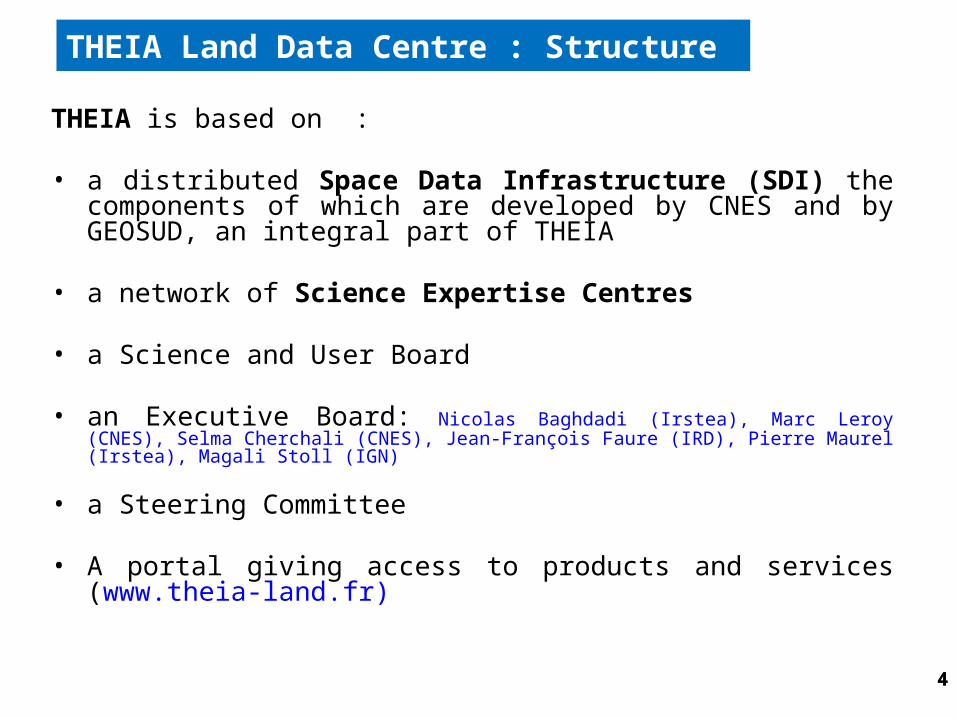
THEIA is based on :
• a distributed Space Data Infrastructure (SDI) the components of which are developed by CNES and by GEOSUD, an integral part of THEIA
• a network of Science Expertise Centres
• a Science and User Board
• an Executive Board: Nicolas Baghdadi (Irstea), Marc Leroy (CNES), Selma Cherchali (CNES), Jean-François Faure (IRD), Pierre Maurel (Irstea), Magali Stoll (IGN)
• a Steering Committee
• A portal giving access to products and services (www.theia-land.fr)
THEIA Land Data Centre : Structure
4

5
THEIA Structure
5
www.theia-land.fr
6
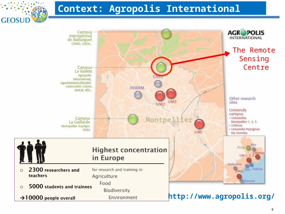
Context: Agropolis International
http://www.agropolis.org/
Montpellier
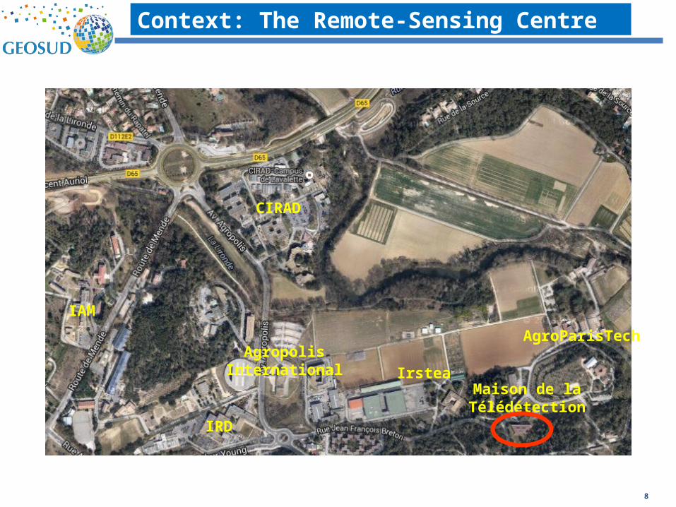
The Remote Sensing Centre
8
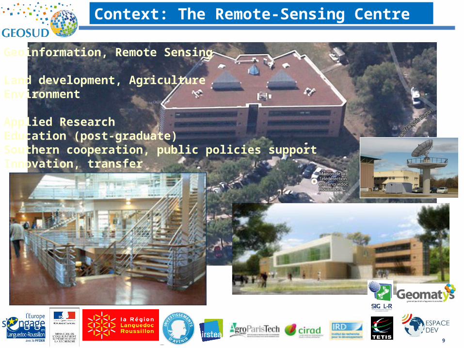
Context: The Remote-Sensing Centre
CIRAD
AgropolisInternational
IRD
Irstea
AgroParisTech
Maison de laTélédétection
IAM
9
Context: The Remote-Sensing Centre
Geoinformation, Remote Sensing
Land development, AgricultureEnvironment
Applied ResearchEducation (post-graduate)Southern cooperation, public policies supportInnovation, transfer

V1 portail GEOSUDGEOSUD SDI V1 (products, processing)
http://www.equipex-geosud.fr/
1 2 3
Methods, algorithms: CIPAN (nitrogous)Urban sprawl, oasis,…
Networking ( 300 public members, sept 2014)(research, education, State, local authorities…)
THEIA Land Data Centre
10
Training materials,Capacity building, distant learning
Images North, South« all public bodies » licences Annual national coverages 5m
Pleiades images 0,5m,…
GEOSUD Direct receiving station (SPOT 6-7 - end 2014)
GEOSUD SDI main components

11
Missions
• Acquire, process, distribute space data products
• Provide tools and methodology user guides to the user community
• Assure data long term archiving
• Contribute to the operationalisation of thematic methods developed by the Science Expertise Centres
• Provide support to the user community
THEIA Space Data Infrastructure
11
12
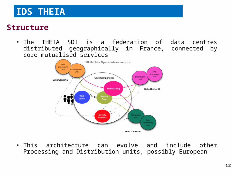
• The THEIA SDI is a federation of data centres distributed geographically in France, connected by core mutualised services
• This architecture can evolve and include other Processing and Distribution units, possibly European
IDS THEIA
Structure

13
THEIA Products 2013 - 2016

14
• SEC = grouping of laboratories developing innovative methods on Land thematic area
• Two SEC categories– SEC « Product » : around a value-added product. They can
associate one or several labs. Example : SEC Land Cover• In the process of being defined. As of today around 20 propositions of such
SEC
– SEC « Regional » : the mission is to federate and animate the science community at the regional scale, and to participate to training of the community in particular on the products developed by the SEC « Product »
• As of today 4 SEC « Regional » identified : Languedoc-Roussillon, Midi-Pyrénées, Alsace, Aquitaine
Science Expertise Centre (SEC)
14

15
To structure a national institutional remote sensing sector :
– To answer the needs of scientists and policy makers – Associating intermediary actors of the sector (public, private)– For a perenial access to data, equipment, products and services
Priority to national satellites and to shared-cost data Cluster of complementary and quality-controlled imageries
Pleiades images (IGN, CNES, GEOSUD) National coverage GEOSUD HR products from the GEOSUD receiving station (SPOT 6-7…) Sentinel-2 images (Copernicus) Spot World Heritage
…
– Opening to international cooperation (Southern countries)– As a concertation platform to elaborate jointly national strategies towards
Europe and beyond
Towards a national institutional remote sensing sector

17
• a THEIA Collaborative Ground Segment has been proposed to ESA
– ESA is putting in place a system of Collaborative Ground Segments to assure the distribution of the huge amount of Sentinel data in the Member States
– The national science community has strong interest to S1 (radar imagery), S2 (HR optical imagery) et S3 (LR optical imagery)
– The THEIA Collaborative Ground Segment will be linked to the national PEPS (Sentinel Product Exploitation Platform)
• Sentinel data mirror site• distribution of the Sentinel data to the national community• facilitation of access to data processing tools
17
THEIA European strategy

18
• The THEIA Collaborative Ground Segment includes 3 components :
– Component 1: Processing of S2 (atmospheric corrections and monthly composites), on areas totalising 5 Mkm2
– Component 2: provision of value added products on various regions worlwide, such as land cover, change detection, vegetal biogeophysical variables, albedo, water level, …
– Component 3: user support for the use of value added products
18
THEIA European strategy

19
THEIA European strategy
To act in such a way that the products developed by THEIA SEC have a European future in Copernicus framework Example: Surface reflectance Sentinel-2 Example: Lake and river water level with Jason and Sentinel-3 Example: Vegetal biogeophysical variables
Insert THEIA in European network
Knowledge and project network» Most natural vector: reply to H2020 Call for Tenders
Space Data Infrastructure (SDI) network» The idea is to connect the THEIA SDI in a network of European SDIs» Work on SDIs interoperability when possible» Approach followed byTHEIA : participate if possible to the ESA TEPs
(Thematic Exploitation Platforms)

20
ContactsNicolas Baghdadi, THEIA Scientific Director
Maison de la Télédétection
500 rue JF Breton
34033 Montpellier Cédex 5
France
Mail: [email protected]
Phone: +33467548754
Marc Leroy, THEIA Technical Director
CNES Toulouse, France
Tel: +33 (0)5 61 27 36 25
Mob: +33 (0)6 03 94 94 11
Mail :[email protected]
Web site: theia-land.fr
Thank you for your
attention
Any questions?