1 subject database management information system & applications of remote sensing and gis...
TRANSCRIPT
1
SubjectDatabase Management Information System &
Applications of Remote sensing and GIS
“Introduction to Image Interpretation”Topic:
Dated: 21/10/14
Presented by
Rehana Jamal
Lecture # 02 Part-II
Section-II “Applications of Remote sensing and GIS”

2
1. INFORMATION EXTRACTION IN REMOTE SENSING
2. IMAGE INTERPRETATION
3. INTERPRETATION ELEMENTS/KEYS
Database Management Information System & Applications of Remote sensing and GIS
Subject
Dated:21/10/14Lecture#2 Part-II
Topics
Section-II “Applications of Remote sensing and GIS”

3
1. INFORMATION EXTRACTION IN REMOTE SENSING
“Remote sensing is the technology allowing to obtain information of an object, area or phenomenon by means of data coming from an apparatus, which is not in physical contact with this object, area or phenomenon.”
In practice, this means that the information of the Earth's surface is obtained by sensors mounted on an airplane or a satellite.
Remote sensors record electromagnetic radiation emitted or reflected from the Earth’s surface. Different types of vegetation, soils and other features emit and reflect energy differently.
4
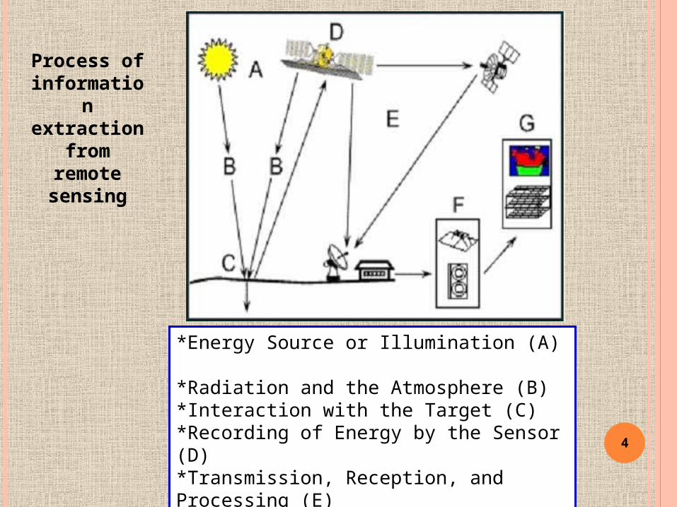
*Energy Source or Illumination (A) *Radiation and the Atmosphere (B)*Interaction with the Target (C) *Recording of Energy by the Sensor (D)*Transmission, Reception, and Processing (E) *Interpretation and Analysis (F) *Application (G)
Process of information extraction
from remote sensing
5
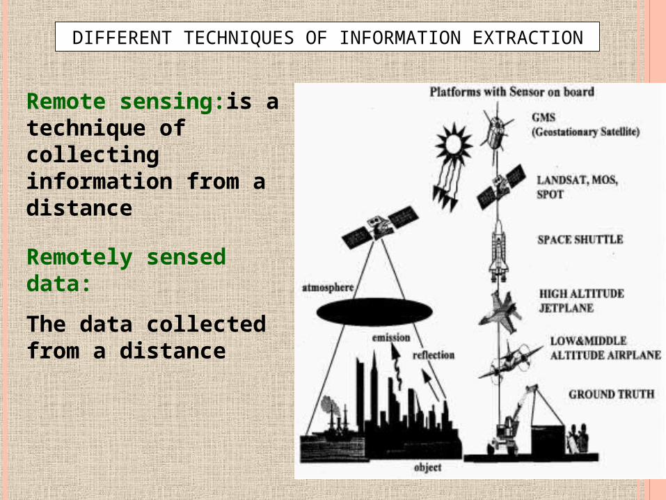
DIFFERENT TECHNIQUES OF INFORMATION EXTRACTION
Remote sensing:is a technique of collecting information from a distance
Remotely sensed data:
The data collected from a distance

6
“Remote Sensing (RS) is the science and art of acquiring information (spectral, spatial, temporal) about material objects, area, or phenomenon, without coming into physical contact with the objects, or area, or phenomenon under investigation”
Definitions of Remote Sensing
“Remote sensing is the science and art of obtaining information about an object ,area or phenomenon through the analysis of data acquired by a device that is not in contact with the object, area or phenomenon under investigation”
OR
7
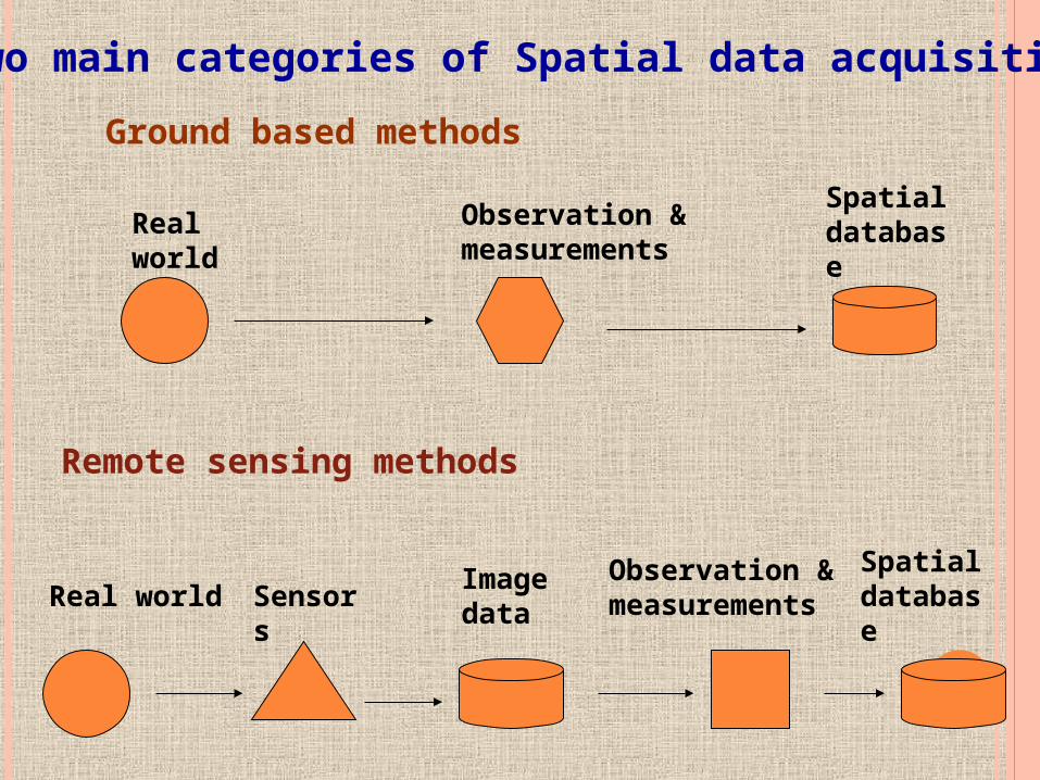
Two main categories of Spatial data acquisition
Ground based methods
Remote sensing methods
Real world
Real world
Observation & measurements
Spatial database
Spatial database
Observation & measurementsSensors
Image data

8
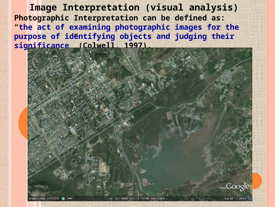
“Image Interpretation”
Photographic Interpretation can be defined as: “the act of examining photographic images for the purpose of identifying objects and judging their significance” (Colwell, 1997).
Topic:2

9
Image Interpretation (visual analysis)

10
NEW CAMPUS(PU), LAHORE

11
Can you interpret Old CIMR in PU, Lahore?

12
Can you interpret New CIMR in PU, Lahore?

13
What is Dead Ground Effect?
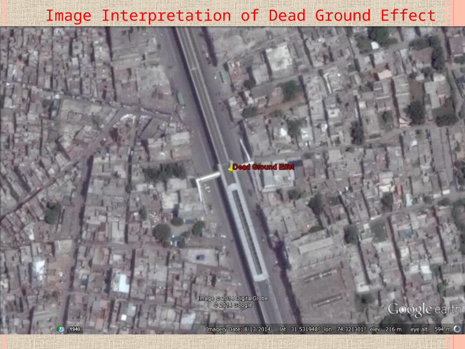
14
Image Interpretation of Dead Ground Effect
15
Image Interpretation (visual analysis)
Photographic Interpretation can be defined as: “the act of examining photographic images for the purpose of identifying objects and judging their significance” (Colwell, 1997).
16
Two methods of information extraction from remote sensing imagery
Information extraction based on visual analysis or interpretation of data e.g. land use, soil map, updating of topographic maps from aerial
photographs
Information extraction based on semi-automatic processing by computer e.g. automatic generation of DTM, image classification and calculation of surface parameters

17
Image understanding and Interpretation
1st Method
Human Vision
Interpretation elements
Stereoscopic vision

18
Direct and spontaneous recognition----refers to the ability of an interpreter to identify objects or phenomena at a first glance.
By a reasoning process (logical inference) ---In the reasoning interpreter will use his professional knowledge & experience. If reasoning cannot help then field observation is required
Two situations of human vision:
i. Direct and spontaneous recognitionii By a reasoning process(logical inference)
1- Human Vision

19
Direct and Spontaneous recognition

20
By a reasoning process
21
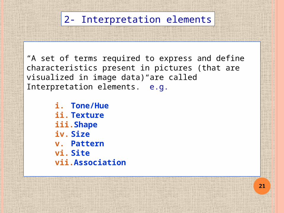
“A set of terms required to express and define characteristics present in pictures (that are visualized in image data) are called Interpretation elements.” e.g.
i. Tone/Hueii. Textureiii. Shapeiv. Sizev. Patternvi. Sitevii. Association
2- Interpretation elements

22
1. Tone/Hue--- relative brightness of black and white image
2. Texture--- refers to the colour on the image as defined in the Intensity, Hue ,Saturation (HIS)system
3. Shape--- form characteristics many terrain objects visible in the image
4. Size--- relative or absolute
5. Pattern--- refers to the spatial arrangement objects e.g. concentric, radial---irrigation and housing have different pattern
6. Site--- relates to the topographic or geographic location
7. Association--- refers to the fact that a combination of objects makes it possible to infer about its meaning or functioning
2- Interpretation elements/Keys

23
The impression of depth in real world can be realized by the pair of images of the same object taken from different positions. Such a pair of images, photographs or digital images that are separated and observed at the same time by the two eyes give images on the retinas in which objects at different positions in space are projected on relative different positions. This is called Stereoscopic Vision
Stereo grams---Pairs of images that can be viewed stereoscopically are called Stereo grams.
Convergence---Focusing both eyes to the object(point) of interest is called convergence.
3- Stereoscopic Vision
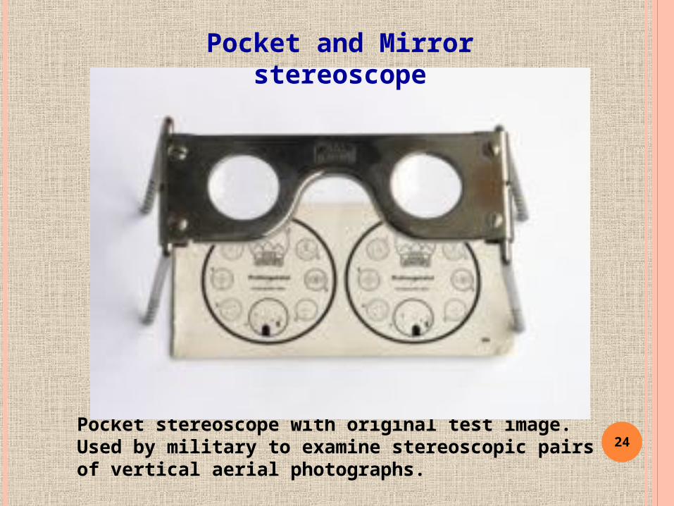
24Pocket stereoscope with original test image. Used by military to examine stereoscopic pairs of vertical aerial photographs.
Pocket and Mirror stereoscope
25
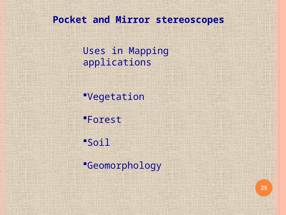
Pocket and Mirror stereoscopes
Uses in Mapping applications
Vegetation
Forest
Soil
Geomorphology

26
Photogrammetric plotters
Uses
Topographic Mapping
Large scale Mapping

27 Anachrome optical diopter glasses
Anachrome "compatible" color anaglyph method

28
Anaglyphs
29
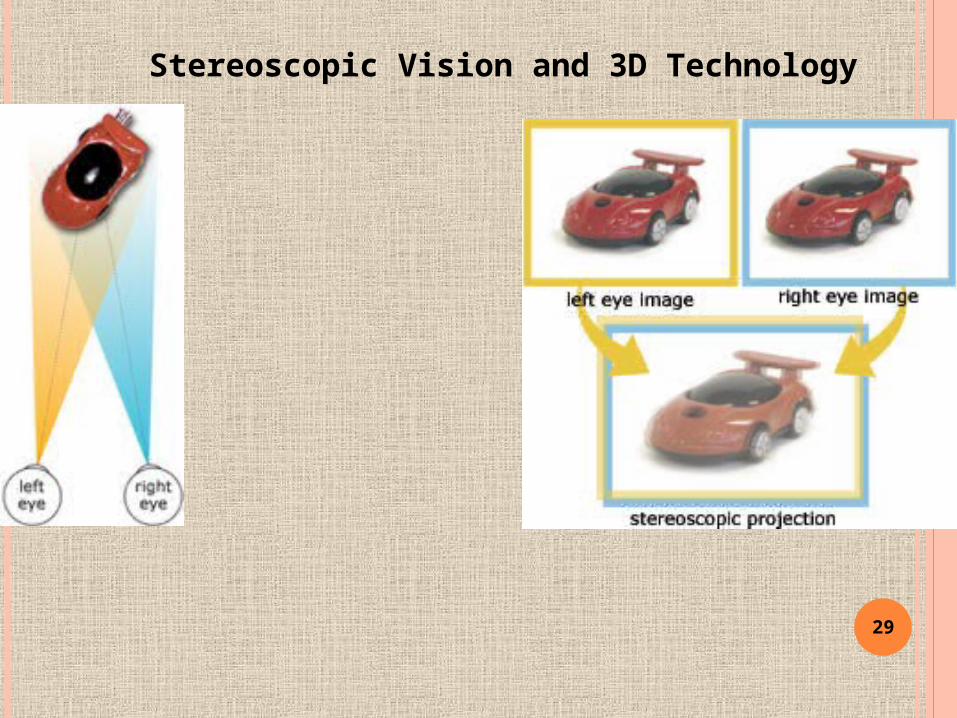
Stereoscopic Vision and 3D Technology
30
Process of visual image interpretation
Selection of image data and its hard copy prints
Use of transparencies to overlay on hard copy print of image for interpretation
Digitization of Point, Line & Polygon features in the form of line patterns on transparencies having
class codes & land cover codes.
Validation: independent assessment of accuracy
31
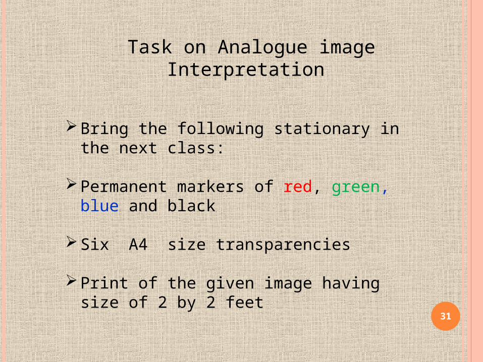
Task on Analogue image Interpretation
Bring the following stationary in the next class:
Permanent markers of red, green, blue and black
Six A4 size transparencies
Print of the given image having size of 2 by 2 feet
32
References:
www.google.com
“Principles of Remote sensing”
by Lucas L.E. Janssen
Recommended websites for notes http://userpages.umbc.edu/~tbenja1/umbc7/santabar/vol1/lec2/2-3.htmlhttp://en.wikipedia.org/wiki/Aerial_photographic_and_satellite_image_interpretationhttp://www.nrcan.gc.ca/earth-sciences/geography-boundary/remote-sensing/fundamentals/1223