1 climate smart communities webinar1 climate smart communities webinar 1-866-394-2346 code:...
TRANSCRIPT

1
Climate Smart Communities Webinar
1-866-394-2346
Code: 1982360347#
No audio signal will be transmitted over the Internet
Telephone call-in number

2
Climate Smart Communities Webinar February 12, 2015
NYSDOT Flooding Vulnerability Assessment and NYSDEC Fine-Scale Culvert Assessment Project
This webinar will begin shortly. Please be considerate of your fellow attendees:
• Please mute your phone to reduce background noise
• If you need to take an incoming call, please hang up this line first, and then pick up the incoming call
• Please do not put your phone on hold at any time.
• To ask a question, please type your question or comment in the chat box feature.

3
Welcome
Kim FarrowEnvironmental Program Specialist
Office of Climate ChangeNew York State
Department of Environmental Conservation

4
Climate Smart Communities Webinar
Mark Lowery [email protected]
Climate Change Office [email protected]
E-Mail Addresses

5
Climate Smart Communities Webinar
http://www.dec.ny.gov/energy/50845.html
Website Address

6
Climate Smart Community WebinarsSchedule: http://www.dec.ny.gov/energy/86246.html
• March 12, 10:30 a.m. Mobilizing Regional Climate Action.• April 9, 10:30 a.m. Reducing Community Transportation Emissions.
• Stormwater Training Series. Central New York Planning and Development Board. See website for course descriptions and schedule: http://www.cnyrpdb.org/stormwater/?2015-Stormwater-Training-Series-155
• March 27-29, 15th Annual Meeting, New York State Floodplain and Stormwater Managers Association. East Syracuse. http://nyfloods.org
Events

7
Beginning the Certification Process1. Review certification materials2. Designate a project coordinator3. Get organized4. Gather publicly available information5. Request materials from local government staff
Recommendation: Start with priority actions – see “First Steps” resources guide at www.dec.ny.gov/energy/96532.html .

8
More Extreme Precipitation Events and FloodingMore summer downpoursMore extreme snow/ice events
Observed trends in 1-day very heavy precipitation (1958 to 2010). 8

9
Too much water when we don’t want it, too little when we do
• Less frequent summer rainfall may affect water supply
• Reduced flows on larger rivers
• Flooding may increase water pollution
• Damage to transportation infrastructure
• Changes in accretion & scour
• Landslides

NYSDOTStatewide Flooding Vulnerability Assessment
Elisabeth Lennon NYSDOT Statewide Policy & Performance
February 2015

NYS Multi-Modal SystemDiverse, Complex and Vital
7,632 State Bridges 9,800 Local Bridges
40,000 State Lane Miles200,000 Local Lane
Miles
4,137 Rail Route Miles
> 44 Million Enplanements
130 billion vehiclemiles annually

STORM SURGE&
SEA LEVEL RISE
HEAVY RAINFALL
&FLOODING
SNOW ICE WIND
STORMS

NYSDOT Mission
• To ensure our customers - those who live, work and travel in New York State -- have a safe, efficient, balanced and environmentally sound transportation system.
▫ ** Addressing changing climate and extreme weather impacts on transportation infrastructure and mobility is critical.

FHWA Approved Costs of Events

Higher frequency and intensity of extreme weather in NYS
There has been a 71% increase in the number of 2-inch rainfall events occurring over a 48-hour period since the 1950s.

Climate Change Initiatives
Statewide:ó NYS Sea Level Rise Task Force (2008)ó NYSERDA’s ClimAID Projectó NYS Climate Action Council (2009)ó NYS Climate Smart Communities (ongoing)ó NYS 2100 Commission (2013)ó NY Rising (ongoing)ó 2014: Community Risk and Resilience Actó NYS Climate Change Clearing House (Future)ó Ongoing Research
NYS Interagency Adaptation Work Group (ad hoc )
Local/Regional Examples: ó New York City’s PlaNYCó Hudson Valley Climate Action Networkó Kingston Waterfront Flooding Taskforce

Executive Management Support• NYSDOT hosted “Climate Change and Extreme Weather
Workshop”▫ Executives and Practitioners▫ Climate Scientists, Planners and Engineers▫ Held Oct 24, 2012
• NYSDOT Commissioner chairs national committee (AASHTO): “Resilient and Sustainable Transportation Systems
Technical Assistance Program and Steering Committee”

NYSDOT CC Vulnerability Assessments
1) NY-NJ-CT Post Sandy Study -FHWA
2) NYSDOT/TNC Lake Champlain Watershed - FHWA Pilot
3) Statewide Flooding Vulnerability Assessment (state system only)

FHWA

NYSDOT Statewide Flooding Vulnerability Assessment
▫ Based on WashDOT’s 2011 FHWA Pilot
▫ Obtain & share knowledge from Regional staff
▫ Communicate vulnerabilities

Diverse Team
Tools:Maps
Climate Science
Meetings with Regions
Regional Reviews Populate
Spreadsheets
Team QA/QCBuild Statewide GIS Data Layer
Communicate Findings
STEPS OF ASSESSMENT

Diverse Team
Tools:Maps
Climate Science
Meetings with Regions
Regional Reviews Populate
Spreadsheets
Team QA/QCBuild Statewide GIS Data Layer
Communicate Findings
STEPS OF ASSESSMENT
PlanningHydraulic EngineeringDesign ServicesGISEnvironmental

Diverse Team Tools:
Maps
Meetings with Regions
Regional Reviews Populate
Spreadsheets
Team QA/QCBuild Statewide GIS Data Layer
Communicate Findings

Diverse Team Tools:
Maps
Meetings with Regions
Regional Reviews Populate
Spreadsheets
Team QA/QCBuild Statewide GIS Data Layer
Communicate Findings

Tools:Climate Science

Understand Trends & Projections
Example: Gage Record of annual peak flows from a 2.94 sq mi watershed in Southern Wayne County
Walton, Delaware County Photo: Town of Walton
Newburgh, Orange County

Diverse Team
Tools:Maps
Climate Science
Meetings with
Regions
Regional Reviews Populate
Spreadsheets
Team QA/QCBuild Statewide GIS Data Layer
Communicate Findings

Diverse Team
Tools:Maps
Climate Science
Meetings with Regions
Regional Teams & Reviews
Populate Spreadsheets
Team QA/QCBuild Statewide GIS Data Layer
Communicate Findings
Regional Teams:Maintenance Staff: Regional, Residencies, Bridge MaintenanceHydraulic EngineersDesign & StructuresEnvironmental

Future Trends
Recent Experiences
Maps
Prioritize
Regional Reviews
What keepsyou up
at night?

Diverse Team
Tools:Maps
Climate Science
Meetings with Regions
Regional Reviews
Populate Spreadsheets
Team QA/QCBuild Statewide GIS Data Layer
Communicate Findings

2.Location Info1.Impact /Cause 3. Criticality Factors

• 1. Location/Impacts/Causes▫ Present or Future Vulnerabilityñ State highways and bridgesñ Regional knowledge ñ Note:ñ FEMA mapping ñ – not necessarily indicative of vulnerabilityñ - not available throughout state
Populate Spreadsheets

Determine Criticality
Low
Short Detours Available
Not on a Significant Access Route to
Essential Services
Medium
Detours will affect some people
Access to Emergency Services Not Affected
High
No or Long Detours
Evacuation Route
Significant Access to Hospital, Schools,
Employment
Populate Spreadsheets

Diverse Team
Tools:Maps
Climate Science
Meetings with Regions
Regional Reviews
Populate Spreadsheets
Team: QA/QCBuild
Statewide GIS Data
Layer
Communicate Findings

Diverse Team
Tools:Maps
Climate Science
Meetings with Regions
Regional Reviews Populate
Spreadsheets
Team QA/QCBuild Statewide GIS Data Layer
Communicate Findings

Information for improved decision-making

Diverse Team
Tools:Maps
Climate Science
Meetings with Regions
Regional Reviews Populate
Spreadsheets
Team QA/QCBuild Statewide GIS Data Layer
Communicate Findings
Annual Updates

NYSDOT Flooding Vulnerability Data Dissemination Policy
• Share Data ▫ Spreadsheet and/or GIS Files▫ Not NYSDOT GIS Application (CAMCI)▫ Conditions
• State and Local Agencies▫ Consultants/contractors
• Publish analyses from data but not original data
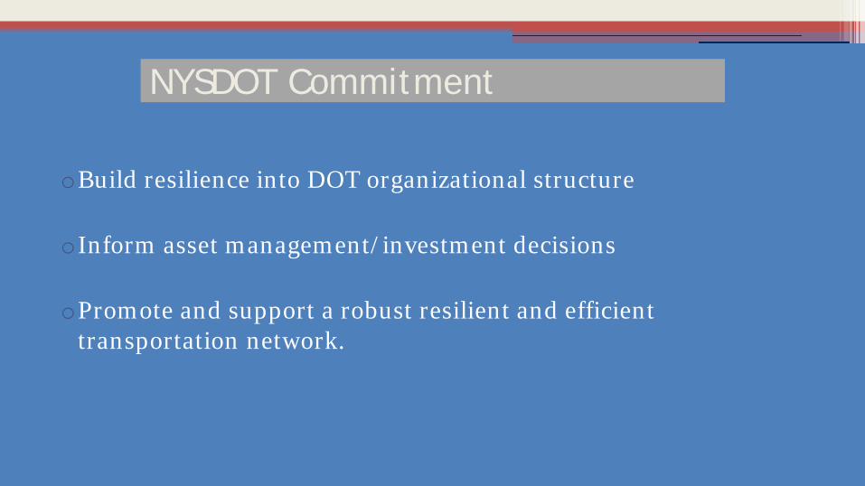
NYSDOT Commitment
oBuild resilience into DOT organizational structure
oInform asset management/investment decisions
oPromote and support a robust resilient and efficient transportation network.

FLOODPLAIN MAPPING
CLIMATE CHANGE PROJECTIONS FOR NY
STATE POLICIES
LIFE CYCLE DESIGN
Uncertainties
FUTURE IDF CURVES
EMERGENCY RESPONSEOPERATIONS
CLIMATE CHANGE DENIERS
COSTS $$
TIGHT BUDGETS
GUIDANCE
EXTREME WEATHER
GETTING TO RESILIENCE
Critical Infrastructure

We Can’t Do It Alone
Universities/Climate Scientists

Community Assessments Critical
•Drained by > 70,000 miles of streams•10 major river systems• >>% of population lives in coastal areas
Lake Ontario
Lake Erie
Atlantic OceanMap Source - http://geology.com/state-map/new-york.shtml


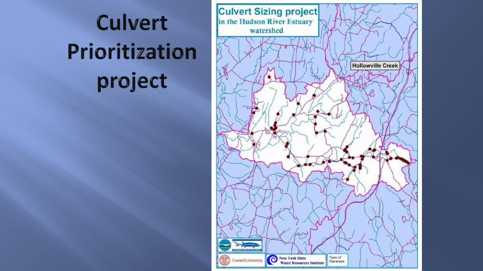
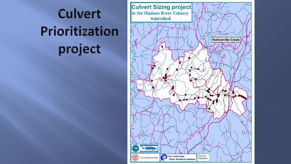
Culvert Assessments in the Hudson River Estuary Watershed
Climate Smart Communities webinarThursday, February 12th, 2015

Core Mission¨ Ensure clean water
¨ Protect and restore fish, wildlife, and their habitats
¨ Provide water recreation and river access
¨ Adapt to climate change
¨ Conserve world-famous scenery
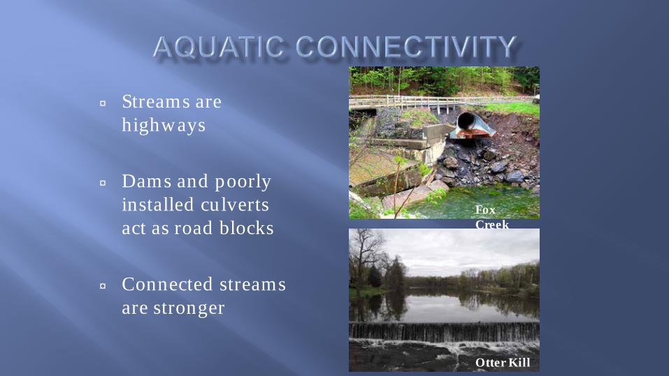
¨ Streams are highways
¨ Dams and poorly installed culverts act as road blocks
¨ Connected streams are stronger
Fox Creek
Otter Kill

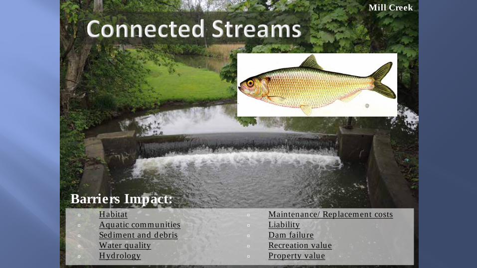
¨ Habitat ¨ Aquatic communities¨ Sediment and debris¨ Water quality¨ Hydrology¨ Maintenance/Replaceme
nt costs¨ Liability¨ Dam failure¨ Recreation value¨ Property value
Barriers Impact:
Clear Creek
¨ Habitat ¨ Aquatic communities¨ Sediment and debris¨ Water quality¨ Hydrology
¨ Maintenance/Replacement costs¨ Liability¨ Dam failure¨ Recreation value¨ Property value
Barriers Impact:
Mill Creek

¨ Habitat ¨ Aquatic communities¨ Sediment and debris¨ Water quality¨ Hydrology
¨ Maintenance/Replacement costs¨ Liability¨ Dam failure¨ Recreation value¨ Property value
Barriers Impact:
Mill Creek

Hollowville Creek
¨ Habitat ¨ Aquatic communities¨ Sediment and debris¨ Water quality¨ Hydrology
¨ Maintenance/Replacement costs¨ Liability¨ Dam failure¨ Recreation value¨ Property value
Barriers Impact:

Hollowville Creek
¨ Habitat ¨ Aquatic communities¨ Sediment and debris¨ Water quality¨ Hydrology
¨ Maintenance/Replacement costs¨ Liability¨ Dam failure¨ Recreation value¨ Property value
Barriers Impact:

Number of barriers¨ 64% not fully passable, Great Lakes basin (Janushowski-
Hartley et al. 2013)
¨ Over 60% not fully passable, Green Mountain National Forest (USFS 2013)
¨ 1 million culverts statewide (NYSDOT)
¨ 5700 dams in NYS Dam Inventory, on average 69 years old (Vedachalem and Riha, 2013)
Cost of Mitigation¨ Ecologically-based designs increase cost by 80%,
and 300% for small culverts (as cited in draft TNC NYSDOT culvert prioritization project report)
¨ $77,582 median cost for dam removal (n=225, Biohabitats, 2010)


¨ The Nature Conservancy and Hudson River Estuary Program
¨ Prioritized barriers¡ watershed condition¡ river network ¡ Natural Heritage
Program Important Areas
¨ Field-verified

¨ Field work identifies culverts
¨ Assess passability of culvert
¨ Model current and future stream flow
¨ Prioritize culverts
¨ Work with municipalities to fund replacement of top priorities


¨ Many culverts are undersized

¨ Culverts are largely on town roads


• Plan for climate adaptation• Integrate water resource
protection into municipal plans
• Move infrastructure out of floodplains
• Create partnerships, work intermunicipallyand with watershed groups

• Replace undersized road crossings• Remove dams where feasible• Manage runoff with green
infrastructure• Build demonstration sites• Protect forests, wetlands, floodplains• Restore vegetation along streams
Catskill Mountain stream

¨ Funding opportunities¨ Resources
¡ American Rivers¡ Cornell Cooperative Extension Hudson River Resiliency webpage¡ Land trusts and non-profits¡ NYSDEC Hudson River Estuary Program webpage
¨ Other Estuary Program projectsRoeliff Jansen
Kill
Lake Creek

Aquatic barriers “…sit unneeded, unused, undermaintained—a growing ecological and fiscal liability” National Forest System Legacy Roads and Trails program 2013
USFS Legacy Roads and Trails program 2013

Andrew Meyer [email protected]
Hudson River Estuary ProgramNew York State Department of Environmental Conservation
in cooperation with Cornell University
NYS Water Resources Institute

70
Climate Smart Communities Webinar
Mark Lowery [email protected]
Climate Change Office [email protected]
E-Mail Addresses

71
Climate Smart Communities Webinar
http://www.dec.ny.gov/energy/50845.html
Website Address