1 2012 high park fire & 2013 fort collins flood prepared by: jill oropeza, watershed program...
TRANSCRIPT
1
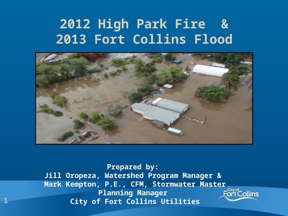
2012 High Park Fire &2013 Fort Collins Flood
Prepared by: Jill Oropeza, Watershed Program Manager & Mark Kempton, P.E., CFM, Stormwater Master
Planning Manager City of Fort Collins Utilities
Insert photo here
2
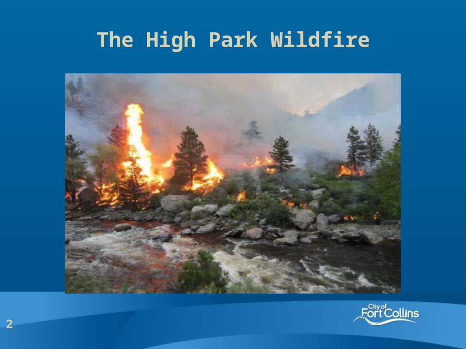
The High Park Wildfire
3
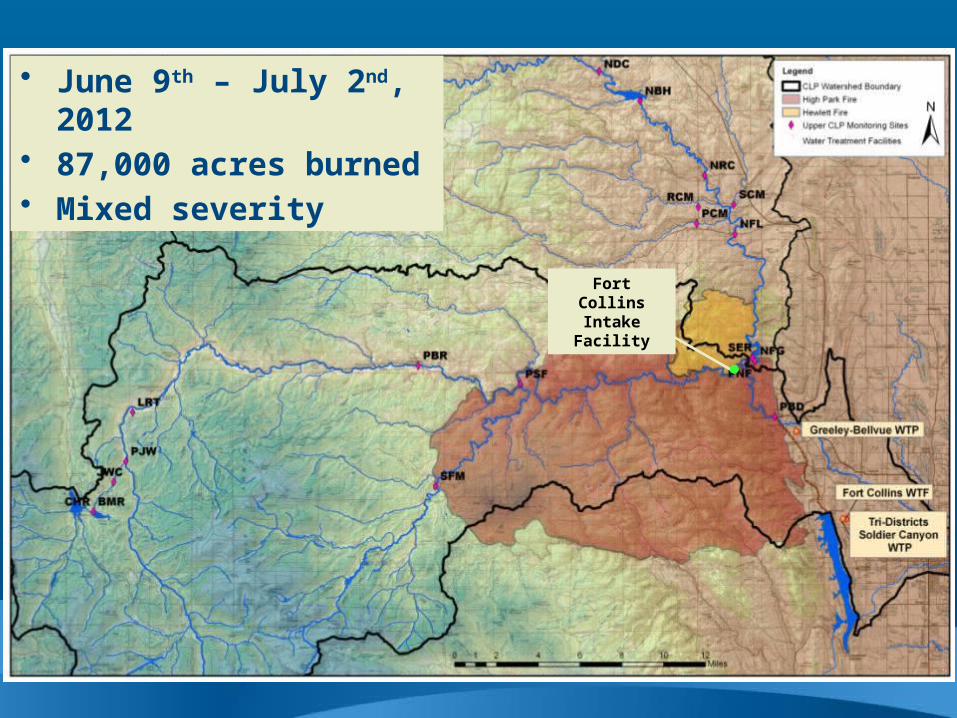
Fort Collins Intake Facility
• June 9th – July 2nd, 2012• 87,000 acres burned• Mixed severity
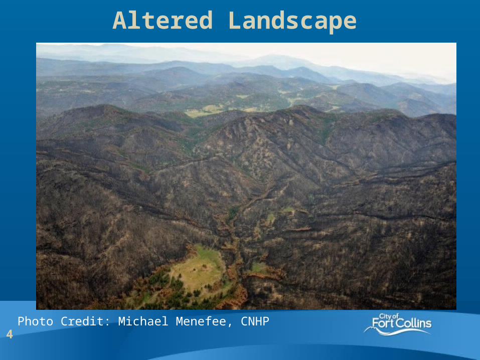
4Photo Credit: Michael Menefee, CNHP
Altered Landscape
5
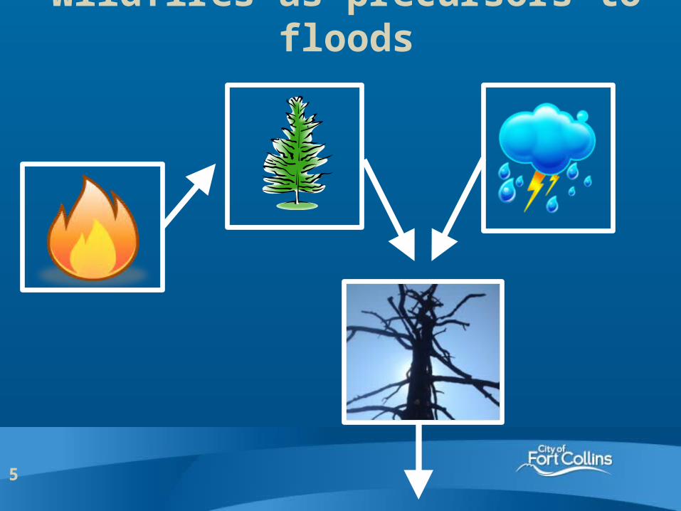
Wildfires as precursors to floods
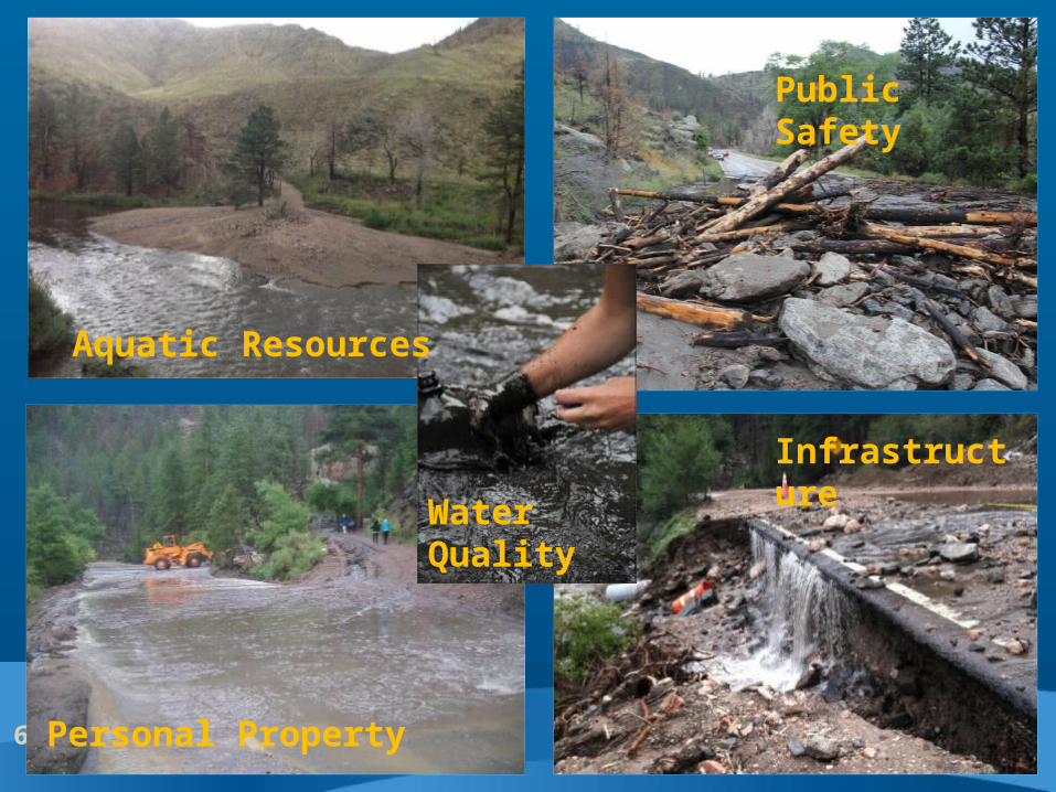
6
Public Safety
Infrastructure
Aquatic Resources
Water Quality
Personal Property
7
Emerging Best Practices
8
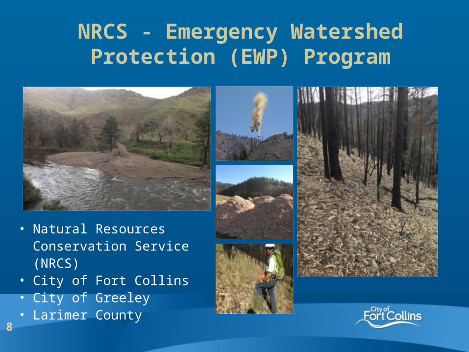
NRCS - Emergency Watershed Protection (EWP) Program
• Natural Resources Conservation Service (NRCS)
• City of Fort Collins• City of Greeley• Larimer County
9
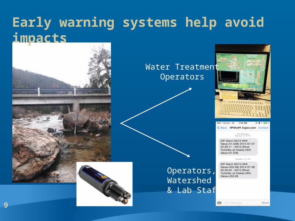
Water Treatment Operators
Operators, Watershed & Lab Staff
Early warning systems help avoid impacts
10
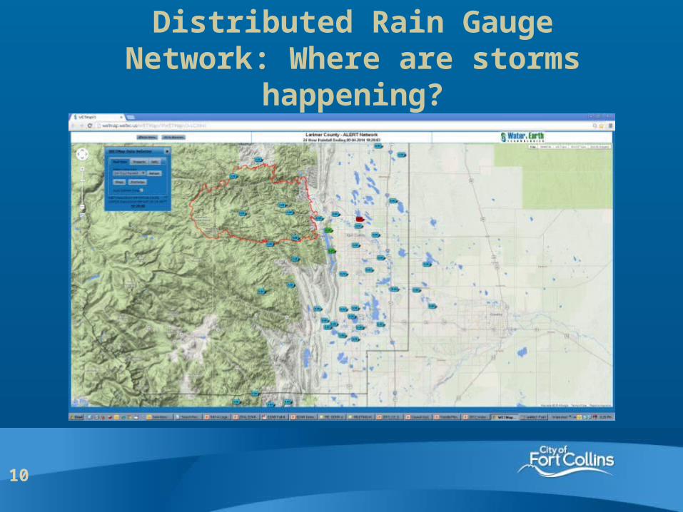
Distributed Rain Gauge Network: Where are storms happening?
11
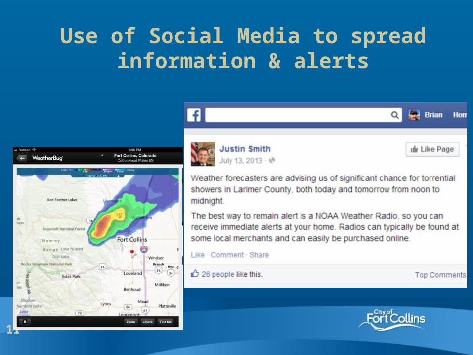
Use of Social Media to spread information & alerts
12
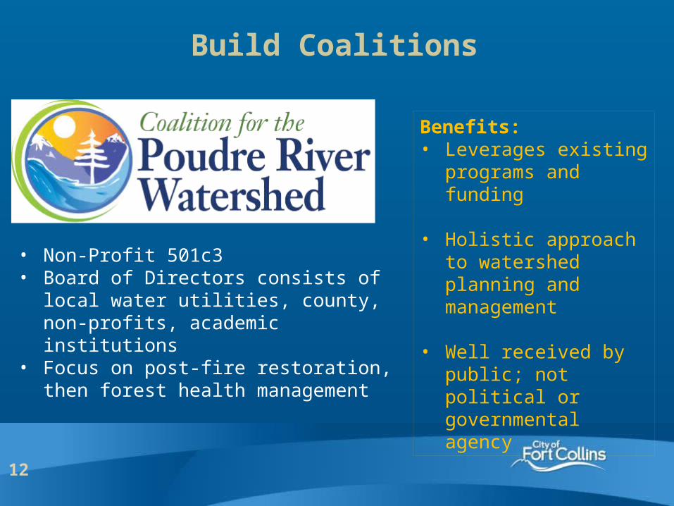
• Non-Profit 501c3• Board of Directors consists of local water
utilities, county, non-profits, academic institutions
• Focus on post-fire restoration, then forest health management
Build Coalitions
Benefits: • Leverages existing
programs and funding
• Holistic approach to watershed planning and management
• Well received by public; not political or governmental agency
13
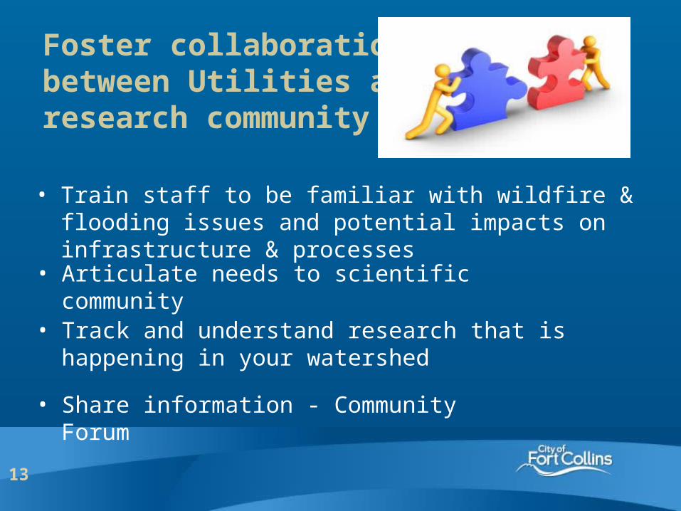
Foster collaboration between Utilities and research community
• Train staff to be familiar with wildfire & flooding issues and potential impacts on infrastructure & processes
• Share information - Community Forum
• Track and understand research that is happening in your watershed
• Articulate needs to scientific community
14
Future Needs to Increase Resiliency

15
Coordinated planning & funding for pre-fire forest management
• Patchwork of land ownership
• Differing abilities to implement projects based on: – available resources– regulatory
requirements– management
philosophiesBarriers to effective
risk mitigation!
16
Develop and enhance prioritization tools for pre-fire mitigation & post-fire restoration
- Where to focus $$?
- What are best methods for restoration?
- For maintaining watershed health?
17
Secure funding for post-fire response:
NRCS – Emergency Watershed Protection
• Enables local entities to begin reducing post-fire hazards associated with flooding and debris flows that impact private lands
• Funding was not secured until 8 months after HPF, after much negotiation and uncertainty in the US House and Senate
• A strong federal commitment will help communities respond and recover from disasters by acquiring adequate EWP funding in a timely manner

18
19
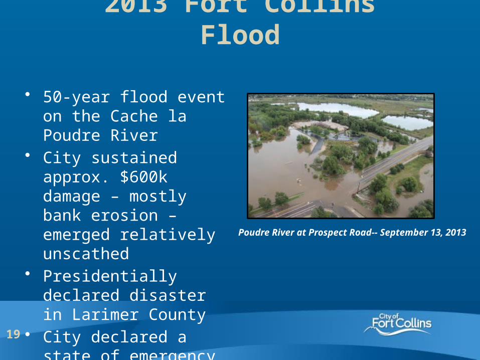
Poudre River at Prospect Road-- September 13, 2013
• 50-year flood event on the Cache la Poudre River
• City sustained approx. $600k damage – mostly bank erosion – emerged relatively unscathed
• Presidentially declared disaster in Larimer County
• City declared a state of emergency
2013 Fort Collins Flood
20
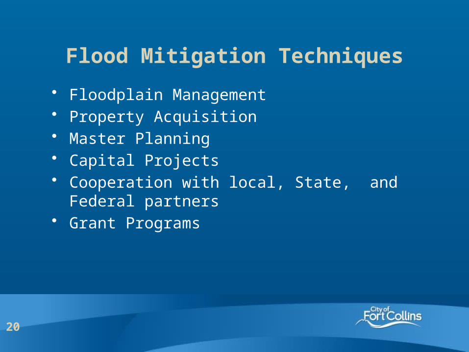
Flood Mitigation Techniques
• Floodplain Management• Property Acquisition• Master Planning• Capital Projects• Cooperation with local, State, and Federal
partners• Grant Programs
21
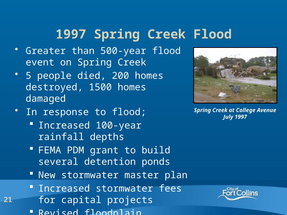
1997 Spring Creek Flood• Greater than 500-year flood event on
Spring Creek• 5 people died, 200 homes destroyed,
1500 homes damaged• In response to flood;
Increased 100-year rainfall depths FEMA PDM grant to build several
detention ponds New stormwater master plan Increased stormwater fees for
capital projects Revised floodplain regulations
Spring Creek at College AvenueJuly 1997
22
Floodplain Management
• Fort Collins floodplain regulations meet or exceed State and Federal regulations Elevate 2 feet above 100-year water surface Prohibit residential development and critical
facilities in the floodplain FEMA Community Rating System (CRS) – rating of
4 – in top 5% of communities in the nation New development – detain runoff to 2 year-event
pre-development condition• Effective floodplain management can be politically
difficult
23
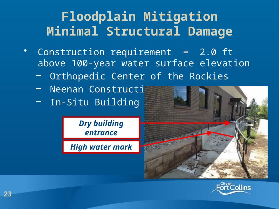
• Construction requirement = 2.0 ft above 100-year water surface elevation– Orthopedic Center of the Rockies– Neenan Construction– In-Situ Building
Floodplain MitigationMinimal Structural Damage
High water mark
Dry building entrance
24
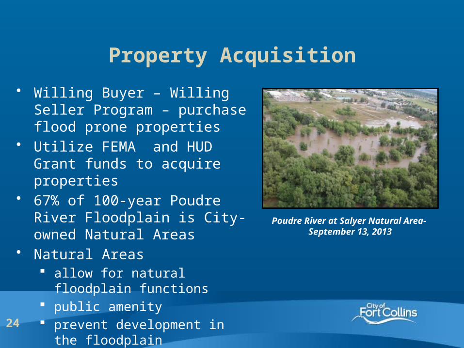
Property Acquisition
• Willing Buyer – Willing Seller Program – purchase flood prone properties
• Utilize FEMA and HUD Grant funds to acquire properties
• 67% of 100-year Poudre River Floodplain is City-owned Natural Areas
• Natural Areas allow for natural floodplain
functions public amenity prevent development in the
floodplain
Poudre River at Salyer Natural Area- September 13, 2013
25
Cooperation with partners
• Regional Hazard Mitigation Plan – partner with Larimer County and Loveland, Estes Park, Wellington, and Berthoud
• State and FEMA funding pay for the plan• FEMA (HMGP) and HUD (CDBG) grant programs
to fund hazard mitigation projects• State of Colorado - OEM and CWCB very
proactive in assisting with identifying and mitigating hazards
26
Potential Obstacles
• Federal, State, and local permits Section 404 of the Clean Water Act FEMA floodplain revisions State Historic Preservation Office Colorado Department of Public Health and
Environment – Dewatering permit Local environmental and floodplain regulations
• Funding – stormwater fees average $16 per household
• $150 million backlog in Stormwater projects
27
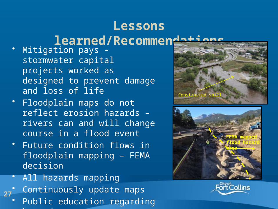
Lessons learned/Recommendations• Mitigation pays – stormwater
capital projects worked as designed to prevent damage and loss of life
• Floodplain maps do not reflect erosion hazards – rivers can and will change course in a flood event
• Future condition flows in floodplain mapping – FEMA decision
• All hazards mapping• Continuously update maps• Public education regarding hazards
FEMA mapped flood hazard area
Constructed spill

28