· web viewthose industries whose processing of products result in the emission of any...
TRANSCRIPT

ZONING REGULATIONS
FOR
SHELBY COUNTY, KENTUCKY
MARCH 1994
TRIPLE S PLANNING COMMISSION501 Main - CourthouseShelbyville, Kentucky
40065

ZONING REGULATIONS
FOR
SHELBY COUNTY, KENTUCKY
TRIPLE S PLANNING COMMISSION
Recommended for Adoption by the Triple S Planning Commission in:
November 1993
Adopted: May 1994 The Triple S Planning Commission, City Council of Shelbyville, City Commission of Simpsonville, and the Shelby County Fiscal Court.
Shelby County Fiscal Court: City of Shelbyville:
Publication Date: March 23, 1994 March 25, 1994Effective Date: April 1, 1994 March 25, 1999
Agricultural and City of Shelbyville Downtown DistrictsAmended Date: December 18, 1997 November 21, 1997Effective Date: January 1, 1998 January 1, 1998
Lighting, Noise and Odor

Amended Date: July 6, 1999 January 13, 1999 Effective Date: July 6,1999 February 1, 1999
Traffic Impact Study, Parking, Signage Amended Date: October 3, 2000 October 3, 2000Effective Date : October 31, 2000 October 31, 2000
City of Simpsonville:_____________ Publication Date: May 6, 1994 October 3, 2000 Effective Date: May 6, 1994 October 31, 2000Amended Date: November 1997Effective Date: January 1, 1998Amended Date: October 26, 1998Effective Date: November 1, 1998
TITLE: ZONING REGULATIONS FOR SHELBYVILLE Simpsonville, and Shelby County, Kentucky
SUBJECT: Zoning Regulations
DATE: March 23, 1994
AMENDED DATE
LOCAL PLANNING AGENCY: Triple S Planning Commission
SOURCE OF COPIES: City Hall of Shelbyville City Hall of Simpsonville Shelby County Courthouse
NUMBER OF PAGES: 154
PURPOSE: The purpose of these Regulations is to promote the public health, safety and general welfare; to prevent the overcrowding of land and the wasteful scattering of population; to avoid undue concentration of the population; to protect and guide development of rural areas; to insure adequate provisions for transportation, water supply, sewage disposal, schools,

parks, open space, natural areas and other public requirements; to encourage appropriate use of land and structures throughout the County of Shelby; to guide and accomplish a coordinated, adjusted, and harmonious development of all areas of the cities; and to aid in the implementation of the Comprehensive Plan.
PREAMBLE
An ordinance of the County of Shelby, Kentucky, enacting zoning regulations in accordance with the provisions of KRS 100, dividing the County of Shelby into zones and districts, encouraging, regulating and restricting therein the location, construction, reconstruction, alteration and use of structures and land; promoting the orderly development of residential, business, industrial, agricultural, recreational and public areas; providing

for adequate light, air, and convenience of access to property by regulating the use of land and buildings and the bulk of structures in relationship to surrounding properties; limiting congestion in the public right-of-way; providing for the compatibility of different land uses with the most appropriate use of land, providing for the administration of these Regulations; defining the powers and duties of the Administrative Official as provided hereinafter, and prescribing penalties for the violation of the provisions of these Regulations or any amendment thereto; all for the purpose of protecting the public health, safety, comfort and general welfare; and for the repeal thereof.
Therefore, be it ordered and ordained by:
Triple S Planning Commission City Council of Shelbyville City Commission of Simpsonville Shelby County Fiscal Court
TABLE OF CONTENTS
Page
ART ICLE I TITLE, INTERPRETATION AND ENACTMENT 1
100 Title 1 110 Authority 1

120 Goal and Objective 1 130 Purpose 1 140 Jurisdiction 2 150 Interpretation 2 160 Separability Clause 3 170 Repeal of Conflicting Resolution and Ordinances; Effective Date
3 180 Continuity 3
ARTICLE II TERMS AND DEFINITIONS 4-25
ARTICLE III ADMINISTRATION AND ENFORCEMENT26
300 Administrative Official 26 310 Zoning Permits 26 315 Exceptions 27 320 Procedure 27 330 Expiration of Zoning Permits 28 340 Enforcement by Commission 29 350 Enforcement 29 360 Penalties 29 370 Fee Schedule 30 380 Complaints Regarding Violations
30
ARTICLE IV BOARD OF ZONING ADJUSTMENT 31
400 Establishment of Board 31 410 Meetings of Board, Quorum, Minutes, Bylaws
31 420 Other Rights and Powers of Board 32 425 Administrative Review Appeal to the Board
33 430 Conditional Use Permits 33 435 Conditional Use Permits That May Only Be Approved In All Zones 34 436 Specific Zones/Districts 35 437 Procedure 35 440 Dimensional Variances 35

450 Recording of Variances and Conditional Use Permits 36 460 Existing Nonconforming Use, Continuance, Change 36 470 Administrative Review 37 480 Procedure for All Appeals to Boards
37 481 Appeal from Board of Adjustment, Planning Commission, or Legislative Body Action, Final Action Defined 38 482 Interpretation of Zoning Map 39 484 Off Street Parking, Loading and Unloading
39 486 Special Conditions 39 488 Limits of Authority 39 490 Summary of Duties of Administrative Official, Board of Adjustment, Legislative Bodies, and Courts on Matters of Appeal
40
ARTICLE V NONCONFORMING LOTS, STRUCTURES AND USES41
500 Intent 41 510 Nonconforming Lots of Record 41
520 Nonconforming Uses of Land and Structures41
525 Junkyards 42530 Nonconforming Structures 43540 Ordinary Repair and Maintenance
43 550 Restrictions Imposing Highest Standard Apply 43
ARTICLE VI ESTABLISHMENT OF DISTRICTS 44
600 General Regulation 44 610 Official Zoning Map 44 615 Replacement of Official Zoning Map 45 620 Interpretation of District Boundaries
45 630 Rezoning for Unincorporated Land
46

640 Zones/Districts Established46
641 Expressly Prohibited Uses in Shelbyville and Simpsonville 47 650 Agricultural Districts 47 652 Agricultural District 47 654 Recreational/Open Space (ROS) Zone
50 660 Residential Districts 51 662 Residential Estates 52 664 Very Low Density Residential District (R-1)
53 665 Low Density Residential district (R-2)
54 666 Medium Density Residential District (R-3)
55667 Multi-family Residential district 56668 Residential Rehabilitation District 57
669 Mobile Home Parks (MHP)58
670 Business Districts 58 672 Central Business District (C-1) 58 674 Neighborhood Business District (C-2)
60 676 General Commercial District (C-3)
63 678 Highway Commercial District (C-4) 64 680 Professional Districts 66 681 Professional Limited Office (P-1)
67 682 Professional General Usage (P-2)
68 683 Interchange Zones 70 684 Limited Interchange Zones (X-1)
70 685 General Interchange Zones (X-2)
72 686 Industrial Districts 73 687 Light Industrial District (I-1)
73 689 Heavy Industrial District (I-2) 76 690 Floodplain/Conservation District (F/C)
79

695 Shelbyville Downtown Districts81
ARTICLE VII APPLICATION OF REGULATIONS 90
700 Application of Regulations90
710 Special Provisions for Agricultural Areas90
720 Subdivision of Agricultural Land90
730 Coordination with Subdivision Regulations91
740 Certificates of Land Use Restrictions91
750 Satellite Dish Guidelines91 760 Certificate of Land Use
Restriction Form 92
ARTICLE VIII GENERAL ZONE REGULATIONS FOR LOTS & YARDS 93 800 Applicability 93 810 Yard Regulations 93 812 Building Line Setback 95 815 Setback Lines, Exceptions
95 820 Lot Access Requirements
95 830 Accessory Buildings 96 831 Storage of Materials or Supplies
96 832 Swimming Pools 97 840 Lot for Every Building
97 850 Exceptions to Height Limitations
97 860 Subdivision or Consolidation of Lots
97 865 Co-ordination With Subdivision Regulations
98 870 Visibility at Intersections 98 880 Water Supply and Sewage Disposal 98 890 Excavation and Regrading
98

891 Temporary Building or Temporary Use99
892 Minimum Zone Size 99 895 Buffer Zone Requirements
99
ARTICLE IX MOBILE HOME PARKS
MANUFACTURED AND MOBILE HOMES 100
900 Intent 100 905 Co-ordination With Kentucky Revised Statutes On Specific Uses 100 910 Certified Mobile Homes Permitted 102 920 Classification of Manufactured/Certified Mobile Homes 103 930 Schedule of Uses 107 940 Manufactured/Certified Mobile Home Installation Requirements 108 950 Temporary Use of Manufactured or Certified Mobile Homes 111 960 Penalty for Violation 112 970 Manufactured Home Definitions 113 980 Mobile Home Parks and Recreational Vehicles 119 990 Storage of Recreational Vehicles 120
ARTICLE X GENERAL REGULATIONS FOR OFF STREET PARKING AND LOADING 121
1000 Existing Parking Spaces 121 1010 Required Off-Street Parking Spaces 121 1020 Off-Street Parking Standards 121 1030 Off-Street Loading and Unloading Space

Regulations for Trucks 122 1040 Additional Parking, Loading and Unloading Regulations 122 1050 City Ordinance 123
ARTICLE XI SIGNS 124
1100 Intent 124 1110 General Sign Regulations 124 1120 Residential Districts 126 1130 Business Districts 127 1140 Industrial Districts 128 1150 Sign Maintenance 128 1160 Violations 129
ARTICLE XII PLANNED UNIT DEVELOPMENTS (PUD) 131
1200 General 131 1205 Purpose of Planned Unit Development Projects 131 1210 Procedure 131 1220 Uses 133
1230 Standards 133 1240 Special Conditions 133
ARTICLE XIII DEVELOPMENT PLANS 135
1300 General 135 1310 Preliminary Development Plans Required 135 1320 Final Development Plans Required 135 1330 Contents of Preliminary Development Plan 135 1340 Contents of Final Development Plan 136 1350 Approval of Development Plan Before Building
Permit 137 1360 Amendments to Development Plan 137
ARTICLE XIV ZONING MAP AND TEXT AMENDMENTS 138
1400 General 138 1410 Application for Amendment 138 1420 Planning Commission Procedure 139 1430 Notice of Public Hearing 141 1435 Special Public Hearing 141 1440 Public Hearing on Application 141 1450 Recommendation of Commission for Zoning Map Amendment 142 1460 Action by City Council on Zoning Map Amendments 143 1465 Amendment of Comprehensive Plan Prior to Annexation Permitted 143 1470 Recommendation of Commission for Text Amendment 143 1480 Action by City Council(s) on Text Amendments 143 1490 Special Conditions to the Granting of Zoning Changes 144 1491 Denial of Zone Change Request 144
ARTICLE XV BUFFER ZONE REQUIREMENTS 145
1500 General Requirements 145
ARTICLE XVI LIGHTING, NOISE, AND ORDOR REQUIEMENTS 147
1600 General Requirements 147
ARTICLE XVII TRAFFIC IMPACT STUDY 152

ARTICLE I TITLE, INTERPRETATION, AND ENACTMENT
100 Title
These Regulations shall be known and referred to as the "Zoning Regulations for Shelby County, Kentucky." It may be cited as the "County Zoning Regulations."
The maps referred to herein are entitled the "Zoning Map for Shelbyville, Kentucky", the "Zoning Map for Simpsonville, Kentucky," and the "Zoning Map for Shelby County". They may be cited as the "Shelby County Zoning Map."
Certified copies of these Regulations and Maps are on file in
in the office of the Triple S Planning Commission.
110 Authority
Authority for these Regulations is granted by the Kentucky Revised Statutes, Section 100.201 through Section 100.271. The Triple S Planning Commission, the Shelbyville City Council, the Simpsonville City Commission, and the Shelby County Fiscal court have fulfilled the requirements set forth as prerequisite to the adoption of these Regulations.
120 Goal and Objective
The goal of these Regulations is to establish a program of land protection for the County of Shelby. The objective of these Regulations is to guide the use of
land and the location and design of structures in a manner that will stabilize property values, assist in achieving a sound growth policy, promote an orderly pattern of land use, and direct development of county and community facilities and services within the jurisdiction of the County of Shelby. In addition, the general intent of these Regulations is to help provide for the harmonious and orderly development of the entire County.
130 Purpose
The land protection regulations and districts set forth herein have been made in accordance with the Shelby County Comprehensive Plan adopted by the Triple S Planning Commission to:
a. Promote and protect the general welfare, health, safety, and convenience of the citizens of Shelby County.
b. Execute the provisions of the Shelby County Land Use Plan regarding growth and development in Shelby County, Shelbyville, Simpsonville and unincorporated areas and the areas immediately surrounding the cities' city limits, to ensure suitable and satisfactory arrangements between the various types of land use.
c. Lessen traffic congestion and secure safety from fire, flood and other dangers in the County of Shelby.
d. Provide adequate light and air while preventing the encroachment of undesirable noise, odor, glare, and vibration.

e. Facilitate the adequate provision of transportation, schools, recreation, and other public improvements stemming directly or indirectly from the use of land in the County of Shelby.
f. Regulate and restrict the height, number of stories, and site of buildings, and other structures, the percentage of lot that may be occupied, the size of yards, courts and other open spaces, the density of population, the location and use of buildings, structures, and land for agricultural, trade, industry, residence, and other purposes as detailed in KRS 100.203.
140 Jurisdiction
These Regulations shall apply to all lands within the limits of Shelby County, Kentucky.
150 Interpretation
In their interpretation and application, the provisions of these Regulations shall be held to be minimum requirements, adopted for the promotion of the public health, safety and general welfare. Whenever the requirements of these Regulations differ from the requirements of any other lawfully adopted rules, regulations, resolutions, or ordinances, the most restrictive, or that imposing higher standards, shall govern.
160 Separability Clause
Should any word or words, phrase or phrases, section or provision of these Regulations be declared by the courts to be unconstitutional or invalid, such decision shall not affect the validity of the ordinance as a whole, or any part thereof other than the part so declared unconstitutional or invalid.

170 Repeal of Conflicting Resolution and Ordinances, Effective Date
All ordinances, resolutions, or parts of same in conflict with these Zoning Regulations or inconsistent with the provisions of these Regulations are hereby repealed to the extent necessary to give these regulations full force and effect. Any previously adopted ordinance entitled Zoning Ordinance for Shelby County, Kentucky, together with all amendments thereto, is hereby repealed, and declared to be of no effect. These Regulations shall become effective from and after the date of its approval and adoption as provided by law.
180 Continuity
Nothing in these Regulations shall change the effective date of a violation of any provision of any previously adopted Zoning Ordinance that continues to be a violation of any provision of these Regulations.

ARTICLE II TERMS AND DEFINITIONS
Unless the context otherwise requires, the following definitions shall be used in the interpretation of these Regulations. The words, which are defined, are those having special or limited meanings in these Regulations. Words with self-evident meanings are not defined here. Words used in the present tense include the future; words used in the singular include the plural and the plural include the singular; the word "shall" is mandatory; the word "may" is permissive; the word "should" is preferred; the word "building" includes the word "structure"; the word "lot" includes the words "plot" and "parcel"; the word "person" includes a firm or corporation as well as an individual; and the word "submission" indicates a complete filing as called for by the Ordinance. These definitions shall be first used in the interpretation of any words or phrases used in these Regulations. Any words or phrases not defined in these regulations shall be given the definition provided in KRS Chapter 100 or KRS Chapter 219. Words neither defined in these Regulations nor in KRS 100 and KRS 219 shall be given their ordinary meaning and usage.
1. Accessory Use or StructureAny use or structure subordinate to the principal use or structure located on the same lot serving a purpose
customarily incidental to the use of the principal structure or the land use.
2. Administrative Official/Enforcement Officer
The Administrative Official is that individual who shall be appointed by the Triple S Planning Commission to administer these Regulations.

3. Agricultural Use
"Agricultural Use" means the use of a tract of at least five (5)
contiguous acres for the production of agricultural or horticultural
crops, including but not limited to livestock, livestock products,
poultry, poultry products, grain, hay, pastures, soybeans, tobacco,
timber, orchard fruits, vegetables, flowers or ornamental plants,
including provision for dwelling for persons and their families who
are engaged in the above agricultural use of the tract, but not
including residential building development for sale or lease to the
public. Agricultural Purpose means the same as Agricultural use.
4. Agriculture Structure
Any structure or building accessory to the principal agricultural use of the land. Farm dwellings, however, are principal buildings.
5. Agricultural Community Farm

A farm of 25 acres or more, on which the owner resides and personally operates/manages the activities. A conditional use shall be given only if traffic, noise, light pollution and waste management plans are provided and approved. Also, the uses shall compliment and enhance the agricultural nature and use of the surrounding community. No conditional use shall be granted if it will require major improvements of infrastructure or public services. Conditions shall be clear in defining the scope and limitation of these activities. 6. Alley
A minor way primarily for vehicular service access to the back or sides of properties otherwise abutting on a street.
7. AlterationAny change or addition to the supporting members or foundation of a building or other structure.
8. Apartment
A room or suite of rooms in a multi-family building, consisting of at least one (1) habitable room, together with a kitchen or kitchenette and sanitary facilities.
9. Approving Authority
The Triple S Planning Commission and/or the zoning administrator or enforcement officer, unless a different agency is specifically designated by ordinance.
10. Automotive Repair, Major
Repair of motor vehicles or trailers, including rebuilding or reconditioning of engines and/or transmissions; collision services including body, frame or fender

straightening or repair; overall painting or paint shop and vehicle steam cleaning.
11. Automotive Repair, Minor
Incidental minor repairs, upholstering, replacement of parts and motor service to passenger cars and trucks not exceeding one and one-half (1-1/2) tons capacity, but not including any operation named under "Automotive Repair, Major," or any other similar thereto. Cars or trucks being repaired or under repair shall not be stored outside the building for more than 48 hours.
12. Automotive Wrecking
The dismantling or disassembling of used motor vehicles, or the storage, sale or dumping of dismantled, obsolete or wrecked vehicles or their parts.
13. Basement
A story whose floor line is below grade at any entrance or exit and whose ceiling is not more than five (5) feet above grade at any such entrance or exit.
14. Bed and Breakfast
Bed and breakfast establishments, which shall be limited to four rooms to let, the owner or manager shall live on the premises, only a small, unlighted sign consistent with maintaining the residential character of the neighborhood.
One (1) off-street parking space for each room to be rented shall be provided, and breakfast only shall be served and only to guests.
15. Billboard
A sign, or structure, which directs attention to a
business, commodity, service, activity or entertainment not conducted, sold or offered upon the premises upon which the sign is located.
16. Board
The Board of Zoning Adjustment for Shelby County, Kentucky.
17. Boarding or Lodging House
A dwelling or part thereof occupied by a single housekeeping unit where meals and lodgings are provided for four (4) or more persons (not transients) for compensation by previous arrangement.
18. Building
Any structure constructed or having enclosed space and a roof, or used for resident, business, industry, or the public or private purposes, or accessory thereto, and including tents, lunch wagons, dining cars, trailers, billboards, signs, and similar structures whether stationery or movable.
(a) Principal Building: a building, including porches in which it is understood as the principal use of the lot on which it is situated. In any residence zone any dwelling unit shall be deemed to be the principal building on the lot which the same is situated. (b) Accessory Building: a subordinate building, the use of which is incidental to that of a principal building on the same lot.
19. Building, Height of
The vertical distance from the average contact ground level at the front wall of the building to the highest point of the coping of a flat roof or to the deck line of a

mansard roof, or to the mean height level between eaves and ridge for gable, hip or gambrel roofs. Excludes structures for agricultural use.
20. Building Line
The line beyond which no building or part thereof shall project, except as otherwise provided by these regulations.
21. Buildable Lot Area
The part of a lot not included within the open areas required by these Regulations.
22. Clinic
A place used for the diagnosis and treatment of sick, ailing, infirm and injured persons and those who are in need of medical or surgical attention, but limited to outpatients only.
23. Commercial Floor Area
Building floor area devoted to the storage and display of merchandise, the performance of consumer services, or the circulation and accommodation of customers.
24. Common Open Space
An open space area within or related to a site designated as a development, and designed and intended for the use or enjoyment of residents and owners of the development. Common open space may contain such complementary structures and improvements as are necessary and appropriate for the use or enjoyment of residents and owners of the development.
25. Commission, Planning

The Triple S Planning Commission of Shelbyville, Simpsonville, and Shelby County, Kentucky.
26. Comprehensive Plan
A plan prepared to serve as a guide for public and private actions and decisions to assure the development of public and private property in the most appropriate manner within the planning area.
27. Conditional Use
A use which is essential to or would promote the public health, safety and/or welfare in one or more zones, but which would impair the integrity and character of the zone in which it is located, or of adjoining zones, unless restrictions on location, size, extent and character of performance are imposed in addition to those set forth by the zoning regulations.
28. Conditional Use Permit
Legal authorization to undertake a conditional use, issued by the administrative official pursuant to authorization by the Board of Zoning Adjustment, consisting of two parts:
a. A statement of the factual determination of the Board of Zoning Adjustment, which justifies the issuance of the permit; and
b. A statement of the specific conditions which must be met in order for the use to be permitted.
29. Consolidation
The joining together by the recording of a new deed, of two or more contiguous lots and/or tracts to form one (1) lot and/or tract.

30. Convalescent or Nursing Home
An establishment which provides full-time convalescent or chronic care or both for three (3) or more individuals who are not related by blood or marriage to the operator and who by reason of chronic illness or infirmity, are unable to care for themselves. No care for the acutely ill or surgical or obstetrical services shall be provided in such a home. Hospital or sanatorium shall not be construed to be included in this definition.
31. Court
An open, unoccupied and unobstructed space other than a yard, on the same lot with a building or a group of buildings.
32. Consumer Services
Sale of any service to individual customers for their own personal benefit, enjoyment, or convenience, and for fulfillment of their own personal needs.
33. City Council
Legislative body for Shelbyville, Kentucky; includes the term "City Commission" for Simpsonville, Kentucky.
34. Coverage
The percentage of the lot area covered by the building including all overhanging roofs.
35. CUTOFF
The point at which all rays emitted by a lamp, light source or luminaire are completely eliminated at a specific angle above the ground.

36. Development Plan
A presentation in the form of sketches, maps, and drawings of a proposed use and/or structure by the owner of the land which sets forth in detail the intended development (see site plan).
37. Developer
The legal owner or owners of all land proposed to be included in a development.
38. District
An area or zone of the planning unit for which regulations governing the use of premises and structures or the height and area of buildings are uniform (as per KRS 100.111 (15)).
39. Driveway, For One-and Two-Family Dwellings
A private paved vehicular access extending on the shortest reasonable path through the front yard or side street side-yard to the required off-street parking area. All other areas paved for vehicular use within any front or side street side yard shall be considered additional parking and be subject to the area limitation requirements of these Zoning Regulations.
40. Dwelling
A building or portion thereof providing shelter, sanitation, and the amenities for permanent habitation and designed or used exclusively as the residence or sleeping place of one or more persons, but not including a tent, cabin, boarding or rooming house, motel, mobile home or recreational vehicle.
a. Dwelling UnitOne or more rooms designed for or used by one (1)

family for living or sleeping purposes and having one (1) kitchen or kitchenette.
b. Dwelling, Single-Family
A building occupied exclusively for residential purposes by one (1) family.
c. Dwelling, Two-Family
A building designed to be occupied by two families living independently of each other, commonly known as a duplex.
d. Dwelling, Multi-Family
A building or portion thereof designed for or occupied by three (3) or more families living independently of each other.
e. Dwelling Group
A group of two or more detached dwellings located on a parcel of land in one ownership and having any yard or court in common.
41. Easement
A grant by the property owner to the public, a corporation, or persons, of the use of a strip of land for specific purposes.
42. Entertainment, Live
Any performance at a restaurant, lounge, or club by any person, including, but not limited to, a patron of such establishment if such performance is part of a regularly occurring event. Live entertainment includes, but is not limited to, singing, dancing, musical performance, comedy acts, magic acts, variety acts, or performance

contests engaged in by patrons.
43. Family
A person living alone or two or more persons related by blood, marriage, or adoption, or not more than five (5) unrelated persons living together as a single housekeeping unit and using common cooking facilities, for non-profit purposes, as distinguished from a group occupying a boarding house, lodging house, hotel, motel, philanthropic institution, group home, and other like groups.
44. Filing
Filing with the County Court Clerk of Shelby County unless a different county official is designated by ordinance.
45. Final Approval
The official action of the planning commission taken on a final plan after all conditions, engineering plans and other requirements have been completed or fulfilled and the required improvements have been installed or guarantees properly posted for their completion.
46. Floor Area, Total
The area of all floors of a building measured from the exterior faces of exterior walls or from the center lines of walls separating two buildings including finished attics, finished basements and covered porches.
47. Garage, Private
A detached accessory building or a portion of the principal building used by the occupants of the premises for the shelter or storage of vehicles owned or operated by the occupants of the principal building.

48. Garage, Public
A building or structure used for the parking of vehicles on an intended profit basis.
49. GLARE Light emitting from a luminaire with intensity great enough to reduce a viewers' ability to see and, in extreme cases, causing momentary blindness.
50. Group Home
A residential care facility, operated by a sponsoring private or governmental agency to provide services in a homelike setting for handicapped persons. "Services" means, but is not limited to, supervision, shelter, protection, rehabilitation, personal development, and attendant care.
51. Height of Structure
See "Building, Height of" page 7, Definition number 18.
52. Home Occupation
An occupation or profession as specified in the residential district and described in 50 (a.) carried on within a dwelling by the occupant thereof which is clearly incidental and secondary to the use of the dwelling for residential purposes and meeting the following requirements: the use is conducted entirely within the dwelling and not in any accessory building; the use is carried on only by residents of the dwelling, with no more than one non-resident employee or agent; there is no display of merchandise and no external alteration of the dwelling except one(1) non-illuminated sign two (2) square feet in area attached to the main building; and the use does not adversely affect the uses

permitted in the immediate neighborhood by excessive traffic generation or noise.
(a) Home Occupations: professional offices, studios, personal services, and the renting of sleeping rooms maintained or conducted within a dwelling. Such activities are incidental to the principal residential use and involve the employment of no more than one person who does not reside on the premises. Such activities occupy no more than twenty-five (25%) percent of the total floor area of the dwelling. (The selling of any merchandise is not a home occupation.)
Home Occupation signs in the Historic District in the City of Shelbyville shall meet their guidelines for design only.
53. Home Occupation, Agricultural
Any occupation as defined in "Home Occupation" which occurs in the residential dwelling on the farm, plus any occupation conducted in an accessory building in the agricultural zone, provided that the use is clearly an agricultural use only andany product offered for sale shall be produced on
property operated or owned by the person conducting the home
occupation.
54. Hospital or Sanatorium
An establishment which provides accommodations, facilities and services over a continuous period of twenty-four (24) hours or more for observation, diagnosis and care of two (2) or more individuals suffering from illness, injury, deformity or abnormality or from any condition requiring medical services. Convalescent homes and nursing homes are not included.

55. Industry, Heavy
Those industries whose processing of products result in the emission of any atmospheric pollutant, light flashes or glare, odor, noise or vibration which may be heard and/or felt off the premises, those industries which constitute a fire or explosion hazard, and those industries that require a large amount of water and wastewater treatment for operations. Those industries with negative off-site environmental effects shall be excluded from heavy and light industries.
56. Industry, Light
Those industries whose processing of products results in none of the conditions described for heavy industry. Light industry excludes those industries which are required to obtain a hazardous waste treatment storage or disposal permit pursuant to the Resource Conservation Recovery Act (RCRA), 42 U.S.C Section 9601 et seq. or State statutes promulgated in lieu thereof.
57. Junk Yard
A place where junk, waste, discarded or salvaged materials are bought, sold, exchanged, stored, baled, packed, disassembled or handled, including auto wrecking yards, used lumber yards, and places or yards for use of salvaged house wrecking and structural steel materials and equipment; but not including such uses when conducted entirely within a completely enclosed building, and not including pawn shops, and establishments for the sale, purchase or storage of used furniture and household equipment, used cars in operable condition, or the processing of used, discarded or salvaged materials as a minor part of manufacturing operations.

58. Kennel, Commercial
A compound where three or more dogs over four (4) months of age are kept and where the owner is actively engaged in buying dogs for resale, training of dogs, consistently selling offspring of the owner's dogs, and/or boarding dogs which are not owned by the owner for compensation.
59. Kennel, Noncommercial
A compound in or adjoining a private residence where hunting or other dogs are kept for the hobby of the householder or for protection of the householder's property. The occasional sale of pups by the keeper of a noncommercial kennel does not change the character of residential property.
60. LAMP See Luminaire.
61. Land Use Plan
Proposals for the most appropriate economic, desirable and feasible patterns for the general location, character, extent and inter-relationship of the manner in which the community and/or county should use its public and private land.
62. Legislative Body
The governing body of Shelby County, Shelbyville, or Simpsonville.
63. Light Trespass The shining produced by a luminaire beyond the boundaries of the property on which it is located.

64. Loading Space
An off-street space or berth on the same lot with a building or contiguous to a group of buildings and accessory buildings, for the temporary parking of a commercial vehicle while loading or unloading merchandise or materials, and which abuts on a street, alley or other appropriate means of access.
65. Lot
A piece or parcel of land occupied or intended to be occupied by a principal building or group of such buildings and accessory building, or utilized for a principal use and uses accessory thereto, together with such open spaces as required by these Regulations and having frontage on a public street. Agricultural tracts are not included (See "Tract" definition, number 103).
66. Lot Area
The computed area contained within the lot lines.
67. Lot, Corner
A lot abutting and situated at the intersection of two streets.
68. Lot Depth
The mean horizontal distance between the front and rear lot lines.
69. Lot, Interior
A lot other than a corner lot.
70. Lot Lines
The property lines bounding a lot.

a. Lot Line, Front: The property line separating the lot front and the street.
b. Lot Line, Rear: The lot line opposite and most distant from the front lot line.
c. Lot Line, Side: Any lot line other than a front or rear lot line. A side lot line separating a lot from a street is called a side street lot line. A side lot line separating a lot from another lot or lots is called an interior side lot line.
71. Lot, Through (also known as a "double frontage lot")
A lot having frontage on two parallel or approximately parallel streets.
72. Lot Width
The mean width of the lot measured at right angles to its depth.
73. Lot of Record
Recorded lot on file in the County Court Clerk's Office.
74. Lumen A unit of luminous flux. One foot-candle is one lumen per square foot. Lumen output values shall be the initial lumen output ratings of a lamp.
75. LUMINAIRE A complete lighting unit of a light source and all necessary mechanical, electrical, and decorative parts.
76. Manufactured Home

See Article IX for definitions of Type I, II, and III Manufactured Homes.
77. Map
A map of the jurisdiction indicating district boundaries according to these regulations.
78. Mobile Home or Trailer
See definitions relating to the three types of manufactured homes, certified mobile homes, and mobile homes/trailers in Article IX.
79. Mobile Home Park or Trailer Park
An area of land upon which two or more occupied mobile homes are placed, either free of charge or for revenue purposes, and which is constructed in compliance with the standards of these regulations as specified in Article IX.
80. Motel or Motor Hotel
A series of attached, semi-attached or detached sleeping or living units, for the accommodation of automobile transient guests, said units having convenient access to off-street parking spaces, for the exclusive use of the guests or occupants.
81. Municipality
Any incorporated city, borough, town, township, or village.
82. Municipal Authority
The City Councils of Shelbyville and/or Simpsonville, Kentucky.

83. Nonconforming Use or Structure
An activity or a building, sign, structure or a portion thereof which lawfully existed before the adoption or amendment of these Zoning Regulations, but which does not conform to all of the regulations contained in the zoning regulation which pertain to the zone in which it is located.
84. Non-retail Commercial
Commercial sales and services to customers who intend resale of the products or merchandise sold or handled. For example non-retail commercial includes wholesaling, warehousing,
trucking terminals, and similar commercial enterprises.
85. Objectionable Noise Objectionable noise, shall be measured in decibels, (dB) not to exceed 55 dB outdoors and 40 dB indoors within 1000 feet of the property line of an Industrial land use.
86. Objectionable Odors/Odorous
Matter Odors/odorous matter within 2000 feet of the property line of an odor-emitting source.
87. Open Space
Any parcel or area of land or water essentially unimproved and set aside, dedicated, designated or reserved for public or private use or enjoyment of owners and occupants of land adjoining or neighboring such open space. Such areas may be improved with only those buildings, structures, streets and off-street parking and other improvements that are designed to

be incidental to the natural openness of the land.
a. Public Open Space
An open space area conveyed or otherwise dedicated to a municipality, municipal agency, board of education, state, county or city agency, or other public body for recreational or conservational uses.
88. Occupancy
The condition of occupying a dwelling or structure for any length of time.
89. Original Property
Any and all lots and/or tracts of land which were described by a single deed as recorded in the office of the Shelby County Clerk prior to November 15, 1961.
90. Owner
The holder of legal title of a particular property through the deed of record.
91. Parking Space
A permanent area not less than nine (9) feet x eighteen (18) feet in residential zones, either in an enclosure or in the open, exclusively for the parking of a motor vehicle.A permanent area in commercial and industrial zones not less than ten (10) feet x eighteen (18) feet for perpendicular parking and not less than (9) feet x (18) feet for angular parking at 45 degrees, either enclosed or in the open, exclusively for the parking of a motor vehicle.
a. Accessible Parking Spaces

Parking spaces designated for handicapped people and accessible passenger loading zones that serve a particular building shall be located on the shortest possible accessible circulation route to an accessible entrance of the building. In separate parking structures or lots that do not serve a particular building, parking spaces for physically handicapped people shall be located on the shortest possible circulation route to an accessible pedestrian entrance of the parking facility.(See Article X for dimensions of handicap parking).
92. Plan
The provisions for development of a planned unit development including a plat of subdivision, all covenants relating to use, location and bulk of buildings and other structures, intensity of use or density of development, private streets, ways and parking facilities, common open space and public facilities. The phrase "provisions of the plan" when used in this act shall mean the written and graphic materials referred to in this definition.
93. Planned Unit Development (PUD)
An area with a specified minimum contiguous acreage as imposed by the Triple S Planning Commission to be developed as a single entity according to a development plan, containing one or more residential clusters or planned unit residential developments and one or more public, quasi-public, commercial or industrial areas in such ranges of ratios of nonresidential uses to residential uses as shall be specified in the Zoning Regulations.
94. Planned Unit Residential Development
An area with specified minimum contiguous acreage as imposed by the Triple S Planning Commission to be

developed as a single entity according to a plan containing one or more residential clusters, which may include appropriate commercial or public or quasi-public uses primarily for the benefit of the residential development.
95. Planning Commission
The Triple S Planning Commission as established pursuant to Chapter 100 of the Kentucky Revised Statutes.
96. Plat
A map or maps of a subdivision showing lot lines therein.
97. Principal Use of Structure
The primary use of the land or the main structure on a lot which determines the primary activity that takes place on the land or in the structure.
98. Preliminary Approval
The conferral of certain rights pursuant to this act prior to final approval after specific elements of a subdivision plat have been agreed upon by the Planning Commission.
99. Premises
A lot or other tract of lands under one ownership and all the structures on it.
100. Public Service Building
Any building necessary for the operation and maintenance of a utility.
101. Residential Cluster
An area developed as a single entity according to a plan containing residential housing units in which the individual lots have a common or public open space area.
102. Residential Unit
Any unit designed for use by one family for living purposes being self-contained, and being either in a detached, semi-detached, attached, multi-family or multi-story structure.
103. Retail Sales
Sale of any product or merchandise to customers for their own
personal consumption and use, not for resale.
104. Road
A traffic-carrying way.
105. Setback Line
The distance between a given lot line, easement, or right-of- way line and any structure -- front, rear, or side as specified.
106. Sign
A sign which directs attention to a business, profession, product, activity or entertainment sold or offered upon the premises where such a sign is located.
a. Sign, Flashing: A sign, the illumination of which is not kept constant in intensity at all times when in use. Illuminated signs which indicate time,

temperature, weather, or other similar public service information shall not be considered flashing signs. Revolving signs of constant illumination shall not be considered flashing signs.
b. Sign, Identification: A non-illuminated sign which indicates only the name, address and nature of the business which is operating as a legal home occupation on said premises. Said sign being placed flat against the building and not exceeding two (2) square feet in area.
Home Occupation signs in the Historic District in the City of Shelbyville shall meet their guidelines for
design only.
c. Sign, Illuminated: Signs which are artificially lighted by direct or indirect lighting.
d. Sign, Off Premises Advertising: A sign which directs attention to a business, product, service or activity generally conducted, sold or offered elsewhere than on the premises where such sign is located (see billboard).
e. Sign, Portable: Any name, identification, description, display illustration or device which is not permanently affixed, which directs attention to a product, place, activity, person, institution, or business. Maximum sign area for such device shall not exceed thirty (30) square feet.
f. Sign, Real Estate: Any non-illuminated sign not over thirty-two (32) square feet in area, advertising the sale, leasing, or rental of the premises on which said sign is located.
g. Sign, Revolving: A sign of constant illumination,

the information area of which is not kept fixed in position.
h. Sign, Temporary: Signs which denote events or happenings in a time frame not to exceed forty-five (45) days in duration.
I. Sign, Agricultural: On-premises signs which denote the location and/or nature or the agricultural or horticultural activity and/or products for sale on the property.
107.Site Plan
A development plan of one or more lots on which is shown (1) the existing and proposed topography of the lots, (2) the location of all existing and proposed buildings, drives, parking spaces, means of ingress and egress, drainage facilities, landscaping, structures and signs, lighting, screening devices, and (3) any other information that may be pertinent in order for the Planning Commission to make an informed decision.
108. Story
That portion of a building, other than a basement, included between the surface of any floor and the ceiling next above it.
109. Street
A public right-of-way which provides a public means of access to abutting property. The term street shall include avenue, drive, circle, road, parkway, boulevard, highway, thoroughfare, or any other similar term (See Shelby County Subdivision Regulations for further detail).

110. Structure
Any combination of materials fabricated to fulfill a function in a fixed location on the land; includes buildings.
111. Subdivision
A. Major SubdivisionThe division of a parcel of land into three (3) or more lots or which does require the construction, improvement, or widening of streets; or the major construction of utility lines and other public services, singularly on in combination of any of the above.
B. Minor Subdivisions
The subdivision of land into two (2) lots, with a minimum of two (2) acres per lot with a minimum of 250 feet of road frontage per lot which must have a minimum residual tract of fifteen (15) acres with a minimum of 100 feet of road frontage, which does not require the construction, improvement, widening of streets or other major construction of utility lines and other public services singularly or in combination of any of the above. The original parcel would be the status as existed as of November 15, 1961. Minor boundary adjustments for consolidation purposes only and not for building development are exempted from subdivision determination.
Subdivisions in Agricultural Districts with three (3) or more lots of less than five (5) acres shall not be approved without first obtaining a zone change from Agricultural to Residential.
112. Subdivision Regulations
The regulations governing the subdivision of land within

the County of Shelby and any designated extra-territorial jurisdiction as adopted by the Triple S Planning Commission. (See the "Subdivision Regulations for Shelby County and Shelbyville").
113. Surface Mining/Strip Mining
The breaking of the soil in order to facilitate or accomplish the extraction or removal of minerals, ores, or other solid matter; any activity or process constituting all or part of a process for the extraction or removal of minerals, ores, and other solid matter from its original location; and the preparation, washing, cleaning or other treatment of minerals, ores, or other solid matter so as to make them suitable for commercial, industrial, or construction use; but shall not include the extraction of coal by a land owner for his own non-commercial use from land owned or leased by him; the extraction of coal as an individual part of federal, state or local government financed highway or other construction under regulations established by the department nor shall it include the surface effects or surface impacts of underground coal mining.
114. Total Floor Area
See "Floor Area, Total"
115. Tract
A parcel of land with an area of five (5) acres to less than fifteen (15) acres. Tracts of land five (5) acres to ten (10) acres, unless existing, must have a minimum depth to width ratio of 4 to 1. The width shall be measured at the front property line. Tracts of land from 10 to 15 acres do not have to conform to the 4 to 1 ratio requirement but must have a minimum of 250 feet of road frontage on a public road or street and no portion of the tract may be a width of less than 250 feet. This also includes an agricultural tract as defined in the

proper zone.
116. Trailer Park
See "Mobile Home Park"
117. Use
Use" broadly refers to the activities which take place on any land or premises and also refers to the structures located thereon and designed for those activities.
118. Variance, Dimensional
A departure from the terms of the zoning regulations pertaining to height or width of structures and size of yards and open spaces, where such departures will not be contrary to the public interest, and where, owing to conditions peculiar to the property because of its size, shape, or topography and not as a result of actions of the applicant, the literal enforcement of the zoning regulations would result in unnecessary and undue hardship.
119. Yard
An open space or lot other than a court, unoccupied and unobstructed from the ground upward except as otherwise provided in these regulations.a. Yard, Front: That portion of the yard extending the
full width of the lot and extending between the front lot line and the nearest part of the principal building, which line shall be designated as the front yard line.
b. Yard, Rear: That portion of the lot extending the full width of the lot and extending between the rear lot line and the nearest part of the principal

building.
c. Yard, Side: Those portions of the yard extending from the nearest part of the principal building to the side lot line.
120. Yard Sale
The short term temporary use of a yard, lot, porch, or garage in a residential zone for the sale or trading of new and/or used merchandise. The use of a yard, lot, porch, or garage for this purpose for any period exceeding five (5) consecutive days or more frequently than two (2) times per month will be considered a commercial enterprise and will require appropriate zoning.
121. Zoning Permit
A permit issued by the Administrative Officer authorizing the placement or alteration of a specific building or other structure on a specific lot.

ARTICLE III ADMINISTRATION AND ENFORCEMENT
300 Administrative Official
An Administrative Official, designated by the Triple S Planning Commission, shall administer and enforce these Regulations. He/she may be provided with the assistance of such other persons as the Planning Commission may direct.
If the Administrative Official shall find that any of the provisions of this ordinance are being violated, he/she shall notify in writing by certified mail with return of receipt requested, the person responsible for such violations, indicating the nature of the violation and ordering the necessary action to correct it. He/she shall order discontinuance of illegal use of land, buildings, or structures; removal of illegal buildings or structures or of illegal additions, alterations, or structural changes; discontinuance of any illegal work being done; or shall take any other action authorized by this ordinance to ensure compliance with or to prevent violation of its provisions.
The Administrative Official shall keep accurate records in a permanent file for the issuance of zoning permits, inspections, violations, and stop orders. If the Administrative Official finds any provisions of the Ordinance being violated, the person or persons responsible for such violation shall be notified by the

Administrative Official through certified mail with return of receipt requested. Said notification shall order the discontinuation of any illegal use of land, buildings, and/or structures.
Any zoning permit issued in conflict with the provisions of these Regulations shall be null and void.
The Administrative Official shall be required to inform and/or report his/her actions to the Planning Commission. Said report shall be in writing and issued to the Planning Commission on or before each monthly meeting.
310 Zoning Permits
No building or other structure shall be erected, moved, added to, or structurally altered without a zoning permit, therefore, issued by the Administrative Official except as specified in Article III of these Regulations. No zoning permit shall be issued by the Administrative Official except in conformity with the provisions of these regulations, unless he/she receives a written order from the Board of Adjustment in the form of an administrative review, conditional use, or variance as provided by these Regulations.
If no zoning permit has been issued and a builder begins or
continues to build, a restraining order may be obtained upon
application to the proper court of record and evidence of the
case for the issuance of the restraining order.

a. Construction And Use To Be As Provided In Applications, Plans, and Zoning Permits
Building permits or Certificates of Occupancy issued on the basis of plans and applications approved by the Administrative Official authorize only the use, arrangement, and construction set forth in such approved plans and applications, and no other use, arrangement, or construction. Use, arrangement, or construction at variance with that authorized shall be deemed violation of these Regulations and punishable as provided Section 360 hereof.
315 Exceptions
No zoning permit shall be required in the following cases:
a. Recurring maintenance work regardless of cost.
b. Construction or alteration of agricultural structures when they are three (300) hundred feet or more from the nearest property line or road.
c. Installation of required improvements according to an approved preliminary subdivision plat or planned development plan.
320 Procedure
a. Application: All applications for zoning permits shall be accompanied by plans drawn to scale, showing the actual dimensions and shape of the lot to be built upon; the exact sizes and locations on the lot of buildings already existing, if any, and the location and outside dimensions of the proposed building or alteration. The application shall include

such other information as lawfully may be required by the Administrative Official, including existing or proposed uses of the building and land; the number of families, housekeeping units, or rental units the building is designed to accommodate; conditions existing on the lot; and such other matters as may be necessary to determine conformance with, and provide for the enforcement of these Regulations. The governing health official's certificate approving proposed water and sewage facilities must accompany applications according to Section 880 of these Regulations. In addition, an entrance or encroachment permit from the Shelby County road engineer, State Highway Department, or City of Shelbyville Engineer for the driveway entrance will be required.
b. Issuance: If the proposed construction or alteration conforms with all applicable ordinances, regulations and codes, the Administrative Official shall issue a zoning permit authorizing such construction or alteration. If proposed construction or alteration fails to conform the Administrative Officer shall refuse to issue a zoning permit and shall cause delivery of written notice to the applicant stating the reasons for refusal. The Administrative Official shall act upon applications for zoning permits within two (2) weeks from the date of their submission.
c. Restraint of Construction Without Permit: If no zoning permit has been issued and a builder begins or continues to build, a restraining order may be obtained upon application to the proper court of record. Evidence of the lack of a zoning permit shall establish a prima facie case for the issuance of the restraining order.
d. Validity: The issuance of a zoning permit shall not waive any provisions of this regulation.

330 Expiration of Zoning Permit
If the work described in any zoning permit has not begun within one (1) year from the date of issuance thereof, said permit shall expire; it shall be canceled by the Administrative Official; and written notice by certified mail with return of receipt requested thereof shall be given to the persons affected.
If the work described in any zoning permit has not been substantially completed within two (2) years of the date of issuance thereof, said permit shall expire and be canceled by the Administrative Official, and written notice thereof shall be given to the persons affected, together with notice that further work as described in the canceled permit shall not proceed unless and until a new zoning permit has been obtained.
340 Enforcement by Commission
The Planning Commission may bring action for all appropriate relief including injunctions against any governmental bodies or any aggrieved person who violates the provisions of these Regulations.
350 Enforcement
a. Correction Period: All violations of these Regulations shall be corrected within a period of thirty (30) days after the order to correct is issued by the Administrative Official or in such longer period of time, not exceeding three (3) months, as the Administrative Official may determine. A violation not corrected within the allowed time for correction shall be reported to the City and/or County Attorney who shall initiate prosecution procedures.
b. Violation a Misdemeanor: Every person,

corporation, or firm who violates, disobeys, omits, neglects, or refuses to comply with any provision of these Regulations or any permit, license, or exception granted hereunder, or any lawful order of the Administrative Official, the Board of Zoning Adjustment, the Planning Commission, the City Council, or the Fiscal Court issued in pursuance of these Regulations shall be guilty of a Class B misdemeanor, as so adjudged by a court of appropriate jurisdiction.
c. Remedies: The Administrative Official, the Board of Zoning Adjustment, the Planning Commission, the City Council, the Fiscal Court, or any interested party may institute an injunction, mandamus, abatement or other appropriate proceedings to prevent, enjoin, abate, or remove any violation of these Regulations.
360 Penalties
Except as provided in Section 960 of Article IX, violations of the provisions of these Regulations or failure to comply with any of its requirements (including violations of conditions and safeguards established in connection with grants of variances or special exceptions) shall constitute a misdemeanor. Any person(s) who violates these Regulations or fails to comply with any of its requirements shall upon conviction thereof be fined not more than one-hundred ($100) or imprisoned for not more than thirty (30) days, or both, and in addition shall pay all costs and expenses involved in the case. Each day such violation continues shall be considered a separate offense.
The owner or tenant of any building, structure, premises, or part thereof, and any architect, builder, contractor, agent, or other person who commits, participates in, assists in, or maintains such violation may each be found guilty of a separate offense and

suffer the penalties herein provided.
Nothing herein contained shall prevent the city or county from taking such other lawful action as is necessary to prevent or remedy any violation.
370 Fee Schedule
The legislative bodies adopting these Regulations do hereby grant the Planning Commission and Board of Adjustment the power to establish a reasonable schedule of fees, charges, and expenses and a collection procedure for certificate of zoning compliance, appeals, application for amendments, and other matters pertaining to these Regulations. The schedule of fees shall be posted in the office of the Administrative Official, and may be altered or amended as the Planning Commission and/or Board of Adjustment see fit.
Until all applicable fee, charges, and expenses have been paid in full, no action shall be taken on any application or appeal.
380 Complaints Regarding Violations
Whenever a violation of these Regulations occurs, or is alleged to have occurred, any person may file a written complaint. Such complaint stating fully the causes and basis thereof shall be filed with the Administrative Official. He shall record properly such complaint, immediately investigate, and take action thereon as provided by these Regulations.

ARTICLE IV BOARD OF ZONING ADJUSTMENT
400 Establishment of Board
A board of Zoning Adjustment shall be appointed as stipulated by KRS 100.217. The Board of Adjustment shall adopt rules necessary to the conduct of its affairs and in keeping with the provisions of these Regulations. Meetings shall be held at the call of the chairperson who shall give written or oral notice to all members of the Board at least seven (7) days prior to the meeting which notice shall contain the date, time, and place for the meeting and the subject or subjects to be discussed.
The Board of Adjustment shall keep minutes and records of all proceedings including regulations, transactions, findings of fact and determinations and the number of votes for and against each question all of which shall be public record and be immediately filed in the office of the Board.
410 Meetings of Board, Quorum, Minutes, Bylaws
The Boards shall conduct meetings at the call of the chairperson who shall give written or oral notice to all members of the board at least seven (7) days prior to the meeting which notice shall contain the date, time and place for the meeting, and the subject or subjects which will be discussed.
A simple majority of the total membership, as established by regulation or agreement, shall constitute a quorum. Any member of the Board who has any direct or indirect financial interest in the outcome of any question before the body shall disclose the nature of the interest and shall disqualify himself from voting on the question.

The Board shall adopt bylaws for the transaction of business and shall keep minutes and records of all proceedings, including regulations, transactions, findings of fact, and determinations and the number of votes for and against each question, and if any member is absent or abstains from voting, indicating the fact, all of which shall, immediately after adoption, be filed in the office of the Board. If the Board has no office, such records may be kept in custody of an officer of the board and shall be available to the general public. A transcript of the minutes of the Board shall be provided if requested by a party, at the expense of the requesting party, and the transcript shall constitute the record.
420 Other Rights and Powers of Board
a. The Board of Adjustment may employ or contract with planners or other persons as it deems necessary to accomplish its assigned duties.
b. The Board shall have the right to receive, hold, and spend funds which it may legally receive from any and every source in and out of the Commonwealth of Kentucky, including the United States Government, for the purpose of carrying out its duties.
c. The Board shall have the power to issue subpoenas to compel witnesses to attend its meetings and give evidence bearing upon the questions before it. The Chief of Police and/or Sheriff shall serve such subpoenas. The Circuit Court may, upon application by the Board, compel obedience to such court or such subpoena by proceedings of contempt.
d. The Chairperson of the Board shall have the power to administer an oath to witnesses prior to their testifying before the board on any issue.
425 Administrative Review - Appeals To The Board

Appeals to the Board may be taken by any person or entity claiming to be injuriously affected or aggrieved by an official action or decision of any Zoning Administrative Official. Such appeal shall be taken within thirty (30) days after the appellant or his/her agent receives notice of the action appealed from, by filing with the Administrative Official and the Board of Adjustment a notice of appeal specifying the grounds thereof. The Administrative Official shall forthwith transmit to the Board all papers constituting the record upon which the action appealed from was taken.
The Board shall find a reasonable time for hearing the appeal and give public notice in accordance with KRS, Chapter 424, as well as written notice to the appellant and Administrative Official at least one (1) week prior to the hearing, and shall decide the same within sixty (60) days. At the hearing any interested party may appear and be heard and may appear in person or by agent or attorney.An appeal stays all proceedings in furtherance of the action appealed from, unless the Administrative Official from whom the appeal is taken certifies to the Board of Adjustment after the notice of appeal is filed with him/her, that by reason of facts stated in the certificate, a stay would, in his/her opinion, cause imminent peril to life and property.In such case, proceedings shall not be stayed other than by a restraining order which may be granted by the Board of Adjustment or by a court of record on application, or notice to the Administrative Official from whom the appeal is taken and/or due cause shown.
430 Conditional Use Permits
The Board shall have the power to hear and decide applications for conditional use permits to allow the proper integration into the community and/or county of uses which are specifically named in the Zoning

Regulations which may be suitable only in specific locations in the zone only if certain conditions are met.
a. The Board may approve, modify or deny any application for a conditional use permit. Before granting any such permits, the Board is required to consider the comments of all adjoining property owners. If it approves such permit it may attach necessary conditions such as time limitations, requirements that one or more things be done before the request can be initiated, or conditions of a continuing nature. Any such conditions shall be recorded in the Boards' minutes and on the conditional use permit, along with a reference to the specific section in the Zoning Regulations listing the conditional use under consideration. The Board shall have power to revoke conditional use permits, or variances for noncompliance with the condition thereof. Furthermore, the Board shall have a right of action to compel offending structures or uses removed at the cost of the violator and may have judgment in person for such cost.
b. Granting of a conditional use permit does not exempt the applicant from complying with all of the requirements of building, housing and other regulations.
c. A conditional use permit must be exercised within the time limit set by the Board, or within one (1) year of issuance.
d. The Administrative Official shall review all conditional use permits, except those for which all conditions have been permanently satisfied, at least once annually and shall have the power to inspect the land or structure where the conditional use is located in order to ascertain that the land owner is complying with all of the conditions which

are listed on the conditional use permit. If the landowner is not complying with all of the conditions which are listed on the conditional use permit, the Administrative Official shall state conditions on the conditional use permit, and prepare a report, in which a copy of the report shall be furnished to the landowner at the same time that it is furnished to the Chairperson of the Board. Upon hearing the report, as required by KRS 100.237, if the Board finds the facts alleged to be true and that the land owner has taken no steps to comply with them between the date of the report and the date of the hearing, the Board may authorize the Administrative Official to revoke the activity on the land which the conditional use permit authorizes.
e. Once the Board has completed a conditional use permit and all the conditions required are of such type that they can be completely and permanently satisfied, the Administrative Official upon request of the applicant, may, if the facts warrant, make a determination that the conditions have been satisfied, and enter the facts which indicate that the conditions have been satisfied and the conclusion in the margin of the copy of the conditional use permit which is on file with the County Clerk, as required in KRS 100.237. Thereafter said use, if it continues to meet the other requirements of the Regulations, will be treated as a permitted use.
f. Any person or entity claiming to be injured or aggrieved by any
final action of the Board of Zoning Adjustment shall appeal from the action to the Shelby Circuit Court. Such appeal shall be taken within thirty (30) days after action of the board. All final actions which have not been appealed within thirty (30) days shall not be subject to judicial review.

g. Notice of public hearing shall be given as per Article XIV.
435 Conditional Uses That May Be Approved In All Zonesa. Non-local public utility and private
transmission lines and pipes.
b. Radio, T.V., and telephone transmission structures (See Section 750 for Satellite Dish Guidelines).
c. Large utility structures and public service buildings.
d. Expansion of railroads and appurtenances.
e. Government buildings and uses.
f. Churches and libraries.g. Private and/or public satellite dish and similar
components (see Article VII, Section 750).
436 Specific Zones/Districts
Other conditional uses may be approved only in those zones where they are designated as conditional uses under the zoning Regulations.
437 Procedure
An applicant shall submit an application for a conditional use permit to the Administrative Official, and the applicant shall follow all procedures set forth in Sections 320 and 450 of these Regulations and KRS 100.237. The Administrative Official shall refer the application to the Board of Adjustment. Payment of a fee shall be required of the applicant before the issuance of the conditional use permit. An applicant

shall be the owner of the property.
440 Dimensional VariancesThe Board shall have the power to hear and decide on applications requested by the owner of the property for dimensional variances where, by reason of the exceptional narrowness, shallowness, or unusual shape of a site on the effective date of these Regulations or by reason of exceptional topographic conditions, or some other extraordinary situation or condition of that site, the literal enforcement of the dimensional requirements (height or width of building or size of yards, but not population density) of these Regulations would deprive the applicant of reasonable capacity to make use of the land in a manner equivalent to the use permitted other landowners in the same zone. The Board may impose any reasonable conditions or restrictions on any variance it decides to grant.
Before any variance is granted, the Board must find all of the following, which shall be recorded along with any imposed conditions or restrictions in its minutes and records and issued in written form to the applicant to constitute proof of the dimensional variance.
a. The specific conditions in detail which are unique to the applicant's land and which do not exist on other land in the same zone.
b. The manner in which the strict application of the provisions of these Regulations would deprive the applicant of a reasonable use of the land in the manner equivalent to the use permitted other landowners in the same zone.
c. The circumstances are not the result of actions of the applicant taken subsequent to the adoption of these Zoning Regulations from which relief is sought.
(KRS 100.243)

d. Reasons that the variance will preserve, not harm, the public safety and welfare and will not alter the essential character of the neighborhood.
e. Consideration of all adjoining property owner's comments regarding the variance request.
f. Notice of public hearing shall be given as Article XIV.
g. The public hearing shall be held. Any party may appear in person or have an agent or attorney represent them.
h. Any variance request must be accompanied by a development and/or site plan.
i. The Board of Adjustment shall make findings that the requirements of Article IV have been met by the applicant. The Board shall further make a finding that the reasons set forth in the application justify the granting of the variance, and that these findings shall be recorded along with any imposed conditions or resolutions in its minutes and records and issued in written form to the applicant to constitute proof of the dimensional variance.
The Board shall not possess the power to grant a variance to permit a use of any land, building, or structure which is not permitted by the Ordinance in the zone in question, or to alter density requirements in the zone in question.
A dimensional variance applies to the property for which it is granted, and not to the individual who applied for it. A variance also runs with the land and is transferable to any future owner of the land, but it cannot be transferred by the applicant to a different site.
450 Recording of Variances and Conditional Use Permits

All variances and conditional use permits approved by the Board of Zoning Adjustment shall be recorded at the expense of the applicant in the Office of the County Court Clerk.
460 Existing Nonconforming Use, Continuance, ChangeThe lawful use of a building or premises, existing at the time of the adoption of these Zoning Regulations, may be continued, although such use does not conform to the provisions of such regulation, except as otherwise provided herein (See Article V for details).
The Board of Adjustment shall not allow the enlargement or extension of a nonconforming use beyond the scope and area of its operation at the time the Regulations, which makes its use nonconforming, was adopted. Nor shall the Board permit a change from one nonconforming use to any other nonconforming use that is less compatible.
470 Administrative Review
The Boards shall have the power to hear and decide cases where it is alleged by an applicant that there is error in any order, requirement, decision, grant, or refusal made by the Administrative Official in the enforcement of these Regulations. A request for review shall be taken within thirty (30) days after the applicant or his agent receives notice of the action alleged to be in error.
480 Procedure for All Appeals to BoardAppeals to the Board may be taken by any person, or entity claiming to be injuriously affected or aggrieved by an official action or decision of any official enforcing these Regulations. Such appeal shall be taken within thirty (30) days after the appellant or his agent receives notice of the action appealed from by filing with said officer and with the appropriate Board a notice of appeal

specifying the grounds thereof, and giving notice of such appeal to any and all parties of record. Said official shall forthwith transmit to the Board all papers constituting the record upon which the action appealed from was taken and shall be treated as and be the respondent in such further proceedings. At any hearing by the Board any interested person may appear and enter his appearance, and all shall be given opportunity to be heard.
The Board shall fix a reasonable time for hearing the appeal and give public notice in accordance with KRS Chapter 424, as well as written notice to the appellant and the Administrative Official at least one (1) week prior to the hearing, and shall decide it within sixty (60) days. The affected party may appear at the hearing in person or by attorney.
Any person or entity claiming to be injured or aggrieved by any final action of the Planning Commission or Board of Zoning Adjustments may appeal from the action to the Shelby County Circuit Court.
All appeals shall be taken in the circuit court within thirty (30) days after the action or decision of the Planning Commission or Board of Zoning Adjustment and all decisions which have not been appealed within thirty (30) days shall become final. After the appeal is taken the procedure shall be governed by the rules of civil procedure. When an appeal has been filed, the Clerk of the Circuit Court shall issue a summons to all parties, including the Planning Commission in all cases, and shall cause it to be delivered for service as in any other law action.
481 Appeal from Board of Zoning Adjustment, Planning Commission, or legislative body action - Final Action Defined
a. Any person or entity claiming to be injured or

aggrieved by any final action of the Board of Zoning Adjustment shall appeal from the action to the Shelby Circuit Court. Such appeal shall be taken within thirty (30) days after the final action of the Board. All final actions which have not been appealed within thirty (30) days shall not be subject to judicial review. The Board of Adjustment shall be a party in any such appeal filed in the circuit court.
b. Any person or entity claiming to be injured or aggrieved by any final action of the Planning Commission shall appeal from the final action to the Shelby Circuit Court. Such appeal shall be taken within thirty (30) days after such action. Such action shall not include the Commission's recommendations made to other governmental bodies. All final actions which have not been appealed within thirty (30) days shall not be subject to judicial review. Provided, however, any appeal of the Commission's action granting or denying a variance permit authorized by KRS 100.203 (5) shall be taken pursuant to this sub action. In such cases, the thirty (30) day period for taking an appeal begins to run at the time the legislative body grants or denies the map amendment for the same development. The Commission shall be a party in any such appeal filed in the Circuit Court.
c. Any person or entity claiming to be injured or aggrieved by the final action of the Shelby County Fiscal Court, the Shelbyville City Council, or the Simpsonville City Commission, relating to a map amendment shall appeal from the action to the Shelby Circuit Court. Such appeal shall be taken within thirty (30) after the final action of the legislative body. All final actions which have not been appealed within thirty (30) days shall not be subject to judicial review. The legislative body

shall be a party in any such appeal filed in the Circuit Court.
d. The owner of the subject property and applicants who initiated the proceeding shall be made parties to the appeal. Other persons speaking at the public hearing are not required to be made parties to such appeal.
e. For purposes of this section, final action shall be deemed to have occurred on the calendar date when the vote is taken to approve or disapprove the matter pending before the body.
482 Interpretation Of Zoning Map
Where the street or lot layout actually on the ground, or as recorded, differs from the street and lot lines indicated on the zoning map, the Board, after notice to the owners of the property and after public hearing, shall interpret the map in such a way as to carry out the intent and purposes of these Regulations for the particular district or zone in question as stipulated in Article VI, section 620, of these Regulations.
484 Off Street Parking, Loading and Unloading
The Board shall interpret the amount of off-street parking, loading and unloading space required according to Article X of these Regulations.
486 Special Conditions
The Board may attach special conditions to any decision it is authorized to make to ensure that the intent of the Zoning Regulation is carried out.
488 Limits Of Authority

The Board shall act only within the strict limits of its authority as defined in these Zoning Regulations. The Board shall not possess the power to grant a variance to permit use of any land, building, or structure, which is not permitted by the zoning regulation in the zone in question, or to alter density requirements in the zone in question.
The Board shall not allow the enlargement or extension of a non-conforming use beyond the scope and area of its operation at the time the regulation that makes its use non-conforming adopted. Nor shall the Board permit a change from one non-conforming use to another unless the new non-conforming use is in the same or a more restricted classification.
490 Summary of Duties of Administrative Official, Board of Adjustment, Legislative Bodies and Courts on Matters of Appeal.
It is the intent of these Regulations that all questions of interpretation and enforcement shall be first presented to the Administrative Official, and that such questions shall be presented to the Board of Adjustment only on appeal from the decision of the Administrative Official, and that recourse as provided by law and particularly by State Statutes.
It is further the intent of these Regulations that the duties of the City and County Legislative Bodies in connection with these Regulations shall not include hearing and deciding questions of interpretation and enforcement that may arise. The procedure for deciding such questions shall be as stated in this section and these Regulations. Under these Regulations, the legislative bodies shall have only the duty of considering and adopting or rejecting proposed amendments or the repeal of these Regulations as provided by law.

ARTICLE VNONCONFORMING LOTS, STRUCTURES, AND USES
500 Intent
It is the intent of these Regulations to permit nonconforming lots, structures, and/or uses to continue until they are removed, but not to encourage their survival. It is further the intent of these Regulations that non-conformities shall not be enlarged upon, expanded, extended, or be used as grounds for adding structures or uses prohibited elsewhere in the same zone.
510 Nonconforming Lots of Record
In any zone in which single-family dwellings are permitted, a single family dwelling and permitted accessory uses, including manufactured and certified mobile homes as permitted in Article IX, may be erected on any single lot of record at the effective date of adoption or amendment of these Regulations. Such lot must be in separate ownership and not of continuous frontage with other lots in the same ownership. This provision shall apply even though such lot fails to meet the requirements for area and width or both that are generally applicable in the zone, provided that yard dimensions and requirements other than those applying to area or width or both of the lot shall conform to the Regulations for the district in which such lot is located. Variance of yard requirements shall be obtained only through action of the Board of Zoning Adjustment.
520 Nonconforming Uses of Land and Structures
Where, at the time of passage of these Regulations, the lawful use of a building or premises exists which would not be permitted by the regulations imposed by these Regulations, the use may be continued so long as it

remains otherwise legal with the following limitations:
a. A non-conforming structure shall not be enlarged, replaced, or structurally altered except in conformance with this order. Any structure, however, may be restored to a safe condition if declared unsafe by the Administrative Officer or another official with jurisdiction.
b. A non-conforming use shall not be re-established
after discontinuation for a period of six (6) months unless it is determined by the Board of Zoning Adjustment that the proposed use is of a similar, or less restrictive use and that the proposed use will be of benefit to the neighborhood. Vacating of premises or building or non-operative status shall be evidence of a discontinued use.
c. Except as provided in Section 905 (4), for Article IX, a non-conforming structure damaged to an extent greater than fifty (50) percent of the current replacement value may be repaired and restored only to a structure and use conforming to the provisions of these Regulations; provided, however, that a nonconforming residential structure may be rebuilt in the same general yard area if such damage is due to fire or natural causes and if rebuilt within twelve (12) months of the date of damage. Manufactured and certified mobile homes are only to be placed on lots in conformance with Article IX. Restoring to a safe condition of any structure declared to be unsafe by any public official shall not be prohibited by these Regulations.
d. A non-conforming or non-certified mobile or manufactured home, as defined in Article IX, shall not be sold for use upon the same property or re-rented unless and until it is upgraded to the standard required for the zone in which it is

located.
e. A non-conforming use may be changed to another non-conforming use which is less compatible with permitted uses, but it may not be changed to a less compatible use. The Board of Zoning Adjustment and Appeals shall rule on compatibility upon application by the Administrative Official for an interpretation. A non-conforming use may be changed to a conforming use.
f. An owner claiming a continuing non-conforming use shall bear the burden of showing that said use was in existence as of the effective date of these Regulations and has not been discontinued for a period of one (1) year since the said effective date. An owner may register a continuing non-conforming use with the Administrative/Enforcement Official within twelve (12) months of the adoption of these Regulations to establish that said use was in existence as of the effective date of these Regulations.
525 Junkyards
Junkyards are not designated as permitted uses in any zone and are consequently non-conforming uses in all zones. They shall conform with Article V, section 520 of this order prescribing regulations for non-conforming uses. The Administrative Official shall ensure that all existing junkyards maintain valid permits to operate issued by the Kentucky Department of Highways as required by the Kentucky Revised Statutes 177.905 through 177.990, and he/she shall ensure that all screening required by the Department of Highways is maintained. The Planning Commission may authorize the Administrative Official to require that all existing junkyard, in addition to the permit to operate, shall maintain valid certificates of occupancy as non-conforming uses according to Article III of these

Regulations.
530 Nonconforming Structures
Where a lawful structure exists at the effective date of adoption or amendment of these Regulations that could not be built under the terms of these Regulations by reason of restrictions on area, lot coverage, height, yards, its location on the lot, or other requirements concerning the structure, such structure may continue so long as it remains otherwise lawful.
Any proposed addition or substantial remodeling of a nonconforming structure may be granted after a public hearing as a dimensional variance by the Board of Zoning Adjustment. The Board must first determine that the proposed addition or substantial remodeling will not facilitate or expand a nonconforming use before such variance can be granted.
540 Ordinary Repair and Maintenance
Work may be done on ordinary repair and maintenance, or on repair or replacement of non-load-bearing walls, fixtures, wiring, or plumbing. Nothing in these Regulations shall be deemed to prevent the strengthening or restoring to a safe condition a building or other structure in accordance with the order of an appropriate public agency which declares such building or other structure to be unsafe and orders its restoration to a safe condition.
550 Restrictions Highest Standards Apply.Whenever any other restrictions or covenants impose a
higher standard than permitted by this chapter, then such other
restriction or covenant shall govern. (KRS 100.3291)

ARTICLE VIESTABLISHMENT OF ZONES
600 General Regulation
No land shall be used or occupied and no structure shall be erected, altered, used or occupied except for the principal uses permitted for each of the zones created by these Regulations together with lawfully permitted conditional uses and/or accessory uses as listed in the following Sections of these Regulations.
610 Official Zoning Map
The Official Zoning Map shall be identified by the signature of the County Judge and/or Mayors and attested by the City and/or County Clerk and bearing the seal of the legislative bodies under the following words: "This is to certify that this is the Official Zoning Map referred to in section 620 of the Shelby County Zoning Regulations," together with the date of the adoption of these Regulations.
If, in accordance with the provisions of these Regulations and KRS 100, changes are made in a zones boundaries or other matter portrayed on the Official Zoning Map, such changes shall be entered on the Official Zoning Map promptly after the amendment has been approved by the legislative body involved with an entry on the Official Zoning Map as follows: "On _________ (date), by official action of the legislative body, the following change(s) were made on the Official Zoning Map: (brief description of nature of change)," which entry shall be signed by the County Judge or Mayor, and attested by the County or City Clerk. No amendment to

these Regulations which involves matter portrayed on the Official Zoning Map shall become effective until after such change and entry has been made on said map.
No changes of any nature shall be made on the Official Zoning Map or matter thereon except in conformity with the procedures set forth in these Regulations. Any unauthorized change of whatever kind by any person or persons shall be considered a violation of these Regulations and punishable as provided under Section 360.
Regardless of the existence of purported copies of the Official Zoning Map which may from time to time be made or published, the Official Zoning Map which shall be located in the office of the Triple S Planning Commission, shall be the final authority as to the current zoning status of land and water areas, buildings, and other structures in the County (including all incorporated areas).
615 Replacement of Official Zoning Map
In the event that the Official Zoning Map becomes damaged, destroyed, lost or difficult to interpret because of the nature or number of changes and additions, the legislative body (bodies) may by resolution adopt a new Official Zoning Map which shall supersede the prior Official Zoning Map. The new Official Zoning Map may correct drafting or other errors or omissions in the prior Official Zoning Map, but no such correction shall have the effect of amending the original Official Zoning Map or any subsequent amendment thereof. The new Official Zoning Map shall be identified by the signature of the Mayors and/or the County Judge attested by the City and/or County Clerk, and bearing the seal of the legislative body under the following words: "This is to certify that this Official Zoning Map supersedes and replaces the Official Zoning Map adopted (date of adoption of map being replaced) as part of the Shelby County Zoning Regulations."

Unless the prior Official Zoning Map has been lost, or has been totally destroyed, the prior map or any significant parts thereof remaining, shall be preserved, together with all available records pertaining to its adoption or amendment.
620 Interpretation of Zone BoundariesBoundaries of zones established under provisions of these Regulations are shown on the County Zoning Maps on file in the Office of the City Clerk, Shelbyville, Kentucky, the Office of the City Clerk, Simpsonville, and in the Office of the Shelby County Clerk, Kentucky.
The following rules shall be used to interpret the exact location of the zone boundaries shown on the County Zoning Maps:
a. Where a zone boundary follows a street or railroad the centerline of the street or railroad right-of-way is the boundary of the zone.
b. Where a zone boundary approximately follows a lot or property line, that line is the boundary of the zone.
c. Boundaries indicated as approximately following city corporation limits shall be construed as following such corporation line.
d. Where a zone boundary follows a stream or the shore of a body of water, that stream or shore line is the boundary of that zone.
e. Where a zone boundary does not clearly follow any of the features mentioned above, its exact location on the ground shall be determined by measurement according to the map scale.
f. All questions not covered by 620(a) through 620(e)

concerning the exact location of any zone boundary line or portion thereof, shall be determined by the Board of Zoning Adjustment.
Where a zone boundary line on the County Zoning Map divides a lot of single ownership which was recorded at the time of enactment of these Regulations, the Board of Zoning Adjustment may permit the extension of the Regulations for either portion of the lot a distance not to exceed fifty (50) feet into the remaining portion of the lot.
Whenever any street, alley, public way, or public easement is vacated through legal action, the abutting zones shall be extended, depending on the land to which the vacated lands revert.
630 Rezoning for unincorporated land
In case any area hereafter becomes a part of the unincorporated land area of Shelby County as a result of the dissolution of an incorporated city or by any other means, the Triple S Planning Commission shall initiate the amendment procedure to assign such area to a zone. The Triple S Planning Commission shall consider such an amendment during the first amendment meeting at which it is eligible for consideration. Zoning permits shall not be issued for such area until it is assigned to a zone.
640 Zones/Districts Established
The following zoning district classifications are established for the County of Shelby, Kentucky and their environs:
A Agricultural ROS Recreational/Open SpaceRE Residential EstatesR-1 Residential - Very Low Density
R-2 Residential - Low DensityR-3 Residential - Medium DensityR-4 Residential - Multi-Family
RRD Residential Rehabilitation DistrictMHPMobile Home ParkPUD Planned Unit DevelopmentC-1 Commercial - Central Business District (Downtown)C-2 Commercial - NeighborhoodC-3 Commercial - GeneralC-4 Highway Commercial P-1 Professional - Limited OfficeP-2 Professional - General UsageX-1 Limited Interchange X-2 General Interchange CommercialI-1 Industrial - Light I-2 Industrial - HeavyF/C Flood Plain/Conservation Zone
Shelbyville 2000 Zones: 1. Central Business District2. Downtown Commercial District3. Limited Mixed Use District4. Agricultural/commercial District5. Warehouse District
641 Expressly Prohibited Uses in Shelbyville, Simpsonville, and Shelby County
Hazardous and inert waste storage, incineration, landfills, storage and/or handling of any type and mining of any type are expressly prohibited in the City limits of Shelbyville, Simpsonville, and Shelby County.
650 Agricultural Districts
The intent of the Agricultural District is to preserve, promote and protect the rural character of the land, including agricultural uses, significant natural features, wooded areas, the water courses, and to minimize erosion of soil, siltation and pollution of streams and

lakes.
652 Agricultural District (A)
The purpose of the Agricultural District (A) is to maintain the agricultural endeavors within the unincorporated areas of Shelby County.
1. Principal Permitted Uses
a. Land used exclusively for agricultural endeavors
b. Agricultural use services
c. Hunting, trapping, wildlife refuge, forestry
d. Single family detached dwelling
e. One mobile home as principal residence on a tract of land of at least fifteen (15) acres minimum, maximum one (1) mobile home per farm (see Section 910)
f. Agricultural Home Occupations (As defined)
2. Conditionally Permitted Uses
a. Non-profit or private facilities, such as schools, churches, cemeteries, libraries, parks
b. Airports and/or private landing strips for the land owners use only
c. Veterinarian clinics
d. Wireless transmitting stations
e. Municipal, county, state, and federal buildings

f. Agricultural Community Farm
(1) Selling to the public from an open sided
road stand only agricultural products produced on a Shelby County Farm.
(2) Farm tours with the primary activity of selling to the public products produced on the subject farm.
(3) A restaurant owned and operated/managed by the farm owner who resides thereon and sells to the public products produced on the subject farm.
g. Recreational facilities, including playgrounds,
golf courses, country clubs, sportsman's farms, riding stables, fishing lakes, private clubs, and RV parks (See Article IX) but not including amusement parks and other commercial endeavors which require large amounts of construction or equipment or which are incompatible with a rural atmosphere.
h. Bed and breakfast occupied by the owner or manager serving only breakfast to guests only
3. Permitted Accessory Uses
a. Accessory uses in connection with agriculture, such as tenant homes and single-family dwellings, for occupancy by full-time employees of the farm operation, agriculture structures, stables, and parking areas
b. Roadside stands offering for sale only agricultural products grown on the premises and on-premise signs advertising such stands

according to standards in Article XI.
c. Keeping of roomers or boarders by a resident family
d. Swimming pools and tennis courts for private use
e. Horse training track, boarding of horses, riding classes
4. Development Standards
Minimum lot area 5 acres
(Exception Per KRS 100:111 22 One (1) tract that would be the first division from a farm since 1961, a minimum two (2) acres, 200 feet of road frontage and meet the 4 to1 ratio shall not require plat approval.)
Minimum lot area for singularmobile home
15 acres
Minimum width at building line 250'
Minimum road frontage 5 to 10 acres250 feet of
road frontage, shall
meet 4 to 1 ratio at front property
line.
10 to 15 acres250 feet of
road

frontage, nopart of the
tractshall be less than
the minimum. Over 15 acres
100 feet of road
frontage, no part shall be less
than the minimum.
Minimum front yard100'
from front property line
Minimum side yard (each side) 25'Minimum rear yard 25'Maximum building height 36' or 3
stories(see definition 18)Signs See Article XIParking See Article X
Minimum size lot on septic tank in the agricultural district shall be two (2) acres.
654 Recreational/Open Space (ROS)
This zone is to designate areas of the city for parks, recreation and open space so as to provide the necessary and desirable recreation activities in the community.

1. Principal Permitted Uses
a. Recreational uses and equipment necessary for recreational activities
b. Storage buildings necessary for mechanical equipment, storage, and maintenance equipment
c. Swimming pools
d. Shelter structures
2. Conditionally Permitted Uses
a. Retaining wallsb. Signs limited to thirty (30) square feet
c. Necessary utilities
d. Off-street parking
e. Dwelling of caretaker or administrator
f. Museum and other temporary exhibits
3. Development Standards
Minimum lot area
noneMaximum building height
35 feet
660 Residential Districts
The purpose of residential districts is to establish and preserve single and multifamily home neighborhoods as

desired by large numbers of people free from other uses except those which are both compatible with and convenient to the residents of such a district. The following regulations shall apply in all residential districts:
1. Principle Permitted Uses
a. Single-family dwellings
2. Accessory Structures and Uses Permitted
a. Private swimming pools. The pool or the lot must be fenced to prevent access of children.
b. Garage or other buildings not used as a dwelling and accessory to the principal use.
c. Home occupations
d. Signs as permitted in Article XI.
3. Conditional Uses
a. The following non-profit public or private facilities are Conditional Uses and must comply with Section 430 of these Regulations; schools, churches, and other places of worship, parish houses, hospitals, nursing homes, fraternities, public libraries, parks, recreational facilities as defined in Section 652(2g), municipal, county, state or federal use, public utilities, funeral homes, cemeteries, philanthropic institutions and clubs, except a club in which the chief activity is customarily carried on as a business, animal or poultry farms, group homes, greenhouses and kennels.
b. Renting of sleeping rooms. Three (3) sleeping rooms are the maximum that shall be rented in any
building.
c. Bed and Breakfast (see 664.2(h)).
4. Planned-Unit Development - project for residential use only. The procedure under Article XII, Sections 1200-1240 shall be followed.
662 Residential Estates (RE)
Minimum lot size of one (1) acre on septic tank type sewage.1. Principle Permitted Uses
a. Detached single-family dwellings on septic tank type sewage
2. Conditionally Permitted Uses
a. Churches, parish houses and other places of worship
b. Public parks, non-commercial private recreational areas and other public facilities of non-commercial nature
c. Public libraries and public schools
d. Bed and breakfast occupied by the owner or manager serving only breakfast to guests only
3. Accessory Uses
Accessory uses and buildings may be permitted only as customarily incidental to any of the permitted and conditionally permitted uses listed above.
4. Development Standards
Minimum lot area
43,560 Sq. Ft.
Minimum lot width at the bldg. line 100 Feet
Minimum Front Yard100
Feet fromcenterline of roadway
Minimum side yard (each side) 25 Feet
Minimum rear yard25
FeetMaximum building height
36' or 3 Stories
664 Very Low Density Residential District (R-1)
The low density residential classification is a restrictive residential district. The principal land use in this district is for single-family dwellings and for associated religious, recreational, educational and public facilities necessary to provide for a balanced and attractive low density residential area. Lands in this district are intended to be protected from encroachment of uses detrimental to and not performing a function appropriate to the residential environment.

1. Principal Permitted Uses
a. Detached single-family dwellings on sewer line.
2. Conditionally Permitted Uses
The following uses are special exceptions and require written approval of the Board of Zoning Adjustment. The Board may attach certain conditions to its approval which it feels are necessary to preserve and protect the character of the district in which the proposed use would locate.
a. Churches, parish houses and other places of worship
b. Public libraries and public schools
c. Public parks, noncommercial private recreational areas and other public facilities of a noncommercial nature
d. Funeral homes and cemeteries
e. Hospitals and clinics for human care, nursing and convalescent homes
f. Philanthropic institutions and clubs, except a club which is customarily carried on as a business
g. Noncommercial kennel on the premises of a residence occupied by the owner or tenant as a dwelling.
h. Bed and breakfast occupied by the owner or manager serving only breakfast to guests only.
3. Accessory Uses
Accessory uses and buildings may be permitted

only as customarily incidental to any of the permitted and conditionally permitted uses listed above.
4. Development Standards
Minimum lot area on sewer 12,500 sq.ft.Min. lot width at the building line 75 feetMinimum front yard 30 feetMinimum side yard (each side) 15 feetMinimum rear yard 25 feetMaximum building height 36'or 3
storiesSigns See Article XIParking See Article X
665 Low Density Residential District (R-2)
1. Principal Permitted Uses
a. Single-family dwellings
b. Two-family dwellings
c. All other uses permitted in Residential Estates (RE) and the Very Low Density Residential (R-1) District
d. Agricultural Uses as permitted in the Very Low Density
(R-1) District
2. Conditionally Permitted Usesa. The following uses are conditional uses and
require a conditional use permit as stipulated in Article IV, Section 435 of these Regulations; all conditional uses permitted in R-1; funeral homes and mortuaries; and townhouses not exceeding two (2) units per building.

3. Development Standards
Minimum lot area on sewer8,500
sq.ft. per unit; 10,500 for duplex
Minimum lot width75
feetMinimum front yard
30 feet
Minimum side yard (each side) 12 feet
Minimum rear yard25
feet Maximum lot coverage
30 percent
666 Medium Density Residential District (R-3)
The Medium Density Residential District is intended to provide for medium population density. Single-family dwelling units are the principal uses permitted along with the associated uses referred to in Section 664 as being necessary to provide a balanced and attractive residential area. The purpose of this district is the same as that of the R-1, Low Density Residential District except that two-family, detached, dwelling units are permitted.

1. Principal Permitted Uses
a. Detached single-family dwellings
b. Detached two-family dwellings
c. Multi-family up to twelve (12) units per acre
2. Conditionally Permitted Uses
a. Any use conditionally permitted in an R-1 residential district and subject to the requirements thereof as provided in Section 664.
3. Accessory Uses
Accessory uses and buildings may be permitted as customarily incidental to any of the principal and conditionally permitted uses listed above.
4. Development Standards
Minimum lot area on sewer 7,500 sq.ft. for single-family; 10,000 sq.ft. for two-family dwellings; add 2,500 sq. ft. per multi-family unit
Min. lot width at bldg. line 60 feet for one-family; 75 feet for two-family dwellings; over two family 90 ft.
Minimum front yard 25 feetMinimum side yard (each side) 7 feetMinimum rear yard 25 feet

Maximum building height 36' or 3 stories
Maximum lot coverage 30 percent
Signs See Article XIParking See Article XBuffer Zone
See Article XV
667 Multi-family Residential District (R-4)
This residential district provides for medium and high population density. The principal use of land may include two-family residential units to multi-family dwellings. Uses are also permitted on a conditional or accessory basis that complement the more intense residential use that is intended in an R-3 district.
1. Principal Permitted Uses
a. Detached single-family dwellings
b. Detached two-family dwellings
c. Multi-family dwellings including town houses, condominiums, rooming and boarding houses and tourist homes
2. Conditionally Permitted Uses
a. Any use conditionally permitted in an R-1 residential district and subject to the requirements thereof as provided in Section 664(2)
b. Private nursery, day school, kindergarten and child care center
3. Accessory Uses

Accessory uses and buildings may be permitted as customarily incidental to any of the permitted and conditionally permitted uses listed above.
4. Development Standards
Minimum lot area on sewer 5,000 sq.ft. for single-family; 7,500 sq.ft. for two-family; 5,000 sq.ft. for 1st unit + 2,000 sq.ft. for each add'l unit for multi-family dwellings
Min. lot width at bldg line 50 feet for one-family; 70 feet for two-family; 80 feet for multi-family dwellings
Minimum front yard 25 feetMinimum side yard (each side) 7 feetMinimum rear yard 15 feetMaximum Building Height 36' or 3
storiesSigns See Article XIParking See Article XBuffer Zones
See Article XV
668 Residential Rehabilitation District City of Shelbyville Only
The intent of this district is to permit higher density zoning and reduced lot dimensions for residential property in need of rehabilitation, including rehabilitation that will promote the historic characteristic of such property within the City of Shelbyville only.
1. Principal Permitted Uses

a. Detached single-family dwelling b. Detached two-family dwellings c. Multi-family dwellings including townhouses and condominiums
2. Accessory Uses Accessory uses and buildings may be permitted as customarily incidental to any principal permitted uses.
3. Development Standards Minimum lot area on sewer 2,000 sq. ft. (The minimum lot area shall not be less than 750 sq. ft. per dwelling unit.) Minimum lot width at building line 20 feet Minimum front yard 15 feet Minimum side yard (each side) 5 feet Maximum building height 36 feet or 3 stories Parking See Article X
669 Mobile Home Parks (MHP)
See Article IX
670 Business Districts
Accommodate existing and future business development in such locations and with such regulations so as to provide availability and accessibility for the success of business operations, to encourage the development of new business at appropriate locations and to preserve and protect existing and future development of non-business uses of access points, service roads, parking and loading areas, screening, and other regulations.
672 Central Business District (C-1)
The Central Business District is intended for the conduct of retail business and for personal and business service for the city and its trade area. It is the most intensely developed district and contains stores and services for all areas of the city, requiring a high degree of internal interaction that demands close proximity and freedom of movement by pedestrians within the District.
1. Principal Permitted Uses
Any consumer and personal service establishments such as, but not limited to, the following:
Shoe repair shops, drug stores, hardware stores, barber and beauty shops, clothing stores, banks and other financial institutions, hotels, office buildings, walk-in restaurants, pool rooms, gift shops and variety stores, printing shops, jewelry stores, mail-order houses, radio and television studios, and health center.
Dry cleaning establishments are permitted, provided that establishments meet all fire code requirements; have installed venting which assures dispersion of all obnoxious fumes and odors at least twenty-five (25) feet above the street level or five (5) feet above the roof level of the highest adjoining building, whichever is the higher; use only nonflammable solvents as specified by the Underwriters' Laboratory, Incorporated, receive and disburse merchandise for processing on the premises; and provide at least two (2) off-street parking spaces for customers.
In no case, shall the following uses be permitted within the Central Business District:
New or used car sales, farm implement sales,

trailer sales, drive-in theaters, drive-in restaurants, or any other similar uses which the Board of Zoning Adjustment determines to be detrimental to the district as a pedestrian-oriented retail consumer-service district.
2. Conditionally Permitted Uses
The following uses are special exceptions and require written approval of the Board of Zoning Adjustment:
Churches and other places of worship; parish houses; public libraries; passive recreation and/or public parks, service stations, municipal county, state and federal buildings, public utilities; funeral homes; hospitals and clinics for human care, philanthropic institutions and clubs, including a club of which the chief activity is customarily carried on as a business; use of upper floors as residential dwellings by the owner of the business on the lower floors, the owner of the building, or as rental property, provided there are not any mixed floor uses within the building and a development plan has been submitted and approved.
The Board of Zoning Adjustment may attach certain conditions to its approval which it feels are necessary to preserve and protect the character of the district in which the proposed use would locate.
3. Accessory Uses
Any accessory use or building customarily incidental to the above permitted uses is permitted.
4. Required Conditions
All permitted and conditionally permitted uses
within the Central Business District shall be conducted wholly within an enclosed building except for off-street parking and loading facilities provided for under Article X of these regulations.
5. Development StandardsMinimum lot area on sewer
noneMinimum yard requirements
noneMaximum building height
36'or 3 stories
Signs
See Article XI
Parking
See Article X
Buffer Zones
See Article XV
Lighting, Noise, Odor See Article XVI
674 Neighborhood Business District (C-2)
The purpose of the Neighborhood Business District is to provide retail stores and personal service outlets to meet the need of the people in adjacent or nearby residential areas for convenient services. These districts are closely related to residential districts but they are also commercial areas that generate activities that can be disruptive in residential areas unless they are properly regulated. The intent of these Regulations is to make the C-2 districts as compatible as possible with associated residential districts while permitting

commercial activity. 1. Principal Permitted Uses
Any convenience-type retail business or service establishments such as, but not limited to, the following:
Groceries, drug stores, shoe repair shops, hardware store, barber and beauty shops, clothing shops, banks and finance companies, walk-in restaurants, self-service laundries, convenience type stores, theaters, places of amusement and assembly, car washes and antique shops. Any other retail business or service establishment which is determined by the Board of Zoning Adjustment to be of the same general character as the above mentioned uses.
Any retail or wholesale business or service (except warehouses), including the making of articles to be sold at retail on the premises; manufacturing incidental to a retail business or service where the products are sold principally on the premises by the producer to the consumer and where not more than five persons are employed in such manufacture; provided further, however, that the following uses shall not be permitted: auto wrecking; coal or lumber yards; dairy; electric welding; gasoline, oil or alcohol storage above the ground in excess of five hundred (500) gallons; grist or flour mill; junk, scrap paper or rag storage; baling; laundry or bakery employing more than five persons; machine shop, slaughter house or stock yard; tinsmith shop; or sheet metal works; or any other use which in the opinion of the Board of Zoning Adjustment would be injurious because of offensive fumes, odors, noises, dust, vibrations or other objectionable features, or hazardous to the community and/or county on account of danger of fire or explosion, even when conducted under safeguards.

2. Conditionally Permitted Uses
The following uses are special exceptions and require written approval of the Board of Zoning Adjustment:
Churches and other places of worship; parish houses; public libraries; public schools; parks, and noncommercial public recreational facilities; public utilities; funeral homes; cemeteries; nursing homes, hospitals and clinics for human care, philanthropic institutions and clubs, including a club of which the chief activity is customarily carried on as a business. The Board of Zoning Adjustment may attach certain conditions to its approval which it feels are necessary to preserve and protect the character of the district in which the proposed use would locate.
3. Accessory Uses
Any accessory use or building customarily incidental to the above permitted uses is permitted, including dwelling units occupying the same building as the principal commercial use and being for use by the owner and/or operator of the permitted commercial use.
4. Required Conditions
a Screening: Where a side lot line is shared with an adjoining residential lot, a well-maintained compact hedge, a solid fence or similar solid screening device at least six (6) feet in height shall be installed by the property/business owner or the developer to screen the business use from the adjoining lot in the residential district. The screen shall begin at the front

building line and extend along the common side lot line to the rear property line.
b Access to Highways and Streets: In all commercial zones, points of access to highways and streets shall be controlled by the Planning Commission and by Article VIII, Section 820 of these Regulations. Before any building permit for any structure in a C-2 district may be issued the prospective builder or operator of the proposed C-2 activity shall submit a sketch of the layout and design of the proposed structure and/or use and its access points to the highway and/or street to the Planning Commission. The Planning Commission may require that when two or more consumer commercial establishments adjoin along one side of any street or highway that they share access points to the street. When more than four consumer commercial establishments adjoin along any highway or street, a road parallel to the highway or street may be built, at the expense of all adjoining consumer commercial establishments, to provide service to all consumer commercial establishments on the same side of the street or highway. This road shall have access to the highway or street at no more than two points for every four consumer commercial establishments. The provisions of Article VIII of these Regulations shall also apply in a C-2 district. Parking and off-street loading requirements are provided in Article X of these regulations.
5. Development Standards Minimum lot area on sewer none
Minimum lot frontage 60 feet
Minimum front yard 25

feet, or one-half of the street right-of-way, whichever is greater
Minimum side yard if adjacent to residential district, must comply with adjacent district's requirements
Minimum rear yard same as side yard
Maximum building height 36' or 3 stories
SignsSee
Article XIParking See Article XBuffer Zones
See Article XV
Lighting, Noise, Odor See Article XVI
676 General Commercial District (C-3)
The C-3 zone is for the conduct of retail sales and personal business oriented to vehicles and vehicular travel primarily on major streets, roads and arterials. Characteristically, the District is centering about major road intersections and along arterial routes. Travel within the District is mainly by way of private

automobile.
1. Principal Permitted Uses
a. Any uses in the Neighborhood Business District (C-2).
b. New or used car sales, farm implement sales, trailer sales, drive-in theaters, drive-in restaurants, or any other similar uses.
2. Conditionally Permitted Uses
The following uses are special exceptions and require written approval of the Board of Zoning Adjustment:
Churches and other places of worship; public libraries; public parks, and commercial public recreational facilities; public utilities; funeral homes; cemeteries; roadside stands and clubs, including a club of which the chief activity is customarily carried on as a business; dwelling units occupying the same building as the principal commercial use and being for the use of the owner and/or operator of the permitted commercial use; mobile home park; mobile home subdivision; recreational vehicle park, and recycling pick-up/center.
The Board of Zoning Adjustment may attach certain conditions to its approval which it feels are necessary to preserve and protect the character of the district in which the proposed use would locate.
3. Accessory Uses
Any accessory use or building customarily incidental to the above permitted uses is
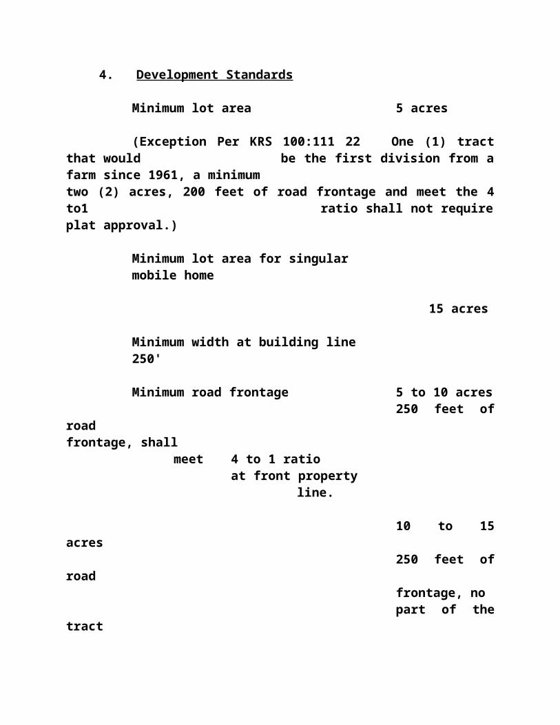
permitted.
4. Special Use
A Planned Unit Development for highway business shall be permitted as a special use in conformance with Article XII of these Regulations.
5. Required Conditions
Same as the required conditions for the C-2 District.
6. Development StandardsMinimum lot area on sewer noneMinimum lot frontage
100 feetMinimum front yard 25
feet, or one-half of the street right-of-way, whichever is greater
Minimum side yard if adjacent to residential district, must comply with adjacent district's requirements
Minimum rear yard (each side) same as side yard
Maximum building height 36' or 3 stories
SignsSee
Article XIParking See Article XBuffer Zones
See Article XV Lighting, Noise, Odor See
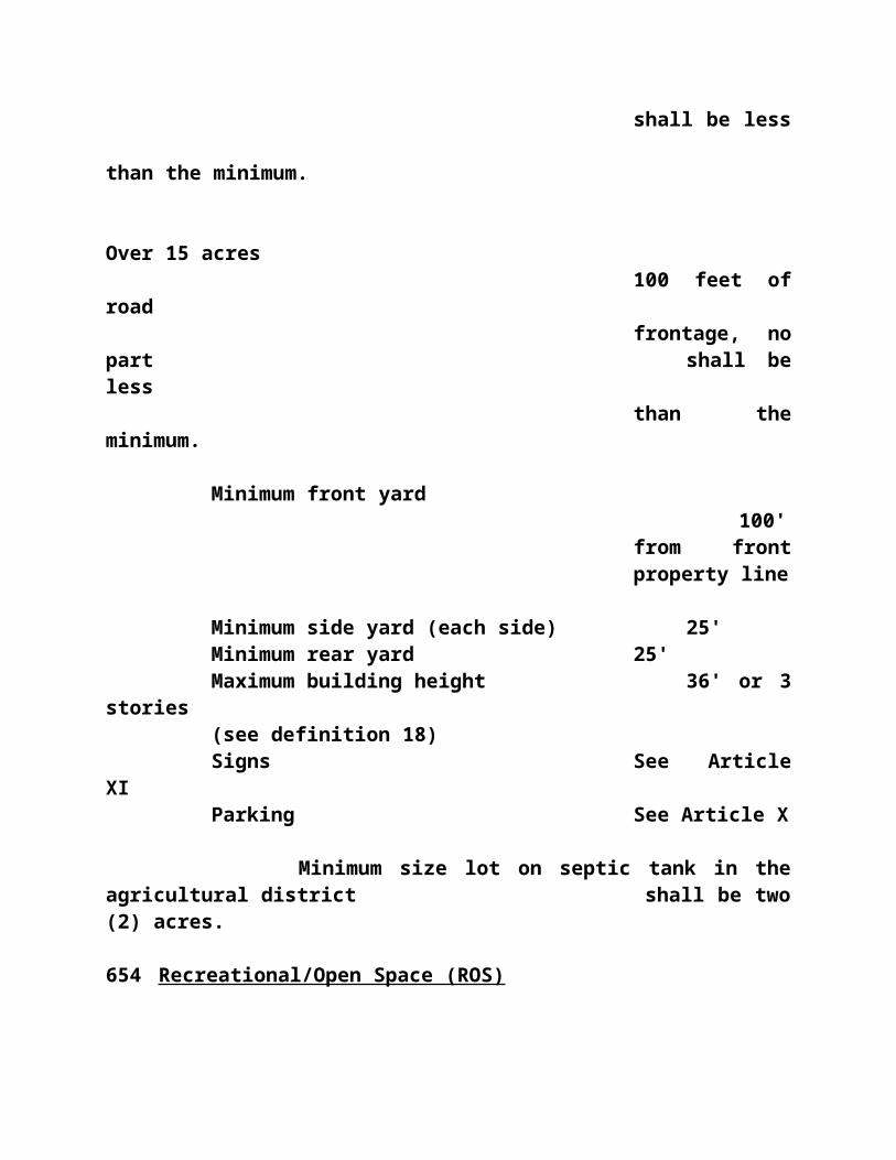
Article XVI
678 Highway Commercial (C-4)
The Highway Commercial Zone (C-4) is for the conduct of retail sales activities as described in C-1, C-2, and C-3 districts. Residential uses including multi-family uses may be allowed in this zone provided a plan for such use is acceptable.
1. Principal Permitted Uses
a. Any consumer and personal service established as indicated in the C-1, C-2, and C-3, and planned shopping center districts, but limited to the uses mentioned above.
2. Conditionally Permitted Uses
a. The following uses are special exceptions and require written approval of the Board of zoning Adjustment:
Churches and other places of worship; parish houses; public libraries; public schools; parks, and non-commercial public recreational facilities; public utilities; funeral homes; cemeteries; nurses' homes, hospitals and clinics for human care, philanthropic institutions and clubs, including a club of which the chief activity is customarily carried on as a business.
The Board of Zoning Adjustment may attach certain conditions to its approval which it feels are necessary to preserve and protect the character of the zone in which the proposed use would locate.
3. Accessory Uses

Any accessory use or building customarily incidental to the above permitted uses is permitted, including dwelling units occupying the same building as the principal commercial use and being for use by the owner and/or operator of the permitted commercial use.
4. Required Conditions
a. Screening: Where a side lot line is shared with an adjoining residential lot, a well-maintained compact hedge, a solid fence or similar solid screening device at least six (6) feet in height shall be installed by the property/business owner or the developer to screen the business use from the adjoining lot in the residential zone. The screen shall begin at the front building line and extend along the common side lot line to the rear property line. The Triple S Planning Commission holds the right to invoke a more stringent buffering zone if a potential threat to the health, safety, welfare and morals of the general public exists.
b. Access to Highways and Streets: In all commercial zones, points of access to highways and streets shall be controlled by the Triple S Planning Commission and by Article VIII, Section 820, of these Regulations. Before any zoning permit for any structure in a C-4 zone may be issued the prospective builder or operator of the proposed C-4 activity shall submit a sketch of the layout and design of the proposed structure and/or use and its access points to the highway and/or street to the Triple S Planning Commission. The Triple S Planning Commission may require that when two or more consumer commercial establishments adjoin along one side of any
street or highway that they share access points to the street. When more than four (4) consumer commercial establishments adjoin along any highway or street, a road parallel to the highway or street may be built, at the expense of all adjoining consumer commercial establishments, to provide service to all consumer commercial establishments on the same side of the street or highway. This road shall have access to the highway or street at no more than two (2) points for every four (4) consumer commercial establishments. The provisions of Article VIII of these Regulations shall also apply in a C-4 zone. Parking and off-street loading requirements are provided in Article X of these regulations.
5. Development Standards
Minimum lot area on sewer None
Minimum lot frontage
100 feetMinimum front yard
35 feet, or one-half of the street-right-of-way, whichever is greater
Minimum side yardif
adjacent to a residential district, must comply with adjacent district's

requirementsMinimum rear yard (each side)
same as side yard
Maximum bldg. height 36'
or 3 storiesSigns
See Article XI
Parking
See Article X
Buffer Zones
See Article XV
Lighting, Noise, Odor See Article XVI
680 Professional Districts
The Professional Zones were established to provide for professional offices, limited personal service businesses, and for community oriented public and private facilities in urban areas.
681 Professional (P-1) Limited Office
1. Principal Permitted Uses
a. Offices devoted to business management and professional services.
b. Banks, building and loan companies, savings and loan companies, and similar financial

institutions
c. Design offices, studios, offices to facilitate architects, engineers, planners, interior designers and graphic artists, but not limited to the above.
2. Conditionally Permitted Uses
The following uses are special exceptions and require written approval of the Board of Zoning Adjustment.
a. Business and personal services of a type and nature clearly supplementary to and complementing the principal uses permitted, and in the same building with said principal use, such as medical laboratories, office supply and equipment repair shops and services, pharmacies, restaurants and similar uses; provided, that said business and personal services shall be conducted primarily for the convenience of the principal permitted uses and that all the entrances to such service establishments shall be from within the building in which located.
3. Accessory Uses
Any accessory use or building customarily incidental to the above permitted and conditionally permitted uses.
4. Special Uses
A planned unit development (PUD) for professional limited office space shall be permitted as a special use in conformance with Article VII of these Regulations.

5. Required Conditions
a. Loading Docks: No loading dock shall be constructed fronting on any public street or roadway.
b. Storage Facilities: No materials or supplies shall be stored or permitted to remain on any part of the property outside the buildings constructed thereon without proper screening and adequate distances from adjoining properties.
c. Buffer requirement must meet the conditions set forth in Article XV.
6. Development StandardsMinimum lot area on sewer
22,500 sq. ft.Minimum lot frontage
100 feet
Minimum front yard50
feet, or one-half of the street right-of-way, which ever is greater
Minimum side yard (each side) 15 feet minimum; 35 feet if adjacent to a residential zone
Minimum rear yard35
feet

minimum; 50 feet if adjacent to a residential zone
Maximum building height36' or
Three (3) stories
Signs
See Article XI
Parking
See Article X
Buffer Zones
See Article XV
Lighting, Noise, Odor See Article XVI
682 Professional (P-2) General Usage
1. Principal Permitted Uses
a. Any use permitted in the Professional Limited Office (P-1) Zone.
b. Clinics - medical or dental offices, medical or dental laboratories.
c. Public/government buildings - police and fire stations, community buildings and recreation centers.
d. Personal health care services - beauty shops, barber shops, exercise and leisure facilities.
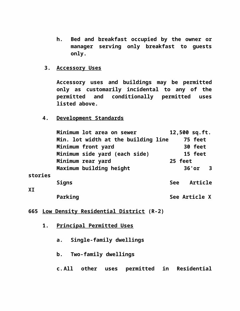
2. Conditionally Permitted UsesThe following uses are special exceptions and require written approval of the Board of Zoning Adjustment.
a. Business and personal services of a type and nature clearly supplementary to and complementing the principal uses permitted, and in the same building with said principal use, such as office supply and equipment repair shops and services, pharmacies, restaurants and similar uses; provided, that said business and personal services shall be conducted primarily for the convenience of the principal permitted uses and that all the entrances to such service establishments shall be from within the building in which located.
3. Accessory Uses
Any accessory use or building customarily incidental to the above permitted and conditionally permitted uses.
4. Special Uses
A planned unit development (PUD) for professional limited office space shall be permitted as a special use in conformance with Article VII of these Regulations.
5. Required Conditions
a. Loading Docks: No loading dock shall be constructed fronting on any public street or roadway.
b. Storage Facilities: No materials or supplies shall be stored or permitted to remain on any

part of the property outside the buildings constructed thereon without proper screening and adequate distances from adjoining properties.
c. Buffer Zones - See Article XV
6. Development Standards Minimum lot area on sewer 22,500
sq. ft.Minimum lot frontage
100 feetMinimum front yard
50 feet, or one-half of the street right-of-way, which ever is greater
Minimum side yard (each side) 35 feet minimum; 40 feet if adjacent to a residential zone
Minimum rear yard35
feet minimum; 50 feet if adjacent to a residential zone
Maximum building height36' or
three (3) stories

Signs
See Article XI
Parking
See Article X
Buffer Zones
See Article XV
Lighting, Noise, Odor See Article XVI
683 Interchange Zones
Zones with uses that are adjacent and near to interstate highways.
684 Limited Interchange Zones (X-1)
Zones adjacent to and near interstate interchanges consisting of hotels, motels, restaurants, shopping centers, theaters, wholesale centers, outlet malls, recreational facilities, service stations, flea and farmers markets and similar uses. Interchange commercial districts should have more permissive signage regulations than commercial districts.
1. Principal Permitted Uses
a. Agriculture.
b. Agricultural structures.
c. Farm dwellings.
d. Recreational facilities.e. Commercial centers and complementary uses

as determined by the Triple S Planning Commission.
2. Conditionally Permitted Uses
a. Commercial subdivisions.
b. Automobile, vehicle, machinery and/or material recyclers as defined in KRS 177.905.
3. Special Regulations
a. The effect of a planned-development project on surrounding uses shall be considered in determining its approval or disapproval.
b. The Triple S Planning Commission shall require the
dedication or reservation of rights-of-way as authorized to provide access to interior land in interchange zones. Streets providing this interior access shall be spaced according to the standard defined by Section 870 of these Regulations.
c. Planned Unit Development project for any uses except heavy industry. The procedure under Article XII, Section 1210 shall be followed.
d. Buffering as required in Article XV.
4. Development StandardsMinimum lot area on sewer
30,000 sq.ft.Minimum lot frontage
150 feet
Minimum front yard75
feet, or one-half of the street right-

of-way, whichever is greater
Minimum Side Yard25
feet minimum, 50 feet if adjacent to Residential or Agricultural
Minimum rear yard50
feet minimum; 75 feet if adjacent to a residential zone
Maximum building height36' or
three (3) stories
Signs
See Article XI
Parking
See Article X
Buffer Zones
See Article XV
Lighting, Noise, Odor See Article XVI
685 General Interchange Zones (X-2)

Zones adjacent to interstate interchanges utilizing the uses as stipulated in the Limited Interchange Zone (X-1), but may also include truck stops, mobile homes sales lots, warehousing and distribution centers.
1. Principal Permitted Uses
a. All uses permitted in the Limited Interchange (X-1) Zone
b. Various types of light industry as approved by the Triple S Planning Commission. These various types of light industries cannot create obnoxious noise, odors, glare, or other types of pollutants that may be considered hazardous to the health, safety, welfare and morals of the general public.
2. Conditionally Permitted Uses
a. Commercial subdivisions.
b. Automobile, vehicle, machinery and/or material recyclers as defined in KRS 177.905.
3. Special Regulations
a. The effect of a planned-development project on surrounding uses shall be considered in determining its approval or disapproval.
b. The Triple S Planning Commission shall require the dedication or reservation of rights-of-way as authorized to provide access to interior land in interchange zones. Streets providing this interior access shall be spaced according to the standard defined by Section 870 of these Regulations.

c. Buffering as required in Article XV.
4. Development Standards
Minimum lot area on sewer 40,000 sq. ft.
Minimum lot frontage 150
feetMinimum front yard
75 feet or one half of the street right-of-way, whichever is greater
Minimum Side Yard25
feet minimum, 50 feet if adjacent to Residential or Agricultural
Minimum Rear yard50
feet minimum, 75 feet if adjacent to a residential zone
Signs
See Article XI
Parking
See

Article X Buffer See Article XV Lighting, Noise, Odor See Article XVI
686 Industrial Districts
687 Light Industrial District (I-1)
The Light Industrial District is primarily intended for production and assembly plants and industrial operations or services that are conducted in such a manner that noise, odor, dust, glare and vibration produced is essentially contained within the premises. These activities shall not: 1) present any significant on-site release or discharge of pollutants including but not limited to, odor, noise, dust, smoke, contaminants, hazardous substances, wastewater, vibrations, waste, recycled materials into the environment including, without limitation to, the air, water, or land, regardless or approval of Federal, State, or Local agencies, and 2) have any negative off-site environmental effects, and 3) require visible outdoor storage or large amounts of water or wastewater treatment operations.
Light industry excludes those industries which are required to obtain a hazardous waste treatment storage or disposal permit pursuant to the Resource Conservation Act (RCRA), 42 U.S.C. Section 9601 et seq. or State statutes promulgated in lieu thereof. In determining which industries are excluded from light industrial districts according to the above referenced standards, the Planning Commission shall take into account the presence, storage, treatment, recycling, or disposal of any hazardous substance as defined by the Comprehensive Environmental Response, Compensation, and Liability Act (CERCLA), 42 U.S.C. Section 9601 et seq., or hazardous waste as defined by the RCRA or State statutes promulgated in lieu thereof.
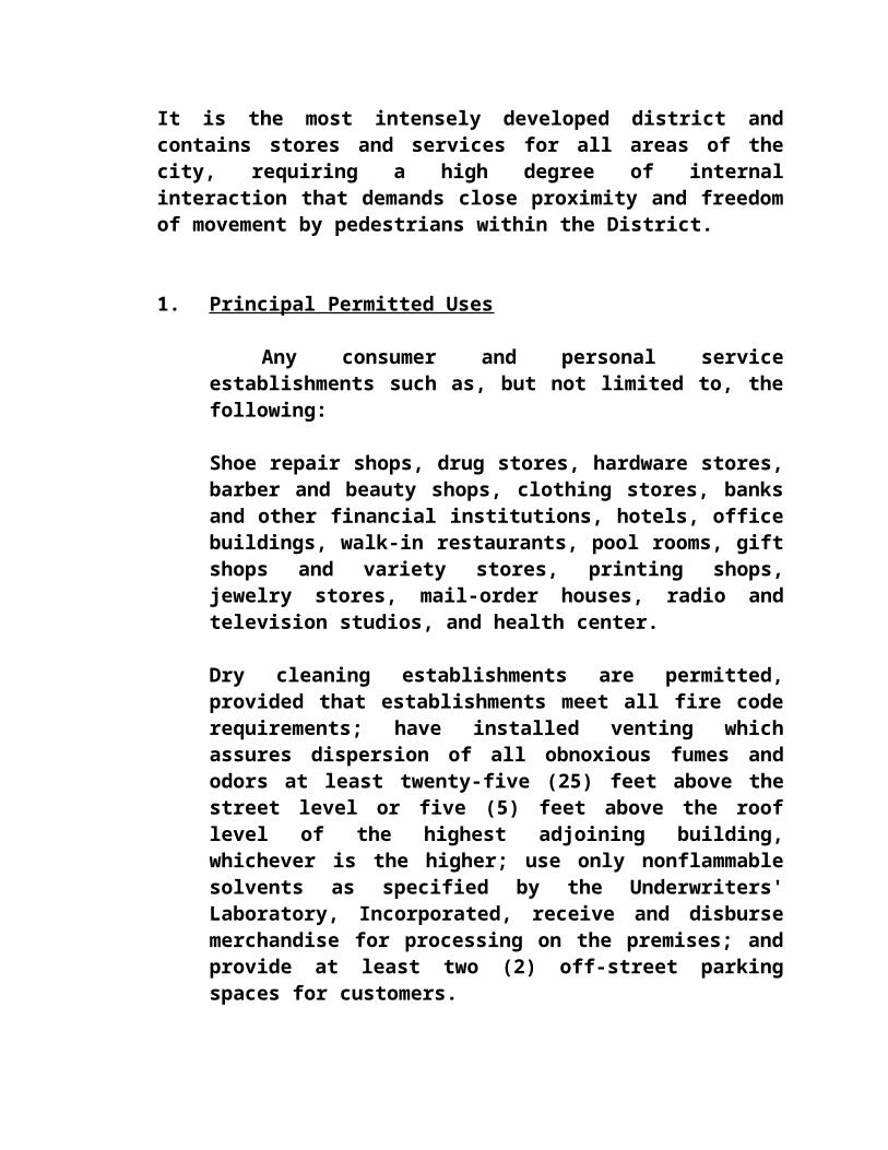
1. Principal Permitted Uses - as interpreted by the Administrative Official, but not limited to the following:
Adding machine manufacture; artificial flower manufacture; automobile assembly; automobile rental agency; automobile, trailer and farm implement dealers; animal hospitals, veterinary clinic and associated kennels; baggage transfer, storage and warehouse; bakery; bottling works and beverage manufacture; bicycle and motorcycle repair; blacksmith; book publishing; boot and shoe manufacture; broom manufacture; building materials yard; cabinet maker; candy manufacture; canning and preserving factory; cap and hat manufacture; carpenter shop; carpet cleaning; car wash; chicken hatchery; cigar
and cigarette manufacture; coal yard; coffin and concrete burial vault manufacture; cold storage warehouses; condensed milk manufacture; contractors' storage yard; cosmetic manufacture; creamery; dry goods; wholesale or storage; dyeing and cleaning; electrical supply manufacture; enameling and painting; engraving plant; envelope manufacture; express storage and delivery station; feed, wholesale, flour and grain storage and elevators; food products manufacture; fruit and vegetable drying; fuel distributing station; fuel gas storage; fur warehouse; furniture warehouse or storage; repair garage; garment factory; grocery store, wholesale; ice manufacture; laundry; lumber yard, not including sawmill; moving company and storage facilities; paper box, can, tube and sack manufacture; radio and television manufacture; screw and bolt manufacture; seed company; sheet metal shop; sporting goods manufacture; tinsmith shop; tire manufacture, including recapping plants; warehouses; welding shop; and wood products manufacturing.

2. Conditionally Permitted Uses
The following uses are special exceptions and require written approval of the Board of Zoning Adjustment:
Any industrial, manufacturing, fabrication, processing or industrial service use which the Board of Zoning Adjustment determines would not emit obnoxious noise, odor, smoke, dust, particles, materials, or vibration beyond the confines of its property may be conditionally permitted.
The Board may attach certain conditions to its approval which it feels are necessary to preserve and protect the character of the zone in which the proposed use could locate.
3. Accessory Uses
Any accessory use or building customarily incidental to the above permitted and conditionally permitted uses.
4. Special Uses
A Planned Unit Development for light industries shall be permitted as a special use in conformance with Article XII of these Regulations.
5. Required Conditions
a. Yards: On lots adjacent to a residential district, all buildings shall be located so as to provide a minimum yard of one-hundred (100) feet.
b. Loading Docks: No loading dock shall be constructed fronting on any public street or roadway.

c. Storage Facilities: No materials or supplies shall be stored or permitted to remain on any part of the property outside the buildings constructed thereon without proper screening and adequate distances from adjoining properties.
d. Waste Disposal: No waste material or refuse shall be dumped upon or permitted to remain upon any part of an industrial property outside of buildings constructed thereon. In addition, the property shall not be used by an industry whose primary business requires industrial sewerage, unless the governing municipal body authorizes the use of its sewage disposal facilities.
e. Buffering as required in Article XV.
6. Development Standards
Minimum lot area on sewer noneMinimum lot frontage 100
feetMinimum front yard 40
feet, or one-half of the street right-of-way, whichever is greater
Minimum side yard 50 feet minimum; 100 feet if adjacent to residential zone
Minimum rear yard
50 feet minimum, 100 feet if adjacent to a residential zone

Maximum building height 60 feetSigns
See Article XI
Parking See Article XBuffer Zones
See Article XV Lighting, Noise, Odor See Article XVI
689 Heavy Industrial District (I-2)
The Heavy Industrial District is primarily intended for production and assembly plants and industrial operations or services that present: 1) the potential of a significant release or discharge of waste, wastewater, hazardous substances, pollutants or contaminants into the environment including, without limitation air, water, or land, or 2) activities that require a large amount of water and wastewater treatment for operation, and 3) industrial uses with negative off-site environmental effects shall be excluded. Industrial uses with negative off-site lighting, noise and objectionable odor impacts shall be excluded. Heavy Industries should be located in areas with topographic features suitable for such industries and where adequate utilities and transportation are available.
1. Principal Permitted Uses
a. Any use permitted in the Light Industrial (I-1) District.
b. Agricultural implement manufacture; airplane repair and manufacture; aluminum manufacture; automobile manufacture; bank equipment manufacture; barrel manufacture; bicycle manufacture; boat manufacture, can manufacture; candle manufacture; cast iron pipe manufacture; casting foundry; celluloid

manufacture; concrete plant; corrugated metal manufacture; culvert pipe manufacture; engine manufacture; fixture manufacture; furnace manufacture; furniture manufacture; hardware manufacture; iron (ornamental) works; linoleum manufacture; locomotive manufacture; machine shop; metal products manufacture; motorcycle manufacture; shoe manufacture; structural iron and steel manufacture; tobacco manufacture; tool manufacture; and wire manufacture.
2. Conditionally Permitted Uses
The following uses are special exceptions and require written approval of the Board of Zoning Adjustment:
a. Abattoirs and meat processing; acid manufacture; acetylene gas manufacture; ammonia manufacture; asphalt manufacture, refining or storage; blast furnace, brick kiln, charcoal manufacture and pulverizing; chemical manufacture, creosote treatment and manufacture; exterminator or insect poison manufacture; fat rendering, fertilizer manufacture; flour and grain milling; gasoline storage, wholesale; junk yards; leather curing and tanning; lime manufacture; monument works; plaster of paris manufacture; quarry works; refuse dump; rock crushing; salvage storage yard; sawmill; scrap iron; storage yard; stock yards; sulphur, sulfuric acid, or derivatives manufacture; tar distillation or manufacture; terra cotta manufacture; wrecking material yard; and coal washing, storage and transfer yards and facilities.
The Board may attach certain conditions, including buffer zones surrounding the entire

site, to its approval which it feels are necessary to preserve and protect the character of the zone in which the proposed use would locate.
b. Any other industrial, manufacturing, fabrication or processing uses which the Board of Zoning Adjustments determines to be non-detrimental to surrounding properties nor possess other characteristics that would be a nuisance to the residents of the city and/or county.
3. Accessory Uses
Any accessory use or building customarily incidental to the above permitted and conditionally permitted uses.
4. Special Use
A Planned Unit Development for heavy industries shall be permitted as a special use in conformance with Article XII of these regulations.
5. Required Conditions
a. Yards: On lots adjacent to a residential district, all buildings shall be located so as to provide a minimum side and rear yards of one-hundred (100) feet.
b. Loading Docks: No loading dock shall be constructed fronting on any public street or roadway.
c. Storage Facilities: No materials or supplies shall be stored or permitted to remain on any part of the property outside the buildings constructed thereon without proper screening

and adequate distances from adjoining properties.
d. Waste Disposal: No waste material or refuse shall be dumped upon or permitted to remain upon any part of an industrial property outside of buildings constructed thereon. In addition, the property shall not be used by an industry whose primary business requires industrial sewerage, unless the governing municipal body authorizes the use of its sewage disposal facilities.
e. Junk yards, salvage and scrap iron yards and similar uses shall be enclosed by an acceptable fence, wall or other screening not less than six (6) feet in height. The Board of Zoning Adjustment shall determine the acceptability of said screening.
6. Development StandardsMinimum lot area on sewer noneMinimum lot frontage 100
feetMinimum front yard 50
feet, or one-half of the street right-of-way, whichever is greater
Minimum side yard 50 feet minimum; 100 feet if adjacent to residential district
Minimum rear yard
50 feet, or 100 feetif adjacent to a residential district

Maximum building height 60 feetSigns
See Article XI
Parking See Article XBuffer Zones
See Article XV Lighting, Noise, Odor See Article XVI
690 Floodplain/Conservation District (F/C)
The Floodplain/Conservation District is an exceptional area for which special regulations have been developed. This district is composed of lands that are subject to being flooded and the special regulations have the purpose of preventing development in the flood plain of buildings and structures that will increase flood heights and damage and preventing excessive property damage and loss of life in areas of greatest flood hazard.
1. Principal Permitted Uses
None
2. Conditionally Permitted Uses
The following uses are permitted in a Floodplain District, subject to the restrictions, limitations and procedures set forth in this Section and in other provisions of these regulations.
a. Agricultural uses not involving the commercial slaughtering of animals or other operations producing obnoxious odors or noises.
b. Open-type recreational facilities, either public or private.
c. Outdoor advertising subject to provisions of

Article XI of these regulations.
d. Temporary uses subject to Article VIII of these regulations.
e. Any other uses customarily accessory or incidental to the above uses.
3. Restrictions and Limitations in Floodplain Areas
a. The erection of any structure for residential purposes is prohibited.
b. No use or structure shall be permitted in a Floodplain District that restricts, impedes or diverts the natural flow of water in the area.
c. There shall be no filling of land or excavation of land unless and until a certificate shall be issued by the City Engineer, or an equivalent official, and the State Division of Water (if applicable), and approved by the Planning Commission that such filling or excavation does not alter the natural flow of water.
4. Procedure for Development
No building, structure, use or improvement shall be undertaken in a Floodplain District without the prior approval of the Planning Commission nor without a Conditional Use Permit issued by the Board of Zoning Adjustment.
a. A development plan shall be prepared by the applicant and submitted to the Planning Commission for review and approval. Provisions of Article XIII of these regulations pertaining to Development Plans shall be followed.

b. In reviewing the submitted plan of development, the Planning Commission shall be guided by the following standards:
i. Permitted uses shall be of the type not subject to major damage by floods as set forth in Section 690(2).
ii. Structures shall be placed on the lot so as to offer no obstruction to the flow of water at the one-hundred (100) year flood plain level.
iii. Structures shall be firmly anchored to prevent floating away during floods.
iv. Topographic data, hydrological data, engineering studies or other special studies may be necessary to determine the effects of flooding on a proposed structure or the effect on the floodway of the structure and the Planning Commission may require that such studies by prepared by competent engineers or other professionals.
v. The granting of approval shall not be construed to imply that the action of the City Council, Planning Commission or any of their offices or agencies is a representation, guarantee or warranty of any kind of the practicality or safety of any structure or plan proposed and shall create no liability upon or a cause of action against such public bodies, officers or employees for any damage that may result pursuant thereto.
c. The Board of Zoning Adjustment shall secure a written recommendation from the Planning
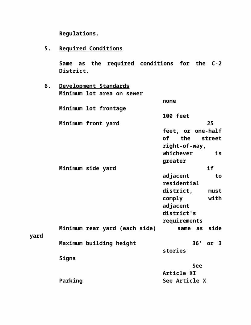
Commission setting necessary standards and conditions for the proper operation of the proposed use or structure before issuing the Conditional Use Permit.
d. Nothing in these regulations shall be construed to relieve the developer of the responsibility to conform to all State and Federal regulations regarding identified federal floodway.
695 City of Shelbyville Downtown DistrictsSome areas within Shelby County have specified physical characteristics that warrant special conditions. This provision shall apply only those regulations specifically addressed by the Shelbyville Downtown Districts.
a. Site Plan - At a minimum, a site plan would be required for review of the on site location of the parking and to review the appropriateness of the planned screening or fencing. This site plan would be submitted to the Planning Commission (in duplicate) by the owner or developer. One copy would be forwarded to the Shelby Development Corporation for their advisory review and comments. The Planning Commission would be the administrating agency for this site plan review, while giving due consideration to the comments of the Shelby Development Corporation. The applicant would have the right to appeal the decision of the Planning Commission to the Shelbyville City Council. The Planning Commission may require
at its discretion a development plan as required in Article XIII.
b. Permitted Uses - Uses as currently enforced by these Regulations for that particular zone and any other guidelines as invoked by the city and/or county. The City of Shelbyville has specific guidelines for historic

preservation. These particular guidelines can be found in The Shelbyville Historic District Guidebook. c. Buffer Zones - As required in Article XV or at the discretion of the Planning Commission.
1. Central Business District
The intent of this district is to maintain the character currently established in the area with predominantly three story buildings, urban in character. There will not be any requirements for off-street parking in the district. It is anticipated that these regulations shall work to implement these concepts and shall encourage building character (material, height, facade treatment) compatible with existing character.
Principal Permitted Uses Include But Are Not Limited to the Following:
a. Retail and Personal Service Outlets as Follows: antiques; apparel stores; bakeries, including baking on the premises; barber shops; beauty parlors; camera and photo supply stores; dairy products sales; drug stores of any size; dry cleaning and laundry; florists; fruit and vegetable markets; health centers; household furnishings; jewelry and leather goods sales and repairs; mail order houses; opticians and orthopedic specialists; paint and art supplies; radio and other electronic repair shops; shoe sales; tobacco shops; toy stores; variety stores;
b. Offices: business and professional offices of any kind;
c. Banks: Including drive-in facilities, savings and loan companies, finance companies;
d. Eating and drinking places: soda fountains; ice

cream parlors; tea rooms; private dining rooms; restaurants; sidewalk cafes in conjunction with restaurants: taverns and bars. No drive-in/drive through restaurants are allowed; sidewalk cafes in conjunction with a restaurant;
e. Commercial Parking Lots:
f. Residential Uses: As regulated in the multi-family zoning district;
g. Accessory Uses: Accessory uses and structures customarily accessory and incidental to any of the foregoing principle uses.
Development Standards
Minimum lot frontage NoneMinimum front yard NoneMinimum side yard NoneMinimum rear yard NoneMaximum building height 36' or three (3)
stories Parking
None Sign Article XI
Parking should be located to the rear of the building. If the parking area abuts a street, it should be fenced on the abutting street to a minimum height of six (6) feet. The fence should provide solid screening through the use of landscape or fence materials for a three (3) foot minimum. Fencing materials should be compatible with the building's materials and the area's architectural style with preference to iron or brick (Article X). The applicant will submit a site plan which indicates the location of the parking on the site and its relation to the building. The materials and location of the fencing should be shown.

Maximum driveway width of twenty (20) feet.
2. Downtown Commercial District
The intent of this district is to provide a transition between the downtown commercial area and the more visually open highway commercial areas. While the range of commercial activities would be considerably more inclusive than the Central Business District, the set-backs and on-site parking would be more of an urban character. (Would only apply to underlay district if commercial)
a. Principal Permitted Uses
All uses permitted in the Central Business District
Retail businesses and service establishments such as groceries including drive-in convenience type stores, pawnshops, package beer and liquor sales,
automotive parts and supply stores, service stations providing fuel and oil for vehicles, oil change and lubrication shops provided that the activity is carried out inside the building, sales of hardware,
lumber, plumbing and other building supplies as long as there is no manufacturing or fabrication carried out on the premises and there is no outside storage
of inventory, tool and equipment rental centers, car washes and cleaning service, plumbing, heating and air conditioning service companies where there is not outside storage of materials. Any other retail business or service establishment which is
determined by the Board of Adjustments and Appeals

to be of the same general character as the above mentioned.
b. Conditionally Permitted Uses
The following uses are special exceptions and require the approval of the Board of Adjustments and Appeals: Drive thru restaurants, bank and other financial institutions with drive thru facilities businesses providing light mechanical repairs to cars and trucks (as a minimum condition all repairs shall take place inside the building and there shall be no outside storage or materials used in the business or of any damaged or inoperative vehicles), package beer and liquor stores and other retail outlets with drive thru facilities.
c. Prohibited Uses
Automotive or truck sales and rentals and other like businesses (i.e. boat sales, farm implements and industrial machinery, etc.) which have outside storage and display, welding shops and machine shops.
d. Development Standards
Minimum lot frontage Forty (40) feet
Minimum front yard Minimum eight (8) feet; Maximum Twenty-Five (25) feet
Minimum side yard None. If adjacent to

residential, the side yard must comply with residential requirement
Minimum rear yard Same as side yard
Maximum building height Two (2) stories
ParkingSame as
Central Business Districtand:
1 space per 250 square feet + 1 per truck regularly used by the business. Driveway should be single ingress and egress where possible with a maximum width of twenty-four (24) feet.
SignSingle sign on
both front and rear of building permitted, which would be attached to building
3. Limited Mixed Use District
This district is intended to maintain the predominant visual style and characteristics of the area as a pre-twentieth century residential area, while allowing the uses of the buildings to include limited types of commercial and professional activities.
Principal Permitted Uses
a. Retail and personal service outlets including but

not limited to as follows:
AntiquesApparel storesBeauty parlorsBook storesCustom tailors and weaversGift shopsJewelryPicture framingPhotographic studios and shopsStamp and coin storesStationary storesTravel agencies
b. Offices: Business and professional offices of any kind
c. Residential uses: As regulated in the multi-family zoning district
d. Bed and breakfast, with cooking as accessory use
e. Accessory Uses: Accessory uses and structures customarily accessory and incidental to any of the foregoing principal uses.Development Standards
Minimum lot area 5,000 sq. ft.
Minimum lot frontage 60 FeetMinimum front yard The
setback is the average of the existing setback for the two adjacent properties on each side (four total)
Minimum side yard 8 feet

Minimum rear yard noneMaximum building height 36' or three
storiesSigns
One freestanding non-electric sign within the front yard setback is permitted that is the same or similar material as the building.
Buffer Zone
See Article XV
4. Agricultural/Commercial District
This district focuses on those commercial activities related to agricultural production, as well as related retail activities. The district recognizes the important role agriculture plays in the local economy and integrates it in an on-going manner into Shelbyville, while recognizing the special on-site needs of such development. Parking and loading requirements and outside activities in this district would be designed to reflect the distinct nature of these commercial activities. The purpose of this district is to support the type of commercial activity located there, while recognizing the contiguous residential neighborhoods and reducing the possibility that heavy commercial or manufacturing would locate in these areas.

a. Permitted uses include but are not limited to: animal supply houses; automotive supply stores; enclosed recycling centers; feed and seed stores; farm implement dealership sales and repair; garden supply stores; hardware, lumber, and building centers, including incidental repair service; home remodeling or improvement centers; lawnmower sales and service; light industrial uses conducted within a structure; plumbing supplies; transfer and distribution centers; veterinarians and veterinary supply stores; warehousing activities; welding and vehicular repair activities; wholesaling activities.
Development Standards
Minimum lot frontage 50 feetMinimum front yard NoneMinimum side yard None. If
adjacent to residential zone, the side yard must comply with residential zone requirement
Minimum rear yard Same as side yard
Maximum building height Two (2) stories
Sign Article XI
ParkingSame as
Central Business Districtand:
Loading docks should not face onto a public street.

1 space per 300 square feet + 1 for each truck regularly used by the business.
Buffer ZoneSee
Article XV and:
Outdoor operations or storage should be screened with an eight (8) foot fence which should be closed for at least the bottom three (3) feet.
c. Prohibited Uses include: heavy industrial uses; outdoor storage operations other than agricultural products; salvage operations; vehicular auctions; wholesale dealerships.
5. Warehouse DistrictThis district is to permit the continued viable economic operation of warehousing activities and to recognize the importance of the tobacco industry to Shelby County, while acknowledging the proximity of the adjacent residential areas. The district would allow commercial activities such as warehousing and associated distribution and sales activities and would prohibit the storage of certain highly flammable or hazardous substances with a procedure for notifying the Fire or Police department or appropriate officials of materials to be stored. The purpose of this district is to support warehouse and related activities, while eliminating the possibility of manufacturing activities locating within this area in the future.
Principal Permitted Uses Include: Distribution activities; tobacco warehousing; sales and distribution activities; limited warehousing of other goods and products contained in a structure principally used for the tobacco industry

and during off season periods.
Development Standards
Minimum lot frontage 100 feetMinimum front yard 8 feetMinimum side yard None. If
adjacent to residential, then a 50 foot requirement
Minimum rear yard Same as side yard
Maximum building height 20 feetParking
1 space per 2 employees + 1 space for each truck used by business. Enclosed loading dock.
Buffer Zone
See Article XV
Sign Article XI
6. Civic DistrictIt is intended that the Civic District and the Central Business District will function together as the
downtown hub of Shelbyville. All uses permitted in the Central Business District are permitted uses in the Civic District. The primary difference between the two districts is the location in the Civic District of a

number of public offices and institutions requiring adequate off-street parking to accommodate the users of these public facilities. For public buildings and others places of public assembly in the Civic District, the required off-street parking shall be set forth in Article X of these regulations.
7. Conservation District
The Conservation District includes some (but not all) areas of the City of Shelbyville that are adjacent to Clear Creek and are subject to flooding. Those parts of the District that are in the flood plain should be left in their natural state as much as possible and used for recreation and other open air activities.
The Conservation District includes the area bounded by 2nd Street on the west, Washington Street on the South, and Clear Creek on the North and East; by Third Street on the West, Bradshaw Street on the North and Clear Creek the South and East.
a. Principal Permitted Uses
All uses and conditional uses permitted in the underlying zoning district.
b. The following open space uses are permitted in the Conservation District
Agricultural use as defined in Article II of these regulations.
Wildlife refuge and conservation programs, hunting, trapping fishing and forestry.
Nature trails, walkways, scenic paths, parks and similar recreational uses.

Small structures such as boat ramps, handicap ramps, steps or railings necessary to maintain or develop scenic and/or conservation uses and provide for access.
ARTICLE VII
APPLICATION OF REGULATIONS
700 Application of Regulations
All existing and future structures and uses of premises within the County of Shelby, shall conform with all applicable provisions of these Zoning Regulations. Each zone is established to permit only those uses specifically listed as permitted uses or accessory uses, except as provided under the nonconforming or conditional use provisions, and is intended for the protection of those uses. No other uses are permitted except as specifically permitted elsewhere in these regulations.
710 Special Provisions for Agricultural Areas
For the purposes of these regulations, land which is used solely for agricultural purposes, shall have no regulations imposed as to zoning permits, height, yard, location or court requirements for agricultural buildings except that:

1. Setback lines shall be required for the protection of existing and proposed streets and highways. In connection therewith, all requirements of the appropriate governing authority as regarding sight and sight-line distance and drainage shall be complied with; and
2. All existing and/or future buildings or structures in a designated floodway or floodplain, or which tend to increase flood heights or obstruct the flow of flood waters may be fully regulated.
720 Subdivision of Agricultural Land Landowners or developers desiring to subdivide agricultural land for any non-agricultural use must meet the following requirements:
1. Obtain a zoning change to the appropriate zone unless the intended use is suitable in the agriculture zone.
2. Conform with the Subdivision Regulations, including design and processing requirements.
3. Conform with the dimension requirements and other special requirements as may be imposed by the Planning Commission.
730 Coordination with Subdivision Regulations
In all cases, the provisions of the Subdivision Regulations of Shelby County, Shelbyville, Simpsonville and unincorporated areas and amendments thereto shall apply in addition to the provision of these Zoning Regulations.
740 Certificate Of Land Use Restrictions

Whenever a legislative body approves a zoning map amendment with conditions, whenever the Planning Commission approves a development plan or subdivision plat, and whenever the Board of Zoning Adjustments approves a variance or conditional use permit, a Certificate of Land Use Restriction as detailed below shall be filed with the county clerk as per KRS 100.3681 - 100.3683 (see example Certificate of Land Use Restriction Form, Section 760).
750 Satellite Dish Guidelines
1. Apply for a Conditional Use Permit hearing through Triple S Planning Commission Office only if conditions 3,4,5 and 6 below, cannot be met.
2. Fee for hearing $100.
3. Must be placed in rear yard only. May not be placed on top of any structure.
4. Must be twenty-five (25) feet from all property lines.
5. Any and all wiring must be placed in conduit.
6. Maximum size of the satellite dish cannot exceed twelve (12) feet.
7. There is a twenty dollar ($20) permit fee.
8. A Satellite Dish three (3) feet and smaller shall not
require a permit.

760 CERTIFICATE OF LAND USE RESTRICTION
1. Name and address of property owner(s)_________________________ ______________________________________________________ ______________________________________________________ _____________________________
2. Address of Property 3. Name of subdivision or development (If
applicable)_________________________ _______________________________________________________ _______________________________________________________ ______________________________
4. Type of Restriction(s) (Check all that apply)
______Zoning Map Amendment ______ Conditional Zoning Condition
to_____Zone

______Development Plan ______ Other______Subdivision Plat (Specify)________________________Variance______Conditional Use Permit
5. Name and address of Planning Commission, Board of Zoning Adjustment, legislative body or fiscal court which maintains the original records containing the restriction.
_________________________________________________________________________________________________________
________________________________Signature of Completing
Official
________________________________Name and Title of
Completing Official (type or print)

ARTICLE VIIIGENERAL ZONE REGULATIONS FOR LOTS AND YARDS
800 Applicability
Except as hereinafter specified, the provisions of this Article shall apply to all districts.
The provisions of these Regulations affect every building and use. No building or land shall be used, and no building shall be erected, moved, altered, or demolished, except in conformity with these Regulations. No excavation, cut or fill of earth or debris shall be undertaken unless a permit is issued in conformance with the provisions of these Regulations.
810 Yard Regulations
1. Yards
Any part of any yard, open space, off-street parking or loading space required in connection with any building to comply with these Regulations shall not be included as part of any yard, open space, or parking or loading space for any other building.
2. Non-Reduction of Yards
A yard or lot existing at the time of adoption of these Regulations, or created subsequently, shall not be reduced in dimension or area below the minimum requirements set forth in these Regulations. In addition, no lot shall be reduced in area so that yards are not maintained. This section shall not apply when a portion of a lot is acquired for a public purpose.
3. Front Yards and Through Lots

Front yards for corner and/or through lots shall be of the depth required by these Regulations for the zone in which the lots are located. The side yard adjacent to the intersecting or parallel street shall be of the depth required by these Regulations for front yards in the zone in which the lot adjacent to the corner and/or through lot is located.
4. Corner Lots
Front yards and side yards for corner lots shall be measured from the street right-of-way line; provided that for the purposes of this measurement no city street shall be considered to be less than fifty (50) feet wide. This provision shall not be construed as requiring the dedication of any property to the public.
5. Architectural Features
Steps, terraces, decks, carports, bay windows, fire escapes, balconies, open porches, and other unenclosed architectural features may extend into required yard space not more than nine (9) feet, provided that no such projection shall be less than five (5) feet from a side lot line. Enclosing such projection in the required yard space is prohibited.
6. Use of Yards for Accessory Buildings
No accessory buildings are permitted in front yards. They are permitted in the rear or side yards according to the dimension and area regulations.
7. Rear Dwellings
No dwelling shall be erected on a lot which does not abut on at least one street for at least forty (40) feet.

No building in the rear of a main building on the same lot may be used for residential purposes, unless approved as a special exception by the Board of Zoning Adjustment.
8. Fences, Walls and Hedges
In any required front yard or side yard for corner lots, no fences or walls shall be permitted which materially impede vision across or into such yard above thirty (30) inches in height, except in commercial and industrial areas. Fences, walls and hedges are permitted in or along the edge of a yard except as provided above. In Planned Unit Developments requiring Development Plan review, the Planning Commission may permit fences, walls and hedges above thirty (30) inches in height in the front yard.
9. The owner of a lot of official record, improved or unimproved, which lot a the time of the adoption of these Regulations does not include sufficient land to conform to the yard or other requirements of these Regulations, may submit an application to the Board of Zoning Adjustment for a variance from the terms of this ordinance in accordance with provisions of Article V. Such lot may be used as a building site, provided, that the yard and other requirements of the zone are complied with as closely as is possible in the opinion of the Board of Zoning Adjustments.
812 Building Line Setback
A building line to establish a front yard for all buildings and structures shall be established at a distance from the street right-of-way line equivalent to one half (1/2) the width of the right-of-way of the street on which the
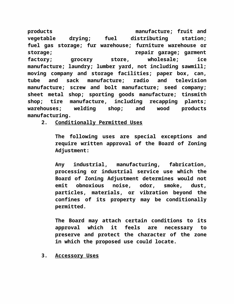
building fronts. In no case shall this distance be less than twenty five (25) feet from the right-of-way line of the street, and it shall not be required to be more than one-hundred (100) feet.
Variances may be granted where existing development on adjoining lots does not meet this front yard requirement.
This section of these Regulations shall not apply to the Central Commercial District, which allows for zero setbacks from the right-of-way (ROW).
815 Setback Lines, Exceptions
Front yard setback lines may be varied by the Board of Zoning Adjustment where the average depth of principal buildings on adjoining properties is less or greater than the depth prescribed elsewhere in these Regulations. In such case, the front yard in question shall not be less than the average depth of existing front yards on the two (2) lots immediately adjoining.
820 Lot Access Requirements
Every lot upon which a building is erected for use shall either be adjacent to or have direct and permanent and exclusive access to a public street of at least sixty (60) feet unless otherwise specifically permitted in these Zoning Regulations. Access to buildings in a Planned Unit Development shall be approved by the Planning Commission.
The following restrictions regarding lot access control shall apply:
1. Lots with less than one-hundred (100) feet of frontage on a public street shall have no more than one (1) point of access to the public street. Lots with more than 100 feet but less than 400 feet shall

have no more than two (2) points of access to the public street. Lots with more than 400 feet of frontage shall have no more than two (2) points of access for each four-hundred (400) feet of frontage.
2. The location of access drives for lots with 400 or more feet of frontage shall be approved by the appropriate agency.
3. No point of access shall be allowed within thirty (30) feet of the intersection of the right-of-way lines of intersecting streets.
4. No curbs on public streets or public rights-of-way shall be cut, removed, or altered nor shall any curb or pavement be constructed within the right-of-way without written approval of the appropriate agency.
5. An access drive shall not exceed twenty (20) feet in width for one-way and/or one-lane ingress or egress. Two-way and/or two-lane access drives shall not exceed thirty-five (35) feet in width. Total access to any lot shall not exceed 40% of the lot width.
830 Accessory Buildings
Accessory buildings shall be permitted in rear yards only and must be at least five (5) feet from any other buildings on the same lot and five (5) feet from all adjoining lots. On any corner lot adjoining in the rear another lot which is in a residential zone, accessory buildings shall conform to the side yard requirements for the residential zone. Residential accessory buildings shall not be used for or involved with the conduct of any business, trade, or industry.
Temporary structures and accessory buildings may be

allowed for the storage of equipment during construction.
No buildings in the rear of a main or principal building on the same lot shall be used for residential purposes unless it conforms to all requirements of these Regulations, including, but not limited to, Section 810 (7).
831 Storage of Materials or Supplies
In all zones, no materials or supplies shall be stored or permitted to remain on any part of the property outside the buildings constructed thereon without adequate screening as determined by the Planning Commission or meeting the requirements of Section 830 of these Regulations.
832 Swimming Pools
All private in-ground and above-ground pools except as noted must be covered or completely enclosed, including a gate, with a minimum of a four foot fence so as to prevent unauthorized or accidental access by children. Above-ground pools greater than four feet in height with a retractable or removable ladder and all pools smaller than 100 square feet and 18" in depth or less and not containing any recirculating equipment shall be exempt from this requirement.
The Enforcement Official shall have the authority to waive this requirement in light of extenuating circumstances regarding a particular piece of property such as natural barriers preventing access and location on large fenced lots.
All public swimming pools must meet all applicable Kentucky State Regulations regarding fencing.
840 Lot for Every Building

Except in a Planned Unit Development, every principal building shall be located on a separate lot with only one principal building and permitted accessory structures. Temporary structures are permitted during construction only (See Article 8, Section 891) and may be erected on a single lot unless requirements of these Regulations are met as though it were on an individual lot.
850 Exceptions to Height Limitations
The height limitations of these Regulations shall not apply to church spires, belfries, cupolas, and domes not intended for human occupancy; monuments, water towers, observation towers, transmission towers, windmills, chimneys, smokestacks, derricks, conveyors, flagpoles, masts and aerials; provided, however, that a conditional use permit is obtained for the exception from the Board of Zoning Adjustment.
860 Subdivision or Consolidation of Lots
In all cases where the ownership of land is divided or consolidated for the purpose of eventual development of lots, of any kind, the provisions of the Shelby County Subdivision Regulations shall apply in addition to the provisions of these Regulations.
865 Co-Ordination With Subdivision Regulations
It is desirable that access points to the major streets serving all zones shall be located no more frequently than once every eighth to quarter mile. Topography and traffic volumes determine the exact locations of heavy volumes requiring greater spacing. Along any major street where subdivided land and its minor streets are not sufficiently developed to permit acceptably spaced access points, the Planning Commission may approve the platting of temporary access and may require that temporary access points

shall be eliminated by the developer when minor streets or marginal access streets are extended to the permanent access points.
870 Visibility at Intersections
Within the area defined by the intersection of any two right-of-way lines of streets and railroads and a straight line intersecting those two right-of-way lines at points twenty (20) feet from their intersection, no obstructions to vision between a height of two (2) and one half (1/2) feet and twelve (12) feet above the imaginary plane defined by those three (3) points of intersection are permitted.
880 Water Supply and Sewage Disposal
No building or dwelling can be constructed without a safe drinking water supply and sewage disposal facilities which have been approved by the governing health official. Wherever public water and/or sewer mains are accessible, all buildings and dwellings shall be connected to such mains. In every case, individual water supply and sewage disposal must meet the requirements set by the governing health official and/or the County's/City's water and sewer department superintendent. A certificate showing approval of proposed and/or completed water and sewerage facilities must accompany applications for zoning permits.
890 Excavation and Regrading
The excavation of natural materials or filling of land shall be permitted without a conditional use permit only to the degree necessary to permit construction of buildings, streets, or accessory uses for which a building permit has been granted. Materials used for fill shall be natural materials only, such as sand, gravel or dirt, and shall not consist of rubbish, refuse, garbage or

decomposable animal or vegetable materials. Any excavation or filling which is not clearly necessary and incidental to an approved construction project shall require a conditional use permit. Regrading shall be undertaken at a time which is customary to the overall construction timetable of similar projects.
891 Temporary Building or Temporary Use
Temporary permits not to exceed six (6) months and renewable for additional six (6) months periods for a maximum of eighteen (18) months may be issued by the Administrative Official for site construction purposes. Non-renewable temporary permits not to exceed sixty (60) days may be issued by the Administrative Official for carnivals, circuses, tent revival meetings and similar special event activities. Temporary events by local schools, churches and civic clubs of short duration shall not require a permit.
Before issuing a temporary permit, the Administrative Official shall find that the site is adequate for the proposed activity and that the proposed use, including related parking and traffic is not detrimental to the surrounding area.
The Board of Zoning Adjustment may permit temporary conditional uses for a period not to exceed six (6) months for structures and/or uses referred to above provided that the requirements for site adequacy, parking, and traffic are met in addition to the Board's conditions.
892 Minimum Zoning District Size
No land zoning district created under the provisions of these Regulations shall be less than two (2) acres in size.
895 Buffer Zone Requirements

All new commercial or industrial development shall, at the least, abide by the conditions set forth in Article XV - Buffer Zones, in regard to landscaping and buffer requirements.

ARTICLE IXMOBILE HOME PARKS - MHP
MANUFACTURED AND MOBILE HOMES
900 Intent
It is the intent of this Article to encourage provision of alternative, modest housing in general residential areas by permitting the use of certain manufactured homes and certified mobile homes, as defined herein, in all districts in which similar dwellings constructed on site are permitted, subject to the requirements set forth herein to assure acceptable similarity in exterior appearance between such manufactured homes and dwellings that have been or might be constructed under these and other lawful regulations on adjacent or nearby lots in the same zone.
It is further the intent of this Article is to guide the establishment of mobile home parks, mobile home subdivisions and recreational vehicle parks in areas providing a residential setting and convenient to major arterials, and to provide maximum compatibility between the adjacent uses and the mobile home park or subdivision.
905 Co-Ordination with Kentucky Revised Statutes On Specific Uses
Mobile Home Parks may be permitted only in those zones where they are designated as a conditional use under the specific zoning regulations for that zone. All Mobile Home Parks shall conform with all provisions of the Kentucky Revised Statutes 219.310 through 219.410 and shall conform with all applicable provisions of these zoning Regulations and all attached special conditions. All Mobile Home Parks shall be subject to the following regulations:
1. Procedure

In applying for a zoning permit for a Mobile Home Park, the applicant shall follow the procedure set forth in Section 437 of these Regulations describing the application procedure for a conditional uses permit. The plan to be submitted to the Administrative Official shall show at least the following information:
a. Name and address of applicant.
b. Name and location of Mobile Home Park.
c. Dimensions and locations of all lot lines, roads and easements. Each mobile home shall be numbered.
d. Contour lines to indicate slope and drainage.
e. Location of all utilities: public and private water, sewage, drainage, and electrical facilities and easements.
f. Public areas such as visitors' parking, recreational areas, etc., if such areas are proposed.
g. Large scale plans of one typical mobile-home lot showing mobile home location, automobile parking space, etc.
h. Location of planting for landscaping purposes or as required for protective buffer purposes as a special condition.
2. Standards
All Mobile Home Parks shall conform with the following standards for development:

a. All Mobile Home Parks shall include lots for at least ten (10) mobile homes. Mobile homes are not permitted on lots outside of approved mobile home parks in any zone unless specifically permitted by other provisions of this order.
b. Each mobile home shall have a lot of at least four (4) thousand square feet and be connected with a public sewer.
c. All Mobile Home Parks shall front on a public street for at least one hundred (100) feet.
d. No mobile home shall be located closer than twenty (20) feet to another mobile home.
e. A road with a pavement at least twenty-six (26) feet wide shall provide direct access to each mobile home lot. The area occupied by the road shall not fulfill part of the area requirements for any lot. All roads shall be designated to enable mobile homes entering the Mobile Home Park to reverse direction without having to back more than one mobile home length.
f. Two (2) paved automobile parking spaces shall be provided on every mobile home lot.
g. All Mobile Home Parks shall conform with the governing health department regulations which prescribe standards for water supply, sewage disposal, and other facilities. Each mobile home park shall be adequately drained so that no mobile home lot shall be subject to the collection of storm water.
3. Enforcement

The Administrative Official shall ensure that all Mobile Home Parks maintain valid permits to operate and maintain conformance with all applicable regulations of these zoning Regulations and all special conditions.
4. Non-Conforming Uses
Any non-conforming manufactured or mobile home damaged, whether by fire or natural causes, to an extent greater than sixty (60) percent of its fair sales value immediately prior to the damage, or moved off the current site, or vacated for a period of one (1) month or greater, shall not be reoccupied, and shall only be replaced by manufactured and certified mobile homes in conformance with this Article and Section 520(c) of Article 5. Non-certified mobile homes shall not be sold for use upon the same property or re-rented unless said mobile home is brought up to the standard required for the zone in which it sits.
910 Certified Mobile Homes Permitted
Certified mobile homes shall be allowed only as provided in Article VI and in this Article, with the following exceptions:
1. In an A zone, certified mobile homes used as dwelling units by farm owners, members of the farm owner's immediate family or full-time employees of the farm owner, provided that prior approval of the sanitary waste disposal system is granted by the governing health department, and provided that the setback requirements of the zone can be met. Placement of more than one (1) certified mobile homes as permitted herein shall require application and approval of the Triple S Planning Commission. Provided further, in no event shall the certified mobile home and dwelling

unit density exceed one (1) certified mobile home and one (1) dwelling unit per fifteen (15) acres. Two (2) or more mobile homes per property results in the creation of a Mobile Home Park pursuant to the provisions of these regulations.
2. Certified mobile homes used as temporary offices of construction companies on or near a construction site.
3. All certified mobile homes used as dwellings are to be placed on fixed permanent perimeters with the wheels or mobile parts removed, and they are to be considered as real estate in accordance with Kentucky Revised Statutes 132.750.
920 Classification of Manufactured/Certified Mobile Homes
Manufactured and certified mobile homes shall be classified by type as to acceptable compatibility or similarity in appearance with site constructed residences:
1. Type I Manufactured Homes
Type I Manufactured Homes shall:
a. have more than nine hundred and fifty (950) square feet of occupied space or 14'x 70' in a double or larger multi-section unit;
b. be placed on a permanent foundation;
c. utilize a permanent perimeter foundation and enclosure, if applicable, in accordance with approved installation standards, as specified in Section 940(1);
d. be anchored to the ground, in accordance with the One and Two Family Dwelling Code and to the manufacturer's specifications;

e. have wheels, axles and hitch (tongue) mechanisms removed;
f. have utilities connected, in accordance with the One and Two Family Dwelling Code and manufacturer's specifications;
g. have siding material of a type customarily used on site-constructed residences. The list of approved siding materials shall be adopted and revised by the building inspector only; and
h. have roofing materials of a type customarily used on site-constructed residences. The list of approved roofing materials shall be adopted and revised by the building inspector only.
2. Type II Manufactured Homes
Type II Manufactured Homes shall:
a. have more than three hundred and twenty (320) square feet of occupied space in a single, double, expanded, or multi-section unit (including those with add-a-room units);
b. be placed onto a support system, in accordance with approved Installation Standards, as specified in Section 940(1);
c. be enclosed with foundation siding/skirting, in accordance with approved Installation Standards, as specified in Section 940(2);
d. be anchored to the ground, in accordance with manufacturer's specifications or the ANSI/NFPA 501 A Installation Standards;
e. have utilities connected in accordance with manufacturer's specifications or the
ANSI/NFPA 501 A Installation Standards;
f. have siding material of a type customarily used on site-constructed residences approved by the building inspector; and
g. have roofing material of a type customarily used on site-constructed residences approved by the building inspector.
3. Type III Manufactured Homes
Type III Manufactured Homes shall:
a. have more than three hundred and twenty (320) square feet of occupied space in a single, double, expando, or multi-section unit (including those with add-a-room units);
b. be constructed after the 1976 Federal Mobile Home Construction and Safety Act went into effect;
c. be placed onto a support system, in accordance with approved Installation Standards, as specified in Section 940(1);
d. be enclosed with foundation siding/skirting, in accordance with approved Installation Standards, as specified in Section 940(2);
e. be anchored to the ground, in accordance with manufacturer's specifications or the ANSI/NFPA 501 A Installation Standards; and
f. have utilities connected, in accordance with manufacturer's specifications or the ANSI/NFPA 501 A Installation Standards.

4. Certified Mobile Homes
For purposes of determining appropriateness for placement, certified mobile homes shall:
a. have more than three hundred and twenty (320) square feet of occupied space;
b. be placed onto support system, in accordance with approved Installation Standards, as specified in Section 940(1); and
c. be built prior to the 1976 Federal Mobile Home Construction and Safety Act and be upgraded to be able to receive a "B" seal certifying that the unit has been inspected and in compliance with standards set forth in the HUD Code.
5. Manufactured/Modular Homes
Minimum requirements for manufactured/modular homes are:
a. Twenty-eight (28) foot wide minimumb. Remove wheels and tongue and install on
permanent perimeter foundationc. Cut off tongued. Pass all Kentucky Building Codes and obtain
local building inspector approvale. Shrubbed and landscaped within six (6)
monthsf. Owner must own two (2) acres of land on
which home sitsg. Must be a permanent residenceh. Governing health department approval

930 Schedule of Uses
Manufactured or certified mobile homes are permitted for permanent residences as follows:
CERTIFIED
TYPE I TYPE II TYPE III MOBILE MH MH MH HOME
A C C C C
MobileHome Pks. P P PX
MobileHome Subvn. P P PX
P - PermittedC - ConditionalX - Not PermittedC* Conditional - BZA can permit them for industrial related purposes only.
NOTE: See Section 950 regarding the temporary use of manufactured and/or certified mobile homes.

940 Manufactured/Certified Mobile Home Installation Requirements
1. Installation Standards
a. Permanent Perimeter Enclosure Those manufactured homes designated in the Zoning Ordinance as requiring a permanent perimeter enclosure must be set onto an excavated area, with foundations, footings and crawl space or basement walls constructed in accordance with the terms of the One and Two Family Dwelling Code. The space between the floor joists of the home and the excavated under floor grade shall be completely enclosed with the permanent perimeter enclosure (except for required openings).
b. Foundation Siding/Skirting (for temporary structures) All manufactured or certified mobile homes without a permanent perimeter enclosure shall have an approved foundation siding/skirting enclosing the entire perimeter of the home. Foundation siding/skirting and back-up framing shall be weather-resistant, non-combustible or self-extinguishing materials, which blend with the exterior siding of the home. Below grade level and for a minimum distance of six (6) inches above finish grade, the materials shall be unaffected by decay or oxidation. The siding shall be installed in accordance with manufacturer's recommendations or approved equal standards.
The siding shall be ventilated by openings, which shall have a net area of not less than one and one-half (1-1/2)

square feet for each twenty-five (25) linear feet of exterior perimeter. The openings shall be covered with corrosion resistant wire mesh not larger than one half (1/2) inch in any dimension. The under floor area shall be provided with an eighteen (18) inch by twenty-four (24) inch minimum size access crawl hole, which shall not be blocked by pipes, ducts, or other construction interfering with the accessibility of the under floor space, or other approved access mechanism.
c. Remove wheels and tongue.
d. Pass all codes by building inspector.
e. Shrubed and landscaped within six (6) months.
f. Permanent residence.
g. Governing Health Department approval.
2. Support System
a. Type I Manufactured Homes:

All HUD-Code TYPE I Manufactured Home load-bearing foundations shall be installed in conformance with the regulations in the One and Two Family Dwelling Code and with the manufacturer's installation specifications.
b. Type II and III Manufactured Homes And Certified Mobile Homes:
All HUD-Code TYPE II and III Manufactured Homes and all Certified Mobile Homes not placed on a permanent foundation, shall be installed on a support system in conformance with the manufacturer's installation specifications or with the Support Systems regulations in the ANSI/NFPA 501A 1977 Installation Standards.
3. Improvement Location Permits
a. Requirements
Prior to the location, relocation or establishment of any manufactured orcertified mobile home, the homeowner or authorized representative shall secure, from the Administrative Official, an Improvement Location Permit,which states that the building and its location conform with the ComprehensivePlan. Each application for an Improvement Location Permit shall be accompanied by:
i. Those plot plans as required for all dwelling units, but which at a minimum include elevations or photographs of all sides of the home, exterior dimensions, roof materials, foundation siding or permanent perimeter enclosure treatment, foundation siding or perimeter retaining wall treatment, foundation construction and materials, exterior finishes and the like (see the Manufactured Home Data Sheet at the end of these Regulations).
An entrance permit is also required from the City, County and/or State;
ii. Governing health department approval for any sewage disposal or
water supply, where applicable;
iii. P.U.D. or subdivision permit approval, where applicable;
iii.A copy of the approved instructions, which will be used for installation
purposes, where applicable;
iv.Such other information, as may be required by the Administrative Official
for proper enforcement of these Regulations; and
v. An agreement signed by the homeowner or authorized representative
pledging compliance with the terms set by the Planning Commission in the Improvement Location Permit.
b. Issuance of Permit

After receipt of the information required for an Improvement Location Permit,the Administrative Official shall review the standards set in these Regulations. If the applicant has met all required standards, then within three (3) working days the Improvement Location Permit shall be issued by the Administrative Official.
c. Additional Action Necessary
If after receipt of the information required for an Improvement Location Permit,the Administrative Official finds that the applicant has not fully met the standardsset in these Regulations, and the changes or additional actions needed aredeemed by the Administrative Official to be relatively minor or simple, within three (3) working days a conditional approval can be issued, with the stated conditions which must be met prior to occupancy spelled out, and the reasonsfor change clearly stated in writing. If the applicant agrees in writing to the further conditions, the effect being an amendment to the application to conform to the requirements, approval is given and the applicant proceeds. If the applicant does not agree, the application is denied, with reasons stated inwriting.
d. Denial of Permit
If any of the major elements are clearly out of line with the standards, within three (3) working days issuance of the Improvement Location Permit will be

denied, with a written statement specifying the reasons for the denial.
4. Certificate of Occupancy (optional)
a. Occupancy Requirement Prior to the occupancy of any manufactured or certified mobile home, the
homeowner or authorized representative shall secure from the Administrative Official administrator a Certificate of Occupancy, stating that the building and its use comply with all provisions of the ordinance applicable to the building or the use in the zone in which it is to be located.
b. Issuance of Certificate
After submission of an application for a Certificate of Occupancy, the Administrative Official shall inspect the property and make such referrals to other local officials for technical determinations, as he/she deems appropriate, for conformance with conditions of the Improvement Location Permit and the standards set in these regulations. If the applicant has conformed with all of the required conditions and standards, a Certificate of Occupancy shall be issued within three (3) working days.
c. Temporary Certificate
If after submission of the application for Certificate of Occupancy and the examination by the Administrative Officer, it is found that the applicant has not fully met the required conditions and standards, a temporary Certificate of Occupancy, along with a written statement of necessary modifications, may be issued for a period not to exceed two (2) months, pending completion of the modifications.
d. Denial of Certificate

If any of the major conditions or standards have not been complied with, the Certificate of Occupancy is denied, with a written statement specifying the reasons for the denial.
5. Failure to Obtain Required Permits
Failure to obtain either an Improvement Location Permit or a Certificate of Occupancy shall be violation of these Regulations and punishable under the provisions of these Regulations.
950 Temporary Use of Manufactured or Certified Mobile Homes
1. Circumstances for Permit Issuance
Subject to conditions, fees, and standards otherwise required by these Regulations, a temporary use permit may be issued:
a. to an applicant in the process of building a conventional dwelling to locate a manufactured or certified mobile home on an agricultural tract during the course of construction of the dwelling; such permit shall not be issued until after a zoning permit for the dwelling has been issued;
b. to an applicant to use a manufactured or certified mobile home as a tenant's dwelling quarters or construction office at a job site; and
2. Length of Permit
A temporary use permit may be issued, at the discretion of the Administrative Official, for a period not to exceed one (1) year. The temporary permit may be renewed for additional one (1) year period upon showing of good cause, and with permission to do so at the discretion of the Administrative Official.
3. Permit Expiration
At the time the temporary permit expires, the manufactured or certified mobile home and all appurtenances shall be removed form the property within ninety (90) days.

4. Utility Requirements
Manufactured or certified mobile homes used for temporary uses shall have an approved water supply, sewage disposal system, and utility connections, where appropriate, and at the discretion of the Administrative Official.
5. Permit Fee A temporary use permit shall be issued by the Administrative Official. The fee shall be twenty-five dollars ($25) and is in addition to all other required permits for utilities and sewage disposal systems.
960 Penalty for Violation of Article IX
1. Failure to Comply
Each day of non-compliance with the provisions of these Regulations constitutes a separate and distinct ordinance violation. Judgment of up to five hundred dollars ($500) per day may be entered for a violation of these Regulations.
2. Subject to Removal
A mobile home, sited upon property in violation of these Regulations, shall be subject to removal from such property; however, the owner must be given a reasonable opportunity to bring the property into compliance before action for removal can be taken. If action is finally taken by the appropriate authority to bring into compliance, the expenses involved may be recovered by a lien made against the property for the appropriate authority.
3. Removal Method
The Administrative Official may institute a suit in an appropriate court for injunctive relief to cause such violation to be prevented, abated or removed.
970 Manufactured Home Definitions

1. Add-a-Room Unit
A unit of manufactured housing, not designed as a part of the original structure, which may have less occupied space than a manufactured housing section.
2. Anchoring System
An approved system of straps, cables, turnbuckles, chains, ties, or other approved materials used to secure a manufactured or certified mobile home.
3. ANSI/NFPA 501A Standard for Installation of Manufactured/Certified Mobile Homes
Model national standards (including all authorized successor documents) for installation of manufactured and certified mobile homes, as adopted and copyrighted by the National Fire Protection Association and the Manufactured Housing Institute.
4. Approved Acceptable to the appropriate authority having jurisdiction, by reason of investigation, accepted principles, or tests by nationally recognized organizations.
5. Expando Unit An expandable manufactured housing unit.
6. Foundation Siding/Skirting A type of wainscoting constructed of fire and weather resistant materials, such as aluminum, particle board, treated pressed wood or other approved materials, enclosing the entire undercarriage of the manufactured or certified mobile home.
7. Manufactured Home

A dwelling unit fabricated in an off-site manufacturing facility for installation or assembly at the building site, bearing a seal certifying that it is built in compliance with the Federal Manufactured Housing Construction and Safety Standards Code. The three (3) types of manufactured homes (TYPE I, TYPE II, AND TYPE III) are defined as meeting all of the appropriate requirements of this chapter.
8. Manufactured Home Subdivision
A parcel of land platted for subdivision according to all requirements of the Shelby County Comprehensive Plan and Zoning Regulations designed or intended for lots to be conveyed by deed to individual owners for residential occupancy primarily by manufactured homes.
9. Manufactured Housing Construction and Safety StandardsCode
Title VI of the 1974 Housing and Community and/or County Development Act (42 U.S.C 5401 et sequential), as amended (previously known as the Federal Mobile Home Construction and Safety Act), rules and regulations adopted hereunder (including information supplied by the home manufacturer), which has been stamped and approved by a Design Approval Primary Inspection Agency, an agent of the U.S. Department of Housing and Urban Development pursuant to HUD rules.
10. Manufactured or Mobile Home Community and/or county (Park)
A parcel of land on which two (2) or more manufactured or certified mobile homes are occupied as residences.
11. Mobilehome A transportable structure larger than three hundred and twenty (320) square feet, designed to be used as a year-round residential dwelling, and built prior to the enactment of the
Federal Mobile Home Construction and Safety Act of 1974, which became effective for all mobile home construction June 15, 1976 (For criteria for certified mobile homes see Section 920(4).)
12. Occupied Space
The total area of earth horizontally covered by the structure, excluding accessory structures, such as, but not limited to, garages, patios and porches.
13. One and Two Family Dwelling Code
The nationally recognized model building code prepared by the Council of American Building Officials.
14. Permanent Perimeter Enclosure
A permanent perimeter structural system completely enclosing the space between the floor joists of the home and the ground.
15. Permanent Foundation
Any structural system for transposing loads from a structure to the earth at a depth below the established frost line without exceeding the safe bearing capacity of the supporting soil.
16. Recreational Vehicle A portable vehicular structure not built to the Federal Manufactured Housing Construction and Safety Standards Code (or the obsolete ANSI 119.1 Mobile Home Design and Construction Standard) designed for travel, recreational camping or vacation purposes, either having its own motor power or mounted onto or drawn by another vehicle, and including but not limited to travel and camping trailers, truck campers, and motor homes.
17. Section
A unit of a manufactured home at least ten (10) body feet in width and thirty (30) body feet in length.

18. Special Exception Permit or Conditional Use Permit
A device for permitting a use within a district other than a principally permitted use.
19. Support System
A pad or a combination of footings, piers, caps, plates, and shims, which, when properly installed, support the manufactured or certified mobile home.
980 Mobile Home Parks

a. Definition
A mobile home park is a residential area in which mobile home lots are rented exclusively for use as sites for certified mobile homes for residential use along with other uses permitted herein. Ownership of all land in a mobile home park shall be maintained by the developer, his heirs, successors or assigns. No lots shall be severed and sold from the mobile home park.
b. Basic requirements
i. Mobile home parks shall comply with the regulations of the Kentucky Mobile Home and Recreational Vehicle Park Law, as set forth in Chapter 219 of the Kentucky Revised Statutes.
ii. All mobile home parks shall abut upon an arterial or collector thoroughfare.
iii. No mobile home park shall be located on less than five (5) acres of land and must be on public sewers.
iv. No person shall operate a park without having first obtained a permit, as provided for in KRS 219.310 to 219.410.
v. An application for a permit to construct a mobile home park shall be submitted to the Planning and Zoning Commission and shall contain the same information as that submitted to the governing health department. In addition, the following information shall be presented to the Planning Commission.
- A vicinity map showing the proposed location of the park in relation to major streets or highways.
- A description of the method proposed for disposal of storm drainage.
- Proof of receipt of KRS 219 Mobile Home Park Permit.
c. Construction Plan Submission
Following tentative approval from the Planning Commission and the governing health department, the applicant shall submit a complete plan, drawn to scale, submitted in triplicate, of the proposed park or alteration, showing the following:
i. A site plan showing all existing facilities and proposed facilities, as follows:
- The area and dimensions of the tract of land to be developed
- The number, location and size of all lots for certified mobile homes.
- A detailed drawing of the foundation for the placement of certified mobile homes within the mobile home subdivision.
- The location and width of roadways, driveways and walkways; the number, location and size of all off-street automobile parking spaces.
- The location of parking, street lighting and electrical systems; detail
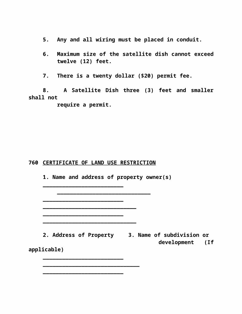
drawings of water supply; detail drawings of sewage disposal facilities; the location and size of all existing or proposed water and sewer lines.
- A separate floor plan of all buildings and other improvements either existing or proposed.
- A site plan illustrating buffer zones and landscaping.
- Size and location of the playground and other public areas to be provided within the park.
d. Location and General Layout
All certified mobile homes shall be located at least one-hundred (100) feet from any park boundary line abutting a public street or highway, and at least 20 feet from other park property boundary lines. Proper buffer zones and planting materials shall be specified on the site plan (see Article XV).
e. Utility Systems
i. Responsibilities of Permit Holder:
- The person to whom a permit is issued for a mobile home park shall operate the park in compliance with these Regulations and KRS 219, and shall provide adequate supervision to maintain the park, its facilities and equipment in good repair, and in a clean and sanitary condition.
- The park management shall notify

park occupants of all applicable provisions of these Regulations and KRS 219, and inform them of their duties and responsibilities under these Regulations.
ii. Supplementary Provisions and Regulations:
- The Planning Commission may impose such other conditions as it deems necessary to ensure that the mobile home park will not adversely affect the public health, safety or general welfare.
- The developer in designing the park and the Planning Commission in reviewing the park proposal shall give special attention to ensuring that the park is compatible with existing and planned land use and with circulation patterns of adjoining properties. In addition special attention shall be given to proper buffer zones and buffering techniques.
- Off-street parking shall be provided according to the following requirements: - two (2) spaces for each mobile
home lot.- one (1) space for each full-time
park employee- one (1) space for each 400
square feet of gross floor area for any structure used for office, recreational or cultural activities
- one (1) space for each four (4)

mobile home lots for use by guests
- two (2) parking spaces required for each certified mobile home should be located on the mobile home lot; all other required spaces should be located in bays convenient to facilities
- Adequate anchorage facilities must be provided for each certified mobile home. Each certified mobile home must be equipped with tie-downs which must be used.
iii. Existing Parks
Any mobile home park presently holding a valid construction or operating permit on the effective date of these Regulations which does not fully meet the design and construction requirements of these Regulations may continue to presently operate so long as the facilities in the park are capable of being maintained in a safe and sanitary manner and no public health nuisance is allowed to exist.
3. Recreational Vehicle Parks
A. Definition
Recreational vehicle parks are designed to accommodate recreational vehicles for short periods of time, ranging from one (1) night to several weeks.
B. Basic Requirements
1. Size:

The minimum size of a recreational vehicle park shall be not less than five (5) acres.
2. Density:
Minimum lot area per recreational vehicle space shall be not less than 2,500 square feet except that 20% of the lots may be as small as 1,200 square feet in area, but these may be used by tent campers only.
3. Buffer Zones:
An RVP shall have a fifty (50) feet buffer zone on the front, back and side lot lines that abut residential areas (see Article XV).
C. Zoning
Recreational vehicle parks may be permitted as conditional use in certain zones provided they meet the following criteria, and provided further that they are approved by the Planning Commission:
1. That the proposed park will contribute to the welfare and convenience of the traveling public seeking this type of accommodations.
2. That the park will not be detrimental to the health, safety or general welfare of persons who live in the adjacent areas.
3. That the park will comply with all city, county, state or federal regulations. Documentation of such compliance shall be required of applicants for recreational vehicle park construction permits.

4. That the park will comply with all adopted plans (prepared by or for governmental agencies) for the neighborhood or community and/or county.
D. Existing Recreational Vehicle Parks
Any recreational vehicle park presently holding a valid construction or operating permit on the effective date of these Regulations which does not fully meet the design and construction requirements of these Regulations may continue to operate so long as the facilities in the park are capable of being maintained in a safe and sanitary manner and no public health nuisance is allowed to exist.
990 Storage of Recreational Vehicles
Recreational vehicles, trailers, or mobile homes used exclusively for the purpose of traveling or camping and which do not exceed the width of eight (8) feet or the length of thirty-five (35) feet may be stored in the rear yard of any residential lot provided yard requirements as designated in these Regulations are maintained and the recreational vehicle, mobile home, or trailer is not occupied.
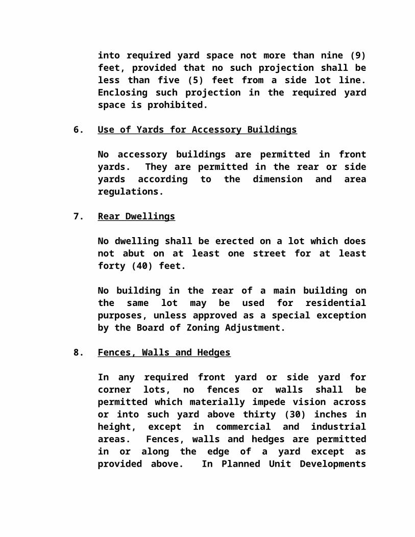
ARTICLE XGENERAL REGULATIONS FOR OFF-STREET PARKING AND
LOADING
1000 Existing Parking Spaces
Existing off-street parking provided for any building or use at the time of adoption of these Regulations shall not thereafter be reduced, unless it exceeds the requirements of these Regulations. Any existing building or use not provided with conforming parking space shall be provided with off-street parking space in conformance with these Regulations at the time of any structural alteration of the building or expansion of the use.
1010 Required Off-Street Parking Spaces
When any building is built or any use of the land is initiated, there shall be provided sufficient off-street parking space on the premises so that no automobile parking on any street will result from the normal activity. If the off-street parking capacity is exceeded and street parking is generated more often than six times (6) during a six-month (6) period, this shall be considered as resulting from normal activity, and additional off-street parking shall be provided. The Board of Zoning Adjustment shall interpret the amount of parking space required for any building or use, assisted by the following standards, whenever the Administrative Official is unable to apply the following standards literally or determines a parking space deficiency according to the standard above. In either case, he/she shall apply to the Board for an original interpretation. In the Central Business District Zones, no off-street parking shall be required except for residential dwellings.

1020 Off-Street Parking Standards
The following standards comprise the minimum off-street parking requirements for the several common types of building and uses listed:
A. Dwelling: Two (2) parking spaces single for family dwelling unit; 1 1/2 parking spaces for two family & multi-family dwellings that shall measure 9 ft. x 18 ft.
B. Indoor Retail Businesses: One (1) parking space is required for each one hundred (100) square feet of commercial floor area, plus one (1) space for every truck operated by the business. Shall measure 10 ft. x 18 ft.
C. Industrial Plants: One (1) parking space for every two (2) employees at maximum employment on a single shift plus one (1) space for every truck operated by the plant. Shall measure 10 ft. x 18 ft.
D. Places for public assembly, institutions, and recreational facilities: One (1) parking space for every five (5) people, based on maximum capacity.
Shall measure 10 ft. x 18 ft.
E. Additional parking standards: The Board of Zoning Adjustment may alter the standards listed above when necessary to conform with Section 1010 and shall use similar criteria of floor area, employment, or capacity to interpret standards for buildings and uses not specifically listed above.
F. No off-street parking areas shall be permitted in a required front yard, except in zonings areas wherethe width at the building line is 60 feet or less.

1030 Off-Street Loading and Unloading Space Regulations for Trucks
All buildings and uses which generate regular trucking traffic shall be provided with sufficient off-street loading and unloading space on the premises so that they will generate no loading or unloading activity on their required parking spaces or on any street. The Board of Zoning Adjustment shall interpret the amount of loading and unloading space required for any building or use whenever the Administrative Official is unable to apply this standard literally and applies to the Board for an original interpretation.
1040 Additional Parking, Loading, and Unloading Regulations
A. Arrangement of off-street parking space: Off-street parking space required for any building or use may be located within walking distance or four hundred (400) feet from the premises it serves but detached there from and may be consolidated into a large parking area serving other buildings and uses if approved by the Board of Zoning Adjustment. The Administrative Official shall apply to the Board for an original interpretation when building permits are requested in such cases. The Board may not authorize the total amount of parking space required for all buildings and uses to be diminished except as follows: If a consolidated parking area serves buildings or uses which do not generate automobile parking at the same times - i.e.: Churches and stores, - total parking space may be diminished to the maximum required by those buildings and uses which do generate the parking of automobiles at the same time.

B. Proof of availability: The Board of Zoning Adjustment may require a plat, deed, and any other proof necessary to show that required parking space, if located off the premises it serves, is controlled by and available to the applicant for a building permit.
C. The surfacing of parking, loading, and unloading spaces and the access thereto shall be surfaced in a manner adequate to eliminate dust and mud.
1050 City Ordinance
Nothing in this Article shall be construed to be in conflict with any city ordinance regarding the parking of vehicles on city streets.

ARTICLE XISIGNS
1100 Intent
The purpose of this Article is to promote and protect the public health, welfare, and safety by regulating existing and proposed outdoor advertising, outdoor advertising signs, and outdoor signs of all types. It is intended to protect property values, create a more attractive economic and business climate, enhance and protect the physical appearance of the community and/or county, and preserve the scenic and natural beauty of designated areas. It is further intended to reduce sign and advertising distraction and obstructions that may contribute to traffic accidents, reduce hazards that may be caused by signs overhanging or projecting over public rights-of-way, provide more open space, and curb the deterioration of the natural environment and enhance community and/or county development.
1110 General Sign Regulations
1. Signs
All signs, unless other wise specified in these Regulations, shall be set back from the established right-of-way of any road or highway at least as far as three-quarters of the required front yard depth for the principal building in the zone in which it is located.
All signs of any type in any zone, other than real estate signs as provided for in this section and others specifically excluded, require a permit to be obtained from the Administrative Official.
No sign or billboard, other than real estate signs advertising the sale, rental or leasing of the premises, shall be permitted in any residential zone except as provided in Section 1120. Said real estate signs shall

not exceed four (4) square feet in area and shall be displayed at least ten (10) feet from all lot lines. Real estate signs shall only be placed on lots which they advertise.
Advertising signs, structures, or lights for support and illumination of signs, where permitted, shall in no case be placed in or extend over the street right-of-way.
2. Temporary Signs
All temporary signs must be set back a minimum of twenty (25) feet from the centerline on the adjacent road or ten (10) feet from the right-of-way of the road which ever is a greater distance from the edge of the pavement. Political and yard sale signs shall not exceed eight (8) square feet in size and must abide by all regulations regarding visibility at intersections in Section 870 of these Regulations. Political signs shall be posted no earlier than thirty (30) days prior to the election and shall be removed no later than seven (7) days following the date of the election. Yard sale signs may be posted no earlier than seven (7) days prior to the start of the yard sale and must be removed no later than two (2) days following the final day of the yard sale. Under no circumstances shall political or yard sale signs be posted on utility poles. Temporary signs do not require a permit from the Administrative Officer. All violations of these requirements will be penalized as per Section 360 of these Zoning Regulations.
Provisions regarding the regulation of other temporary signs apply as required in other sections of this Article.
3. Government Signs
Any official informational or directional sign or historic marker erected by a governmental agency is permitted in all zones and does not require a location or a zoning permit.

4. Lack of Conflict
In no way shall the provisions of this Article be taken to be in conflict with and state or federal regulations regarding obstructions or the placement of structures in state or federal rights-of-way. In all cases, the most restrictive provision will apply.
5. Ingress and Egress Free
No outdoor advertising display sign shall be erected, constructed, or maintained so as to obstruct any fire escape or any window or door or opening used as a means of egress or so as to prevent free passage from one part of a roof to any part thereof. No sign shall be attached in any form, shape, or manner to a fire escape and shall not be placed in such a manner as to interfere with any opening required for legal ventilation.
6. Flashing Signs ProhibitedFlashing signs shall not be permitted in any zone, whether permanent or temporary on or off premise. Flashing signs shall be defined as a sign, the illumination of which is not kept constant in intensity at all times when in use. Illuminated signs which indicate time, temperature, weather or similar public service information, shall not be considered flashing signs. Revolving signs of constant illumination shall not be considered flashing signs.
1120 Residential Districts
Signs are permitted in residential zones only in accordance with the following provisions:
1. Temporary signs pertaining to the lease or sale of a building or land may be erected as provided in Section 1110 of these Regulations. Real Estate

signs shall not be displayed on and/or over city or public property except by the appropriate public agency.
2. Temporary signs, for one (1) year, may be erected to advertise a new subdivision of five (5) or more lots, provided that the sign is no larger than sixty (60) square feet in area, is not internally illuminated, advertises only the subdivision in which it is located and is erected only at a dedicated street entrance.
3. One unilluminated sign may be erected in conjunction with the construction of a building to identify the owner, architect, engineer, contractor and others instrumental in the construction of the building provided that such sign is not more than twelve (12) square feet in area, no more than fifteen (15) feet above the ground, and is removed within thirty (30) days of receiving the Certificate of Occupancy.
4. One identifying sign of not more than thirty (30) square feet in area may be erected for churches, libraries, schools, parks, hospitals for human care, and other public facilities of a similar nature. Such sign shall be solely for the purpose of displaying the name of the institution and its activities or services. It may be illuminated, but shall not be flashing.
5. Directional signs, not exceeding two (2) square feet in area shall be permitted only on major thoroughfare approaches to institutions listed in four (4) above. No such signs shall be permitted on minor residential streets.
6. One (1) indirectly lighted name plate sign for a dwelling group of four (4) or more dwellings not exceeding six (6) square feet in area. Such signs

may indicate only the names of buildings or of occupant of the buildings.
7. Accessory uses for professional offices or home occupations as specified in Section 662(2) and 663(2) shall be permitted one (1) indirectly lighted name plate (sign) not over two (2) square feet in area.
1130 Business Districts
In all business districts, each business shall be permitted to have permanent outside signs. Signs permitted under this section shall be limited to those as described below:
1. Each business shall be entitled to have one sign which is mounted flush against a building. The depth of such a sign from a face to the building shall not exceed two (2) feet. The area of such a flush mount sign shall be limited to a total surface area equivalent to 1-1/2 square feet of sign area for each lineal foot of building width occupied by such enterprise. In the event that the area shall exceed fifty (50) square feet, then a variance application must be made to and approved by the Board of Adjustments and Appeals.
2. Additionally, one (1) free-standing sign structure shall be permitted for each lot of one hundred (100) foot frontage or less and one (1) additional structure for each additional one hundred (100) feet of lot frontage. Any such freestanding sign structures in a Commercial or Business District shall be no more than seventy-two (72) square feet in area nor shall two (2) or more smaller signs be so arranged and integrated as to create a single sign in excess of seventy-two (72) square feet.

In an Interchange District a hi-rise pylon sign may be
approved through a Development Plan by the Planning
Commission or by a variance from the Board of Adjustments
and Appeals.All such freestanding signs shall be set back
twenty- five (25) feet, or more, from the front property line.
The dimensions of any two-faced or multi-sided sign must be determined by measuring the surface area on one side of the sign. Free standing signs shall not exceed a height of twenty-five (25) feet.
All freestanding signs designed to face into a residential district shall be located fifty (50) feet or more from the residential district.
If a business is adjacent to more than one street or highway, additional free-standing signs may be allowed upon application to and receiving approval of the same from the Triple S Planning Commission or the Board ofAdjustments and Appeals.
3. Each neighborhood business area built as a Planned Unit Development may have one free-standing identification sign for each street on which it fronts, set back at least twenty-five (25) feet from the front property line and presenting only the name of the shopping center, the businesses located therein, and the hours of business. Each such sign shall not exceed three hundred (300) square feet in area.
4. No illuminated business signs within a business or industrial zone shall be located closer than fifty (50) feet to a residential zone.

5. No revolving business sign within a business or industrial zone shall be located closer than seventy-five (75) feet to a residential zone.
6. Portable business signs within any zone shall maintain the same setback as that required of other business signs with respect to type, illumination, etc., and shall not be permitted on properties (businesses) that have an existing permanent sign already in place.
7. Portable signs to be used in any zone and displayed by only those that do not have a permanent business sign.
1140 Industrial Districts
1. All signs permitted in Business Districts are also permitted in Industrial Districts and subject to the requirements thereof.
2. One (1) sign structure for identification and direction purposes may be erected at access points to public streets provided that such signs are no larger than fifty (50) square feet in area.
1150 Sign Maintenance
1. It shall be the duty of the Zoning Administrator or his/her authorized agent to inspect every off-premise sign and business signs at least one (1) time annually.
2. Should any sign become insecure or in danger of falling or otherwise unsafe in the opinion of the Zoning Administrator, the owner thereof, or the person or firm maintaining the same, shall upon written notice from the Zoning Administrator, in the case of immediate danger forthwith and in any

case within ten (10) days, secure the same in a manner to be approved by the Zoning Administrator or remove such sign. If such order is not complied with within ten (10) days, the Zoning Administrator shall remove or cause removal of such sign at the expense of the owner or lessee thereof.
3. All signs for which a permit is required, together with all their supports, braces, guys, and anchors, shall be kept in repair unless constructed of galvanized or non-corroding material and shall be thoroughly painted at least once every two (2) years. The Zoning Administrator shall order the removal of any sign that is not maintained in accordance with the provisions of this section. Such removal shall be at the expense of the owner or lessee.
4. Any sign now or hereafter existing which no longer advertises a bonafide business shall be taken down and removed by the owner, his agent, or person having the beneficial use of the building, structure, or lot. Upon failure to comply with such notice within the time specified in such order, the Zoning Administrator is hereby authorized to cause the removal of such sign, and any expense incidental thereto shall be paid by the owner of the building, structure, or lot to which the sign is attached. The Board of Zoning Adjustment may waive this requirement only for historic preservation purposes and when the owner can prove the need for the waiver to qualify for funding or tax credits.
1160 Violations
In any case any sign shall be installed, erected, constructed, or maintained in violation of any of the terms of these Regulations, the Enforcement or Administrative Official shall notify by registered mail or

written notice served personally to the owner or lessee thereof to alter such sign as to comply with these Zoning Regulations and to secure the necessary permit, therefore, or to remove the sign. If such order is not complied with within ten (10) days, the Zoning Administrator shall remove such sign at the expense of the owner or lessee thereof. Additionally, failure to comply with any of the provisions of this Article shall be deemed a violation, and shall be punishable under Section 360 of these regulations.

ARTICLE XIIPLANNED UNIT DEVELOPMENTS
1200 General
A Planned Unit Development (PUD) project which may depart from the literal conformance with the regulations for individual lot development may be permitted in those zones where it is designated as a special use under the zone regulations. All Planned Unit Development projects shall be subject to the following regulations.
1205 Purpose of Planned Unit Development Projects
In general the purpose of Planned Unit Development's (PUD) are as follows:a. To encourage a more creative approach in land and
building site planning.
b. To encourage an efficient, aesthetic and desirable use of open space
c. To encourage variety in physical development pattern

d. To achieve flexibility and incentives for development which will produce a wider range of choice in satisfying the changing needs of the area.
e. To permit special consideration of property with unique features, including, but limited to, historical significance, unusual topography, landscape amenities, and size and shape.
f. To convert land so poorly developed as to be a public liability.
g. To simplify processing of development proposals for developers and the Planning Commission by providing for concurrent review of land use, subdivision, public
improvements and siting considerations.
1210 Procedure
When a Planned Unit Development project is proposed, the procedure and standards for major subdivision approval as set forth in the Shelby County Subdivision Regulations shall be followed in their entirety. A preliminary plat and final plat, both approved by the Planning Commission shall be required for every Planned Unit Development project. The Planning Commission may establish a schedule of reasonable fees to be charged for plat review. The project shall be developed according to the approved final plat. Building permits and certificates of occupancy shall be required for each building.
a. PlatsA preliminary plat and final plat, both approved by the Planning Commission, shall be required for every Planned Unit Development project. In addition, the Planning Commission shall hold a public hearing on the preliminary plat of the proposed PUD to aid them in deciding the merits of

the proposed project. (Nothing herein should be construed to mean that the land owner has the inherent right to develop a PUD. The Planning Commission has the power to decide whether or not to allow the PUD based on their experience, knowledge, public hearing and the standards set forth herein.) Accompanying all preliminary plats shall be calculations for overall density, parking requirements and other material the Planning Commission may reasonably require. Furthermore, the Planning Commission may establish a schedule of reasonable fees to be charged for plat review.
If the Planning Commission approves the preliminary plat the developer may proceed with activities leading to final plat approval providing that the project shall be developed in conformance with the approved preliminary plat.
b. Permits
Zoning permits shall be required for each building in accordance with Section 310 through 330 of these Regulations.
c. Expiration of Approval
Final approval of a PUD shall expire if road and utility improvements on the site have not been completed within one (1) year of original approval and/or if the project is abandoned for more than twenty-four (24)
consecutivemonths. An extension of time shall be requested by
the property owner and /or the owner's legal counsel,
by letter submitted to the Administrator and the
request placed on the next Commission docket.

(Abandonment shall be deemed to have occurred when the above
mentioned improvements have not been made pursuant to the
approved PUD Plat.)
d. Recording
All approved PUD plats shall be recorded in the County Clerk's Office
1220 Uses
The uses in a Planned Unit Development project shall conform with the permitted uses of the zone in which it is located. If a Planned Unit Development project is proposed which includes mixed uses, or other uses that are not permitted in the zone where it is proposed, or uses not permitted in any zone, the project may be permitted only after an overlay to the Zoning Map is approved by the Planning Commission. Such an overlay shall designate the proposed location as a Planned Unit Development overlay zone. The overlay zone may be permitted only after the conditional approval of the preliminary plat and shall be valid only for that project as approved.
1230 Standards
In any Planned Unit Development project, although it is permissible to depart from literal conformance with the individual-lot dimension and area regulations, there shall be no diminution of the total equivalent lot area, parking area, and loading and unloading area requirements that would be necessary for the equivalent amount of individual-lot development. The Planning Commission may allow reductions in these requirements however, upon proof by the developer that efficiencies of large-scale development may permit

such reductions without destroying the intent of these Regulations.
1240 Special Conditions
The Planning Commission shall attach reasonable special conditions to insure that there shall not be a departure from the intent of these Regulations. The Planned Unit Development project shall conform with all such conditions. Because a Planned Unit Development project is inherently more complex than individual-lot development and because each such project must be tailored to the topography and neighboring uses, the standards for such projects cannot be inflexible.
The following standards define the typical special conditions the Planning Commission shall attach in addition to the standards for lot, parking, and loading and unloading area defined in Section 1230 above. The Planning Commission may also attach any other reasonable special conditions.(a) It is desirable that access points to all arterial
streets shall be located no more frequently than once every eighth to a quarter of a mile. The Planning Commission may approve the platting of temporary access points.
(b) Wherever there is an abrupt change in uses - i.e., residential to commercial - it is desirable that a buffer area of open space or protective planting be placed between them which will protect each use from the undesirable effects of the other.
(c) Parking and other public areas used at night shall be adequately lighted, and private areas shall be adequately protected from such lighting and any other lighting from public areas. Public streets may also require protection from excessive glare of lighted areas.

(d) It is desirable that all Planned Unit Development projects be constructed promptly after approval of the final plat. Construction shall be initiated within one (1) year after approval of the final plat, and shall be completed in a reasonable length of time. Failure to initiate construction within one (1) year shall void the permit.
ARTICLE XIIIDEVELOPMENT PLANS
1300 General
This section sets forth the content and procedure for submission, review, and approval of all development plans called for by the Planning Commission.

The Planning Commission at its discretion may require the submission and approval of a preliminary and/or a final development plan if the Planning Commission finds there are existing or potential substantial flood, drainage, traffic, topographic, or other similar problems relating to the development of the subject property that could have an adverse effect on existing or future development of the subject property in the vicinity (see Section 1490 for Zone Changes).
1310 Preliminary Development Plans Required
Preliminary development plans must be submitted to the Planning Commission and shall contain all information required by Section 1330 below. A public hearing on a map amendment shall not be held until the required preliminary development plan has been submitted to the Planning Commission.
1320 Final Development Plans Required
Final development plans required herein shall be submitted within two (2) years of the approval of the Preliminary Development Plans and the Commission shall approve a final development plan for the subject property with such conditions as are found necessary to comply with the provisions of these Regulations, if any, within ninety (90) days after the applicant has submitted his final development plan. An extension of time request shall be requested by the
property owner and/or the owner's legal counsel, by letter submitted to the Administrator and the request placed on the next Commission docket.
1330 Contents of Preliminary Development Plan
(a) Vicinity sketch
(b) Topography with contour interval of five (5) feet or
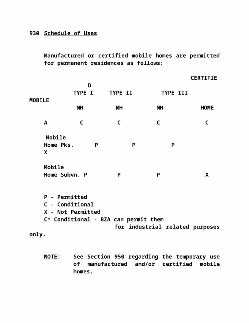
less
(c) Location, arrangement, and approximate dimensions of existing and proposed driveways, streets, sidewalks, parking areas, and layout of spaces, points of ingress and egress, and other vehicular and pedestrian rights-of-way
(d) Screening, landscaping, buffering, recreational, and other open space areas. Noise, objectionable odors and lighting information as required by the Planning Commission and these regulations.
(e) Approximate size, location, height, floor area, building area, arrangement and proposed use of buildings and signs
(f) Storm drainage areas and facilities; this information shall be supplied to the Planning Commission as a part of the Development Plans for all zone change requests throughout the cities to facilitate the Planning Commission's decision making process.
(g) Proposed and existing easement(s) (h) A concept Lighting Plan shall be submitted as part of the Preliminary Development Plan depicting light cutoff points and lumens including, but not limited to, types of lighting, shielding, lighting affixed to buildings, along access roads and walkways, in parking areas, at ingress/egress points and in rights-of-ways, to conform with Article XVI, Section A - LIGHTING.
1340 Contents of Final Development Plan
(a) Vicinity sketch

(b) Topography with contour interval of two (2) feet or less
(c) Boundary features such as bearings and dimensions of all property lines
(d) Size, location, height, floor area, building area, and arrangement of proposed and existing buildings and signs
(e) Screening, landscaping, buffering, recreational and other open space areas showing dimensions of and materials of fences, planting, buffer and other open areas. Noise contours, lighting information and objectionable odors/odorous matter as required by the Planning Commission and these regulations.
(f) Location, arrangement, and dimensions of existing and proposed driveways, streets and street cross section drawings, sidewalks, parking areas including a number of off-street parking spaces, points of ingress-egress, off-street loading areas and other vehicular and pedestrian rights-of-way
(g) Utilities information on existing and proposed water, gas, electric, telephone, and sewer lines, including location of easements, size of lines and location of appurtenances. A Lighting Plan conforming to Article XVI, Section A - LIGHTING
(h) Location and dimensions of other existing or proposed easement(s)
(i) Statistical summary of above items.
1350 Approval of Development Plan Before Zoning Permit
When the Planning Commission has required a

Development Plan to be submitted, no zoning permit shall be issued until a development plan is approved by the Triple S Planning Commission and a copy of said plan is certified by the Chairman and Secretary of the Commission. The approval of a development plan shall limit, control and restrict the construction, location and use of all land, lighting and structures to the conditions set forth in the plan.
1360 Amendments to Development Plan
Amendments to approved development plans can be made only by official Planning Commission action.
ARTICLE XIVZONING MAP AND TEXT AMENDMENTS
1400 General
Whenever the public necessity, convenience, general welfare, or good zoning practices require, the legislative body may, by ordinance, after receiving a recommendation thereon from the Planning Commission, and subject to procedures by law, amend,

supplement, change or repeal the regulations, restrictions, and boundaries or classification of property.
1410 Application for Amendment
A proposal for amendment to the official County and/or City Zoning Map(s) may originate with the Planning Commission, the City Council, any other government body, the owner of the subject property, or by a person having written authorization from the owner of the subject property. A proposal for amendment to the text of these Regulations may originate with the Planning Commission or governmental body, the City Council of Shelbyville, City of Simpsonville and the Shelby County Fiscal Court. Regardless of the origin of the proposed amendment an application must be filed with the Planning Commission requesting the proposed amendment in such form and accompanied by such information as required by these Regulations and the Planning Commission. As per section 1490, the Planning Commission shall require the prior submission of a development plan prepared in accordance with Article XIII of these regulations, which when approved by the Planning Commission, shall be followed. At the time of filing an application, a non-returnable filing fee shall be paid according to the schedule of fees; however, there shall be no filing fee for an amendment requested by the City Council, the Planning Commission or any governmental agency. Upon the filing of an application for a map amendment by a governmental body, the Planning Commission shall promptly notify the owner of the subject property by certified mail, receipt requested.
1420 Planning Commission Procedure
Upon the filing of an application for an amendment to the Official County/City Zoning Map(s) or the text of these Regulations, the Planning Commission shall study

and review the application as provided in these Regulations and the bylaws of the Planning Commission. No amendment shall be adopted without first being reviewed by the Planning commission.
The Planning Commission shall then hold at least one (1) public hearing after notice as required by KRS 424 and KRS 100 and shall make findings of fact and a recommendation for approval or disapproval of the proposed amendment to the various legislative bodies or fiscal court involved. A tie vote shall be subject to further consideration by the Planning Commission for a period not to exceed thirty (30) days, at the end of which if the tie has not been broken, the application shall be forwarded to the fiscal court or legislative body without a recommendation for approval or disapproval.
1430 Notice of Public HearingThe Planning Commission shall present every proposed amendment to the public at a public hearing. Public hearings on amendments to the zoning order shall be scheduled at the time of application for the next regular Planning Commission meeting and shall comply with the required submission date. The Planning Commission shall publish notice once weekly for two (2) consecutive weeks in a newspaper having general circulation throughout the county no less than seven (7) and no more than twenty-one (21) days before the scheduled hearing, indicating the time and place of each public hearing on proposed amendments to the zoning order and may establish a schedule of reasonable fees to be paid by the applicant for a zoning amendment. The Planning Commission may also issue notification of the public hearings by such other means as it may determine.
Any published notice shall include the street address of the property in question, or if one is not available or practicable due to the number of addresses involved, a geographic description sufficient to locate and identify

the property, and the names of two (2) streets on either side of the property which intersect the street on which the property is located; and when the property in question is located at the intersection of two (2) streets, the notice shall designate the intersection by name of both streets rather than name two (2) streets on either side of the property.
When a hearing is scheduled on a proposal by a property owner to amend any zoning map, the following notice shall be given in addition to any other notice required by statute, local regulation or ordinance:
A. Notice of the hearing shall be posted conspicuously on the property, indicating the proposed classification to be changed, for fourteen (14) consecutive days immediately prior to the hearing. Posting shall be as follows:
1. The sign shall state "zoning change" and the proposed classification change in letters three (3) inches in height. The time, place and date of hearing shall be in letters at least one (1) inch in height; and
2. The sign shall be constructed of durable material and shall state the telephone number of the Planning Commission Office; and
3. It shall be the responsibility of the administrator to post the sign conspicuously on the property. The Administrative Official shall verify to the Planning Commission at the hearing that placement occurred pursuant to the provisions of these Regulations.
B. Notice of the hearing shall be given at least fourteen (14) days in advance of the hearing by certified mail with return receipt requested. Certification by the Planning Commission Secretary

or other official of the Planning Commission that the notice was received by the owners of every parcel of property adjoining the property requesting the zone change is necessary before a public hearing can be held on the map amendment. Willful non-receipt of notice by an adjoining property owner shall not, in itself, cause the notice procedure to be deficient. It shall be the duty of the person or persons proposing the map amendment to furnish to the Planning Commission the names and addresses of the owners of all adjoining property. Records maintained by the Property Valuation Administrator may be relied upon conclusively to determine the identity and address of said owner. In the event such property is in condominium or cooperative forms of ownership, then the person notified by mail shall be the president or chairman of the owner group which administers property commonly owned by the condominium or cooperative owners. A joint notice may be mailed to two (2) or more co-owners of an adjoining property who are listed in the Property Valuation Administrator's records as having the same address.
In addition to the public notice requirements of this section, when the Planning Commission or legislative body of any planning unit originates a proposal to amend the zoning map of that unit, notice of the public hearing shall be given at least thirty (30) days in advance of the hearing by certified mail, return of receipt to an owner of every parcel of property the classification of which is proposed to be changed. Records by the Property Valuation Administrator may be relied upon to determine the identity and address of said owner.
1435 Special Public Hearing
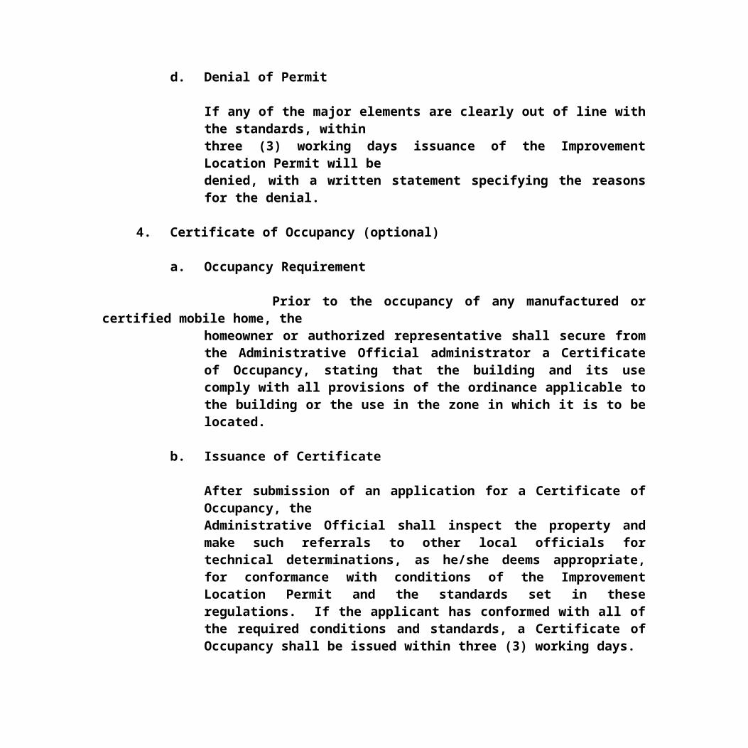
The Planning Commission may call a special public hearing in accordance with KRS 100 and KRS 424 at any time to consider a zoning amendment and may establish a separate schedule of reasonable fees to be paid by the applicant for the zoning advertisement of the special hearing by such means as the Planning Commission determines to be necessary.
1440 Public Hearing on Application
After notice of the public hearing as provided for above, the Planning Commission shall hold a public hearing on the proposed amendment.
1450 Recommendation of Commission for Zoning Map Amendment
Before recommending to the City Council or Fiscal Court that an application for amendment to the Zoning Map be granted, the Planning Commission must find that the map amendment is in agreement with the County's Comprehensive Plan, or in the absence of such a finding, that:
(1) the original zoning classification given to the property was inappropriate or improper, and that the proposed classification is proper, or
(2) that there have been major changes of an economic, physical or social nature within the area involved which were not anticipated in the Comprehensive Plan adopted by the Planning Commission and which have substantially altered the basic character of the area.
Any owner of property who requests a map amendment(s) shall provide at his/her expense, a stenographer who will make a transcript of the public hearing before the Planning Commission. Should the

Fiscal Court, City Council/Commission or the Planning Commission originate the map amendment, the Planning Commission shall provide the stenographer to produce the transcript. This transcript and a Finding of Fact shall be presented to the Commission at the next regularly scheduled monthly meeting for approval by the Commission. The deliverance of the recommendation, with the approved Finding of Fact and approved transcript, to the Fiscal Court or City Council/Commission shall constitute the Final Action by the Planning Commission on the map amendment.
1460 Action by City Council or Fiscal Court on Zoning Map Amendments
The County or City Council shall not act upon a proposed amendment to the Official City Zoning Map until it has received the written findings of fact and recommendation thereon from the Planning Commission. The Planning Commission recommendation relating to the proposed amendment shall become final and the map amendment shall be automatically implemented subject to the provisions of KRS 100.347, as set forth in the Planning Commission recommendations, unless within twenty-one (21) days after the final action by the Planning commission: (KRS 100.2111 (4)
A. Any aggrieved person files a written request with the Planning Commission that the final decision shall be made by the appropriate legislative body or Fiscal Court; or
B. The appropriate legislative body or Fiscal Court files a notice with the Planning Commission that the legislative body or Fiscal Court shall decide the map amendment.
It shall take a majority of the entire legislative body to override the recommendation of the Planning

Commission and it shall take a majority of the entire legislative body to adopt a zoning map amendment whenever the Planning Commission forwards the application to the legislative body without a recommendation of approval or disapproval due to a tie vote. Unless a majority of the entire legislative body votes to override the Planning Commission's recommendation, such recommendation shall become final and effective and if a recommendation of approval was made by the Planning Commission, the ordinance of the legislative body adopting the zoning map amendment shall be deemed to have passed by operation of law.
If the legislative body chooses to decide the map amendment, the legislative body shall take final action upon a proposed zoning map amendment within ninety (90) days of the date upon which the Planning Commission takes its final action upon such proposal. The legislative body shall also notify the Administrative/Enforcement Official and the Planning Commission as to when the proposed map amendment will be heard by the legislative body prior to the legislative body's final action. The legislative body shall complete and file for recording with the County Clerk, a Certificate of Land Use Restriction for any map amendment approved with conditions by the City Council/Commission or Fiscal Court.
1465 Amendment of Comprehensive Plan Prior to Annexation PermittedWhen a city which has adopted zoning or other land use regulations pursuant to KRS 100 proposes to annex new territory, it may amend the comprehensive Plan and the official zoning map to incorporate and establish zoning or other land use regulations for the property proposed for annexation prior to adoption of the ordinance of annexation. If the city elects to follow this procedure, the Planning Commission shall hold a public hearing, after the ordinance stating the city's intent to annex

and prior to final action upon the ordinance of annexation, for the purpose of adopting the Comprehensive Plan amendment and making its recommendations as to the zoning and other land use regulations which will be effective for the property upon its annexation. Notice setting forth the time, date, location, and purpose of the public hearing shall be published as required by KRS 424 and these Regulations and shall be given to the owners of all properties within the area proposed for annexation and to adjoining property owners in accordance with KRS 100.212(2). The city legislative body shall take final action upon the Planning Commission's recommendations prior to adoption of the ordinance of annexation and shall include in the ordinance of annexation a map showing the zoning or other land use regulations which will be effective for the annexed property. If the city elects not to follow the procedure provided for in this selection prior to the adoption of the ordinance of annexation, the newly annexed territory shall remain subject to the same land use restrictions, if any, as applied to it prior to annexation until those restrictions are changed by zoning map amendments or other regulations in accordance with these regulations.
1470 Recommendation of Commission for Text
Amendment
After voting to recommend that an application for amendment to the text of these Regulations be granted or denied, the Planning Commission shall forward to Fiscal Court or City Council/Commission, a recommendation as to the text of the amendment and whether the amendment shall be approved or disapproved and shall state the reasons, in writing, for its recommendation. This action shall be deemed the Final Action by the Planning Commission on the amendment.
In the case of a proposed amendment originating with a

City Council/Commission or Fiscal Court, the Planning Commission shall make its recommendation within sixty (60) days of the date of its receipt of the proposed amendment.
1480 Action by City Council(s) or Fiscal Court on Text AmendmentsThe City Council/Commission or Fiscal Court shall not act upon a proposed amendment to the text of these Regulations until it shall have received the written recommendation thereon from the Planning Commission. If the proposed amendment originated with the Planning Commission, it shall take a majority of the entire City Council/Commission to override the recommendation of the Planning Commission. If the proposed amendment originated with a legislative body, it shall take an affirmative vote of the majority of the Fiscal Court or legislative body to adopt the proposed amendment. The legislative body or Fiscal Court shall take final action within ninety (90) days of the date upon which the Planning Commission takes its final action upon such proposal.
1490 Special Conditions to the Granting of Zoning Changes
As a condition to the granting of any zoning change, the Planning Commission shall require the submission of a preliminary development plan as per Article XIII. Upon approval of the final development plan, such plan shall be followed. As a further condition to the granting of a zoning change, the Planning Commission shall require that a portion of the property is being used for the purpose for which the zone change was granted, within two (2) years of the date of final approval or the property shall revert to its original designation through a public hearing. An extension of time request shall be requested by the property owner an/or the owner's legal counsel, by letter submitted to the Administrator and the request placed on the next Commission docket.

1491 DENIAL OF A ZONE CHANGE REQUEST
The Planning Commission shall take no action on property or receive
a request for action on property for which litigation is pending relating to some action that the Planning Commission has taken or is
requested to take regarding said property until such time as the
litigation is settled. A zone change denied by the Planning
Commission for any reason shall not be resubmitted to the Planning
Commission for a period of one (1) year from the date of the last
denial unless the Planning Commission ordered by a judicial court
to consider said zone change.
ARTICLE XVBUFFER ZONES
Screening areas shall be provided for the purpose of minimizing the friction between land uses and improving the aesthetic and functional quality of new development.
1500 GENERAL
A. Buffer area requirements. All screening areas shall be approved by the Administrative Official
according to a submitted site plan as regulated by the applicable requirements of Article VIII. Screening area shall be designed, provided, and maintained according to the following:
1. Where vegetative or topographic conditions that provide a natural screening and buffer exist prior to development of properties in question, every effort shall be made to retain such conditions. In such cases additional screening may not be required, provided that the provision is made for maintenance of such condition to the satisfaction of the legislative body.
2. Whenever screening is required, it shall be provided as follows:(a) All trees shall be a minimum of ten (10) feet in height when planted, however, smaller trees (a minimum of five (5) feet in height) may be utilized in combination with berms (e.g., earthen mounds) to provide the minimum ten (10) foot height requirements; berms must be covered with suitable vegetation, such as grass, ivy, and shrubs, to preclude erosion of the berm;
(b) Trees which are intended to provide screening to separate multi-family development from single family, shall not be planted further than fifteen (15) feet apart; parking facilities which are located adjacent to the single-family areas shall be additionally screened to a minimum height of three (3) feet (via earth berm, depressed parking, solid fence, etc.) to reduce automobile headlight glare onto adjacent property;
(c) Trees which are intended to separate commercial and industrial development form residential development (single and multi-family) shall not be planted further than ten (10) feet apart; parking facilities which are located adjacent

to residential areas shall be additionally screened to a minimum height of three (3) feet (via earth berm, depressed parking, solid fence, etc.) to reduce automobile headlight glare onto adjacent property.
3. All trees, shrubs, and other planting materials shall be living plants (not artificial) and shall be suitable to the Central Kentucky area and the specific conditions of the site in question, such as, but not limited to, soil conditions, slopes, reduction of noise pollution, maintenance necessary, and the type of screening needed.
The legislative body or planning commission may require review or the proposed screening plan from the U.S. Soil Conservation
Service, or the applicable County Agricultural Extension Service.

ARTICLE XVI LIGHTING, NOISE AND ODOR/ODOROUS MATTER
1600 (A) LIGHTINGLighting shall be designed for security, safety and illumination without producing undo glare in order to minimize friction between land uses and prevent momentary blindness to motorists.Section A of this Article is intended to reduce the problems created by improperly designed and installed outdoor lighting. It is intended to eliminate problems of glare, minimize light trespass by establishing regulations which limit the area of certain kinds of outdoor light fixtures can illuminate and by limiting the total allowable illumination of lots in Shelbyville, Simpsonville and unincorporated areas of Shelby County, Kentucky. All public and private outdoor lighting installed in Shelbyville, Simpsonville and unincorporated areas of Shelby County shall be in conformance with the requirements established in this Article.
1600 (A) GENERAL
A. Lighting requirements. All lighting plans shall be approved by the Enforcement Officer and/or the Planning Commission according to a submitted LIGHTING PLAN as regulated by the Article and the requirements of ARTICLE XIII - DEVELOPMENT PLANS,

Sections 1330(h) and 1340(g).
1. Where lighting is proposed, it shall be provided as follows:
(a) No lighting shall be permitted which would glare onto any street, into any adjacent property, or be deemed as lighting trespass, e.g., the shining of light produced by a luminaire beyond the boundaries of the property on which such luminaire is located;
(b) Any luminaire with a lamp or lamps rated at a total of more than 1800 lumens and all flood or spot luminaries with a lamp or lamps rated at a total of more than 900 lumens shall not emit any direct light above a horizontal plane through the lowest direct light emitting part of the luminaire;
(c) Any luminaries with a lamp or lamps rated at a total of more than 1800 lumens and all flood or spot luminaries with a lamp or lamps rated at a total of more than 900 lumens shall be mounted at a height equal to or less than the value 3 + (D/3) where D is the distance in feet to the nearest property boundary. The maximum height of the luminaries may not exceed 25 feet. Lighting for parking areas shall not exceed the maximum building height permitted, or 25 feet, whichever is less, and buffering of vehicular light shall follow ARTICLE XV, BUFFER ZONE REQUIREMENTS, and Section A.2. (b)(c);
(d) LIGHTING IN THE RIGHT-OF-WAY: Perimeter lighting placed in a right-of-way (ROW) shall not exceed 25 feet in height unless a variance is requested and granted by the Planning Commission or Board of Adjustments and Appeals as applicable for adjoining roads and vehicular use areas and ingress/egress points upon approval by the

responsible ROW agency. Written permission from the authority having jurisdiction over the ROW shall be submitted by the developer prior to the approval of the Lighting Plan which is proposed in the ROW. The Enforcement Officer, the Planning Commission or its designated Consultant may consult with a representative of the appropriate lighting utility agency to determine that glare from proposed lighting in the right-of-way will not be a hazard to drivers or a nuisance to adjacent properties. The developer will be responsible for the cost and maintenance of proposed lighting in the right-of-way;
Luminaries used for public roadway illumination may be installed at a maximum height of 25 feet in height unless a variance is requested and granted by the Planning Commission and may be positioned at that height up to the edge of the bordering property; (d) Lighting for walkways, building entrances, parking areas and loading areas shall be sufficient so that an object or a person may be seen directly;
(f) Lighting for temporary construction projects shall consist of lighting sufficient to safely illuminate the site without producing glare onto adjacent properties and shall cease at 10:00 PM EST/EDT except in an emergency situation;
(g) No flashing lights or strobe lights are permitted, either affixed, non-affixed, or internal which would be seen from any adjacent property, road or aerial location, except in situations involving public health or safety;
(h) Installation of any new outdoor lighting other than for traffic control shall be approved by the Planning Commission and/or

the Enforcement Officer.
2. The Planning Commission reserves the right to direct the developer and/or owner to conduct studies by a professional engineer using state of the art engineering methods to determine findings of fact as to objectionable lighting emanating from any existing or potential land use.
1600 (B) NOISE
Noise produced by any land use, excluding Agricultural and Residential zones, shall conform to the following regulations for the purpose of minimizing friction between land uses of lesser or equal intensity and protecting the environment of Shelby County.
1600(B) GENERAL
1. All proposed or expanding developments except in Residential andAgricultural zones shall include a decibel analysis as regulated and required by the following:
a. A vicinity site plan depicting current land uses and zoning districts within 1000 feet of the property boundary of the site;
b. A noise contour overlay map depicting the anticipated noise as measured in decibels (dB) using a sound level meter that conforms to specifications published by the American National Standards Institute (specifications for Sound Level Meters S1.4 - 1971, or the latest edition of such noise standards, shall be used) of the proposed development;

c. When the noise contour overlay map depicts projected outdoor noise exceeding 55 dB or indoor noise exceeding 40 dB within 1000 feet of the property boundary should it overlap a land use of lesser intensity, effective noise abatement measures shall be incorporated with the Final Development Plan in text format. The Final Development Plan Map shall depict outdoor noise contours not to exceed 55 dB and indoor noise not to exceed 40 dB within the 1000 foot perimeter of the development property boundary.
2. The Planning Commission reserves the right to direct theDeveloper and/or owner to conduct studies by a professional engineer using state of the art engineering methods to determine findings of fact as to objectionable noise emanating from any existing or potential land use.
1600 (C) OBJECTIONABLE ODORS
Potential objectionable odors emitted by industrial, commercial andother land uses which rise to the level of intensity so as to beconstrued as commercial or industrial-like shall be regulated byKentucky Administrative Regulations (KAR) Title 401, Chapters 50-65; Sections 1(a)(b)(c)(d) and Section 2 as follows to protect the general health, safety and welfare of the citizens of Shelby County.
1600 (C) GENERAL
1. Objectionable odors and odorous matter shall be kept to a minimum through technology and site planning strategies to the best degree possible as regulated by the requirements of this Article and Article XIII, Development Plans, and shall

include the following as a minimum:
a. The PRELIMINARY DEVELOPMENT PLAN shall detail, in text format and on a vicinity map, where odors that could be objectionable, are likely to originate, and include the reasonable distance that odors can be detected. The PRELIMINARY DEVELOPMENT PLAN shall include the prevailing winds, the types of odors expected to be emitted, and shall comply with all State and Federal regulations which shall be cited in the text submitted with the PRELIMINARY DEVELOPMENT PLAN;
b. The vicinity map shall include all land uses (existing and proposed) and zoning districts within 2000 feet of the property line of the site. Should objectionable odors/odorous matter be expected to travel farther than 2000 feet, the Enforcement Officer shall determine the distance to be depicted on the Vicinity Map;
c. All reasonable mitigation measures shall be taken by the developer/owner to minimize anticipated objectionable odors/odorous matter and shall be submitted in text and Vicinity Map format with the FINAL DEVELOPMENT PLAN as required by ARTICLE XIII, DEVELOPMENT PLANS.
2. The Planning Commission reserves the right to direct the developer and/or owner to conduct studies by a professional engineer using state of the art engineering methods to determine findings of fact as to objectionable odor/odorous matter emanating from any existing or potential land use.


ARTICLE XVII
TRAFFIC IMPACT STUDY
A Traffic Impact Study shall be required by the Triple S Planning Commission prior to consideration of any Zone Change and the Board of Adjustments and Appeals prior to consideration of any Conditional use.. The Traffic Impact Study will provide the Commission/Board the information necessary to properly evaluate the impact of a development and to identify the need for any improvements to the transportation system to reduce congestion, maintain and improve safety, and provide site access and impact mitigation associated with the development. The Commission/Board shall require that a Traffic Impact Study be submitted for any zone change/conditional use.
1. Using a city street or county road for access and generating 25 or more additional (new) peak directions (inbound or outbound) trips to or from the site during the adjacent roadway's peak hour or the development's peak hour.
2. Use a state or federal highway for access and generate 50 or more additional (new) peak directions (inbound or outbound) trips to or from the site during the roadway's peak hour or the development's peak hour.
Agricultural tract development is exempt from a Traffic Impact Study if no new road or street is involved.
MINIMUM INFORMATION REQUIREDFOR A TRAFFIC IMPACT STUDY
1. A site plan and vicinity map2. A description of the proposed land use ( size, type,

location, phasing)3. Study purpose and objectives4. Determination and identification of the area of influence of the development (impacted study area)5. Description of existing roadway conditions including traffic volumes, accessibility, accidents, geometries, pedestrians, traffic signals and overall traffic operations and circulation. Current AADT and Peak Hour traffic volume counts on the adjacent road or roads and intersections (including turning movements), existing levels of service on roadways and physical character- istics of the subject roadways. Average peak hour traffic volume shall be the highest average Peak Hour volume for any weekday 24 hour period.6. Identification of the traffic congestion, accident areas and other deficiencies of the transportation system in the study area as may be determined by accident data available to the public.7. Anticipated nearby land development (planned or under construct- ion) associated traffic; and overall growth trends in the area8. Capacity and level of service determination during the peak or critical period(s) for the full development year for all affected streets/roads and the first intersections, in both directions, as measured from the boundary of the property to the first County Road/Street, City Road/Street, State Road/Highway or US Highway. The Commission/Board may also require that other major intersections that may be impacted by the proposed development be included in the Traffic Impact Study. The Professional Engineer responsible for the study will consult with the Commission/Board prior to beginning the study to determine if other intersections

should be included. If the Traffic Impact Study indicates that the proposed development has a very insignificant or no effect on the existing road at the proposed intersection then additional intersection studies may not be required. 9. Projection of existing traffic volumes to the full development year (assuming full build out and occupancy) composed of all the following: (A) Existing Traffic Volumes (B) Non-Site traffic volume growth in the corridor between the existing year and the Full development year
(C) The traffic volume added by the proposed development 10.A future combined traffic volume plan for typical daily and key peak hours of the development and roadway system. A description of any roadway/intersection improvements which have been assumed as being in place at full development.11.An assessment of the change in roadway operating conditions resulting from the development (quantifying the impact of the development)12.Development and evaluation of potential improvement measures needed to mitigate the impact of the development to the level of acceptable service-Level of Service D. (Level Service C for Shelby County)13.Recommendations for site access and transportation improvements needed to maintain traffic flow to, from, within, and past the site at an acceptable and safe level of service. Improvements typically include roadway widening (minimum pavement width is 18 feet), turn lanes, traffic signals, safety (sight distance) measures, and transportation demand management strategies. Detailed improvements and their cost specifically associated with the development should be identified. Improvements needed to achieve

Level of Service D (Level Service C for Shelby County) should be recommended and would be constructed at the developer’s expense. 14.On site issues including number and location of driveways, parking needs, circulation, pedestrians and truck access and operations.15.The Traffic Impact Study report should be presented in a straightforward and logical sequence. It should lead the reader step by step through the various stages of the process and to the resulting conclusions and recommendations. Transportation improvements that achieve the needed level of site access and mitigate any adverse effects the development related traffic may have on the transportation system should be described. Sufficient detail should be included so the reviewing agency will be able to follow the methodology of the analysis and associated findings and recommendations.
TRAFFIC IMPACT STUDY GENERAL INFORMATION
The Triple S Planning Commission or the Board of Adjustments and Appeals will, at the developers expense, obtain a Traffic Impact Study for any zone change which results in an increase of traffic as stated above. If no action is taken to advance the project within one (1) year, the Traffic Impact Study must be updated if the project continues. However, the Commission/Board may request an updated Traffic Impact Study at any time.Changes to the project during development will require that the Traffic Impact Study be revised to reflect the changes. The Developer will submit all necessary information relative to his development to the Commission/Board prior to his request for action by the Commission. The Commission/Board will contact a Professional Engineer in regard to preparing a Traffic Impact Study for the proposed development and obtain the cost associated with the Study.

The Commission/Board will then notify the developer of the cost of the Study and the Developer will submit payment to the Commission / Board for the study. The Engineer will not be given authority to proceed with the Traffic Impact Study until payment for the study has been received by the Commission/Board. The Commission/Board will forward the Developer a copy of the Study when received and determine if the Developer wishes to proceed with his development.
If the Developer chooses to provide his own Traffic Impact Study he will be responsible for payment to the Commission/Board to cover the cost of checking the Study by an independent Engineer. The checking of this study must be paid for and completed prior to consideration by the Commission/Board. A Professional Engineer, who has specific training in transportation and traffic engineering relating to preparing such studies must prepare the Traffic Impact Study. The Professional Engineer responsible for the Traffic Impact Study shall sign and seal the report. The Engineer shall be responsible for all data collection, analysis and reporting associated with the Traffic Impact Study. Generally the Traffic Impact Study will provide operating capacityand level of service analysis for critical roadway segments and intersections within the development impact area. The Impact Studywill show that entrances and exits have been designed to accommodate anticipated traffic in a safe and efficient manner and will identify the impact on the surrounding streets and roads resulting from the development.The Engineer preparing the Study will be responsible for identifying the development impact area, the critical intersections to be analyzed, and the scope of the study. The Planning Commission/Board reserves the right to ask for modifications to the study as it may deem necessary. A proposed Zone Change/Conditional Use may be denied if the Traffic Impact Study indicates that the development causes the existing or proposed roads and/or streets and

intersections to operate at a level of service D.
Approval of a Zone Change/Conditional Use may require the developer to make improvements which will maintain the existing or an acceptable level of service.