· web viewcutting and pasting comments from word documents cannot include ... round whitefish...
TRANSCRIPT

GENERAL INSTRUCTIONS FOR EXCEL TEMPLATE: 1. Do not leave blank rows above or between comments.2. Do not modify or delete the instructions or the column headings (i.e. the grey areas). 3. Each comment must have an associated topic and recommendation. 4. All formatting (i.e. bullets) will be lost when this file is uploaded to the Online Comment Table.5. If necessary, adjust the cell width and height in order to view all text.6. Cutting and pasting comments from WORD documents cannot include hard returns (spaces between paragraphs). 7. If you would like to create paragraphs within a single cell, please use a proper carriage return (ALT & ENTER).
TOPIC COMMENT RECOMMENDATION
Be as specific as you think is appropriate; for example a section or page of the document, a recommendation #, general comment, etc.
Comments should contain all the information needed for the proponent and the Board to understand the rationale for the accompanying recommendation.
Recommendations can be for the proponent or for the Board. Recommendations should be as specific as possible, relating the issues raised in the "comment" column to an action that you believe is necessary.
Item Number Topic Comment Recommendation1 Project Alternatives; DAR
Reference: Project Alternatives s. 2.4.6.1 Level 1Pre-Screen Results, Table 2.4-1
There appears to be a flaw in DDEC’s Pre-screening Assessment of Mining Alternatives. For the Environmental Considerations category, all three mining options get the same rating even though the underground method contains significantly lighter impacts on the terrestrial and aquatic environments (i.e. smaller waste rock pile, less noise and dust generation and no need to enclose and dewater a bay in Lac du Sauvage). This rating system ranks the chosen dike method more favorably than one would objectively expect.
DDEC should re-assess the three mining options with a view to providing a finer differentiation of favourability ratings for each, not just 0 or 1.
1

2 Project Design; DAR Reference: Project Description, s. 3.5.6 Waste Rock Storage Area, pg.3-63
The Jay Waste Rock Storage Area is designed to have a minimum 100 m buffer zones between it and Lac du Sauvage, but only minimum 30 m between it and streams. This is the case for the streams flowing into Lac du Sauvage from Lakes C1 and C17 (Maps 3.5-1 and 8.4-1).
DDEC should explain the rationale for the 30 m buffer zone between the Jay waste rock pile and streams flowing into Lac du Sauvage and assess possible impacts to Lac du Sauvage water quality from any waste rock seepage flowing into these streams.
3 Return to Baseline Conditions in Lac de Gras; DAR Reference: s. 8.5.4.1.2 Water Quality in Lac du Sauvage and Lac de Gras during Operations and Post-Closure; s. 9.4.3.2.1 Summary of Water Quality Changes, pg. 9-182 to 9-196, 9-199
In Lac de Gras, concentrations of various contaminants and nutrients are predicted to return to baseline or near baseline conditions post-closure. The DAR states “Concentrations of these parameters peak in the operations phase, but decrease in post-closure to a steady state concentration that is predicted to be within or slightly higher than the range of existing conditions.” (emphasis added) The DAR should state whether this is also the case for background concentrations for Lac de Gras. We would want to see the company strive for concentrations returning to Background (pre-2000) rather than baseline (2010 – 2012) as much as possible. See table 8.5-13 for last column, S2 and S3 for Open Water; background concentrations for at least two nutrients, two metals and one major ion are substantially below the existing condition.
DDEC should clearly indicate whether contaminants of potential concern and nutrients are predicted to return to pre-development background levels in Lac de Gras.
4 Map of Water Level Changes; DAR Reference: Appendix 1A Terms of Reference – 7.3.2 Impacts to fish and fish habitat from project components, pg.32
The ToR requires DDEC to provide a map showing water level changes and changes in riparian areas of affected lakes. The Agency cannot find this map. Map 9.4.1 only shows drained area within the dike.
DDEC should provide a map of lake water level changes resulting from the Jay project including riparian zones, or indicate where such a map can be found in the DAR.
5 Effects of Dike Breaching; DAR Reference: s. 9.3.2.2.1 Fish and Fish Habitat – Pathways with No Linkage, pg. 9-137
The DAR states there is no link to fish on pit back-flooding. It is not clear whether the dike breaching may create currents through the openings that could re-suspend pit lake sediments.
DDEC should explain whether cutting openings into the dike at closure could create currents through the openings that would cause sediment upwelling, and the potential for incoming fish exposure to suspended pit sediments.
2

6 Trends in Fish Contaminants; DAR Reference: Annex XIV Fish and Fish Habitat Baseline Report, pg. 2-13
Discussion of historic trends in fish tissue contaminants for the Koala watershed is not complete as the 2012 AEMP results are not included.
DDEC should include the 2012 AEMP fish monitoring results in the DAR discussion of historic fish tissue contaminants.
7 Zooplankton Changes; DAR Reference: s. 9.4.3.2.2 Effects from Changes to Water Quality During Operations and Closure – Zooplankton, pg.9-189; AEMP Re-Evaluation and Proposed Program for 2007-2009 Rescan 2006-Section 3.1-2, and pg. 3-46 to 3-48
The DAR states: "Higher concentrations of TDS (in particular calcium) may stimulate growth of Daphnia species and potentially cause a shift in community structure towards larger-sized zooplankton. Calcium limitation may explain the observation that high TDS lakes are associated with higher zooplankton productivity". It is not clear how DDEC reconciles this statement with the results of Rescan 2006 multivariate analysis (in the AEMP Re-Evaluation report) where a decline in the cladocera community in Moose Lake downstream of the LLCF was correlated with elevated TDS, hardness and some major ions.
DDEC should consider the 2006 Rescan report in re-evaluating the DAR assessment of increasing levels of TDS effects on cladocera growth in the Jay-impacted lake watershed.
8 Phytoplankton Trends; DAR Reference: Annex XII-Plankton Baseline Report, pg. 9-83; p.2-54
The DAR uses Diavik’s Lac de Gras AEMP phytoplankton data only to 2011. Data from 2012 and 2013 were not yet available when the report was prepared. The Diavik AEMPs show (1) a declining trend in phytoplankton abundance and biomass in all areas of Lac de Gras from 2008 to 2011, and (2) the FF2 exposure site shows consistently higher phytoplankton abundance and biomass than all the far-field/reference sites, likely due to nutrient enrichment. DDEC should now include the 2012 and 2013 data to confirm whether that trend continues to persist in Lac de Gras. This is important information for the cumulative effects assessment given the suggestion that this phytoplankton trend indicates that “a regional factor beyond Mine-related effects was influencing the phytoplankton community”.
DDEC should incorporate the Diavik 2012 and 2013 AEMP phytoplankton results into its assessment of phytoplankton trends in Lac de Gras.
3

9 Blasting Effects on Fish; DAR Reference: s. 9.3.2.1.1 Blasting, pg. 9-121
The DAR mentions a higher-than-normal blast at Diavik that created some fish egg mortality.
DDEC should explain (1) what the circumstances were that created this higher-than-normal blast, and (2) what measures will DDEC put in place to ensure this magnitude of blast does not occur at Jay.
10 TK Use in Evaluation of Impacts; DAR Reference: Appendix 1A Terms of Reference - Section 2.2;Fish and Fish Habitat – pg.9-116
The ToR states: “DDEC will make all reasonable efforts to incorporate traditional knowledge from Aboriginal culture holders as a tool to ... evaluate the specific impacts.” The DAR states “The Yellowknives Dene have noted concerns about the effects on fish populations of spilled oil and winter roads.” It is not clear whether there are aspects of winter roads that Yellowknives Dene believe could have affected the Lac du Sauvage fish habitat baseline beneath the winter road that crosses that water body.
DDEC should clarify the concerns of the Yellowknives Dene regarding the impact of hydrocarbon spills on fish populations.
11 Effects of Dust on Fish DAR; Reference: s. 8.5.4.2.1 Acidifying air emissions and the deposition of dust and metals from air emissions to water quality and lake bed sediments in waterbodies within the Lac du Sauvage and Lac de Gras watersheds, pg. 8-351; s. 9.3.2.2.2 Secondary Pathways, pg.9-142 and 9-143
In assessing possible impacts on the aquatic environment from dust deposition, the DAR focuses on water quality (e.g., TSS) and not sediments. It is not clear how dust deposition from Jay might affect fish spawning and rearing habitat. DDEC’s dust models show dust particles of 30 μm diameter descending over half of Lac du Sauvage at a daily maximum of more than 120 µg/m3 (Map 7.4-19, Jay Project Air Quality Assessment Update). Within that deposition zone are a number of shoals considered as spawning habitat (S2 to S8, with S3 considered higher quality for trout, round whitefish and lake cisco).
DDEC should assess how dust generated during the Jay Project dust may impact fish and fish habitat in lakes receiving dust.
4

12 Effects of Phosphorus Loading; DAR Reference: s. 8 Water Quality and Quantity, pg. 8-356 to 8-359 and pg. 8-370 to 8-374
The assessment of impacts of elevated phosphorus in Lac du Sauvage and Lac de Gras focuses on concentrations only and not total loadings. Over a prolonged time period, the total loadings of nutrients into lakes can change their trophic status without necessarily being exposed to waters that are significantly above thresholds.
DDEC should assess what would be the expected total loadings (i.e. kg/month) of Total Phosphorus into Lac du Sauvage and Lac de Gras and the likely impacts to the trophic level status and to aquatic life.
13 Meromixis Predictions; DAR Reference: Appendix 8G Hydrodynamic Modelling of Jay and Misery Pits, s. 8G4 Conclusions, pg.8G-25; 9.5 Prediction Confidence and Uncertainty, pg. 9-204
There are no documented cases of meromixis occurring in reclaimed flooded diked areas in the Arctic (DAR, pg. 9-204). There are no predictions of impacts to benthic invertebrate colonization, fish use and habitat suitability in a scenario where meromixis is not established. The DAR also states: “Ultimately, even the best of models cannot compare with operational monitoring data...” In addition, for pit lake stratification patterns, “A lack of under-ice field data at most sampling locations throughout the lake added uncertainty in the calibration of the model to seasonal trends...” (pg. 8G-25).
DDEC should reassess the uncertainty ratings for water quality in flooded pits and predict the effects on closure requirements if meromixis is not be established in Misery and Jay pits.
14 Meromixis Predictions; DAR Reference: Appendix 8G Hydrodynamic Modelling of Jay and Misery Pits
The DAR should discuss what factors (e.g., pit wall slumping and other causes of extreme water column turbulence) could cause meromixis to be disrupted or prevented. There does not appear to be any predictions of the probability of these scenarios in the case of Misery and Jay pits. This is important information as a stable, thick picnocline is what is thought to provide a barrier to chemicals of concern in the bottommost water depths from entering the water column, which would degrade surface pit-lake water.
DDEC should discuss what factors could cause the picnocline in reclaimed mine pits to be destabilized, thus disrupting meromixis in reclaimed mine pits. It should assess what the probability is of this occurring in pit lakes at Ekati.
5

15 Traditional Knowledge Reference; DAR Reference: Annex XVII Traditional Land Use and Traditional Knowledge Baseline Report for the Jay Project
The TK literature review for Lutsel K’e Dene First Nation appears to be incomplete. Not listed are two sources of TK for that First Nation: (1) Parlee, B. et al. 2005. Understanding and communicating about ecological change: Denesoline indicators of ecosystem health. P. 165-182. In: Breaking Ice: renewable resource and ocean management in the Canadian North. Ed: F. Berkes et al. Univ Calgary Press.396 p. and (2) Parlee B. et al. 2005. Using Traditional Knowledge to adapt to ecological change: Denesoline monitoring of caribou movements. Arctic 53:1. The former in particular explains how Lutsel Ké Dene traditionally assess health of land and water and the fish and animals living in it.
DDEC should reference and incorporate any relevant TK from the two Parlee et al. (2005) papers.
16 Cumulative Effects; DAR Reference: s. 17 Cumulative Effects Summary, Table 17.2-2 Assessment Cases Used for Each Valued Component
For Caribou, Grizzly Bear and Wolverine, the Lupin and Jericho mines are listed under future projects (column 3). If these mines are currently under care and maintenance, it would seem that they should also be listed under Base Case since they have open pits, roads and exposed tailings ponds.
DDEC should assess cumulative effects incorporating the Lupin and Jericho mines within the Base Case.
17 Cumulative Effects; DAR Reference: s. 17 Cumulative Effects Summary, 17.9.1 Waterbirds and raptors
For the predicted cumulative impacts on water birds, habitat loss and sensory disturbance are the impacts considered. However, based on past experience, this should be supplemented with direct mortalities from accidental by-catch during fish-out of the diked Jay area. In 2007, a red-throated loon was killed when tangled in gill nets in Kodiak Lake. It is not clear to what lessons have been learned from water bird mortalities from fish-outs and what mitigation measures may have developed to avoid similar occurrences.
DDEC should document and discuss direct water bird mortalities from previous fish-outs, lessons learned and mitigation measures to prevent reoccurrences. Incidental mortalities during fish-outs should also be included in the cumulative effects assessment on water birds.
6

18 Reclamation Cost Estimate; DAR Reference: Appendix 3B Conceptual Closure and Reclamation Plan and Appendix 1A Terms of Reference
The Terms of Reference state that 'the likely effectiveness of proposed mitigation and management plans that are demonstrably viable both economically and technically while providing sufficient information and analysis for the Review Board and parties to analyze and evaluate the environmental acceptability of the proposed development' (pg. 44). Since the Closure Plan is the key mitigation strategy for the post-closure period, information that demonstrates the Plan does not threaten the economic viability of the Project should be provided.
DDEC should provide an initial estimate of the costs of reclamation and closure, including post-closure monitoring and upkeep, to a sufficient level of detail that can demonstrate the measures proposed will not threaten the economic feasibility of the project.
19 Jay Waste Rock Storage Area (WRSA) Seepage and Contingency DAR Reference: Project Description, s. 3.5.6 WRSA Area, pg. 3-60 and Effects of the Environment on the Project, s. 16.4 Summary, pg. 16-10 and Appendix 3B Jay Project Conceptual Closure Report, s. 4.2.2 Configuration, pg. 14
The Jay WRSA will be as close as 100 m from the shore of Lac du Sauvage and there will be no separation of PAG rock within the WRSA to allow for potential seepage away from the shore. DDEC is relying on permafrost encapsulation to prevent acid generation in the Jay WRSA. As experience with the Misery and Fox dumps has shown, freezing may not occur as predicted. There does not appear to be any information presented on thermal monitoring of the Jay WRSA. Closure plans should consider the 'worst case' wherein internal freezing of the Jay dump (which, like Misery, contains significant portion of metasediments) does not occur, and present an adaptive management plan to deal with drainage that may require treatment prior to discharge. There does not appear to be any contingency measures outlined for potential seepage should encapsulation fail either in design or over the long-term with climate change.
DDEC should provide analysis of the potential effects of climate change on the performance of the Jay WRSA. DDEC should indicate how it intends to monitor thermal performance of the Jay WRSA and how monitoring data will be used for adaptive management that includes how seepage and run-off will be monitored, what triggers and thresholds will be used, and what mitigation or treatment methods will be applied if dumps fail to freeze. DDEC should indicate what the contingencies are for seepage from the Jay WRSA should encapsulation fail as a result of design or over the long-term with climate change.
7

20 Waste Rock Storage Area Cover; DAR Reference: Appendix 3B Conceptual Closure and Reclamation Plan – Section 5.4.1.2 Waste Rock Storage Area
A 5 m cap of non-PAG granite is proposed to cover the Jay WRSA at closure. No estimate of the volume of rock is provided, or where/how it will be stored during operations.
DDEC should provide Information to demonstrate that there are adequate supplies of NAG, where it will be stored during operations, and that it will remain accessible for use in reclamation.
21 Caribou Aerial Survey Data; DAR Reference: Annex VII – Wildlife baseline report: Caribou aerial survey baseline, pg. 1-8 and 2-1;Caribou Section 12.2.2.1, pg. 12-17 to 12-18
Wildlife baseline report Table 1.5-1 (pg. 1-8) states Ekati conducted “aerial surveys to determine the abundance and distribution of caribou” from 1998 to 2009, but Section 2.1.1.1.1 (pg. 2-1) states “Caribou aerial surveys were completed at the Ekati Mine from 1998 to 2009 and 2012”. The 2012 Ekati WEMP (Rescan 2013) does not mention aerial surveys. The wildlife baseline report does not provide or refer to data from 2012 (pg. 3-1), and the assessment report shows data only from 1998 to 2009 (Map 12.2-4). The most recent data available should be used in this assessment.
DDEC should clarify whether aerial surveys to determine caribou abundance and distribution around the Ekati mine complex were carried out in 2012, and demonstrate how these data were considered in the caribou assessment.
8

22 Conclusions from wildlife cameras on caribou deflection rates and implications to uncertainty and confidence in mitigation; DAR Reference: Annex VII – Wildlife baseline report: 2.1.1.1.6
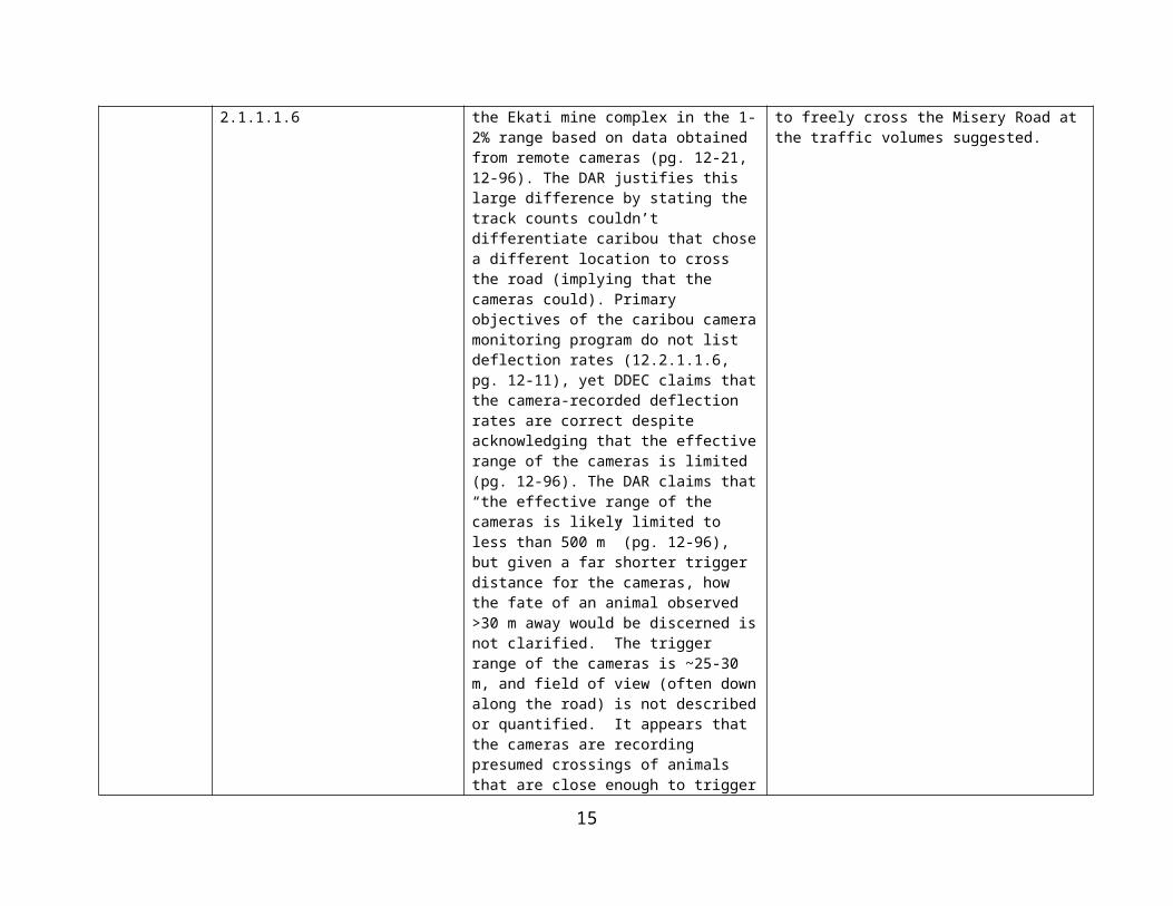
Snow track surveys from 2002-11 indicate that caribou deflected from crossing the Misery Road ~57% of the time, suggesting the road was a partial barrier to caribou movement (Rescan 2012). The DAR refers to caribou deflection rates on roads within the Ekati mine complex in the 1-2% range based on data obtained from remote cameras (pg. 12-21, 12-96). The DAR justifies this large difference by stating the track counts couldn’t differentiate caribou that chose a different location to cross the road (implying that the cameras could). Primary objectives of the caribou camera monitoring program do not list deflection rates (12.2.1.1.6, pg. 12-11), yet DDEC claims that the camera-recorded deflection rates are correct despite acknowledging that the effective range of the cameras is limited (pg. 12-96). The DAR claims that “the effective range of the cameras is likely limited to less than 500 m” (pg. 12-96), but given a far shorter trigger distance for the cameras, how the fate of an animal observed >30 m away would be discerned is not clarified. The trigger range of the cameras is ~25-30 m, and field of view (often down along the road) is not described or quantified. It appears that the cameras are recording presumed crossings of animals that are close enough to trigger a camera. The implication of accepting a 1-2% deflection rate on the road means that mitigation measures do not need to be as rigorous if higher deflection rates were assumed.
DDEC should a) justify that the cameras are recording actual deflection rates of caribou approaching the Misery Road at any distance, b) provide details on the mitigation measures in place (and proposed) to enable caribou to freely cross the Misery Road at the traffic volumes suggested.
9

23 Wildlife Management Plan; DAR Reference: s. 3 Project Description
The project description states “The Wildlife Management Plan will be amended to include the relevant information and changes resulting from the Project. This amendment will be addressed during the regulatory process subsequent to successful completion of the EA. The DAR will provide the basis for the amendment” (3.4.3.9). The current Plan is out-dated (the last version the Agency is aware of is dated 2001). An updated Plan that incorporates the Jay Project will enable a more knowledgeable assessment of the implications of the project.
To enable full assessment of the implications of the Jay Project, DDEC should provide an updated Wildlife Management Plan that addresses the Jay Project.
10

24 Adequacy of proposed mitigation measures; DAR Reference: s. 12 Caribou
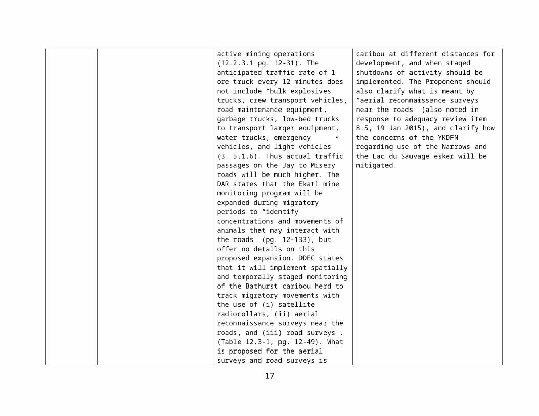
Mitigation measures proposed (Table 12.3-1 and s. 12.3.2.1) provide inadequate detail and result in reduced confidence in predicted effects. The Yellowknives Dene First Nation have identified the Narrows, and the Lac du Sauvage esker as critical caribou migration routes. They expect caribou use of the Narrows to increase as the animals attempt to avoid active mining operations (12.2.3.1 pg. 12-31). The anticipated traffic rate of 1 ore truck every 12 minutes does not include “bulk explosives trucks, crew transport vehicles, road maintenance equipment, garbage trucks, low-bed trucks to transport larger equipment, water trucks, emergency vehicles, and light vehicles” (3..5.1.6). Thus actual traffic passages on the Jay to Misery roads will be much higher. The DAR states that the Ekati mine monitoring program will be expanded during migratory periods to “identify concentrations and movements of animals that may interact with the roads” (pg. 12-133), but offer no details on this proposed expansion. DDEC states that it will implement spatially and temporally staged monitoring of the Bathurst caribou herd to track migratory movements with the use of (i) satellite radiocollars, (ii) aerial reconnaissance surveys near the roads, and (iii) road surveys”. (Table 12.3-1; pg. 12-49). What is proposed for the aerial surveys and road surveys is unclear. Details on what monitoring triggers each mitigation and how mitigation will be implemented are lacking.
DDEC should provide a comprehensive table or a decision tree detailing mitigation measures, monitoring that will trigger those measures, and how mitigation will be hierarchical (intensified or reduced) as appropriate. The table or decision tree should include specifics considering how traffic and mining activity should react to differing group sizes and composition of caribou at different distances for development, and when staged shutdowns of activity should be implemented. The Proponent should also clarify what is meant by “aerial reconnaissance surveys near the roads” (also noted in response to adequacy review item 8.5, 19 Jan 2015), and clarify how the concerns of the YKDFN regarding use of the Narrows and the Lac du Sauvage esker will be mitigated.
11

25 Location of Jay Road; DAR Reference: Jay DAR Sable Addendum: Appendix I - 2014 Wildlife Baseline Study; s. 2 Project Alternatives; s. 3 Project Description
The 3 alternative routes for the Jay Road examined environmental considerations in the selection process (2.5.1.1; pg. 2-43). The selected (alternative 3) portion of the Jay road crossing the esker is designed as a cut through a naturally occurring narrow section (3.5.1.5; pg. 3-46). However, field work from 2013 and 2014 couple with GIS modelling suggests that the proposed road alignment is adjacent to a high concentration of caribou trails and cuts through several areas of medium to high trail classification, especially on the section of road close to Misery and adjacent to the esker crossing compared with other alternatives (DAR Sable Addendum: Appendix I; Map I-5). Road alternative 1 in fact crosses far fewer areas of medium to high trail classification. It is not clear that the selection among alternative road routes was informed by the caribou trail survey/modelling (released in Dec 2014).
DDEC should re-evaluate the Jay road options and demonstrate that from a caribou movement perspective that the route selected has the least potential to disturb caribou movement through the project.
12

26 Project Effects on Caribou; DAR Reference: s. Caribou - 12.5 Prediction Confidence and Uncertainty; Adequacy response DAR-MVEIRB-15
The prediction confidence and uncertainty section devotes much discussion to the uncertainty of climate change and fires. Several aspects of uncertainty are not fully discussed: a) The DAR acknowledges that “little specific research has been completed on how low voltage distribution lines affect caribou movement and distribution” (pg. 12-123), but does not discuss implications;b) The DAR does not appear to consider the implications of only Bathurst cows (not bulls) being collared on range use patterns and timing; c) The DAR does not appear to address the implications of the apparent extreme collapse in Bathurst herd numbers in 2014 (Boulanger et al. 2014b), and likely lower resilience to development impacts. This fact is mentioned in modelling provided in response to DAR-MVEIRB-15, but model parameter inputs (e.g., cow survival) do not reflect demography likely during the rapid decline since 2012 (but instead use parameters consistent with a stable herd from 2009 to 2012).
DDEC should re-examine these sources of uncertainty and reconsider how they would affect the conclusions of the DAR with regard to predicted effects on caribou.
13

27 Project Effects on Wolves; DAR Reference: s. 13.1.4.4 Gray Wolf Effects Study Area adequacy and s. 13.2.1.1.4 Gray Wolf review of research
The wolf assessment focusses on denning, but the wolf effects study area (ESA) is only 3% of the size of the wolverine and grizzly bear ESA (pg. 13-9 to 13-11). Wolf movements are often long-distance from den sites. Wolf populations are affected by and tied closely to caribou, and any impacts of development on caribou would impact wolves. A study area that considers wolf denning in the larger context of treeline (Heard and Williams 1992) and long distance movements during denning would be more appropriate. The Review of Regional Effects Monitoring and Research for wolves (13.2.1.1.4) ignored several regional papers (Heard and Williams 1992, Walton et al. 2001, Mattson et al. 2009, Dean Cluff and current student’s larger study areas).
DDEC should a) redefine the wolf ESA to consider an area that encompasses wolf movements during the denning period, or justify why the ESA selected is adequate to assess potential impacts on wolves, and b) update the literature review and discussions of wolf denning success and pup productivity (all declining in recent years), and provide this context for the evaluation of development impacts on wolves.
28 Project Effects on Raptors; DAR Reference: s. 13.2.1.2.2 Raptors 2013 data adequacy and incorporation in the EA
The DAR states under baseline surveys that “An aerial survey was completed on July 24 and 25, 2013, of 36 potential nest sites located in highly suitable habitat (high elevation and steep terrain) to determine the presence of raptors” (pg. 13-38). Late July does not capture nest site occupancy (misses nest sites occupied earlier in the nesting period and abandoned and thus gives a misleading indication of occupancy; and gyrfalcons would have likely fledged by this period). The raptor distribution and abundance section (13.2.2.3, pg. 13-41 to 42) does not provide any data from 2013.
DDEC should provide the results of the 2013 raptor survey data, justify why these data represent a rigorous assessment of the raptors nesting within the study area, and demonstrate how the 2013 data were incorporated into the Project and cumulative assessment.
14
29 (To ENR–GNWT): Clarification of the effects of mining on Bathurst caribou numbers
Adamczewski et al. (2009: pg. 3, 69) indicated that effects from previous and existing mines are limited and unlikely a major contributing factor in the recent decline of the Bathurst caribou herd. This statement is repeated in the DAR (pg. 12-135). Adamczewski et al. (2009: pg. 68-69) provide a limited literature review to back up their assertion.
ENR-GNWT should provide more details backing up their assertion that effects from previous and existing mines are limited and unlikely a major contributing factor in the recent decline of the Bathurst caribou herd. ENR-GNWT should also clarify whether they believe the Jay Project could contribute to a further decline in herd abundance.
30 Winter Road Operating Season; DAR Reference: s. 16.3-2 Freezing Index Correlated with Historical Operating Season
The dataset used to generate Figure 16.3-2 and resultant conclusions is based on the period 1994-2006. As the data is used to determine future effects and related mitigation, the latest data should be used to confirm or amend projections.
DDEC should provide the latest data and confirm or amend the conclusions drawn from the dataset.
15

31 Cumulative Effects on Caribou; DAR Reference: s. 17.8 Barren-Ground Caribou
It is generally agreed that the collapse of the Bathurst Caribou (from over 400 000 animals to approximately 15 000 animals) is largely a natural event. However, concerns over whether human developments in the region have an adverse effect on this valued component led to caribou impacts being included as a Key Line of Inquiry. Moreover, the Jay project would also adversely affect the herd, even if not greatly. The question that needs to be asked is how great is the cumulative effect on the herd? If it is great enough that the herd has been pushed beyond its recovery threshold, then this is surely a significant adverse cumulative effect and, since Jay would add to it, the cumulative effect would be significant. The Agency agrees that the answer to this important question to the recovery threshold for the herd is not known. But the risk to the very important valued component is great. DDEC has committed to using the precautionary principle (the Environmental Agreement).
For the record, the Agency is of the view that it is more correct to proceed in a precautionary manner and assume the Bathurst herd is suffering a significant adverse cumulative effect than to assume the cumulative effect is not significant without evidence.
In the absence of scientific certainty, DDEC should provide information on what measures it is proposing to mitigate the (presumed) significant adverse cumulative effect on the Bathurst Caribou Herd. It should be demonstrated that these measures will be adequate to offset the adverse effects of the Jay Project so that the Bathurst herd would be better off after the Jay Project than it would be without the project.
32 Response to Aboriginal Concerns; DAR Reference: Annex XVII - Traditional Land Use and TK Baseline Report.
Throughout the document DDEC notes that a particular Aboriginal group “Has expressed concern(s) about the impacts of mining on…(a VEC). There is no explanation given as to how DDEC has addressed or mitigated these concerns in the development of the project.
DDEC should make specific reference to the concerns expressed by the Aboriginal organizations and how they have addressed these concerns in the development of the project.
16
33 Documentation of community Concerns; DAR Reference: s. 4 Community Engagement, Table 4.4-1, Table 4.4-2, and Table 4.4-3 and s.5 Traditional Knowledge, Table 5.3-1
Columns that are labeled: Relevant Comments/Issues/Commitments. These columns do not include relevant comments or issues or commitments made as the title indicates, they only summarizes what the objectives of the consultation was intended to provide. This is misleading.
DDEC should re-label the column with a different title such as “Objective for Meeting”. A reference should be provided as to where in the DAR the general and TK comments, issues and commitments made at the workshops, scoping sessions, site visits and other consultation meetings can be found (i.e., Section 15 Culture).
34 Meteorological Data; DAR Reference: s. 7 Air Quality, 7.2.2 Meteorology
The DAR states that Koala station was the only sampling site that recorded year-round data from 2009-2013. There is no mention that for a four month period in 2011 when there were no meteorological data collected due to power failures. No mention if the data and calculations were adjusted accordingly.
DDEC should ensure calculations using meteorological data are adjusted accordingly to account for missing data from 2011.
35 Base Case Emission Sources; DAR Reference: s. 7 Air Quality, Map 7.4-2 Base Case Emission Source Locations
It is not clear why the airstrip and Misery Haul Road are not included in the Base Case as an emission source. These facilities are both used frequently and contribute a significant amount of dust and other emissions to the air.
DDEC should adjust the map and text to reflect that both the Airstrip and Misery Haul Road as emission sources for the Base Case.
36 Air Quality Standard Exceedences; DAR Reference: s. 7 Air Quality 7.4.2.2.4 PM2.5
Dominion Diamond plans to develop an ambient air quality monitoring program that will be used to guide adaptive management strategies and the implementation of mitigation, if and as required, to maintain exposure to PM2.5 levels below those that would be of concern. It is not clear what mitigation strategies are currently being proposed to minimize or eliminate exceeding the air quality standards for the monitoring parameters, particularly PM2.5
DDEC should revise and provide an updated Air Quality Monitoring and Management Plan that includes current plans to mitigate or eliminate air quality standard exceedences from the Jay Project.
37 Project Alternatives; DAR Reference: Project Alternatives s. 2.1 Introduction, pg. 2-1
It is not clear whether DDEC consulted or involved any of the parties, or whether Traditional Knowledge was used in any way, in the identification, evaluation and selection of project alternatives or alternatives means of carrying out the development.
DDEC should clearly indicate how and where any of the parties were consulted or engaged regarding the identification, evaluation and selection of project alternatives or alternative means of carrying out the development.
17

38 Esker Crossing Design and Mitigation; DAR Reference: Project Description, s. 3.5.1.5 Roads and Pads, pg. 3-45
It would be helpful to have a conceptual diagram showing the full width and configuration of a combined road, pipeline bench and power line corridor. Given the importance of eskers as wildlife habitat, there do not seem to have been any alternative mitigation measures discussed that could include a reduced corridor configuration through the esker, burying the pipeline and/or power line, one-way traffic with stop lights, reduced speed limits or other options.
DDEC should provide a conceptual diagram showing the full width and configuration of a combined road, pipeline bench and power line corridor. To reduce the impact of the corridor on the esker crossing, DDEC should discuss alternative mitigation measures discussed that could include a reduced corridor configuration through the esker, burying the pipeline and/or power line, one-way traffic with stop lights, reduced speed limits or other options. A rationale for discarding any options should be provided.
39 Traffic Type and Volumes; DAR Reference: Project Description, s. 3.5.1.6 Traffic, pg. 3-47 and s. 12 Barren-Ground Caribou, pg. 12-97
Vehicular traffic related to the Jay Project is estimated only for the long-haul trucks at 56 round trips per day. No estimates are provided for other vehicle types, as identified by DDEC, including bulk explosive trucks, crew transport vehicles, road maintenance equipment, garbage trucks, low-bed trucks, water trucks, emergency vehicles and light vehicles. There does not appear to be any details provided on lessons learned from current traffic management at Ekati (it is not clear if there is a comprehensive traffic management plan) and how that will be applied or modified for the Jay Project. The analysis of vehicle traffic effects on caribou only included the long-haul truck traffic (DAR s. 12, pg. 12-97). The Agency is not aware of a recent and comprehensive Traffic Management Plan that explains current mitigation efforts and procedures.
DDEC should provide traffic volumes (numbers of trips per day and timing as it may relate to haul trucks) for all vehicles expected to use the Misery and Jay roads related to the Jay Project. Traffic volumes for bulk explosive trucks, crew transport vehicles, road maintenance equipment, garbage trucks, low-bed trucks, water trucks, emergency vehicles and light vehicles should be included. DDEC revise its impact assessment on caribou to include all of these vehicle types. DDEC should also provide its current Traffic Management Plan and any proposed changes for the Jay Project, to show how it intends to mitigate the effects of such traffic.
18

40 Dike Design and Performance; DAR Reference: Project Description, s. 3.5.3.1 Jay Dike, pg. 3-48
Given the recent examples of dike and dam failures in other mining projects, it is not clear whether DDEC is using best practices by establishing an independent dike review board that would review the design and performance of the Jay Dike and make its reports public along with the DDEC response.
DDEC should commit to the establishment of an independent dike review board that would review the design and performance of the Jay Dike and make its reports public along with the DDEC response.
41 Jay Dewatering Thresholds; DAR Reference: Project Description, s. 3.5.5 Dewatering and Mine Water Management, pg. 3-57
DDEC presents figures for dewatering volumes for Jay into various pits during dewatering but does not provide the assumptions behind what the TSS or other thresholds it uses for determining volumes and the rationale for same.
DDEC should clearly indicate what thresholds were used for TSS, phosphorus or other contaminants of potential concern thresholds were used in determining Jay dewatering volumes. DDEC should provide a rationale for the use of any thresholds including how they may or may not relate to water quality objectives.
42 Misery Water Quality for Discharge; DAR Reference: Appendix 3A Minewater Management Plan, Table 7-2
Predictions of Misery Pit water quality are presented at a point in time when discharge is to take place into Lac du Sauvage in Table 7-2. The text discusses how the bottom layer will have elevated levels of TDS and chloride compared to the surface but the Table does not provide this data. It would be helpful to have data for metals due to leaching from pit walls. The text also discusses the potential for some mixing of water within the pit so it would be more helpful to have the actual predictions of discharge from end of pipe at the diffuser into Lac du Sauvage.
DDEC should clarify the presentation of data in Appendix 3A, Table 7-2 to clearly indicate predicted Misery Pit water quality for TDS, chloride and metals at various layers within the pit. The effects of potential mixing and expected end of pipe water quality for the diffuser into Lac du Sauvage should also be presented for TDS, chloride and metals.
43 Fish Habitat Enhancement; DAR Reference: Appendix 3B Jay Project Conceptual Closure Report, s. 4.4.2 Sub-Basin B Diversion Channel, pg. 16
There is no discussion of fish habitat enhancements in the Sub-Basin B Diversion Channel. Significant efforts and lessons learned from fish habitat enhancements at Ekati in the Panda Diversion Channel and Pigeon Stream Diversion should be used in the Jay Project.
DDEC should describe what fish habitat enhancements it intends to apply to the Sub-Basin B Diversion Channel based on the experience from the Ekati Panda Diversion Channel and Pigeon Stream Diversion.
19

44 Esker Reclamation; DAR Reference: Appendix 3B Jay Project Conceptual Closure Report, s. 4.5.1 Roads, Pipeline Benches and Pads, pg. 18
There is no discussion in the Jay Project Conceptual Closure Report of how the combined road, pipeline and power line crossing of the esker will be reclaimed. Given the importance of eskers as wildlife movement corridors and habitat, it is not clear whether DDEC is committed to replacing the esker material and rejoining the two ends of the cut, revegetation or other special measures.
DDEC should provide details on its commitments to reclaim the combined road, pipeline and power line crossing of the esker will be reclaimed.
45 Fish Habitat Enhancement; DAR Reference: Appendix 3B Jay Project Conceptual Closure Report, s. 5.4.1.1 Jay Project Open Pit, pg. 25; s. 5.4.1.3 Dike pg. 26; s. 5.4.2.1 Misery Pit, pg. 28; s. 5.4.2.1.2 Mined-Out Panda and Koala Pits, pg. 28 and s. 5.4.2.3 Lynx Pit
In the past, commitments have been made at Ekati to ensure that pits are safe for use by fish with some effort expended toward creating fish habitat through shallow zones and riparian vegetation enhancements. There is very little discussion of fish use or habitat enhancement of any of the water bodies or pits used as part of the Jay Project.
DDEC should provide a detailed explanation of whether the Jay open pit and diked area, Misery Pit, Panda Pit, Koala Pit and Lynx Pit will be safe for fish passage and what efforts will be made towards fish habitat enhancement as part of closure and reclamation.
46 Reclamation Schedule; DAR Reference: Appendix 3B Jay Project Conceptual Closure Report, Table 5, pg. 33
A more detailed schedule that includes actual year of work would be helpful in understanding how progressive reclamation will be carried out across the Ekati Mine. DDEC provides a reclamation schedule for the Jay Project that contains very few details, unlike the schedule that appears in the approved ICRP as Figure 8.5-1.
DDEC should provide a reclamation schedule for the Jay Project that shows the same level of detail and integration with the ICRP Reclamation Schedule (Figure 8.5-1).
20

47 Significance Determinations; DAR Reference: s. 6 Determination of Significance, pg. 6-9
Several of the valued components (Key Line of Inquiry/Subject of Note) analysed indicate they would be significant if the assessment end point is exceeded. “Results from the residual impact classification are then used to determine the environmental significance from the Project (and other developments) on assessment endpoints.” (pg. 6-30). For wildlife and vegetation valued components, the following is described as the assessment endpoint: “Self-sustaining and ecologically effective populations (and communities)”. Ecological well-being is an important indicator of the significance of environmental effects for these valued components. However, societal values should play an important role in determining significance of environmental effects. For example, whether an environmental effect violates a law, whether it contradicts a management plan, program or policy for the valued component, or whether it conflicts with Aboriginal plans for use of the valued component for traditional purposes. These do not appear to have been considered in determining the significance of environmental effects for wildlife and vegetation valued components. For the record, the Agency believes that violations of laws or regulations caused by the project (alone or cumulatively) would be a strong indicator that the effect is significant. The Agency believes that contradicting an approved management plan, policy or program, or conflicting with Aboriginal plans for use of the valued component for traditional purposes would also be an indicator that the effect is significant.
For each of the valued components for which the endpoint is “self-sustaining and ecologically effective population”, we request that DDEC please provide the following: 1. What laws or regulations provide some protection for this valued component? E.g., the Species at Risk Act for listed species, the Wildlife Act of the NWT. 2. What protection is provided in the laws or regulations for this valued component? E.g., Section 32 (1) of the Species at Risk Act: “No person shall kill, harm, harass, capture or take an individual of a wildlife species that is listed as … an endangered species or a threatened species.” 3. What management plans or equivalent exist that apply to this valued component? These would be available from such sources as Environment Canada, Environment and Natural resources or the WRRB. 4. In view of the results of parts 1, 2 and 3 above, how might one revise the determination of significance for the effects on these valued components? The Agency requests that GNWT-ENR and Environment Canada responds to questions 1-4 above.
21

22