· soil conservation act 1986 this soils of ipswich field guide is designed to assist you to...
TRANSCRIPT

www.ipswich.qld.gov.au

Rationale for the guide
We are all obligated under Queensland legislation to conduct our activities in a manner that prevents harm to the environment. In particular we are bound by:
Environmental Protection Act 1994 Environmental Protection (Water) Policy 2009 Sustainable Planning Act 2009 Soil Conservation Act 1986
This Soils of Ipswich Field Guide is designed to assist you to identify soils at risk of erosion, so that you can plan and undertake appropriate erosion and sediment control measures in conducting your activities. Activities you conduct to which this applies include:
Building and maintaining roads and services.
Infrastructure (e.g. stormwater, potable water, sewers etc.).
Construction works (e.g. building, installation of minor infrastructure in parks etc) and landscaping.
Designing, approving and monitoring development activities.
Any other activities that require the excavation and/or trenching of soils.
The ultimate aim of the Guide is to assist you in preventing the erosion and transport of sediment to infrastructure (e.g. roadways, stormwater systems etc) and vulnerable environments (creeks, rivers, lakes, dams, wetlands etc) which results in costly or irreversible damage.
The Guide includes a general description of landforms and erosion, how to describe basic soil features and assess rapidly the vulnerability of a soil to water erosion. It includes basic descriptions of the major soil types in the Ipswich area that include general soil properties and management options.
Produced by AECOM Pty Ltd and Ipswich City Council
Published by Ipswich City Council
DisclaimerThis publication is made available for information purposes only and on the basis that users remain responsible for satisfying themselves as to its accuracy, completeness and currency. All images remain property of the original author and are used purely for educational purposes only and may not be reproduced without further approval. The publisher accepts no liability and (including liability for negligence) for any loss or damage (including consequential or indirect loss or damage) that may be incurred as a result of any person’s use of this publication.

Contents
Landforms, Water Flow and Soil Erosion 2
Types of soil erosion 3
Erosion Control 7
Sediment Control 8
Water Flow, Rainfall and Soil Clay Content 9
Describing Soils – Basic Features 10
Describing Soils – What the Colours Mean 12
How to Assess Soil Erosion Slaking and Dispersion Potential 13
Soil Erosion Risk Matrix 16
Soil erosion and sediment control — the next steps 17
Major soil types in the Ipswich area 18
Chromosols — neutral to alkaline soils with sharp texture contrast 20
Dermosols — structured subsoils with minor texture contrast 22
Hydrosols — wet soils 24
Kandosols — strongly weathered earths with minor texture contrast 26
Sodosols — alkaline and sodic soils with sharp texture contrast 28
Vertosols — Cracking Clays 30
Further Reading 32

Landforms, Water Flow and Soil Erosion
Landforms can determine the risk of soil erosion due to the type of water flow they receive, and the catchment area that delivers the flow. Side slopes often produce Sheet Flow, whereas valley floors and gullies produce Concentrated Flow.
In the diagram on the right, soils on the ridge at have low catchment area and experience minimum Sheet Flow.
Soils on lower side slopes at receive higher amounts of Sheet Flow and have a larger catchment area.
Soils at the valley head at receive Concentrated Flow from surrounding slopes and have a large catchment area.
Soils in the lower valley at receive the highest amounts of Concentrated Flow and have the largest catchment area.
In this diagram, the risk of soil erosion based on landform is greatest at , then , , and lowest at .
When assessing the risk of soil erosion from a landform perspective, the following should be asked:
Is the soil situated on a ridge, side slope or valley?
What is the relative catchment area of the site?
Is the site expected to receive Sheet or Concentrated Flow?
SheeT FLoW
SheeT FLoW
ConCenTrATeD FLoW
1
2
3
4
4 3 2 1
1
2
3
4

Types of soil erosion
A. Rainsplash Erosion
B. Sheet Erosion
C. Rill Erosion
D. Gully Erosion
E. Stream Erosion
STreAm FLoW
A
BC
D
E
1.

Types of Soil Erosion
Rainsplash Erosionerosion due to the impact of raindrops blasting soil particles from the soil surface. Particles can then be transported easily by sheet and other erosion types.
Sheet Erosionremoval of a shallow, uniform layer of soil from the surface. Often difficult to see due to no channels being formed, with downslope accumulation being the only indication.
DoWnSLoPe ACCumuLATIon
SheeT eroSIon
DoWnSLoPe ACCumuLATIon
2.
3.
4.

Types of Soil Erosion
Rill Erosionremoval of soil from the surface whereby small channels (rills) up to 300 mm deep are formed. These form where runoff concentrates into depressions caused naturally or by wheel tracks
Gull Erosionremoval of soil from the surface and subsurface caused by concentrated runoff eroding channels greater than 300 mm deep.
GuLLy
rILLS

Types of Soil Erosion
Tunnel ErosionTunnelling occurs when infiltrating rainwater or overland flow causes subsoils to disperse, leading to subsurface piping and erosion. Dispersive soils are especially prone to tunnelling. If the topsoil collapses, sinkholes and gullies can form.
SInk hoLe
CoLLAPSeD TunneL
Photo by matthew hughes
DISPerSIve SubSoIL
DISPerSIve SubSoIL
non - DISPerSIve ToPSoIL
non - DISPerSIve ToPSoILSInk hoLe
GuLLy FormeD ThrouGh CoLLAPSe
FLoW
TunneLS
1
2

Erosion Control
Erosion control measures are the first line of defence in preventing onsite and offsite erosion effects and should be undertaken at all sites. erosion controls are always the preferred option in managing on site and off site erosion effects. erosion control is ultimately the cheapest control measure and achieves best outcomes when considering costs.
erosion control aims to prevent or reduce soil erosion caused mainly by rainsplash and sheet erosion. The best form of erosion control is to maintain maximum plant cover on the soil surface, and minimise the “footprint” of soil disturbance. If plant cover is to be removed and soils disturbed, other typical erosion control measures may include:
Bonded fibre matrix• Compost blankets• erosion control blankets • Gravelling• mulching• revegetation• Soil binders and surface stabilisers• Surface roughening•
Specific control measures will need to be selected depending on site conditions.
Focal points for erosion control are entry and exit points at work sites where heavy vehicles transit frequently. These need to be gravelled appropriately. These sites are dominated by finds due to constant vehicle movement.
effective erosion control also means effective drainage control measures. Considerations should include:
Diversion of up-slope stormwater runoff around soil • disturbances and discharge off siteDivision of the work site into manageable drainage areas, • and flow paths stabilised and managed. Dirty water is to be kept on site and disposed of appropriatley e.g. evaporation, flocculation and discharge of clean waterMinimise flow velocity and soil erosion within drainage • channels and chutes (e.g. regular spacing of check dams etc.)
For detailed information see: IECA (2008). Best Practice Erosion and Sediment Control. International Erosion Control Association (Australasia)

Sediment control measures are the second line of defence in preventing onsite and offsite erosion effects. They aim to trap and retain sediment eroded from the site (both very fine and larger particles).
Typical sediment control measures include:
buffer zones• Construction exits• Sediment fences• Sediment basins / weirs• Check dams • Grass filter traps• Rock filter traps• Compost/mulch berms• Drop inlet protection• Flocculants•
Specific control measures will need to be selected depending on site conditions.
Drainage control measures applicable to sediment control include:
Diverting up-slope stormwater runoff away from excavations• Diversion of “clean” water around sediment traps, reducing • total volume of water to be trapped and treated and in turn reducing the size of the sediment control measure
For detailed information see: IECA (2008). Best Practice Erosion and Sediment Control. International Erosion Control Association (Australasia)
Sediment Control

Water Flow, Rainfall and Soil Clay Content
The higher the clay content of the soil, the greater the benefit normally obtained by erosion control measures.
The higher the sand content of the soil, the greater the benefit normally obtained by sediment control measures.
The diagram at right demonstrates how the general benefits of drainage, erosion and sediment control vary for various rainfall, water flow and soil particle size conditions.
The diagram does not imply that erosion, sediment and drainage control should be used in isolation from each other. Each work site will probably use some combination of all three control types.
Drainage Control (increased priority)
Erosion Control (increased priority)
Sediment Control (increased priority)
SoIL CLAy ConTenT
FLoW
TyP
e
SHEE
T FL
OW
COnC
EnTR
ATED
FL
OW
HEAVy
LIGHT
SAnDyCLAyEy
rAIn FALL InTeSITy
Adapted from IeCA & Local Government Association of Queensland Inc

Describing Soils – Basic Features
non-Cracking clays and most other soils
Surface horizon with some accumulation of organic matter that is usually darker colour than lower horizons, or horizon which may be lighter in colour but has less clay than lower horizons
Subsurface horizons characterised by one or more of: concentrations of clays, stronger colours (e.g. redder) than topsoils, structure and texture different to topsoils
ToPSoIL
uPPer SubSoIL
LoWer SubSoILreproduction of the photograph has been
approved by the State of Queensland (Department of environment and resource
management) [2010]

Cracking Clays
Surface horizon comprised of crumb-like or larger soil aggregates, with irregular coarse spaces between them. usually has same dark colour throughout
Subsurface horizons characterised by larger, coarse blocky structures with usually only narrow spaces between them. usually has same dark colour throughout
ToPSoIL
uPPer SubSoIL
LoWer SubSoIL
Describing Soils – Basic Features
reproduction of the photograph has been approved by the State of Queensland
(Department of environment and resource management) [2010]

Describing Soils – What the Colours Mean
Soil colour Characteristics Constraints
blackSoils high in organic matter, such as cracking clays, peats or organic soils
excessive/prolonged wetness, vunerable to compaction, salinity
redWell-drained soils with high content of iron oxides
Possibly vulnerable to compaction
yellow or yellow-brownImperfectly drained to moderately well-drained soils with high content of iron oxides
excessive/prolonged wetness, possibly vulnerable to compaction
brownmoderate soil organic matter concentrations and some iron oxides
Subsoil may be dispersive
Grey or blue Greynearly permanent waterlogging excessive/prolonged wetness
mottles (red,orange,yellow)Intermittent waterlogging excessive/prolonged wetness
Adapted from Pattison et al. (2010). Soil health for vegetable production in Australia. State of Queensland, Department of employment, economic Development and Innovation. Pr10–4543

Exposing the SoilDepending on the nature of works, choose the most appropriate manner of observing the soil.
This may be as simple as using an auger to extract topsoil and subsoil for testing. Alternatively, a nearby road or stream cutting may provide sufficient information. If an excavator is being used due to the nature of works, such as trenching or landscaping, a pit or trench can be excavated.
As with all trenching activities, appropriate health and safety precautions should be followed. No person should enter a trench or pit deeper than 1.2 metres.
How to Assess Soil Erosion Slaking and Dispersion Potential
Equipment neededSpade or trowel• Small glass or plastic jar• Clean, clear water (1 litre)• Timer (watch or mobile phone)•

Assessing Soil Slaking (Collapse) and Dispersionusing the spade or trowel, take a sample from the topsoil1. Pour a small amount of water into the jar2. Select 2 or 3 pea-sized soil aggregates you consider representative of the topsoil, 3. and gently place them in the waterLeave on a stable surface and observe after 5 minutes4. repeat the process for the upper subsoil and the lower subsoil5. using your judgement, assign an overall rating to the subsoil e.g.6.
If the aggregates stay together then the soil has good aggregate stability. The soil is largely stable in water; or
If the aggregates fall apart, but the water remains clear, the aggregates have slaked. The soil is vulnerable to slaking (collapse) in water, but shows little or no clay dispersion; or
If the aggregates fall apart and the water is cloudy, the soil is dispersive. The soil is vulnerable to collapse in water and associated clay dispersion.
How to Assess Soil Erosion Slaking and Dispersion Potential

How to Assess Soil Erosion Slaking and Dispersion Potential
Stable aggregate
Slightly dispersive
Slaked aggregate
moderately dispersive highly dispersive
Slaked soil
Dispersive soil
© The State of Queensland, Department of employment, economic Development and Innovation (2010)

Soil Erosion Risk Matrix
Dispersion Slaking
high moderate Slight Slaked Stable
Conc
entra
ted
Flow
high
Low
Conc
entra
ted
Flow
high
Low
high erosion risk
moderate erosion risk
Low erosion risk* overall dispersion or slaking rating for whole soil (Pages 14 and 15)
† Determine general flow conditions based on the diagram on Page 2

Soil erosion and sediment control — the next steps
This Guide presents general advice only on assessing soil vulnerability to erosion. once general site conditions have been assessed according to the Soil erosion risk matrix, site checks to confirm soil types still need to be conducted and expert advice sought for erosion and sediment controls.
A comprehensive erosion and sediment control plan needs to be devised. This will include locations of:
erosion control measures• Sediment control measures• Drainage controls• Site entry and exit controls• Soil stockpiles•
For comprehensive and detailed information see:
IECA (2008). Best Practice Erosion and Sediment Control. International Erosion Control Association (Australasia)
Local Government Association of Queensland Inc. (2006). Introductory Erosion and Sediment Control Guidelines for Queensland Councils

Major soil types in the Ipswich area
The following section describes the six major Australian Soil Classification Orders mapped in the Ipswich City Council area. Where possible more than one example of a typical soil profile is presented.
It should be noted that this is not a comprehensive compilation of all possible soils found in the area, only the dominant ones. However, this is sufficient for conveying the general diversity of soils and their properties, especially as they relate to erosion present in the Ipswich area. The distribution of the six major soil types in the area is shown on the following map “major soil types in the Ipswich area.” The six major soils are described on pages 20 - 31.
A note on terminologyDispersive soils – soils that are comprised largely of clays that are vulnerable to dispersion and erosion when wet. The soils known as Sodosols are particularly dispersive, but other clay-rich soils such as Chromosols, Dermosols, vertosols and some hydrosols and kandosols are also vulnerable to dispersive erosion.
Texture contrast – those soils that have a significant change in soil particle size (texture) between topsoil and subsoil. This almost always refers to soils with sandy topsoils and clay-rich subsoils.
Structured/well structured – soils or individual soil horizons that exhibit organisation. This means that soil particles are amalgamated into large units called “aggregates”. Well structured soils have distinct aggregates of different sizes, with abundant cracks or pores throughout.

Major soil types in the Ipswich area
Soil data from Derm (2008).Soils dataset, scale 1:250,000

Vertosols — Cracking Clays
reproduction of the photograph has been approved by the State of Queensland (Department of environment
and resource management) [2010]
reproduction of the photograph has been approved by the State of Queensland (Department of environment
and resource management) [2010]

Landform and DistributionWidespread on flat to undulating alluvial plains, creek flats and higher terraces
Key FeaturesClay-rich and often well-structured. Susceptible to water logging and compaction. highly sticky when wet
Erosionvulnerable to sheet and gully erosion on moderate slopes
Erosion and Sediment ControlSurface cover should be maintained as much as possible. On site drainage should be diverted to reduce water flow velocity and to separate clean from dirty water. Sediment controls may require sediment basins
EarthworksLimitations due to water logging, clay content and cracking. Allow for 30% settling
Fertility and Plant GrowthSome soils may be nutrient deficient, and aluminium and manganese toxicities may occur in some areas. Slow drainage may cause waterlogging and restrict plant growth
Vertosols — Cracking Clays

Hydrosols — wet soils
reproduction of the photograph has been approved by the State of Queensland (Department of environment
and resource management) [2010]

Landform and DistributionOccur in the poorly drained sections of valley floors
Key FeaturesSoil properties largely determined by height of water table, which is almost always relatively high. Grey colours and mottling indicate prolonged saturation. may be clay or sand throughout, or combinations of the two
Erosionbecause they occur in the lowest parts of the landscape, sheet, rill, gully or tunnel erosion is rare, although flooding may be a problem. Disturbed soils exposed to stream flow may erode
Erosion and Sediment Controlupstream diversion should be considered to prevent site flooding and waterlogging. Sediment controls should be implemented to prevent downstream effects. Clay-rich soils may require sediment basins and the use of flocculants to settle out clays
EarthworksSuitable for roads and tracks except in the lowest positions
Fertility and Plant GrowthGenerally nutrient rich, although aluminium and manganese toxicities may occur in some areas. Soil surface may crust leading to poor soil-seed contact. Poor drainage may lead to oxygen-poor root conditions and inhibit plant growth
Hydrosols — wet soils

Kandosols — strongly weathered earths with minor texture contrast
reproduction of the photograph has been approved by the State of Queensland (Department of environment
and resource management) [2010]

Landform and Distributionoccur on the crests and slopes of low hills
Key FeaturesUsually deep (1.0 – 5.0 m). Weak soil profile development and gradual increase in clay content with depth
Erosionhighly erodible even on low slopes if bare
Erosion and Sediment ControlSurface cover should be maintained as much as possible. On site drainage should be diverted to reduce water flow velocity and to separate clean from dirty water. Sediment controls for coarser (sandy) materials may include sediment fences, but finer materials may require sediment basins and the use of flocculants to settle out clays
EarthworksSuitable for most earthwork operations. Allow for 30% settling
Fertility and Plant GrowthGenerally very low nutrient status, especially phosphorus and nitrogen.
Plant available water capacity is generally very low, and salinity may be a problem in some areas
Kandosols — strongly weathered earths with minor texture contrast

Sodosols — alkaline and sodic soils with sharp texture contrast
reproduction of the photograph has been approved by the State of Queensland (Department of environment
and resource management) [2010]
reproduction of the photograph has been approved by the State of Queensland (Department of environment
and resource management) [2010]

Landform and DistributionWidespread on plains and low hills
Key FeaturesSharp contrast between sandy topsoils and clay-rich subsoils
Erosionhighly erodible. vulnerable to sheet, tunnel and gully erosion due to highly dispersive subsoils
Erosion and Sediment ControlSurface cover should be maintained as much as possible. On-site drainage should be diverted to reduce water flow velocity and to separate clean from dirty water. Sediment controls for coarser (sandy) materials may include sediment fences, but finer materials may require sediment basins and the use of flocculants to settle out clays
Earthworksunsuitable for most earthwork operations
Fertility and Plant GrowthGenerally low to very low nutrient status. Plant available water is very low.
Plant growth is impeded by poor subsoil drainage due to high clay content, and is also impeded by tough clay subsoil
Sodosols — alkaline and sodic soils with sharp texture contrast

Chromosols — neutral to alkaline soils with sharp texture contrast
reproduction of the photograph has been approved by the State of Queensland (Department of environment
and resource management) [2010]
reproduction of the photograph has been approved by the State of Queensland (Department of environment
and resource management) [2010]

Landform and Distributionyellower soils occur on gently undulating rises to rolling country. redder soils occur on gently inclined and steep slopes in hilly country
Key FeaturesSharp texture contrast between sandy topsoils and clay-rich subsoils
Erosionhighly erodible even on shallow slopes. Prone to sheet erosion. because subsoils are clay-rich, they are vulnerable to dispersion
Erosion and Sediment ControlSurface cover should be maintained as much as possible. On site drainage should be diverted to reduce water flow velocity and to separate clean from dirty water. Sediment controls for coarser (sandy) materials may include sediment fences, but finer materials may require sediment basins and the use of flocculants to settle out clays
EarthworksSuitable for most earthwork operations. Allow for 30% settling
Fertility and Plant GrowthGenerally low to very low nutrient status, and plant available water capacity is low
Chromosols — neutral to alkaline soils with sharp texture contrast

Dermosols — structured subsoils with minor texture contrast
reproduction of the photograph has been approved by the State of Queensland (Department of environment
and resource management) [2010]
reproduction of the photograph has been approved by the State of Queensland (Department of environment
and resource management) [2010]
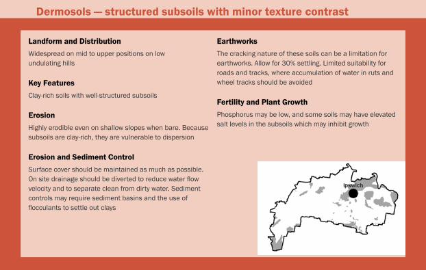
Landform and DistributionWidespread on mid to upper positions on low undulating hills
Key FeaturesClay-rich soils with well-structured subsoils
Erosionhighly erodible even on shallow slopes when bare. because subsoils are clay-rich, they are vulnerable to dispersion
Erosion and Sediment ControlSurface cover should be maintained as much as possible. On site drainage should be diverted to reduce water flow velocity and to separate clean from dirty water. Sediment controls may require sediment basins and the use of flocculants to settle out clays
EarthworksThe cracking nature of these soils can be a limitation for earthworks. Allow for 30% settling. Limited suitability for roads and tracks, where accumulation of water in ruts and wheel tracks should be avoided
Fertility and Plant GrowthPhosphorus may be low, and some soils may have elevated salt levels in the subsoils which may inhibit growth
Dermosols — structured subsoils with minor texture contrast

harms, b.P. (1996). Field manual, in noble. k.e. (ed) understanding and managing Soils in the moreton region. Department of Primary Industries Training Series Qe96003, brisbane.
IeCA (2008). best Practice erosion and Sediment Control. International erosion Control Association (Australasia)
Local Government Association of Queensland Inc. (2006). Introductory erosion and Sediment Control Guidelines for Queensland Councils.
mckenzie, n., Jacquier, D., Isbell, r. and brown, k. (2004). Australian Soils and Landscapes – An Illustrated Compendium. CSIro Publishing
national Committee on Soil and Terrain (2009). Australian Soil and Land Survey Field handbook, 3rd edition. CSIro Publishing.
Pattison, T. et al. (2010). Soil health for vegetable production in Australia. State of Queensland, Department of employment, economic Development and Innovation. Pr10–4543
Image Attributions
Adapted from: http://saferenvironment.files.wordpress.1. com/2009/08/type-of-soil-erosion.jpg.From: http://www.ipm.iastate.edu/ipm/icm/2005/5-2-2. 2005/splash.jpg.Adapted from: http://www.vbco.org/media/3. planningeduc/tn_raindrp.jpg.From: http://www.mo.nrcs.usda.gov/news/4. mophotogallery/erosion/sheet1.jpg.
Further Reading


Ipswich City CouncilPhone (07) 3810 6666Fax (07) 3810 6731
www.ipswich.qld.gov.au