!/ by - usgs
TRANSCRIPT

DEPARTMENT OF THE INTERIOR U.S. GEOLOGICAL SURVEY
The Hijinah uplift and regional gravity sliding in the Wajid sandstone,
Kingdom of Saudi Arabia
by!/ y
Douglas B. Stoeser and William R. Greenwood
Open-File Report 85-
Prepared for the Ministry of Petroleum and Mineral Resources, Deputy Ministry for Mineral Resources, Jiddah, Kingdom of Saudi Arabia
This report is preliminary and has not been reviewed for conformity with U.S. Geological Survey editorial standards and stratigraphic nomenclature.
]_/ U.S. Geological Survey, Denver, CO 2J U.S. Geological Survey, Reston, VA
1985
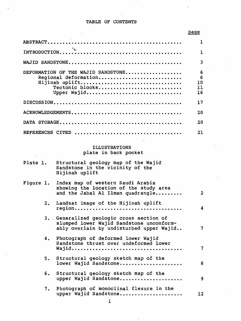
TABLE OF CONTENTS
page
ABSTRACT............................................**
INTRODUCTION.....V ..................................
WAJID SANDSTONE.....................................
DEFORMATION OF THE WAJID SANDSTONE..................Regional deformation...........................Hijinah uplift.................................
Tectonic blocks...........................Upper Waj id...............................
DISCUSSION..........................................
ACKNOWLEDGEMENTS....................................
DATA STORAGE........................................
REFERENCES CITED ...................................
ILLUSTRATIONS plate in back pocket
Plate 1. Structural geology map of the Wajid Sandstone in the vicinity of the Hijinah uplift
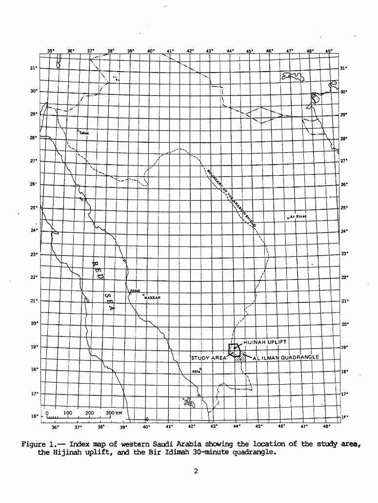
Figure 1. Index map of western Saudi Arabiashowing the location of the study area and the Jabal Al Ilman quadrangle........
2. Landsat image of the Hijinah upliftregion..................................
3. - Generalized geologic cross section ofslumped lower Wajid Sandstone unconform- ably overlain by undisturbed upper Wajid
4. Photograph of deformed lower WajidSandstone thrust over undeformed lower Waj id...................................
5. Structural geology sketch map of thelower Wajid Sandstone...................
6. Structural geology sketch map of theupper Waj id Sandstone...................
7. Photograph of monoclinal flexure in the upper Waj id Sandstone...................
1
1
3
66
101116
17
20
20
21
7
8
9
12

8. Photograph of tectonic block of metagabbroin deformed lower Wajid Sandstone......... 12
9» Geologic sketch map of area within the core zone of the Hijinah uplift showing distribution of tectonic blocks of Preeambrian basement...................... 13
10. Aeromagnetic and radiometric map of thewestern half of the Hijinah uplift........ 18
TABLE
Table 1. Potassium-argon and argon-argon mineral ages for biotite-hornblende gabbro sample 771-22A............................ ' 15
ii

THE HIJINAH UPLIFT AND REGIONAL GRAVITY SLIDING IN THE WAJID SANDSTONE, KINGDOM OF SAUDI ARABIA
byI/ 2/
Douglas B f^ Stoeser and William R. Greenwood
ABSTRACT
The chief conclusion of this report is that a felsic pluton was emplaced at shallow depths beneath the epicontinental lower Wajid Sandstone while it was being deposited on the Precambrian basement of the southern Arabian Shield. The initial effect of this intrusion was to generate a circular uplift, the Hijinah uplift, about 20 km in diameter in the basement and Wajid sediments. At least one phreatic eruption associated with the intrusion caused basement blocks as much as 50 m in diameter to be blown upward into and mixed with the Wajid sediments. Seismic activity related to the intrusion and uplift, and probably to the phreatic event in particular, caused regional gravity slides to develop in the Wajid sediments. These slides developed on a sedimentary shelf south of the Hijinah uplift and flowed northward around the uplift into a shallow marine basin. The regional slumping occurred at a time when about 100 m of Wajid sediment had been deposited in the study area. The initial phase of activity was followed by a period of quiescence during which a minimum of an additional 150 m of Wajid sand was deposited unconformably over the extensively slumped lower Wajid sediments. The upper Wajid sediments were domed and deformed by a resurgence of the Hijinah uplift, the effects of which, except for minor local slumping within the upper Wajid, appear to have been confined to the area of the uplift. These events probably occurred during either very latest Proterozoic or during Cambro-Ordovician time.
INTRODUCTION
This report is the result of a reconnaissance helicopter excursion on February 29, 1976, to field check an apparent circular feature within the Wajid Sandstone which was observed on Landsat imagery. Although no field evidence for this feature was found, the Wajid Sandstone (fig. 1) in the vicinity of lat 19 07 1 N. and long 44 05 1 E. longitude was seen to be unconformably underlain by highly deformed poorly indurated clastic sediments that clearly were not part of the crystalline basement of the Arabian Shield, which normally underlies the Wajid Sandstone. Although at first interpreted by us to be a pre-Wajid Eocambrian or early Proterozoic sedimentary unit, subsequent field work established that the deformed sediments also belonged to the Wajid Sandstone. Mapping further established that the disturbed lower Wajid unit, in fact, consists of severalI/ USGS, Denver, CO , 2/ USGS, Reston, VA
35* 36*___37* 38* 39* 40* 41* 42* 43* 44* 45* 46* 47* 48* 49*
31'
30'
ALILMAfV QUADRANGLE
36* 37- 38* 39* 40' 41' 42* 43* 44* 45' 46* 47* 48*
Figure 1. Index map of western Saudi Arabia showing the location of the study area, the Hijinah uplift, and the Bir Idiroah 30-minute quadrangle.

disturbed domains that are separated by sections of undisturbed lower Wajid Sandstone. The region affected by the disturbance within the lower Wajid unit includes a minimum area of approximately 40 by 50 km (fig. 2; plate 1). A circular uplift 20 km in diameter was also discovered in the northern part of the disturbed area. This report discribes these structural features and offers a preliminary interpretation of their origin.
The field work upon which this report is based represents a total of five days during 1976 and 1977 and 4 days in 1981. Preliminary results of the early work were reported by Greenwood (<*/*M^) . Pallister fap***) extended mapping of the deformed lower Wajid into the Jabal al Ilman 30-minute quadrangle (18/44 A; fig. 1) . Plate 1 was prepared using 1:50, 000-scale photomosaics GSMO HE, 11F, 12E, and 12F as bases and includes with slight modification the mapping of Pallister
WAJID SANDSTONE
The Wajid Sandstone was named in 1948 by R. D. Gierhardt and L. D. Owens after Jibal al Wajid, a broad area of hills and buttes to the east of the present study area {fig. 1) (Powers and others, 1966). It consists primarily of mature epicontinental sandstone intercalated with minor shale and conglomerate and is thought to be between 600 to 1000 m thick (Powers and others, 1966; Hadley and Schmidt, 1975; Pallister , ^pm**) . It forms the basal Phanerozoic sedimentary formation that overlies rocks of the Arabian Shield in southwestern Saudi Arabia and northern Yemen (Powers and others, 1966; Geukens, 1966; Dabbagh and Rogers, 1983) . Although originally assigned a "Lower Permian and older (?)" age by Powers and others (1966), more recent studies have tended, on the basis of trace fossils, to assign the Wajid Sandstone to the Cambro-Ordovician (Brown, 1970; McClure, 1980; Dabbagh and Rogers, 1983).
The overall stratigraphy of the Wajid Sandstone is still poorly known. Hadley and Schmidt (1975) subdivided it into lower, middle and upper units, although that subdivision was not accepted by a more recent study (Dabbagh and Rogers, 1983) . The upper Wajid of Hadley and Schmidt, which may not properly belong to the same formation as the lower and middle Wajid, is the center of an ongoing controversy as to whether it includes erratic boulders of glacial origin (Hadley and Schmidt, 1975; Roland, 1978; McClure, 1980) . For detailed stratigraphic information on the Wajid Sandstone, the reader is referred to Alabouvette and Villemur, 1973; Hadley and Schmidt, 1975; Pallister,
; and Dabbagh and Rogers, 1983.
In the southeastern portion of the study area in the Jabal al Ilman quadrangle, Pallister (i*f#uo) informally subdivided the Wajid into two members, a lower Shum member
3

. J
Figure 2. Landsat image of the Hijinah uplift region, showing the study area outlined and the Hijinah uplift (outlined with dashed lines). The boundary of plate 1 is shown by a solid line.

and an upper Ilman member. Although both are characterized by trough-cross bedded sandstone, the Ilman member is distinguished from the Shum member by containing numerous meter-scale ferruginous beds and by the regional deformation of the Shum member. Although the members are petrographically^ somewhat similar, Pallister described the Shum member as itess mature and consisting least in part of subarkose containing 5 to 15 percent feldspar and minor amounts of other minerals. The Ilman member, however, generally contains only quartz and trace amounts of feldspar. Although we have not done any detailed work on the Wajid Sandstone, our reconnaissance thin section work on the Wajid further north supports Pallister 's conclusions.
Pallister (oiijSwM also indicates that the contact between the two members at any particular locality is either an angular unconformity or disconformity depending on whether the underlying Shum member is deformed or not. Pallister interprets the contact as being a "significant erosional and deformational hiatus in Wajid deposition. 11 He also reports that the Shum member thins from 140 m thick in the northwestern part of the Jabal al Ilman quadrangle to 10 m in the southwest. The overlying Ilman member has a minimum thickness of 210 m in the Jabal al Ilman quadrangle. -In the thickest section of the Wajid Sandstone observed in the area of the Hijinah uplift (at lat 19 02 ' N. and long 43 58 ' E.), we determined by helicopter altimetry a thickness of 104 m for the disturbed lower Wajid (Shum member?) and 153 m for the overlying undisturbed Wajid (Ilman member?) . Given these thicknesses, it appears that the Shum member is included in the lower Wajid of Hadley and Schmidt (1975>-r and the Ilman member is either part of their middle Wajid unit or straddles their lower and middle units. For the sake of convenience relative to the study area, we refer to the lower part of the Wajid Sandstone, which is in part regionally deformed, as the lower Wajid, and the generally undisturbed Wajid, which unconformably overlies the lower unit, as the upper Wajid.
Paleocurrent studies have consistently indicated a northward direction of transport for the Wajid sediments, which were initially laid on a peneplain developed over the Arabian Shield (Alabouvette and Villemur, 1973; Hadley and Schmidt, 1975; Anderson, 1979; Greenwood, 1980; Dabbagh and Rogers, 1983) . The Wajid Sandstone has been interpreted as fluvial deposits by Hadley and S.chmidt (1975) and McClure (1980), beach deposits by Greenwood (1980), and shallow- marine deposits by Alabouvette and Villemur (1973) . Dabbagh and Rogers (1983), in a more detailed study, have recognized a northern shallow marine facies and a southern fluvial facies within the Wajid Sands±one with the transition zone occurring between lat 18 and 19 N. If their interpretation is correct, the Wajid Sandstone within the

study area lies adjacent to or within the transition zone between the two facies, that is, close to the beach and shelf zone.
DEFORMATION OF THE WAJID SANDSTONE
The two *~*iain types of deformation exhibited by the Wajid Sandstone include: (1) regional deformation within the lower Wajid that occurs throughout much of the study area and (2) a circular uplift or doming that affects both the lower and upper Wajid. The uplift is here named the Hijinah uplift after Wadi Hijinah, which wraps around the southern flank of the uplift (figure 2; plate 1) . The name was obtained by Stoeser from Bedouin .living in the wadi.
Regional deformation
Alabouvette and Villemur (1973) , in their sedimentological survey of the Wajid Sandstone, appear to be the first geologists to have observed the deformation within the lower Wajid. Although this deformation or "slumping", including related thrusting, is noted in several of their photographs, sketches, and stratigraphic columns, it is not discussed or noted in their text. They apparently observed the deformation at four localities within the Wajid Sandstone, three of which occur in the present study area. Their fourth locality (Section 5) occurs on the west margin of the sandstone at lat 19 U 50' N. and long 44 U 06' E. If deformation occurs between that locality and the present study area, deformation within the lower Wajid extends, over an area of at least 50 by 150 km.
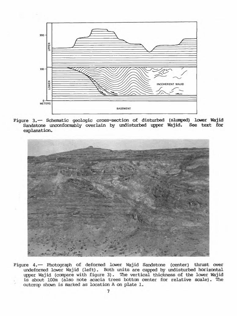
Figure 3 shows schematically the stratigraphic and structural relations between the lower and upper Wajid units. In general, where the lower Wajid is undeformed, the whole section appears to be conformable and the disconformity is not noticeable. The presence of deformed lower Wajid is indicated by (1) an angular unconformity between the lower and upper Wajid, or (2) by well-bedded upper Wajid resting on "incoherent" lower Wajid that is massive or shows only local relics of bedding. Contacts between deformed and undeformed lower Wajid can be observed in a number of well exposed outcrops within the study area (plate 1) . These contacts generally consist of a thrust fault that dips from about 15 to 75 inward toward deformed lower Wajid and commonly gives some indication of drag on both plates. Where well exposed, these thrusts have detachment surfaces near the base of the lower Wajid and .are sharply truncated by the overlying upper Wajid. Although most exposures of these thrusts proved instructive, probably the bes± exposure is the one located at lat 19 04' E. and long 43^56' N. (fig. 4).
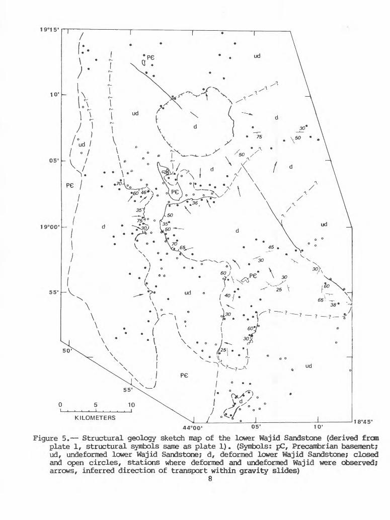
Plate 1 and figures 5 and 6 are maps of the lower and upper Wajid showing the distribution of deformed and
6
200-
100-
METERS
BASEMENT
Figure 3. Schematic geologic cross-section of disturbed (slumped) lower Wajid Sandstone unconformably overlain by undisturbed upper Wajid. See text for explanation.
Figure 4. Photograph of deformed lower Wajid Sandstone (center) thrust over undeformed lower Wajid (left). Both units are capped by undisturbed horizontal upper Wajid (compare with figure 3). The vertical thickness of the lower Wajid is about 100m (also note acacia trees bottom center for relative scale). The outcrop shown is marked as location A on plate 1.
7
19°00' -
KILOMETERS
44°0005'
18°45'
Figure 5. Structural geology sketch map of the lower Wajid Sandstone (derived from plate 1, structural symbols same as plate 1). (Symbols: pC, Precambrian basement; ud, undeformed lower Wajid Sandstone; d, deformed lower Wajid Sandstone; closed and open circles, stations where deformed and undeformed Wajid were observed; arrows, inferred direction of transport within gravity slides)
8

1 9000'
KILOMETERS
44°00' 05'18°45'
10 1
Figure 6. Structural geology sketch map of the upper Wajid Sandstone (derived from plate 1, structural symbols same a plate 1). (Symbols: w, undisturbed upper Wajid; wt, disturbed (slumped?) upper wajid)

undeformed lower Wajid and structural features of the lower and upper Wajid in the study area. The unconformity between the upper and lower Wajid is not shown on these maps because of the difficulty in mapping the unconformity using aerial photography."Therefore, the Wajid Sandstone as a whole has been mapped relative to the Precambrian basement and Quaternary alltivium. Because of the shallow eastward dip of the Wajid (Pallister ,j^^p^^ , exposures of the lower Wajid diminish eastward across the study area, and, along the east edge of the mapped area shown on plate 1, only the upper part of the Wajid Sandstone is exposed at the surface.
Except for a few of the major faults in the basement, only those faults that cut the Wajid Sandstone are shown on plate 1. In general, faults within the Wajid Sandstone show little or no displacement and appear to be mild rejuvenations of basement faults. Cementation along some of the faults makes them resistant to erosion and causes them to form lineaments with positive relief.
It is the nature of the angular unconformity that definitively indicates that the deformation of the lower Wajid was contemporaneous with the deposition of the Wajid Sandstone. Clearly the wet dilatant sands of the lower Wajid were deformed and thrust over undeformed lower Wajid (fig. 3) , planed off to a flat surface (presumably by either current or wave action), and the upper Wajid deposited over them. Where highly deformed, the unindurated lower Wajid sediments lost all coherency and most or all indications of bedding. Unfortunately, time did not permit a detailed study of the internal structures of the slumped lower Wajid. Detailed structural information, particularly the attitude of folds and deformed bedding, would be very valuable in the complete interpretation of the origin of the deformation. As discussed below the deformation is interpreted to be due at least in part to regional slumping (gravity sliding) caused by activity related to the formation of the Hijinah uplift. That the uplift existed at the time of the regional gravity sliding is shown by the flow distribution pattern of the slumps in the lower Wajid which indicate that they flowed around the uplift (fig. 5; plate 1).
Hijinah uplift
The Hijinah uplift appears as a poorly defined circular feature on aerial photographs and Landsat imagery of the region (fig. 2). The uplift does not have a sharply defined boundary and is marked by concentric deformational features that extend over a circular area about 20 km in diameter. It also is partly defined by the wadi pattern which reflects the presence of the structure. The uplift is divided into two zones, an intensely deformed core 10 km in diameter, and a poorly defined, mildly deformed outer zone extending out another 3 to 5 km. The approximate boundary of the core is shown on figures 5 and 6 and plate 1. The outer boundary of
10

the domal uplift is well marked on the east flank by a well-defined arcuate monoclinal flexure in the upper Wajid Sandstone (plate 1; figure 7) . To the north, west, and south the monocline is largely absent, and delineation of the circular feature is more difficult. In these areas, the boundary zone is marked by a sharp increase in deformation of the lower Wajid and, at least locally, by a boundary fault between undeformed or less deformed lower Wajid. The overall impression, however, is that of a domal uplift within the upper Wajid.
Within the core zone of the uplift, the lower Wajid exhibits intense to often chaotic deformation. In contrast to the lower Wajid, the upper Wajid within the uplift is deformed into mild open folds. Minor compressional folds show clearly that the upper Wajid has, at least locally, detached and moved along the unconformity that separates it from the lower Wajid. The overall degree of deformation and the lack of contrast between the lower and upper units have made the detailed mapping of the contact between them impossible on aerial photographs without additional field control.
Tectonic blocks
One of the most striking features of the Hijinah uplift is an area of highly deformed lower Wajid located somewhat to the northwest of the center of the core zone. In this area, which is about 200 m by 400 m in size, xenolithic blocks of basement from less than a meter to over 20 m in diameter can be observed "floating" in a matrix of highly deformed lower Wajid. These blocks are presumed to have been tectonically emplaced into the lower Wajid Sandstone (fig. 8). Figure 9, a geologic sketch map of the area containing the tectonic blocks, is based in part on a series of ten aerial photographs taken by F. J. Fuller, of the U.S. Geological Survey Arabian Mission's Topography Section, during June 1978. The photographs, whose approximate scale is 1:10,000, represent a single east-to-west traverse across the Hijinah uplift, including the area containing the tectonic blocks. These photographs are included in the Saudi Arabian Deputy Ministry for Mineral Resources aerial- photograph archive as frames 1-77 to 1-87 of DGMR Series No. 46. Figure 8 was plotted on a 2X enlargement of frame 1-82. Unfortunately, a gap is present in stereo coverage of the western part of the the area containing the xenolithic blocks (frames 1-82 and 1-83).
The xenolithic blocks can be divided into two groups, smaller metamorphic blocks of mafic schist, metagabbro, metadiorite, metabasalt and metatonalite, and two large blocks of unmetamorphosed biotite-hornblende gabbro. The larger block of gabbro, which is about 50 m in diameter, may in fact be two closely adjacent blocks of approximately equal size separated by a thin east-striking septum of
11

Figure 7. Photograph of monoclinal flexture in the upper Wajid Sandstone on the eastern margin of the core zone of the Hijinah uplift (view is looking north). The upturned section is over 150m thick (note acacia trees at base of upturned section for approximate scale).
Figure 8. Photograph of 20m diameter metagabbro tectonic block in deformed lower Wajid Sandstone.

AP
PR
OX
IMA
TE
SC
ALE
0
50
100
ME
TE
RS
I
i i
t i
I
Figure 9. Geo
logi
c sk
etch
map of
area
within
the co
re z
one of t
he H
ijin
ah u
plift
show
ing
distribution
of Pre
camb
rian
basement
tect
onic
blocks
within t
he l
ower
Wajid Sandstone (see pla
te 1
for l
ocat
ion)
.(S
ynbo
ls:
qal,
Quaternary alluvium;
Wd,
uppe
r Wajid
Sand
ston
e; Wdu, deformed up
per-
lowe
r Wajid
Sandstone; Wd,
defo
rmed
lower
Wajid
Sandstone; gb,
biotite-hornblen
de gabbro;
mg,
meta
gabb
ro;
ms,
afi
c sc
hist
; nb,
metabasalt;
mt,
metatonalite;
mx,
lithology no
t known; c
p, clay pipe)

sandstone. It was these gabbro blocks that were first observed, and at that time interpreted to be shallow intrusions into the lower Wajid (Greenwood, t*pr~t^) . This discovery was of considerable interest because it offered direct evidence for intrusive activity at the time of Wajid sedimentation,and presented an opportunity to date the basal Wajid by dating the gabbro.
Unlike the metamorphic blocks, which tend to weather either flush or slightly negative relative to the surrounding Wajid Sandstone, the gabbro is resistant to weathering and stands out in positive relief. The gabbro from both bodies is essentially identical and has a coarse-grained texture, which consists of plagioclase set in strongly poikilitic hornblende (in patches as much as 5 or 6 cm in diameter). In addition, the rock contains several percent of late interstitial biotite and accessory apatite.
Tectonic rather than intrusive emplacement of the gabbro is is indicated by very fine grained seams of green mylonite that criss-cross the gabbro. Although the gabbro is thus a megabreccia, the mylonitic seams probably constititute only about 5 percent of the gabbro outcrop. The mylonitic matrix, however, is rather unusual in that the microclasts within it are very fresh and angular and appear to have been sintered together. There is essentially no sign of hydrothermal or other hydrous alteration of the matrix materials.
Supporting evidence for the intrusive interpretation was that the gabbro bodies appeared to have a reddened baked zone several centimeters thick against the enclosing Wajid Sandstone. Subsequent examination, however, suggests that these zones are largely discolored by iron that migrated into the Wajid during diagenesis after emplacement of the gabbro.
Potassium-argon dating of hornblende and plagioclase separates was done by R. J. Fleck, of the U.S. Geological Survey, on a sample taken from the southern gabbro body (table 1) . The hornblende data yield ages in the range 478+9 to 628+8 Ma, whereas the two plagioclase separates gave 403+7 and 483+7 Ma. If the 628+8 Ma age is a minimum age for the gabbro, then it is similar to other late Proterozoic gabbros distributed throughout the southeastern Arabian Shield. This group of gabbros was emplaced during the period 620-660 Ma (Coleman and others, 1972; Cooper and others, 1979). Although the Hijinah gabbro is lithologically atypical in that most of these other gabbros are pyroxene gabbros, we assume that it belongs to the suite of late Proterozoic gabbros of the Arabian Shield and that it was tectonically emplaced into the Wajid Sandstone.
Twenty-six metamorphic basement blocks, up to about 20 m in diameter, are shown on figure 9. Within the mapped
14

Table 1. Potassium-argon and argon-argon mineral ages for biotite-hornblende gabbro sample 771-22A. Sample taken from the larger of the two biotite-hornblende gabbro lab) bodies shown in figure 9. Conventional K-Ar and Ar/ Ar techniques are the same as those described by Fleck and others (1976).
Mineral
Hornblende
Hornblende
Hornblende
Plagioclase
Plagioclase
Technique
K-Ar
K-Ar
40Ar/39Ar
K-Ar
40Ar/39Ar
%40Ar*
94.3
93.0
93.1
85.7
57.3
Age (Ma)
587+9
478+9
628+8
403+7
483+7
area, there is a particularly dense concentration of these blocks in the vicinity of the two biotite-hornblende gabbro bodies. Numerous smaller blocks a meter or less in size are also present, but these were too small to map. No detailed petrographic study of the metamorphic blocks was done. They consist primarily of mafic schist and hornblende metagabbro with sparse blocks of metadiorite, metadiabase, metabasalt, and metatonalite. A few blocks are composite and, in particular,, it can be seen that the meta-igneous rocks form the protolith for the schists. The blocks also contain metabasalt dikes, thin seams of pegmatite and quartz, and injections of sandstone along fractures.
The xenolithic blocks occur at all levels in the lower Wajid, although the larger blocks tend to lie deeper in the section. During the preparation of figure 9, which was in part done by photointerpretation, one problematical aspect of the mapping was distinguishing mildly deformed upper Wajid from mildly deformed lower Wajid. In the field, the disturbed lower Wajid is seen to be unconformably capped by less deformed sections of Wajid Sandstone. Although all of these caps were initially interpreted to be upper Wajid, they now thought to be both upper and upper lower Wajid and are subdivided on figure 9 into two units, upper Wajid (Wu) and upper lower Wajid (Wdu). Although the two units appear rather similar on the ground and on aerial photographs, the Wdu unit appears to be lighter in color and considerably more deformed both internally and relative to the basal contact, which is undulatory rather than planar as with the upper Wajid.
15
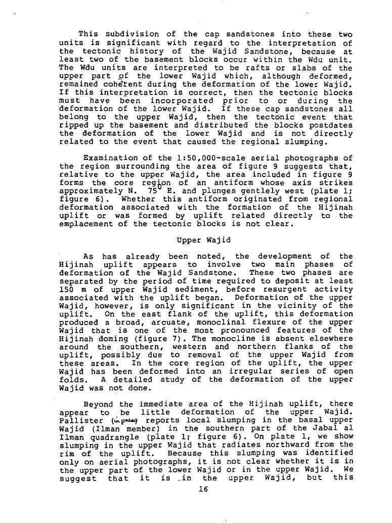
This subdivision of the cap sandstones into these two units is significant with regard to the interpretation of the tectonic history of the Wajid Sandstone, because at least two of the basement blocks occur within the Wdu unit. The Wdu units are interpreted to be rafts or slabs of the upper part pf the lower Wajid which, although deformed, remained coherent during the deformation of the lower Wajid. If this interpretation is correct, then the tectonic blocks must have been incorporated prior to or during the deformation of the lower Wajid. If these cap sandstones all belong to the upper Wajid, then the tectonic event that ripped up the basement and distributed the blocks postdates the deformation of the lower Wajid and is not directly related to the event that caused the regional slumping.
Examination of the 1:50,000-scale aerial photographs of the region surrounding the area of figure 9 suggests that, relative to the upper Wajid, the area included in figure 9 forms the core region of an antiform whose axis strikes approximately N. 75 E. and plunges gentlely west (plate 1; figure 6) . Whether this antiform originated from regional deformation associated with the formation of the Hijinah uplift or was formed by uplift related directly to the emplacement of the tectonic blocks is not clear.
Upper Wajid
As has already been noted, the development of the Hijinah uplift appears to involve two main phases of deformation of the Wajid Sandstone. These two phases are separated by the period of time required to deposit at least 150 m of upper Wajid sediment, before resurgent activity associated with the uplift began. Deformation of the upper Wajid, however, is only significant in the vicinity of the uplift. On the east flank of the uplift, this deformation produced a broad, arcuate, monoclinal flexure of the upper Wajid that is one of the most pronounced features of the Hijinah doming (figure 7). The monocline is absent elsewhere around the southern, western and northern flanks of the uplift, possibly due to removal of the upper Wajid from these areas. In the core region of the uplift, the upper Wajid has been deformed into an irregular series of open folds. A detailed study of the deformation of the upper Wajid was not done.
Beyond the immediate area of the Hijinah uplift, there appear to be little deformation of the upper Wajid. Pallister (uxp*t*^ reports local slumping in the basal upper Wajid (Ilman member) in the southern part of the Jabal al Ilman quadrangle (plate 1; figure 6). On plate 1, we show slumping in the upper Wajid that radiates northward from the rim of the uplift. Because this slumping was identified only on aerial photographs, it is not clear whether it is in the upper part of the lower Wajid or in the upper Wajid. We suggest that it is ,in the upper Wajid, but this
16

interpretation requires field checking. We therefore conclude that slumping occurred at least locally in the Wajid sediments in response to the second phase of activity of the Hijinah uplift.
DISCUSSION»«
The events described above suggest four stages in the history of the Wajid in the study area:
(1) Deposition of the lower Wajid;(2) deformation of the lower Wajid and early development of
the Hijinah uplift;(3) planation of the deformed lower Wajid and deposition of
the upper Wajid; and(4) deformation of the upper Wajid during the final phase of
development of the Hijinah uplift.
Such a history requires a model that can explain the formation in two stages of a circular uplift 20 km in diameter, regional gravity sliding within the lower Wajid sediments, and a local event within the core of the uplift that was violent enough to shatter the basement and emplace blocks of basement into the overlying Wajid sediments.
We have considered three mechanisms to explain the observed structures: meteor impact, emplacement of a diatreme, and intrusion of a pluton. The first two mechanisms are rejected, because although they would explain the features observed for the lower Wajid, they would not allow for a period of quiescence during which the upper Wajid could be deposited followed by a second phase of deformation; nor would they adequately account for a broad uplift. Instead we propose that the Hijinah uplift and associated deformation were caused by an intrusion at a shallow depth beneath the uplift, and the tectonic blocks were emplaced by a phreatic or steam eruption associated with the intrusion. Seismic activity related to the emplacement of the pluton, and in particular the phreatic eruption, triggered gravity sliding within the unconsolidated lower Wajid sediments. Following the initial phase of activity, at least 150 m of upper Wajid sediments was deposited during a period of tectonic quiescence. The upper Wajid was then deformed and domed during a resurgence of the intrusion to complete the Hijinah uplift.
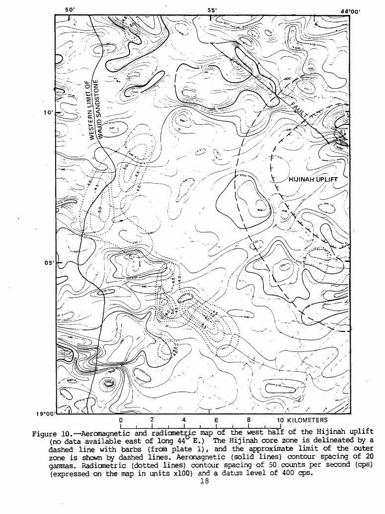
Direct evidence for the existence of such a pluton is present in the aeromagnetic anomaly map of the region (area 4, sheet 162, 1:100,000 scale), which includes the western part of the Hijinah uplift. Figure 10 shows that the mapped outer perimeter of the dome is coincident with a larger circular magnetic pattern on the aeromagnetic map. The pattern consists of three parts: (1) an inner quiet zone enclosed by the Hijinah core zone, (2) a ring of mild positive magnetic highs, which match well with the outer
17
55' 44°00'
10' -
0 2 4 6 8 10 KILOMETERS I i I i I i I t I i I
Figure 10. Aeromagnetic and radicmetric map of the west half of the Hijinah uplift (no data available east of long 44 E.) The Hijinah core zone is delineated by a dashed line with barbs (from plate 1), and the approximate limit of the outer zone is shown by dashed lines. Aeromagnetic (solid lines) contour spacing of 20 gammas. Radiometric (dotted lines) contour spacing of 50 counts per second (cps) (expressed on the map in units xlOO) and a datum level of 400 cps.
18

zone, and (3) an outer annular quiet zone with a radius of approximately 10 to 15 km. The pattern suggests a felsic intrusion with an approximate diameter of the overall circular feature and a possible system of ring fractures. In addition to the broad pattern, the interior quiet zone contains a local sharp magnetic high that is centered over the area where the tectonic blocks occur. This magnetic anomaly is assumed to be caused by the gabbros and other basic rocks exposed at and lying immediately beneath the surface.
Following the proposal of Dabbagh and Rogers (1983) that the Wajid is fluvial in the south and shallow marine in the north, we propose that the slumping within the lower Wajid originated on and within the sedimentary (deltaic?) shelf between these two depositional regimes. Pallister (^^Mrf) notes that the his Shum (basal Wajid) member wedges out to the south and is only about 10 m thick at about lat 18 30' N. This thickness suggests that this area was approximately the location of the south edge of the sedimentary wedge and the position of the marine onlap onto the southern highlands at the time of slumping. The wedging may also reflect thinning of the section to the south due to mass transport of sediment to the north by gravity sliding.
Our reconnaissance field work indicates that only a single regional unconformity separates the lower and upper Wajid units. If so the bulk of the gravity sliding within the lower Wajid occurred during one major event. Pallister (tnpKflA*) interprets this unconformity as representing .a significant erosional hiatus. On the basis of our interpretation, however, we would assume that the unconformity represents only the interval of time required to plane off the upper part of the deformed lower Wajid and renew deposition on that surface. As was mentioned earlier, Pallister also suggests that there is a lithologic distinction between the Shum (lower) and Ilman (upper) members, the lower Wajid being more arkosic and therefore somewhat less mature. By our interpretation, a fundamental change in lithology across the unconformity between the upper and lower Wajid units seems unlikely. Perhaps, the observed lithologic changes simply reflect gradational maturity of the sediments up-section or a change in the depositional regime in the study area following slumping. This question clearly requires further study.
The age of the basal Wajid Sandstone is still very much an open question. As already noted, the 628 Ma minimum age of the biotite-hornblende gabbr-o is too old to allow it to be related to the proposed contemporaneous intrusive activity. Regionally, 680 to 625 Ma was a time when the shield in the vicinity of the study area was undergoing intense orogenesis, probably related to plate collision (Stoeser and others, 19850. Thus, it is unlikely that deposition of the Wajid Sandstone, which represents an
19
episode of epicontinental sedimentation on a regional peneplain, could have begun at that time. Available geochronology, however, indicates that the last major phase of plutonism in the southern Arabian Shield terminated by about 625 Ma (Aleinikoff and others, 1984), and it is therefore possible that deposition of the Wajid after subsidence began by the latest Proterozoic (Eocambrian) . Although, it apparently did not affect the southern shield, a well-documented, widespread episode of felsic plutonism took place during the period 600-570 Ma throughout the central and northern Arabian Shield (Baubron and others, 1976; Calvez and others, 1983; Aleinikoff and others, 1984). If a felsic intrusion produced the Hijinah uplift, this pluton may be related to this later episode of intrusive activity within the shield and the lower part of the Wajid Sandstone could be as old as the latest Precambrian.
ACKNOWLEDGMENTS
We thank Robert J. Fleck, of the U.S. Geological Survey, for providing the potassium-argon ages of the Hijinah gabbro. Mark Gettings provided help with the aeromagnetic interpretation of the uplift and David White, of the Saudi Arabian Directorate General for Mineral Resources, aided in sample collection. We thank James Mytton for his review of the manuscript and our editor, James Pinkerton. The work on which this report is based was performed in accordance with an agreement between the Saudi Arabian Ministry of Petroleum and Mineral Resources and the U. S. Geological Survey.
DATA STORAGE
All materials resulting from this study are archived in base Data-File USGS-DF-04-10 (Stoeser, 1984). No Mineral Occurrence Documentation System (MODS) entries resulted from this investigation.
20

REFERENCES CITED
Alabouvette, B., and Villemur, J. R. , 1973, Reconnaissance survey of the Wajid Sandstone: Bureau de Recherches Geologiques,.et Minieres (Saudi Arabian Mission) , Report 73-JED-3, if'p.
Aleinikoff, J., Stoeser, D. B., and Fisher, L. B, 1984, U-Pb zircon geochronology of selected alkaline and peralkaline post-orogenic Pan-African granites of the Arabian Shield, Kingdom of Saudi Arabia: Unpublished report on file in the Jiddah office of the U.S. Geological Survey Saudi Arabian Mission.
Anderson, R. E., 1979, Geology of the Wadi ! Atf (sheet 17/43 A) and Mayza 1 (sheet 17/43 B) quadrangles, Kingdom of Saudi Arabia: Saudi Arabian Directorate General of Mineral Resources Bulletin No. 25,, 33 p. , scale 1:100,000.
Baubron, J. C., Delfour, J., and Vialette, Y., 1976, Geochronological measurements (Rb/Sr; K/Ar) on rocks of the Arabian Shield, Kingdom of Saudi Arabia: Bureau de Recherches Geologiques et Minieres (Saudi Arabian Mission) Report 76-JED-22, 152 p.
Brown, G. F., 1970 , Eastern margin of the Red Sea and the coastal structures in Saudi Arabia: Philosophical Transactions of the Royal Society of London, Ser. A, v. 267, p. 75-87.
Calvez, J. Y., Alsac, C., Delfour, J., Kemp, J., and Pellaton, C., 1933, Geologic evolution of western, central, and eastern parts of the northern Precambriari shield, Kingdom of Saudi Arabia: Saudi Arabian Deputy Ministry for Mineral Resources Open-File Report BRGM-OF-03-17, 57 p.
Coleman, R. G., Brown, G. F., and Keith, T. E. C., 1972, Layered gabbros in southwest Saudi Arabia: U.S. Geological Survey Professional Paper 800-D, p. D143-D150.
Cooper, J. A., Stacey, J. S., Stoeser, D. B., and Fleck,R. J., 1979, An evaluation of, the zircon method of isotopic dating in the southern Arabian craton: Contributions to Mineralogy and Petrology, v. 68, p. 429-439.
Dabbagh, M. E. and Rogers, J. J., 1983, Depositional environments and tectonic significance of the Wajid Sandstone of southern Saudi Arabia: Journal of African Earth Sciences, v. 1, p. 47-57.
21

Fleck, R. J., Coleman, R. G., Cornwall, H. R. , Greenwood,W. R. , Hadley, D. G. , Schmidt, D. L. , Prinz, W. C., and Ratte, J. C., 1976, Geochronology of the Arabian Shield, western Saudi Arabia: K-Ar results: Geological Society of America Bulletin, v. 87, p. 9-21.
Geukens, F.,*»1966, Geology of the Arabian Peninsula Yemen: U. S. Geological Survey Professional Paper 560-B, 23 p.
Greenwood, W. R. , 1980, Reconnaissance geology of the Wadi Wassat quadrangle, sheet 18/44 C, Kingdom of Saudi Arabia: Saudi Arabian Directorate General of Mineral Resources Geologic Map GM-40, 52 p., scale 1:100,000.
Greenwood, W. R. , ^pte*" , Geology of the Bi'r Idimah quadrangle, sheet 18G, Kingdom of Saudi Arabia, with a Geographic map compiled by F. J. Fuller: Saudi Arabian Deputy Ministry for Mineral Resources map series, scale 1:250,000.
Greenwood, W. R. t t*.pi*A*; Geology of the Jibal al Qahr quadrangle, sheet 19G, Kingdom of Saudi Arabia, with a Geographic map compiled by F. J. Fuller: Saudi Arabian Deputy. Ministry for Mineral Resources map series, scale 1:250,000".
Hadley, D. G. and Schmidt, D. L., 1975, Non-glacial origin for conglomerate beds in the Wajid Sandstone of Saudi Arabia, in Campbell, K. S. W. , ed., Gondwana Geology, Papers presented at the Third Gondwana Symposium, Canberra, 1973: Canberra, Australian National University Press, p. 357-371.
McClure, H. A., 1980, Permian-Carboniferous glaciation in the Arabian Peninsula: Geological Society of America Bulletin, Part I, v. 91, p. 707-712.
Pallister, J. S.,^cy>*i*V Reconnaissance geology of the Jabal al Ilman quadrangle, sheet 18/44 A r Kingdom of Saudi Arabia: Saudi Arabian Deputy Ministry for Mineral Resources map series, scale 1:100,000.
Powers, R. W., Ramirez, L. F., Redmond, C. D., and Elberg, E. L., Jr., 1966, Geology of the Arabian Peninsula Sedimentary geology of Saudi Arabia: U. S. Geological Survey Professional Paper 560-D, 147 p.
Roland, N. W., 1978, Jungpalaozoische glazialspuren auf dem Arabischen Schild (Late Paleozoic glacial influence on the Arabian Shield): Eiszeitalter und Gegenwart, v. 28, p. 133-137.
22
Stoeser, D. B., Stacey, J. S., Greenwood, W. R. and Fisher, L. B., 1985, U/Pb zircon geochronology of the southern portion of the Nabitah mobile belt and Pan-African plate collision in the Saudi Arabian Shield: Saudi Arabian Deputy Ministry for Mineral Resources Technical Record USGS-J.R-04-05 in press .
Stoeser, D. B., 1984, Base materials for Open-File report USGS-OF-04-10 by D. B, Stoeser and W. R. Greenwood on the Hijinah uplift.
23